Most recently updated January 18th, 2022
Estimated Reading Time: 18 minutes
Fort Macon State Park is located on Bogue Banks near Atlantic Beach on the North Carolina coast.
Opened in 1936, at only 424 acres in size, the park is one of the smallest state parks in North Carolina.
But with 1.3 million visitors annually, despite it’s small size, Fort Macon State Park is the second most visited state park in North Carolina.
I’ve always been too busy on my Coastal visits to be one of those visitors.
But I made up for my previous neglect a couple of weeks ago on a spontaneous overnight trip to the Coast.
A visit to Fort Macon was the main thing on my “must-do” list. I was delighted with what I found!
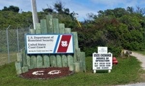
The park completely surrounds the United States Coast Guard Station Fort Macon, and park visitors can catch a glimpse of one of the Coast Guard Cutters that are moored there.
The infamous pirate Blackbeard’s ship, the Queen Anne’s Revenge, has been discovered in shallow water right off the Park in the Atlantic Ocean and is being recovered.
The park is also the site of the Battle of Fort Macon, which was fought there March-April 1862, during the American Civil War.
In addition to tours of the fully restored fort, the park offers both sound-side and surf fishing, hiking trails, ranger guided tours, a protected swim area, a refreshment stand, and a bathhouse.
Some of my posts contain affiliate links. If you make a purchase through an affiliate link, I will receive a small payment at no additional cost to you. As an Amazon Associate, and other marketing affiliations, I earn from qualifying purchases. See full Disclosure page here.
Fort Macon State Park has something for everyone as the site of a perfectly restored Civil War-era fort, a museum-quality coastal education center, and an unspoiled shoreline for swimming, surf fishing and beachcombing.
Nearly surrounded by water at the eastern tip of Bogue Banks, the park offers opportunities to enjoy undisturbed natural beauty, and learn about the local environment.
Cannon and musket demonstrations and frequent guided tours of the Fort complement extensive historical exhibits indoors and out.
A bathhouse and wheelchair-accessible beach-side areas are also available on site. There are also restrooms available.
Unfortunately, the interior of the fort and the Visitor’s Center are currently closed due to COVID-19 restrictions, but the beach and trails and restrooms are open. Tours and education programs have also been suspended.
History Highlights
WARNING: I’m about to go full History Geek for a while, so if you’re only interested in park trails and visitor information, please use the links in the Menu to skip to that part 🙂
In modern times, the danger of naval attack along the North Carolina coast seems remote, but during the 18th and 19th centuries the region around Beaufort was highly vulnerable.
Fort Macon, it’s predecessor Fort Hampton, and even the Bill passed in 1743 to provide ammunition for self-defense are testament to the fighting spirit of the settlers in this region.
Early Defenses
Beaufort was one of the first harbors designed as a port of entry during colonial times. Along with this distinction came a high risk of invasion by seafaring pirates and enemy warships alike.
Early on, coastal colonial towns and local sailors were often attacked by Blackbeard and other pirates.
The need for defense was made very clear in 1747, when Spanish raiders attacked English colonists at Beaufort, captured the town and held it for several days. British raiders also captured and occupied Beaufort in 1782.
To defend the coastal region against future attacks from the sea, plans were developed for the construction of four defensive forts along the eastern seaboard, one of which was to be built at Old Topsail (now Beaufort) Inlet.
Construction began in 1756; the fort (Fort Dobbs) was never completed, and the harbor remained defenseless until 1808 when Fort Hampton was built on the tip of Bogue Banks.
Situated about 300 yards east of the present site of Fort Macon, the small brick-masonry fort protected the harbor for more than a decade. It was later deserted and, in 1825, was washed into the inlet by a hurricane.
Queen Anne’s Revenge
The pirate Blackbeard was one of those that was known to haunt the waters around the inlet, just off the coast of what is now Fort Macon.
In 1996, the wreck of the pirate’s ship the “Queen Anne’s Revenge” was found nearby in the Atlantic Ocean.
Blackbeard’s famous flagship was a 200-ton vessel believed to have been built in 1710.
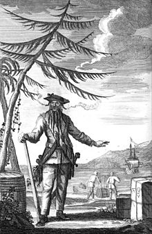
The ship was captured by Blackbeard and his pirates on 28 November 1717, near the island of Saint Vincent in the West Indies.
Blackbeard made the vessel into his flagship, adding more heavy cannon and renaming the ship Queen Anne’s Revenge.
The name may come from the War of the Spanish Succession, in which Blackbeard had served in the Royal Navy.
Blackbeard sailed this ship from the west coast of Africa to the Caribbean, attacking British, Dutch, and Portuguese merchant ships along the way.
Soon after blockading Charleston harbor in May 1718, and refusing to accept the Governor’s offer of a pardon, Blackbeard ran Queen Anne’s Revenge aground while entering Beaufort Inlet, North Carolina on June 10, 1718.
He stranded several crew members on a small island nearby, where they were later rescued by Captain Stede Bonnet. (Some suggest Blackbeard deliberately grounded the ship as an excuse to disperse the crew.)
Shortly afterward, he surrendered and accepted a royal pardon for himself and his remaining crewmen from Governor Charles Eden at Bath, North Carolina.
However, it didn’t take long for Blackbeard to return to piracy. He was killed in combat near First Landing State Park in November 1718.
Discovery and Excavation

Intersal Inc., a private research firm, discovered the wreck believed to be Queen Anne’s Revenge on November 21, 1996.
The shipwreck lies in 28 feet of water about one mile offshore of Fort Macon State Park .
Thirty-one cannons have been identified to date and more than 300,000 artifacts have been recovered.
The 1747 Spanish Intrusion
Even decades after Blackbeard’s death, the harbor at Cape Lookout still provided an excellent base for Spanish privateers to attack passing ships.
In October 1741, a Spanish privateer with eighty men in its crew captured a schooner from Boston off Bogue Inlet about twenty-five miles west of Beaufort.
To defend against these kind of attacks, in 1743 the colonial government passed an act ordering magazines of ammunition to be provided for each County.
The Carteret County Court acted promptly on this measure and Beaufort merchant Arthur Mabson was appointed keeper of the magazine. The preparations were soon put to good use.
On June 4, 1747, a band of Spanish privateers sailed boldly into Beaufort harbor and captured the “Several Vessels” that were anchored there.
But only thirteen of the local militia responded to the alarm, and with the Spanish in control of the harbor, there was not much they could do.
The enemy sailed away, taking their prizes with them.
But the local militia soon got another chance.
On August 26, 1747, Spanish privateers sailed into the harbor, landed and invaded the town itself.
But when the militia arrived, the battle turned and the militia prevailed.
The militiamen remained on constant duty for the next three days, before they were divided into groups which rotated until late in September.
The enemy never returned.
(The 1747 attack and battle is re-enacted each year during the Beaufort Pirate Invasion, a festival in held in Beaufort, NC each summer.)
Nevertheless, the colony was shocked at the activities of this band of privateers and sought to prevent it happening again.
Governor Gabriel Johnston, addressing the Assembly which met at New Bern in October, 1747, described the attacks and the need for ongoing defense.
The Assembly appointed a committee to draft a bill to raise money for “building fortifications in this Province. . . .”
The committee acted promptly, and a bill providing that forts were to be built at Ocracoke, Beaufort, and Bear inlets, and at Cape Fear, was adopted by the Assembly in 1748.
The 1800s: Construction and Civil War
Construction of the fort that now stands began in 1826.
The fort was garrisoned in 1834 and named after U.S. Senator Nathaniel Macon of North Carolina, who procured the funds to build the fort.
A system of stone jetties was constructed in the 1840s to control erosion.
This project was initially engineered by Robert E. Lee, who later became a general of the Confederate States Army.
Fort Macon Construction and History
The fort has a history as intricate and unique as the Park’s ecosystem.
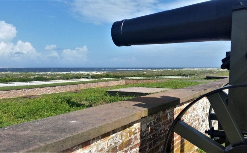
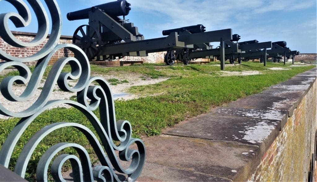
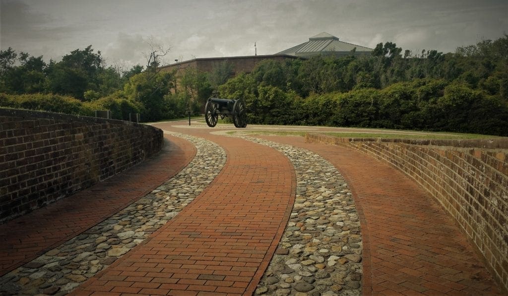
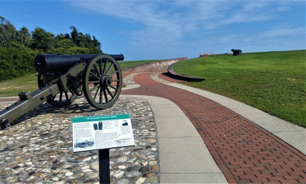
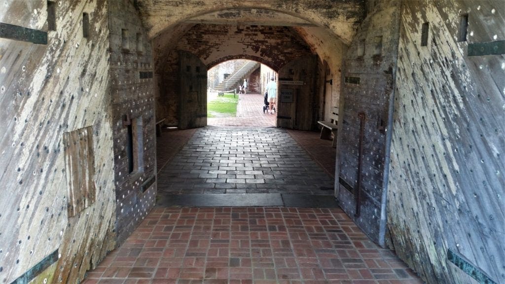
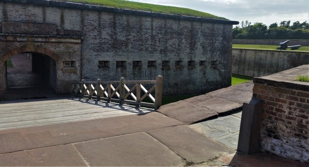
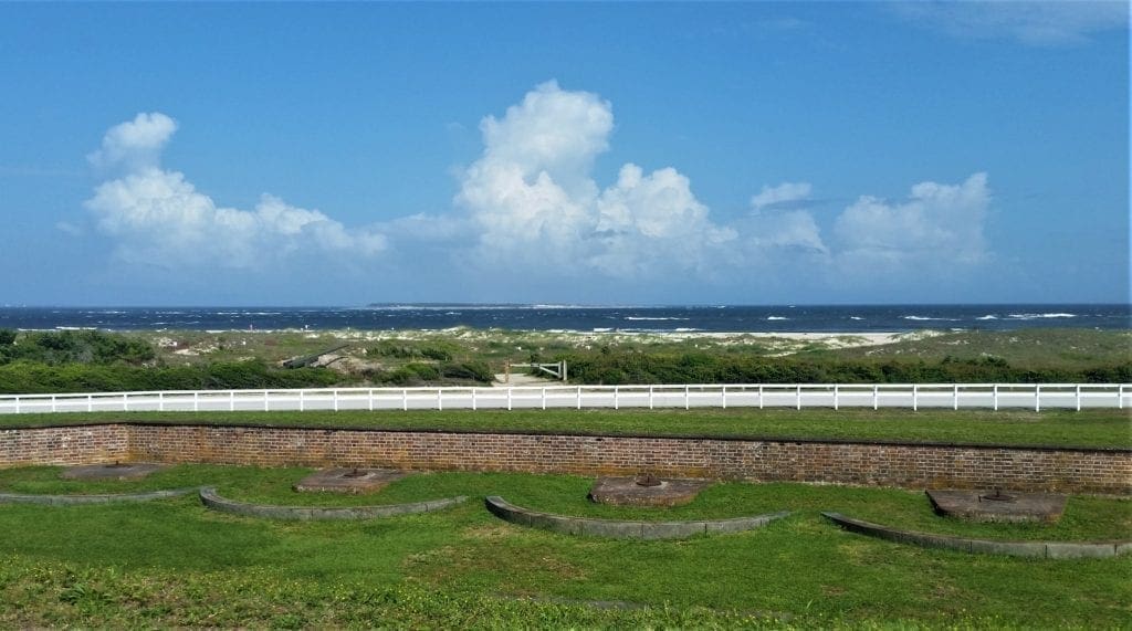
Five-sided Fort Macon is constructed of brick and stone. (Fort Macon construction uses 2,379,546 bricks – more than any other U.S. fort.) Twenty-six vaulter rooms (or casemates) are enclosed by outer walls that are 4.5 feet thick.
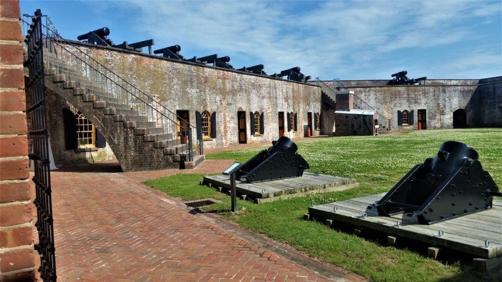
Other features of the fort include powder magazines, counterfire rooms with cannon emplacements, and a wide moat – which served to protect the fort when flooded with waters from Bogue Sound.
Today, an inner court or parade ground is often the scene of historic re-enactments.
Fort Macon was built by the US Army Corps of Engineers specifically to guard Beaufort Inlet and Beaufort Harbor, North Carolina’s only major deepwater ocean port.
Construction began in 1826 and lasted eight years, under the Third System of US fortifications. The fort was completed in December, 1834, and it was improved with further modification during 1841–46.
At the beginning of the Civil War, North Carolina seized the fort from Union forces. The fort was later attacked in 1862, and it fell back into Union hands.
For the duration of the war, the fort was a coaling station for navy ships. Often an ordnance sergeant acting as a caretaker was the only person stationed at the fort.
During the Reconstruction Era, the US Army actively occupied Fort Macon until 1877.
During this time, because there were no state or federal penitentiaries in the military district of North Carolina and South Carolina, Fort Macon was used for about 11 years as a civil and military prison.
The fort was deactivated after 1877 only to be garrisoned by state troops once again during the summer of 1898 for the Spanish–American War.
Finally, in 1903, the US Army completely abandoned the fort.
The Siege of Fort Macon
The Civil War began on April 12, 1861, and only two days elapsed before local North Carolina militia forces from Beaufort arrived to seize the fort for the state of North Carolina and the Confederacy.
After the first spate of enthusiasm during construction, the fort had been allowed to deteriorate. The woodwork rotted, the ironwork rusted, and gun carriages were allowed to decay.
The garrison was steadily reduced in size, until by the time of the beginning of the Civil War the care of the fort was entrusted to a single sergeant.

When the fort was taken over by North Carolina troops under Captain Josiah Solomon Pender on April 14 (before the state had seceded from the Union), only four guns were mounted.
The local military authorities immediately set about improving the armament.
North Carolina Confederate forces occupied the fort for a year, preparing it for battle and arming it with 54 heavy cannons.
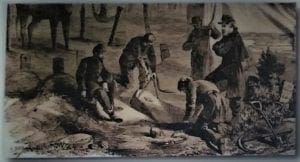
The Siege of Fort Macon took place from March 23 to April 26, 1862.
Union forces commanded by Maj. Gen. Ambrose E. Burnside swept through eastern North Carolina, and part of Burnside’s command under Brig. Gen. John G. Parke was sent to capture Fort Macon.
Parke’s men captured Morehead City and Beaufort without resistance, then landed on Bogue Banks during March and April to gain Fort Macon.
Col. Moses J. White and 400 North Carolina Confederates in the fort refused to surrender even though the fort was hopelessly surrounded.
On April 25, 1862, Parke’s Union forces bombarded the fort with heavy siege guns for 11 hours, aided by the fire of four Union gunboats in the ocean offshore and floating batteries in the sound to the east.
While the fort easily repulsed the Union gunboat attack, the Union land batteries, utilizing new rifled cannons, hit the fort 560 times.
There was such extensive damage that Col. White was forced to surrender the following morning, April 26, with the fort’s Confederate garrison being paroled as prisoners of war.
The Union held Fort Macon for the remainder of the war, while Beaufort Harbor served as an important coaling and repair station for its navy.
At the time of the siege, the garrison of the fort numbered about 430 officers and men, commanded by Colonel Moses J. White.
Sickness reduced that number by about a third. Despite the poor diet and other living conditions that they suffered, only one man died.
Aftermath of Battle
The battle had been relatively bloodless, at least by standards that soon would be common in the Civil War.
On the Union side, only one man was killed, and two soldiers and one seaman were wounded. On the Confederate side, seven were killed outright, two died of wounds, and sixteen were wounded.
Burnside was recalled shortly after the victory at Fort Macon, to assist General George B. McClellan in the Peninsula Campaign in Virginia.
No further major offensive actions took place, and North Carolina became a secondary theater until late in the war.
The flag was returned to the State of North Carolina in 1906, in a Senate Chamber ceremony attended by veterans of the siege.
Fort Macon Post Cemetery
Like most military posts, Fort Macon had a post cemetery to bury deceased soldiers or their family members. In the 19th century, a soldiers death might occur from battle, disease or accidents.
If no one claimed a deceased soldiers remains for private burial, he would be interred in the post cemetery.
The Cemetery Plot
Simple wooden headboards for each grave were painted with the name, rank, regiment and date of death.
The Fate of the Cemetery
The grave headboards were rotted away and shifting sand dunes were covering it over.
The army intended to move the remains of the thirteen people interred init to the nearest national cemetery.
Who Lies in the Cemetery?
-
-
- 1 – William Brown, aged 21, 40th US Infantry, Died Aug 30, 1867. Cause: Dropsy
- 2 – William Jones, aged 26, 40th US Infantry, Died Sept 12, 1867. Cause: Typhoid Fever
- 3 – Peter Alexander, aged 21, 40th US Infantry, Died Nov 21, 1867. No cause given.
- 4 – George W Sedgewick, 40th US Infantry. Died Jan 7, 1868. Cause: Chronic diarrhea.
- 5 – Charles F Brown, 37th US Colored Troops. Died Oct 4, 1868. No cause given.
- 6 – Patrick McAllister, 8th US Infantry. Died January 14, 1869. No cause given.
- 7 – William Downey, aged 22, 8th US Infantry. Died Mar 28, 1869. Cause: Shot by a guard who mistook him for an escaping prisoner.
- 8- Emily Ann Brunn, aged 20 months. Child of Sgt. Robert Brunn, 4th US Artillery. Died Mar 18, 1871. No cause given.
- 9 – Louis Thurnherr, aged 33, 4th US Artillery. Died Oct 19, 1871. Cause: Drowned.
- 10 – Mrs Laura Linnell, aged 29. Died March 1872. Found washed up on the shore at Fort Macon April 10, 1872. Cause: Drowned at sea with her husband and child during the sinking of the schooner Lotte J. Sparrow of Wellfleet, Mass.
- 11 – William R. Livingston, aged 21. Prisoner. Died Jul 5, 1872. Killed by lightning.
- 12 – John Martin, aged 37, 4th US Artillery. Died Jul 18, 1872. Cause: Dyspepsia.
- 13 – James L. Jones, aged 26, 2nd US Artillery. Died Dec 26, 1873. Cause: Exposure.
-
The 1900’s to Present
Congress offered the sale of Fort Macon Military Reservation as surplus federal property in 1923.
However, at the bidding of North Carolina leaders, a Congressional Act on June 4, 1924, sold the fort and surrounding reservation for the sum of $1 to the state of North Carolina to be used as a public park.
During 1934–35, the Civilian Conservation Corps restored the fort and established public recreational facilities, which enabled Fort Macon State Park to officially open May 1, 1936, as North Carolina’s first functioning state park.
At the outbreak of World War II, the US Army leased the park from the state and actively manned the old fort with Coast Artillery troops to protect a number of important nearby facilities.
The fort was occupied by the US Army during WWII from December 1941 to November 1944.
During the WWII occupation some unsuspecting soldiers rolled cannonballs into the fireplaces as andirons, mistaking them for solid iron shot.
The powder-filled balls exploded, killing two men and injuring others, thus firing the “last shot of the Civil War”.
On October 1, 1946, the Army returned the fort and the park to the state.
Portions of Fort Macon have now been restored to appear as they did during the Civil War. You can explore the exterior of the fort on your own and get a guided tour of the inside.
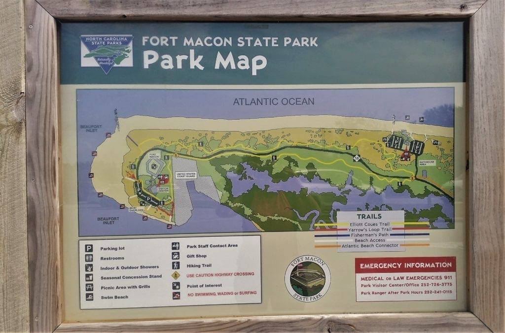
Fort Macon Trails
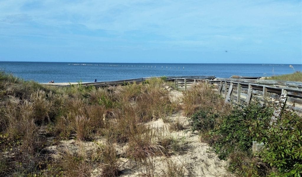
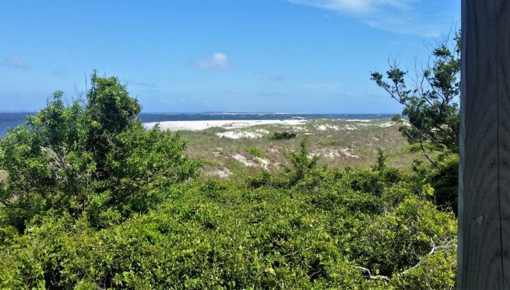
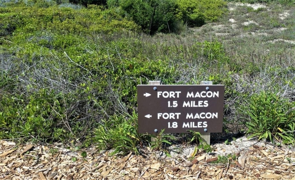
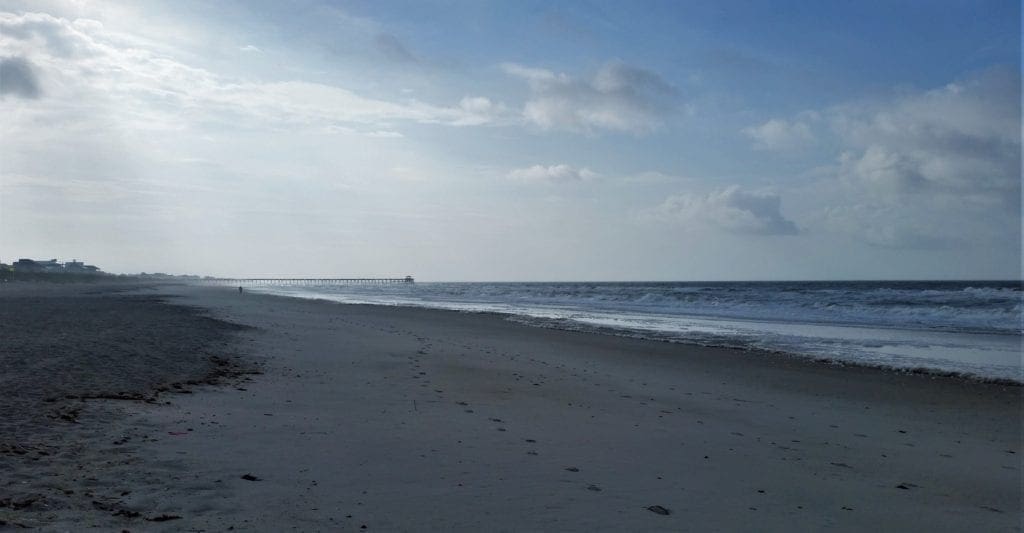
Fort Macon has over 1.5 miles of ocean beach for hiking, and a new nature trail that’s 3.2 miles in length.
Beach Trail
Description:The beach is always available for hikes.
As you walk along the beach you may see one of the 302 different species of birds found in the park or experience the thrill of watching dolphins playing in the ocean.
Surface: sand
Length: 1.50 miles one way
Difficulty: easy hike
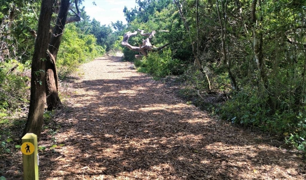
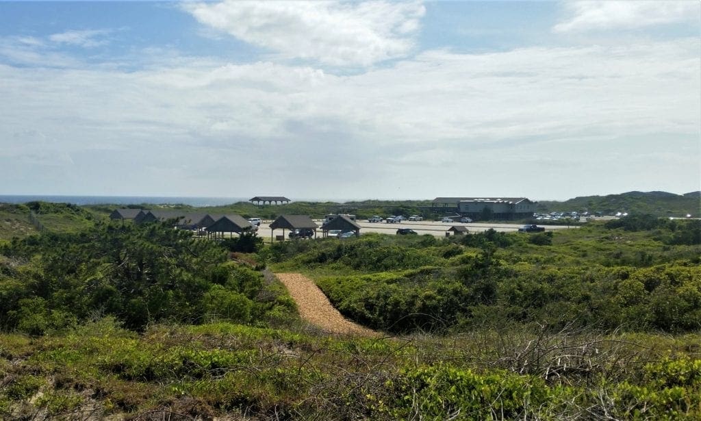
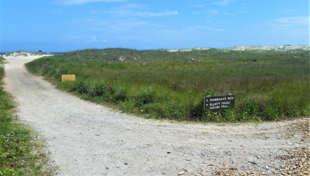
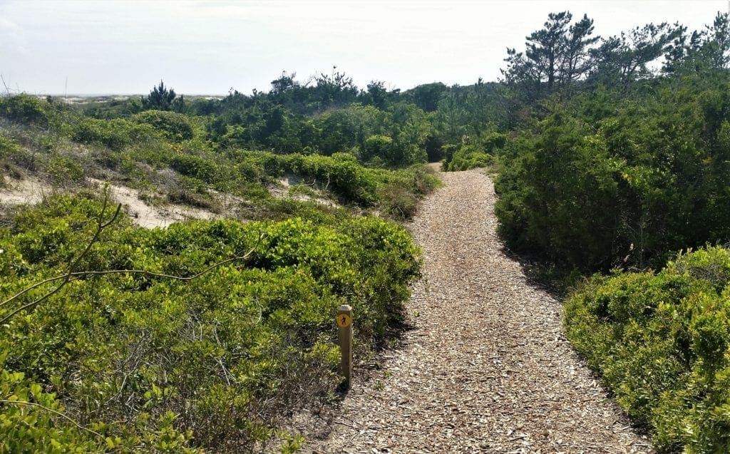
Elliott Coues’ Nature Trail
Location: North end of the Fort area parking lot & Northeast corner of the Beach Access parking lot
Description: The Elliott Coues’ Nature Trail is a new hiking trail that connects the Fort area with the Swim Beach area.
The trail can be accessed both at the Fort parking lot or the Beach Access parking lot.
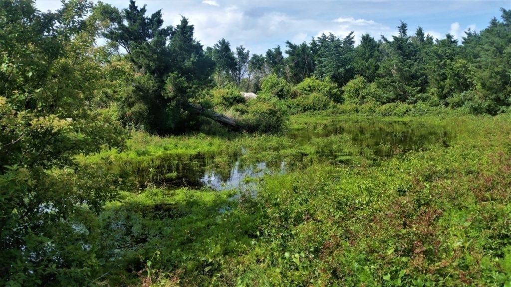
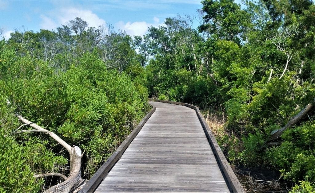
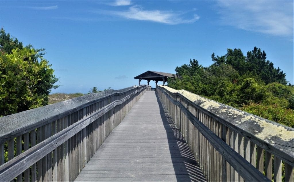
Although I really enjoyed messing around looking at the fort, the main thing I had wanted to do at the park was hike the relatively new Elliott Coues’ Trail.
I started at the trailhead in the far corner of the Visitor’s Center parking lot.
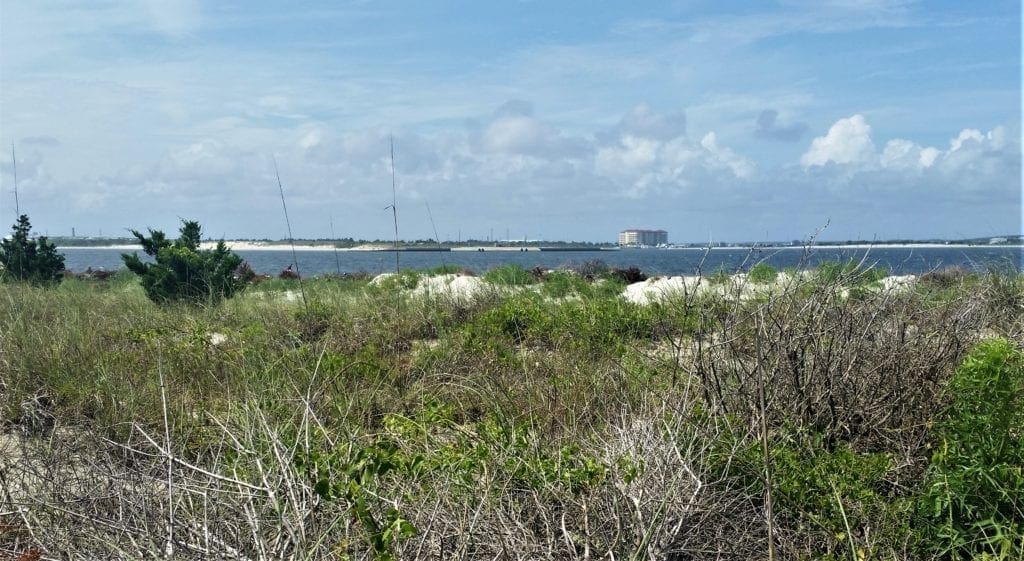
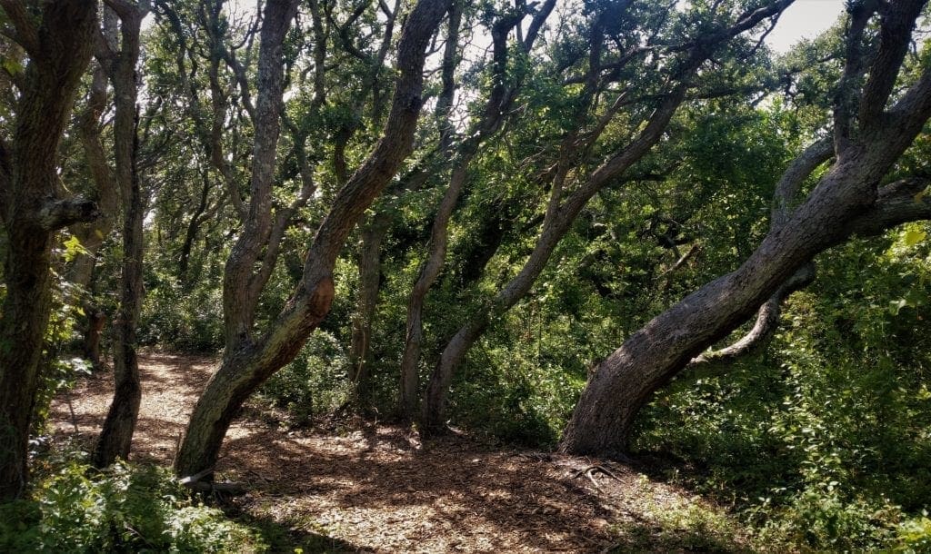
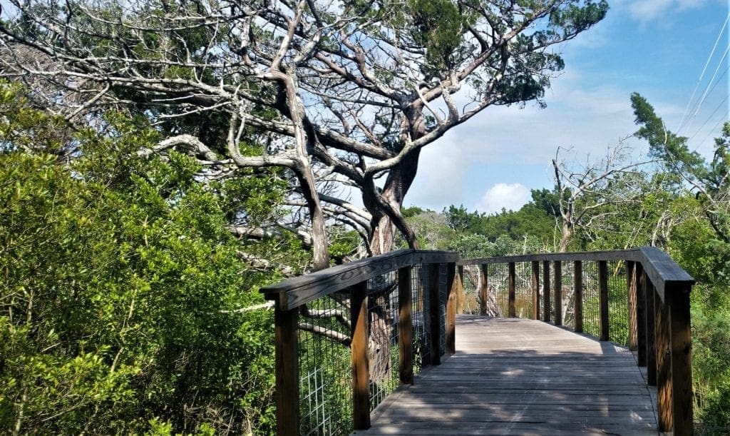
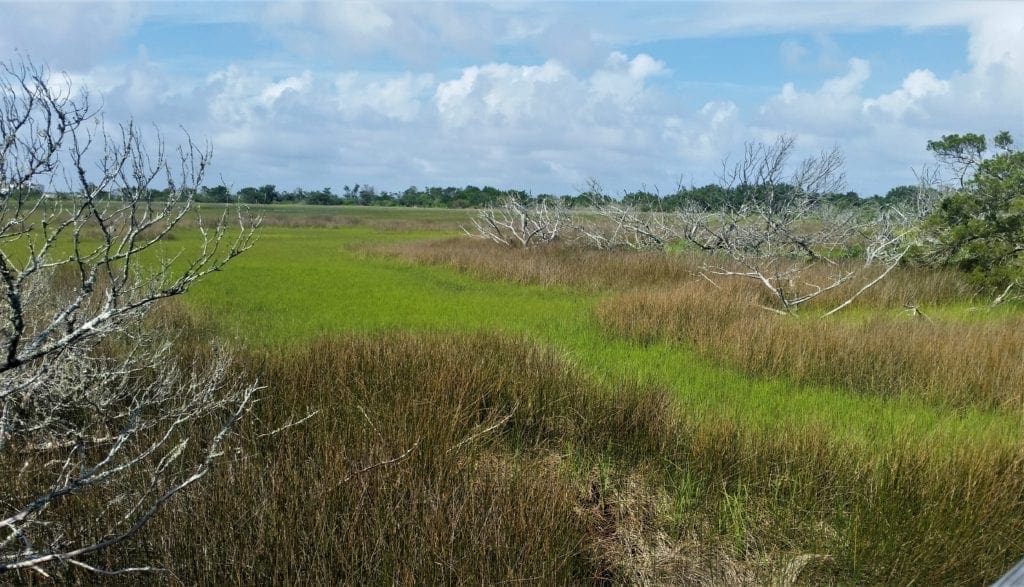
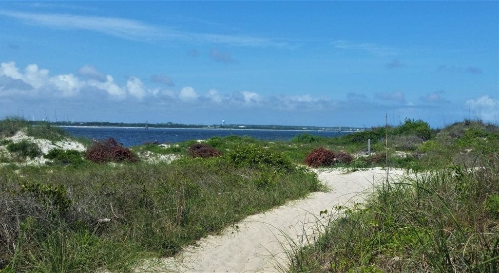
The trail is a 3.3 mile loop that goes along the beach, through salt march and forest, and even along the road beside the Coast Guard station for a short time before returning to the park.
It’s a beautiful trail, with the beach side of the loop paved with a new layer of soft wood chips.
The wooded side is a combination of soft dirt and some boardwalks.
You can see different kinds wildlife from the trail: there were a lot of different birds and I startled a young doe near the marsh side.
This is not a hard hike at all, although there are some un-shaded sections that can be very warm in midday, so you’ll want sunglasses for sure, water and maybe a hat.
I think children would be ok on this trail, if they’re old enough to walk or young enough to carry.
The surface is not really conducive to any kind of stroller.
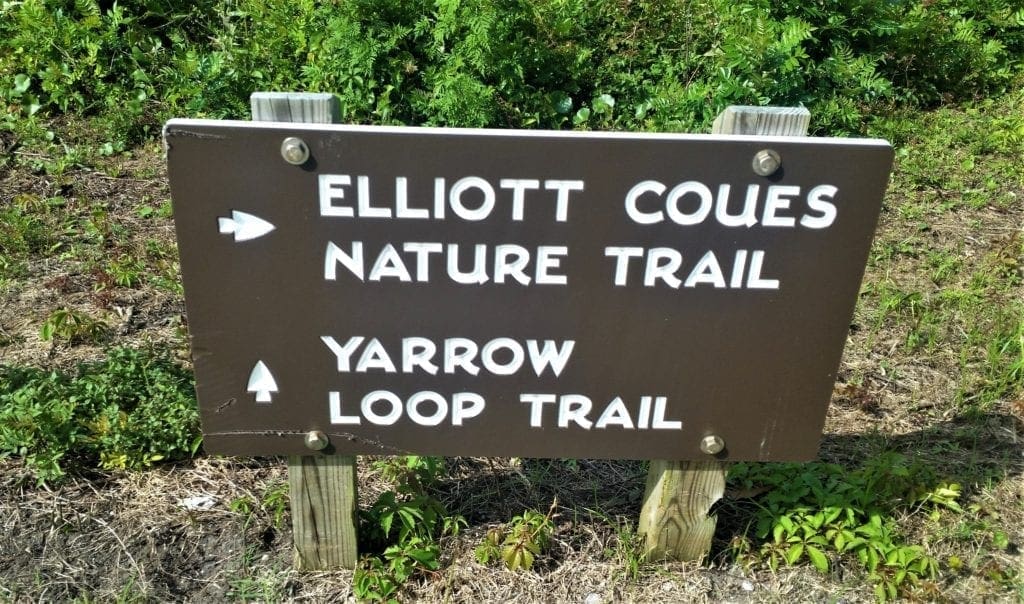
Yarrow’s Loop
Description: Yarrow’s Loop is a short quarter mile nature trail that starts and ends at the north end of the fort parking lot.
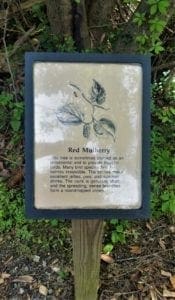
Information signs along the trail tell about some of the common plants and animals that can be found in the park.
Educational Programs
Regularly scheduled education and interpretive programs about Fort Macon State Park are held from April 15 to October 30. Check the Events calendar for more information.
To arrange a special exploration of Fort Macon State Park for your group or class, contact the park office.
-
- Educational materials about Fort Macon State Park have been developed for grades 6-8 and are correlated to North Carolina’s competency-based curriculum in science, social studies, mathematics and English/language arts.
- The Fort Macon program introduces students to the geologic process of barrier island movement and to the plants and animals that thrive in this shifting environment.
- Accompanying the program is a teacher’s booklet and workshop, free of charge to educators.
Natural Resources
While most visitors to Fort Macon spend their time at the fort or relaxing on the beach, the park is also an excellent introduction to the varied and abundant plant and animal life of the North Carolina coast.
Explore the base of the jetty at low tide or walk the beach in search of mollusk shells washed ashore by the last storm.
Sea urchins, sea stars and coral may be spotted on or under rocks or other objects in the shallow water.
You can get plant and animal checklists at the park office.
Visit the nearby Theodore Roosevelt State Natural Area, 8 miles west of Fort Macon.
This area with extensive maritime forests and freshwater ponds is also the site of the North Carolina Aquarium at Pine Knoll Shores, an educational facility with a variety of marine exhibits.
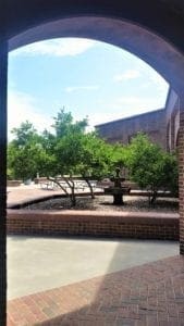
Coastal Education Center
The Coastal Education Center has a large exhibit hall featuring exhibits about the natural history of the park, barrier island ecology, coastal North Carolina, and the interaction of natural and cultural history associated with Fort Macon.
Join a regularly scheduled interpretive program or contact the park office to arrange an exploration for your group or class.
Exhibits and Fort Tour
Join a guided tour of the fort or conduct your own, following the printed guide available at the visitor center information desk.
Exhibits in the museum acquaint you with a vital period in the history of the state and the nation.
Five galleries display artifacts from a period of the fort’s history.
There is also a “Parade of Uniforms” and a reconstructed, handmade brick bake oven and hot-shot furnace (used to heat artillery shells).
The museum has restored soldier barracks, kitchen and commissary exhibits.
Also featured on display is a scale model of the fort, along with lighted maps, weaponry, enlarged photography, a small video theater, mural of sea battles, cannons in action, and military lifestyles.
Additional Info
Boating – The launching or landing of private boats or personal watercraft is not permitted.
Swimming – Because of strong water currents, visitors are encouraged to swim only in the protected area. Surfing is not allowed in protected swimming area.
Event permits – Some events may require a Special Activity Permit. You can download a Special Activity Permit application or obtain one from the park office.
Research and collection permits – A permit is required for any project involving the collection, removal or disturbance of any natural resource. Learn more about research and collection permits or fill out a permit application online.
Other Nearby State Parks
The following state parks are within 30 miles of Fort Macon State Park:
- Hammocks Beach State Park (Onslow County)
- Theodore Roosevelt State Natural Area (Carteret County) – Managed by Fort Macon State Park
Theodore Roosevelt State Natural Area

Located on Bogue Banks, in the town of Pine Knoll Shores, the 265-acre natural area protects the barrier island’s only remaining intact maritime forest.
In 1971, it was donated to the state by the grandchildren of Theodore Roosevelt as a living memorial to the 26th President’s dedication to conservation.
The nature preserve is most well known for the North Carolina Aquarium at Pine Knoll Shores, which it surrounds.
The natural area is jointly managed by the aquarium and Fort Macon State Park, which is 8 miles to the east.
Most of the natural area is not open to the general public due to its fragile nature, but two nature trails allow for limited access to the area.
Hammocks Beach State Park

Located near Swansboro, along the Southern Outer Banks, or Crystal Coast, Hammocks Beach State Park covers 1,611 acres and consists mainly of Bear Island.
Bear Island can be accessed by Ferry or private boat.
There are paddle trails and beach trails for walking. Camping is also allowed.
The park also owns three smaller islands, Dudley, Huggins and Jones, located in the nearby mouth of the White Oak River.
Location and Directions
PARK VISITORS CENTER ADDRESS: 2303 E. Fort Macon Road
Atlantic Beach, NC 28512
DIRECTIONS: From I-95, take US 70 east to Morehead City, and turn south on Atlantic Beach Causeway.
Cross the bridge to Atlantic Beach, and turn left on NC 58. The fort is located at the tip of the island.
Hours and Fees
Hours vary based on season and area of the park, but generally the Visitors Center is open 9-5 daily except for Christmas Day.
For more details, see the park’s website.
There are no entrance fees to enjoy the park.
In addition to park-specific rules, please read the system-wide Park Rules for all North Carolina State Parks.
-
- With the exception of the bathhouse, there are no fees to enjoy the park.
- The park is open year-round and does not charge an admission or parking fee.
- During the non-summer months the protected swimming area, refreshment stand, and bathhouse are not available.
- However, you can swim at your own risk and public restrooms are open year-round.
Have a great trip to Fort Macon State Park! If you have any questions or comments, drop me a note and I’ll get back to you as quickly as I can.
For a family weekend getaway that’s a little more exotic, try St Simon’s Island off the Georgia Coast – it’s just a couple of hours further South, but full of historical sights and white sand beaches!
If you’re looking for more ideas for hiking with small children, without driving to the Coast, try Raven Rock State Park – it’s a great place to get outdoors with your littlest ones 🙂
Thanks for stopping by – see you next time! LJ
To Get New Idratherwalk Posts
sent directly to your inbox (how convenient!) Click this Button
If you enjoyed this post, please share it:

LJ has spent much of her free time as a single Mom – and now as an empty-nester – hiking in the US and around the world. She shares lessons learned from adventures both local and in exotic locations, and tips on how to be active with asthma, plus travel, gear, and hike planning advice for parents hiking with kids and beginners of all ages. Read more on the About page.