Most recently updated April 27th, 2026
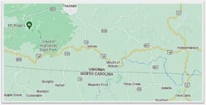
The Grayson Highlands Park is right on the edge of the areas of North Carolina and Virginia that were hardest hit by Hurricane Helene.
That said, the Park is open (with some restrictions) and many of the surrounding communities are open for business and could really use your vacation dollars to help rebuild!
Go to my Hurricane Helene page to get the latest updates on the latest Park, Trail and road repairs.
Grayson Highlands State Park in Virginia is a great place to go hiking and look for wild ponies!
I was lucky enough to spend a few days there in September a few years ago.
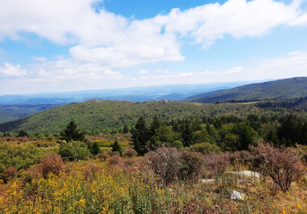
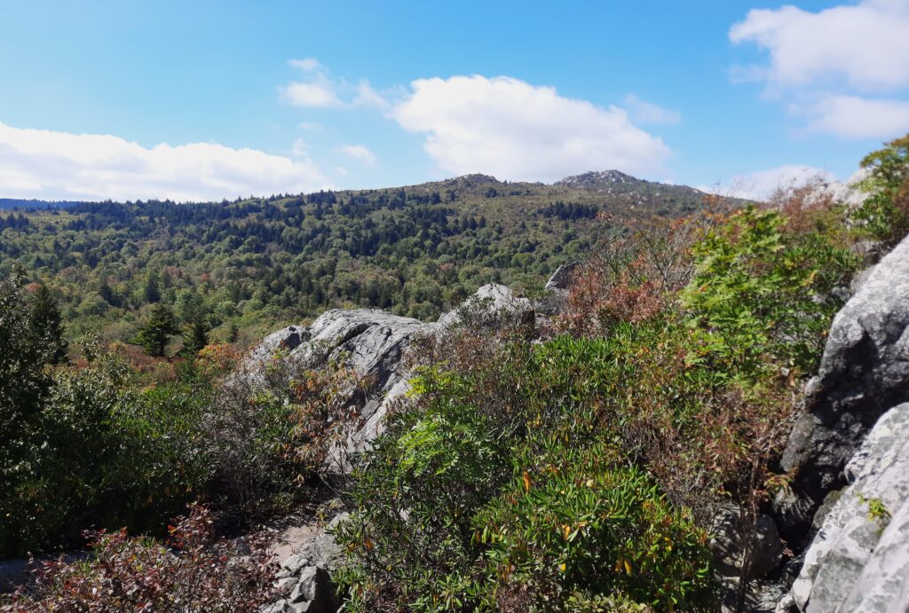
The Park covers 4800-acres, and is adjacent to Virginia’s highest peak at an elevation of 5,729 feet, Mount Rogers.
You’ll find camping, picnicking, overnight horse stables, a visitor center, hiking trails, and access to the Appalachian Trail at Grayson Highlands.
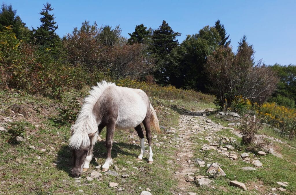
But the ponies were the REAL attraction for me 🙂
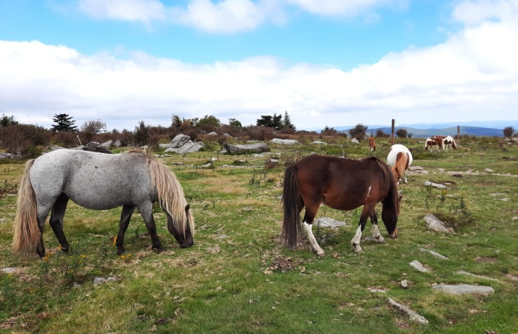
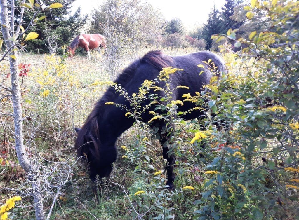
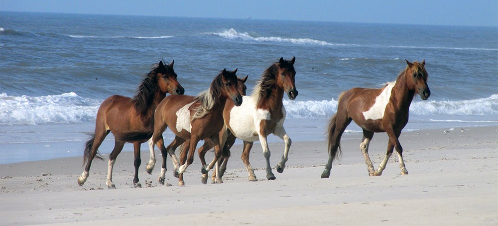
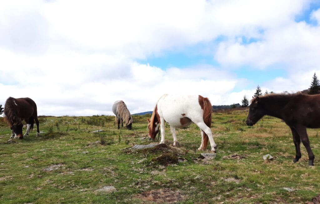
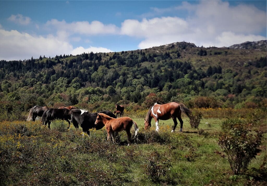
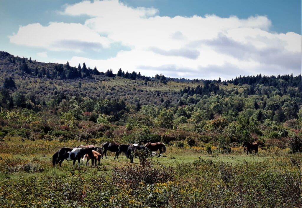
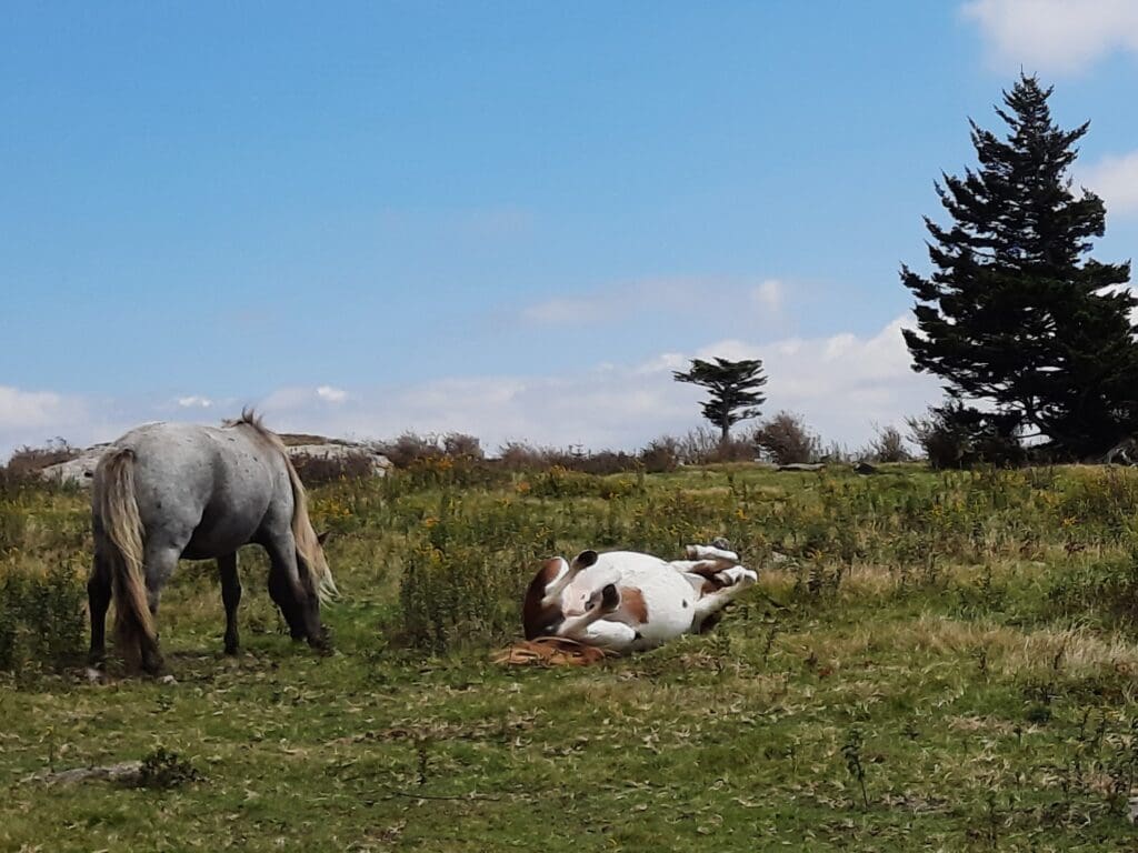
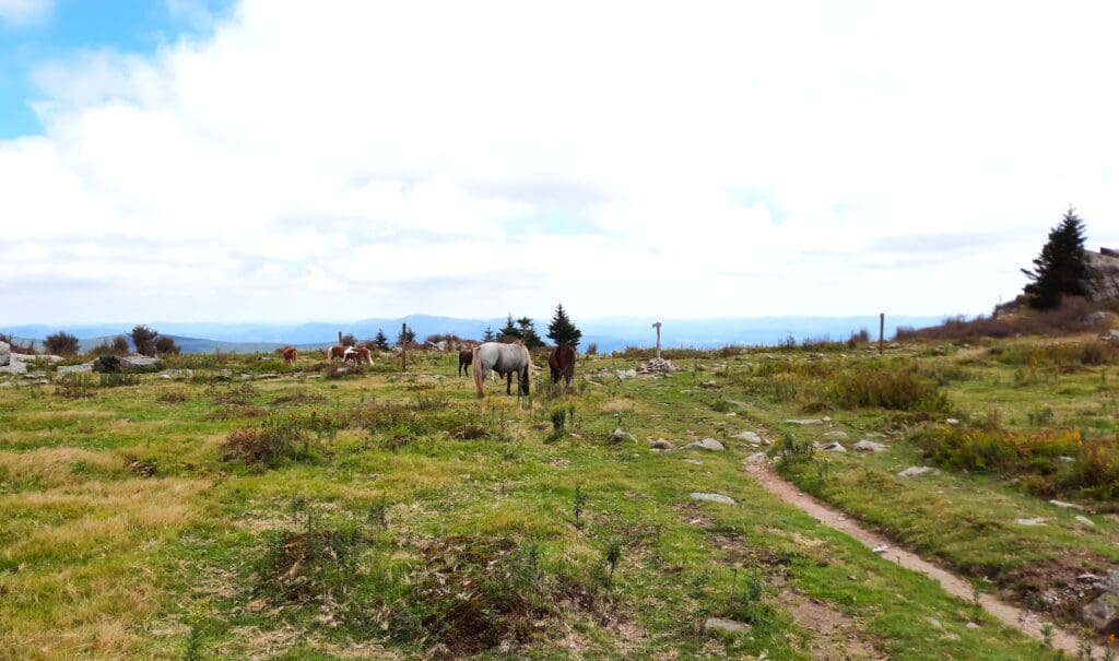
The mountain balds are inhabited by a herd of ~120 ponies that run wild within the confines of the Park.
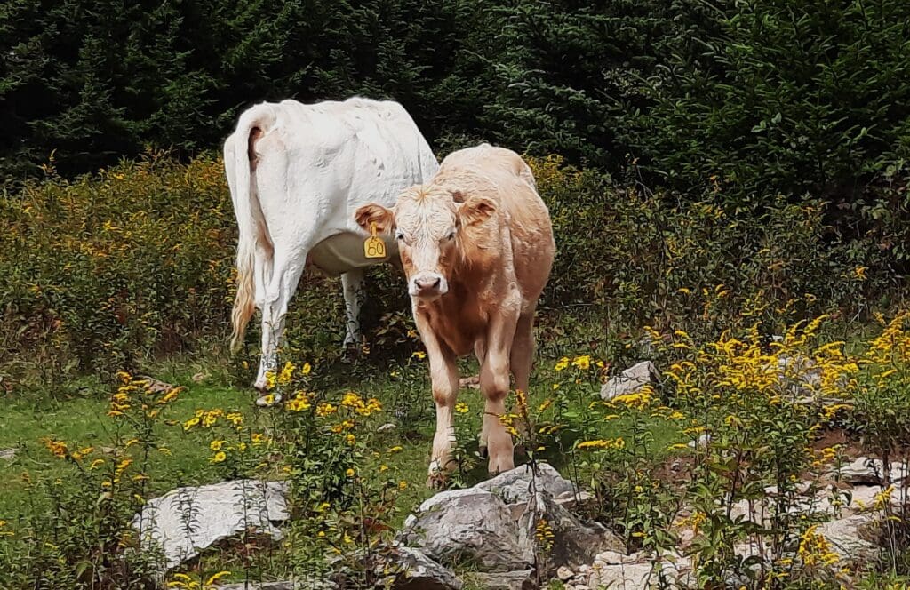
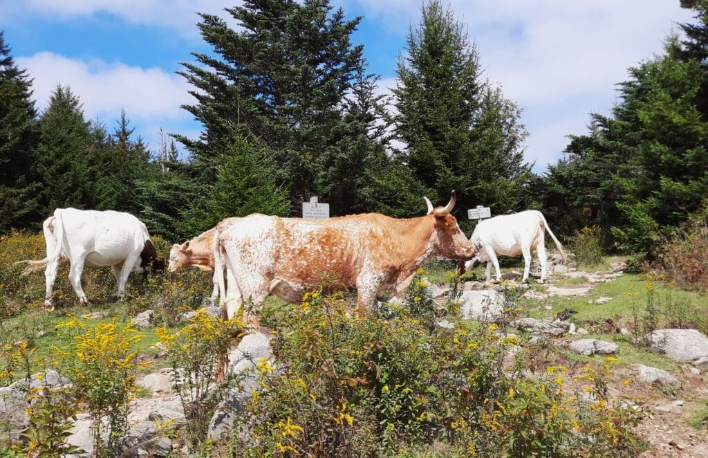
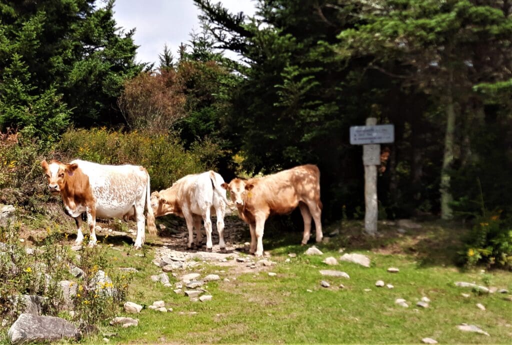
Visitors might also see black bear, bobcat, red fox, ruffed grouse, deer, and wild turkeys – and also longhorn cattle!
Read on to learn about the park and area history, hiking trails, and all of those wild ponies just waiting for you to visit!
Or if you prefer video, click to go to the Grayson Highlands Playlist on IRW Youtube.
Some of my posts contain affiliate links. If you make a purchase through an affiliate link, I will receive a small payment at no additional cost to you. I do not get paid for recommendations, all opinions on this site are my own. See full Disclosure page here.
Grayson Highlands State Park is rugged enough to be interesting to hikers, but it’s also a smaller park with only moderate elevation gain on the trails, so it’s a good family vacation spot, too.
The hiking is beautiful, but for *some people (*me), the main reason to visit Grayson Highlands is the wild ponies!
The Wild Ponies
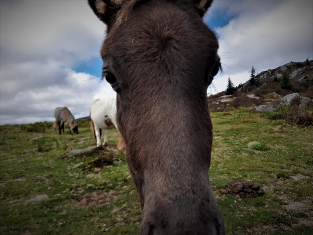
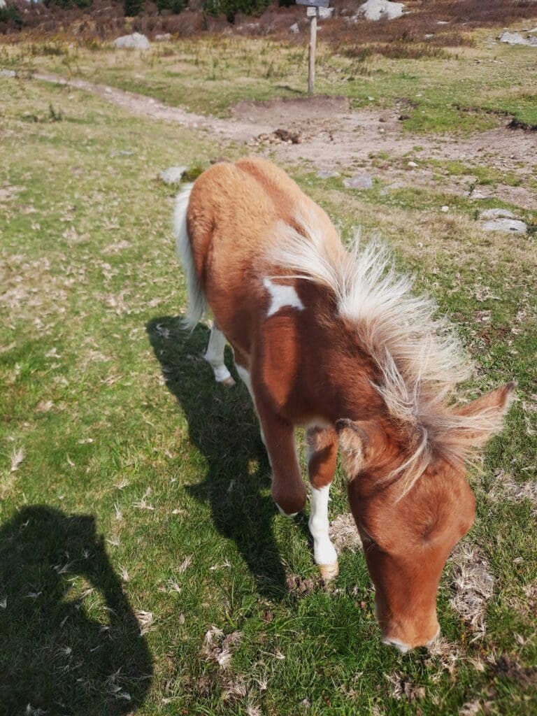
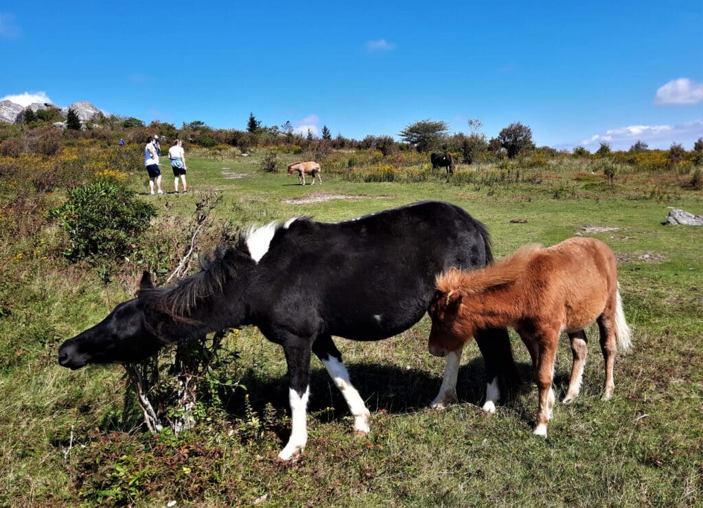
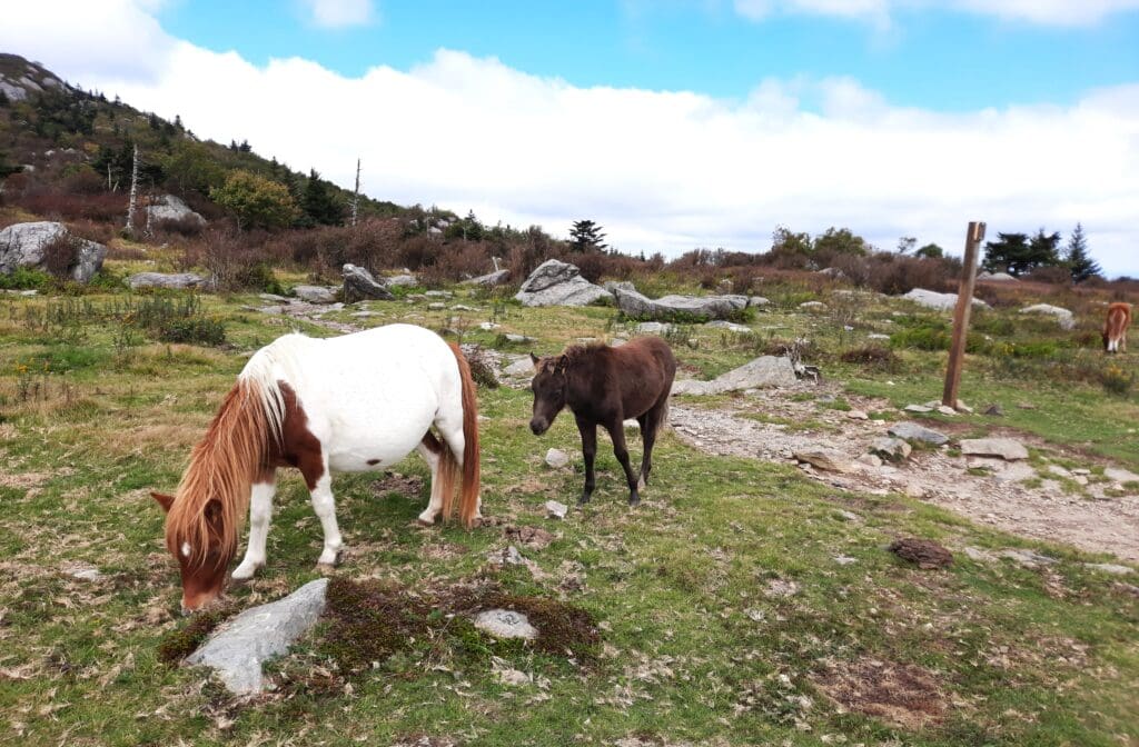
Standing at about four feet tall, the Grayson Highlands Ponies have become a wonderful highlight for anyone visiting the area.
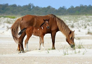
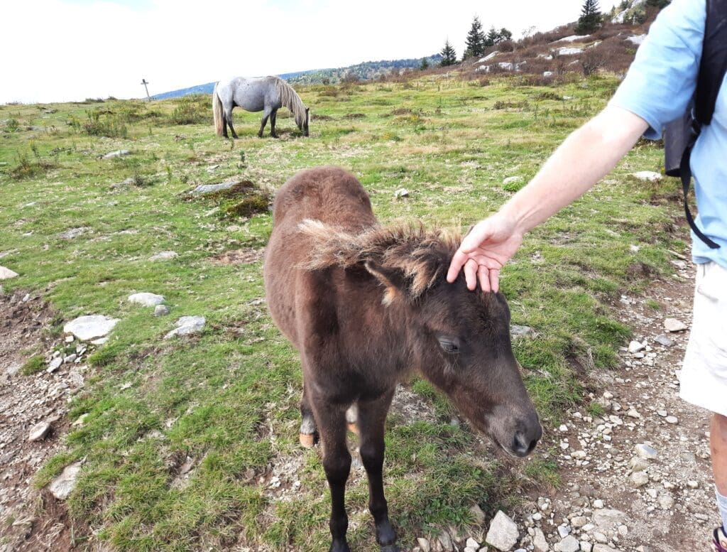
The ponies are used to people and barely look up from grazing as hikers pass close by.
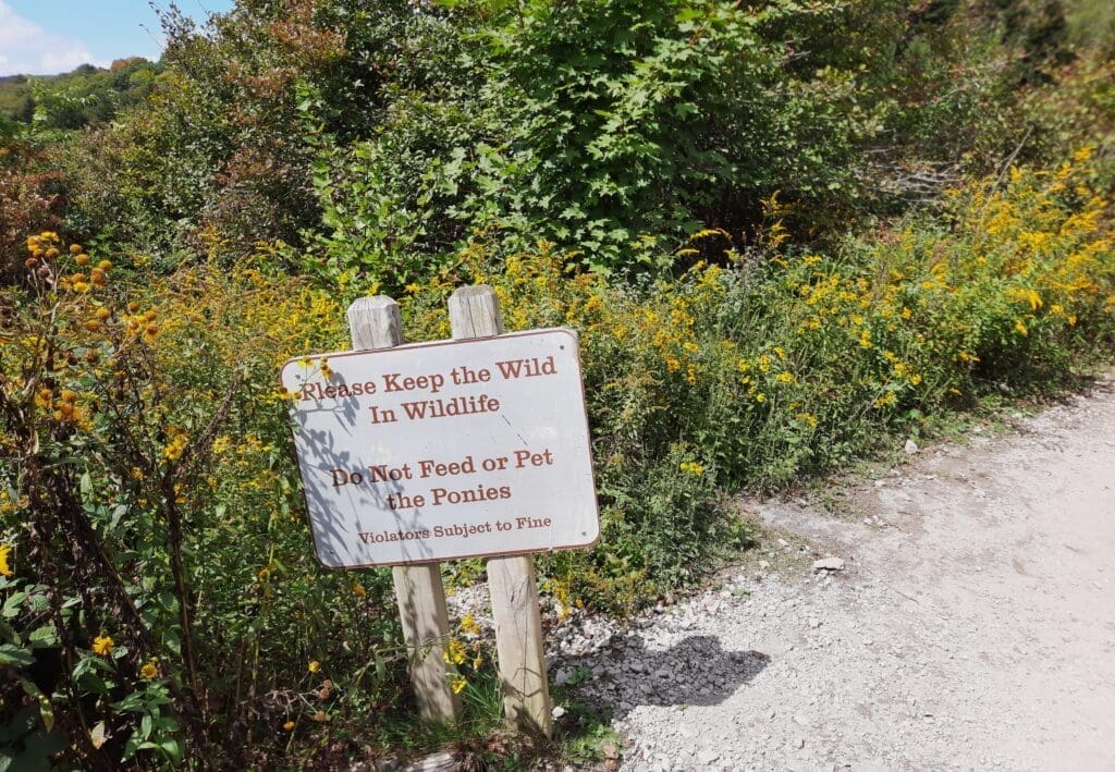
It’s against park policy to touch and feed them, and I tried to comply – but I don’t think anyone told the ponies!
The Herd’s History
According to the Commonwealth of Virginia website, the wild ponies at Grayson Highlands State Park were first introduced to the land in 1974.
The park needed a solution to stop reforestation of the highland balds, and the ponies served the purpose.
-
- Some say that these carefree Grayson Highlands ponies are the descendants of 50 Assateague ponies from the Virginia Coast.
- Another story says that there have been wild equines on the Appalachian Mountains since the 1940s, bred by local ranchers to survive on their own in the wild.
Regardless of how the herd originated, the ponies at Grayson Highlands have been attracting visitors for decades – give or take 30 years 😉
Unlike the wild horses found roaming in the western United States – which are mostly of Spanish mustang descent – the wild ponies of Grayson Highlands are of Shetland pony descent and are not actual horses.
The wild pony population in Grayson Highlands is limited to approximately 120 ponies.
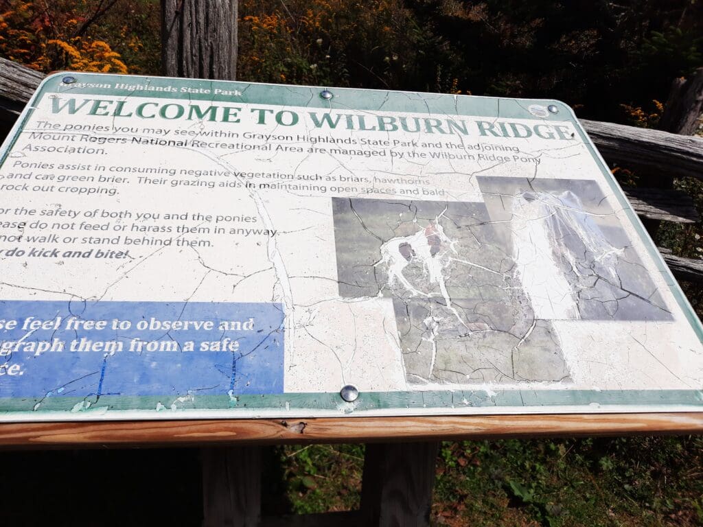
NOTE: The Wilburn Ridge Pony Association, a local citizen group formed in 1974, manages them.

Where Did They Come From, Really?
The U.S. Forest Service, which manages the area, endorses the second pony origin story.
That version maintains that a group of local ranchers wanted to breed small-statured horses that could survive on the Appalachian Mountains, at above 4500′ elevation, with little to no human interference.
So, they bred a horse with a Shetland pony and the lineage resulted in the wild ponies you see living at Grayson Highlands today.
Every Fall, members of the Wilburn Ridge Pony Association round up the ponies and give them a quick once-over to check for any illness and injuries.
Over the years, cowboys have fine-tuned the task.
Using salt licks in place of lassos, they place salt blocks in two different locations, and wait for the salt to lure the ponies in.
When the ponies are gathered, the cowboys do a visual health check and separate extra young males [to prevent the herd from growing too much], and also sometimes a couple of attractive mares, from the herd.
The selected ponies are taken from there by truck and trailer to the auction.
Other than the yearly round up, the ponies are left on their own to munch grass, swat flies with their tails, and attend to other pony business 🙂
Assateague’s Wild Horses
The “wild” horses on Assateague on the Virginia coast – thought by some to be the ancestors of the Grayson Highlands ponies – are actually feral animals, meaning that they’re descendants of domestic animals that have reverted to a wild state.
Local folklore describes the Assateague horses as survivors of a shipwreck off the Virginia coast.
This dramatic tale of survival is popular, but as with the Grayson Highlands ponies, there are no records that confirm that origin story and there’s another conflicting explanation.
That conflicting, more plausible, explanation is that the Assateague horses are the descendants of horses brought to the barrier islands in the late 17th century by mainland owners – in order to avoid fencing laws and livestock taxes.
The Assateague horses are split into two main herds, one on the Virginia side and one on the Maryland side of Assateague.
These herds have divided themselves into bands of 2-12 animals, and each band occupies a home range. They’re separated by a fence at the Virginia/Maryland State line.
The National Park Service manages the Maryland herd.
The Chincoteague Volunteer Fire Company owns and manages the Virginia herd, which is allowed to graze on Chincoteague National Wildlife Refuge.
The grazing permit restricts the size of the herd to approximately 150 adult animals to protect other resources of the refuge.
The Virginia herd is the one often referred to as the “Chincoteague” ponies.
To read more about these horses and their environment go to the NPS page: www.nps.gov/wildhorses
In the years since the ponies were released into the bald at Grayson Highlands State Park , the herd has thrived in the scrubby mountainous terrain.
But Are They Truly Wild?
The ponies are considered wild because they don’t rely on humans for food, water or shelter.
However, some people argue that “semi-wild” is more accurate because they’re very friendly to humans, and have no trouble getting up-close to satisfy their curiosity and ask for snacks.
You should go meet them and decide for yourself 🙂
Plan Your Park Visit
In addition to your usual hike planning, you’ll need to consider your route to actually get to the park, and where you want to stay once you arrive.
The Park Location
The Park is just a short 4-hour drive from the Raleigh area, an even shorter 1.5 hours from Charlotte or Winston-Salem, 2.5 hours from Roanoke, and roughly 7.5 hours from Virginia Beach, Va.
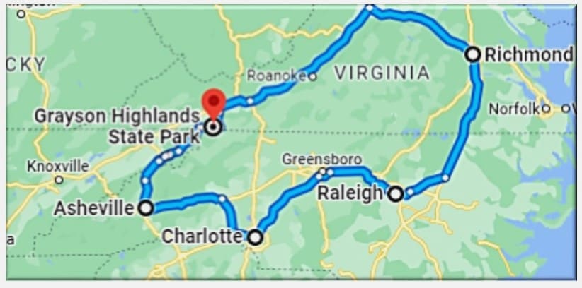
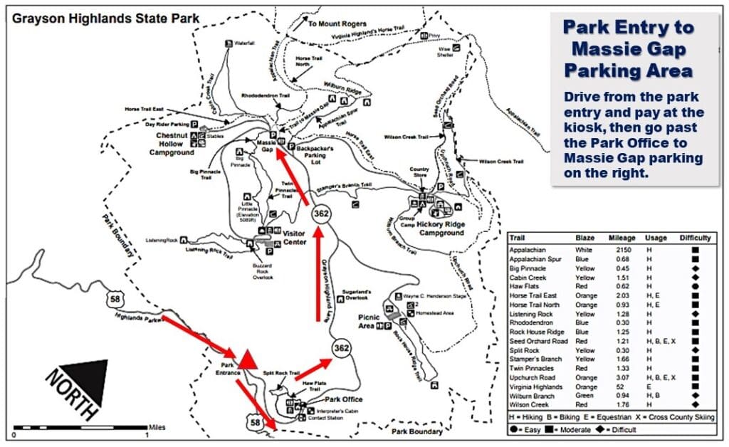
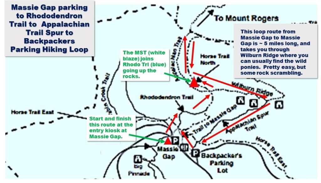
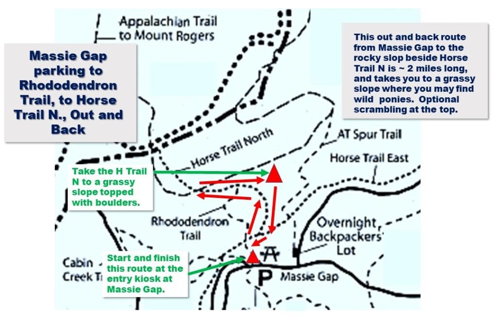
I went through the park entry and used the Massie Gap trail access parking each day, and just walked to the trailheads from there.
This region was once home to early settlers in the late 1800s and early 1900s, and Massie Gap takes its name from Lee Massey, who lived in the gap with his family.
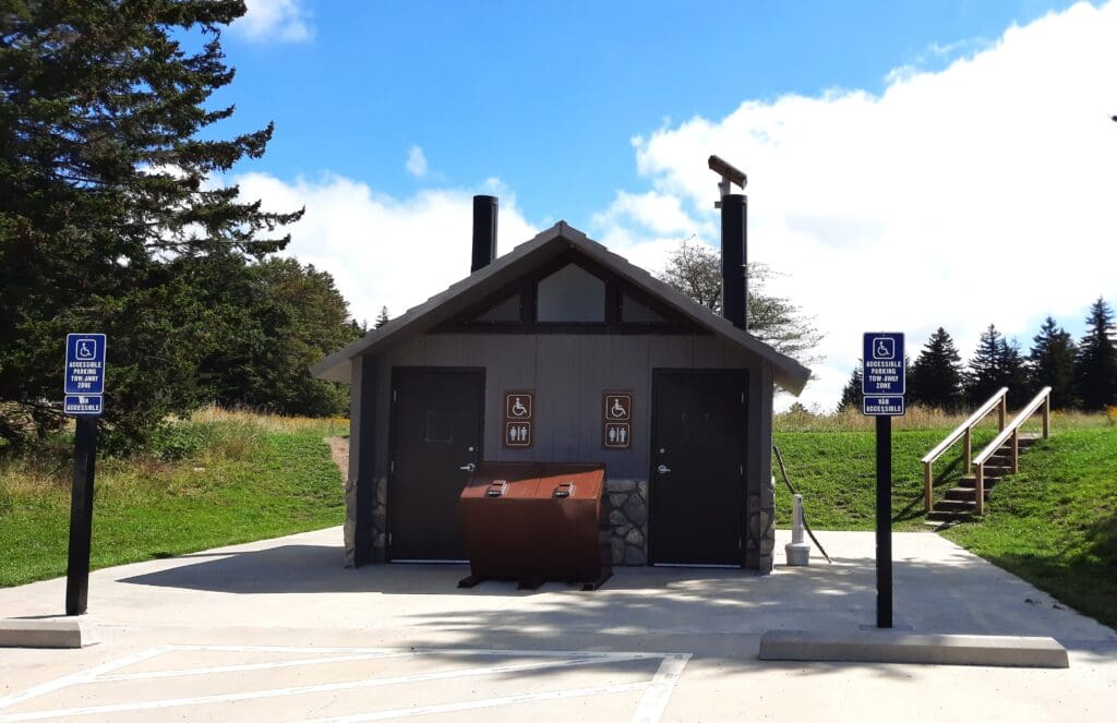
There are limited spots at Massie Gap, so it’s best to get there early!
That said, there is more parking just a few yards further down near the Stable parking and restrooms – also an easy walk to the trailhead kiosk.
DRIVING DIRECTIONS to Grayson Highlands, Massie Gap access :
1) From U.S. Highway 58, go through the park entry gate and pay at the kiosk.
2) turn right (North) onto State Highway 362, and Go past the Park Office on your left.
3) Continue for 2 miles, and you’ll reach the small parking area for Massie Gap on the right.
Where to Stay
You’ve got a couple of options if you want to stay overnight inside the park. But, be warned, none of them have very many amenities.
Even so, you’ll want to make your reservations early, because spots fill up fast!
CAMPING, YURTS & BUNKHOUSE
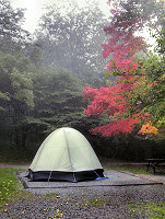
Camping, primitive yurts, and a camping lodge (bunkhouse) are available at Grayson highlands.
For information on availability, or to make a reservation, you can reserve online or call 1-800-933-PARK.
Note: No camping is available from the first Monday in December until the first Friday in March.
To get all of the details about each campground, and learn how to make reservations, see the Park’s camping info page.
Lodgings Outside OF the Park
I stayed at a motel in the small town of Independence, Va. , and there were some available a bit further away in Mouth of Wilson, too.
These were the closest lodgings I could find to the park that weren’t of the camping variety, and they were about a 30 minute drive to Massie Gap.
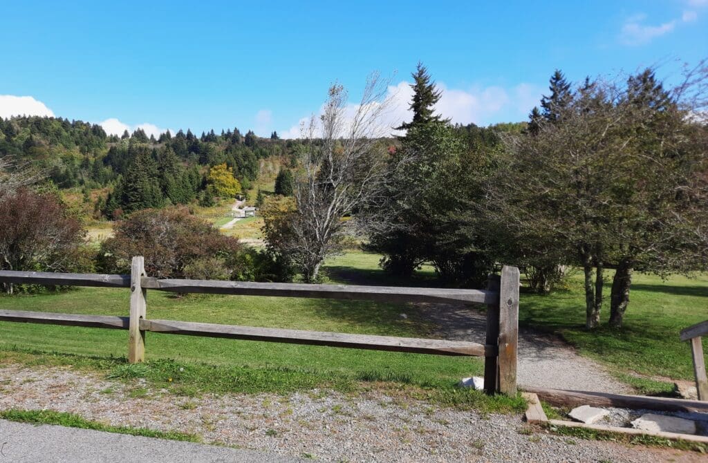
The drive to the Park went through beautiful rolling Virginia hills covered in wildflowers and cattle.
![]() Instead of it being a chore, I looked forward to the drive to the Park and back each day.
Instead of it being a chore, I looked forward to the drive to the Park and back each day.
Park FESTIVALS
Every June, Grayson Highlands hosts the Wayne C. Henderson Music Festival and Guitar Competition. The festival, named for local musician and luthier Wayne C. Henderson, features old time and bluegrass music.
The Grayson Highlands Fall Festival is an annual event with a variety of entertainment including live bluegrass and traditional music, molasses making, and demonstrations of pioneer-living.
This Fall festival also hosts the auctions for selling excess colts from the “wild” pony herd.
Grayson Highlands Hiking
My visit to Grayson Highlands State Park was in September.
The weather was absolutely perfect, with sunny blue skies and just a hint of Fall in the air.
Because a lot of kids had already gone back to school, the Park wasn’t at all crowded, either.
Hiking Trails
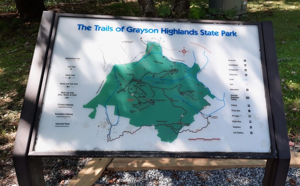
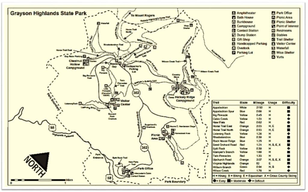
Thirteen trails originate within the park, and they’re all pretty short in length. (See trail list below).
-
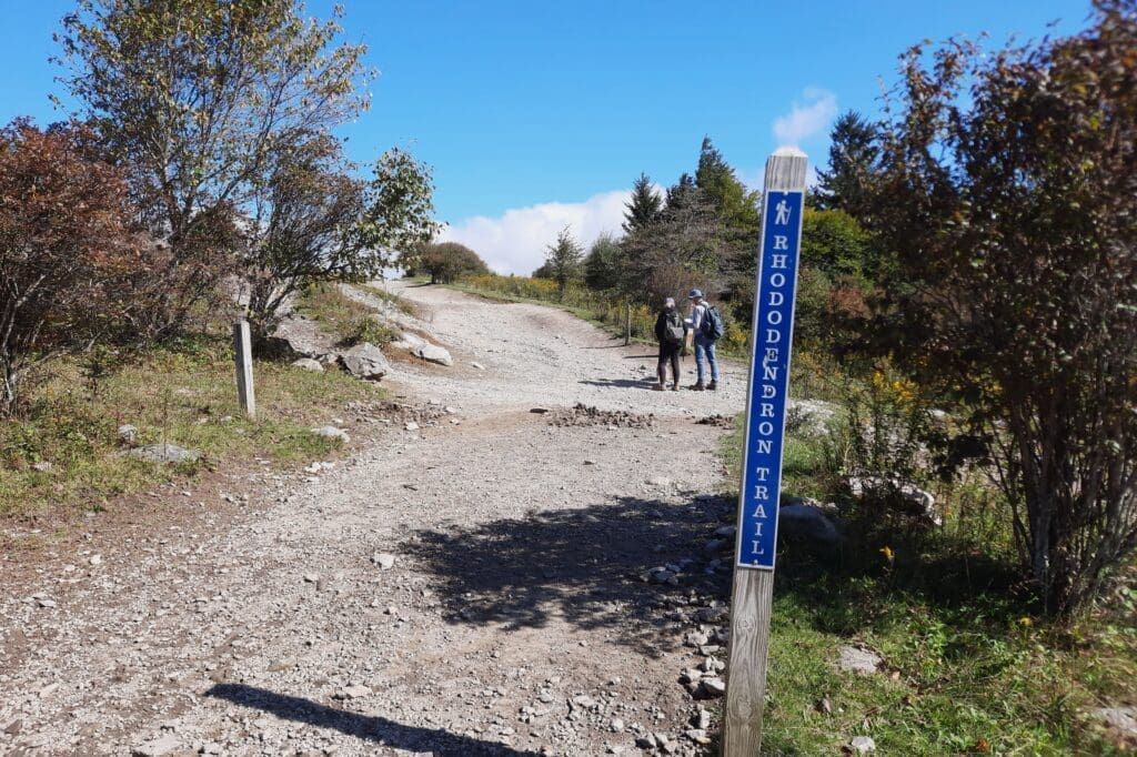
- Rhododendron Trail: 1.0 mile (1.6 km)
- Cabin Creek Trail: 1.9 miles (3.1 km) loop
- Big Pinnacle Trail: 0.4 mile (0.6 km)
- Twin Pinnacles Trail: 1.6 miles (2.6 km)
- Listening Rock Trail: 2.0 mile (3.2 km) loop
- Wilson Creek Trail: 1.8 miles (2.9 km)
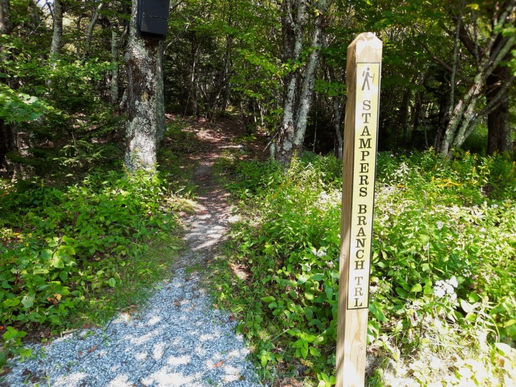
- Stampers Branch Trail: 2.0 miles (3.2 km)
- Rock House Ridge Trail: 1.2 miles (1.9 km) loop
- Appalachian Trail: 2.8 miles (4.5 km)
- Horse Trail (east): 1.7 miles (2.7 km)
- Horse Trail (north): 1.0 mile (1.6 km)
- Appalachian Spur Trail: 0.75 mile (1.2 km)
- Wilburn Branch Trail: 0.8 mile (1.3 km)
That said, several of these connect to the extensive trail networks of Mount Rogers National Recreational Area and the Appalachian Trail – as well as to each other within Grayson Highlands.
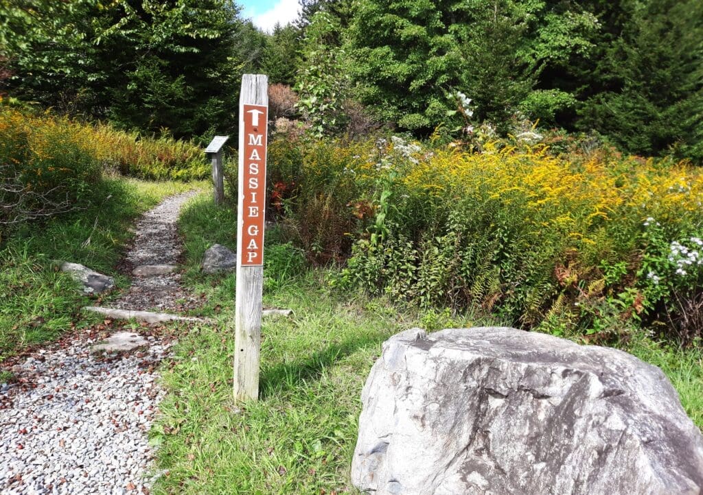
Mountain hikers should note that the least strenuous and shortest trail to the summit of Mount Rogers originates at Massie Gap, and is only 4.2 miles (one way).
The Massie Gap approach is considered the most scenic, and is definitely the most popular, route option for summiting Mount Rogers.
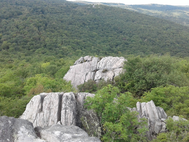
Bouldering
Grayson Highlands is also known as the best bouldering site in Virginia – which I didn’t know until I started researching this article!
So I totally missed it while I was at the Park…
I did do a bit of scrambling on some of my hikes, but the bouldering sounds pretty serious – and for sure I’ll go back and check it out!
More About Mount Rogers
Mount Rogers, famous at an elevation of 5,729 feet as the highest peak in Virginia, takes it’s name from William Barton Rogers, who was Virginia’s first-ever State Geologist as well as the founder of the Massachusetts Institute of Technology (MIT).
Just a year after Grayson Highlands State Park was created in 1965, the United States Congress established the Mount Rogers National Recreational Area (NRA).
You can hike to Mount Rogers’ summit in just over 4 miles from Massie Gap in Grayson Highlands.
In addition to being a State Highpoint, Mount Rogers is also the highest point of two counties – one of only four such peaks in Virginia.
The nearest higher peak is Grandfather Mountain, over 40 miles away in neighboring North Carolina.
My visit was a short one, and I was spending only 2 nights in the area.
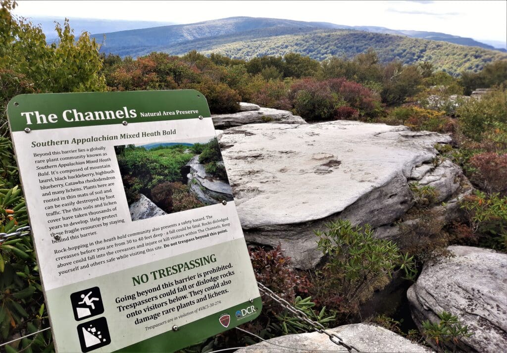
I took the first afternoon following the drive in from Raleigh to hike The Channels at nearby Brumley Mountain.
So, I really only had 1 full day and one morning to hike in Grayson Highlands before my drive back home.
DAY 1 HIKES
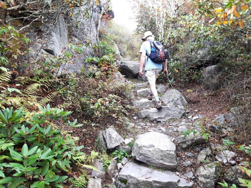
Most of the trails at the park aren’t very long, but some are quite steep and rocky – in other words, fun!!
But I have to admit I got a little confused when I tried to recall my exact hiking routes, for a couple of reasons…
FIRSTLY:
-
- There was a helpful elderly hiker who decided to see me safely through a crowd of steers at the main trailhead crossing, so I was diverted from my intended path for a bit.
- I went back and repeated that route (more or less) later in the day to take more photos and go where I had initially intended to go.
- So those 2 routes have kind of merged in my memory….
AND:
-
- The trails all seem to come from and lead back to a central kiosk and turnstile, so it’s easy to get turned around.
-
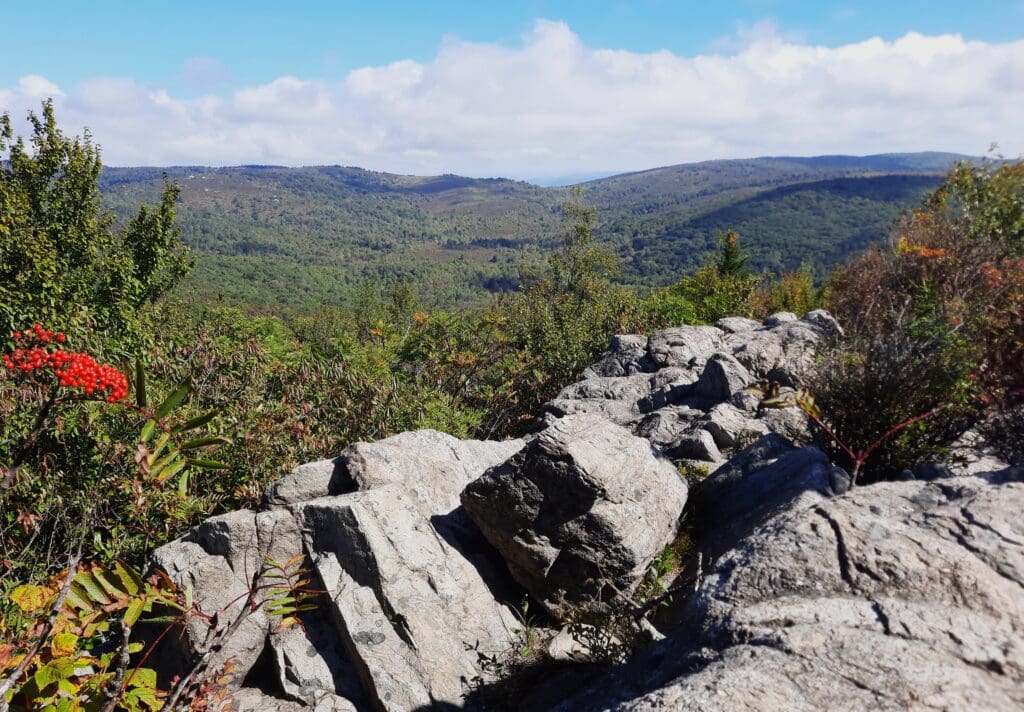
- That said, if you do get confused you can see for miles from the Ridge, and quickly get your bearings again.
Below is a compilation of the first 2 route(s) I took on my full day of hiking at Grayson Highlands, to make around a 5-6 mile hike:
I hiked twice as many miles as this because I hiked some of the trails more than once the first day, so you can tell it’s not hard hiking and you can go pretty briskly.
I’ll just call the consolidated route “Hike 1”.
HIKE 1: Along the Trail
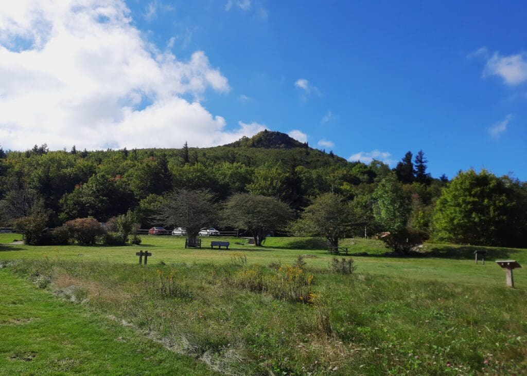
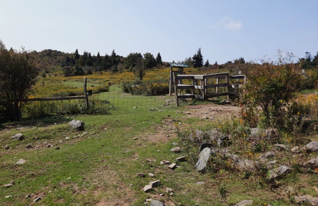
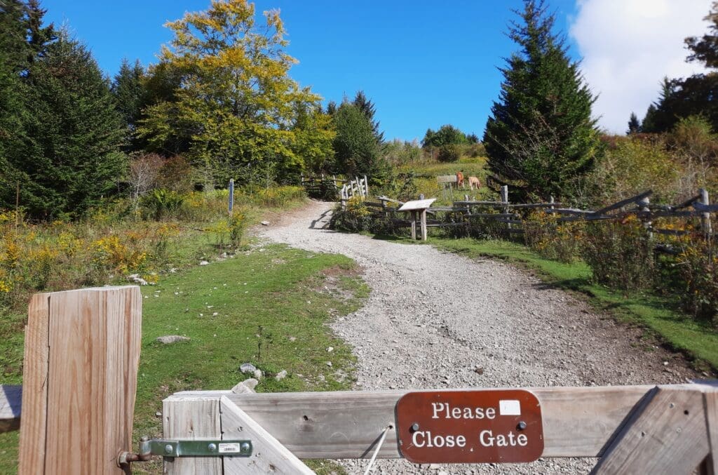
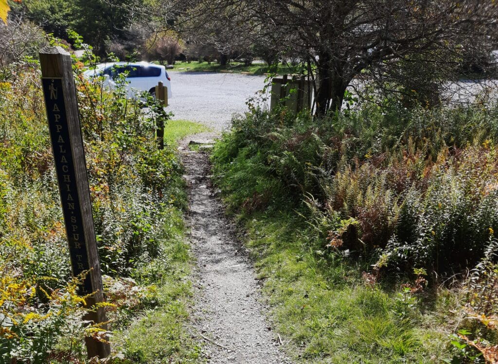
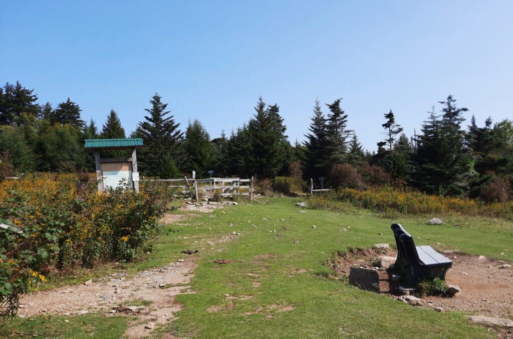
Cross the grassy field from the Massie Gap parking area to the central kiosk in front of the trail, then go through the gate (and close it behind you).
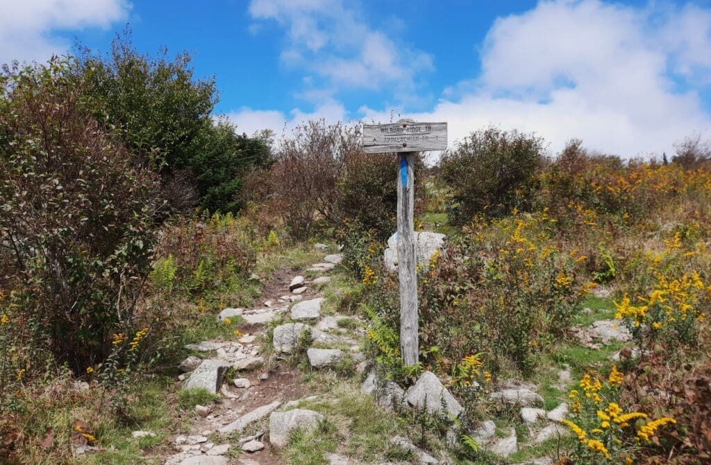
The Rhododendron Trail is straight ahead, and is the easiest way to make your way to Wilburn Ridge, where the ponies hang out.
When I was first looking at my maps, I thought Wilburn Ridge was a trail, but it’s really just an area of the Park.
Wilburn Ridge
Wilburn Ridge is named after the famed bear and wolf hunter Wilburn Waters, born in 1812 in Wilkes County, North Carolina to John Phillip Waters and Elizabeth Cullom, a mixed-race Catawbas Indian.
There’s a boulder – the Wilburn Waters Boulder – in the Park that’s named for him, too.
Waters made a name for himself doing predator control on wolves and black bears in the Blue Ridge Mountains in the mid-1800s.
Stories of his exploits are still told:
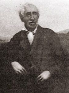
Waters is said to have killed more than 100 bears during his hunting career, and went hand to hand with black bears and wolves on multiple occasions.
A book that retells some of his more famous adventures is sold in the Park Office and Visitors Center.
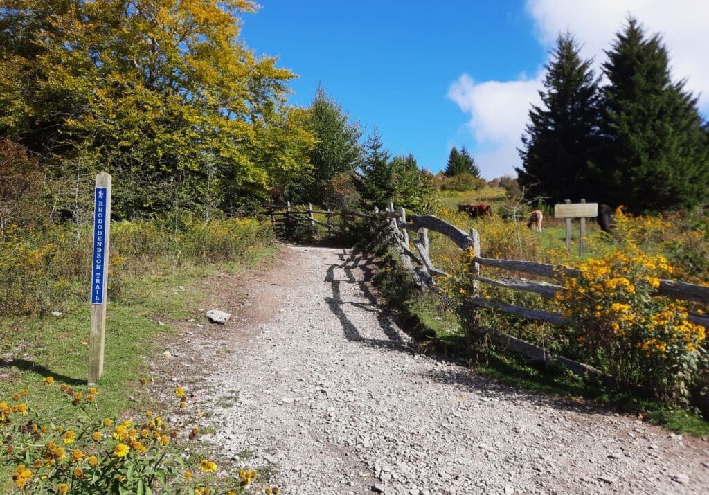
Anyway, getting back to the hike: keep following the Rhododendron Trail.
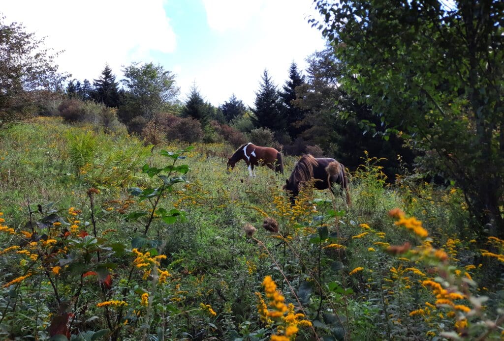
I was fortunate to see ponies right away, grazing on the other side of a split-rail fence lining the trail.
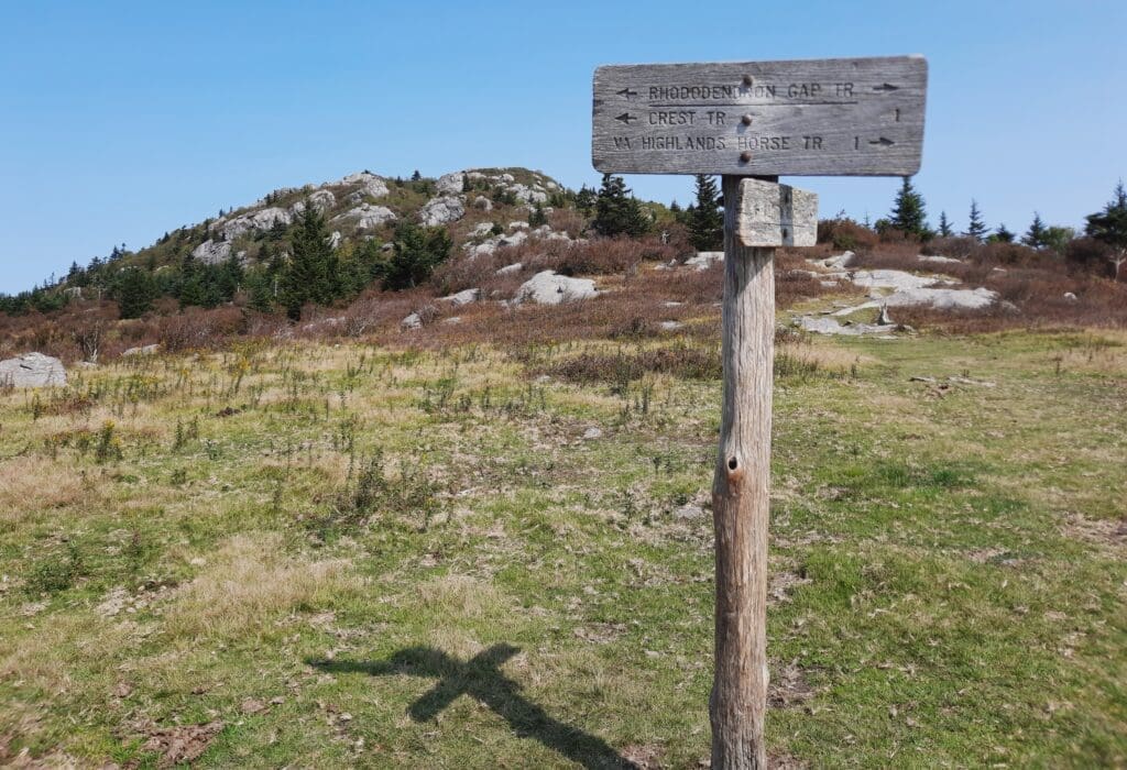
Keep going on the Rhododendron trail (blue blazes) until you get to an intersection with a bench, a kiosk and a turnstile.
And, if you’re lucky as I was the first time, some cattle!!
So, at the multiple trailhead junction, to go up to Wilburn Ridge, take the trail that says Appalachian Trail, Rhododendron Gap.
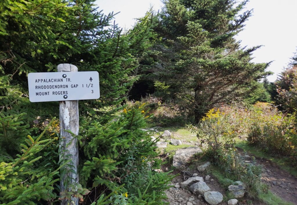
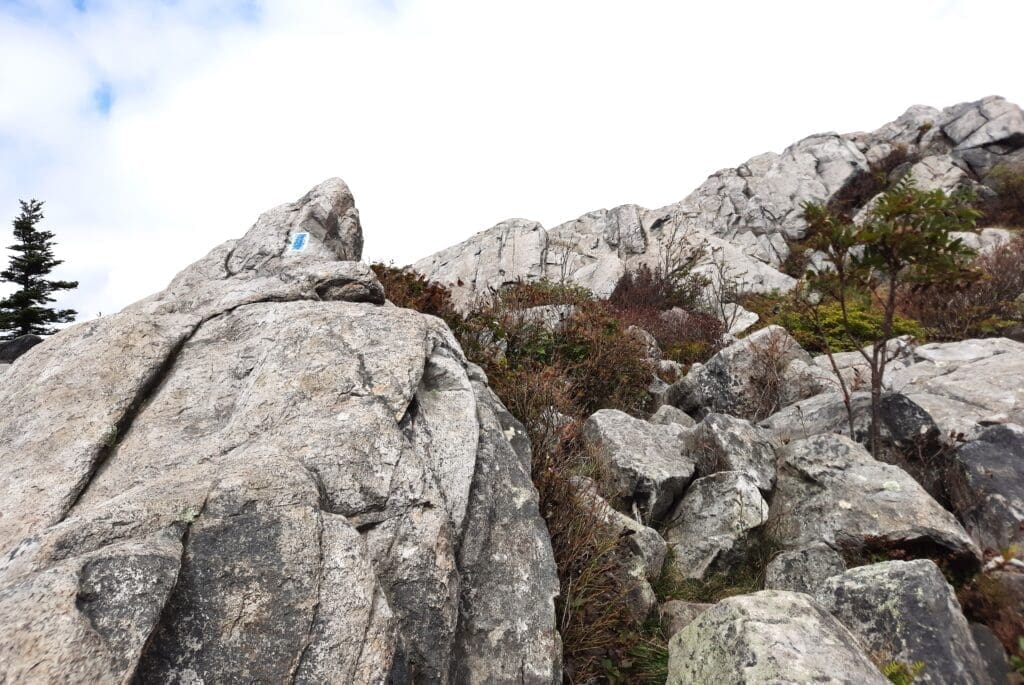
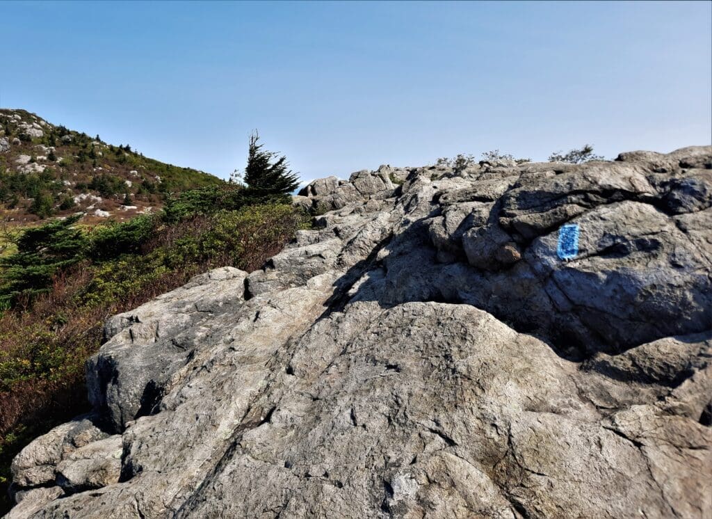
Follow the trail (blue/white blazes) for a mile or so.
At first, the trail is just a rocky path, going mildly uphill.
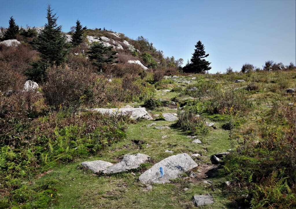
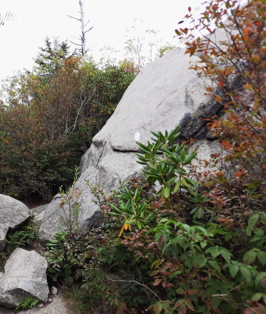
Then after a while, you’ll hit the big rock pile!
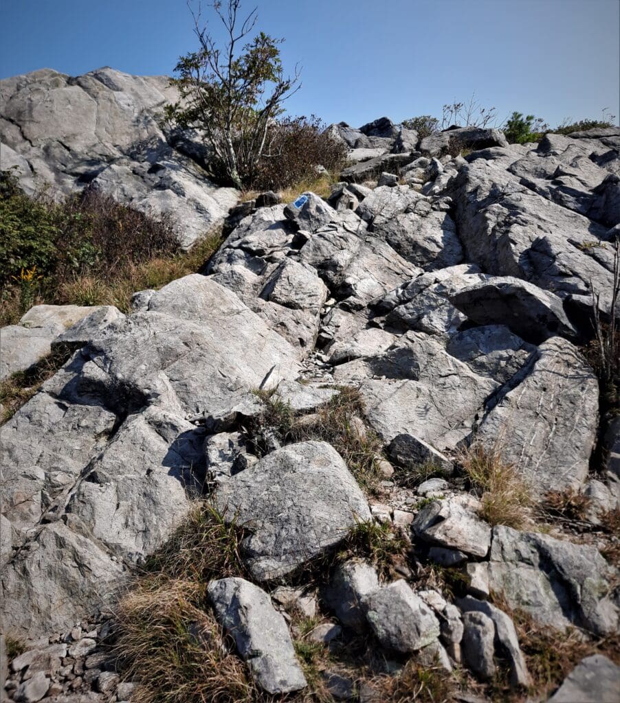
Follow the blue blazes up and over the other side of the rocks.
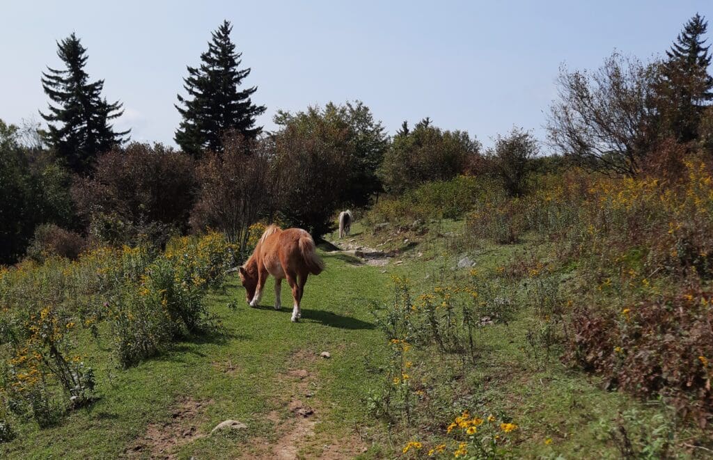
You might see ponies grazing below on the other side of the pile.
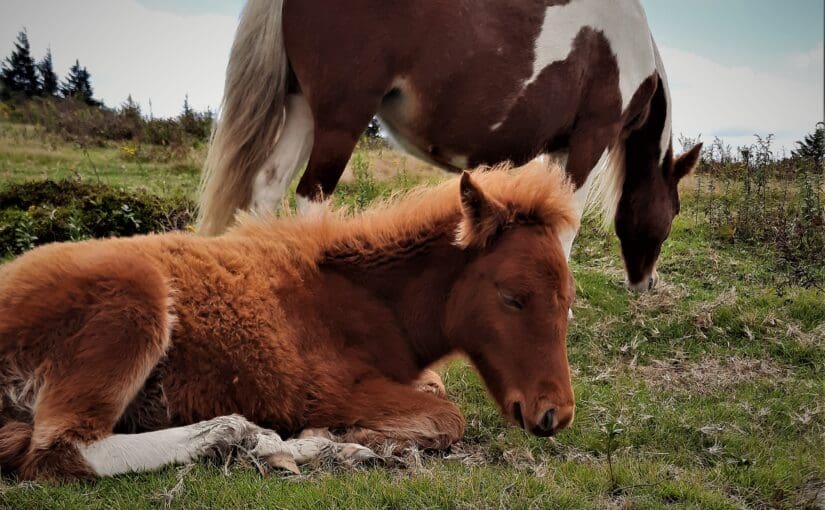
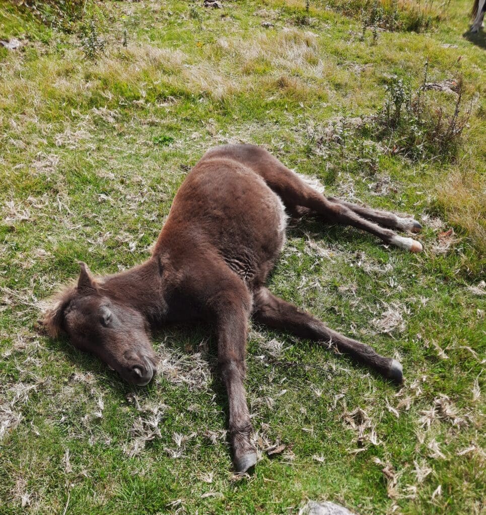
When I got down off the rocks, I found at least a dozen ponies and foals grazing on the other side.
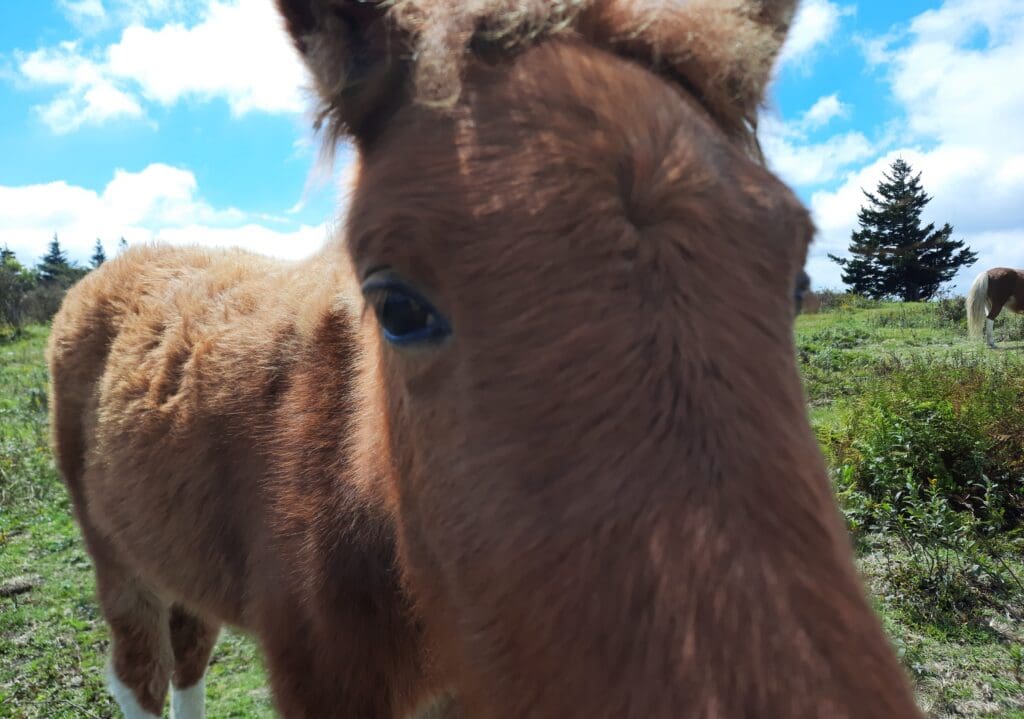
I hung around and took photos of the ponies, especially of the younger ones who checked my pockets for snacks.
One of them even nibbled my kneecap through my trousers – I think because he thought it was an apple!
Then, there was some sort of signal only the ponies could hear, and all of the babies decided it was nap time.
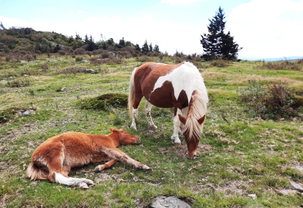
Clearly, being a pony is exhausting work 🙂
i decided to follow the Appalachian Trail further, so I followed the trail North from the sign in the middle of the ridge.
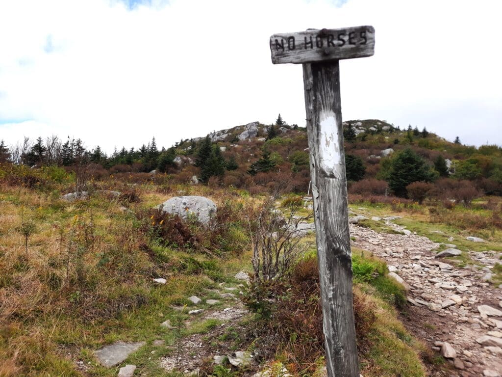
The sign said, “No Horses'”, and sure enough, the ponies didn’t go past that point.
Pretty literate, for ponies 😉
I followed the AT to the Park boundary, and then turned around.
I followed the trail back down to the ridge again, where the ponies were grazing.
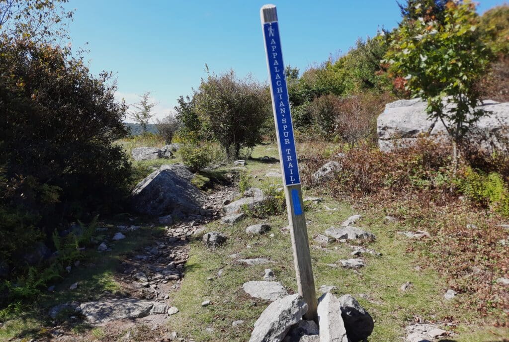
Then from there, I took the AT South (from the Rhododendron Gap sign) towards the AT Spur trail.
The Rhodo Gap trail goes downhill, and there’s some loose rock so watch your step!
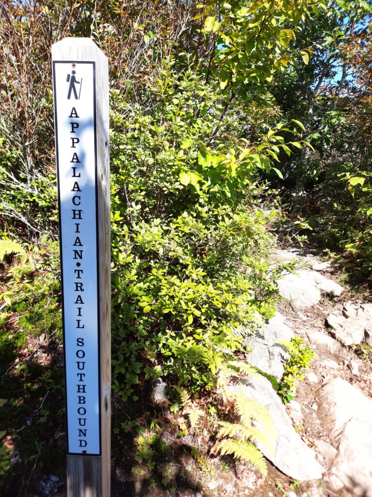
In a little while, you’ll get down off the ridge, and see a sign for the AT Southbound.
Your next turn is at the Appalachian Spur Trail.
The trail will take you through meadows and into the woods, beside a babbling stream.
Eventually, you’ll come to a red gate by a little bridge.
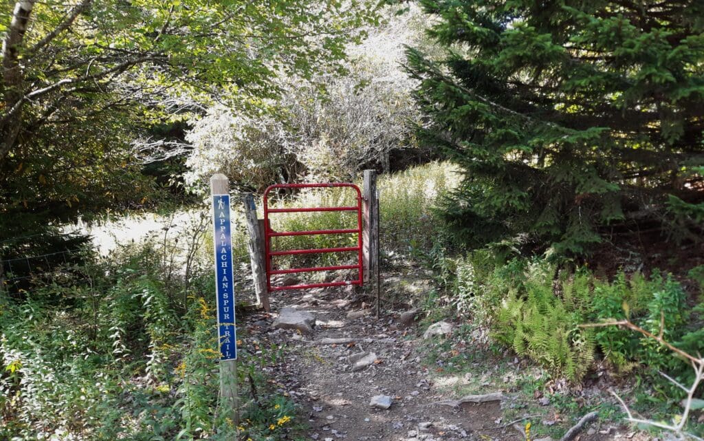
Soon you’ll emerge into the Backpackers Parking lot.
Cross the lot to go back onto the trail that returns you to Massie Gap.
You should emerge from the woods into the grassy field between Massie Gap parking and the trailhead kiosk at the Rhododendron Trail trailhead.
Later in the day, I had to decide whether I wanted to tackle another longish hike or just go mess around with ponies some more, and maybe climb some rocks.
You guessed it – I went for ponies and rocks! But, in a little bit different area of the park.
And, because it was a different area of the park, it was also a completely different group of ponies.
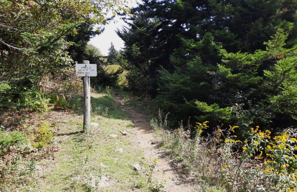
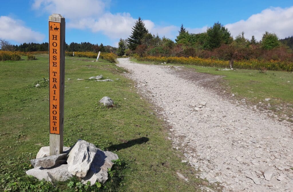
That said, I started the hike from Massie Gap to Rhododendron Trail again, up to the turnstile with all of the trailheads again, but then took a different trail – the Horse Trail North.
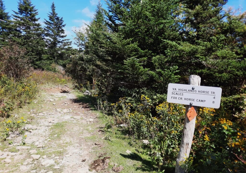
The Horse Trail North becomes a broad gravel trail.
As you walk along, soon you’ll see some rocks in the distance off to your right at the top of a hill.
I was fortunate enough to have a herd of ponies between me and the rocks 😉
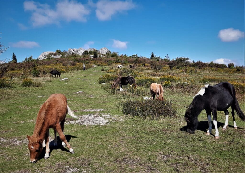
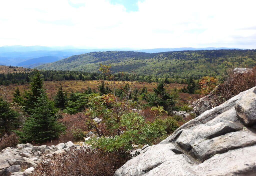
I made my way up the hill, between the ponies. Once I reached the rocks, I climbed up high enough to see the whole area below and found a comfortable seat.
I had a snack and enjoyed the view for a bit.
When the sun started to sink lower in the sky, I made my way back down to the grassy slope, where I found a little “Wild Kingdom” drama about to unfold.
As I walked down the slope, enjoying the changing light of approaching sunset, I could see a group of horses in a grassy area to the right, roughly forming a circle.
Pony Fight!!
The pony circle included a mare with a brand new foal, still slightly unsteady on it’s legs, maybe only a few days old.
Suddenly a stallion ran in from across the hills at the right into the center of the circle, neighing and thrashing his front hooves in the air.
A couple of other hikers and I watched from the grassy slope to the left of the circle, as all around us other male ponies – even the youngest colts – got agitated and ran to join the pony circle.
Another larger male appeared from behind us hikers, and raced to join the other stallion in the circle’s center.
All of this happened in just a matter of seconds – and we humans stayed very still while the horses raced around us.
The two males in the circle reared up on their hind legs, and crashed into each other, neighing and thrashing.
Then, almost as quickly as it had started, the pony fight was over.
The challenger raced away, and the older stallion stayed with the other ponies. As far as I could tell, neither of them had been seriously injured.
The other ponies drifted away from the circle and went back to their usual activities. We humans did the same.
The sun was getting pretty low, and I still had to hike a couple of miles back to Massie Gap before making the winding drive back to my lodgings in Independence.

So I set off briskly, hiking down the hill toward the Massie Gap parking area. What a wonderful day!
DAY 2
The next day, I arrived early at the Park with only a few hours to spend at Grayson Highlands before I had to get on the road back home.
Once again, I had to choose between a serious hike (a.k.a. Mount Rogers Summit) and just messing around, maybe see more of the Park and some more ponies.
Guess which thing I chose? 😉
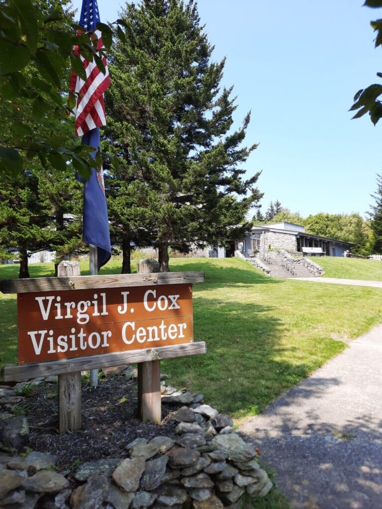
Visitor’s Center
Usually the first thing I do at a Park new to me is go to the Visitor’s Center to check in with a Ranger, get a map and see if there are any trail closures.
But Grayson Highlands is organized a bit differently, and I already had three (yes, three!) printed trail maps, so on the first day I had just gone straight to hiking once I was parked.
So on the second day, I did take time to visit the Visitor’s Center for a little while in the morning before my drive home.
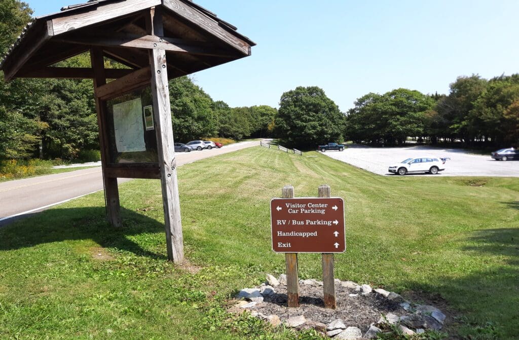
It’s just a short drive along the road beyond Massie Gap to get there.
Parking is in two lots a short walk away from the Center.
You’ll find a couple of short wooded hikes there starting from near the building.
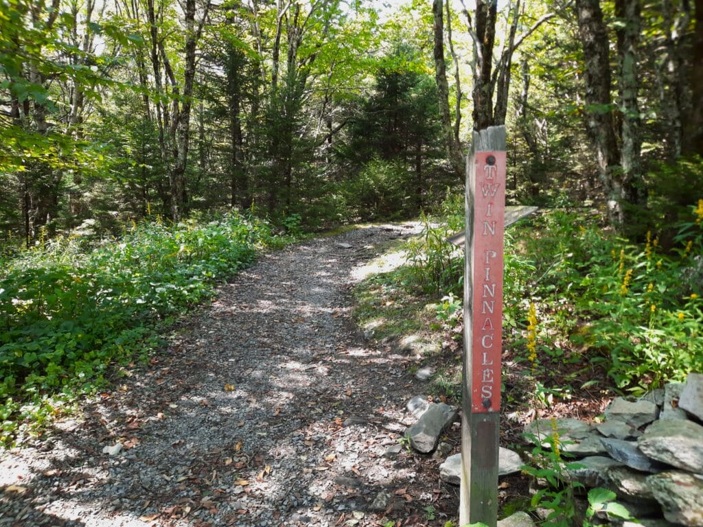
Twin Pinnacles and Stampers Branch trailheads are both just off the sidewalk around the Visitors Center.
I poked around, but wasn’t really interested in those trails, so I drove back to Massie Gap.
I only had a couple of hours left, so I quickly parked and set out to the trailhead for the Rhododendron Trail again.
I hiked back up to Wilburn Ridge and spent more time with the ponies, then came back to Massie Gap the same way.
It was a great visit, and there’s still plenty of new trails – and boulders! – to try the next time 🙂
Park Info
Entrance Fee
Entrance to Grayson Highlands State Park is $7 or $10 at the self-pay kiosk on the way into the park.
For other fee information go here: https://www.dcr.virginia.gov/state-parks/parking-fees
The Park is open 8am-10pm.
I hope this post has inspired you to visit Grayson Highlands State Park to visit the wild ponies, get in some hiking and maybe even try some bouldering!
If you have a question drop me an email and I’ll reply as soon as I can.
Thanks for stopping by – see you next time! LJ
To Get New Idratherwalk Posts
sent directly to your inbox (how convenient!) Click this Button
If you like this post, please share it!

LJ has spent much of her free time as a single Mom – and now as an empty-nester – hiking in the US and around the world. She shares lessons learned from adventures both local and in exotic locations, and tips on how to be active with asthma, plus travel, gear, and hike planning advice for parents hiking with kids and beginners of all ages. Read more on the About page.