Most recently updated October 15th, 2024
Estimated Reading Time: 14 minutes
The Great Channels are right on the edge of the areas of North Carolina and Virginia that were hardest hit by Hurricane Helene.
That said, the Park is open (with some restrictions) and many of the surrounding communities are open for business and could really use your Fall vacation dollars to help rebuild!
Go to my Hurricane Helene page to get the latest updates on the latest Park, Trail and road repairs.
I finally got to explore the Great Channels on Brumley Mountain, Virginia earlier this Fall after obsessing over it for nearly a year!
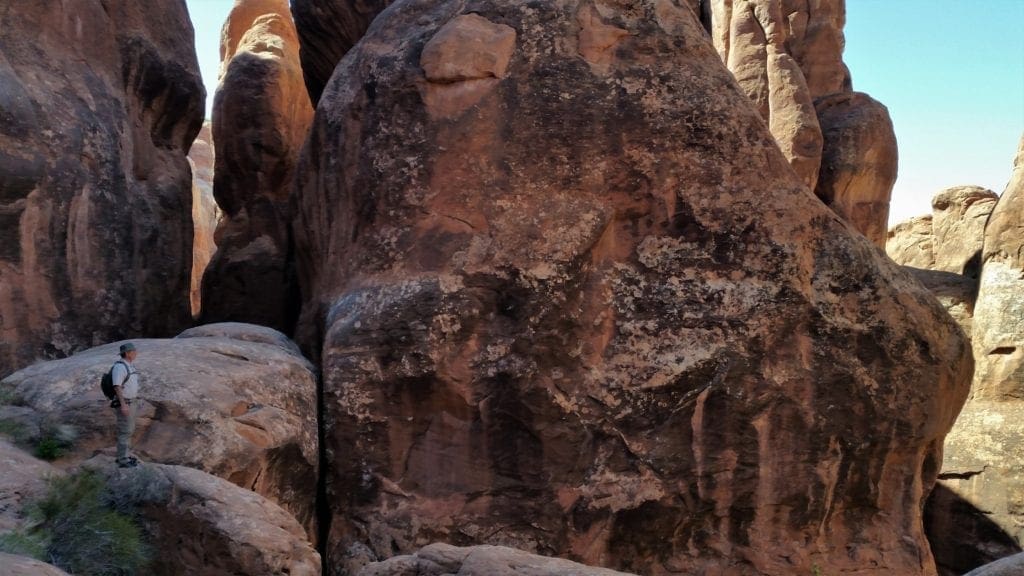
The Great Channels sit at the summit of a mountain, and features a maze of slot canyons similar to those you might find in the parks in Utah or Arizona.
But the Great Channels formation is a surprise geologic gem hidden in southwest Virginia!
Anyway, last year, while planning a hiking trip to Grayson Highlands State Park (more on that later), I stumbled across an article about the Great Channels.
“Stumbled” is probably not the best word for a hiker to use, but you know what I mean 😉
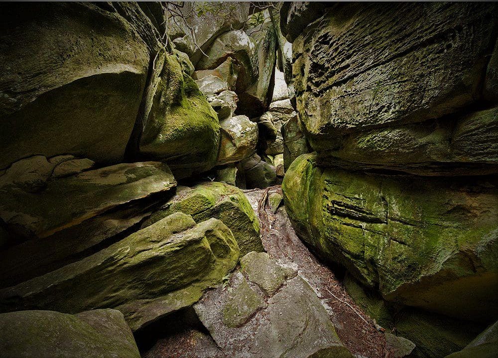
The Channels are a series of deep crevices worn into prehistoric sandstone outcrops, where you can walk down into the maze-like network of crevices and explore.
You can also climb up on top of the Channels to get a stunning 360 view of the surrounding mountains!
Read on to learn how you can hike to the Great Channels, too.
Some of my posts contain affiliate links. If you make a purchase through an affiliate link, I will receive a small payment at no additional cost to you. I do not get paid for recommendations, all opinions on this site are my own. See full Disclosure page here.
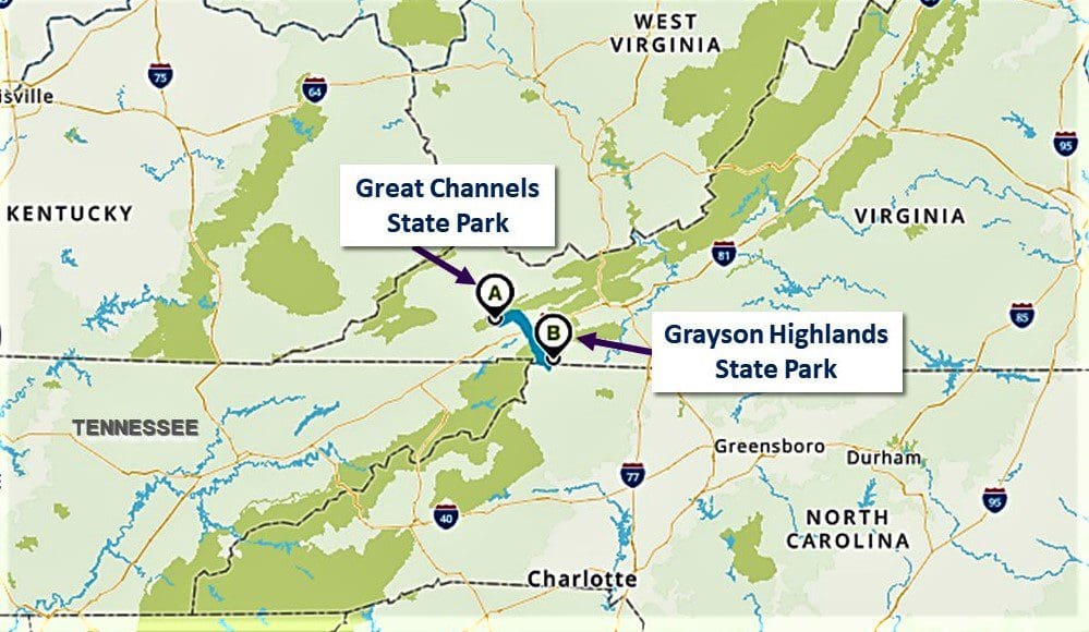
Where are The Great Channels?
Both the Channels and Grayson Highlands are in southern Virginia, pretty close to the northern borders of both Tennessee and North Carolina.
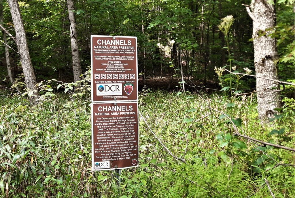
The Channels can be found deep inside the Channels State Forest, specifically in the Channels Natural Area Preserve, which is contained by the State Forest.
About Channels State Forest
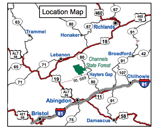
Along Clinch Mountain, Channels State Forest covers 4,836 acres in Washington and Russell counties.
With elevations ranging from 1,800-4,200+ ft above sea level, it’s a predominantly hardwood forest with several streams flowing through it.
Visitors might see black bears, red fox, white-tailed deer, bobcat, hawks and even Bald Eagles.
NOTE: Plan to sing on the trail or bring your bear bells 😉
This is a very popular area for birding and horseback riding, so you’ll probably see some other people during your hike, too.
I did see a few other hikers, and because it wasn’t at all crowded, the other people actually added to the experience in a good way. 🙂
What are the Channels?
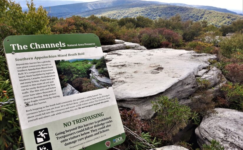
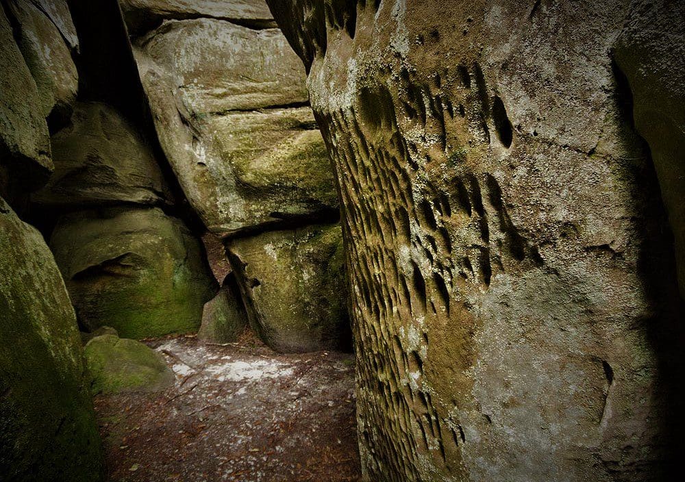
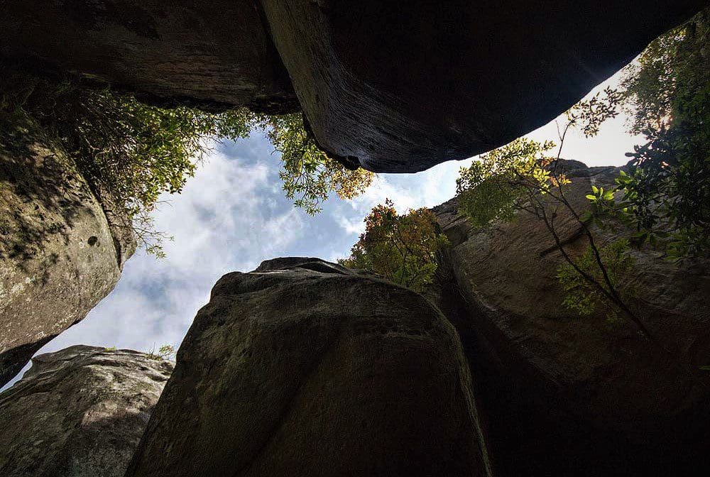
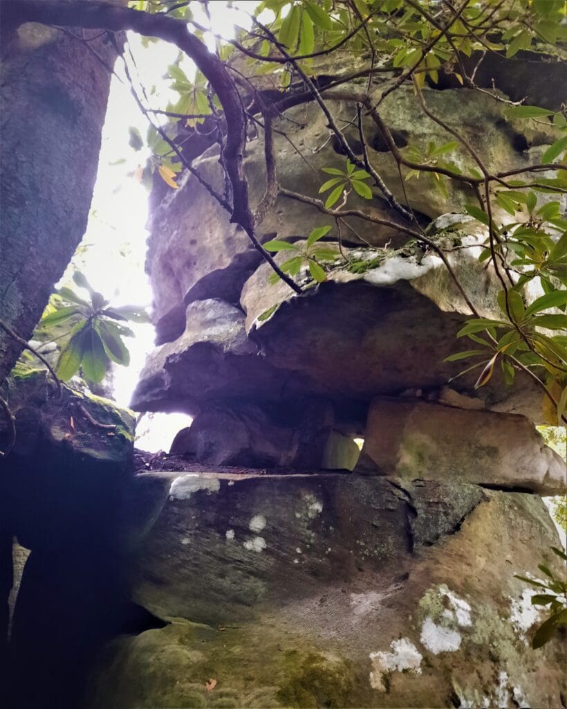
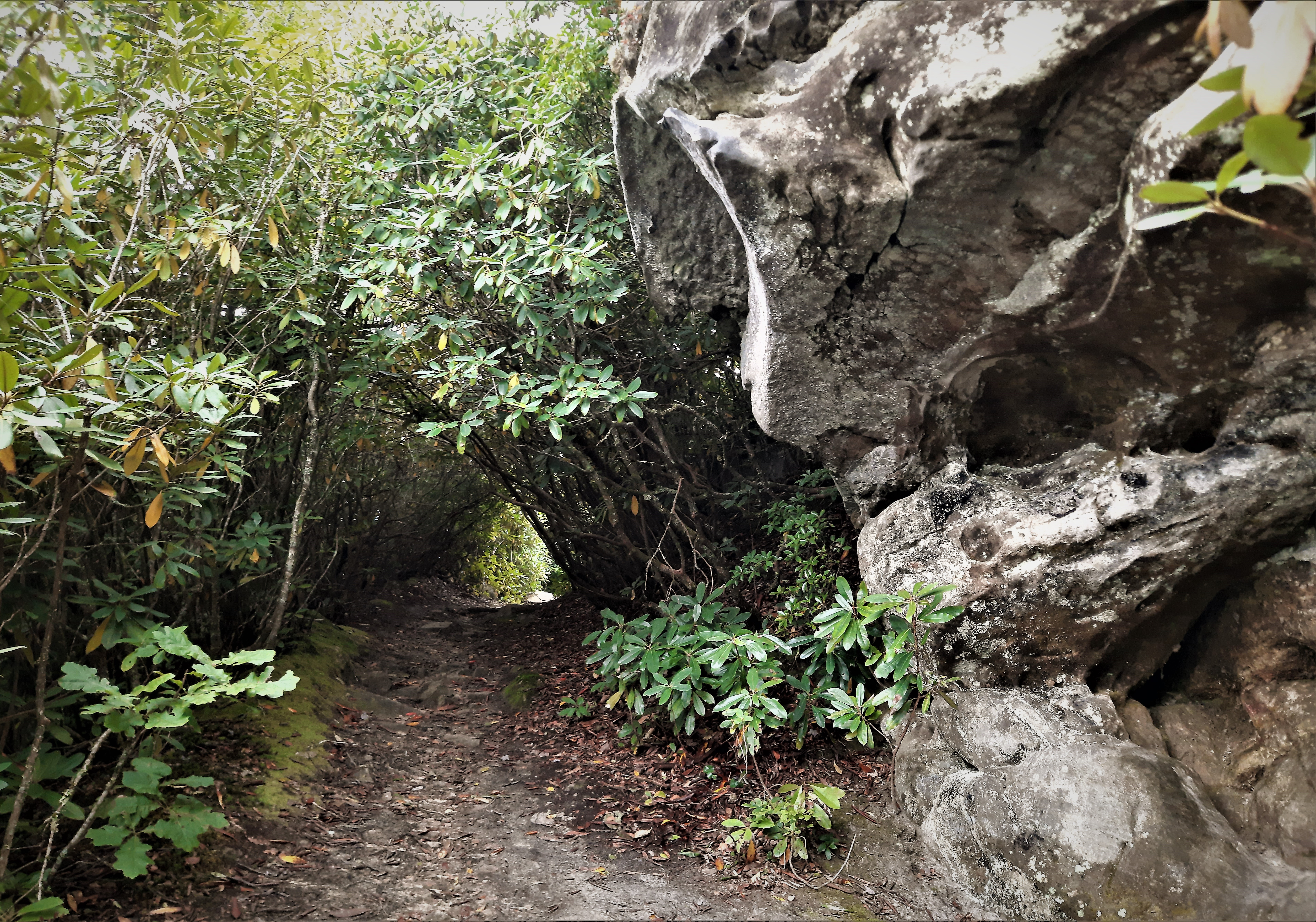
This impressive formation is a sandstone outcropping where time and weather have created a maze of deep crevices or “channels” in between very large boulders.
The sandstone maze covers about 20 acres, and sits hidden at the top of Middle Knob – elevation 4208’ – just beyond the Middle Knob Firetower.
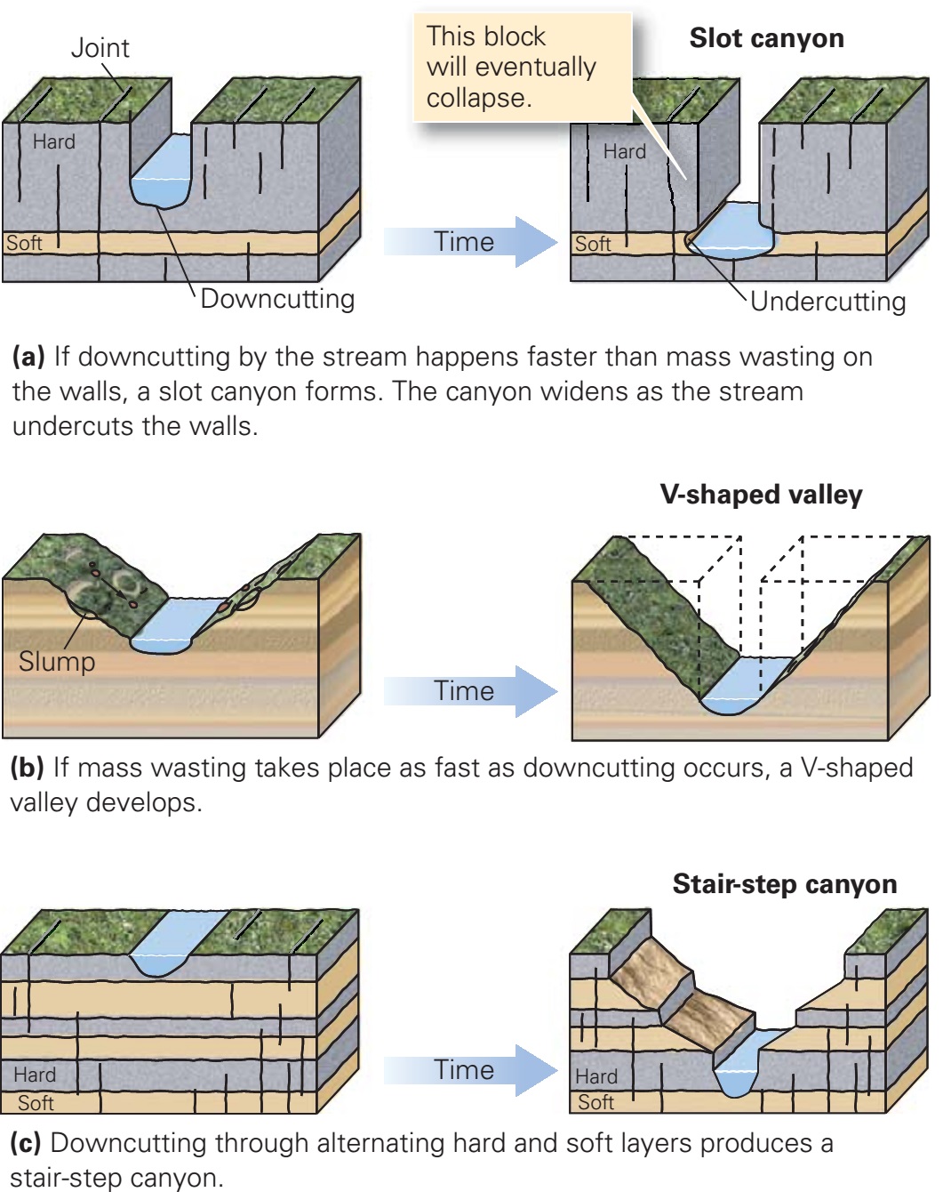
The Channels Are 400 Million Years Old
At one point, 400 million years ago, the Great Channels of Virginia were a single sandstone cap rock.
Geologists believe that the change into separate boulders, outcroppings, and crevices occurred during the last Ice Age.
The pathways in the maze range from 20-40 ft deep and wind their way through damp, moss-covered walls of stone.
Some pathways loop around and connect to other paths and some just reach a dead end.
It stays shady and cool in the Channels even on a hot sunny day. It was mostly cloudy during my visit, and after a while, the maze started feeling kind of claustrophobically creepy.
I probably should have spent more time in the maze – especially after the long uphill hike to get there! – but after a little while, I was more than ready to get back up top into the open air.
Though over 400 million years old, The Channels has only been open to the public for a little over a decade, so it’s really one of Virginia’s newer hikes!
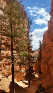
Series of small slot canyons like The Channels are fairly common in the Southwest, but they’re pretty rare on the east coast.
For sure, there’s nothing like the Channels anywhere else in Virginia.
More About Slot Canyons
A slot canyon is a very narrow gorge with steep, high walls often made from soft rock such as basalt or sandstone.
Some have waterfalls at their tail ends, and a river on the bottom.
Deeper than they are wide, these canyons can be treacherous hiking, since they’re prone to flash floods and don’t have many ways to get in or out.
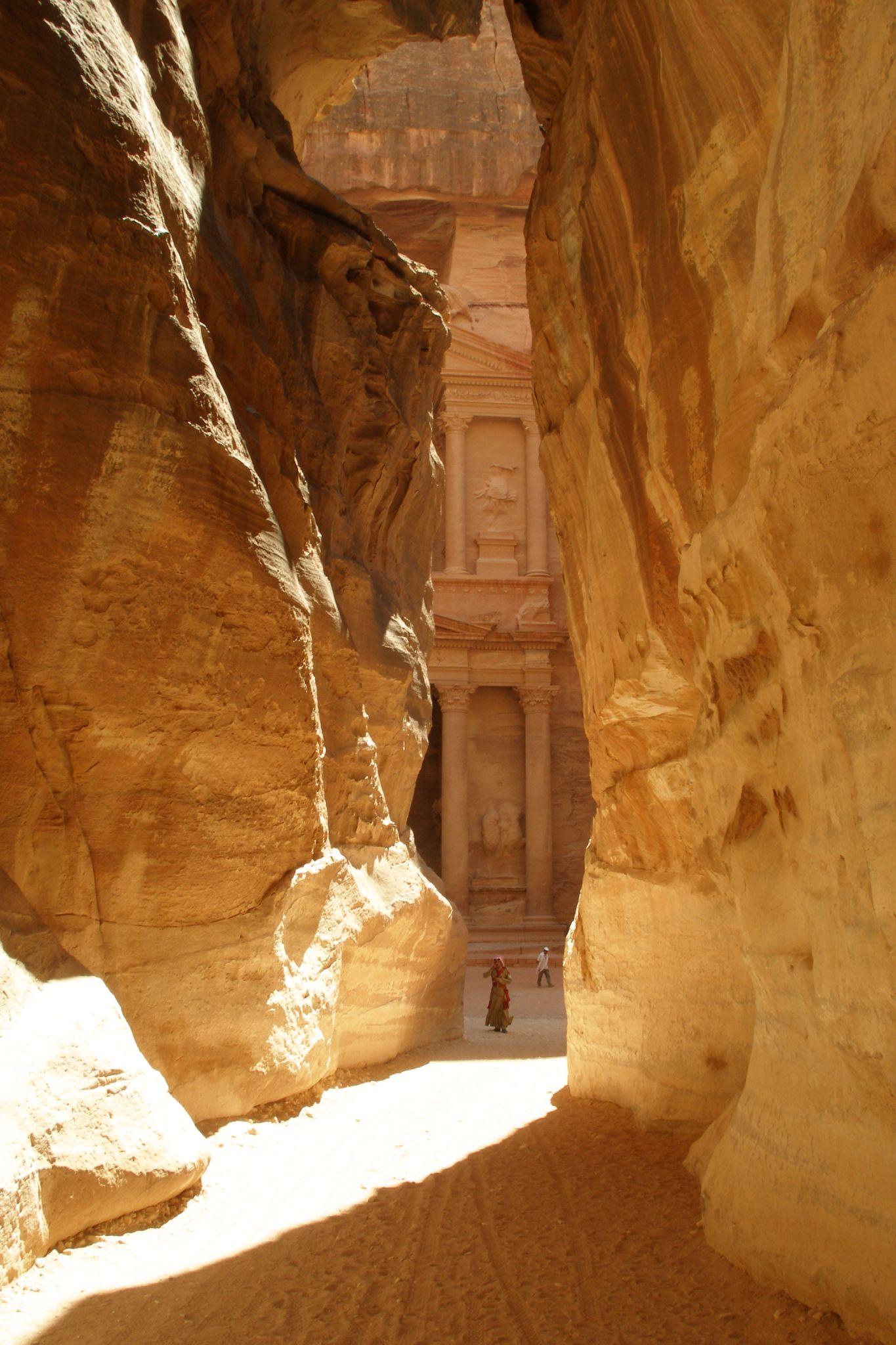
Thanks to its featured role in “Indiana Jones and the Last Crusade,” the canyon at the entrance to the ancient city of Petra in Jordan has become one of the best known in the world!
There are thousands of slot canyons all over the world, with many of the most famous ones right here in the US Southwest.
Utah alone is home to more than 1,000 slot canyons, the largest concentration of slot canyons in the world.
A formation in Arches National Park that I think closely resembles The Great Channels formation is The Fiery Furnace – except the rocks are red in Utah 🙂
Plan Your Visit
When I was doing research for this hike, it seemed like every source I looked at gave different advice on where to find the trailhead.
I think that’s probably because there are 3 different routes you can take to get to The Channels.
Only two of the routes are feasible as day hikes, though.
I guess you could do the entire Brumley Trail as a day hike, but you’d have to place a car at each end or walk in the dark 😉
Let’s see if I can clear up some of the confusion.
Where to Stay
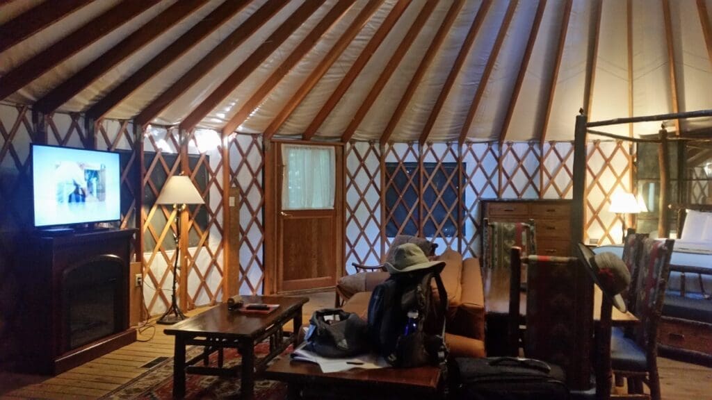
On my visit, I didn’t stay near the Channels, because they were a stop I made on my way to hike in Grayson Highlands State Park – so I stayed in a room near there.
But there are lots of unique places to stay like Cozycozy or other places you’ll find on my Travel Tips & Deals page.
Choose Your Hike
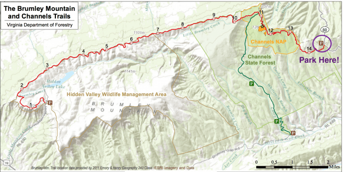
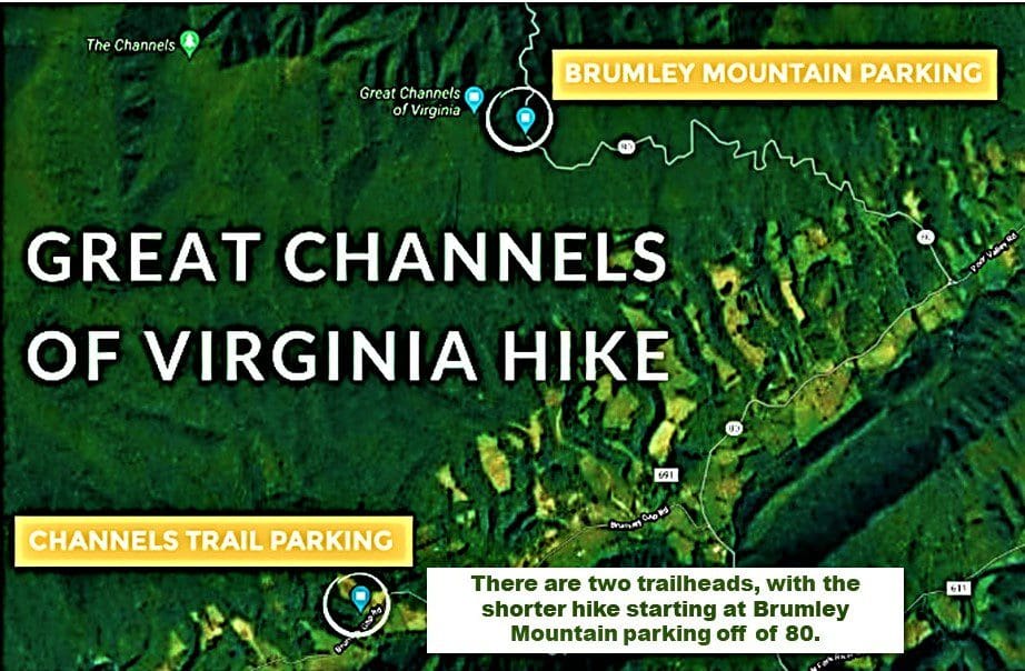
ROUTE 1:
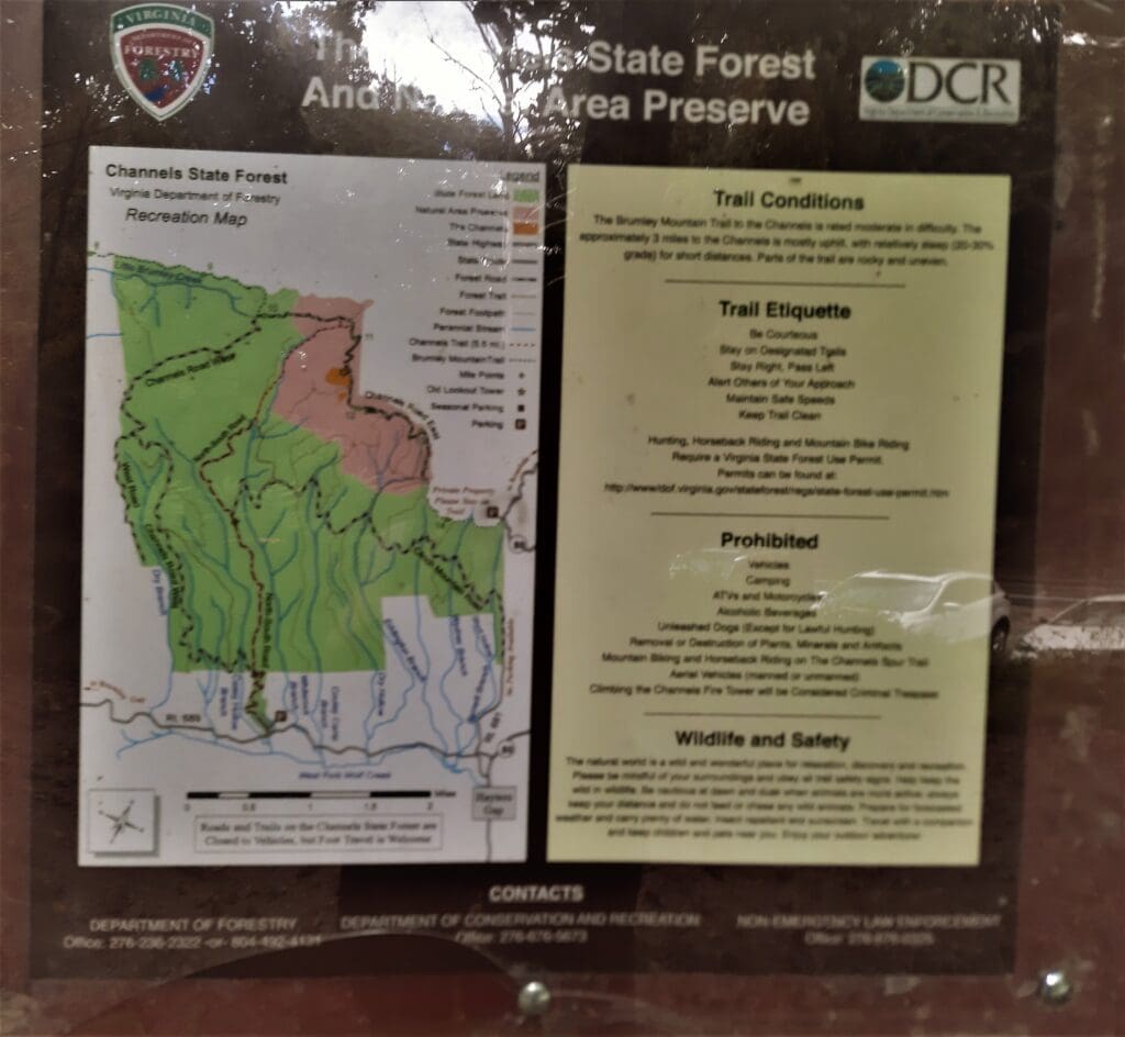
When Channels State Forest was first opened, the only route to the Channels formation was along the rugged Channels Trail, marked in GREEN on the map above. That hike is an 11-mile out-and-back with around 2,600 ft of elevation gain, marked with red blazes.
ROUTE 2:
Then in 2012, the non-profit group Mountain Heritage opened the Brumley Mountain Trail – marked in REDon the map above. It covers 14 miles (one-way) along the spine of Clinch Mountain to the parking area at Hidden Valley Wildlife Management Area on the other end of the trail. Parking to hike the whole Brumley Mountain trail is either there or at Route 80 and Hayter’s Gap.
ROUTE 3: This is the hike I took!
If you park in the new lot at Hayters Gap and follow the Brumley Trail a little over 3 miles to the east, you can access the Channels formation via a moderate, well-graded trail – totaling a little over 6.5 miles, round trip.
Generally considered a moderately challenging route, and therefore the most popular, this route takes an average of around 3 hours to complete.
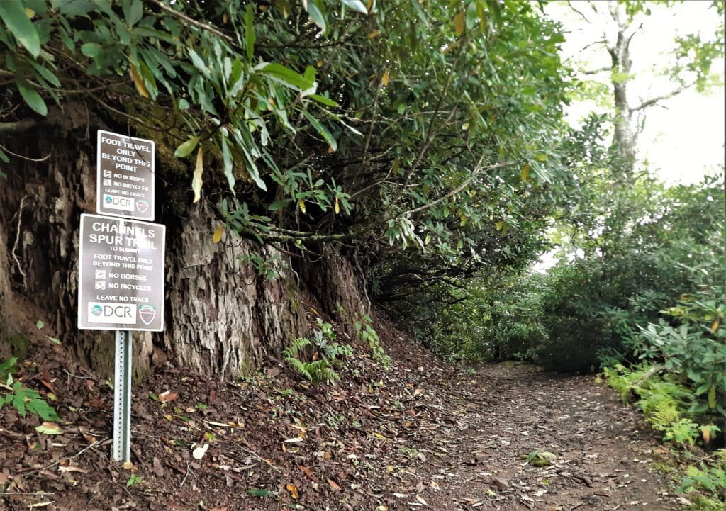
The best times to visit any route on this trail are March through October. Unlike the scramble at Old Rag in Shenandoah, there is no significant climbing so dogs are welcome, but must be on a leash.
This would make a wonderful day-long adventure for a family with kids of any age – as long as you’re willing to carry the littlest ones, if needed!
Directions & Trail Access
Physical Addresses:
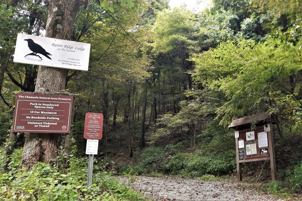
- Brumley Mountain Trail trailhead– 4250 Hayters Gap Road, Saltville, VA 24370 (The easiest and preferred hike to the Channels, which is 3.5 miles from this trailhead – and the one that I did).
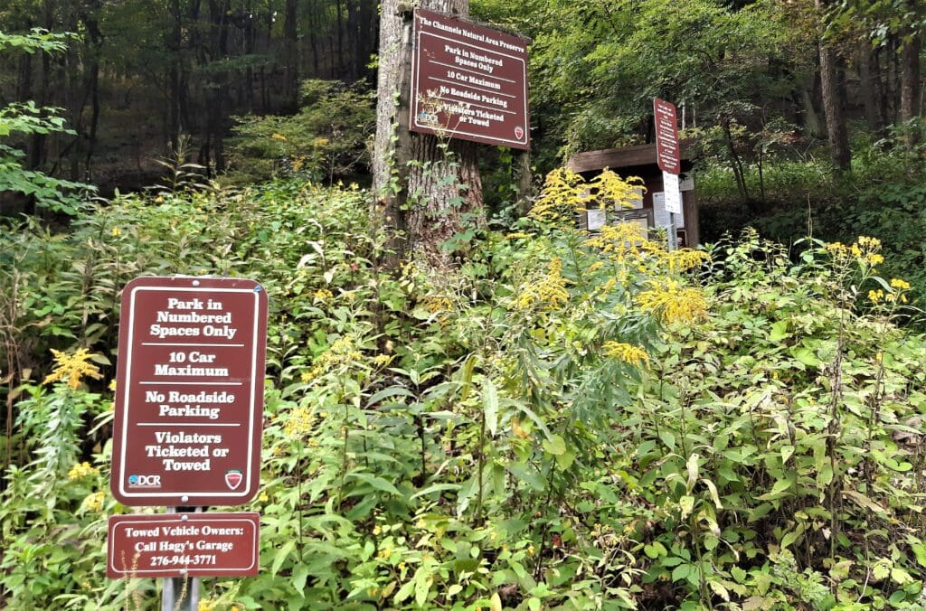
- Channels Trail parking area– 23197 Brumley Gap Road, Abingdon VA, 24210 (seasonally, parking may be available higher on the mountain)
Channels Parking
To the Channels Trail Parking Area:
- From Interstate 81, take exit 24, then turn left onto Hillman Hwy. Take the second right onto Lindell Road and continue for approximately 5 miles. Turn left onto Rich Valley Road, then keep right onto Hayters Gap road. After 3 miles, turn left onto Brumley Gap road. The parking area will be 2 miles ahead on the right.
To the Brumley Mountain Trail trailhead parking:
- From Interstate 81, take exit 24, and follow Route 80 West for approximately 13 miles. The trailhead is at a small gravel parking area on the left at the Russell/Washington County line.
There’s absolutely no way to miss this parking area since there’s nothing else on the mountain until you hit that point.
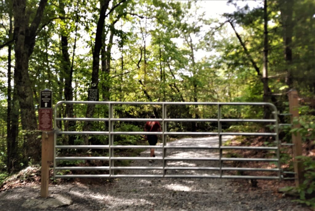
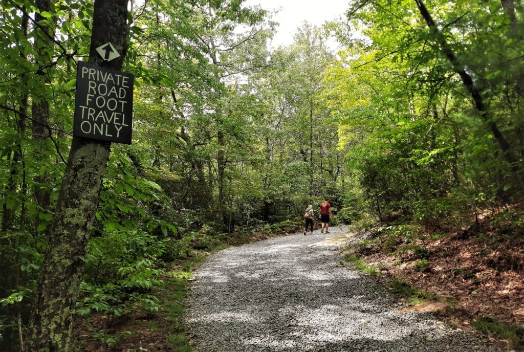
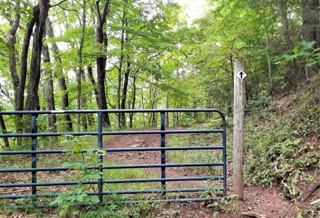
Trail begins behind the gate and travels initially along Raven Ridge Road.
Now let’s get to the actual hike, shall we? 🙂
On the Trail to the Channels
The trail is about three miles each way, so if you add in about an hour to explore the maze itself, you’ll want to allow 3.5-5 hours round-trip.
I was starting the hike on my travel day in from the Raleigh area, so I had just about enough afternoon light remaining to finish before dark, if I didn’t dawdle!
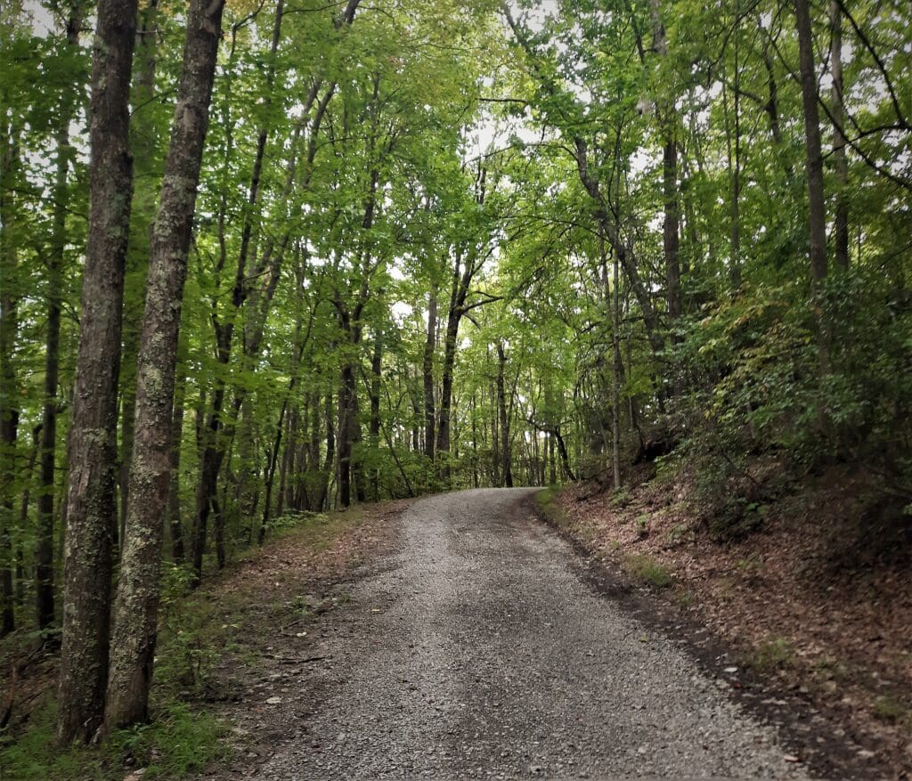
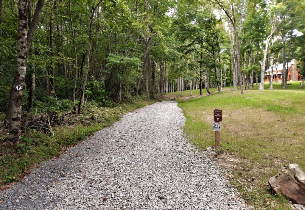
I left the parking lot and followed the fire road that went up the hill to the right of the parking lot.
Almost immediately, I could see a young couple hiking ahead of me.
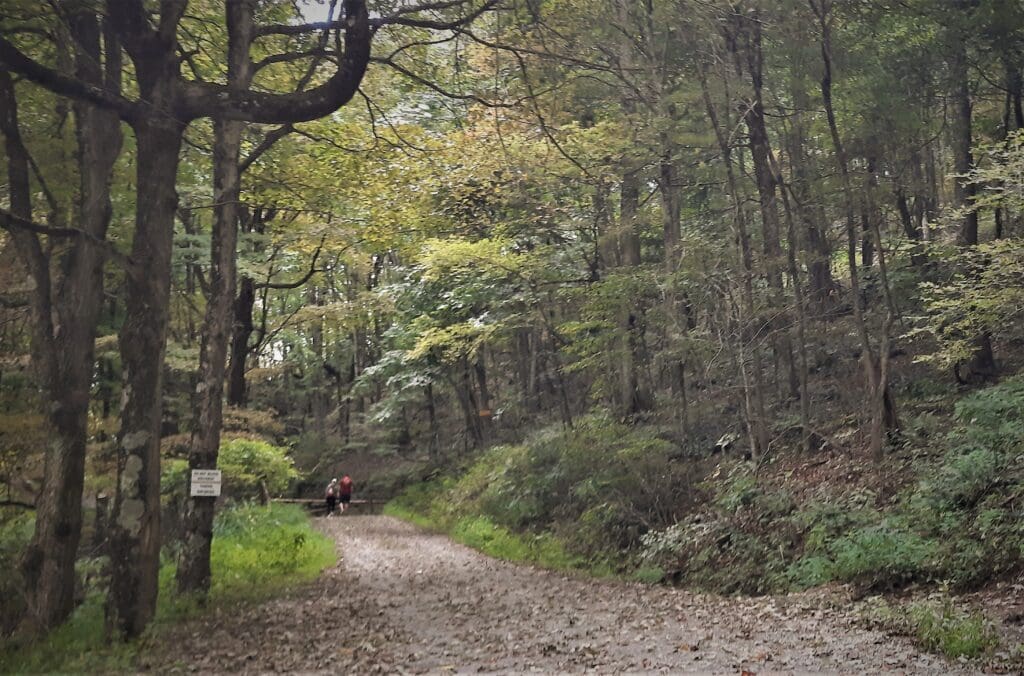
I caught up to them at a kiosk on the trail, where they were contemplating the routes on a trail map.
They thanked me and went ahead on the same route, while I stayed behind for a few minutes to create some space between us.
This is where I caught up with the young couple again – they were walking more slowly than I was, and were uncertain which way to go.
But I caught up to them quickly, and tired of playing leap-frog, passed the couple shortly after the gate, hiking briskly to create more distance between us.
![]() Still traveling along the roadbed, the trail passed the entrance to Channels State Forest, and the trail turned into a natural dirt path.
Still traveling along the roadbed, the trail passed the entrance to Channels State Forest, and the trail turned into a natural dirt path.
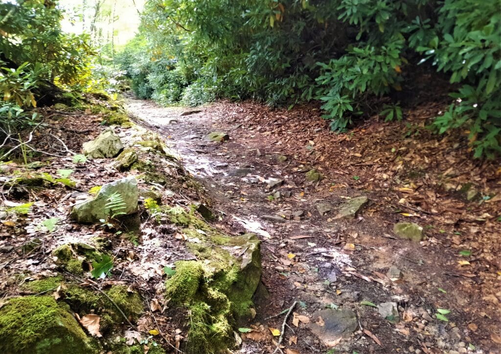
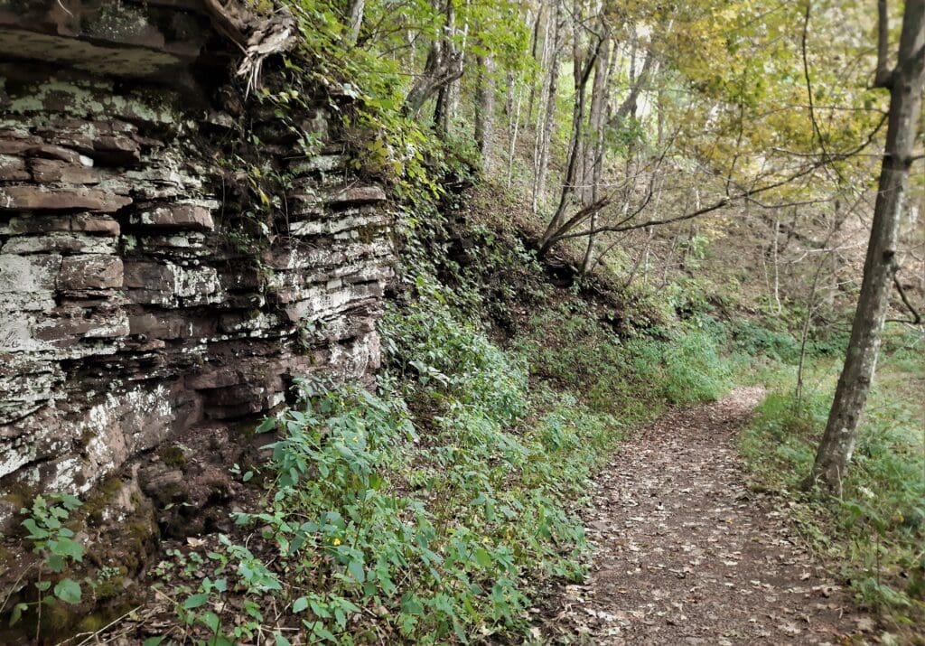
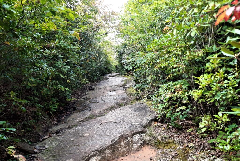
The trail becomes slightly even more steep and rocky from this point and at 2.25 miles, you reach an outcrop of sandstone, which is the kind of rock that forms the Great Channels themselves.

Maybe it was the solitude, or the sameness of this section of the trail, but I started to feel like I was on a sort of magical quest.
The switchbacks began shortly after that, still going up.
I was halfway through the steepest part when I ran into an elderly bearded man with a wooden walking stick, coming downhill.
 “Is it very far?” I asked him, hopefully. ( I was very tired of the uphill.)
“What made you come to this place?” he asked.
“I read about it, and I just had to come see for myself,” I answered.
He smiled kindly at me, and said, “It’s a ways yet. But you’re going at a good clip, you’ll be there in no time.”
I thanked him and continued on.
 “Pretty close,” they said. “But you’ll know you’re almost there when you see the tower.”
This was the first I had heard of any tower! So I thanked them and continued on my way.
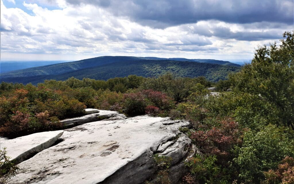
There was a sign posted telling hikers to stay within a roped off area to protect a fragile eco-system, so I did that, and enjoyed the view!
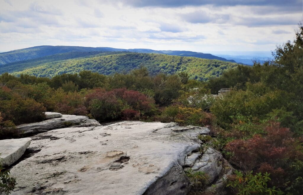
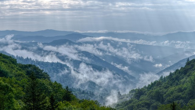
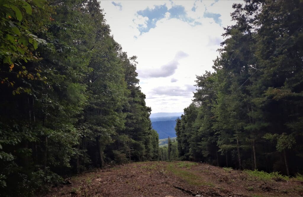
Mount Rogers and Whitetop Mountain – Virginia’s two highest peaks – could be seen on the far horizon, with the Great Valley lying closer in between.
One slip could spell catastrophe – with either you falling from up top, or someone below getting hit with a rock you dislodge.
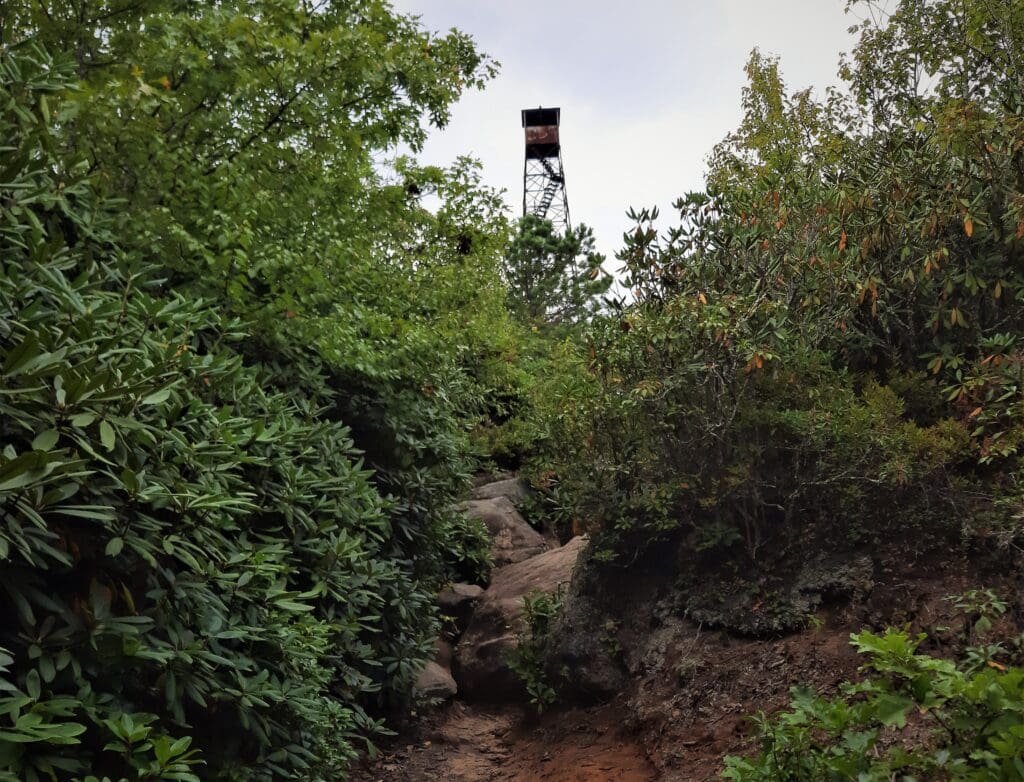
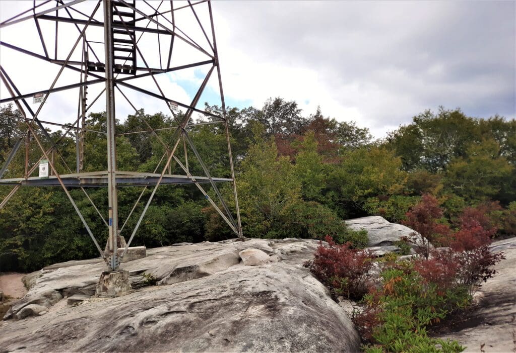
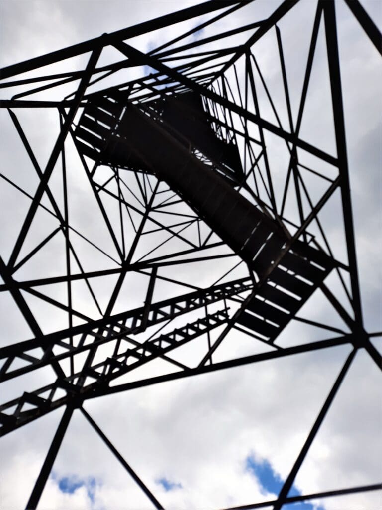
The entrance to the maze is located near the tall rickety fire tower – Middle Knob Tower- once used to spot fires from a long distance.
(Some sources mention an old Warden’s cabin here too – but I didn’t see it. It may have returned to the Earth….)
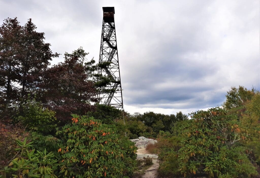
The fire tower had been abandoned, and as I walked on I could see that the lower deck of stairs have been removed, preventing easy access to the tower.
There are also posted signs telling you NOT to climb the tower.
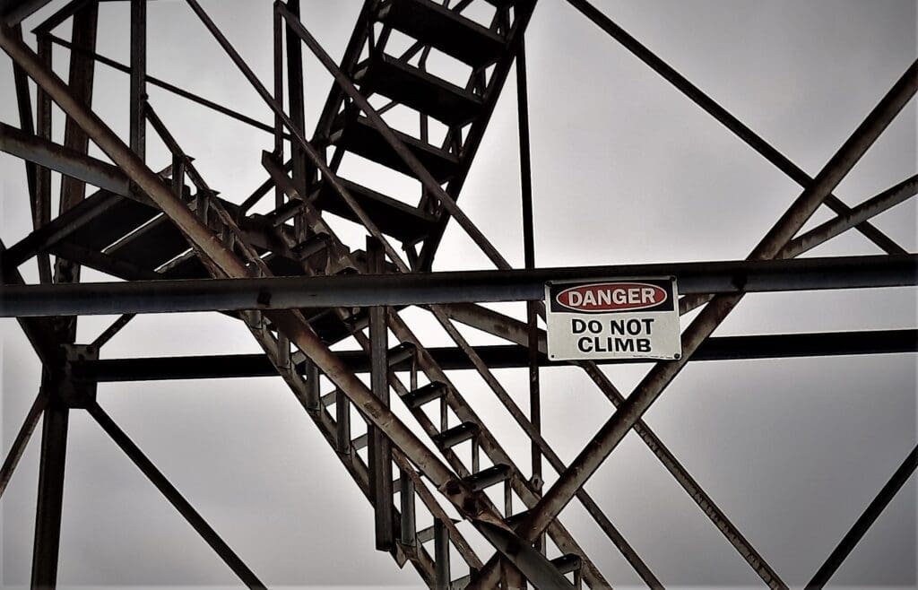
I really wanted to climb the fire tower, but I didn’t. Please stay safe and stay off the tower, too.
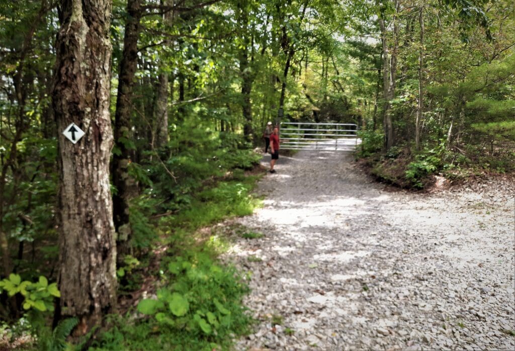
Shortly past and to the right of the fire tower, I found a blaze pointing into the woods.
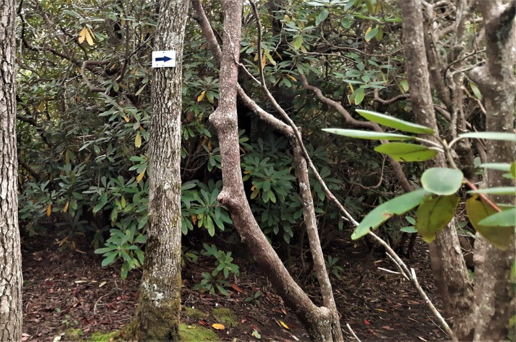
The trail descended the hillside until it led to the entrance of the Great Channels.
Most of the paths between the rocks are passable but be sure to note your route so you can remember the way back.
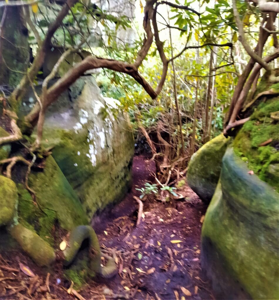
I spent some time exploring, and then turned back the way I came.
It’s All Downhill from Here
The only real way to exit the Channels is to turn around and go back the same way you walked up.
So I got out of the maze and went past the fire tower to the trail again.
This went much faster than it had earlier, because now the path was downhill all the way back to the parking area.
 I did pass the young couple again on my way down.
They were still making their way up the hill, and asked me if they were close.
“You’re very close,” I encouraged them. “Just keep going!”
They thanked me again, and continued on their way.
I’m pretty sure they made it to the top 🙂
I returned to my car, and was just able to make the 90 minute drive down the mountain to my lodgings before sunset.
Turn By Turn with Mileage
For those of you who want more details to track your progress along the way, here are some landmarks to look for at specific mile points:
-
- Mile 0.0 – From the right side of the parking area, head past the entrance and continue uphill.
- Mile 0.6 – Reach an opening created by power lines.
- Mile .75 – Here the fire road turns to the right uphill, but stay straight on the trail (which now becomes a dirt path).
- Mile 1.0 – You’ll see some privately-owned cabins on the right (no trespassing).
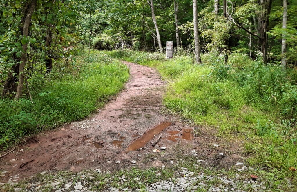
- Mile 1.5 – You reach Shallow Gap, and the trail gets steeper.
- Mile 2.25 – You’ll see a small sandstone outcrop, like what you’ll see at the Great Channels.
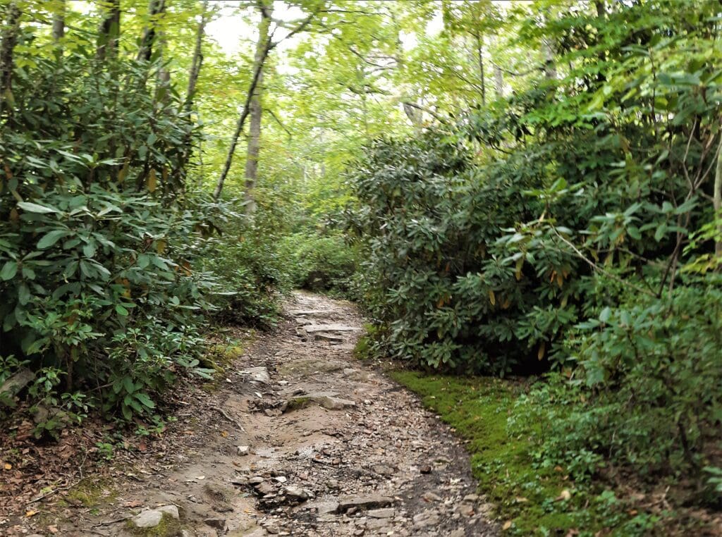
- Mile 2.8 – Reach a junction with the Great Channels Trail. Take a left on this trail and go through a tunnel of rhododendron on the way to the summit.
- Mile 3.0 – Reach the summit of Middle Knob, with the fire tower about 50 yards ahead. To the right of the fire tower you’ll see a sign noting the Great Channels is ahead.
- Mile 3.2 – Reach the entrance to the Great Channels. Explore the rock formations then head back the way you came.
- Mile 3.5 – Return to the summit of Middle Knob and the fire tower.
- Mile 3.7 – Reach the white-blazed Brumley Mountain Trail and take a right.
- Mile 5.75 – Stay straight where the fire road takes a sharp left uphill.
- Mile 6.6 – Pass through the gate and continue down the road to the parking area.
Basic Trail Info
-
- Distance – 6.6 miles
- Elevation Gain – 1200 ft
- Difficulty – Moderate. The hike is actually pretty easy going up to the Middle Knob fire tower, but some people may find climbing down into the Channels to be a bit challenging.
- Trail Conditions – Easy. The trail follows a wide gravel fire road for a good portion of the way up, so footing is easy. The rock path and Channels (as noted above) may be a bit more difficult for some.
- Distance – 6.6 miles
I hope this post has inspired you to visit Channels State Park and hike the Great Channels!
You can learn more about other great Virginia hikes here: Shenandoah Visit Guide and week of hikes!
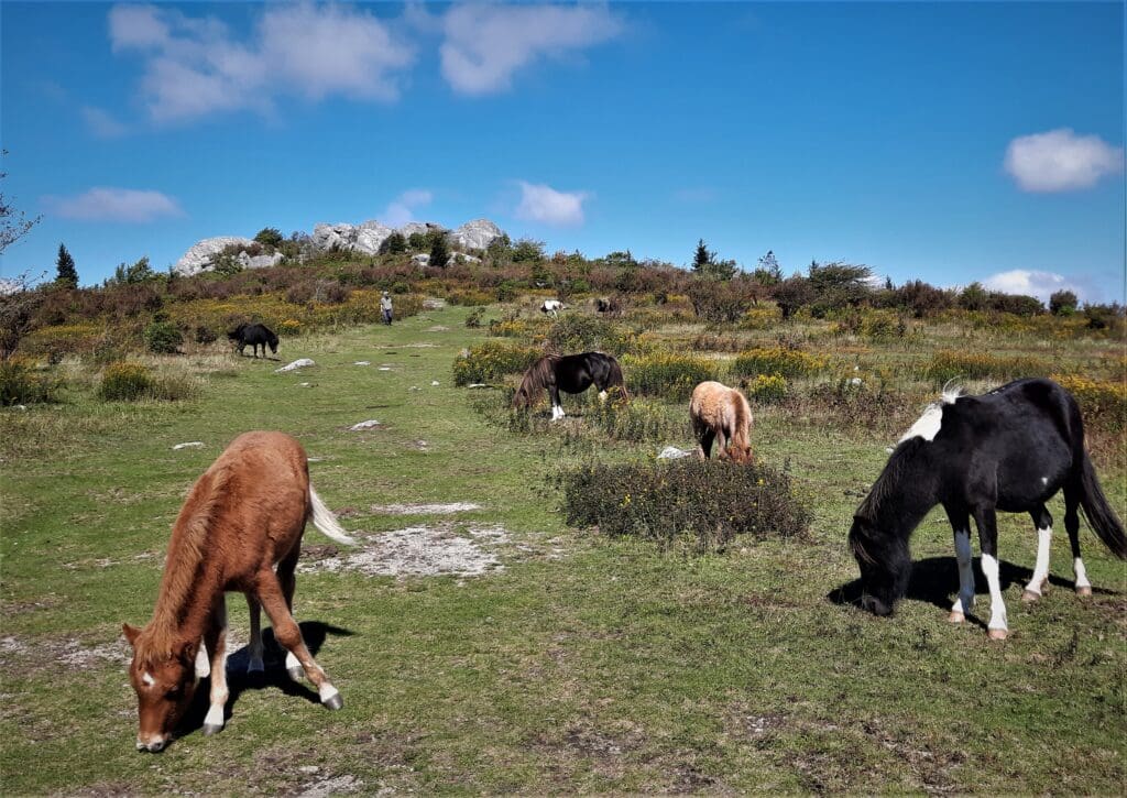
Or, read here about my visit to nearby Grayson Highlands State Park to visit the wild ponies.
If you have any questions drop me an email. Thanks for stopping by – see you next time! LJ
To Get New Idratherwalk Posts
sent directly to your inbox (how convenient!) Click this Button
If you like this post, please share it!


LJ has spent much of her free time as a single Mom – and now as an empty-nester – hiking in the US and around the world. She shares lessons learned from adventures both local and in exotic locations, and tips on how to be active with asthma, plus travel, gear, and hike planning advice for parents hiking with kids and beginners of all ages. Read more on the About page.