Most recently updated May 15th, 2026
The Shenandoah National Park is right on the edge of the areas of North Carolina and Virginia that were hardest hit by Hurricane Helene.
That said, the Park is open and many of the surrounding communities are open for business and could really use your Fall vacation dollars to help rebuild!
Go to my Hurricane Helene page to get the latest updates on the latest Park, Trail and road repairs.
Shenandoah National Park first opened to the public in December of 1936. It’s located in Virginia’s Blue Ridge mountains, less than a half days’ drive from home for me.
Though I’ve lived in the area for more than 20 years, I’ve never had the chance to spend much time in Shenandoah – until this past summer.
With 200,000 acres of protected land, Shenandoah National Park has some of the best hiking in Virginia – and the entire mid-Atlantic region of the US – so you can imagine how excited I was to visit!
I had a great time exploring on my own, but the park hosts a variety of trails and attractions for everyone from expert hikers to families with small children.
Where is Shenandoah National Park?
Shenandoah National Park is only 115 miles from Washington, D.C., 95 miles from Richmond VA, and 250 miles from Raleigh NC.
That’s close enough for a great long weekend or longer family vacation, without getting on an airplane!
I allowed a week for my trip – 2 days for travel, and 5 whole days to explore 🙂
Or if you prefer video, take a look at the Shenandoah playlist on IRW YouTube.
NOTE: For estimation purposes, I used the middle point of the park (lengthwise) at Hwy 33 to figure distance from each city. Actual distance will vary based on your precise start and end points.
Some of my posts contain affiliate links. If you make a purchase through an affiliate link, I will receive a small payment at no additional cost to you. I do not get paid for recommendations, all opinions on this site are my own. See full Disclosure page here.
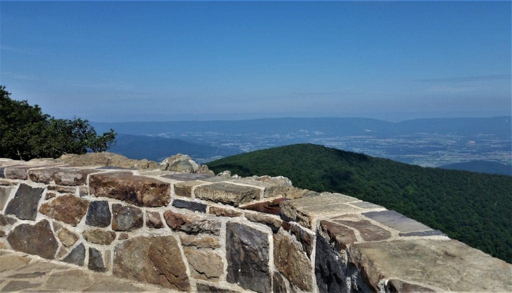
Skyline Drive
No matter where you start your journey, when you enter Shenandoah National Park, you’ll be on Skyline Drive – the primary roadway within the park.
Skyline Drive – along with most of the other facilities within the park – was built by the Civilian Conservation Corps (CCC) and finished just before the start of WWII.
The road runs the whole 105-mile length of Shenandoah National Park from North to South.
Numbered mileposts, like those on the Blue Ridge Parkway, line Skyline Drive. The posts go from 0 in the north to 105 in the south, which helps visitors navigate to specific points in the park.
In addition to access to trail heads, visitors centers, and lodges, many people visit Skyline Drive in the Fall just for the vibrant yellows, reds, and oranges of the classic Shenandoah foliage.
The maximum speed limit on Skyline Drive is 35 mph, with reduced speeds in campgrounds and picnic grounds. With over 75 scenic overlooks along the way, most people allow 3-4 hours to sight-see and drive the whole 105 mile length.
If you are planning to drive through the park, be sure to call ahead. Skyline Drive is often closed due to ice in the winter, and there is a $10 entrance fee.
Plan Your Shenandoah National Park Visit
In addition to your usual hike planning, you’ll need to consider the unique logistics of Shenandoah National Park when planning your visit.
Because the park is so many miles in length, you’ll need to think about how long it’ll take to get from your lodgings to your trailhead on Skyline Drive.
Figure time on the trail on top of that to estimate when you need to set out in the morning to get back to the trailhead before sunset.
The Park Layout
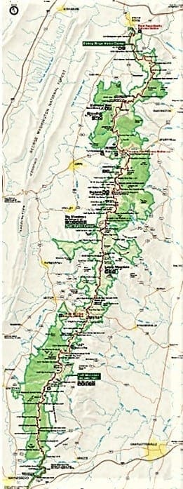
Shenandoah is divided into 3 main sections. Each section has an access point to Skyline Drive, with access to many trailheads and other park attractions from along that road.
At the park’s northern end, visitors enter from Front Royal and go south along Skyline Drive. The first miles of the drive include the Dickey Ridge Visitor’s Center and several scenic overlooks.
About 30 miles in, you’ll reach the Thornton Gap entrance. This is the start of the central region of the park. Many of the best hikes in Shenandoah National Park are in this area including Old Rag, Hawksbill, Dark Hollow Falls, and the Rapidan Camp.
Eventually you’ll reach the Swift Run Gap entrance, which marks the end of the central section and the start of the southernmost area of Shenandoah.
Skyline Drive and the parklands both end at the Rockfish Gap entrance/exit, 18 miles from Staunton, VA.
For my visit, I stayed outside the park, and the closest park entrance was the Swift Run Gap Entrance Station.
So I planned all of my trips to the park based on using that entrance – knowing that it would take me about 30 minutes drive just to get to the park entry.
Lodgings Near Shenandoah
There are two historic lodges and a collection of cabins inside the park, as well as several camping options to choose from.
Park Lodges
- Big Meadows Lodge – Big Meadows (mile 51) has 25 rooms in the main lodge, 71 additional rooms in rustic cabins, multi-unit lodges, and suites.
- Skyland – Skyland (mile 41.7) has 179 guest rooms, rustic cabins, multi-unit lodges, and modern suites.
- Lewis Mountain Cabins – Lewis Mountain (mile 57.5) has several rustic, furnished cabins with private baths and outdoor grill areas.
Check out Go Shenandoah if you’d like to stay at one of these great in-park lodges.
PATC Cabins
The Potomac Appalachian Trail Club maintains six locked, primitive cabins in the park. The cabins are equipped with mattresses, blankets, and cookware. A pit toilet and spring water are nearby. Visit the PATC online.
Camping
- Mathews Arm Campground – at mile 22.1 of Skyline Drive, is the nearest campground for those entering the park from the north.
- Big Meadows Campground – at mile 51.2 of Skyline Drive, Big Meadows Campground is near many of the major facilities and popular hiking trails in the park.
- Lewis Mountain Campground – located off mile 57.5 of Skyline Drive and is the smallest campground in the park.
- Loft Mountain Campground – at mile 79.5 of Skyline Drive, Loft Mountain Campground is the largest campground in the park
- Dundo Group Campground – has three sites for groups of 7 to 20 people
To get all of the details about each campground, and learn how to make reservations, see the Shenandoah camping info page.
Lodgings Outside OF the Park
For hotel accommodation in towns around Shenandoah National Park, such as Harrisonburg or Charlottesville, I like to use Booking.com or VRBO.
If you’re looking for some additional travel pointers or more lodging ideas for your next adventure, check out my Travel Resources page.
For more tips on how to plan a multi-day hiking trip, check out this article.
Park History
 The Yellowstone Act of 1872 that established America ‘s first “ Public Park ” required the Secretary of the Interior to preserve the “wonders within the said park” and also allowed the Secretary to “grant leases…for the accommodation of visitors.”
By the time the National Park Service (NPS) was established in August 1916, Congress had already created nine national parks and twelve national monuments.
 Though Shenandoah National Park wasn’t officially established until 1935, the parklands had been inhabited, farmed and used for recreation for many years before.
Before the Park
The first traces of humans found within the park are thought to be 8,000-9,000 years old.
 Native Americans seasonally visited the area to hunt and some constructed permanent villages at the lowest elevations in the Piedmont and Shenandoah Valley outside the Park.
The park takes it’s name “Shenandoah” from some of these early inhabitants.
The translation of the original Algonquian word means either “spruce stream,” “great plains,” or (my favorite) “beautiful daughter of the stars.”
-
-
- In the 1700s, European hunters and trappers explored the mountains of the Blue Ridge and Shenandoah Valley.
- The earliest European settlers moved into the foothills by the 1750s to farm, graze livestock, and plant fruit orchards.
- In the 1800s people purchased mountain land for it’s natural resources: copper, lumber, bark for leather tanning, and water for powering mill operations.
-
Others, like George Freeman Pollock, saw the beauty of the Blue Ridge as a commercial product in itself. He built Skyland Resort, a getaway from the industrial cities nearby – which is still a part of the Park today.
 President Herbert Hoover and First Lady Lou Henry Hoover built their own getaway here, Rapidan Camp, as a retreat during Hoover’s Presidency.
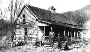
Among the many people who left a legacy in Shenandoah National Park were several hundred mountain residents who lived on what became park lands.
 You can read more about their stories and see an exhibit about their way of life at The Big Meadows visitors center.
The CCC Camps
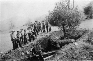
The Civilian Conservation Corps (CCC) employed hundreds of young men to build roads and trails, to re-establish wilderness and create a park that people would come to see.
Established in 1933 as a work relief program, the CCC put young men to work in Federal and State lands during the Great Depression.
From 1933-1942 over 1200 young men would eventually work at one of the 11 camps in and around Shenandoah.
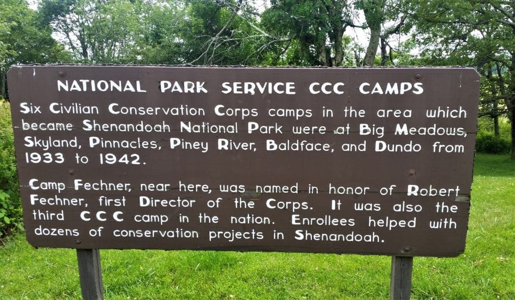
Camps located at Skyland (NP-1), and Big Meadows (NP-2) were the first in the National Park Service, and were visited by Franklin Delano Roosevelt in August 1933.
To learn more, stop by the Visitor Center in Big Meadows, and explore the CCC exhibit. Visitors can also view a free film, “The CCC Boys.” Learn more about the CCC in Shenandoah.
Construction of the park officially began in 1935, and President Franklin Delano Roosevelt formally opened Shenandoah National Park on July 3, 1936.
In 1937, Virginia Sky-Line Company, Inc. built, or rehabilitated the roads, lodges, and cabins that form the core of the Skyline Drive Historic District.
With the help of the CCC, Skyline Drive and the core of the park were completed by the beginning of WWII.
In 1976, Congress declared almost half of the parklands as protected wilderness.
Shenandoah NP Hiking Tips
Even more than 80 years after it’s opening, Shenandoah is still a wild place. The forests are home to many kinds of animals including deer, black bears, and birds of prey.
As close as it is to some pretty large cities, Shenandoah NP is not an urban park and – even though wildlife sightings are common – it’s definitely not a zoo either.
If things go wrong on the trail, or you misjudge the time needed to return from a hike, or if you’ve misjudged your own ability, help is often a hike away – which means it could take hours to reach you.
Also – don’t count on cell service within the park. The mountains themselves can create a barrier to signal.
Below are things you should keep in mind – both before your trip and daily during your adventure – when preparing to hike in Shenandoah National Park.
Shenandoah National Park Weather
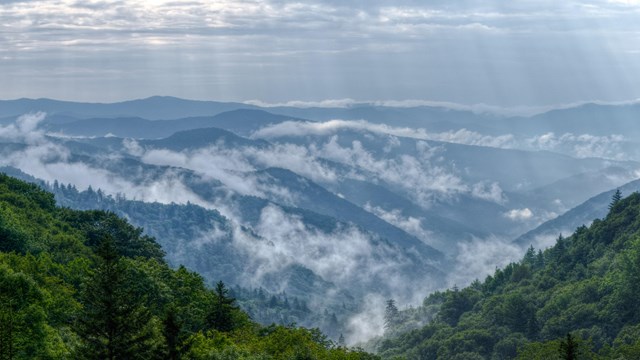
Weather at Shenandoah National Park varies greatly depending on the season and your location. The mountains are usually 10 degrees cooler than the valley below, and rainstorms can crop up very quickly, and streams can become floods!
So, in winter when it’s raining in the lowlands, the park could be blanketed in snow and ice. Be sure to check the daily weather forecast before going on a hike.
You don’t want to be on an exposed summit when a thunderstorm rolls in, or deep in the wilderness during a heavy rainstorm.
As always dress in layers, and be prepared for anything when you hit the trail.
Water and Food
Even on short hikes, you should carry at least 20 oz. of water, and more than that on hot summer days.
Always bring some snacks with you, too – or pack a lunch to eat on the trail.
Bring more than you think you’ll need, just in case something happens or you run across someone else in need on the trail.
Bears
Shenandoah is bear country and one of the best national parks for wildlife watching. Shenandoah National Park is even known to have one of the densest concentrations of black bears in America.
When driving Skyline Drive, bear sightings are a major highlight. And they do happen quite often – just look at the “Bear Collision” road signs!
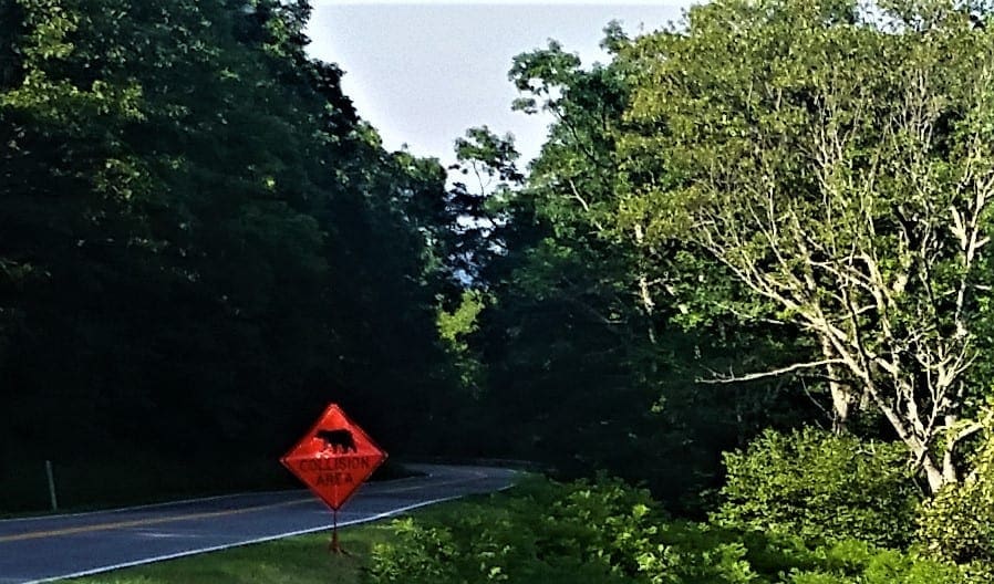
During hikes, you could also run into a bear. If this possibility makes you nervous, invest in some Bear Bells and mace, just in case.
I wear bear bells, but I’m never sure if it’s warning the bears away, or acting like a dinner bell…. 😉
Actual black bear attacks are extremely rare – none has ever been recorded in Shenandoah, and it’s a place with abundant food supplies for the bears!
That said, it’s important to know what to do if you ever do encounter a black bear on the trail:
-
-
- Stay at least 50 yards away from the bear (per Park regulations).
- Make noise – whistle, shout, talk, sing, clap your hands – to let the bear know you’re there.
- If the bear approaches, back away slowly but don’t turn your back to the bear. Make yourself as large as possible, hold your pack over your head and keep making noise.
- Keep children close and stay in a group.
- If the bear charges, stand your ground. Talk to it in a calm, monotone voice and wave your arms.
- If the bear does attack, fight back as hard as you can. Black bears aren’t that big and if you’re more trouble than expected, they’ll back off.
-
Black bears are generally friendly and curious animals. They tend to keep to themselves and usually leave the area once they notice people are around.
The only exception is when food’s present, which is why you should store your food in bear-proof containers.
Don’t let this section put you off – a black bear sighting in the wild is an incredible experience! I’ve seen a few bears over the years and have never been attacked.
Hiking Gear
Most day hikes in Shenandoah National Park have some elevation gain or loss.
None except for Big Meadows are very flat.
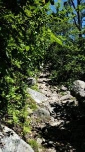
The surface of most of the trails is pretty rocky and rooty.
Trails near waterfalls or in hollows may be wet and slippery, too.
Sturdy hiking boots or shoes are absolutely necessary when hiking in Shenandoah.
Hiking poles aren’t required, but could be useful on many trails.
It’s always a good idea to bring an extra layer of clothing with you, and be ready for rain, too.
And of course, you’ll need a pack to carry your water, food, rain gear and extra layers.
Take a look at my dayhike gear recommendations, gear tips for beginning hikers, or check out the Gear Page for more information on other gear pieces you might need.
Trail Markings
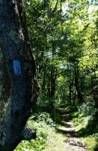
All hiking trails in Shenandoah National Park are marked with colored paint on trees or rocks.
-
-
-
-
- Blue paint for regular trails
- Yellow paint for horse trails or fire roads
- White blazes for the Appalachian Trail.
-
-
-
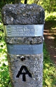
In addition, you’ll find a cement post at every trail intersection.
These posts have a metal wrapping around their top, that are stamped with trails, directions and distances.
Even though Shenandoah’s trails are clearly marked, it’s still a good idea to have a map (and compass) with you.
Sometimes, you just want to be able to double-check your map to make sure you’re going in the right direction.
This Shenandoah National Park maps page has a full park map, and maps of the individual park sections with trails as well.
Shenandoah National Park Trails
There are hundreds of miles of Shenandoah hiking trails, and most of them are pet-friendly – making Shenandoah one of the only National Parks to truly welcome all members of the family!
There are hikes in the park to suit all ability levels and ages, ranging in length from just 1-2 miles up to longer hikes that’ll take the better part of the day.
Most of Shenandoah’s trailheads can be accessed from Skyline Drive, and most trails usually include a descent or upward climb for at least one part of the journey.
Out and back trails mean you’ll have to climb out of wherever you descended into – if it’s a loop trail you might find that one side is hillier than the other and plan your direction accordingly 🙂
No matter which Shenandoah National Park hiking trails you head out on, you’re sure to experience some of the best natural beauty of our National Parks!
SHENANDOAH HIKE ITINERARY
My visit was in late June, and the weather was very warm – so hot it broke records, in fact! Maybe next time, I’ll visit in May…..
Even in normal years, the summer weather pattern frequently includes an afternoon thunderstorm, so it’s a good idea to hit the trails early – both for cooler temperatures and to get back before a rainstorm.
I’ll tell you below about the trails I hiked, and how I decided which hikes to do on which days. Maybe this will help you decide what trails to visit on your trip. 🙂
DAY ONE – Skyline Drive and Big Meadows
On my first day in the park, my goal was to see how long it took me to get there from my lodgings, and also get a feel for the general park layout.
I also wanted some advice from a Ranger about recommended hikes, any trail closures – and hopefully, some detailed section maps to help me do some planning for the week!
I entered the park from the Swift Run Gap entrance, and went north on Skyline Drive.
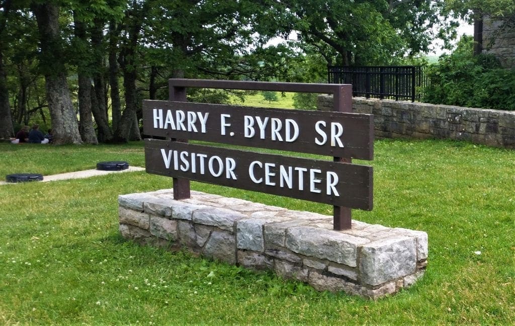
I drove all the way to the Thornton Gap entrance to get a feel for the park, and returned back south to the Big Meadows area, and stopped at the Harry F Byrd Visitor Center.
Harry F. Byrd, Sr. Visitor Center
Located at Mile 51 on Skyline Drive, the visitor center at Big Meadows has
restrooms, information desk, exhibits, ranger programs, videos, bookstore, publications, maps, backcountry permits, and first aid.
Because of it’s central location and all of the services in one location, I decided that Big Meadows visitor center would be my “base of operations” for my time inside the park.
At the visitor center, a Ranger talked me through some good hikes – based on my fitness level, time available, and what I was interested in – and also gave me printed copies of section maps to mark the trails I wanted.
It was already too late in the day to start a long hike, so I went across Skyline Drive and took a walk down the Rapidan Fire Road at Big Meadows while there was still light.
Big Meadows
One of Shenandoah’s main attractions – especially for families – is Big Meadows .
This center section is where you’ll find the Harry F. Byrd Visitor Center, Big Meadows Lodge, a wayside, a campground, bathrooms and the park’s only gas station.
Across Skyline Drive from the visitor center and other facilities lies Big Meadows itself.
A historic farming area, this large grassy expanse is one of the best wildlife viewing spots in the park. Especially at dawn and dusk, deer can be seen all over, and even an occasional black bear can be seen at the edge of the woods.
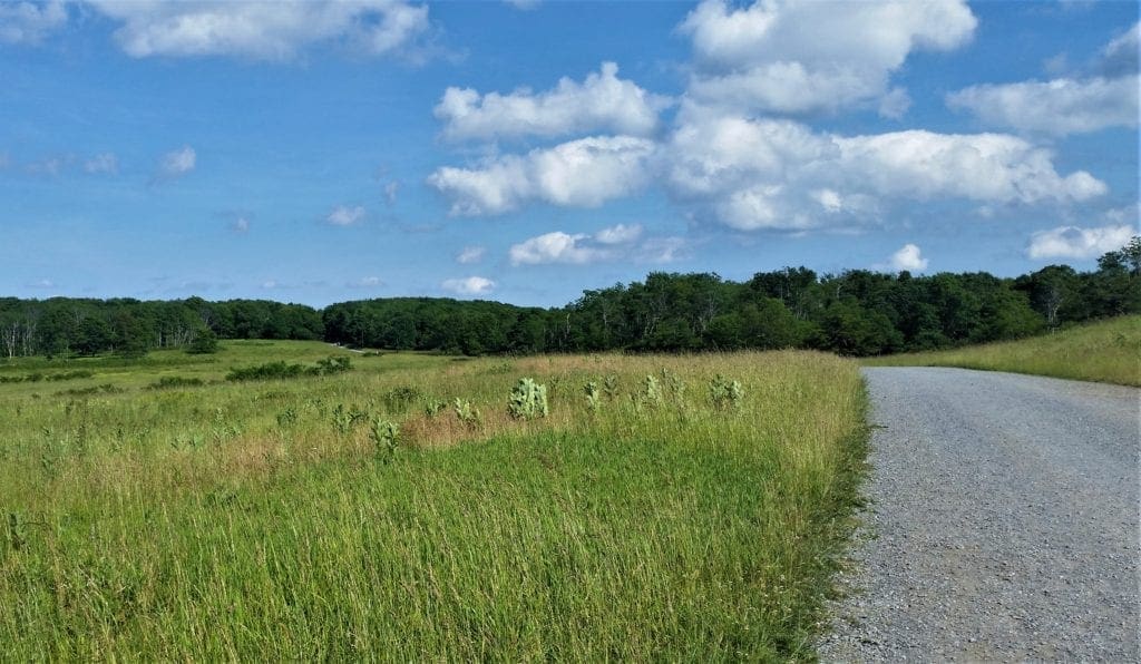
A stroll in Big Meadows is ideal for families with small children. The fire road is gravel and fairly flat, and you can park at the small Rapidan Road Parking lot right at Big Meadows, or across the street at the Visitors Center (near restrooms).
There are no designated trails on the Meadow, so you’re free to explore as you please.
You could explore on some well-trodden pathways through the grass, or take a walk down the Rapidan Fire Road to the Mill Prong Horse Trail, like I did – I went about 3.5 miles.
As I stood beside the Fire Road, a large doe poked her head out of the bushes over my shoulder at eye level.
We looked at each other for a second, and then she pulled her head back under the leaves and retreated into the woods….
Your visit to Big Meadows be as long or short as you like – it’s up to you!
- Distance: various
- Duration: various
- Difficulty: easy
- Trailhead: Skyline Drive MP 51 at the Big Meadows visitor center
- Suggested time of day: any time, best wildlife viewing dawn or dusk
- Map: Big Meadows Area
DAY TWO – Rapidan Camp and Dark Hollow Falls
The next day I got started early.
I planned to spend time exploring the Rapidan Camp – President Hoover’s retreat – and also wanted to hike Dark Hollow Falls and the Rose River Loop if there was time.
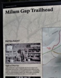
Because there was a storm forecast for the afternoon, and I didn’t know how long I would take exploring Rapidan, I opted to park at Milam Gap and start with the (shorter) 4mi round trip to the Rapidan Camp.
Rapidan Camp Hike
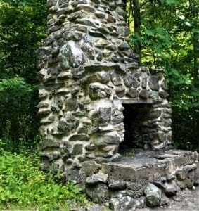
Modern US Presidents often retreat to Camp David to get away from Washington, D.C. Back in the summer of 1929, President Herbert Hoover established a similar retreat at Shenandoah – before it became a National Park.
President Hoover’s three requirements for the retreat were that it must be within 100 miles of Washington, stand at least 2,500 feet above sea level, and be on the banks of a trout stream.
The small, woodsy compound in Shenandoah fit the bill perfectly and Camp Rapidan became the first official summer White House.
The camp has recently been restored to its 1929 appearance and is an excellent reflection of it’s era.
The Rapidan Camp hike is about 4 miles out and back and passes by Big Rock Falls, too.
Start from the Milam Gap parking lot, then take the Appalachian Trail for a short stretch to the Mill Prong Trail.
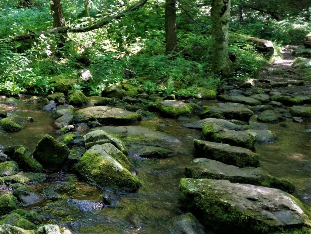
It’s a scenic hike with three water crossings, a meadow, and a meandering trail through the forest.
At the second water crossing, stay right on the Mill Prong Horse Trail (yellow blazes) all the way to the camp. (Return by the same route.)
Exploring Camp Hoover
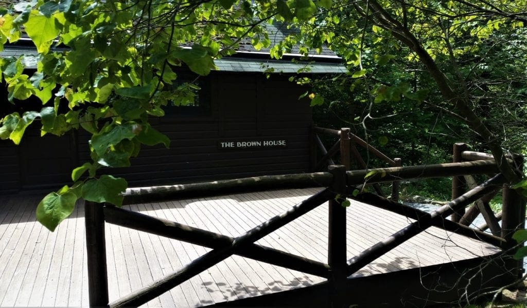
Three buildings are featured in the camp: the Brown House, the Creel Cabin, and the Prime Minister’s Cabin.
The Brown House, which was the Hoovers’ residence, has been historically refurnished to its 1929 appearance. The furnishings were rustic, but comfortable, featuring a number of Navajo rugs on the floor.
The Creel was occupied by two of Hoover’s Chief Aids – his personal bodyguard/assistant, and his personal physician.
An exhibit is located in what was the Prime Minister’s Cabin, offering visitors insight into the Hoovers’ lives and Herbert C. Hoover’s Depression-Era presidency.
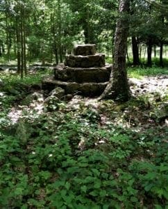
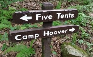
Other structures in the camp include a cabin with a porch referred to as Town Hall, remains of a central fountain and oven, and an area up the hill called Five Tents, where the working men stayed.
Camp Hoover was designated a National Historic Monument in 1988.
Shenandoah National Park offers a 2.5 hour ranger-guided tour of the Hoovers’ presidential getaway late Spring through Fall.
Visit the Ranger programs page for dates. Reservations are required. You can make them online up to six months in advance.
- Distance: 4mi or 7.4mi round trip
- Duration: 3 or 8 hours
- Difficulty: moderate or moderate/strenuous
- Trailhead: Skyline Drive MP 52.4 at Milam Gap
- Suggested time of day: any time, start early to allow time to see the camp
- Map: Rapidan Camp Area
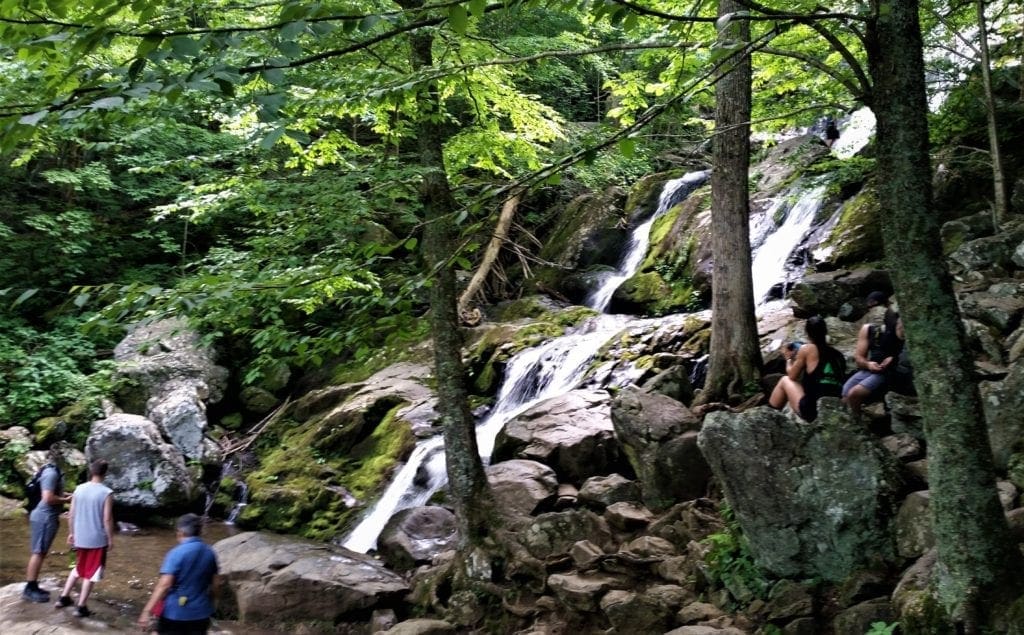
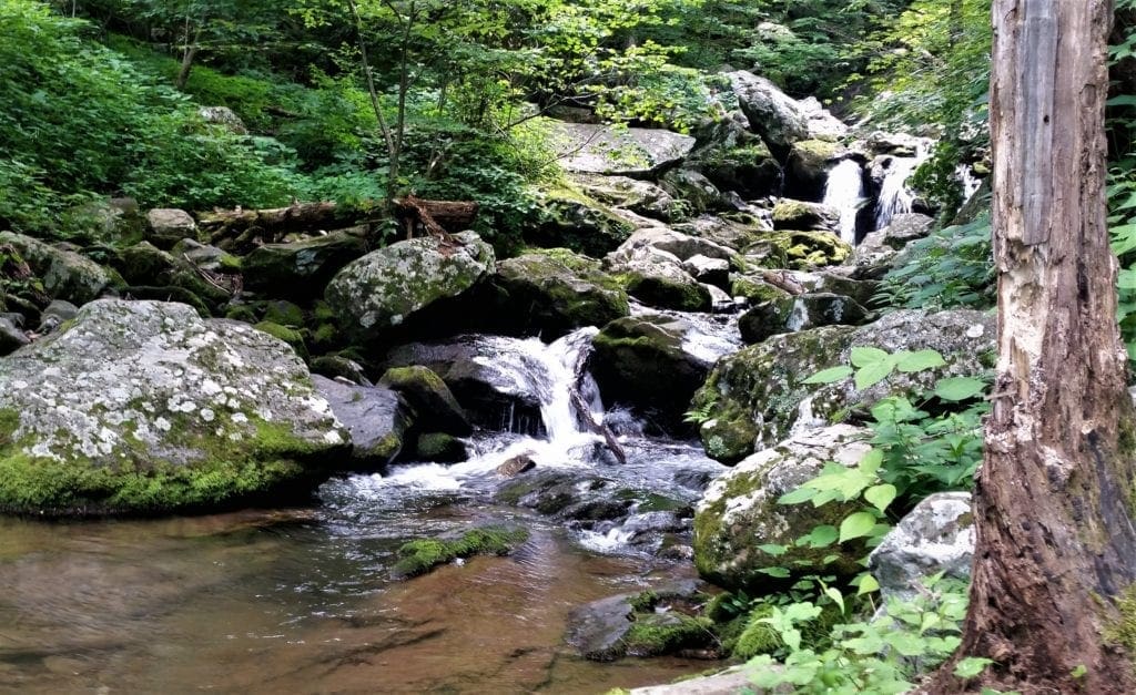
Dark Hollow Falls
After completing the Rapidan Camp hike, I made my way back to the Big Meadows complex to take a little break before starting my next hike.
The Dark Hollow Falls trailhead parking is just across Skyline Drive from the Big Meadows parking lot, so you can park at either place. I chose to leave my car at Big Meadows and walk to the trailhead.
It takes less than a mile walking along Dark Hollow Falls to reach the Falls. The waterfalls run alongside the trail, and hikers can get close to the cascading water without much effort.
This is one of the most popular day hikes in Shenandoah, and is the busiest waterfall hike – probably because the hike is only 1.4 miles roundtrip, so it offers big rewards for not much effort.
That said, the return trip is a steady climb up from the waterfalls which will be a lot harder than the start of the hike.
The trail back is very steep so you might want to plan the return hike to go a bit slower than the way down.
The Dark Hollow Falls trail connects with the Rose River Falls trail, for hikers interested in going on to see more Shenandoah waterfalls.
I was interested, but by that time the clouds were rolling in and it was time to get off the mountain.
I would need to save the Rose River Loop for another day.
- Distance: 1.4 miles (2.25 kilometers), out and back
- Duration: 1 hour and 15 minutes
- Difficulty: moderate
- Trailhead: Skyline Drive MP 50.7 at the Dark Hollow Falls parking lot
- Suggested time of day: any time, but less crowded in the morning
- Map: Big Meadows Area
DAY THREE – Whiteoak Canyon and Limberlost
A friend told me that the Whiteoak Canyon Trail was a must, but also that it could take the whole day – so that’s what I planned to do. 🙂
Whiteoak Canyon Falls Hike
The Whiteoak Canyon Falls hike comes with six waterfalls – three upper falls and three lower falls – making it one of the most scenic hikes in the park. The Whiteoak Canyon Trail is also one of the park’s most difficult trails.
That said, there are a few choices of how to hike this trail:
-
-
- The Boundary to Lower Falls Hike is the easiest. It’s a 2 mile out and back trip to the lower falls at Whiteoak Canyon, and only has a 500 ft elevation gain.
- For the biggest challenge, the very strenuous Cedar Run -Whiteoak Circuit hike is 7 miles with nearly 3,000 feet of elevation gain. (This hike will take all day.)
- The Skyline Drive to Upper White Oak Falls hike is the moderate option, at 4.6 mi round trip and a 1040 ft elevation gain, should take about 3.5 hours.
-
Starting at Skyline Drive MP 42.6 at the Whiteoak parking area, the trail descends through a rocky gorge to the foot of the mountains. There’s a pretty steep climb up on the way back.
I ended up doing the moderate, 4.6 mile hike – kind of. I turned back after seeing all 6 waterfalls – a little way past the sign indicating the midpoint of the longer hike – so ended up going about 6 miles.
- Distance: 4.6 miles, out and back
- Duration: 3.5 hours
- Difficulty: moderate/strenuous
- Trailhead: Skyline Drive MP 42.6 at the Whiteoak parking area
- Suggested time of day: any time, but this is a long steep hike, so start early
- Map: Whiteoak Canyon Area
Limberlost Trail – Accessible Hike
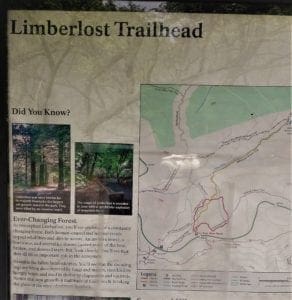
Since I had some time left after the Whiteoak Canyon hike, and the Limberlost Trailhead was right there, I decided to check it out.
Since 1996, several organizations have donated labor, equipment, supplies, and funding to help Shenandoah staff make the trail accessible.
Limberlost Trail is a circuit hike of 1.3 miles, is extremely flat and easy for anyone in a chair, or with other walking assistance devices. The trailhead is located at mile 43 of Skyline Drive.
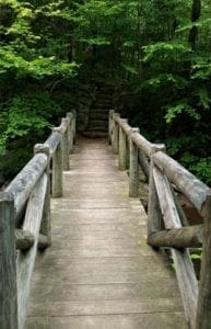
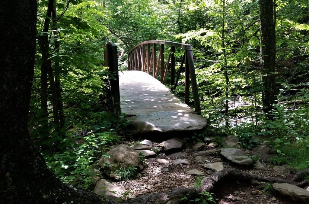
This is also a great trail for very small kids, because it is truly in the woods, but is safe and manicured and very short. There’s also a boardwalk and a bridge.
From the trailhead, take the trail to the right and follow the greenstone path in a circuit until you are back to your starting point. There are many benches and wheelchair pullouts along the trail.
TRACK Trail for Kids: Limberlost is also a part of the Kids in Parks program! Learn about the TRACK Trail program at Limberlost.
- Distance: 1.3 miles, loop
- Duration: 30 mins
- Difficulty: easiest
- Trailhead: Skyline Drive MP 43
- Suggested time of day: any time
- Map: Skyland Area
DAY FOUR – Mary’s Rock
Another friend recommended the Mary’s Rock hike to me.
It was a longer drive for me to get to the trailhead, and it was forecast to be another extremely hot day, so I started out pretty early in the morning.
I planned to go back to the Big Meadows area and do the Rose River Loop if I had time later.
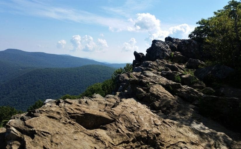
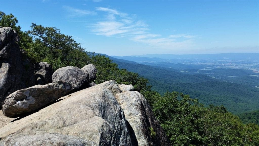
Mary’s Rock
Mary’s Rock is just south of the Thornton Gap Entrance in Shenandoah National Park’s Central District.
If you visit in spring or early summer, as I did, you’ll see lush green forests and wildflowers versus the blazing colors of autumn. But, the real reward for the climb is the 360° view from Mary’s Rock summit!
I took the hike up from the Meadow Spring Parking area, but there are longer alternate routes starting from the Panorama parking area (3.7 miles round trip), Jewell Hollow Overlook (6 miles round trip) and Buck Hollow parking area (9 miles round trip).
At 2.9mi round trip and 830ft elevation gain, the Meadow Spring option is the shortest (and steepest) route to the summit.
My plan was to take the shortest route to the summit, so I’d have time for more hikes later.
The Meadow Spring Parking area is just past the Hazel Mountain Overlook on Skyline Drive, at mile 33.6. Across the street from the parking area, the trail begins 50 yards south along Skyline Drive.
The Meadow Spring Trail is marked with blue blazes and is easy to follow. Most of the elevation gain is on the first half mile of the hike. You’ll see an old homestead about halfway up.
After reaching the junction with the Appalachian Trail, turn right and follow the white blazes. Turn left at the next intersection and follow the trail for a short walk to the summit.
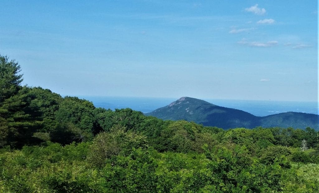
The Mary’s Rock summit view includes the Shenandoah Valley, surrounding mountains, and the Thornton Gap Entrance.
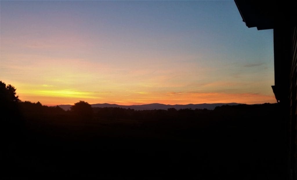
The rock outcropping is a great place to eat lunch, or watch the sunset.
To return, retrace your steps back to the parking area. (Be careful of the trail junctions – you can easily miss a turn and end up at the wrong parking area!)
THIS IS WHERE IT ALL WENT WRONG! (Just Kidding)
After I made the climb and turned to hike back down, I missed a junction and ended up going all the way down to the Panorama parking area.
Actually I figured out what I had done almost immediately, but kept going down to the Thornton Gap entrance parking area just to see a different part of the trail.
After climbed all of the way back up and over again, I quickly found my missed trail junction and returned to the Meadow Spring parking area.
By the time I was done, I had hiked 10 miles instead of 3, and done 2250 ft of elevation gain instead of 830 ft – all in 95+ degree heat.
I was very sweaty and tired, so decided to skip the Rose River Loop (again) and call it a day!
- Distance: 2.8 miles Round Trip – 1000 ft gain
- Duration: 2 hours
- Difficulty: moderate/strenuous
- Trailhead: Skyline Drive MP 33.6, Meadow Spring parking area
- Suggested time of day: early in Summer, this is a steep trail
- Map: Thornton Gap Area
DAY FIVE – Field trip to a Lavender Farm
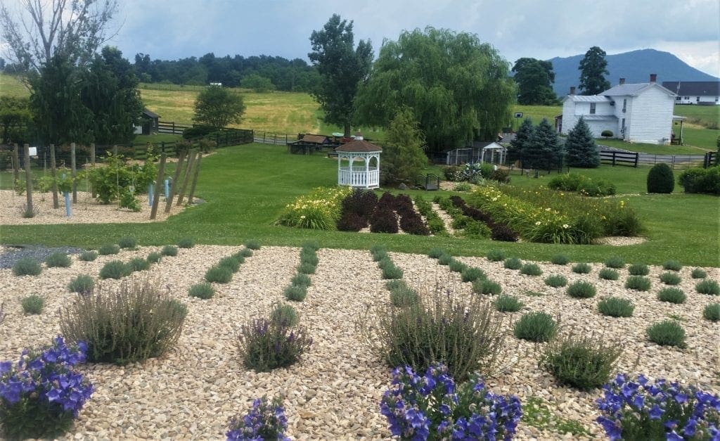
After several days of pretty solid hiking in the summer heat, I decided to take a break from hiking and see what else was going on in the area.
I found White Oak Lavender – a lavender farm with ice cream, farm animals and a walking tour – plus it’s sister business The Purple Wolf Vineyard and wine-tasting.
It was as wonderful as it sounds – and a great change of pace from all of the hiking! You can read my write-up with details of the visit here 🙂
DAY SIX – Hawksbill Mountain and Lewis Falls
For my last day in the park, I had to make some serious decisions.
There were still a number of hikes I wanted to hit – including the iconic Old Rag hike – and what about the Rose River Loop???
It was going to be another very hot day, plus there was an afternoon thunderstorm in the forecast – so whatever I did, I needed an early start.
In the end, I decided to go for multiple shorter hikes (with closer trailheads) instead of any epic long ones.
That way, I could maximize my time, keep an eye on the weather, and stave off any possible heat exhaustion before I was stuck too far away from a trailhead.
I started by climbing to the highest point of the park.
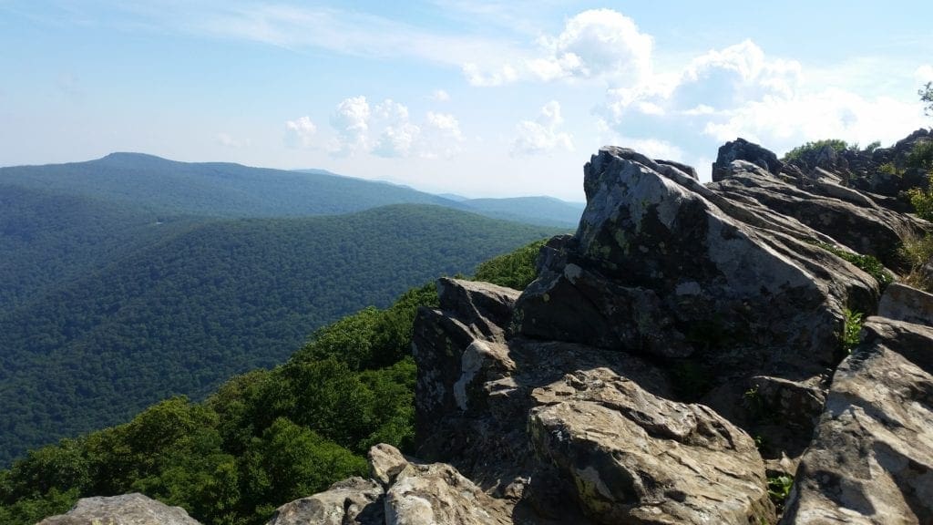
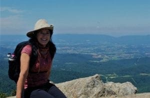
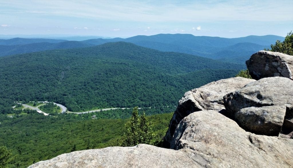
Hawksbill Mountain
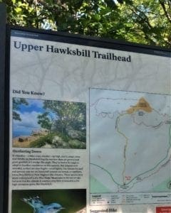
Hawksbill Mountain Summit, at 4051 ft, is the highest point in Shenandoah National Park.
It’s not surprising that the hike to the top is one of the most popular day hikes in the park.
You have a few choices for reaching the summit:
-
-
-
- The Hawksbills Loop hike is a moderate 3-mile round trip.
- The Hawksbill Summit hike is just over 1.5 miles, but rocky and steep, as with several other Skyline Drive hikes. The trail climbs uphill for the entire hike before leveling out at the summit.
- The Upper Hawksbill trail starts a mile south of the other 2 hikes. It’s a 2-mile round trip but, less steep than the other options.
-
-
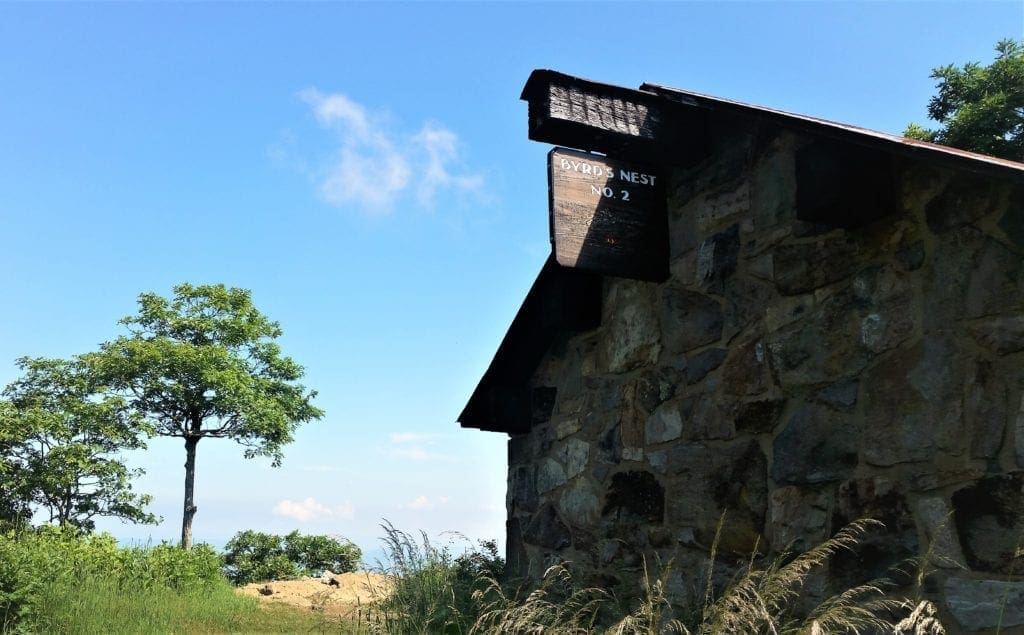
I chose option #3 – the Upper Hawksbill Trail. Whichever trail you choose, once you reach the Byrds Nest 2 Shelter, it’s a short walk to the rocky summit and viewing platform.
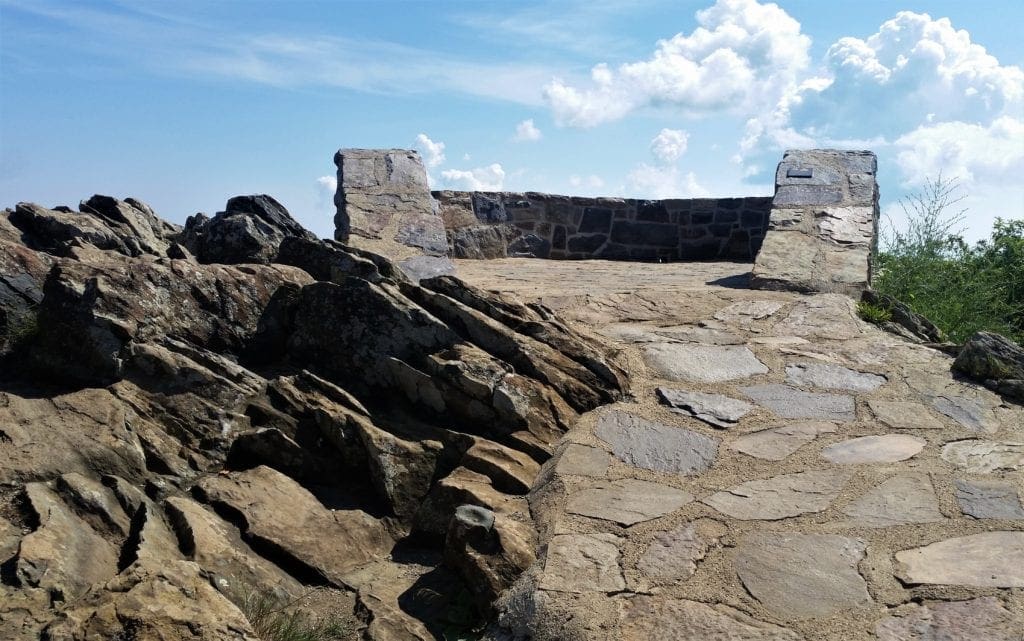
This is the highest point in the whole park, so enjoy the view!
- Distance: 2.1 miles, round trip
- Duration: 1.5 hours
- Difficulty: easy, but has 520ft elevation gain
- Trailhead: Skyline Drive MP 46.5, Upper Hawksbill Gap parking
- Suggested time of day: due to popularity, best early in the morning
- Map: Hawksbill Area
After viewing the park from the Hawksbill Summit, I had to choose between the (sadly neglected by me ) Rose River Loop hike and another waterfall hike in the Big Meadows area – Lewis Falls.
Since I hadn’t hiked any trails in the campground area yet, I decided to try Lewis Falls first.
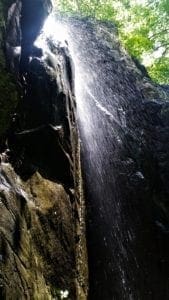
Lewis Falls
Follow the Visitor’s Center roads past the center complex and follow signs to get to the amphitheater.
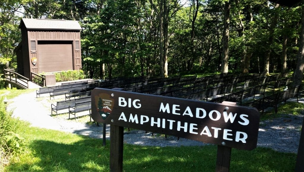
From the Big Meadows amphitheater parking area, take the Lewis Falls Trail. Since it is a loop, you can go either left or right and still end back at the same place.
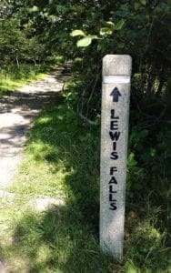
That said, the Ranger recommended heading right from the trailhead, for a little less elevation.
Continue straight to descend—it’s a bit steep and rocky, so watch your footing—to the falls observation point.
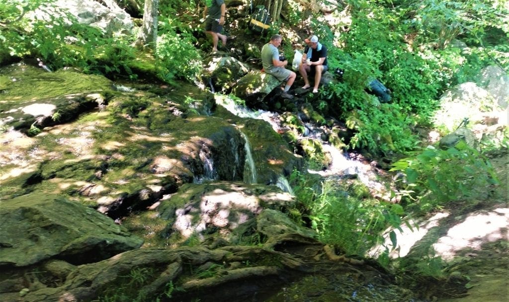
Unfortunately, I arrived around lunchtime, so the Falls were crowded with resting hikers, and kids slurping Gogurt.
Still beautiful, but I like a little more solitude to enjoy the natural beauty 🙂
When you’ve had enough of the Falls, take the Lewis Falls Trail to its intersection with the Appalachian Trail (A.T.). Turn left onto the A.T. and take it back to your starting point.
- Distance: 3.3 miles, loop
- Duration: 4 hours
- Difficulty: moderate
- Trailhead: Big Meadows amphitheatre parking area
- Suggested time of day: a popular hike for families, best in the morning
- Map: Big Meadows Area
It was another hot day, and mid-afternoon when I returned to the trailhead, so I decided to call it a day and head down the mountain.
NEXT TIME – Old Rag
If you’ve heard anything at all about Shenandoah National Park, and you’re a hiker, then you’ve probably heard about Old Rag. And you’re probably wondering why I didn’t hike it.
I did talk to the Rangers about it, and it was on my list. I’m very fit, and not nervous about heights.
But the long ride to the trailhead, an all-day steep 9.2mi hike, record-breaking heat and thunderstorms, plus that I was hiking solo all made me give it a pass this time.
And now I have a reason to go back. Oh, that and the much-neglected Rose River Loop hike :-).
UPDATE: I made it back to Shenandoah again this Spring, and finally had a chance to hike the Rose River Loop and some other hikes, too! Read here about how it went.
I also FINALLY had a chance to hike Old Rag!
Read all about my Old Rag Circuit hike here.
Anyway, here’s a shorter description of the Old Rag Hike, in case you want to tackle it, too:
Old Rag Hike
The iconic Old Rag hike is rated by the park as a “very strenuous” hike, partly because you’ll need to scramble and claw through a couple of miles of rocky terrain to complete the trail.
If your physical fitness is good and you’ve no fear of heights, this hike could just be one of the best ones you’ve ever done.
The hike is a full day, 9.2-mile roundtrip circuit, taking 7+ hours to complete and climbing over 2,000 feet. This trailhead is not directly off of Skyline Drive but rather Route 600, near a parking lot in the village of Nethers, Virginia.
That said, the Old Rag Summit hike via the Berry Hollow Parking area gets you to the summit without the rock scramble. It’s still strenuous, but a shorter 5.4 miles roundtrip and less steep hike.
As the park website says: “a day on Old Rag is one of Shenandoah’s premier experiences”. Just be aware of the dangers and be prepared.
Map: Old Rag Area
The trailhead for Old Rag is different, because it’s outside of the Park in Etlan, Va. You still need to do the same time planning, though.
The trailhead for the Old Rag Circuit Hike is actually inaccessible from Skyline Drive (inside the Park), so use roads outside the Park to get there.
Permits and Passes for Old Rag
To get into Shenandoah (like other National Parks) you’ll need to have some sort of pass or pay a day use fee.
Even though the parking area for Old Rag sits outside of the central part of Shenandoah National Park, you have to pay the Park entrance fee to hike Old Rag.
There’s a manned pay station at the trailhead, so take cash or your National Park pass with you. (The fee is $30 per car or free with Annual Pass.)
If you’d like to purchase an annual pass, go to this website.
NEW: Old Rag Day Hike Tickets
In addition to a Park entrance pass, if you’re hiking the Old Rag Mountain area (including hikers on the Saddle, Ridge, and Ridge Access trails) you’ll need to get an Old Rag day-use ticket in advance online.
The tickets are only $1 each, so I bought tickets for two different days. That way if the weather was bad on one day, I could try the next.
Print out your ticket, or have it available on your phone. They’ll ask to see it at the Old Rag trailhead, and Rangers randomly ask for it on the trail, too.
Learn more on the Old Rag day-use ticket FAQ page.
Park Info
Shenandoah National Park is always open.
However, portions of Skyline Drive, are closed during inclement weather.
Visitors may still enter the park on foot to hike even when the drive is closed.
Check Alerts for Skyline Drive closures and other conditions that could impact your planning.
Always check for closures before you head out!
Winter Hours
Most facilities in the park, including visitor centers, lodging and dining, campgrounds, and picnic grounds begin opening in March and close by late November.
Learn about visiting Shenandoah in winter.
The Park’s Four Entrance Stations
Front Royal (North Entrance) – Near Front Royal, Virginia, off Route 340 (also called Stonewall Jackson Highway)
Thornton Gap – East of Luray, Virginia and west of Sperryville, Virginia, off Highway 211 (also called Lee Highway)
Swift Run Gap – Physical address: 22591 Spotswood Trail, Elkton, VA
Rockfish Gap (South Entrance) – A few miles east of Waynesboro, Virginia off Highway 250
Get Involved
There are many ways you can get involved at Shenandoah National Park.
Volunteer – Join the community of volunteers nationwide who donate their time and talent to our national parks.
Jobs, Internships and other ways for the public to get involved are also available.
See the Park’s Get Involved page for more information.
I hope this post has inspired you to visit the park and try some new hikes!
Or if you prefer video, take a look at the Shenandoah playlist on IRW YouTube.
Leave a comment about your Shenandoah National Park visit, or if you have a question drop me an email and I’ll reply as soon as I can.
Thanks for stopping by – see you next time! LJ
To get new posts via email Subscribe here!
If you like this post, please share it!

LJ has spent much of her free time as a single Mom – and now as an empty-nester – hiking in the US and around the world. She shares lessons learned from adventures both local and in exotic locations, and tips on how to be active with asthma, plus travel, gear, and hike planning advice for parents hiking with kids and beginners of all ages. Read more on the About page.