Pilot Mountain State Park – Hike, Climb, Paddle and Camp
Most recently updated January 16th, 2022
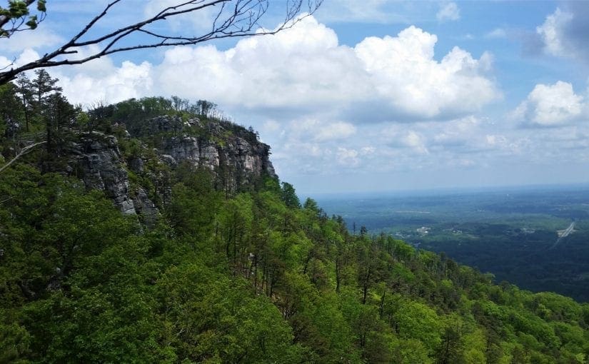
Pilot Mountain State Park views from the top are especially spectacular when the Fall colors come out! It’s a great place to take a family trip any time of year, with miles of trails, camping, climbing, canoeing, and lots of Ranger programs.
I’ve been visiting this park for many years, first with my daughter when she was young, and later with hiking friends or on my own.
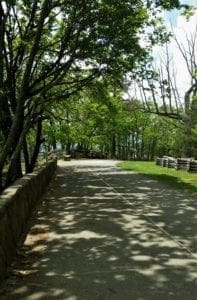
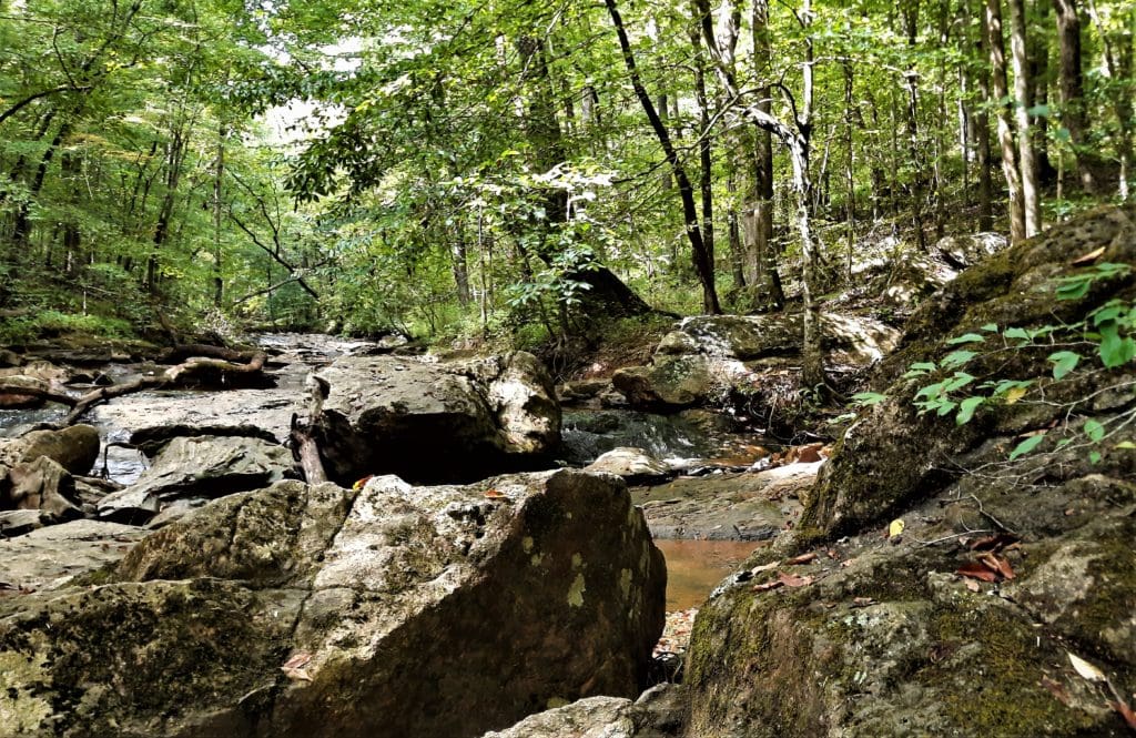
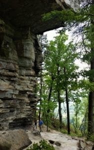
View from the Ledges trail
Like the rocky escarpments in nearby Hanging Rock State Park, Pilot Mountain is a remnant of the ancient Sauratown Mountains.
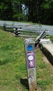
In fact, the Sauratown Trail, a 22-mile (30 miles with spurs) trail for both hikers and equestrians, crosses the range and interconnects the two state parks.
This is a hike I’ve been dreaming of tackling for a while now – you’ll hear all about it when I do!
Perfect for Day Trips
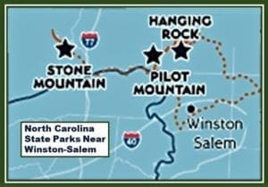
Map of NC State Parks within an easy drive of Winston-Salem
Several NC State Parks are just far enough away to be special trips but still close enough to make good day or weekend trips from the Raleigh area.
Pilot Mountain SP is an easy 2.5 hour drive from Raleigh, so you can easily get there, hike all day and still make it home before bedtime – especially on longer summer days. Of course, if you live in Winston-Salem it’s an even shorter trip 🙂
Every time I visit, there’s something new to see, and the view from the summit never loses it’s charm.
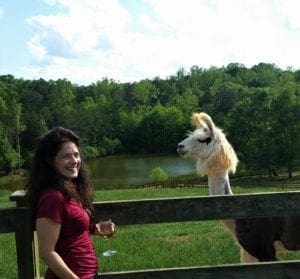
If you want to spend more time to thoroughly explore the park and visit local attractions like Horne Creek Farm or Divine Llama Vineyards, you’ll need to find a place to stay.
There are camping sites and canoe-in camp sites available in the park. You can reserve a campsite on the ReserveAmerica site.
You could also find Pilot Mountain cabins to rent or stay at a Mount Airy or Pilot Mountain hotel.
Some of my posts contain affiliate links. If you make a purchase through an affiliate link, I will receive a small payment at no additional cost to you. I do not get paid for recommendations, all opinions on this site are my own. See full Disclosure page here.
A Landmark for Travelers
Pilot Mountain (the peak that lends the park it’s name) rises boldly out of the North Carolina hills – a rocky surprise that appears out of nowhere as you travel West from Winston-Salem.
Within easy view of surrounding highways, this distinctive peak has guided travelers of all kinds for centuries.
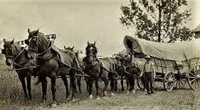
Settlers travel the Great Wagon Road, (Photo credit Forsyth County Library.)
From nomadic Native American tribes seeking food and shelter along the Yadkin River, to Moravian immigrants establishing a new home in the Carolina backcountry, to a buggy full of picnickers in the 1890’s – all have used the iconic quartz capstone of Pilot Mountain as reassurance that they were on the right path.
More recently, it’s been a landmark for families driving from the Midwest to their vacation on the coast – and tells me I’m getting close when I’m driving to Pilot Mountain for some hiking!
Pilot Mountain State Park
Prior to becoming a State Park, the area was a used for public recreation and then a commercial tourist attraction, with private owners charging admission for access.
Before the railroad, Pilot trips were limited by the speed of buggies
After the end of the Civil War, people in the area were just trying to survive, but the Pilot remained a major attraction for almost everyone.
In 1887, the Cape Fear & Yadkin Valley Railway completed its Yadkin section with depots in Mt. Airy, Ararat, Pinnacle and Dalton.
When the Dalton station opened, there was a huge celebration in the streets, lit by bonfires on top of the Pilot.
Pilot Mountain excursions had always been limited by the speed of buggies.
Advertisement for Pilot commercial venture in the late 1800s. (Photo Credit Forsyth County Library)
But the new railroad provided a connection via the Roanoke & Southern line out of Winston that made Pilot trips a simple day trip.
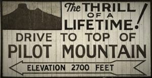
There were even shows and thrill rides at the mountain.
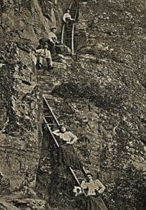
The 2-mile drive cost 50 cents, and for a quarter you could climb a wooden staircase to the summit.
Big Pinnacle view from the Park’s Visitor Center.
A Jump From the Clouds
One Pilot Mountain show advertised by the Grace Shannon Company in May, 1895 was titled “A Jump From the Clouds”.
Featuring the “world’s famous aeronaut, Mlle. Lena Nolan, Queen of the Air, and Daisy, the Dog Wonder” the playbill promised a “grand balloon ascension and double parachute leap from Pilot Mountain.”
Gibson Girls climb ladders to the Pilot Mountain summit ~1900
The balloon was 85 feet high, with a circumference of 180 feet, with the leaps to be made from a height of 8000 ft.
A huge crowd applauded as the aeronauts, both human and canine, made it safely to the ground.
The mountain continued to be used for fun and profit until the entire Pilot property was sold at auction in 1915 to Max C. Butner of Pinnacle for $26,500.
When asked by reporters, he said that he represented a syndicate of Winston-Salem businessmen, who planned to sell the land off as farm tracts.
But no one really believed it. Some editorials suggested that the Pilot might become a major resort, but that never happened.
Exploitation of the Pilot continued for another fifty years. Nobody ever got rich, but they kept trying!
By the 1950s, people realized that the Pilot needed to become a state park, available to all citizens.
The Pilot Mountain Preservation and Park Committee, made up of local residents and conservation-minded property owners, proposed the establishment of Pilot Mountain as a state park to protect it from commercial development.
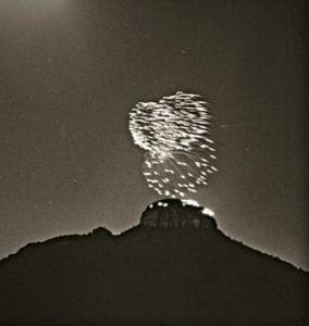
A 1967 gala with fireworks to fund Pilot Mountain State Park
In 1967, to attract enough matching grants to establish the State Park, the organizers held a huge event, complete with fireworks atop the mountain.
They needed to raise over $300,000.
Before the night was over they had far more money than they needed.
The Park Committee secured options on the land and raised matching funds to purchase the land with federal grants.
Pilot Mountain finally became North Carolina’s 14th state park in 1968.
Later, the group acquired more than 1,000 acres of land along the Yadkin River, and added that section to the park in 1970. Further additions brought the park to its present size of 3703 acres.
A New Visitor Center
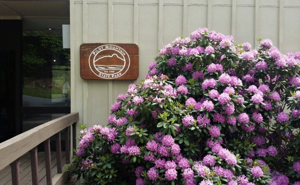
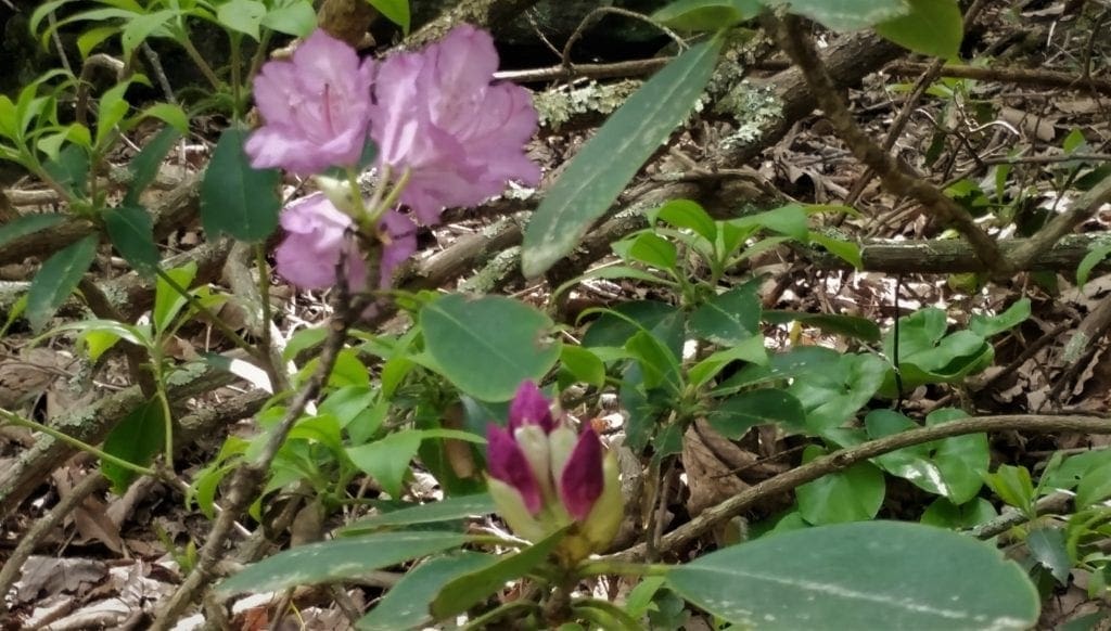
Rhododendrons bloom at the old Pilot Mountain Visitors Center
A couple of years ago, in celebration of the park’s 50th anniversary, officials broke ground on a new Visitor Center at the base of the mountain.
Well, now the new Visitors Center is complete! When I visited the park a few days ago, I finally made it down to check it out.
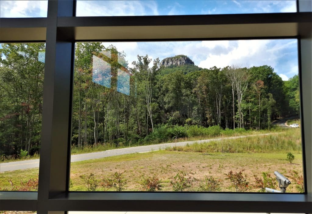
View of the big pinnacle from inside the new Visitor’s Center
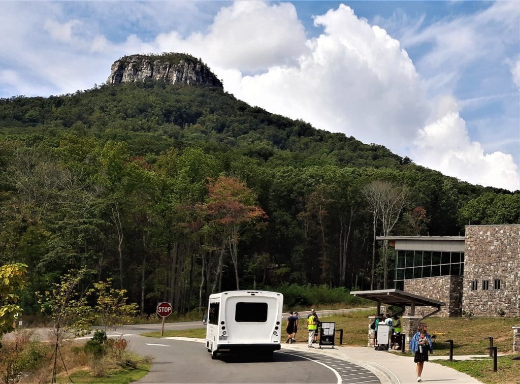
The new facility has increased parking and includes shuttle service to the top of the Mountain to make weekend and holiday traffic less crowded along the park’s only entrance road.
That said, I would still recommend visiting during the week if you can to avoid the more crowded weekends, especially during the summer months.
Depending on where you’re planning to hike, you could also opt to start at one of the less crowded trailheads. It might mean you’ll have to hike a bit more – but what’s wrong with that? 🙂
Shuttle at the new Pilot Mountain Visitor’s Center
Park Geology
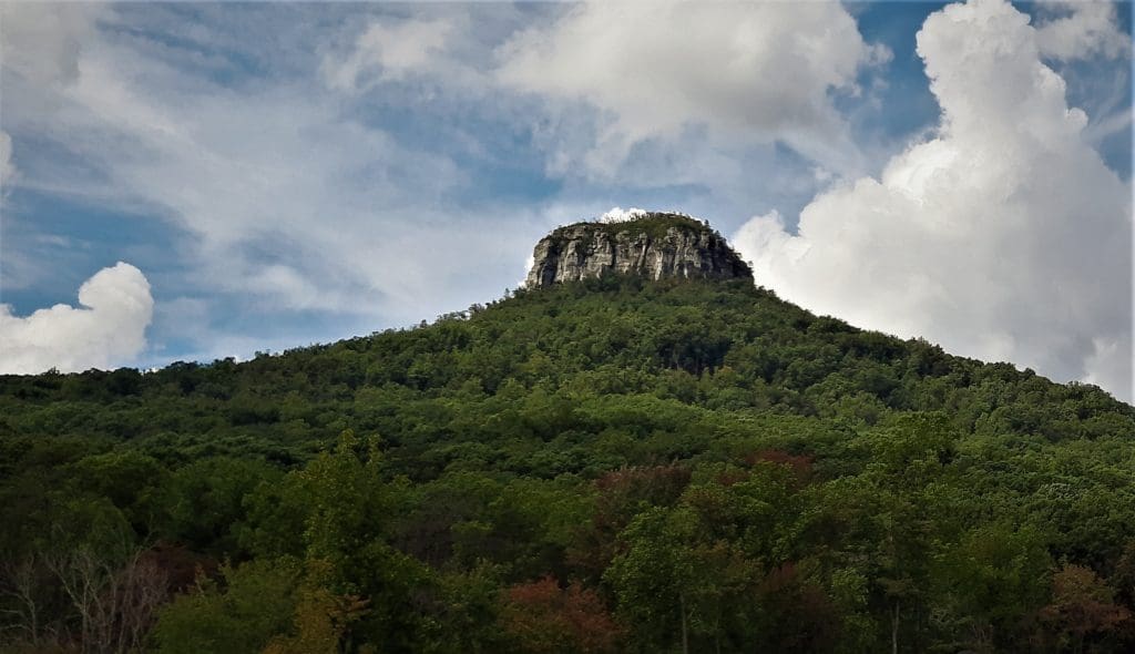
One of four remaining peaks in the Saura Mountain range, Pilot Mountain’s pure quartzite capstone towers 1400 feet above the valley floor, and rises 200 feet above it’s forested base.
Some people believe it’s a volcano, but in fact the white quartzite cap began as beach sand along the shores of an ancient ocean!
Diagram of the ancient Sea of Iepetos and the Carolina Zone
Hundreds of millions years ago, the western Piedmont of North Carolina was covered by a shallow sea called Iepetus (named for the father of Atlantis).
The edge of this sea lay at the base of the world’s oldest mountain range, the Appalachians.
Volcanic activity on the sea floor created a string of islands, now known as the Uwharrie Mountains (a.k.a. Morrow Mountain State Park), the Sauratowns and Pilot Mountain.
Paved .1 mile connector trail between the park’s pinnacles
Pilot Mountain is capped by two prominent pinnacles which are, of course, in the Mountain section of the park.
Big Pinnacle, with walls of bare rock and a rounded top covered by vegetation, is connected to Little Pinnacle by a narrow saddle, which holds a broad hiking path with rock borders.
(NOTE: climbing and rappelling are not permitted on the Big Pinnacle.)
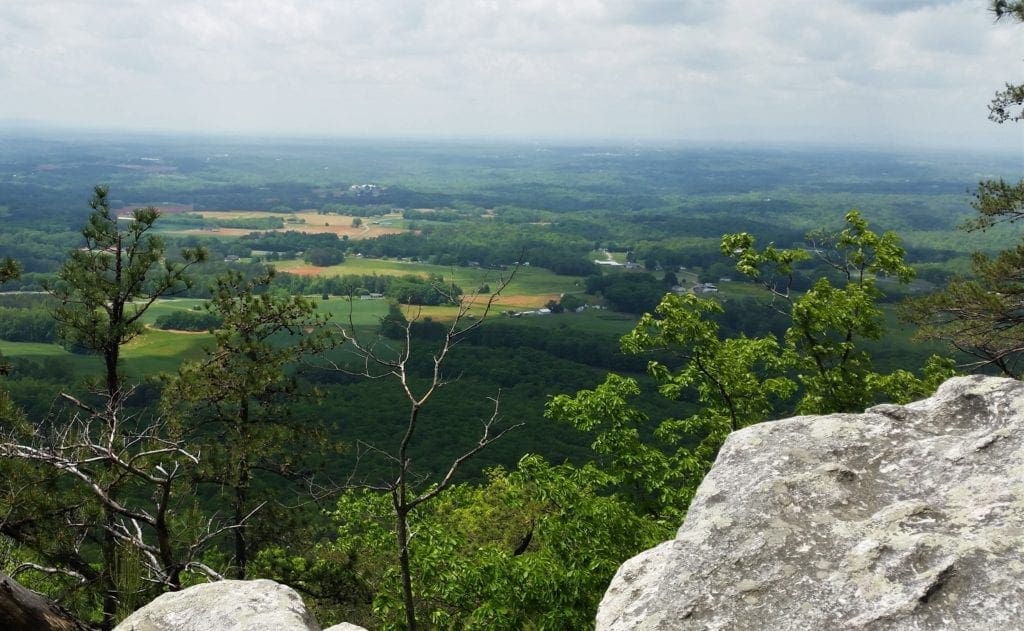
The view from Little Pinnacle encompasses hundreds of square miles of the Piedmont and the nearby mountains of North Carolina and Virginia.
Visitors have easy access to the top of Little Pinnacle, either by walking up from the Grindstone Trail trailhead (at the Park Office), or parking at the upper/summit lot and taking the short walk from there.
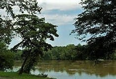
View of the Yadkin River from the Horne Creek Trail
Park Ecology
The vegetation in Pilot Mountain State Park is similar what you’d find in the Blue Ridge Mountains.
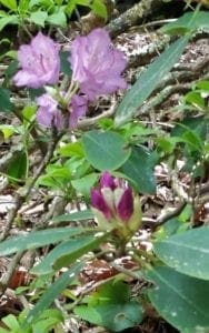
Rhododendrons on the Jomeokee Trail at Pilot Mountain
In late spring, the Big Pinnacle is ringed with the bright pink blooms of Catawba rhododendron.
You’ll also see Mountain Laurel, with leathery evergreen leaves and showy clusters of white flowers.
Watch for the ravens soaring above Big Pinnacle.
Songbirds, like the eastern bluebird and Carolina wren, also fill the air with their musical calls.
You might also see foxes, white-tailed deer, woodchuck, opossum, gray squirrel, and raccoons in the forest.
If you’d like to keep track of what you see, plant and animal checklists are available at the park office. This is a fun activity to do with your kids.
I once found a teeny tiny toad with my 8 year old. We left it where it was (of course), but described it to a Ranger. They helped us identify the toad, and my daughter was thrilled with her discovery!
Early Pilot Mountain History
The region has been inhabited by humans for at least the past 1300 years.
The Donnaha, the earliest known culture inhabiting the park lands, were hunter-gatherers who lived on elk and mountain lions from the forest, grew maize and squash in the fertile bottomlands, and also caught fish in the river.
You can see remnants of Donnaha fishing weirs at Bean Shoals in the River section of the park.
Peter Jefferson, father of Thomas Jefferson
To the native Saura Indians – the people who came after the Donnaha – Pilot Mountain was known as Jomeokee, the “Great Guide” or “Pilot.”
The Sauras were driven southward by the Cherokees, who subsequently occupied the area.
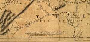
The map was completed in 1751 and published in London inn 1755.
First map of the Pilot area, published 1755 in London
The 1755 map shows the first depiction of Pilot Mountain and the Sauratown range.
Pilot Mountain is labeled “Mt. Ararat”, after the Biblical flood story.
European settlers in search of fertile and available land soon followed, including German Moravians.
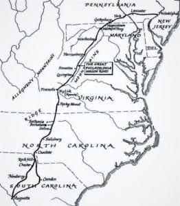
Map of the Great Wagon Road, route between Pennsylvania and S. Carolina
They traveled south along the Great Wagon Road – a former Native American trading path stretching from Pennsylvania to the Carolinas.
Moravian journals describe Pilot Mountain’s distinctive knob peak marking entry into the Carolina backcountry.
The population remained sparse during colonial times due to frontier unrest created by an alliance between the Cherokees and the British.
Remains of Bethabara (the first Moravian settlement) are part of Historic Bethabara Park in nearby Winston-Salem.
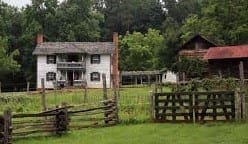
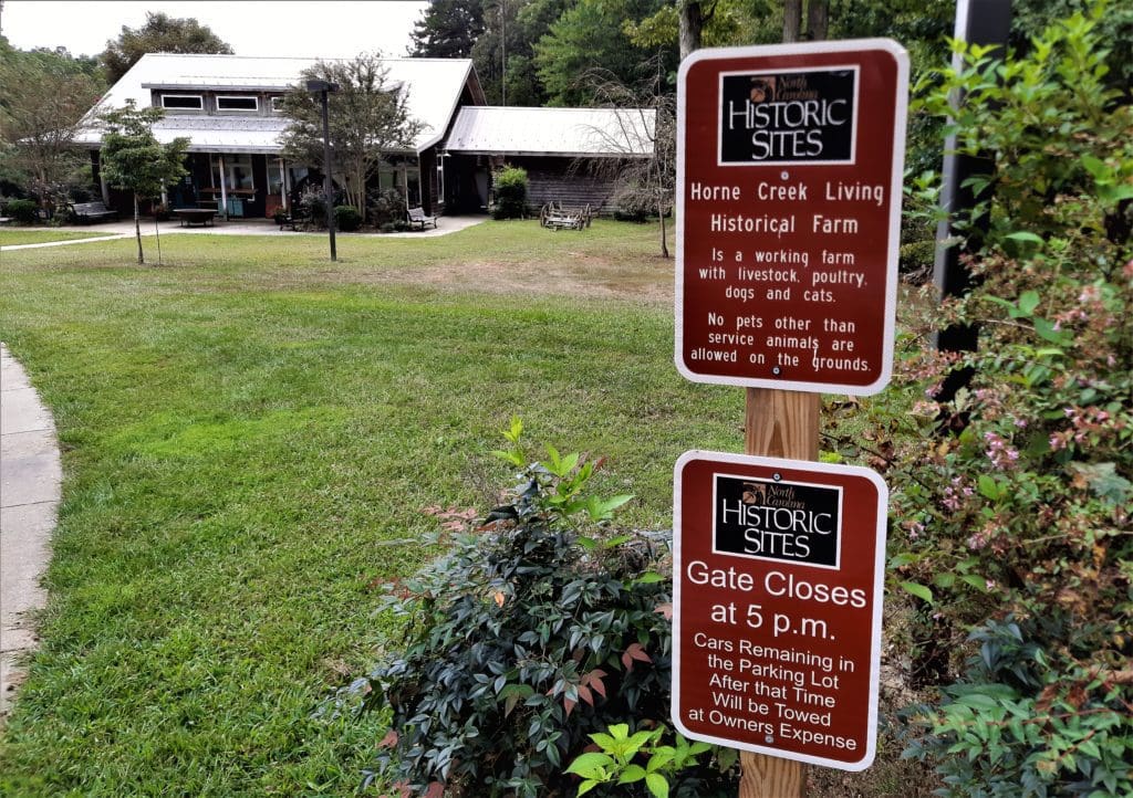
Horne Creek Farm
Horne Creek Farm, adjacent to the River section of the park
Adjacent to the River section of the park, Horne Creek Farm preserves the region’s agricultural heritage through hands-on tours and live demonstrations.
A visit to the 113-acre state historic site is like stepping back to the 1800’s, when family farms dominated the landscape.
Currently being restored to appear as it did in 1900, the farm is an educational center dedicated to preserving North Carolina’s rural heritage.
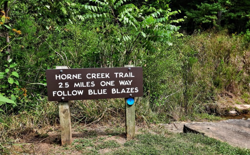
You can hike along the Yadkin River from Bean Shoals to the farm on the 2.5-mile Horne Creek Trail in the park’s River Section.
Trailhead sign at the Horne Creek Trail.
Visitors may participate in other hands-on programs at the farm on Saturdays and Sundays, April through October. To arrange a special tour or educational programs, call 336-325-2298.
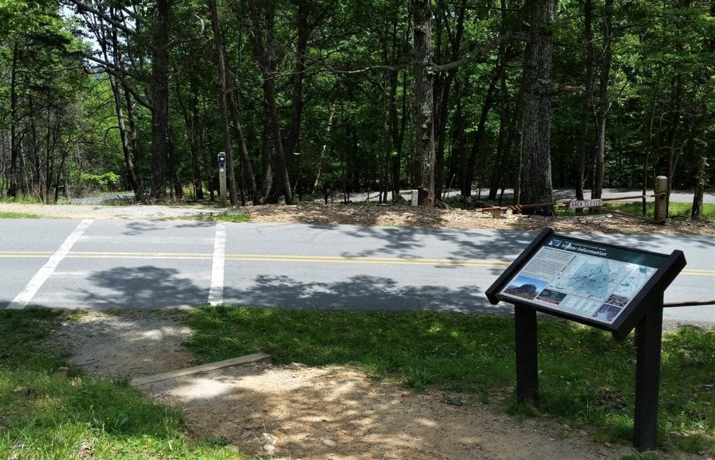
Pilot Mountain State Park Attractions
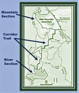
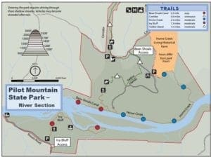
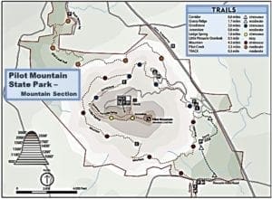
Overview Map of Pilot Mountain State Park
Pilot Mountain State Park has two main sections: the Mountain Section and the River Section.
From above, the 3700-acre park looks like a jumprope, with the sections (handles) connected by the narrow 6.5 mile Corridor Trail.
The River Section
Entry to the Park’s River Section.
The Yadkin River is the main attraction of the River Section of the park. River section hours are 8:30am to 8:00pm from May to September. (See the park’s website for hours at other times of the year – they change slightly to accommodate change in sunset time.)
Map of Pilot Mountain State Park’s River section
You can get to the river from the Mountain section on foot or horseback via the Corridor Trail.
You can park at River section trailhead lots, or park in the Horne Creek Farm parking lot.
(Note: Be advised that you need to cross several shallow creeks to enter the River section by car, and may get stranded after a heavy rain.
View of the Horne Creek Farm visitor center from the parking lot.
Also note that Horne Creek Farm has different business hours than the park.)
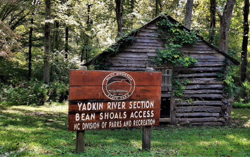
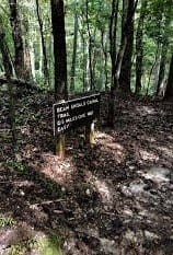
Bean Shoals area trail sign
Bean Shoals and a section of the river were used by the ancient Donnaha people for fishing.
Several fishing weirs are evidence of their efforts to catch the shad that migrated upriver from the ocean to breed – before dams put an end to the fish migration here.
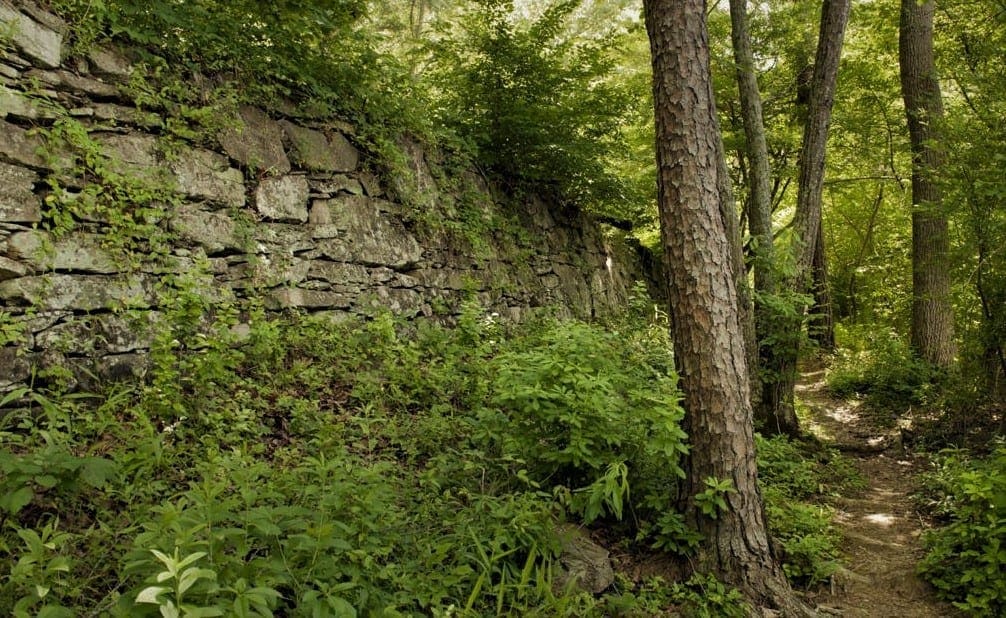
The Canal That Never Was
In 1817, a detailed survey of the Yadkin River showed that the only thing preventing travel and shipment of goods by boat between Wilkesboro and Salisbury was the 4-mile stretch of shallow rocky water called Bean Shoals.
To address the problem, the Yadkin Navigation Company was formed to construct a 3-mile canal. Farmers and merchants in the upper Yadkin raised enough money to start, and work crews began digging the ditch and building a retaining wall.
Stone walls at Bean Shoals from canal construction abandoned in 1825.
Trouble began when Hamilton Fulton, a civil engineer, discovered that the canal and locks were being constructed in the wrong place. By then, the project was already well over budget, and it was too late to start over.
Ultimately, the project failed for lack of funds (unavailable partly due to the economic panic of 1819), and because eastern legislators were hostile toward promoting development in the Piedmont.
You can still see massive stone retaining walls along the riverbank here, though the project was abandoned in 1825.
Despite the failure of the canal project, the site still hosted Shoals Ferry and a railroad depot, making the river crossing a hub of commerce in the late 1800s.
Large boulders in Horne Creek.
Paddling
The portion of the Yadkin River that flows through the park is one of the most scenic stretches along the river’s course.
Part of the Yadkin River Canoe Trail is in Pilot Mountain State Park
Enormous river birches overhang the water, the river is broad and two small islands (45 and 15 acres in size) lie in the river.
The islands may be reached by wading on foot or by canoe.
The 165-mile trail follows the course of the river, passing through five reservoirs to the confluence of the Yadkin and Uwharrie rivers.
The access address for the Canoe Trail within the park is:
SHOALS ACCESS
4454 Shoals Rd, East Bend, NC 27018 GPS coordinates: N 36º15.45’ W 80º31.05’ Maintained by: Pilot Mountain State Park, 336-325-2355 Distance to next access point: 6.9 miles Conditions: dirt and gravel road entrance, limited parking Facilities: none
Contact the park office for more information. (Canoe rentals not available.)
FISHING
This is a rhododendron (not a fish).
Cast your line from the river banks and catch yourself some dinner!
Smallmouth bass, spotted bass and catfish are just waiting to be caught – or to steal your bait 🙂
Anglers need a state fishing license and must obey the regulations of the NC Wildlife Resources Commission.
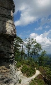
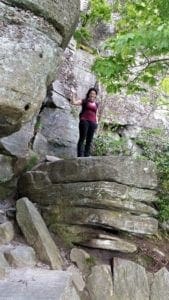
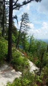
View of the valley from the ledges at Pilot Mountain’s summit.
The Mountain Section
The Pilot Mountain summit, with it’s extensive trail network, is the main park area for hikers and climbers.
Mountain section hours in May to September are 7:00am to 9:00pm daily. (See the park’s website for hours at other times of the year – they change slightly to accommodate change in sunset time.)
Visitors Center is open from 8:00am to 4:30pm daily.
Map of the Mountain section of Pilot Mountain State Park
Camping is available within the park at a 42-site family campground on the lower slopes of the mountain. Sites can be booked at ReserveAmerica.
These sites are augmented by a few canoe-in sites in the River section.
Note: All climbers and rappellers are responsible for their own personal safety, including use of proper equipment, and must schedule their activity in order to leave the park by the posted closing hour.
IMPORTANT: read the FAQS and Rules about climbing in the park.
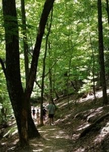
View of the Horne Creek Trail.
Pilot Mountain Hiking Trails
Travel on foot, on horseback or in a canoe – no matter what your mode of travel, Pilot Mountain has nearly 15 miles of trails to explore.
l
The trails range from easy to strenuous in difficulty, and most of them have some elevation gain. You can bring your dog, too – but please keep him on a leash at all times.
In the Mountain section, Little Pinnacle Overlook offers hikers a close-up view of Big Pinnacle and distant views of the valley below.
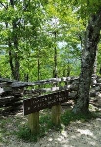
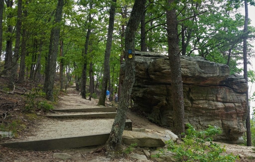
Trail sign for the Jomeokee Trail
Both Equestrians and hikers will enjoy the trails running through the six-mile woodland corridor that connects the Mountain and River sections of the park.
(Note: Horse rentals are not available in the park, but you can bring your own.)
In the River section, there are several shorter trails with less elevation – and even a canoe trail!
My favorite trails (so far) are the Grindstone Trail, the Jomeokee Trail, and the Ledge Spring Trail. These trails are all in the Mountain section – a short description of each is below.
Play
Grindstone Trail
Trailhead Location: Mountain section – park office, upper summit parking lot, or start from the Corridor Trail trailhead to add a couple of extra miles.
Description:The park description calls this “moderately sloped”, but I think it’s a little steeper than that. 🙂 The trail goes through the woods to the summit parking area.
Trailhead is across the road from the park office and is to the right. (The Mountain Trail starts from the same point.)
The Grindstone Trail crosses the main park road
Trail continues up through the woods to a rock building, where you will cross the main park road and hike out past the campground, where trail climbs the mountain through the woods to the summit.
Trail joins the Ledge Springs Trail in last half mile, past the picnic area to the summit parking area.
Surface: natural surface
Length: 3.00 miles one way
Difficulty: strenuous
Blaze: blue dots
The MST goes along with a portion of the Grindstone Trail
If you hike the Grindstone Trail to Little Pinnacle Overlook, you get a close-up, eye-level view of Pilot’s knob.
On your way back, you can take the Ledge Spring Trail.
If you start at the Park Office, you could also go downhill on the Mountain trail and Corridor trails.
It’s a little more than 10 miles down to the Yadkin River.
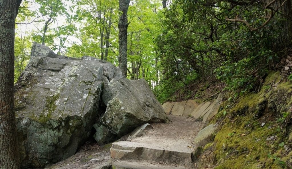
Jomeokee Trail
Large boulders and rhododendron bushes line the Jomeokee Trail
Trailhead Location: Mountain section – upper summit parking lot
Description: A moderate trail with rock steps – but extremely scenic. The trail crosses the gap to the Big Pinnacle, then makes a loop around the base and merges into the same trail to return across the gap.
View from the Ledge Trail
There are rare and interesting plants along this trail, including rhododendron, as well as the tall, impressive cliff.
This trail starts at the upper side of the summit parking area.
Surface: natural surface
Length:0.80 miles loop
Difficulty: moderate
Blaze:none
Ledge Spring Trail
Trailhead Location: Mountain section – upper summit parking lot
Description: The parks describes this as a “very challenging trail”, but it’s really not very difficult as long as you pay attention to where you’re stepping.
The trail is not smooth; it’s filled with large with rock slabs, has varying slope and 1,000 feet of elevation gain and loss.
Hiking beneath the cliffs on the Ledge Spring Trail
The spring is just a trickle of water, but the walk below the cliffs is beautiful.
The trail travels along the foot of the cliffs and ledges to the west of the Little Pinnacle.
To complete the trail, you’ll cross the parking lot.
The trail is easier to begin below the summit picnic area and to end below Little Pinnacle at the Jomeokee Trail.
Surface: natural surface
Length: 1.60 miles loop
Difficulty:strenuous
Blaze: yellow dots
The Grindstone Trail merges with the Ledge Spring Trail near the summit.
I haven’t spent enough time in the River section to have a favorite hike there – but the Horne Creek trail is pretty nice 🙂
For more detailed information about individual trails, go to the park website or see the park map.
Other Park Activities
Bicycling
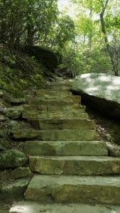
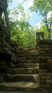
Stone steps on the Ledge Spring Trail
There are no mountain bike trails in the park, but the main park road is popular for hill climbing by bicycle.
The road averages a 10% grade for 2.5 miles and has sections of 16% grades.
This should only be attempted by experienced cyclists wearing proper safety equipment.
Cyclists should plan their ride for the early morning hours when there is less vehicle traffic.
Be careful on the descent and remember that bicycles are subject to the same rules as motor vehicles, including speeding and improper passing.
Picnicking
Road crossing on the Grindstone Trail
The picnic area in the Mountain section is located near the summit parking lot.
Picnic tables and grills are surrounded by a pine and hardwood forest, with drinking water and restrooms are located nearby.
The picnic ground at the River section of the park is approximately a mile from the shore of the river in a meadow along Horne Creek. Tables, grills, and waterless toilets are provided.
Education at the Park
A stone staircase on the Jomeokee Trail
Rangers hold regularly scheduled educational and interpretive programs about Pilot Mountain State Park.
Educational materials about Pilot Mountain State Park that correlate to North Carolina’s competency-based curriculum in science, social studies, mathematics and English/language arts have been developed for grades 9-12.
The Pilot Mountain program introduces students to the “mountains away from the mountains” and the geologic processes that formed them.
The program comes with a teacher’s booklet and workshop, free of charge to educators.
To arrange a special exploration of Pilot Mountain State Park for your group or class, contact the park office.
Events and Programs
Pilot Mountain State Park offers a variety of learning opportunities for all ages.
These interpretive programs, typically led by park rangers, give visitors perspective into what makes North Carolina State Parks naturally wonderful.
Most of the events are free, though some do require pre-registration. Call the park office for more information.
Get Involved
Volunteer at Pilot Mountain State Park
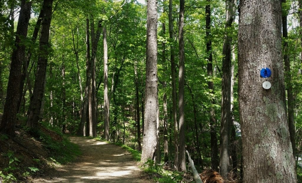
Tree Blazes on the Grindstone and MST trail
Volunteers are needed at Pilot Mountain State Park each year from March 15 – November 30 and must be over 18 years old.
They normally can use 1-2 volunteers per month.
Contact Dylan Joyce (Pilot Mountain Volunteer Contact) for more information. Email: dylan.joyce@ncparks.gov or call (336) 325-2355.
In addition to volunteering with the park, you could also volunteer with the nonprofit Friends of Sauratown Mountains , an organization with over 200 members.
They support park preservation efforts with trail maintenance, local and state advocacy, habitat restoration, fundraising, special events, and publicity.
To fully appreciate the group’s efforts, hike the 6.6-mile Pilot Creek Trail at Pilot Mountain State Park.
The park’s newest trail was built entirely by volunteers and offset $75,000 in equipment and labor expenses.
Park Location and Hours
Pilot Mountain State Park is within easy driving distance of Winston-Salem, and can be visited as a day-tip from Raleigh.
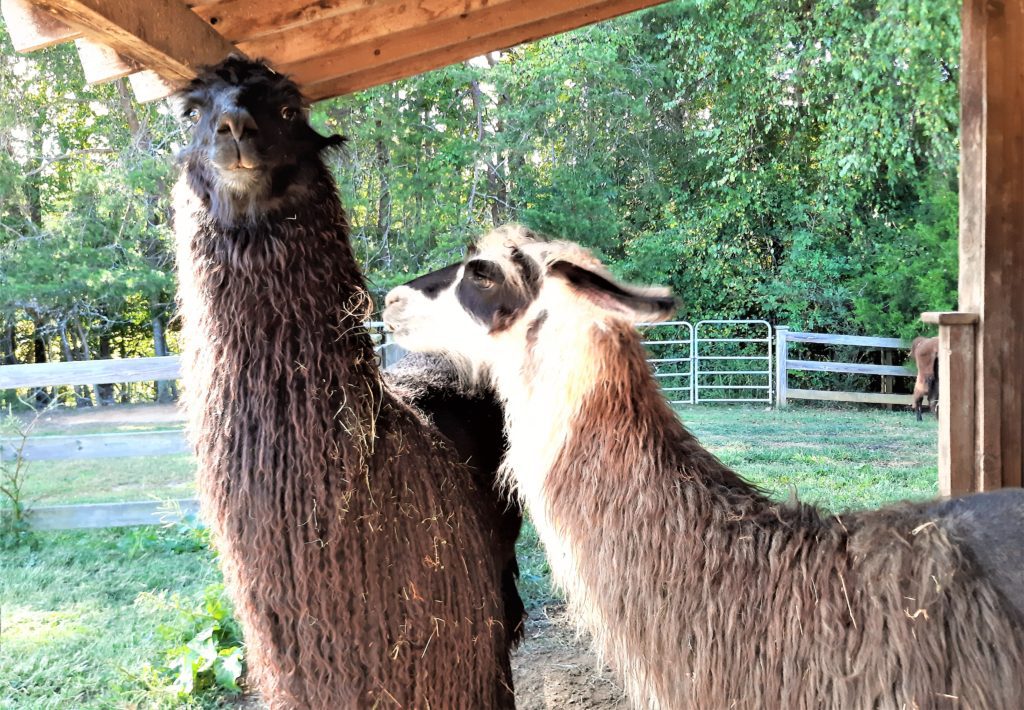
You could even plan a trip to include nearby Hanging Rock State Park – and maybe even make a stop at local Divine Llama Winery.
Friendly llamas at Divine Llama.
Park Location
Pilot Mountain State Park
1792 Pilot Knob Park Road
Pinnacle, NC 27043
Office: 336-325-2355
pilot.mountain@ncparks.gov
Park Hours
See the park’s website for hours at other times of the year – they change slightly to accommodate seasonal changes in sunset time.
Mountain Section: May to September: 7:00am – 9:00pm
River Section:May to September: 8:30am – 8:00pm
Campground Gate:May to September: 7:00am – 10:00pm
Park Office: 8:00am – 4:30pm daily
See the park website for other seasonal hours and trail or road closures.
Fees/FAQs/Rules
There are no entrance fees to enjoy the park. 🙂
In addition to park-specific rules, please read the system-wide Park Rules for all North Carolina State Parks.
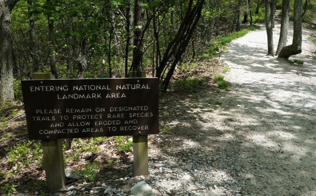
Pilot Mountain State Park is a National Natural Landmark
I hope you enjoyed this post, and got some good ideas for your next day trip or weekend hiking getaway!
If you’re looking for some travel pointers or ideas for your next adventure, check out my Travel Resources page.
If you have a question drop me a note and I’ll reply as soon as I can. Thanks for stopping by – see you next time! LJ
To Get New Idratherwalk Posts sent directly to your inbox (how convenient!) Click this Button
LJ has spent much of her free time as a single Mom – and now as an empty-nester – hiking in the US and around the world. She shares lessons learned from adventures both local and in exotic locations, and tips on how to be active with asthma, plus travel, gear, and hike planning advice for parents hiking with kids and beginners of all ages. Read more on the About page.
Published by
LJ
LJ has spent much of her free time as a single Mom - and now as an empty-nester - hiking in the US and around the world. She shares lessons learned from adventures both local and in exotic locations, and tips on how to be active with asthma, plus travel, gear, and hike planning advice for parents hiking with kids and beginners of all ages. Read more on the About page.
View all posts by LJ
Do you dream of a great hiking trip but aren’t sure where to go?
Need some practical tips on finding amazing trails locally and at adventure travel destinations?
I have a few ideas that might be perfect for you 🙂
Sign up to get new Idratherwalk.com articles in your inbox every month!