Most recently updated October 15th, 2024
Estimated Reading Time: 19 minutes
Stone Mountain State Park is very near areas of North Carolina that were hardest hit by Hurricane Helene.
Stone Mountain is currently closed, along with many other NC State Parks and trails in the Western part of the State.
Go to my Hurricane Helene page to get the latest updates on the latest area Park, Trail and road repairs before you travel.
I’ve been visiting Stone Mountain State Park in North Carolina for almost 20 years, either with kid in tow, with That Man, or on my own.
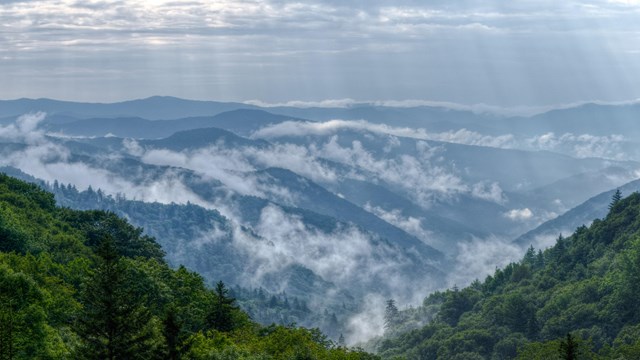
My most recent visit was just a few weeks ago – and the mountain was still just as beautiful as I remembered 🙂
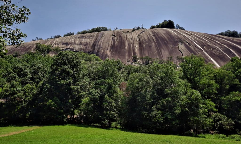
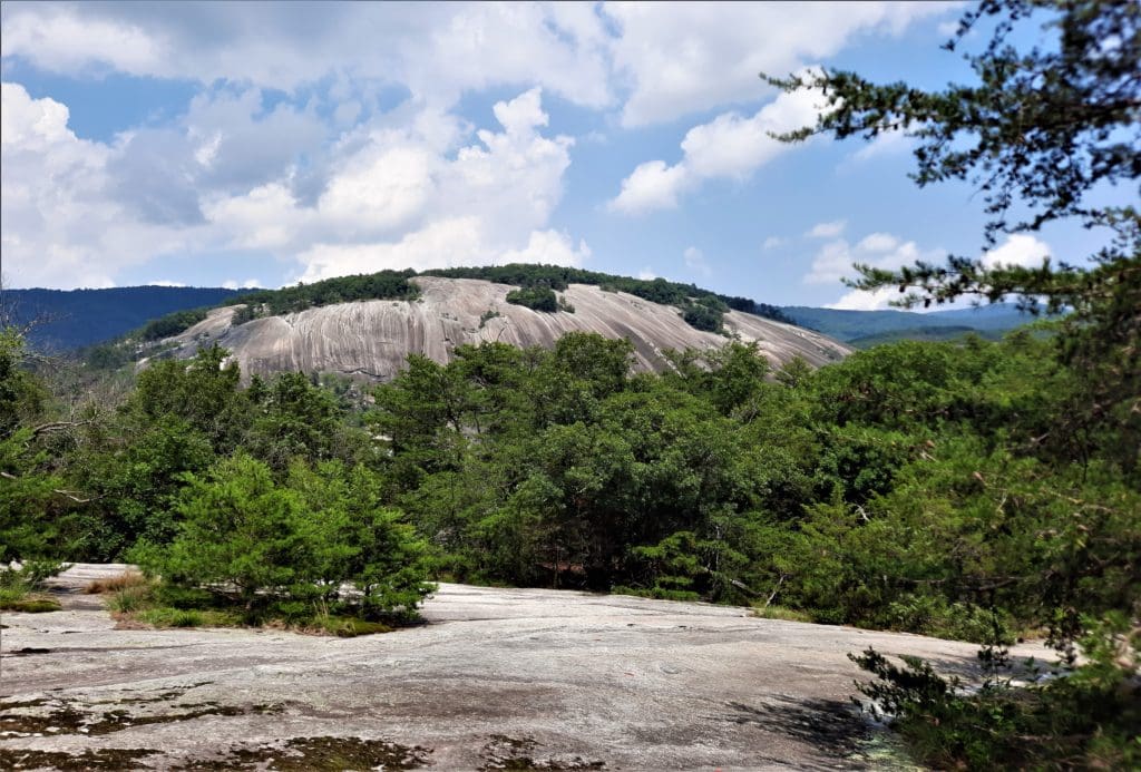
Located on more than 14,100 acres in Wilkes and Alleghany counties in North Carolina, Stone Mountain State Park offers cascading waterfalls, cool mountain streams, and quiet forests to explore.
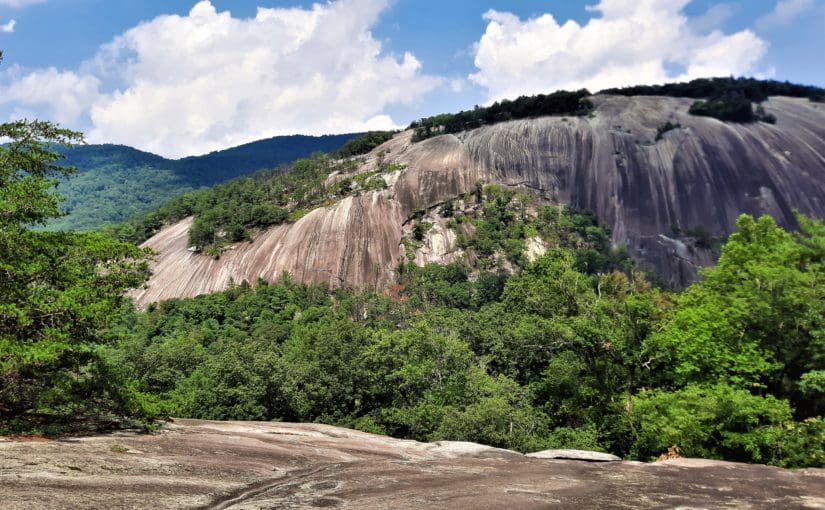
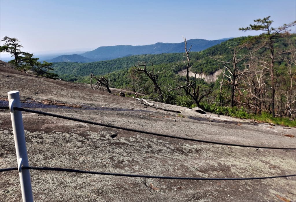
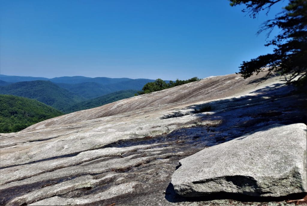
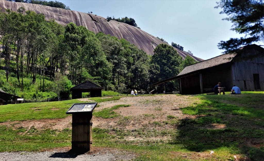
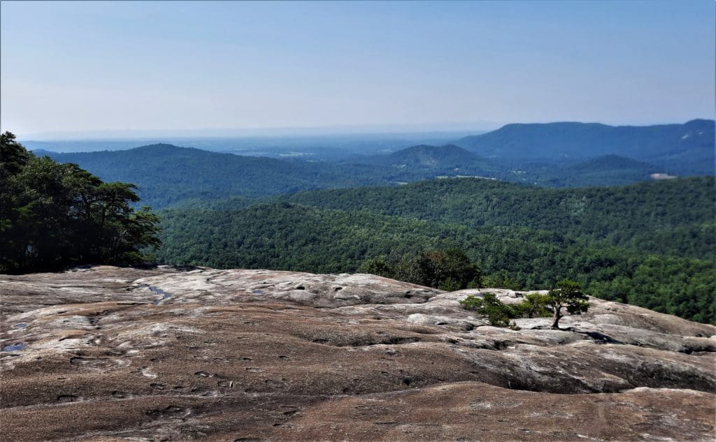
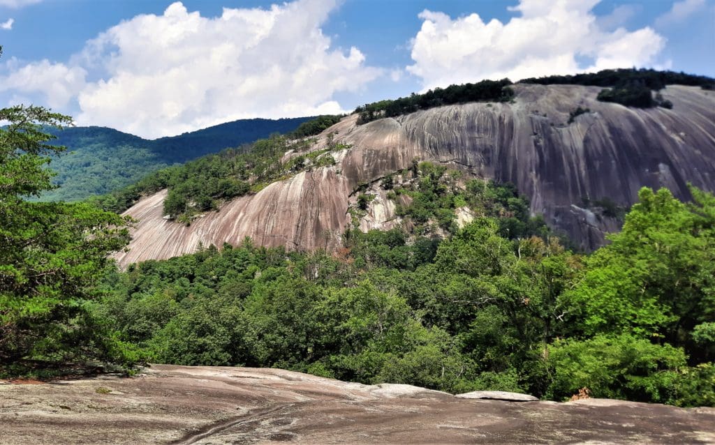
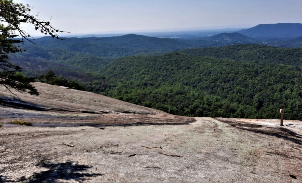
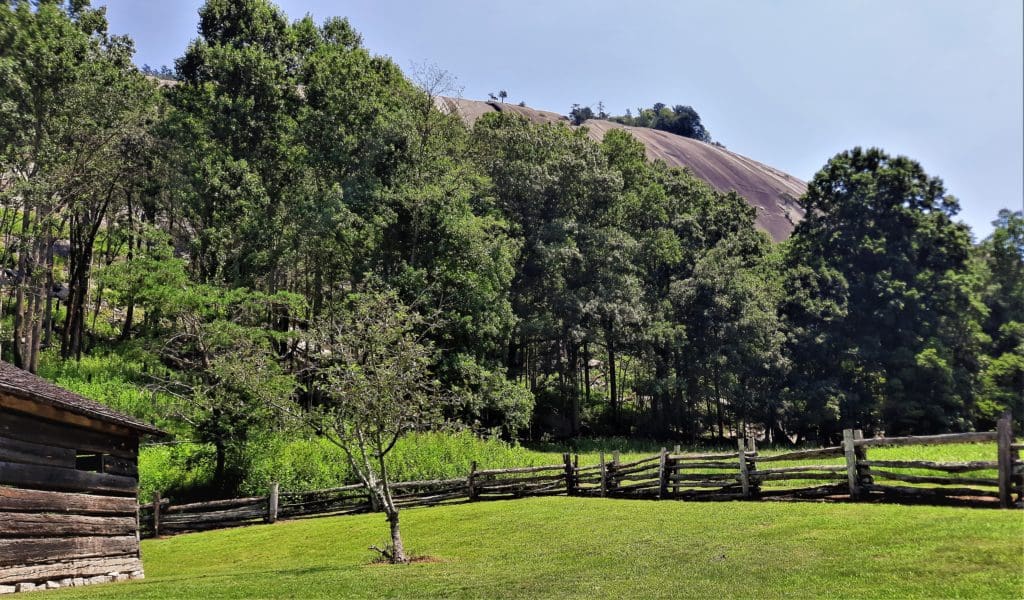
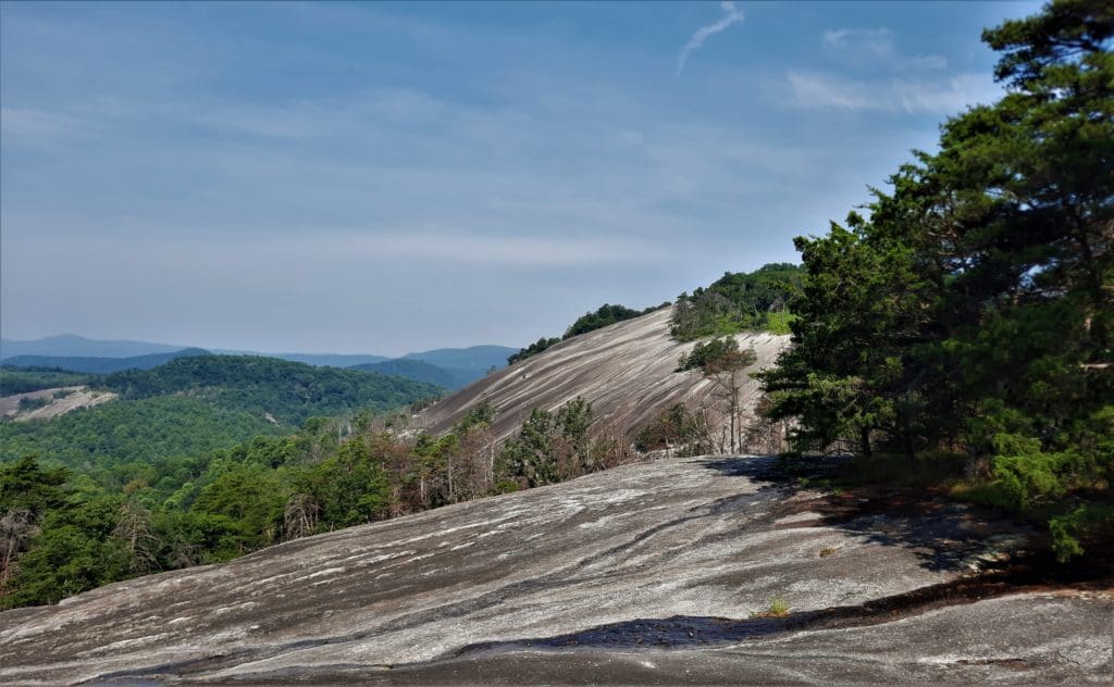
And of course, the massive 600-foot granite dome of Stone Mountain itself.
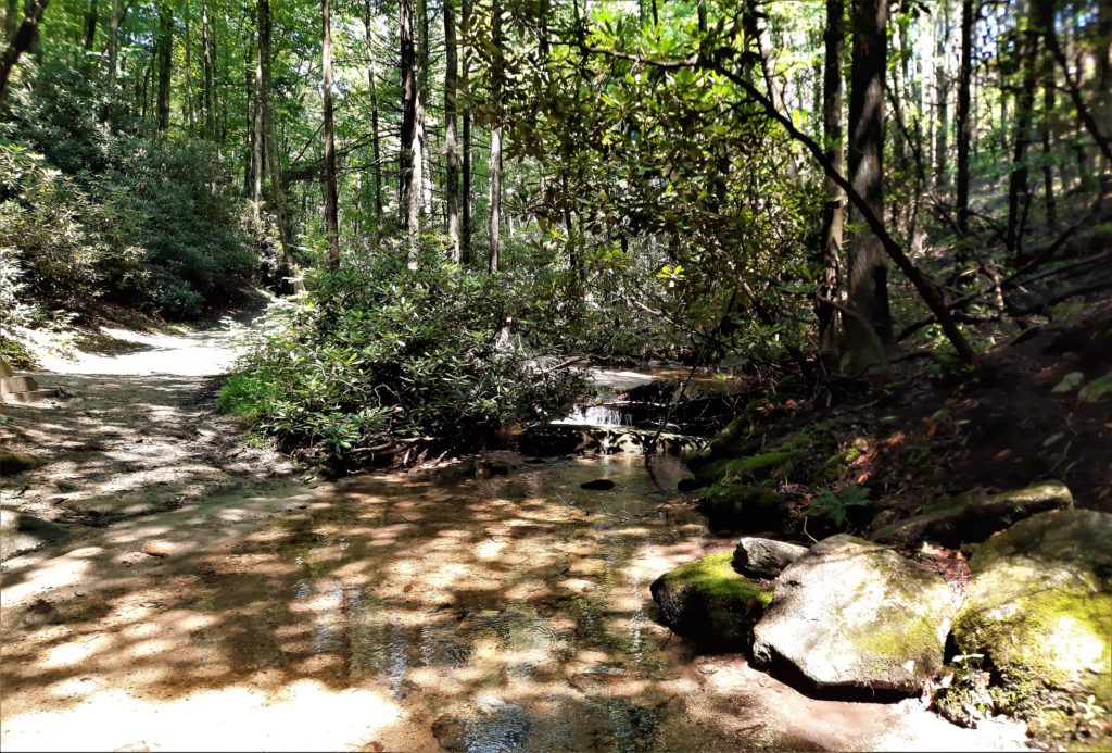
There are more than 18 miles of hiking and riding trails, and 20 miles of designated trout waters available in the park.
You can also go rock climbing (with a permit) on the towering granite face of the landmark mountain.
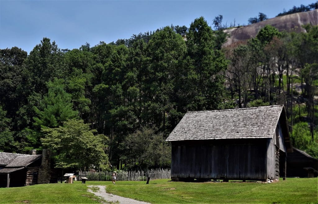
Climbers on the dome look down over the Hutchinson Homestead, a restored mid-19th century mountain farm that rests in it’s shadow.
Read on to learn about the park and area history, hiking trails, and great views just waiting for you to visit!
Some of my posts contain affiliate links. If you make a purchase through an affiliate link, I will receive a small payment at no additional cost to you. I do not get paid for recommendations, all opinions on this site are my own. See full Disclosure page here.
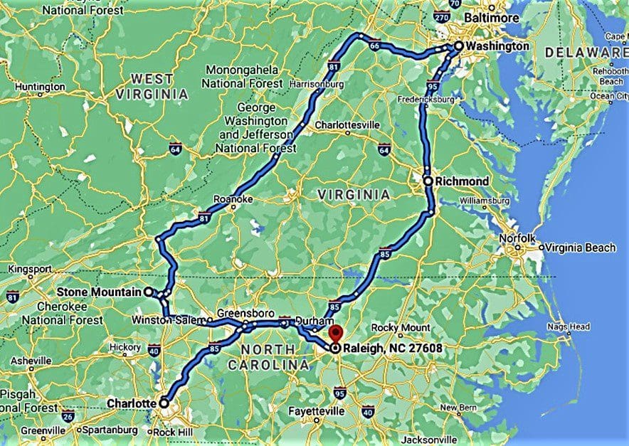
Stone Mountain State Park is just a short 2.5 hour drive from the Raleigh area, almost 6 hours from Washington DC, and roughly 5 hours from Richmond, Va.
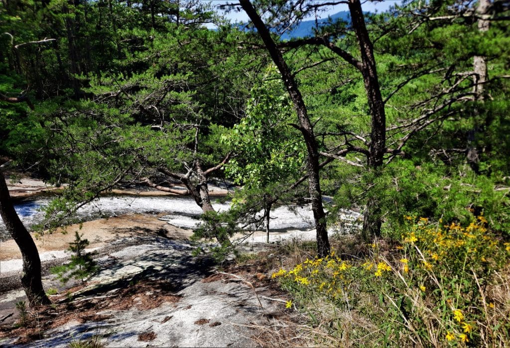
The whole area of the park has extremely rugged wooded terrain, with several large granite outcrop areas, including Stone Mountain’s namesake biotite granite dome.
Stone Mountain is rugged enough to be interesting to hikers, but is also a nice smaller park with camping and other recreation options, so it’s a great family vacation spot!
The Dome
Stone Mountain’s dome is the largest plutonic monadnock in North Carolina, made of light gray granite developed from magma several miles deep in the earth.
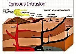
A monadnock is a rocky mass or small mountain that stands isolated in an essentially level area.
A pluton is a body of igneous rock formed below the earth’s surface by the consolidation of molten rock.
P
The dome at Stone Mountain State Park is part of a 25-square-mile pluton.
As erosion removed the overlying granitic rock, the release in pressure caused the rock mass of Stone Mountain to move upward sometime during the mid-Paleozoic era, ~200 million years ago.
Over time, wind, water and other forces gradually eroded the softer layers of rock still on top of the granite block and exposed the outcrop we see today.
Even in modern times, wet weather springs continue to carve troughs in the granite as water runs down the mountain’s sloping face.
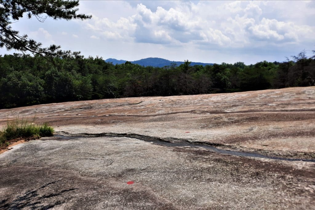
Wolf Rock and Cedar Rock (also within the Park) have a similar structure, and you will find the best views in the park from Wolf Rock.
But every view was beautiful, so I’ve shared as many of them here with you as I could 🙂
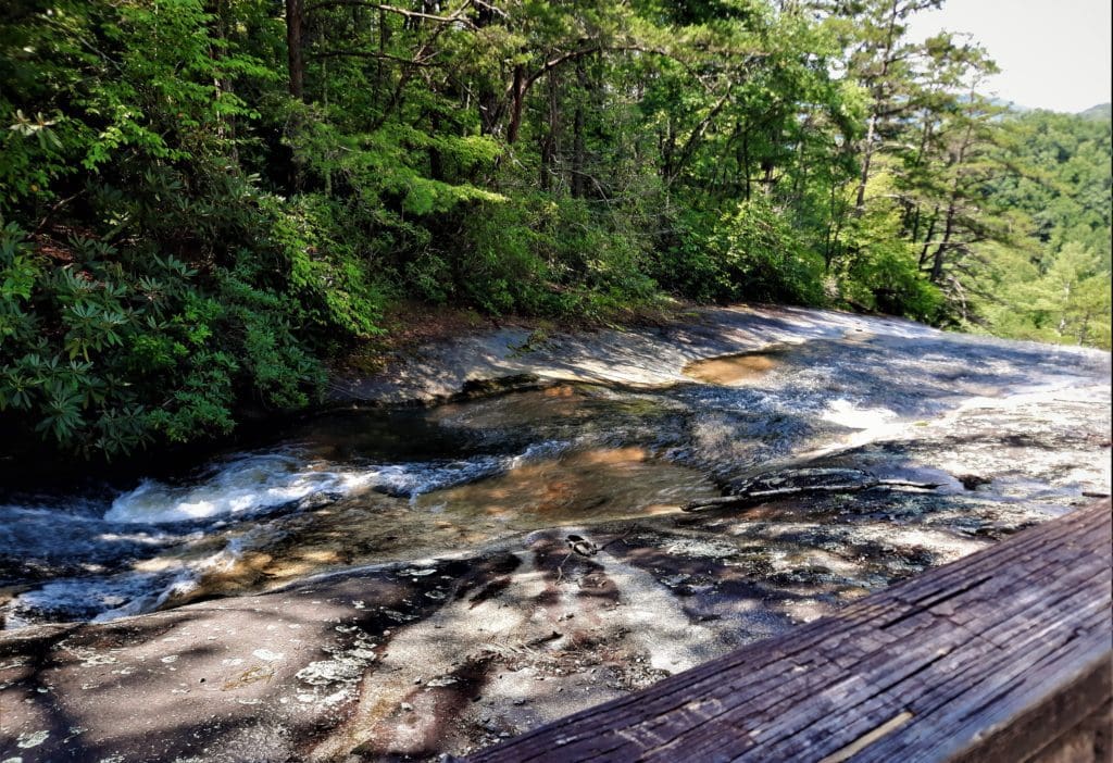
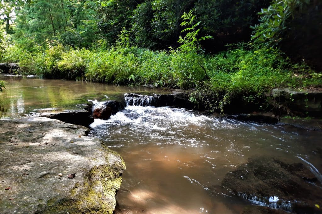
Stone Mountain Waterfalls
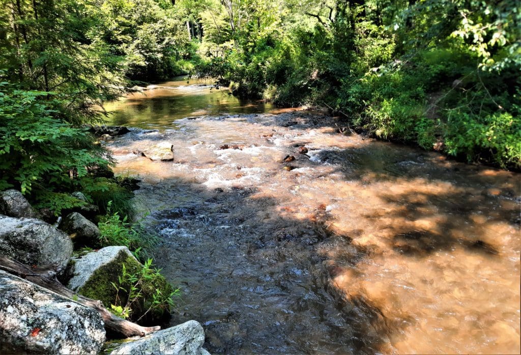
Seventeen miles of cascading trout streams within the park add to the beautiful mountain scenery.
The streams flow through the park to form four waterfalls:
-
-
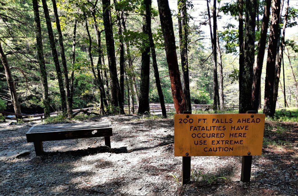
- Stone Mountain Falls – 200 feet in height;
- Middle Falls – a series of low slides;
- Lower Falls – approximately 25 feet in height; and
- Widow’s Creek Falls.
-
Stone Mountain Falls, located on Big Sandy Creek at the southeast end of the mountain, is the highest waterfall.
Thirteen rare plant and animal species, including two endangered species, have also been reported in or near the park.
Plan Your Park Visit
In addition to your usual hike planning, you’ll need to consider your route to get to the park, and where you want to stay once you arrive.
The Park Location
Stone Mountain is located on the eastern edge of the Blue Ridge escarpment in the Mountain Province of North Carolina.
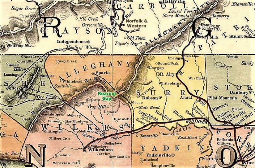
It lies on the northern border of Wilkes County, approximately 17 miles northeast of North Wilkesboro, and extends into the southeastern portion of Alleghany County.
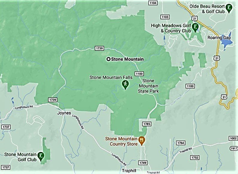
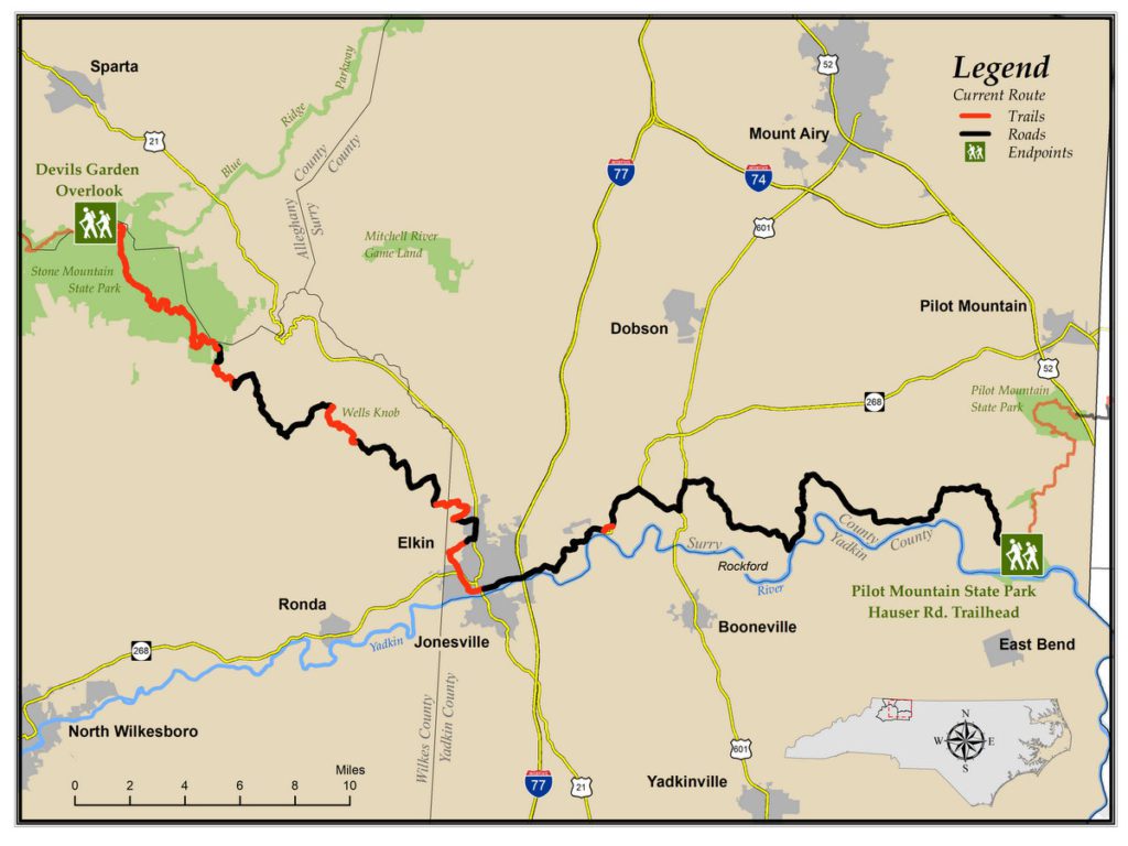
The park is accessible via U.S 21, S.R. 1002, and the John P. Frank Parkway, between Sparta and Elkin.
Park Lodgings
You’ve got a few options if you want to stay overnight inside the park. But you’ll want to make your reservations early, because spots fill up fast!
CAMPING AND BACKPACKING
The campground offers 90 sites, some with utility hookups, and group and backpacking campsites are nearby.
I’ve camped at Stone Mountain, and it was a lot of fun 🙂
A permit, available at ranger stations and via the Park website, is required for all backcountry camping and shelters. (All backpackers must register and pay at the backpack parking area before camping overnight.)
To get all of the details about each campground, and learn how to make reservations, see the Park’s camping info page.
Lodgings Outside OF the Park
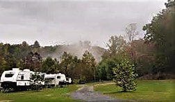
The closest lodgings to the park are right next door at the Sandy Creek Family Campground.
Sandy Creek Family Campground
The campground is owned and run by the historic Hutchison and Higgin’s families of Stone Mountain.
The original Hutchison homestead sits at the base of Stone Mountain proper, and has been restored and preserved.
The Higgin’s homestead once sat where the Visitors center and Hemlock center are now.
Apple and red Sweet Cherry trees that were planted by Grandpa Higgins still stand today in the fields surrounding the visitor center.
Find more info at the Sandy Creek Family Campground website.
Nearby Attractions
The closest attractions on the outskirts of the Park are the Stone Mountain Country Store, and Garden Creek Baptist Church.
Stone Mountain Country Store
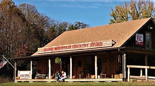
This old-fashioned store is a great place to find a cool drink after a long day of hiking, or get a scoop of old-fashioned ice cream in a cone.
Relax in a rocking chair on the porch to finish your treat before the drive home.
Learn more here: Stone Mountain Country Store
Garden Creek Baptist Church
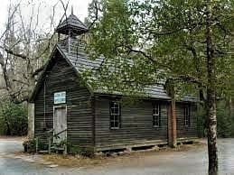
Established in 1897, Garden Creek Baptist is one of the few original churches in Wilkes County that hasn’t undergone any major repairs or remodeling.
Services are held every Sunday, May-October and first Sundays, November-April.
Visitors are welcome to walk the grounds when the church is closed.
Learn more here: Garden Creek Baptist Church
Park History
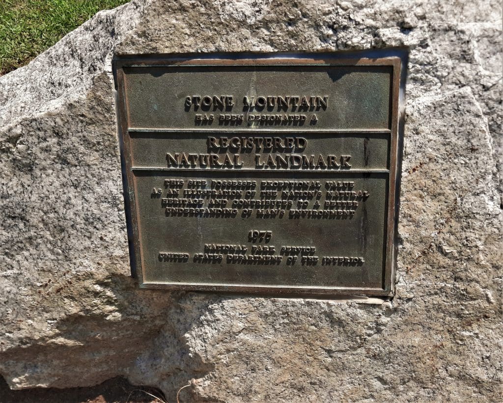
Established in 1969 and designated a National Natural Landmark in 1975, Stone Mountain is bounded by the Blue Ridge Parkway and the Thurmond Chatham Game Lands.
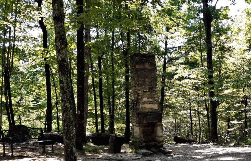
As a relatively new State Park – established long after the Great Depression – Stone Mountain doesn’t display any of the handiwork of the CCC that we see in the older State and National parks.
That said, the forest still holds many stone hearths, chimneys and other remnants of the handiwork done by the earliest settlers in the area.
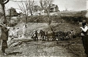
Long before becoming a state park, Stone Mountain was settled by families of English, German, Irish, French and Scotch-Irish descent who built the log homes, farms, mills, churches and schools needed for self-sufficient communities.
The first homesteaders were the Hutchinson family, who came to reside at the base of Stone Mountain in the 1850s.
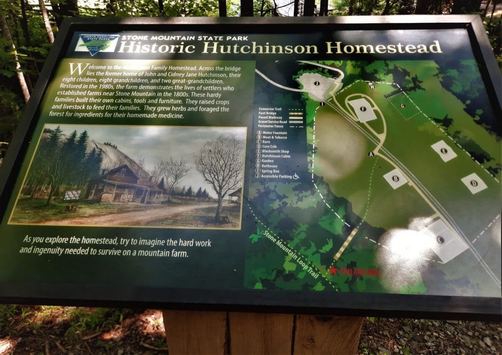
The Hutchinson Homestead
In 1969, the State of North Carolina purchased the Hutchinson property along with several hundred acres of land to establish Stone Mountain State Park.
John and Sidney Jane Brown Hutchinson built the original log cabin in 1855.
In this tiny house they raised a family of eight children. One of the children born in the house was Sylvester Allen.
His son, Barry Hutchinson, owns the modern Sandy Creek Family Campground (which was purchased in 1944 to be a farm) adjacent to the park.
Jim and Ruth Hutchinson, other descendants of John and Sidney Jane, were provided a lifetime option to the Hutchinson Homestead.
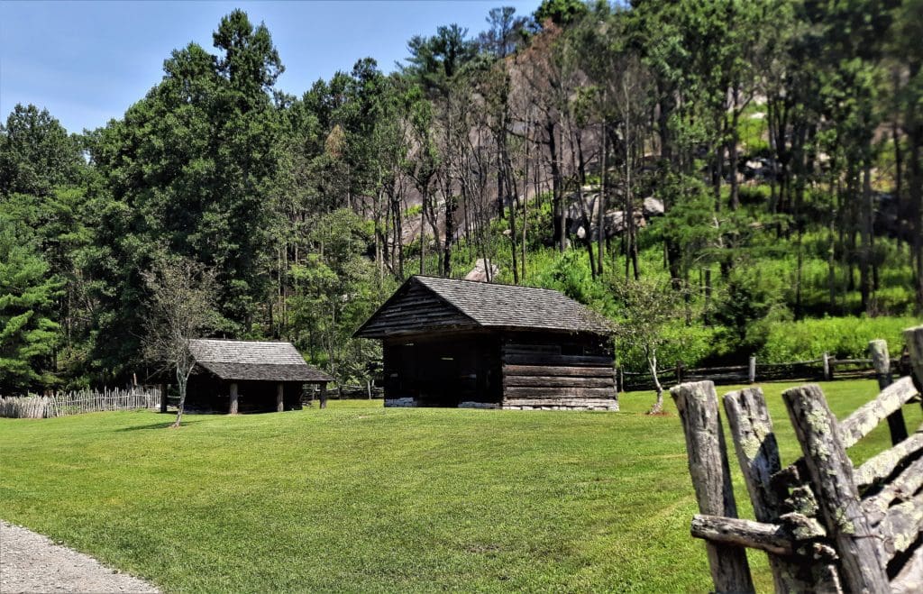
The Hutchinson Homestead is the last remaining original homestead in the park.
Restoration of the property began in 1997, almost thirty years after the purchase, and was completed in 1998.
A log cabin, barn, blacksmith shop, corncrib, meat house and original furnishings, the homestead are representative of the lives of early settlers in the area.
The homestead building is open to visitors on weekends during peak season. Even when the homestead is closed, visitors can walk the homestead grounds.
Long before the establishment of the State Park, nearby business owners saw the value of marketing the area for recreation.
After the end of the Civil War, there was a big push to build out the railroads across the country – including western North Carolina.
Roaring Gap
Down the mountain, in 1890, as the railroad got closer to the town of Elkin, NC, a group of prominent Winston-Salem businessmen developed a mountain summer resort near the new railroad’s terminus.
To do this, they formed the Roaring Gap Summer Resort Company, and purchased several dozen acres of mountaintop land in Alleghany County.
Anyone owning stock valued at $250 or more would be granted a lot near a new hotel, which would be built by a second company, the Roaring Gap Hotel Company. The Roaring Gap Hotel opened on June 15, 1894.
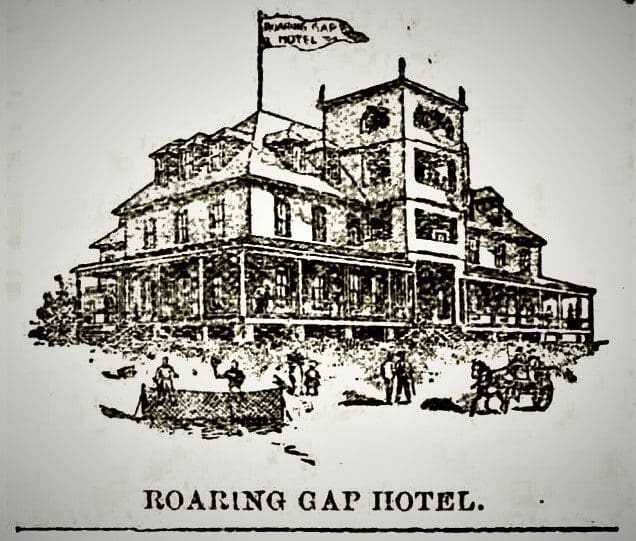
The community was named for the noise the wind makes when rushing through the mountains.
The Roaring Gap hotel was a limited success, because the hack ride from the Elkin train depot took at least four hours and could be double that if the old buggy path to the Gap was muddy.
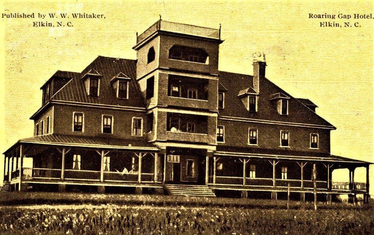
Some of the investors decided that a railroad line to the hotel would solve that problem.
In 1907, the original intent was to build a rail line from Elkin to the Gap, with a long range idea of continuing to Jefferson, sixty miles away.
Work started at once, but progress was slow because just beyond Elkin Creek, the terrain became the rugged eastern slope of the Blue Ridge Mountains.
The railroad rented convicts from the state prisons to do the heavy work, reimbursing the state with shares of stock in the company.
By the spring of 1911, 12 miles of grading had been completed and a mile of track had been laid.
The grand opening of the railroad celebration was scheduled for July 4, 1911.
Today, the community of Roaring Gap is still known for outdoor recreation, with several Golf and Country Clubs in the area, along with close proximity to Lake Louise and Stone Mountain State Park.
To learn more about the history of the area, check out the historical artifacts in the Mountain Culture Exhibit in the Stone Mountain State Park office building.
These exhibits tell the story of how the independent mountain settlers provided shelter, food and clothing for their families.
The exhibits are open during office hours.
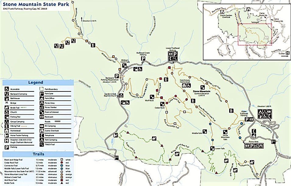
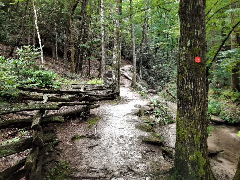
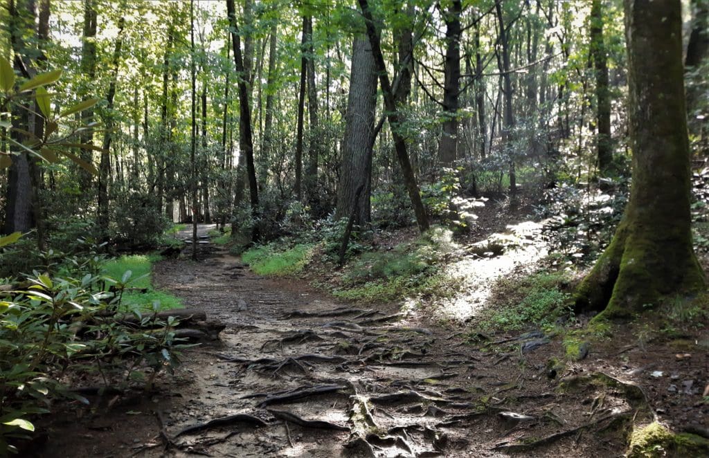
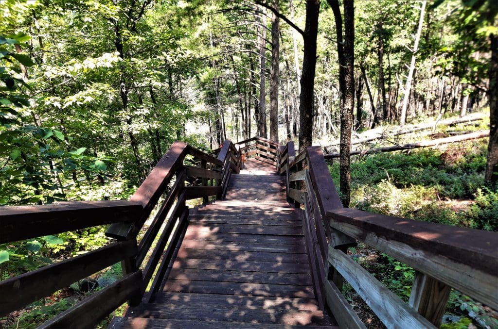
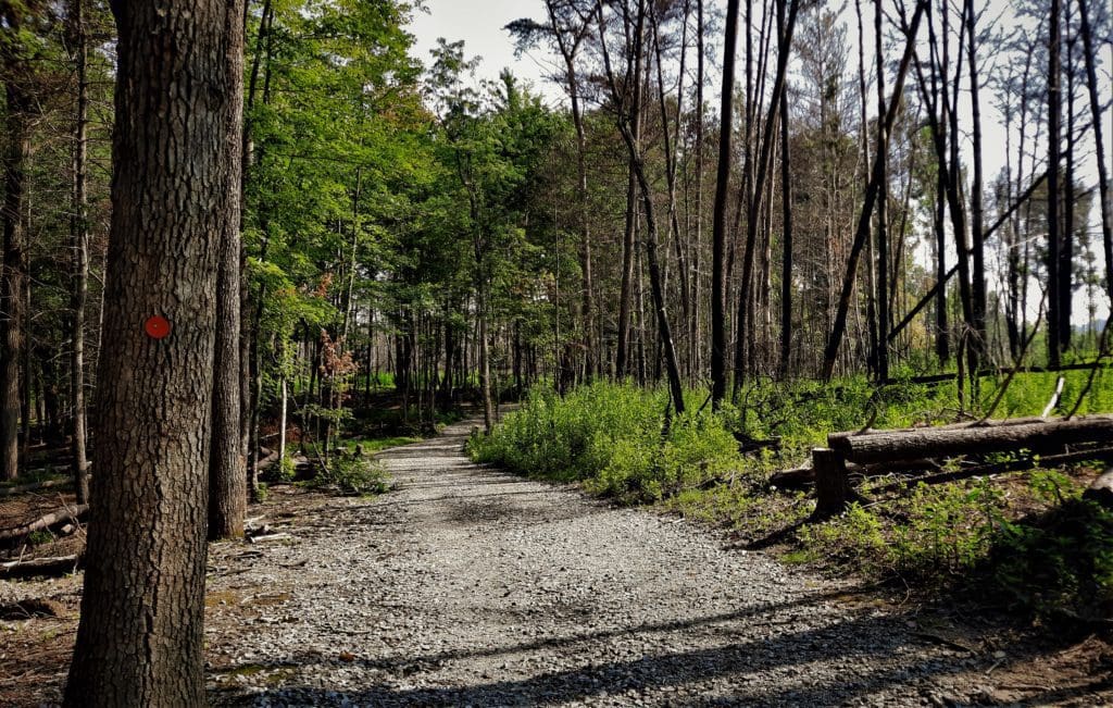
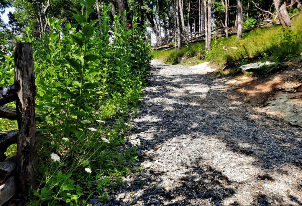
Stone Mountain Hiking
There are 18 miles of trails in the park for hiking and riding.
Gear You’ll Need

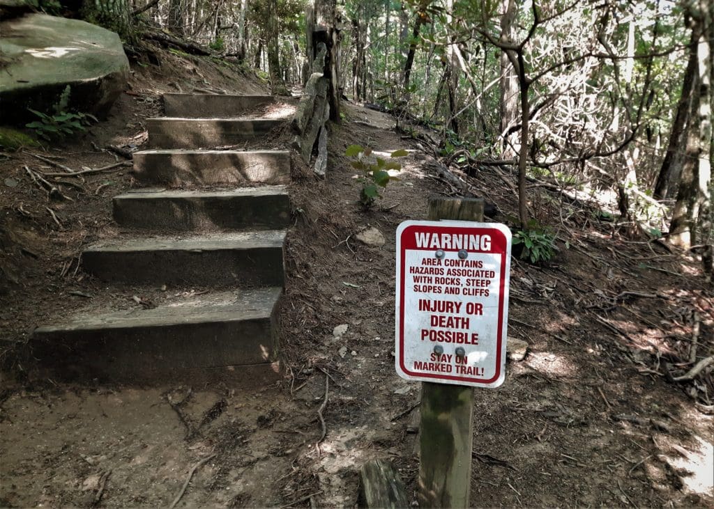
Sturdy hiking boots or shoes are absolutely necessary when hiking the rocky and sometimes slippery trails in Stone Mountain State Park.
Good grippy soles are especially useful on the smooth rockfaces up top!
And you’ll need a pack to carry your water and food, too.
Take a look at myGear Page and links to other articles for more info on useful hiking gear you might need.
The Trails
My most recent visit to Stone Mountain was in late July, and the weather was as expected – meaning very hot – with thunderstorms more likely than not each afternoon 🙂
Since I was driving in from the Raleigh area, there were only a few hours left to hike before a thunderstorm when I got to the Park on the first day.
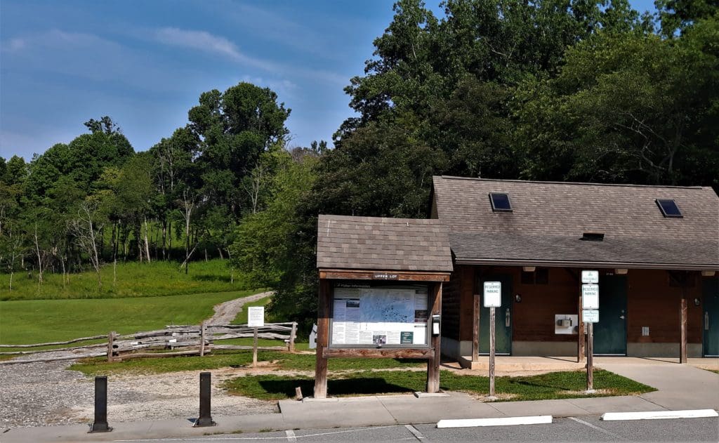
VISITORS CENTER
First thing, I went to the Visitor’s Center to check in with a Ranger, and see if there were any trail closures.

I also wanted some advice on the trail routes I planned to take.
Most of the trails at the park aren’t very long, but some are quite steep.
Stone Mountain State Park’s hiking trail network visits the Stone Mountain summit as well as waterfalls, trout streams, historic homestead and dramatic overlooks.
Since I only had 4 hours at most, I didn’t want to tackle any long trails the first afternoon. I decided instead to combine several shorter trails.
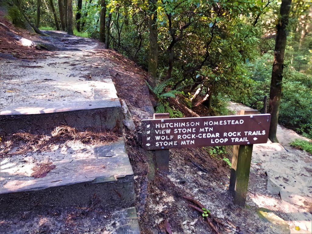
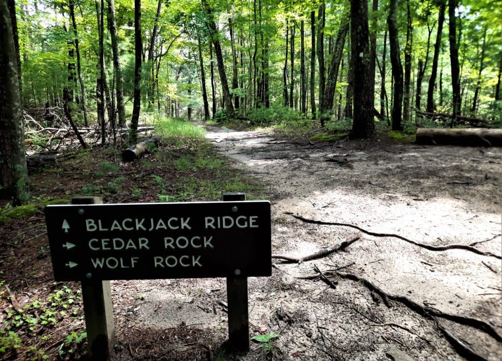
Wolf Rock, Cedar Rock, and Black Jack Ridge
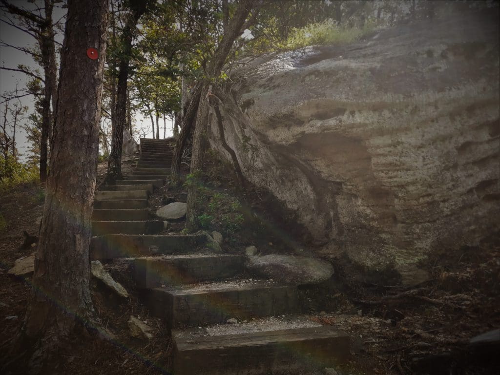
I started going to the right at the trailhead on the Stone Mountain Loop.
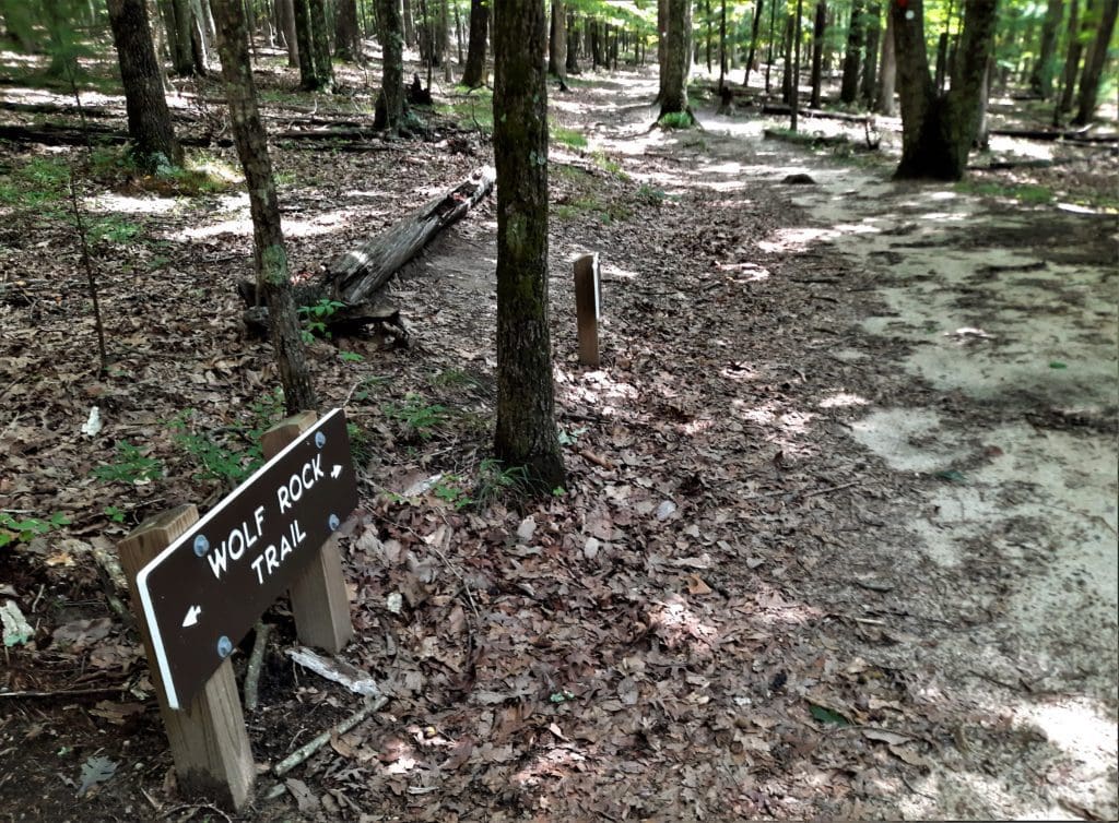
In my opinion, the view from Wolf Rock is the main reason to take this hike 🙂
When you’re done looking, retrace your steps to the main path and keep going to your right. You’ll reach Cedar Rock shortly.
In Winter you have some nice views, but in full summer the trees block a lot of it.
It wasn’t very difficult, and gave me a chance to see some great views in a short amount of time 🙂
Description: This trail takes you to the top of Cedar Rock
Length: 1.00 miles one way
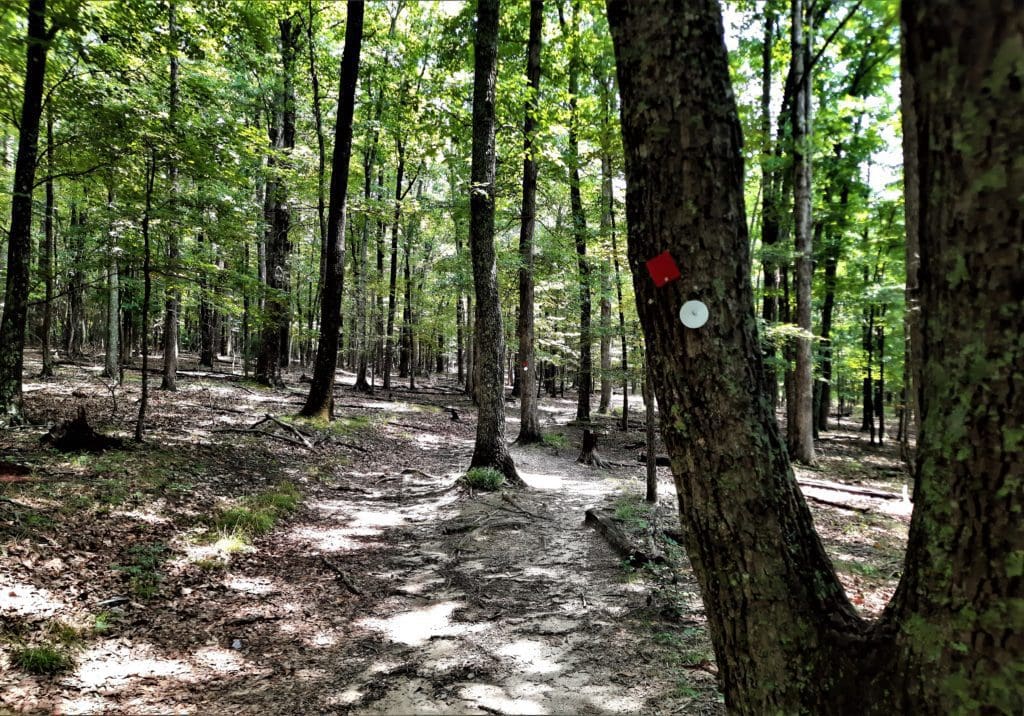
Blaze: red circle
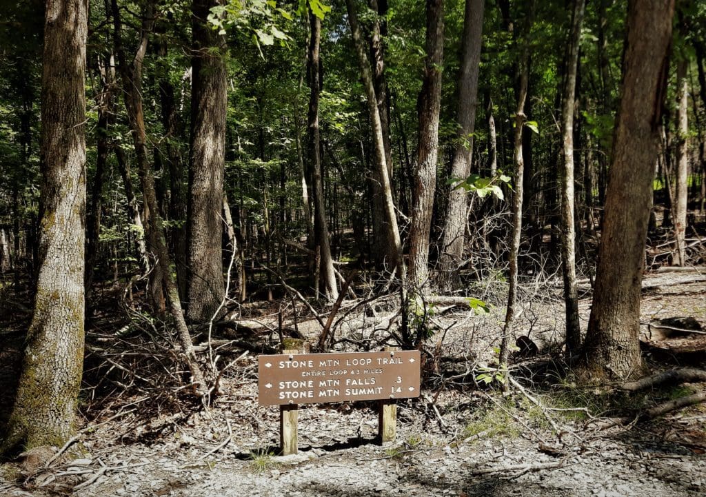
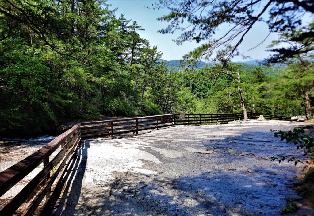
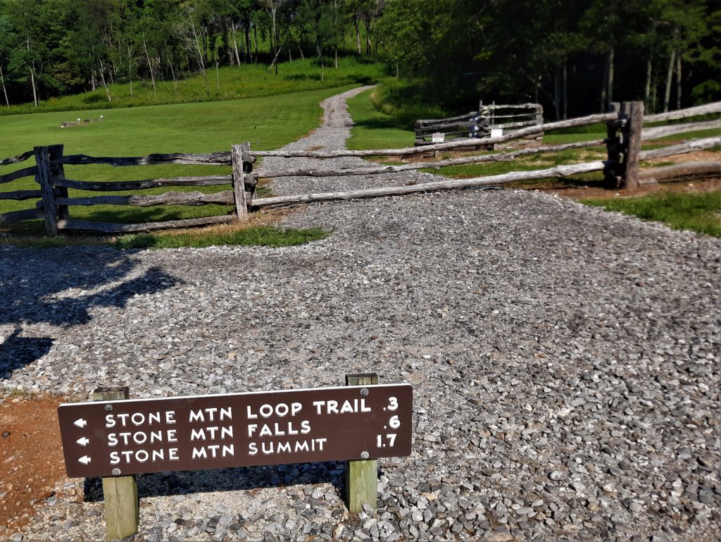
Stone Mountain Loop Trail
The next day I got an early start, because I had a long day of hiking ahead!
I was planning two hikes that would cover ~22 miles and 4,000+ ft elev gain, and take an estimated 10-12 hours to complete.
The weather looked good – although REALLY warm – until the early evening, so I didn’t think I’d need to finish early to avoid a forecasted storm.
So, first thing in the morning, I went back to the Lower Trailhead Parking to get back on the Stone Mountain Loop trail.
Stone Mountain Loop Trail
This time, I wanted to hike the entire loop.
I went left from the trailhead, taking the advice of the Ranger to hike the summit side first to get the hardest part over with while I was still fresh 🙂
It was a climb, but not as bad as I thought. I’d hiked this trail before, and for some reason, it seemed easer this time.
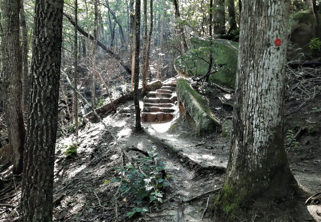
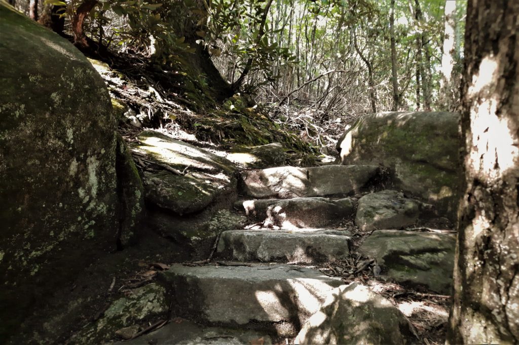
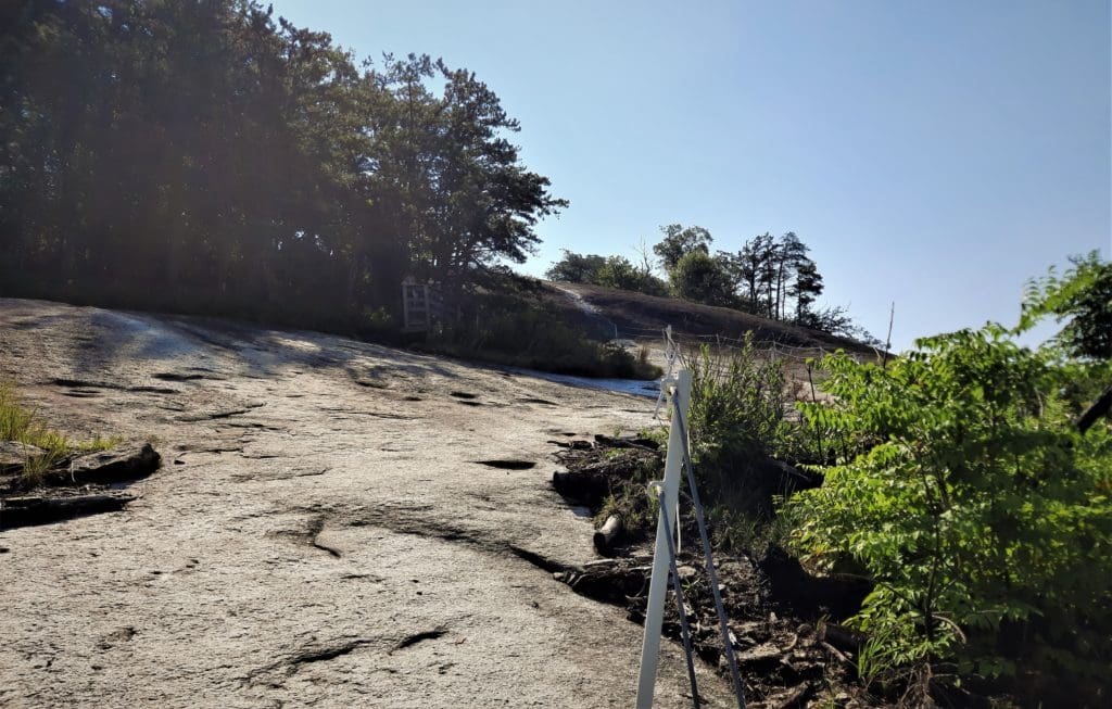
Be careful though! It is steep, and can be slippery if it’s wet.
I had run into a couple of other hikers, and we chatted a bit, but moved off into our own spaces to enjoy the view.
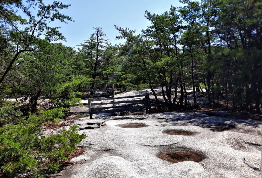
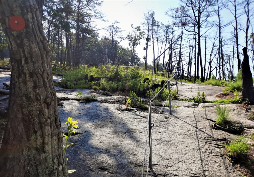
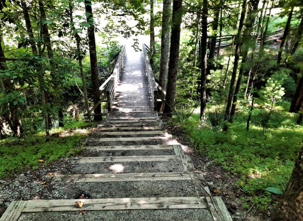
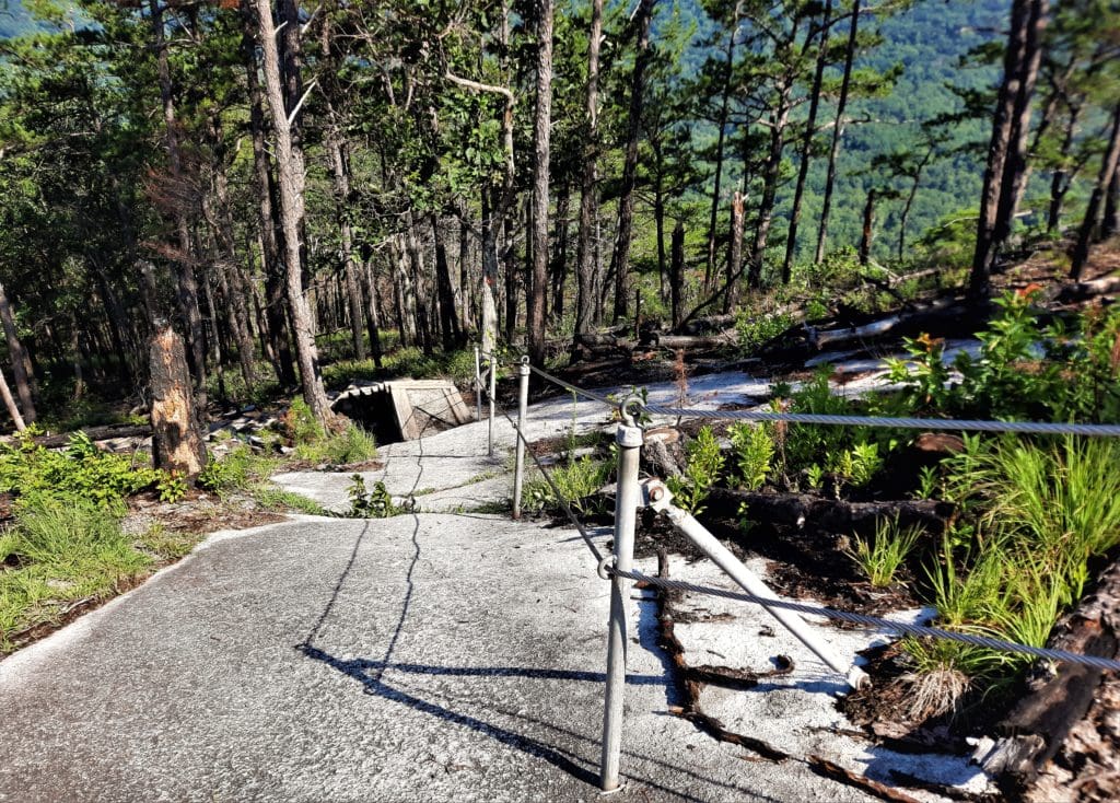
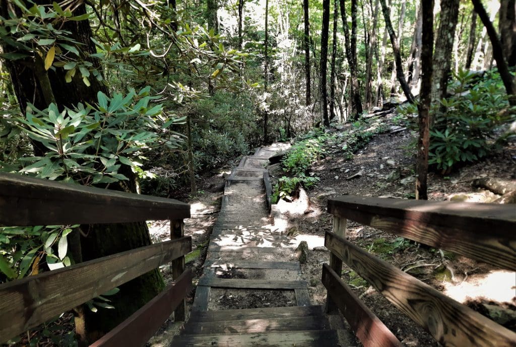
Because the trail is a loop (not an out-and-back) you get to see some really neat things on the way down that you didn’t see on the way up!
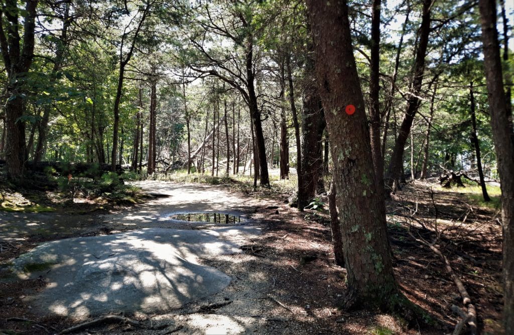
Be very careful along here, because even with the fence, it can be very slippery!
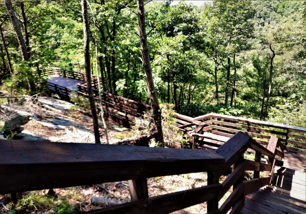
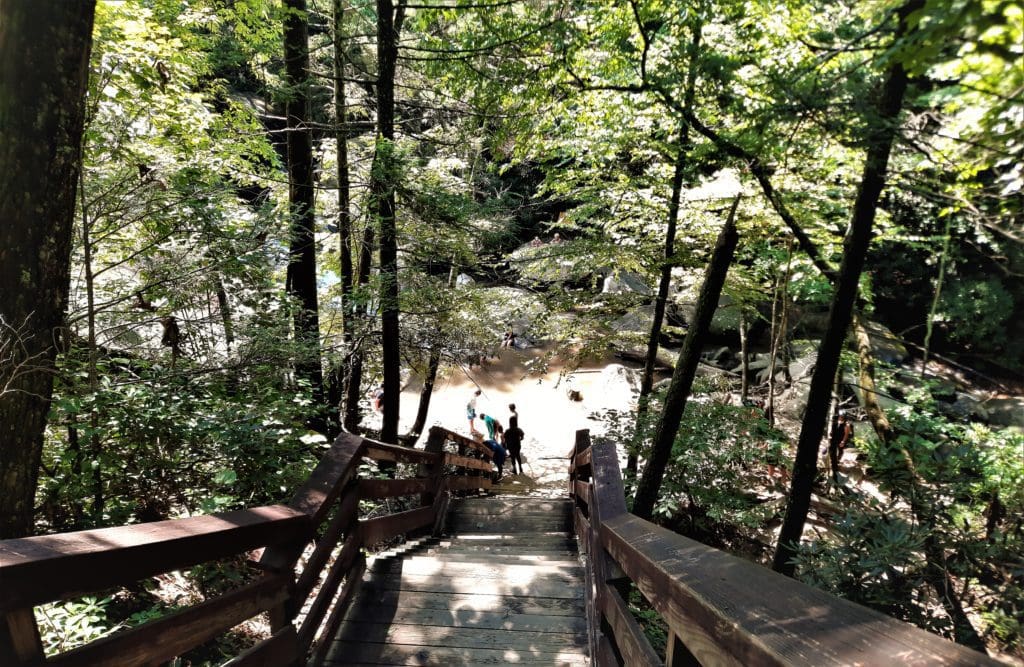
The pool looked kind of crowded already, so I kept heading down the mountain.
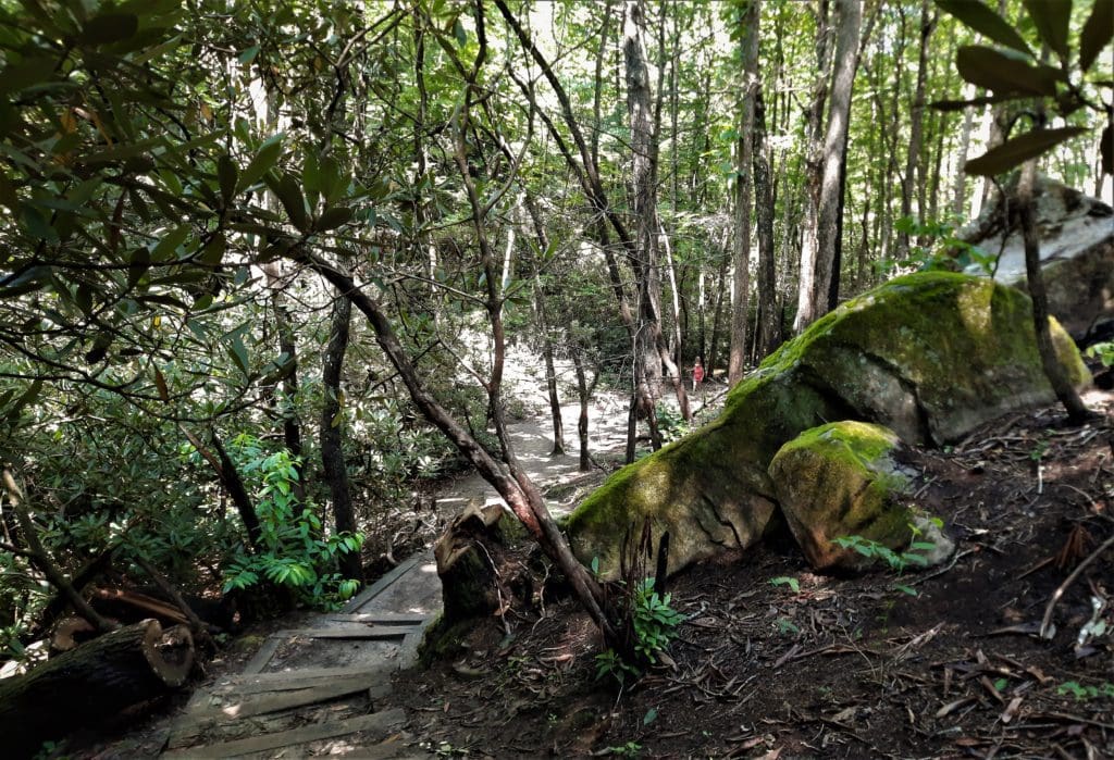
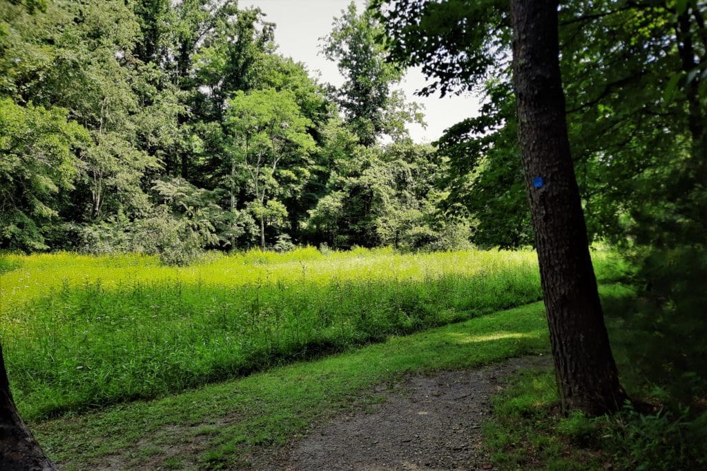
It won’t be long until you come out of the woods, and you’ll see the Hutchinson Homestead across a grassy field to your right.
It’s just a few steps from the creek back to the trailhead at the Lower Parking area.
Access: Lower Parking Area
Length: 4.50 miles loop
Blaze: orange circle
NOTE: Due to the rapid elevation gain, this trail is not recommended for very young children.
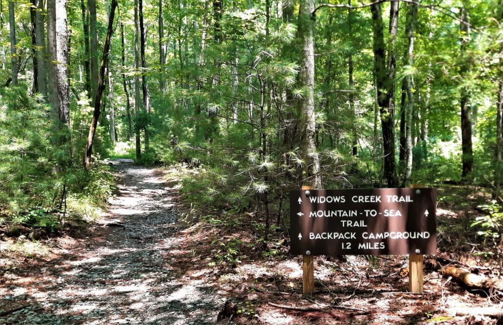
MST in Stone Mountain State Park
According to one of the Stone Mountain Rangers, there are 11 miles of MST trail within the park.
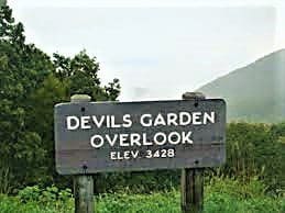
That would include mileage starting from the MST trailhead on John P. Frank Parkway at the southeast corner of the park, all the way across the park diagonally up to the Devil’s Garden Overlook on Blue Ridge Parkway.
After finishing the Stone Mountain Loop Trail, my plan was to hike the Widow’s Creek trail and continue on up to Devil’s Garden Overlook on that section of the MST.
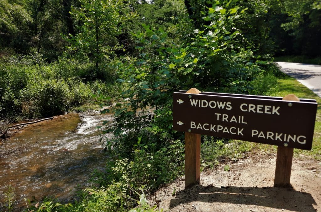
This hike includes 2.5 miles of Widow’s Creek up to the back pack sites, then another 6 miles up the MST to the Blue Ridge Parkway, for a total RT hike of 17 miles.
So that was the plan. On reflection, maybe not the best plan ;- ) But, anyway, a couple of things happened….
The trailhead sign showed a trail closing beyond Backpacking Site D, which is at the end of Widow’s Creek – meaning there was no way to get to the start of the MST.
And, having already hiked mostly uphill for 5 miles, I wasn’t too excited with the idea of hiking another 17 very steep miles anyway.
Sad to say, the whole hike will have to wait for another day – which gives me a reason to go back 🙂
Blaze: orange square
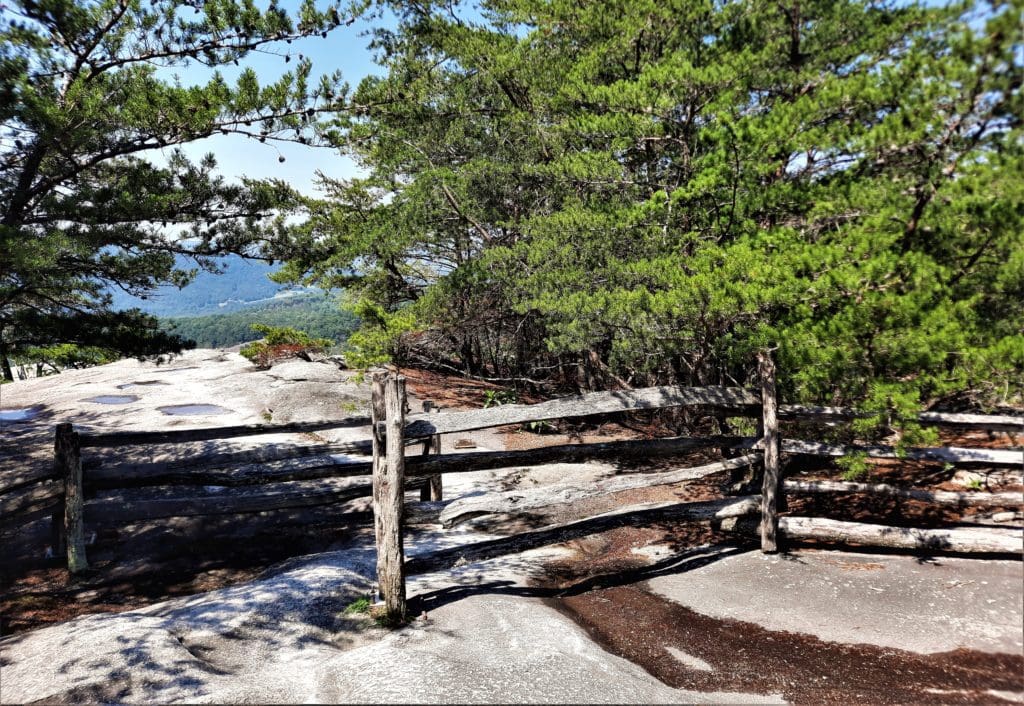
The Stone Mountain Summit
The next morning, I had a couple of hours to spend on the trail before heading back home.
There were a couple of shorter trails I hadn’t seen yet, but….. I just wanted to go back up to the Dome!
I didn’t want to climb all the way back up there again, though. Luckily, I knew a short cut 🙂
If you really want to get to the summit, but you’re not excited about climbing up the mountain, there is an easier way.
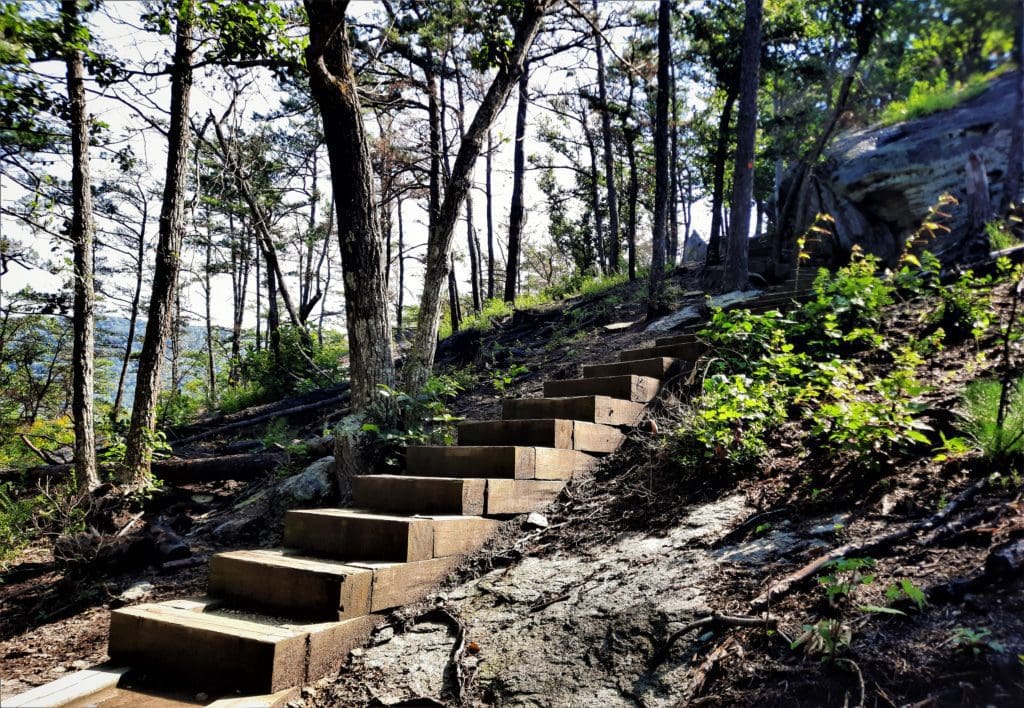
From the parking area, get on the Stone Mountain Loop trail, and go to the right – that will take you on a gravelly path on a gentle slope up to the summit in about 1.7 miles.
I went up to the top again, and hung about for a while just taking in the view 🙂
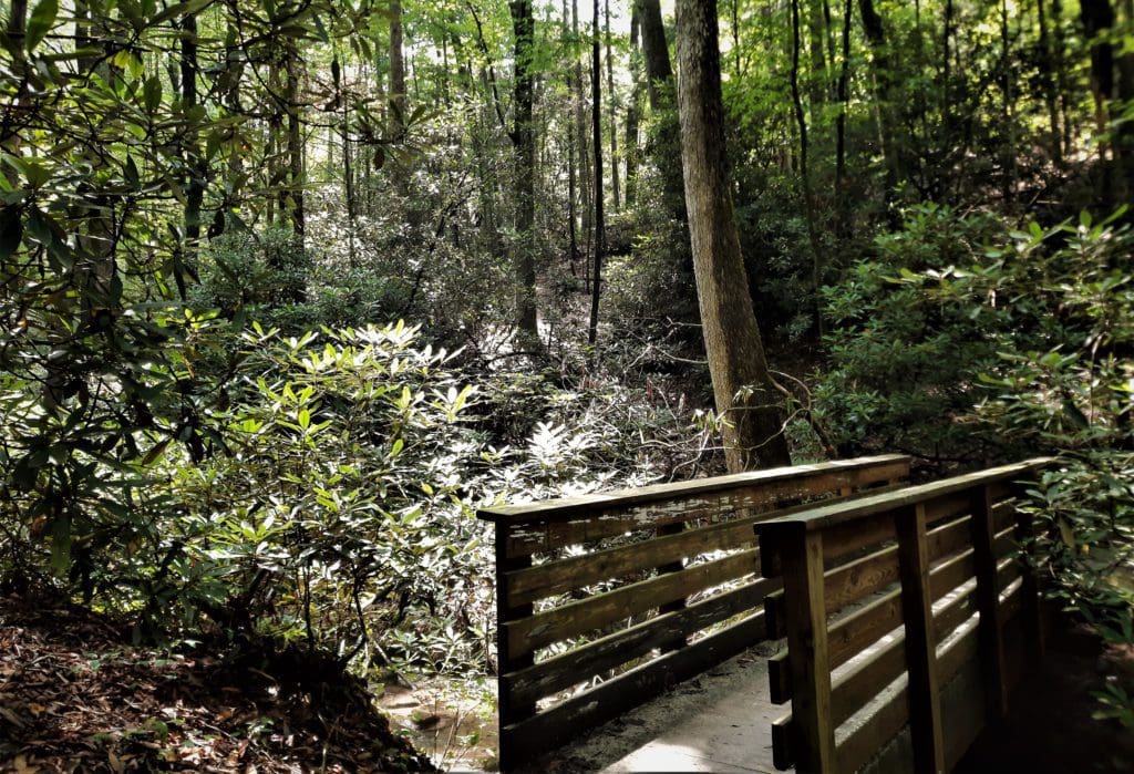
I walked back down the same way, then took a short .75mi Connector Trail along a creek.
This little trail goes to the park’s picnic area – but I stopped along the creek for a snack instead, before heading back home.
Stone Mountain Summit
Blaze: orange circle
Park Info
Entrance Fee
Entrance to Stone Mountain State Park is free.
The Park opens every day at 7am. Closing time is 8-9pm in the summer and fall, 6pm in winter.
The Park office is open 8am-5pm, Mon-Fri.
I hope this post has inspired you to visit Stone Mountain State Park and try some new hikes!
If you have a question drop me an email and I’ll reply as soon as I can.
Thanks for stopping by – see you next time! LJ
To Get New Idratherwalk Posts
sent directly to your inbox (how convenient!) Click this Button
If you like this post, please share it!

LJ has spent much of her free time as a single Mom – and now as an empty-nester – hiking in the US and around the world. She shares lessons learned from adventures both local and in exotic locations, and tips on how to be active with asthma, plus travel, gear, and hike planning advice for parents hiking with kids and beginners of all ages. Read more on the About page.