Most recently updated April 27th, 2026
Estimated Reading Time: 18 minutes
The Shenandoah National Park is right on the edge of the areas of North Carolina and Virginia that were hardest hit by Hurricane Helene.
That said, the Park is open and many of the surrounding communities are open for business and could really use your Fall vacation dollars to help rebuild!
Go to my Hurricane Helene page to get the latest updates on the latest Park, Trail and road repairs.
I went back to Shenandoah again this Spring, to hike the Rose River Loop, the Cedar Run Circuit and maybe add some more to my list.
It wouldn’t be hard to do, since Shenandoah National Park offers some of the best hiking in Virginia!
I had spent a great week there a couple of years ago, but the trip was over before I had a chance to complete my list of “must do” hikes – including the Rose River Loop.
And of course the iconic Old Rag hike.
So I had to go back and try again!
Where is Shenandoah National Park?
Shenandoah National Park is only 115 miles from Washington, D.C., 95 miles from Richmond VA, and 250 miles from Raleigh NC.
That’s close enough for a great long weekend or longer family vacation, without the expense of air travel!
My previous Shenandoah visit was for a whole week. This trip was a quick visit of only 3 nights – which was still enough time to get in a couple of great hikes and see some local sights 🙂
Or if you prefer video, take a look at the Shenandoah playlist on IRW YouTube.
Some of my posts contain affiliate links. If you make a purchase through an affiliate link, I will receive a small payment at no additional cost to you. I do not get paid for recommendations, all opinions on this site are my own. See full Disclosure page here.
Plan Your Visit
When you enter Shenandoah National Park, you’ll be on Skyline Drive – the primary roadway within the park.
Because the park stretches out over such a long distance, you’ll need to include extra time to get from your lodgings to your trailhead in your planning.
Figure time to hike your trail on top of that to estimate when you need to set out in the morning to get back to your trailhead before sunset.
It also helps to know what time the sun goes down 😉
For this visit, I stayed in a Virginia cabin outside the park. The closest park entry to my cabin was the Swift Run Gap Entrance Station, near the center of the park.
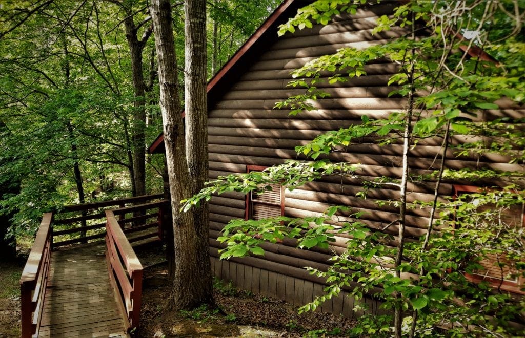
So I planned the timing for all of my trips to the park based on using that entrance – knowing that it would take me about 40 minutes just to get to the park entry from my cabin in Gordonsville, Va.
Hiking Gear You’ll Need
The surface of most of the Park’s trails are pretty rocky and rooty – and may also be wet and slippery.
Sturdy hiking boots or shoes are absolutely necessary when hiking in Shenandoah. Hiking poles aren’t required, but could be useful on many trails.
And of course, you’ll need a pack to carry your water, food, and other gear.
It’s always a good idea to bring an extra layer of clothing with you, and be ready for rain, too.
Take a look at my dayhike gear recommendations, gear tips for beginning hikers, or check out the Gear Page for more information on other gear pieces you might need.
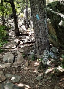
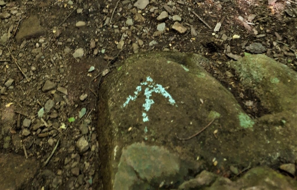
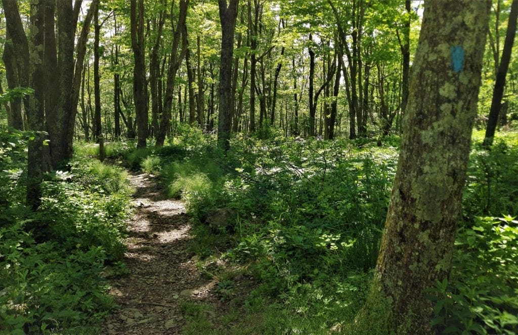
Trail Markings in the Park
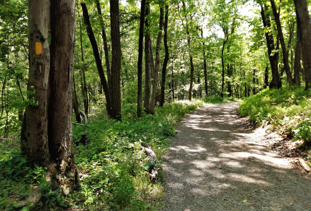
All hiking trails in Shenandoah National Park are marked with colored paint on trees or rocks.
-
-
- Blue paint for regular trails
- Yellow paint for horse trails or fire roads
- White blazes for the Appalachian Trail.
-
You’ll find a cement post at every trail intersection.
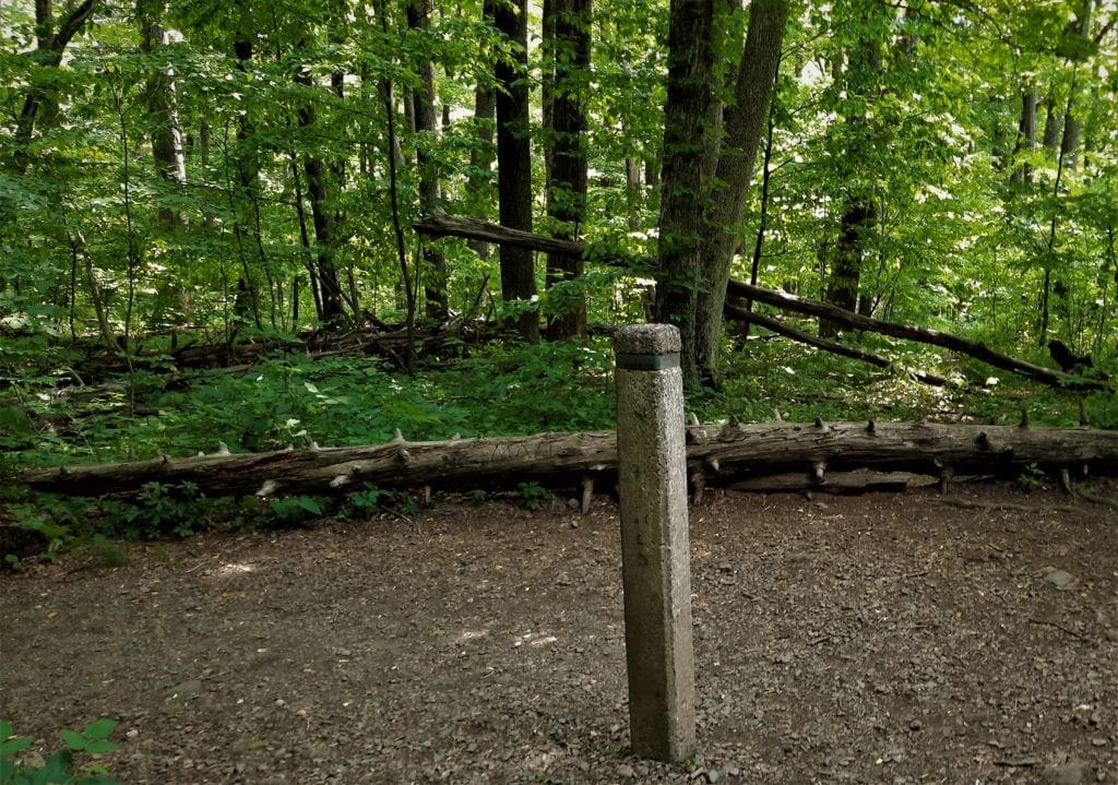
These posts have a metal wrapping around their top, stamped with trail names, directions and distances.
Even though Shenandoah’s trails are clearly marked, it’s still a good idea to have a map (and compass) with you.
This Shenandoah National Park maps page has a full park map, and maps of the individual park sections with trails as well.
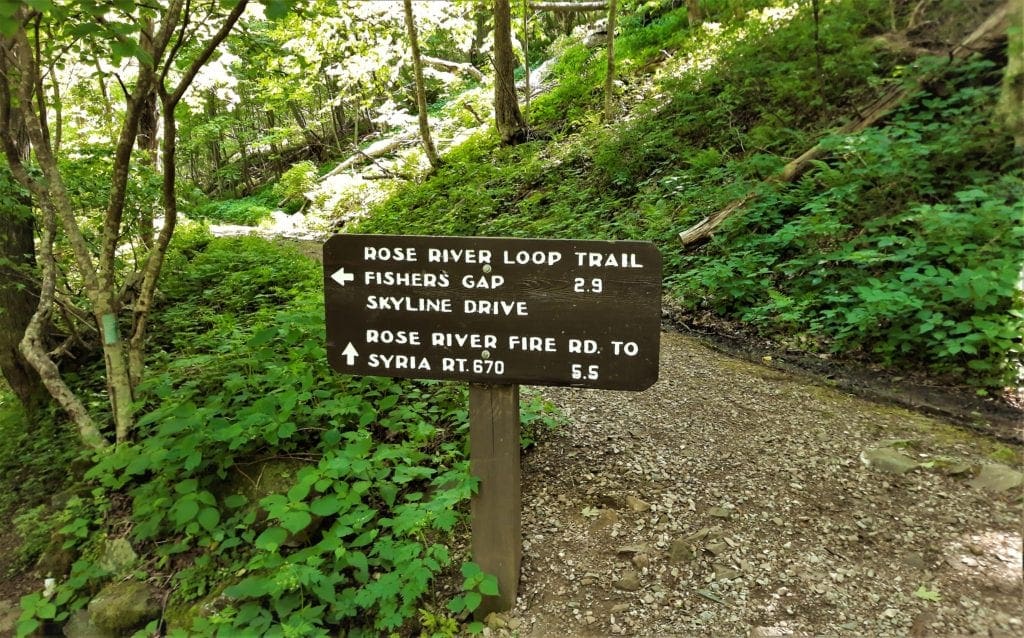
Hike the Rose River Loop Trail
My Shenandoah visit this year was in late May.
I was hoping it would be cooler than my June visit a couple of years ago, when there was record-breaking heat!
It was a little bit cooler this time, but I still wanted to get some miles in before the heat of the day, and hopefully complete the hike before the usual afternoon thunderstorm.
So I set out early the first morning to tackle the Rose River Loop trail.
From my last trip, I knew I could get to the Rose River Loop from the center section of Skyline Drive, so I decided to stop at the the Harry F Byrd Visitor Center at Big Meadow before starting my hike.
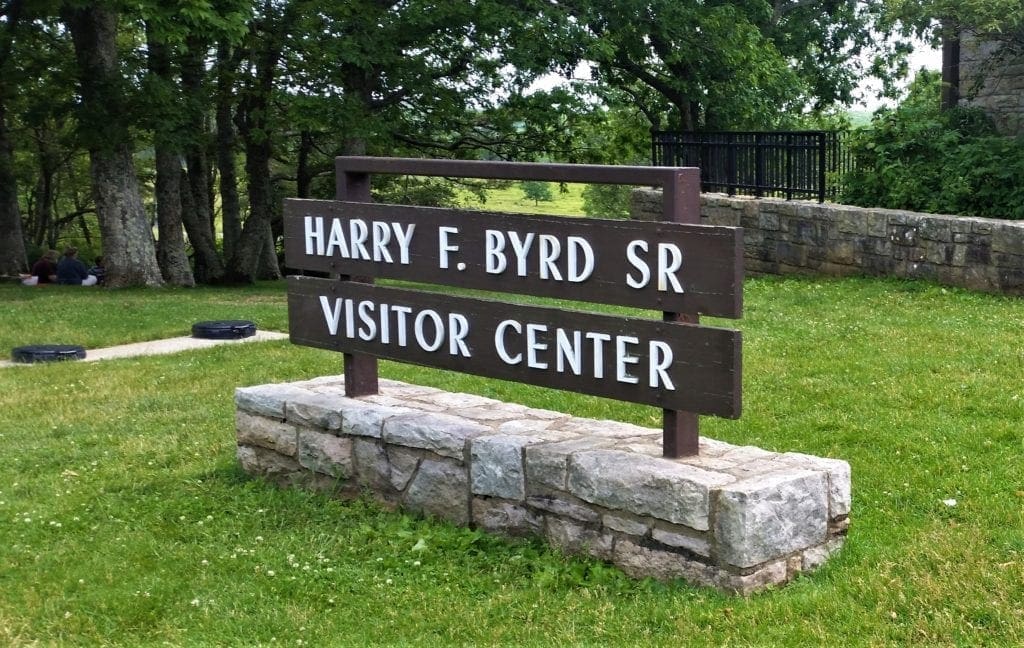
Big Meadow a good place to use restrooms and refill water bottles, and I also wanted some advice from a Ranger about more hikes, and any trail closures that might change my route for the day.
Big Meadows Visitor’s Center
Located at Mile 51 on Skyline Drive, the visitor center at Big Meadows has
restrooms, information desk, exhibits, maps, backcountry permits, first aid and the park’s only gas station.
Across Skyline Drive from the visitor center and other facilities lies Big Meadows itself.
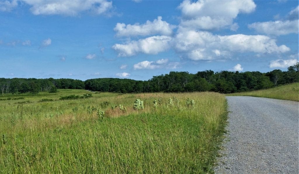
A historic farming area, this large grassy expanse is one of the best wildlife viewing spots in the park, especially at dawn and dusk.
There are no designated trails on the Meadow, so you’re free to explore as you please.
-
- Difficulty: easy
- Trailhead: Skyline Drive MP 51 at the Big Meadows visitor center
- Suggested time of day: any time, best wildlife viewing dawn or dusk
- Map: Big Meadows Area
Getting There – Trail Access
At the Visitor’s Center, I spoke with a Ranger about my hike plan, and she pointed out some alternate routes to hike the Rose River Loop.

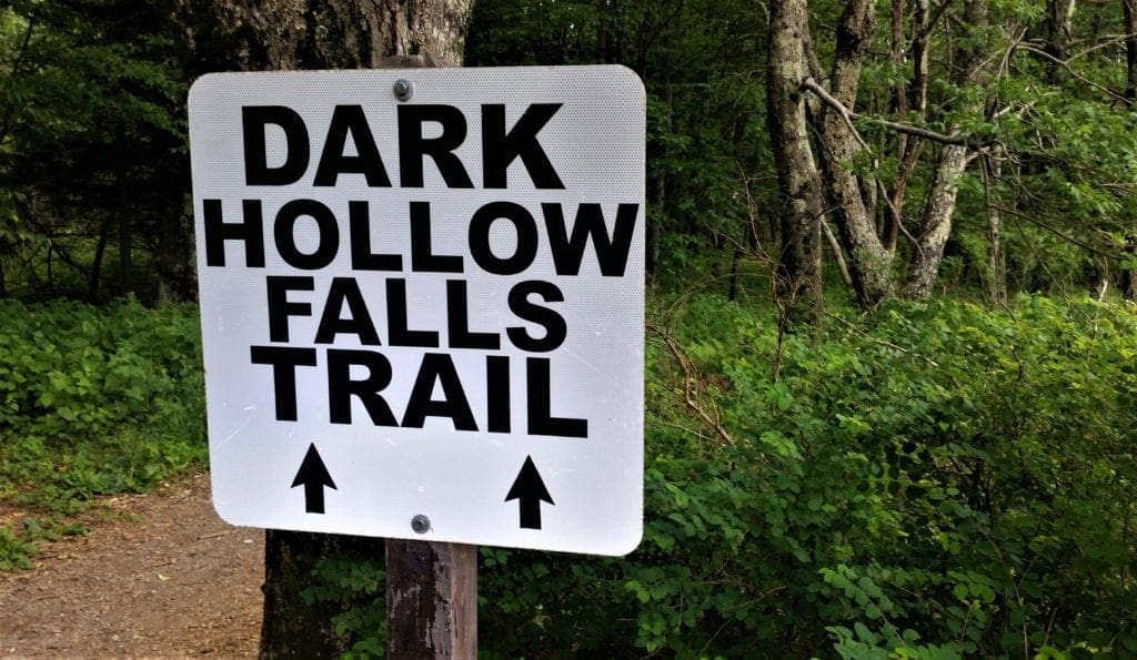
You can access the Rose River Loop trailhead from Skyline Drive, starting from either the Fisher’s Gap Overlook or the Dark Hollow Falls trailhead.
-
- The Fishers Gap Overlook parking area is south of Skyland at mile 49.4, and closest to the Thornton Gap Entrance.
- Dark Hollow Falls is closer to the Swift Run Gap entrance, and almost right across Skyline Drive from the Big Meadow Visitor Center at mile 51.
Choose Your Route
ROUTE OPTION 1: At 4 miles round trip, the Rose River route starting from Fisher’s Gap is significantly shorter and less steep than starting from Dark Hollow Falls.
On this route you don’t actually hike much of the Dark Hollow Falls trail, though you still get a good view of the Falls.
ROUTE OPTION 2: Starting from Dark Hollow Falls is a longer route. Going this way, you’ll hike about 6 miles total – 4 miles of the Rose River Loop and around 2 miles on Dark Hollow Falls, and you’ll also have 440ft more elevation gain for a total gain of ~ 1350 ft.
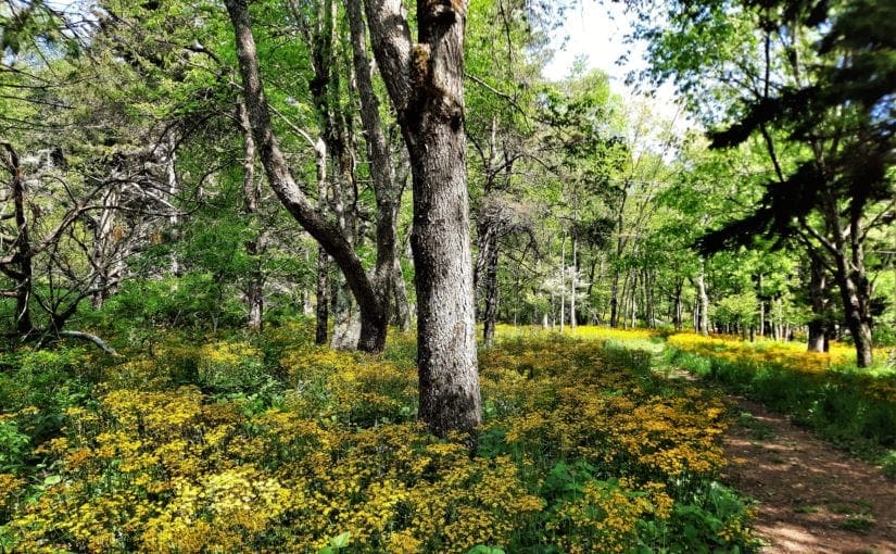
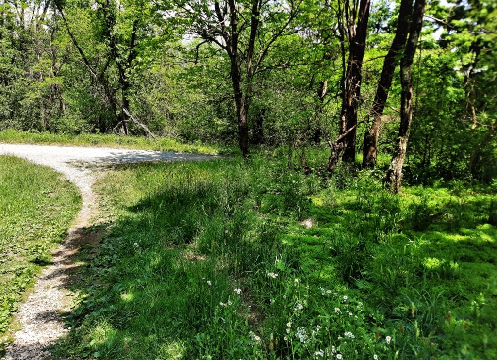
I chose a 3rd route option: Since I was already there, I left my car parked at the Visitor’s Center, walked to the far end of the parking lot, and took a short trail through the woods.
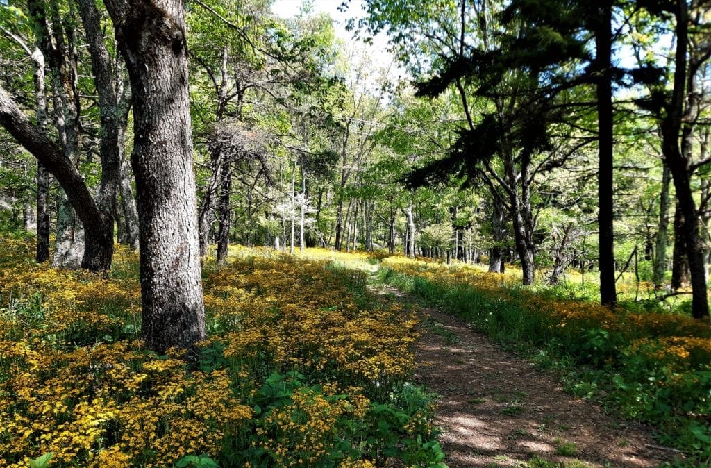
Taking a right turn where the path converged with the Story of the Forest Trail, I continued to follow the path to Skyline Drive and crossed the road to the Dark Hollow Falls Trailhead.
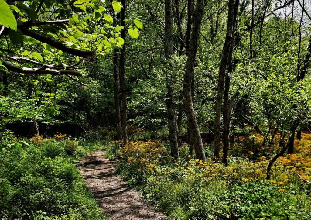
I was delighted to find this section of the forest carpeted with yellow wildflowers! A great bonus for a Springtime visit 🙂
This route added about another 1/2 mile, for a total hike of about 6.5 miles.
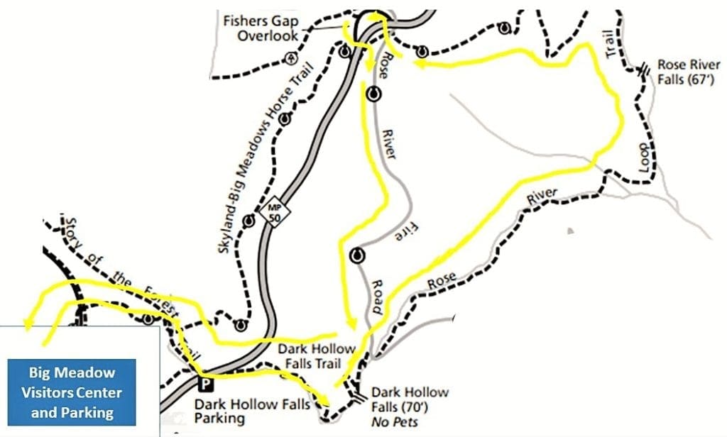
Going this way, I had easy access to the amenities at the Visitor’s Center at the end of the day before heading down the mountain.
Of course, with a Big Meadows Area map, you can create your own customized longer route that includes the Rose River Loop. But to see Rose River Falls, you’ll need to hike at least 4 miles.
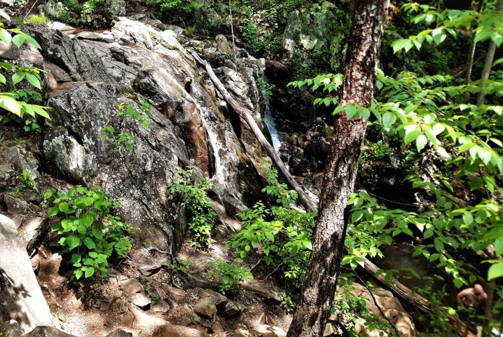
Dark Hollow Falls
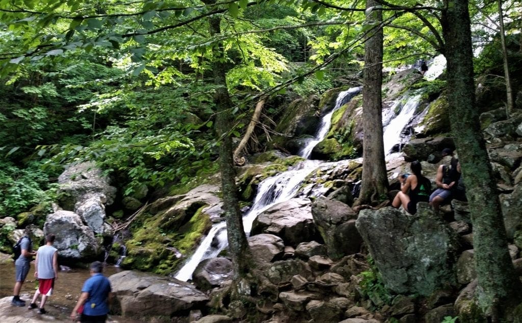
Once I’d crossed Skyline Drive, I immediately started hiking downhill (yay!) on the initial paved section of the Dark Hollow Falls trail.
Historical Note: Locals started calling this area “Dark Hollow” because the large Hemlock trees were so dense that they blocked the sunlight.
This is one of the most popular day hikes in Shenandoah, and is the Park’s busiest waterfall hike.
It takes only .7 miles of walking along the Dark Hollow Falls trail to reach the Falls.
The waterfalls run alongside the trail, and hikers can get close to the cascading water without much effort.
That said, the return trip is a steady climb which is a lot more difficult than the downhill beginning of the trail – especially if you’ve hiked the whole Rose River Loop in between!
So you might want to plan more time for the return hike to take some rest stops beside the Falls on the way back up.
Dark Hollow Falls Hike Details
-
- Distance: 1.4 miles out and back
- Duration: 1 hour and 15 minutes
- Difficulty: moderate
- Trailhead: Skyline Drive MP 50.7 at the Dark Hollow Falls parking lot
- Suggested time of day: any time, but less crowded in the morning
- Map: Big Meadows Area
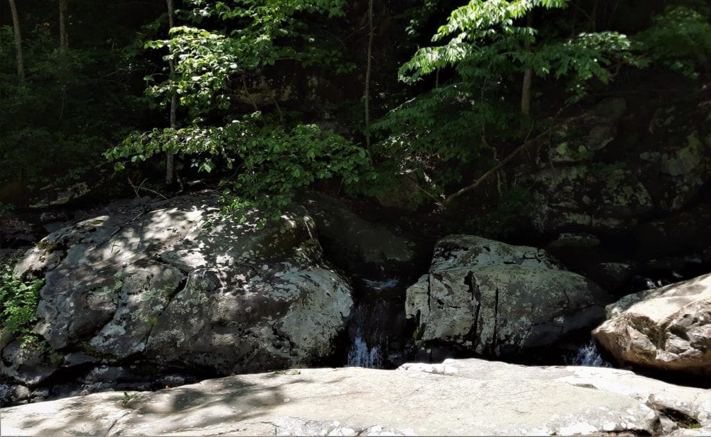
At the bottom of the trail, Dark Hollow Falls connects with the Rose River Falls trail, for hikers (like me!) who want to continue on to the Rose River Loop.
Rose River Loop Trail
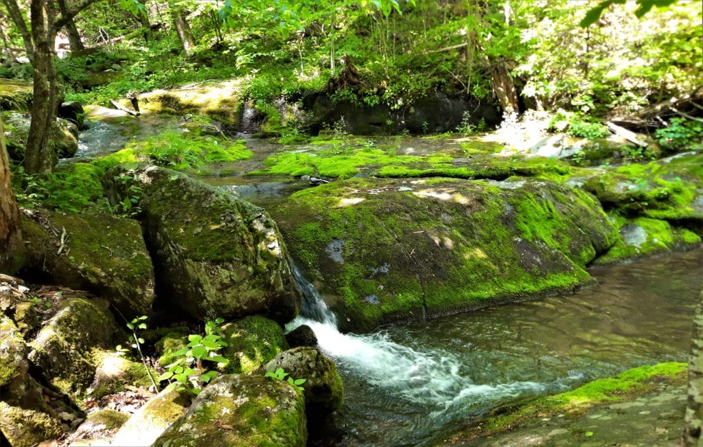
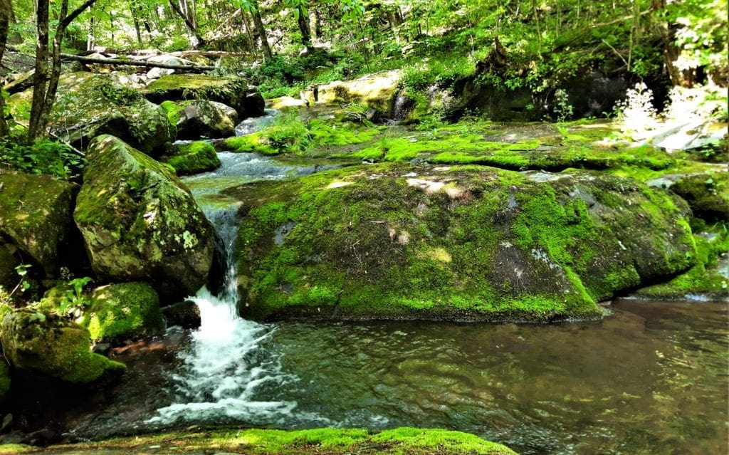
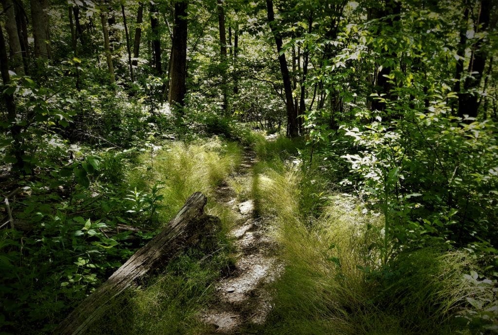
The Rose River Loop Hike is one of the most scenic waterfall hikes in Shenandoah NP because it follows falls and cascades for more than half of it’s 4-mile distance.
Historical Note: This river had originally been called “Row’s River” after George Row who owned property near its head, but morphed into “Rose River” over time.
Pick a Direction
When you reach the bottom of Dark Hollow Falls trail, there’s a flat metal bridge across the Hogcamp Branch stream.
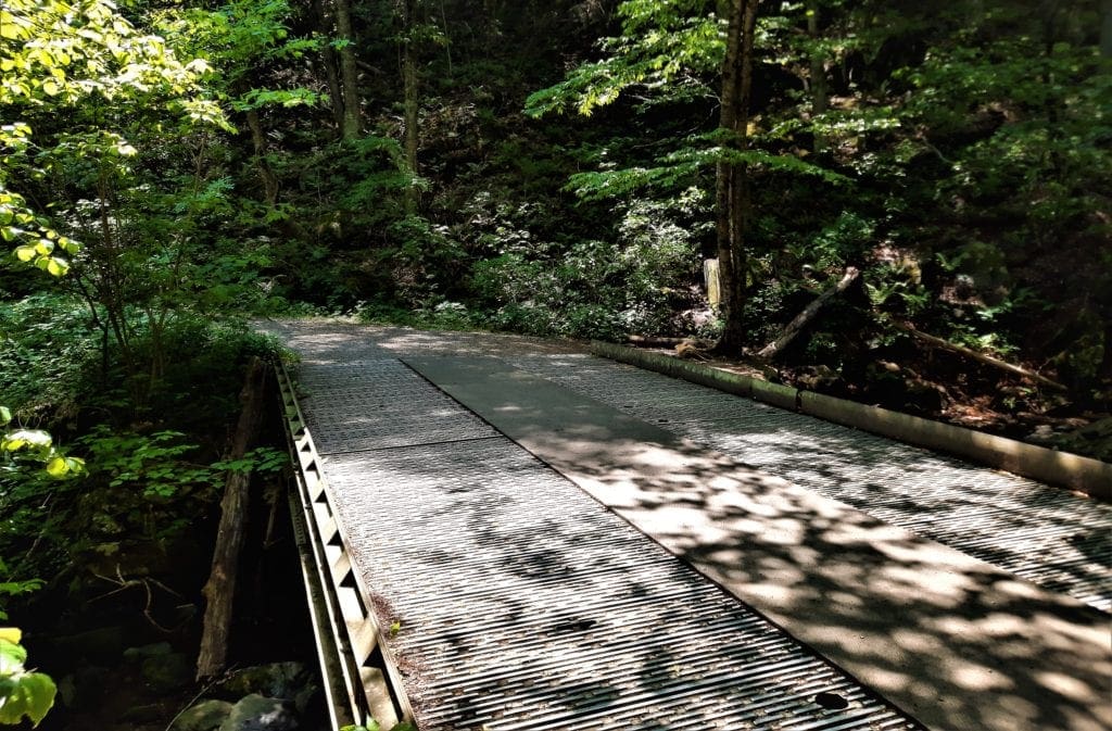
Facing the bridge with the Falls behind you, across the street in the woods the natural blue-blazed Rose River Loop trail goes to the right.
To the left is the yellow blazed lightly graveled Rose River Fire Road.
At this point, you could go either way to make the loop. I chose to cross the Hogcamp Branch on the metal bridge and take the blue-blazed woods trail.
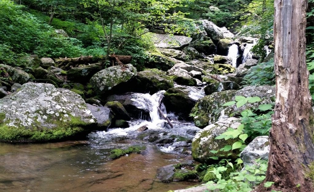
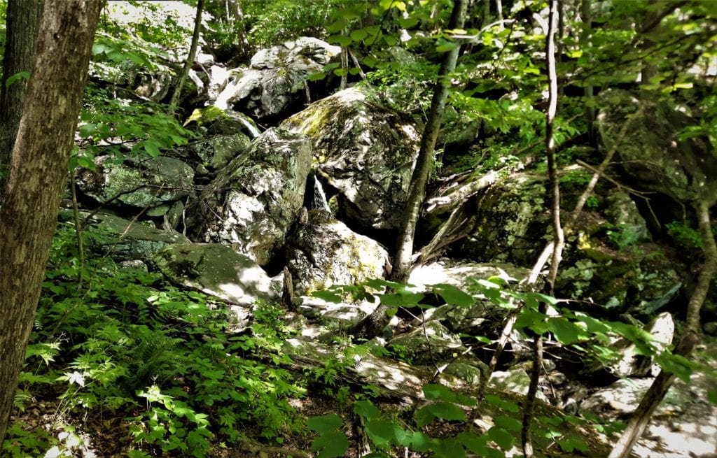
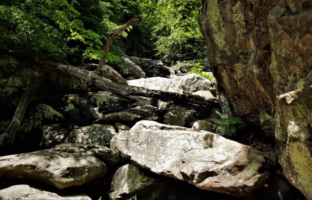
The moderately difficult trail continues descending and following Hogcamp Branch down the Rose River Trail.
This is a steep and rocky portion of trail with many pretty cascades and deep pools. There are also a couple of stream crossings – the first one uses rocks in the stream.
This crossing was a bit difficult to find – in fact, I partnered with a couple of other hikers to decipher where the trail went!
We eventually did find it by spotting a tree with a blue blaze on the other side of the stream, and getting over there as best we could.
Fortunately, the water wasn’t too high, so we managed to cross without getting wet feet.
After the stream crossing, the trail curves and begins to climb.
You’ll walk along that side of the stream for a bit, then at its lowest point the trail crosses over Hogcamp Branch on a pretty bridge.
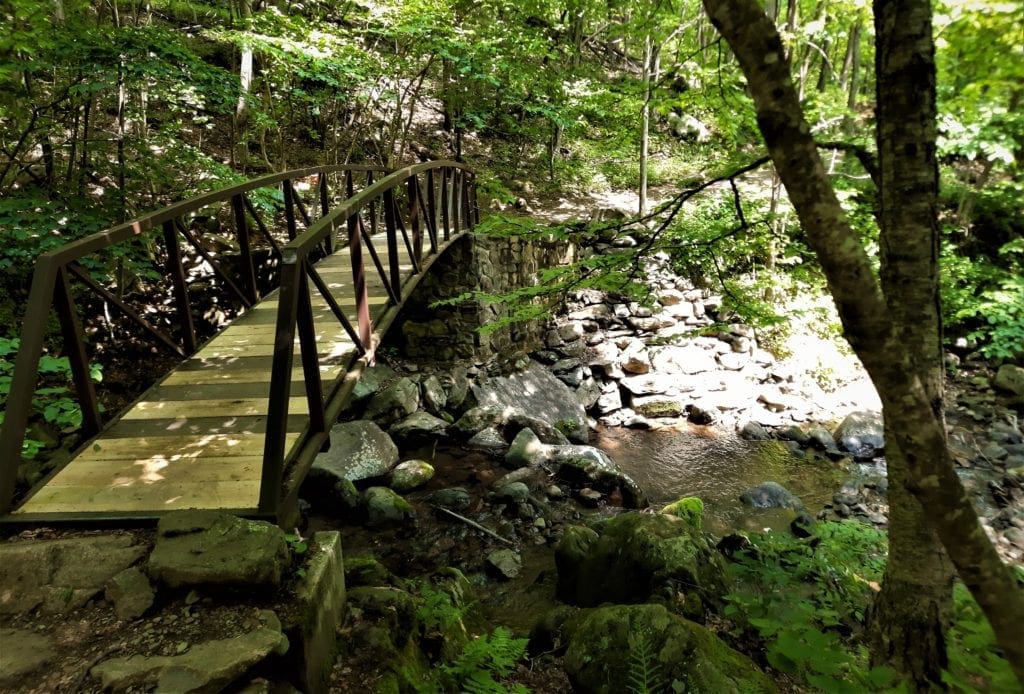
In a few more steps, you’ll see a gravel trail leading sharply uphill to the left.
For a minute I thought this steep path was where I was supposed to go – and then breathed a huge sigh of relief when I realized it wasn’t part of the trail.
But that said, once you cross the bridge, the Rose River Loop Hike does shift into uphill workout mode for real.
The trail climbs steeply for the next mile, and there are a lot of rocky sections.
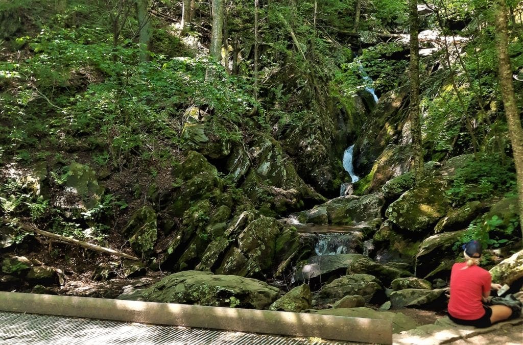
Eventually the trail leads you to Rose River Falls.
It doesn’t stand out dramatically from the other falls along the way, but it is a little taller and wider than other cascades along the trail.
There’s also a pool at the base of the falls that you can take a dip in, if you like 🙂
Eventually the trail pulls away from the Rose River and heads up to Skyline Drive just north of mile 50 at Fishers Gap.
Cross Skyline Drive in the crosswalk if you want to take in the view at Fisher’s Gap. But be careful – people often drive too fast on Skyline!
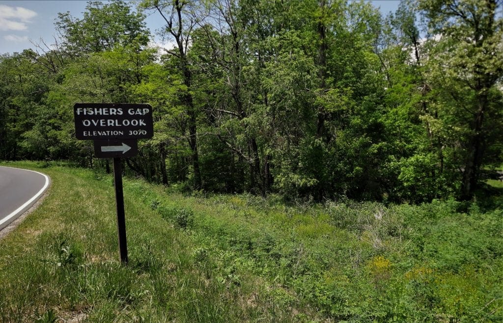
When you’re done with the view, walk back across Skyline drive again, and step over the chain that blocks the Rose River Fire Road.
This shady yellow-blazed trail is a lightly graveled smooth road that descends gently – so it’s a nice change after climbing all of those rocks!
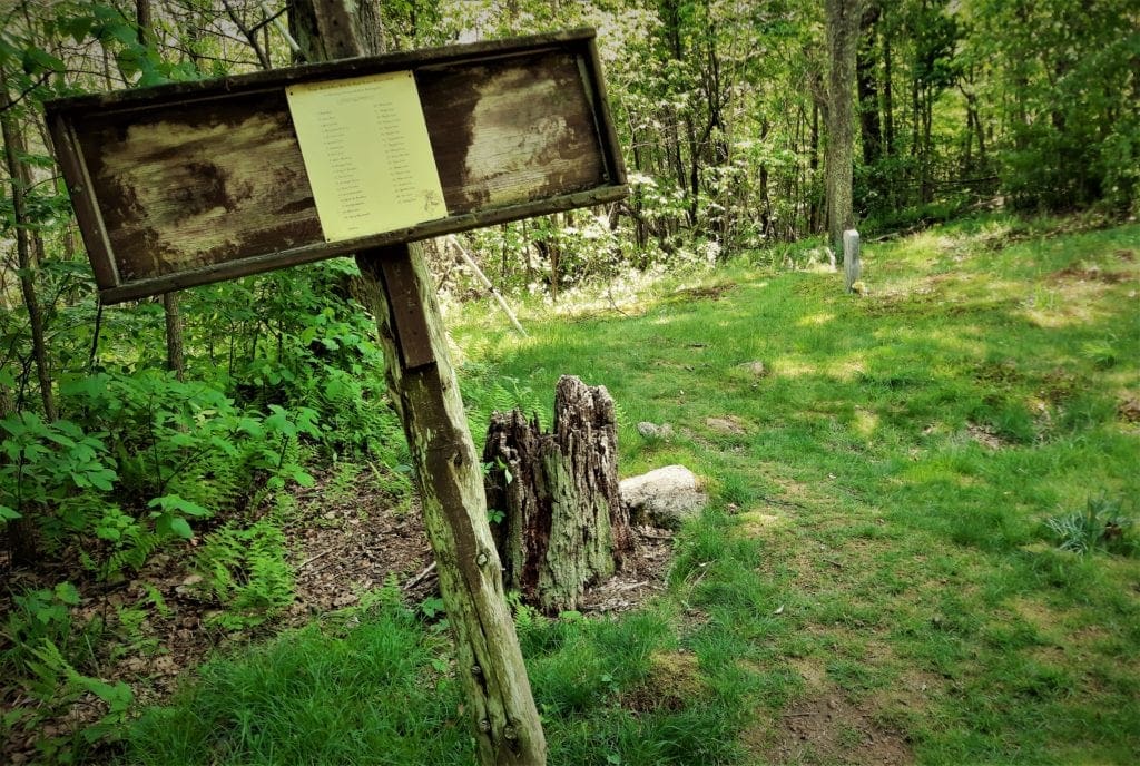
About a half-mile down the fire road, I saw a wooden sign that said “Cave Cemetery”.
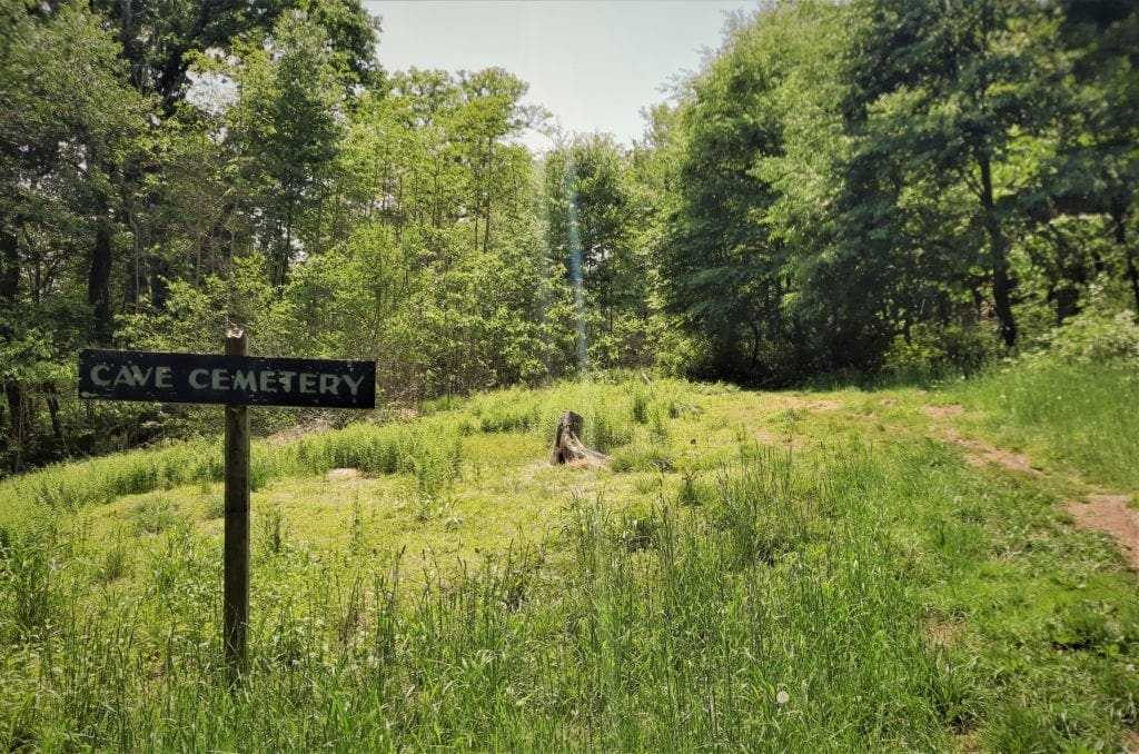
I thought, “A cemetery in a cave! How cool is that?”
Turns out it’s a cemetery, not IN a cave but for a family NAMED “Cave”.
It’s still pretty interesting, though. 🙂
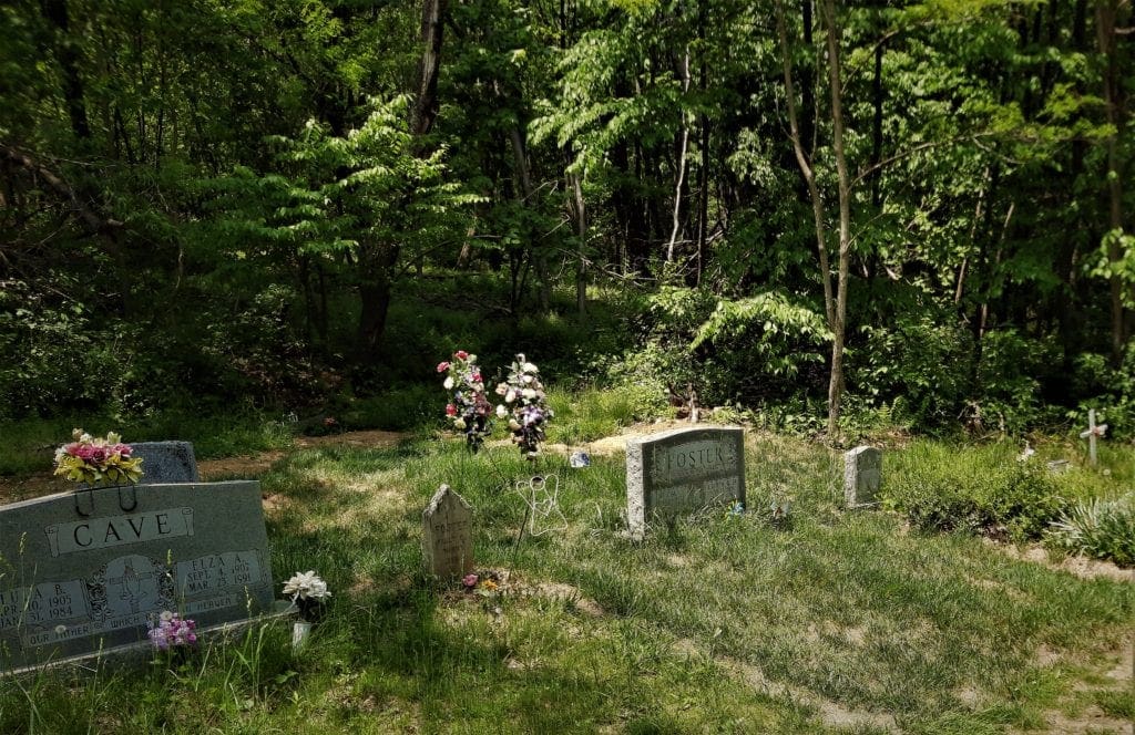
The Cave Cemetery
The Cave family cemetery is one of more than 100 cemeteries across Shenandoah National Park from families who lived within the park boundaries in the 1930’s-40’s.
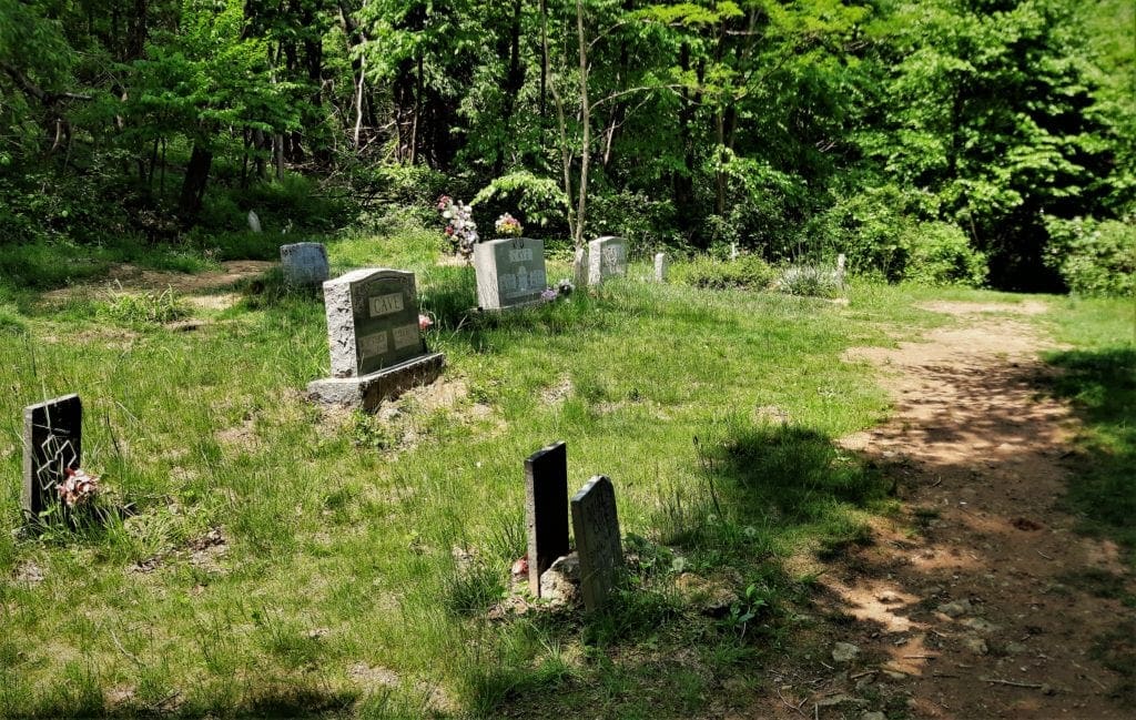
This cemetery was first put in place by Jimmy Cave and Catherine (Katie) Stanley Cave, who were married in 1837 in Page County, Va.
After their marriage, the newlyweds lived in a cabin atop the Blue Ridge Mountains in Fishers Gap, close to Dark Hollow Falls.
Jimmy Cave was the toll keeper on the Red Gate Road, which crossed the Blue Ridge Mountains between New Market, Va. to Gordonsville, Va.
The toll road was also known as the Old Blue Ridge Turnpike.
Jimmy and Katie are the original inhabitants buried in the Cave cemetery in Shenandoah, close to where their cabin stood.
One of the sons of Jimmy and Katie Cave, John Cave, fought in the Civil War, in the Confederate artillery.
Two other local men, John Weakley and Layton Sisk, who served in the 10th Virginia Volunteer Infantry Regiment (VVIR) with John Cave, are also memorialized in the Cave Cemetery.

The 10th VVIR was made up almost entirely of men from the Shenandoah Valley and Blue Ridge Mountains.
They were all part of the “stonewall” brigade that General Jackson originally commanded at the First Battle of Manassas, or other regiments which remained under his command until his death in 1863.
Many of the Cave descendants continued to live in the Blue Ridge Mountains above Marksville, Va. until the 1930’s.
After that time, all of the families in the area were relocated by the Federal Government to build Shenandoah National Park.
To this day, even inside the Park, the cemetery is actively maintained by the Cave family of Page County, Va.
Cave family descendants may still be buried in their family plot if they wish.
Eventually the Rose River Fire Road will lead you back to the metal bridge and the beautiful (and steep!) uphill trail back toward Dark Hollow Falls.
Take the trail back up to and past Dark Hollow Falls, cross Skyline drive and retrace your steps through the woods to the Visitors Center parking.
Rose River Loop Hike Details
-
- Distance: 4-mile circuit hike
- Difficulty: Moderate
- Hiking Time: 4 hours 30 minutes
- Elevation Gain: 910 feet
The 6.5 mile route I took – which combined the Dark Hollow Falls trail and the Rose River Loop with a short hike from the Visitor’s Center – took me about 5 hours to finish.
I think the Rose River Loop would be just fine for older kids, and could be okay for younger ones – if you have the strength to carry them or the patience to go slowly 😉
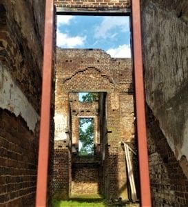
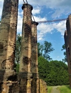
Field Trip to Barboursville Vineyards
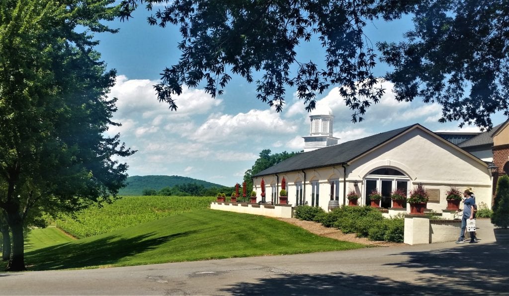 Entry to the Barboursville tasting room.
After hiking the Rose River Loop, I was ready to be done with hiking for the day. But I’d started so early, there was plenty of day left!
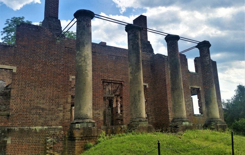
I had noticed some signs for the “Barboursville Winery and Ruins” on my morning drive to the Park, so after I got cleaned up, I decided to go check it out.
The historic estate, located just a few miles from Gordonsville Va, was designed by Thomas Jefferson and was built and named for his friend James Barbour, then Governor of Virginia (1812-14).
Barbour later went on to serve as United States Senator (1814-25), and then as Secretary of War (1825-28) under John Quincy Adams.
Barbour was an experimental farmer (in his spare time, apparently) but unlike his friend Jefferson at Monticello, never attempted to plant a vineyard.
That was left to Gianni Zonin, heir to a Venetian family wine enterprise, when he acquired Barboursville in 1976.
Zonin, ignoring local advice to plant tobacco, went ahead with his plans for a vineyard.
45 years later, the Zonin family is credited with setting the standard for wines in the region – now populated by more than 200 wineries!
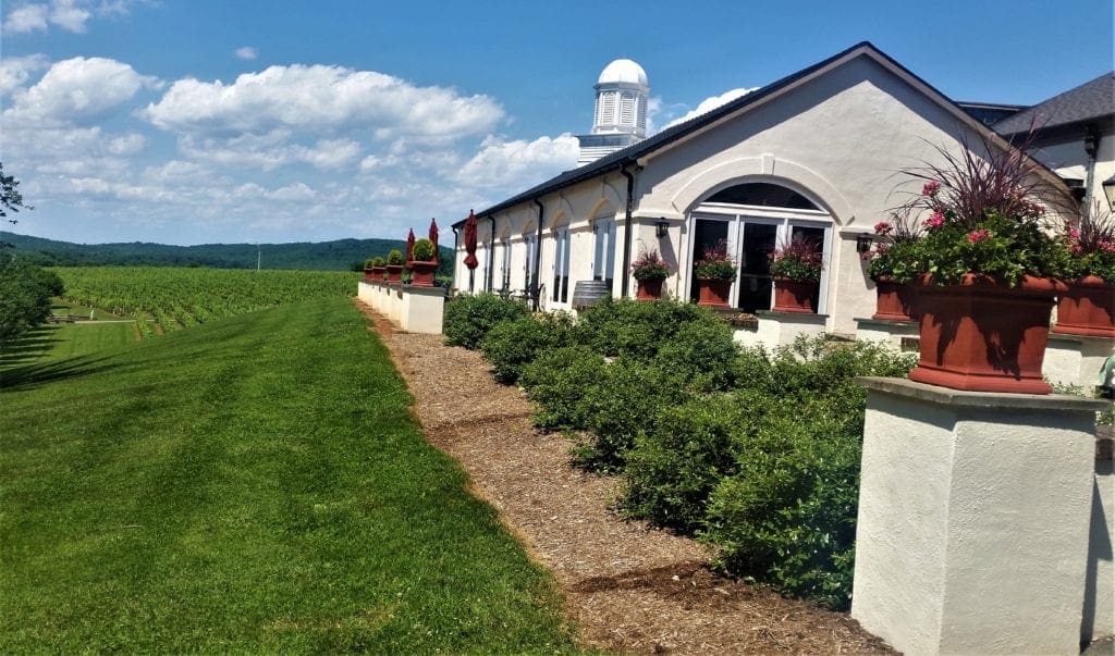
Octagon is the centerpiece of the estate’s wines, and you can get a taste or a bottle in the estate’s Tasting Room.
I parked and made my way to the tasting room. Another woman arrived just as I did, and the host mistakenly thought we were visiting together.
We were actually total strangers, but decided to have our tasting together anyway 🙂

It was a beautiful day, so we had our tasting outdoors overlooking the vineyard.
The entire estate, which also includes an award-winning restaurant and a charming Inn, is open for tasting wines as you stroll or in a picnic.
Staff in the Discovery Room is available to answer questions, and you can also view short videos of the winemaker offering his insights on all the wines.
There is a tasting fee of $15 which includes a choice of six one ounce pours selected from sixteen wines.
Wines are self-dispensed by automated Wine stations at ideal temperature in fine crystal stemware – of course!
DISCOVERY TASTING ROOM HOURS
NOTE: Guided tours of the winery are currently suspended in response to Covid 19 guidelines.

After I finished at the winery and made my way back to the cabin, it was already almost dark.
So I made dinner, watched the sunset over the lake with another glass of wine, and called it a day.
My plan was to spend the whole next day hiking Old Rag!
Sadly, in the morning, my plan to hike Old Rag was thwarted by logistics (again!), so I made my way to the Park to find another all-day hike instead.
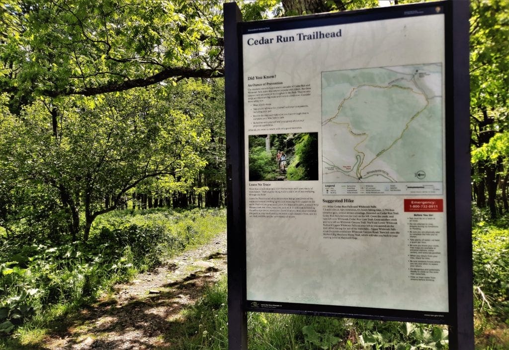
Hike the Cedar Run Whiteoak Circuit
Starting from Big Meadows again, I consulted with a Ranger who recommended the Cedar Run Whiteoak Circuit.
I’d hiked Whiteoak Canyon before, but not in conjunction with Cedar Run.
There are basically 3 routes to hike Whiteoak Canyon, and the circuit with Cedar Run is the most difficult:
Distance: 7.3-mile round trip hike
Difficulty: Very strenuous
Hiking Time: 6 hours 15 minutes
Elevation Gain: 2,794 feet
The trail is long and steep, and includes rock scrambling, stream crossings, and other challenging terrain.
But I had all day – and it was still pretty cool outside – so I decided to give it a go 🙂
I know I seem pretty casual about it, but make no mistake, this is a very strenuous trail!
The Rangers warn that only well conditioned and well prepared hikers should attempt it. Also be aware that this trail has a history of frequent accidents.
Trail Access – Choose Your Route
To hike the Whiteoak Cedar Run Circuit, start from the Hawksbill Gap Parking Area (mile 45.6) off of Skyline Drive. and start hiking the Cedar Run Trail.
Usually, you would then go left on Link Trail, but the Link Trail was closed when I was there.
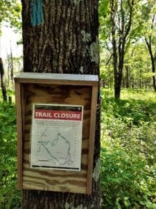
A sign on the trail gave an alternate route:
“To complete the Loop, bypass the Link Trail and use Cedar Run Trail to Whiteoak Canyon Trail.”
Take a left on the Whiteoak Canyon Trail.
Then you’ll start to go up.
You’ll pass six waterfalls on your way up, then after the last waterfall, you’ll cross the creek on a little bridge.
After a while, you’ll come to an intersection with the Whiteoak Canyon Fire Road/Horse Trail. Turn left.
Follow the road to the Skyland-Big Meadows Horse Trail. Turn left once more to return to the Hawksbill parking area.
From either end of the trail you can connect the White Oak Canyon to Cedar Run Loop, or when you reach the Fire Road you can opt to return the way you came.
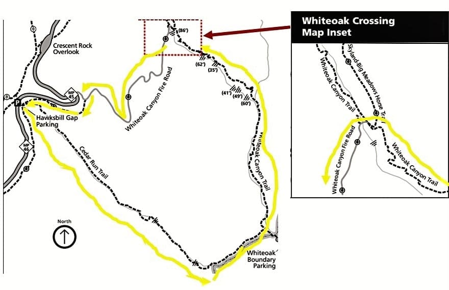
You can combine with other trails if you like for longer hikes. See other possible Whiteoak routes here on the Whiteoak Canyon Area map
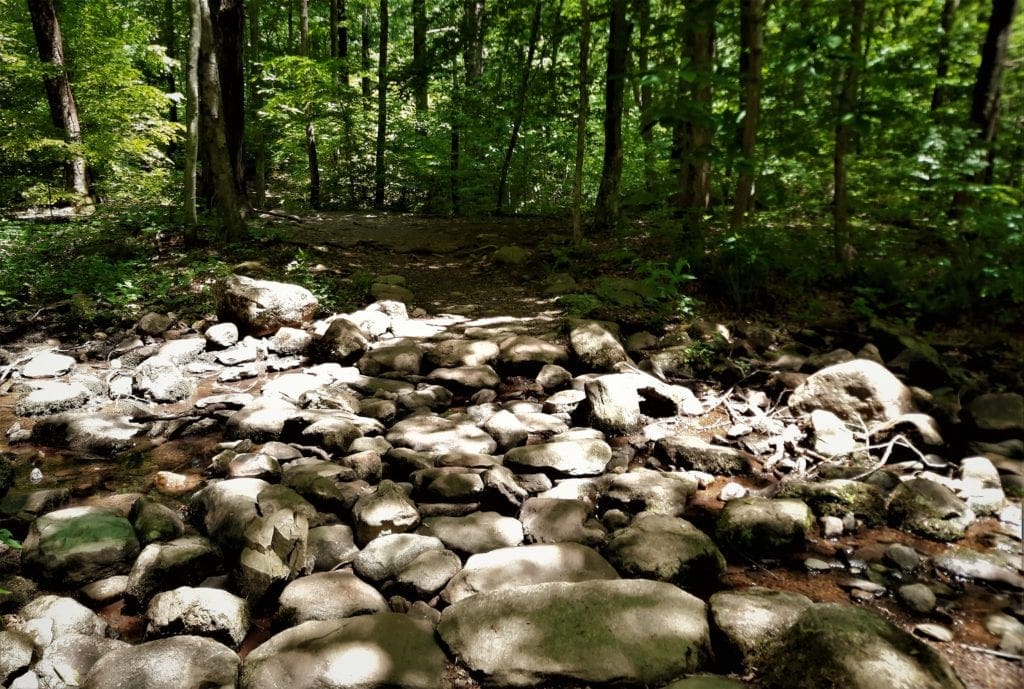
Cedar Run Trail
With many miniature waterfalls and cascades, dense woods and very few visitors, this is the perfect rugged trail for those seeking to get off the beaten path.
At one point along the trail there is an impressive cliff on the other side of Cedar Run, named Halfmile Cliff.
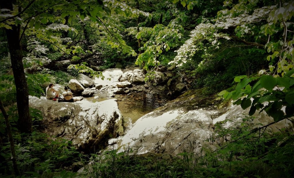
There are also two modest waterfalls along this trail. The upper falls are are locally known as “the slide” and is a favorite swimming spot in the summer.
The lower waterfall is located a good ways below “the slide.”
There is no actual trail to the lower waterfall, although it does pass fairly close to the head of the falls.
Whiteoak Canyon
The Whiteoak Canyon Falls trail has six waterfalls – three upper falls and three lower falls – making it one of the most scenic hikes in the park.
Starting at Skyline Drive MP 42.6 at the Whiteoak parking area, the trail descends through a rocky gorge to the foot of the mountains.
There’s a pretty steep climb up on the way back.
Doing this trail as part of the Circuit, you get to see all of the waterfalls – and do almost all of the climbing, too 🙂
Finding the Fire Road/Horse Trail turn off of Whiteoak was a little tricky – in fact, I wasn’t entirely sure I was on the right trail for a while….
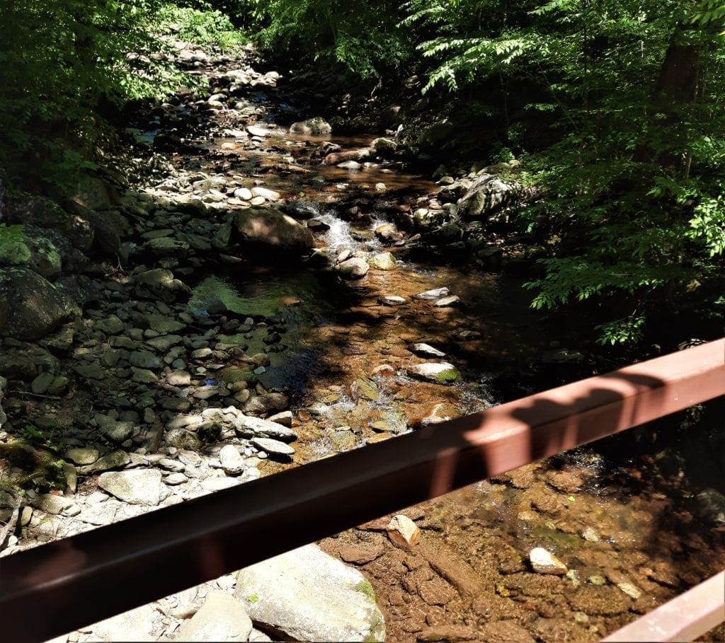
After the last waterfall, you have to cross the creek on a little bridge, and then follow the Whiteoak Canyon Road gravel road.
Look for a sign and turn left on the Skyland-Big Meadows Horse Trail, which will take you back to your trailhead at the Hawksbill parking.
It took me about 6.5 hours to do the whole Circuit, but I didn’t linger anywhere along the way.
You might want to allow at least 7 hours for this hike.
This hike could be a lot of fun for older kids – especially if you take time to splash in the water along the way! It might be too intense for little ones, though.
Although it wasn’t as hot as my previous June visit, it was still hot enough that I had used up most of my water.
By the time I got back to the trailhead, I was soaked in sweat and more than ready to be done hiking for the day.
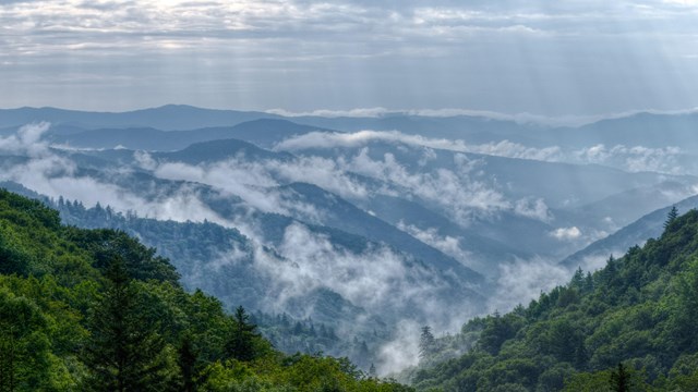
I was leaving for home the next morning, so I said goodbye to Shenandoah until next time and drove back down the mountain to my cabin.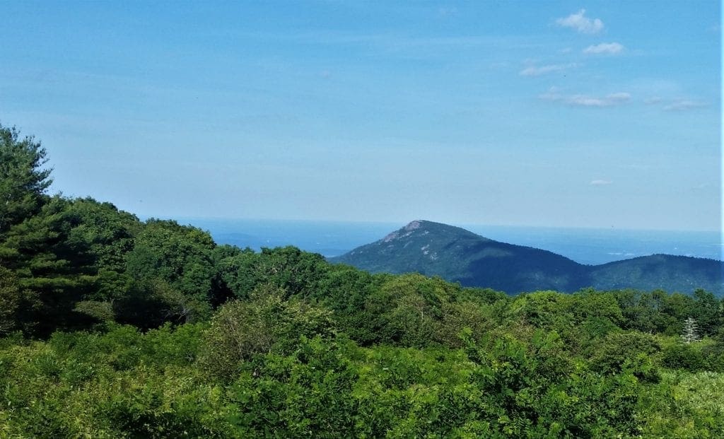 View of Old Rag mountain from Skyline Drive.
NEXT TIME – Old Rag a.k.a “Moby Hike”
Once again, circumstances had conspired to keep me from hiking Old Rag.
It was the hike that got away 🙂
The Old Rag hike is a full day, 9.2-mile roundtrip circuit, taking 7+ hours to complete and climbing over 2,000 feet.
Rated by the park as “very strenuous”, you’ll need to scramble and claw through a couple of miles of rocky terrain to complete the trail.
As the park website says: “a day on Old Rag is one of Shenandoah’s premier experiences”.
Map: Old Rag Area
See you next time, Old Rag….
UPDATE: Old Rag Day Hike Tickets
In addition to a Park entrance pass, if you’re hiking to Old Rag Mountain area (including hikers on the Saddle, Ridge, and Ridge Access trails) you’ll need to get an Old Rag day-use ticket in advance online.
The tickets are only $1 each, so I bought tickets for two different days. That way if the weather was bad on one day, I could try the next.
Print out your ticket, or have it available on your phone. They’ll ask to see it at the Old Rag trailhead, and Rangers randomly ask for it on the trail, too.
Learn more on the Old Rag day-use ticket FAQ page.
Park Info
Shenandoah National Park is always open. Campgrounds, and picnic grounds begin opening in March and close by late November.
Learn about visiting Shenandoah in winter here.
Entry Fees
Admission to the park is $30 per car, but I recommend buying a National Park Pass if you’ll make repeat visits – or if you plan going to any other parks.
The $80 National Park Pass gives access to all national parks and monuments in the United States for a year.
I hope this post has inspired you to visit Shenandoah National Park and try some new hikes!
I finally did get to hike Old Rag! Read about my hike on Old Rag here.
You can learn even more in my full Shenandoah Visit Guide and week of hikes!
Or if you prefer video, take a look at the Shenandoah playlist on IRW YouTube.
Leave a comment about your Shenandoah National Park visit, or if you have a question drop me an email and I’ll reply as soon as I can.
Thanks for stopping by – see you next time! LJ
To Get New Idratherwalk Posts
sent directly to your inbox (how convenient!) Click this Button
If you like this post, please share it!


LJ has spent much of her free time as a single Mom – and now as an empty-nester – hiking in the US and around the world. She shares lessons learned from adventures both local and in exotic locations, and tips on how to be active with asthma, plus travel, gear, and hike planning advice for parents hiking with kids and beginners of all ages. Read more on the About page.