
Most recently updated September 30th, 2022
Working remotely doesn’t mean you have to stay indoors – in fact, it’s healthier for you to take breaks and get outdoors in the fresh air and sunshine!
Being stuck indoors by yourself – or with your kids – with no end in sight could make you nuts.
Getting out on the trail on your own, or with 10 or fewer members of your family or friends, could help bring you back from Crazy Town.
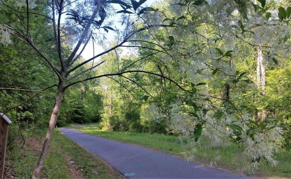
If you’re a hiker local to Cary or Raleigh, NC, you know the nearby hiking places, and have been on the trails.
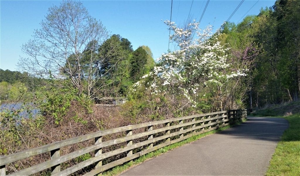
They’re beautiful, have varied terrain and are easily accessible.
But if you’re distance training for a longer thru-hike, or looking for a day-long outing with less populated trails, it’s hard to find any single trail much longer than the 7.2 mile Sycamore Trail in Umstead State Park.
What are your options if you would like to hike longer moderately difficult trails, maybe all day long, but don’t want to have to drive several hours to Hanging Rock State Park , Raven Rock, or Pilot Mountain?
I guess you could hike Sycamore trail a few times, like doing laps around a track – but that doesn’t sound like a lot of fun.
Instead, you can create your own long hikes, with Umstead as a starting point.
Because Umstead State Park is centrally located, and connects to a multitude of other outdoor walking and hiking venues in the Raleigh and Cary area, you really don’t need to turn around and come back when you reach the park boundaries – you can just keep going!
Some of my posts contain affiliate links. If you make a purchase through an affiliate link, I will receive a small payment at no additional cost to you. I do not get paid for recommendations, all opinions on this site are my own. See full Disclosure page here.
Build Your Long Hikes
The trailheads for the three longer trails in the park are split between the two entrances, Sycamore on the Raleigh (Glenwood Ave) side and Company Mill and Loblolly on the Cary (Harrison Ave) side.
Here’s an example of how you can use each one of those trails as the first leg of a longer hike.
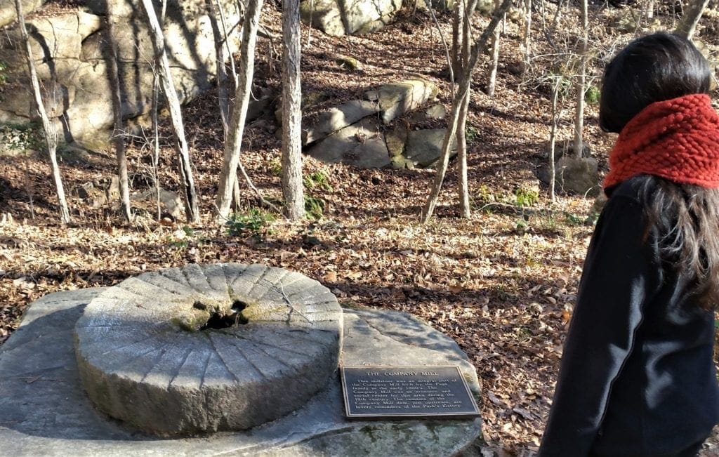
Company Mill and Sycamore – 8-9 miles
At the Harrison Avenue entrance, start at the Company Mill trailhead. Hike the trail to the halfway point, then cross the multi-use trail (MUT) to the other side of the bridge and pickup the Sycamore trail.
I hike Sycamore to the other side of the park, then back down to the multi-use trail again, where we come out at the bridge and do the other side of Company Mill back to the trailhead.
DISTANCE: The whole hike is 8-9 miles.
While you’re over on the other side of the park, you can hack around on other trails, stop for a picnic, look around at the Visitor’s Center, etc. or whatever – just leave enough time to hike back to your car at the Harrison parking lot before the park closes.
IMPORTANT UPDATE: The Crabtree Creek Sewer Rehabilitation project will affect hiking routes in Lake Crabtree County Park and Umstead State Park starting September 2021 through the Spring of 2022.
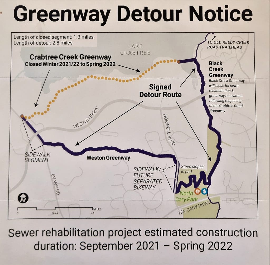
Detour signs will be posted and you can still hike, but be aware your hike length and trail access points may be impacted due to these detours.
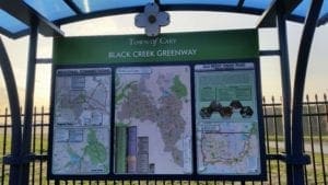
Company Mill to Crabtree County Park and Black Creek Greenway – 8-15 miles (2 Options)
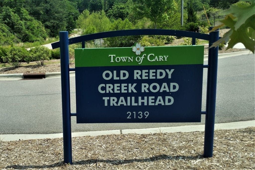
At the Harrison Ave entrance, start at the Company Mill trailhead, take a left at the Reedy Creek Multi-Use Trail and keep going to hike over the old I-40 bridge to the trailhead at Old Reedy Creek road.
Or, you can simply drive to that trailhead on city streets, park and start from there. Starting from the Old Reedy Creek trailhead will shorten your hike by around 5 miles.
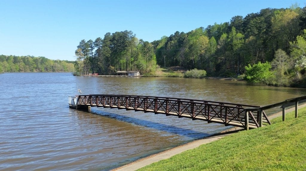
From the Old Reedy Creek trailhead you can go left on the paved Black Creek Greenway, or right to the hiking and biking trails in the woods into Lake Crabtree County Park. Depending on your starting point and direction you go, this could be anywhere from a 5 mile to a 15 mile hike.
Option 1 – From Black Creek Greenway to the left….
LONG ROUTE: Starting from Lake Crabtree at the Old Reedy Creek Trailhead the greenway extends continuously for 7.1 miles across town to the greenway hub at Bond Park. From there it connects to the White Oak Greenway, which is 4.8 miles of trail. White oak will eventually connect to the American Tobacco Trail to make a trail more than 7 miles long.

(The Black Creek/White Oak trail system within Cary is part of the East Coast Greenway which will eventually go from Maine to Florida.) This route is not a loop, so you would need to turn around and make your way back.
DISTANCE: The whole trail would be around 12-15 miles. (Add 5 more miles if starting from Company Mill.)
SHORTER ROUTE: If you don’t want to go that far, you can create a shorter loop by turning right onto the new lake bridge about a half mile from the trailhead down the Black Creek greenway. The bridge goes across the lake to a new paved trail that continues for about 2-3 miles along that side of Lake Crabtree.
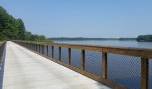
Step off the pavement onto the woods path (the Lake Trail) and continue from there to Lake Crabtree marina.
The trail goes from there back into the woods, and will bring you back to the Old Reedy Creek Trailhead.
DISTANCE: This whole route would be 6-8 miles long. (Add 5 more miles if starting from Company Mill trailhead.)
Option 2 – From the Old Reedy Creek trailhead to the right….
(This route would be the reverse of the shorter route above.) Turn right onto the woods path (the Lake Trail) and continue from there to Lake Crabtree marina.
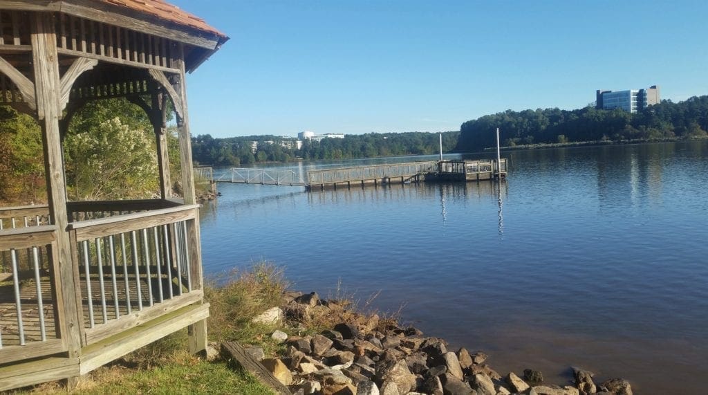
The Lake Trail continues from the marina across the volleyball and soccer field to the raised boardwalk along the right side of the lake, then along the highway and back into the woods.
Eventually the trail will bring you to the new paved greenway and the new lake bridge back to the Black Creek greenway. The Black Creek greenway will lead you back to the Old Reedy Creek Trailhead.
DISTANCE: This whole route would be 6-8 miles long. (Add 5 more miles if starting from Company Mill trailhead.)
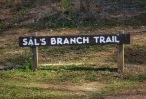
Company Mill to Sal’s Branch – 8-10 miles
At the Umstead Park, Harrison Ave entrance, start at the Company Mill trailhead, take a left at the Reedy Creek Multi-Use Trail and walk about a half mile to the Mid-gate.
Take a right at the gate, then bear left at the fork (right forks go to the camp area).
In another half mile, you will see Big Lake to the left. Take the path to the right of the dock around the lake to Sal’s Branch.
Go up the hill on the red dirt path, then follow the trail to the right and into the woods.
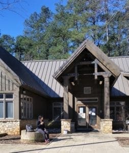
The path will cross a road, back into the woods and end up at the Visitor’s Center, where you can get some water and take a bio break.
Pick up the trail again behind the building to head back on Sal’s Branch to the lake, and from there reverse your steps.
DISTANCE: If you go back on the same leg of Company Mill, the mileage will be around 8 miles.
To add 2 more miles, head further down the MUT trail to the second entrance to Company Mill on the right, then take the trail back to the trailhead for a total of about 10 miles.
Loblolly to Schenck Forest, Reedy Creek, and NC Museum of Art (3 Options)
Start at the Harrison Ave entrance to Umstead park, at the Loblolly trailhead.
Taking the Loblolly Trail to the edge of the park will bring you to the Reedy Creek Greenway.
This out and back trail crosses Reedy Creek and continues to the park boundary.
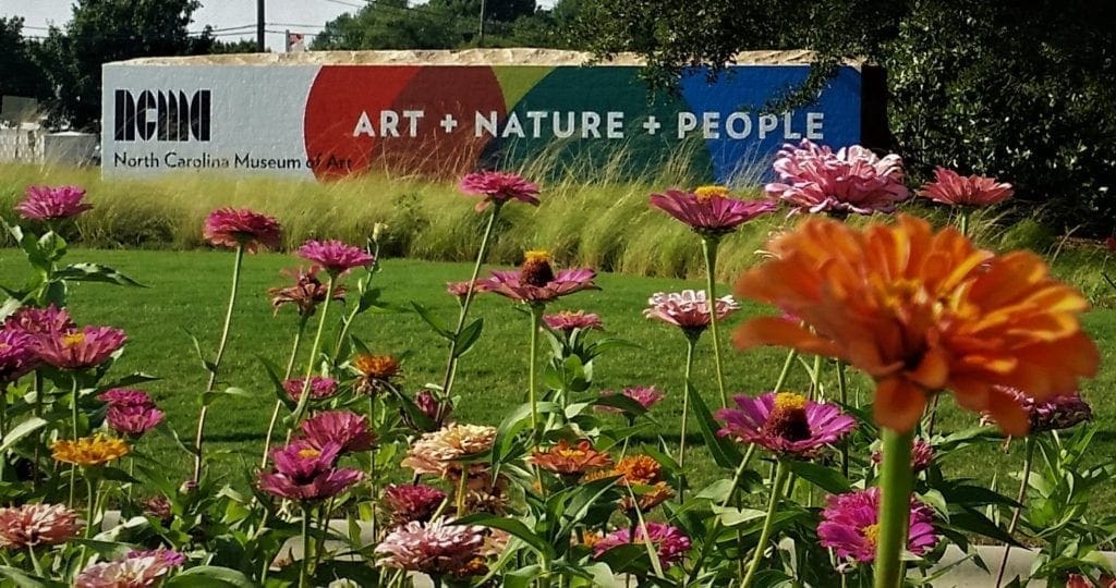
From there you can turn right at Reedy Creek Road to go back into Umstead, cross the street into NC State’s Schenck Forest, or go left along Reedy Creek road (step off the greenway to hike Reedy Creek trails along the way if you wish) to get to the trails at North Carolina Museum of Art Park.
Or any combination thereof.
UPDATE: There have been some major changes to the Schenck Forest access area over the past few weeks. Read on for more updated info.

Getting Into the Forest
There are several ways to get into Schenck Forest, and – like a lot of places – they’re mostly defined by where you can park your car to start your visit.
Entry off of Reedy Creek Trail
Schenck Forest is to one side of the Reedy Creek Trail, which runs along Reedy Creek Road from the NC Museum of Art to the southern entrance of Umstead State Park.
To reach this entrance to the Schenck Forest, follow Reedy Creek Road until you cross Edwards Mill Road, then drive about two-tenths of a mile and take the first unpaved street on the left.
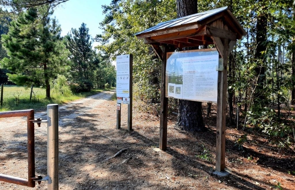
The entrance is a few hundred feet down this gravel drive on the right, and people just park along the gravel road.
NOTE: Due to construction, the Schenck access road is currently blocked to auto traffic and parking. See update below.
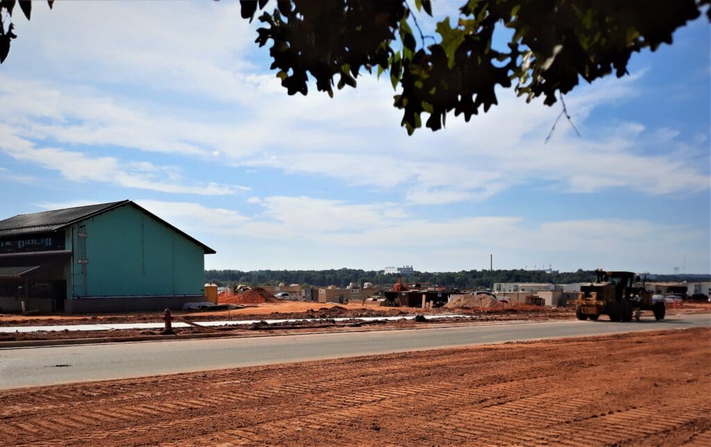
Recent Construction and Changes to the Forest Access
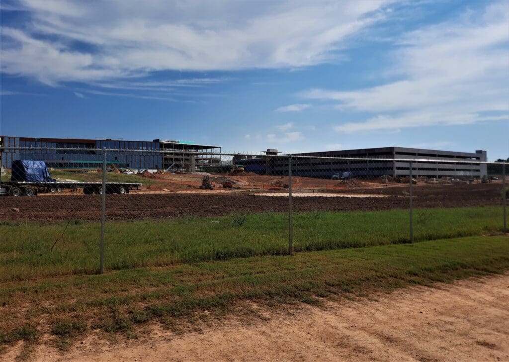
About a year ago, approx. 40 acres across the Schenck Access Road from the main entry to the forest was cleared of trees to become an overflow parking lot for the NC State Fair.
A couple of months ago, construction of at least one large glass and steel building and one large parking structure began in that same field, and access and parking at the Schenck access road is no longer possible.
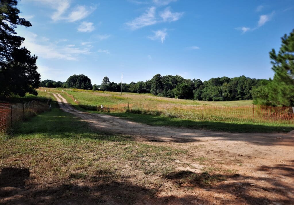
The gravel access road is being paved over and widened, with large buildings under construction across the street from the Schenck Forest entry road.
You can still access the trails by walking across the Reedy Creek Greenway on the walkway from the Loblolly Trail out of the Umstead State Park side of the road.
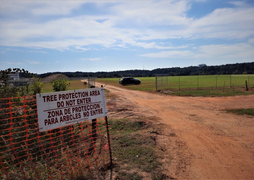
You can also park your car in new “Schenck Forest Greenway” parking area adjacent to the construction site, and walk down the newly-cut dirt road through the old horse meadows to access the natural trailheads from the picnic shelter area.
Forest and trail access may continue to change as construction progresses, but currently all of the trails below still exist and are accessible as stated.
That said, I find all of the tree-clearing and construction much more frightening than the Zombie tunnels 😉
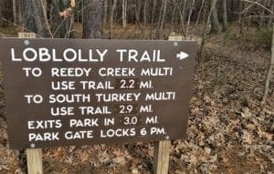
Loblolly – Out and Back Loop – 6.5 miles
This is the shortest route, just hike the Loblolly Trail to Reedy Creek road and back into Umstead park.
Take the Multi-use trail to the next Loblolly sign on the left, and take that trail back to the trailhead and parking lot.
DISTANCE: Taking the Loblolly trail to the park boundary and back would be 6.2 miles, adding the short distance on the MUT to the next Loblolly sign would make a total of 6.5 miles.
Loblolly to Schenck – Frances Liles trail – and back to Umstead – 8-9 miles
Start the same as the 6.5 mile Loblolly loop, except that instead of taking Reedy Creek Rd back to Umstead, you will cross the road (at the designated crosswalk) into Schenck Forest.
NOTE: There are no dogs allowed in Schenck, so you’ll need to leave the puppy at home for this hike.
From there, the trail markers change to white blazes on the trees; in about a half mile you will reach a little plank bridge – cross it and then take the left fork in the trail.
In another half mile you will emerge from the forest into a clearing with a picnic shelter, water pump, porta-john and a stone memorial to Carl Schenck.
To return you can either go back the way you came, or take the freshly-paved road at the entry Kiosk left to Reedy Creek road. Take another left to return to Umstead.
DISTANCE: This hike is around 8-9 miles round trip.
Loblolly to Reedy Creek to NCMA Park – and back to Umstead – 12-13 miles
Start this hike as before at the Loblolly trailhead in Umstead. Take Loblolly to Reedy Creek Road and continue on the greenway all the way down to the Museum of Art Park.
(On the way to the NCMA park, you’ll pass the Prairie Ridge Ecostation, which also has a few nice, family-friendly hikes.
Read more about them here.)
Once in the park, you can take a variety of paved and gravel trails to the pedestrian bridge that crosses I-440.
While you are there, you can look at indoor and outdoor exhibits, and take a break at the Rodin garden. There are also restrooms and water.
Return back to Umstead the way you came.
DISTANCE: This out and back hike is around 12-13 miles.
Umstead to NCMA, House Creek Trail, Meredith College Greenway
Once you are at the NCMA, and you hike the paved trails in the museum park all the way to the pedestrian bridge over the highway – you can keep going even further!
After you cross you can go to the left on House Creek Greenway which will take you all the way to Crabtree Valley Mall.
House Creek is a 6.7 mile loop trail.
Or, you could go right to hike on the portion of Reedy Creek Trail that begins at the I-440 pedestrian bridge and extends to Meredith College.
The distance from Meredith to the pedestrian bridge is 1.3 miles – so this section would be 2.6 miles round trip.

In both of these cases, this is an out-and-back to return to the NCMA, then Reedy Creek Rd (greenway and Loblolly (Umstead), so save time and energy for your return trip.
DISTANCE: Depending on where you start and where you go, this could be a moderate hike of 5 miles or a very long hike of 12 to 18 miles or more.
But Wait, There’s More!
These are just a few of the ways you can combine trails in Umstead State park with the Capitol Greenway System, Town of Cary Greenways, and other walking and hiking trails to make longer trails.
And, you can read here about the Zombie Tunnel hike! It’s perfect for Halloween 🙂
TELL ME WHAT YOU THINK!
Leave a comment below and let me know what your experiences have been in Umstead State Park, and which trails are your favorites.
To learn more about other places to get outdoors on our own or with the kids, take a look at my Hiking Destinations page.
If you have any other questions leave them below, or drop me a line a idratherwalkblog@gmail.com and I will respond as quickly as I can.
Thanks for stopping by – see you next time! LJ
To Get New Idratherwalk Posts
sent directly to your inbox (how convenient!) Click this Button
If you like this post, please share it!


LJ has spent much of her free time as a single Mom – and now as an empty-nester – hiking in the US and around the world. She shares lessons learned from adventures both local and in exotic locations, and tips on how to be active with asthma, plus travel, gear, and hike planning advice for parents hiking with kids and beginners of all ages. Read more on the About page.