Most recently updated November 24th, 2025
Estimated Reading Time: 10 minutes
The Zombie Tunnel Hike is a route that goes from Umstead State Park, and all the way through Carl Alwin Schenk Memorial Forest to the Lenovo arena – with the help of the Richland Creek Trail and Capital Area Greenways.
I’ve been leading this hike for years, and people really enjoy it.

At over 12 miles, it’s a good long hike. It’s pretty flat, but has a lot of different features – like Zombie tunnels!
Okay, there may not *actually* be any Zombies, but it sure looks like there could be….and one time I did find a mutant fish in there 🙂
I don’t host this hike very often because conditions need to be just right or the route is impassable, and I hate to disappoint anyone.
Just in time for Halloween, I hiked the route again AND (for a spook-tacular add-on) took a Ghost Walk in Raleigh the next day!!
(I’ll tell you all about the Ghost walk and how you can take one too, but first – the hike!)
Depending on recent weather conditions or new construction, parts of the trail have been known to disappear like Brigadoon at sunrise.
So earlier this year, before I posted the hike for others to join me, I decided to take a look and see if the route was still there – and still the same.
Good news! The route was still there – and still mostly the same. In fact some parts had actually been improved!
Now I’ll tell you about the trail so you can try this somewhat spooky hike for yourself… perhaps followed by an equally spooky Ghost Walk!
Some of my posts contain affiliate links. If you make a purchase through an affiliate link, I will receive a small payment at no additional cost to you. I do not get paid for recommendations, all opinions on this site are my own. See full Disclosure page here.
About Schenk Forest
Carl Schenk Memorial Forest, like Umstead State Park , is centrally located, with trails that intersect with a multitude of other outdoor walking and hiking venues in the Raleigh and Cary area.
The 300-acre forest is owned by North Carolina State University in western Wake County between Cary and Raleigh.
As a teaching and research forest, its primary mission is education, but the public is allowed access for hiking, picnicking and nature viewing.
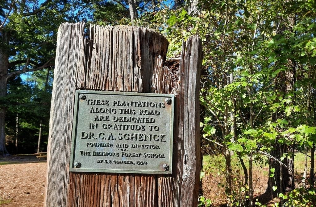
Carl Alwin Schenk
The forest is named for Carl Alwin Schenk, a German forester who came to the United States in the late 19th century to work at George Vanderbilt’s Biltmore Estate.
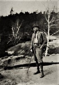
Considered the father of American forestry, Schenk established the Biltmore Forest School near Brevard, the first school of forestry in the United States.
His school greatly influenced the industry in America, and his work on the future Pisgah National Forest set an example of forestry practice at its best.
NCSU’s 300 acre teaching forest allows students to learn and put into effect the principles of selective logging.
These principles enhance the protection of diversity in the forest habitat, and nurturing of future resources.
Biltmore’s huge forest became a National Park, and Schenck Forest in Raleigh is very popular. These wonderful natural spaces for public enjoyment make a fitting memorial to Carl Schenck and his work.
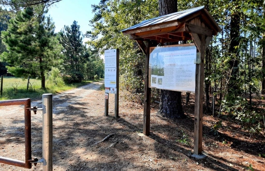
Getting Into the Forest
There are several ways to get into Schenck Forest, and – like a lot of places – they’re mostly defined by where you can park your car to start your visit.
Entry off of Reedy Creek Trail
Schenck Forest is to one side of the Reedy Creek Trail, which runs along Reedy Creek Road from the NC Museum of Art to the southern entrance of Umstead State Park.
To reach this entrance to the Schenck Forest, follow Reedy Creek Road until you cross Edwards Mill Road, then drive about two-tenths of a mile and take the first street on the left.
The Schenk access road off of Reedy Creek Road is paved, with some parking spots along the sides. There are large buildings across the street from the Schenk Forest dirt and gravel entry road.
You can still access the trails by walking across the Reedy Creek Greenway on the walkway from the Loblolly Trail out of the Umstead State Park side of the road.
Entry from Lenovo Center Road
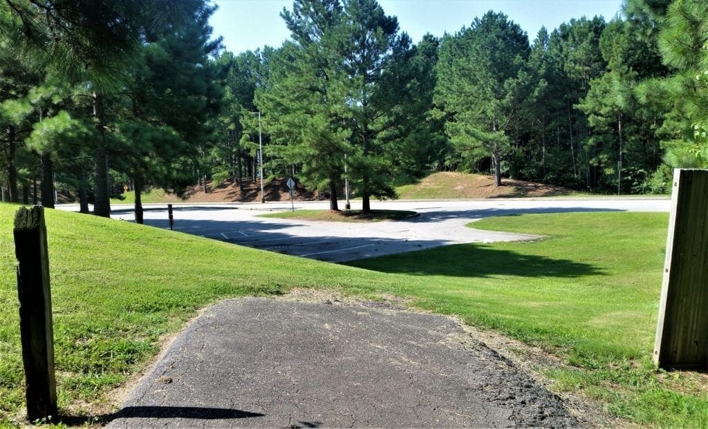
Take your favorite route to Edwards Mill Road and turn onto Lenovo Center Road.
Watch for the parking lot on the left just before Lenovo Center Road intersects with itself.
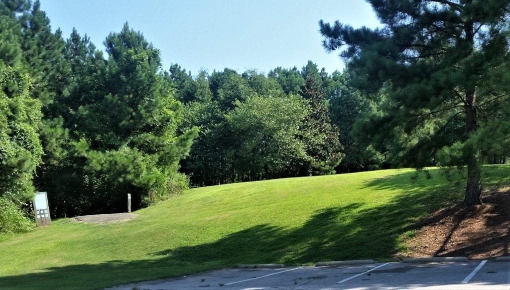
There’s a greenway trail head sign on the little hill at the corner of this parking lot. (Access to this lot might be a challenge if the Center is hosting an event.)
Entry from Umstead State Park
If you have more time, and want a longer hike, why not add a portion in Schenck Forest onto your next Loblolly hike through Umstead?
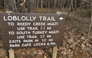
Park at the Harrison Ave entrance to Umstead State Park, and start your hike at the Loblolly trailhead.
Taking the Loblolly Trail to the edge of the park will bring you to the junction with Schenk’s Loblolly Trail, which you should follow to the Reedy Creek Greenway.
Cross Reedy Creek Greenway at the sign and continue into NC State’s Schenk Forest.
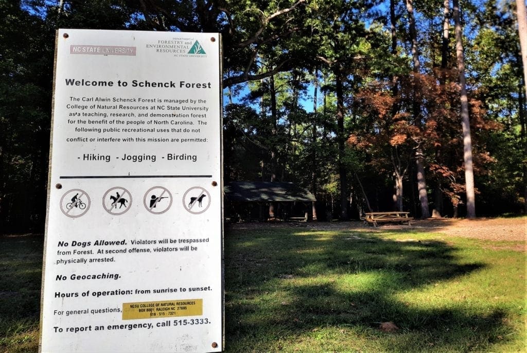
NOTE: No dogs or bicycles are allowed in the forest. (The strict leash rules were implemented in 2005.)
Enforcement via horseback, bike, and undercover on foot takes place afternoons and weekends.
Violators may be banned from the park for a year.
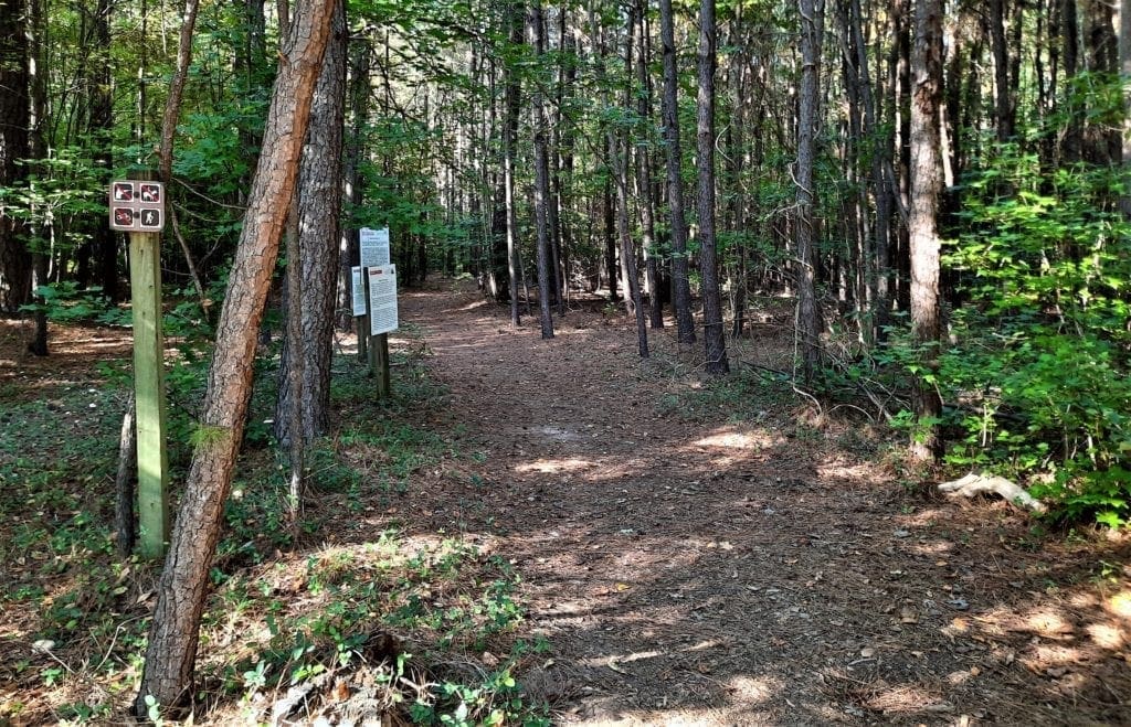
Schenk Forest Trails
Frances L. Liles Trail
Francis L. Liles Interpretive Trail splits from the main access road near the parking and leads through the forest and terminates at Loblolly Trail.
Interpretive signs are located along the trail so visitors can learn about forestry practices.
Loblolly Trail
-
-
-
- Northbound, the trail continues out of the forest, across Reedy Creek Road and ends at the boundary of William B. Umstead State Park. From there it continues as Umstead Park’s Loblolly trail.
- Southbound, Schenk’s Loblolly trail goes uphill and to the left at the intersection with the Richland Creek Trail, and ends at the picnic area along the Service Road.
-
-
Schenk Service Road
The main service road leads from the gate at the parking area across the forest, bisecting it. Interpretive displays along the road give some good details about forestry in practice.
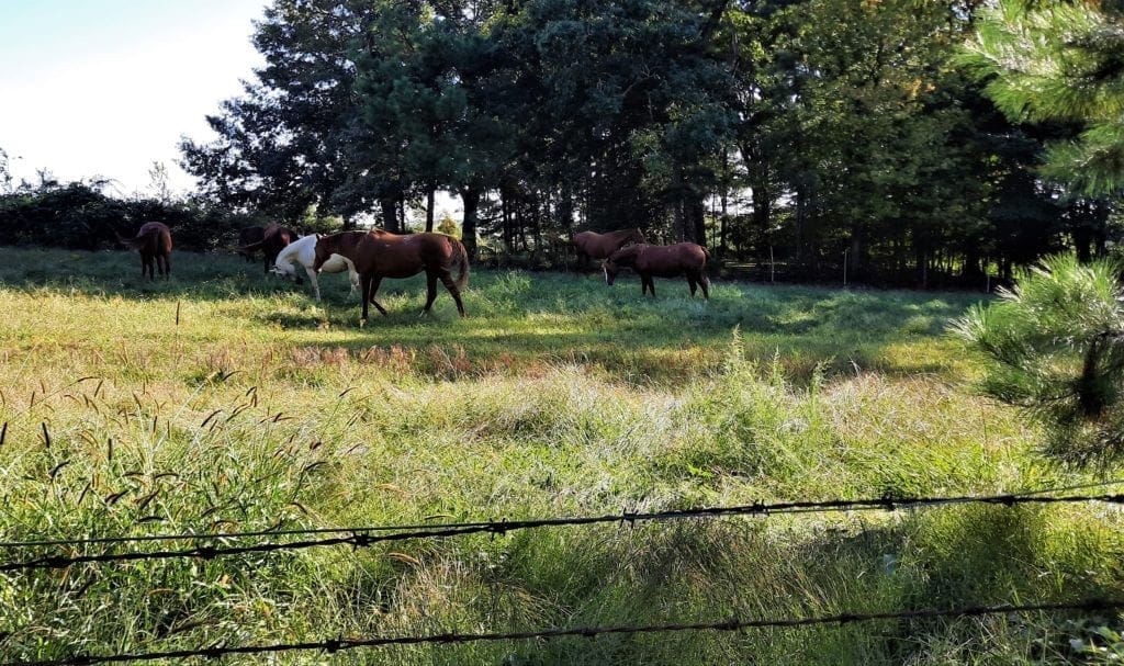
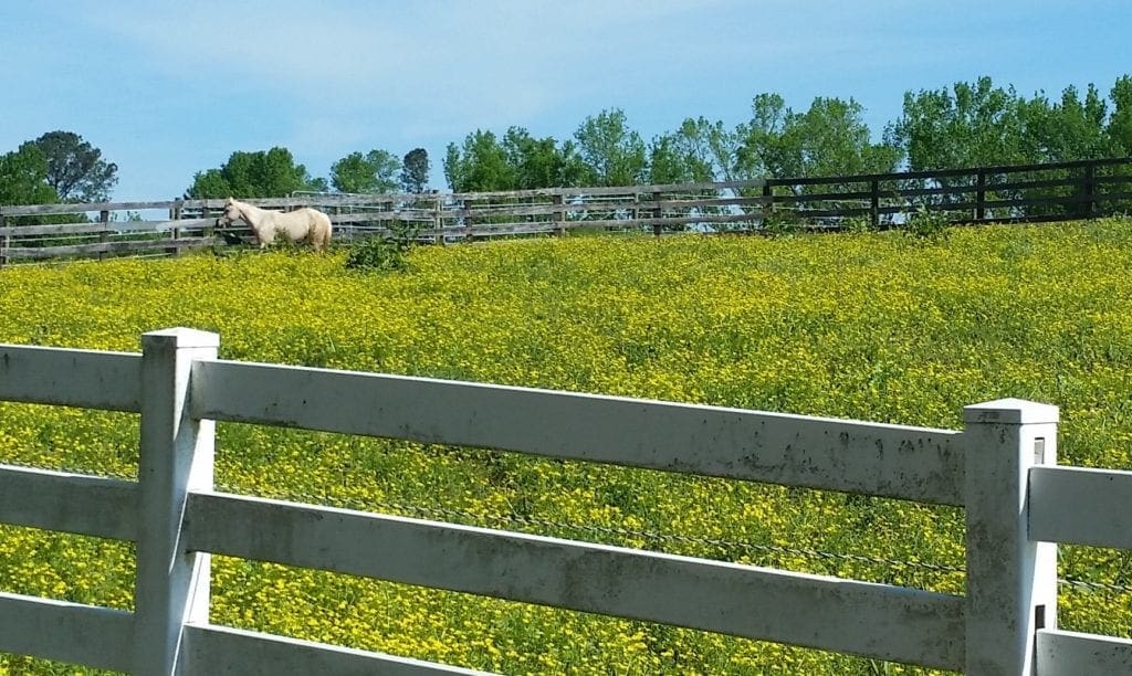
A picnic area with a shelter and another trailhead is just off this road (on the right) in the first quarter-mile, and horse pastures – with horses! – are to the left.
Richland Creek Greenway
Richland Creek Greenway is a 3-mile trail that runs primarily through the Schenk Forest.
There are a couple of places you can start your Richland Creek Greenway hike:
-
-
- One one end the trail starts at a small parking lot across the street from the Arena , goes under Wade Ave and ends at the Reedy Creek Greenway.
- On the other end, you could start at the cul-de-sac at the end of the Service Road into the Schenk forest, where a narrow trail heads down to the creek and up the Richland Creek Trail.
-
NOTE: According to the Capital Area Greenway System Map, both dogs and bicycles are prohibited on the entire length Richland Creek greenway.
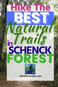
Hiking the Zombie Tunnels Trail
What I call the “Zombie Tunnels Trail” is really a combination of the Loblolly Trail in Umstead State Park, the Schenk Loblolly Trail, and the Richlands Creek Greenway.
It’s not a technically difficult hike, but it’s a pretty good distance.
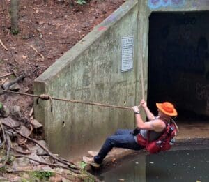
I like it because it covers a variety of terrain, and has some interesting features – like the tunnels, and a rope-swing over a little retaining pond 🙂
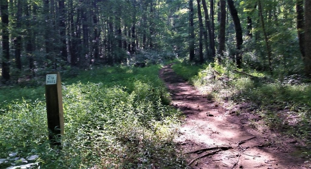
The hike is an out-and-back, with a total of ~12 miles if you do the whole route from Lenovo Road to the Loblolly trailhead in Umstead, and back.
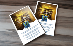
Get The FREE Zombie Tunnels PDF!
Everything that you need to go on the Zombie Tunnels hike is included in this post.
But it’s a long read and may be inconvenient to refer to while you’re hiking.
For your convenience, you can click here to sign up and download your FREE “Zombie Tunnels Hike” PDF file.
You can print it out and refer to your hike route anytime you want. Happy hiking! LJ
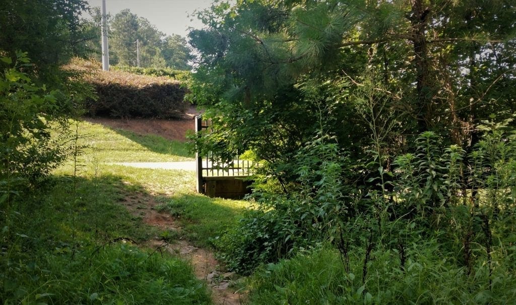
Along the Zombie Tunnels Trail
Starting from the parking area outside the RBC Center, the southeast end of the trail, your first few steps will be on a paved section of greenway.
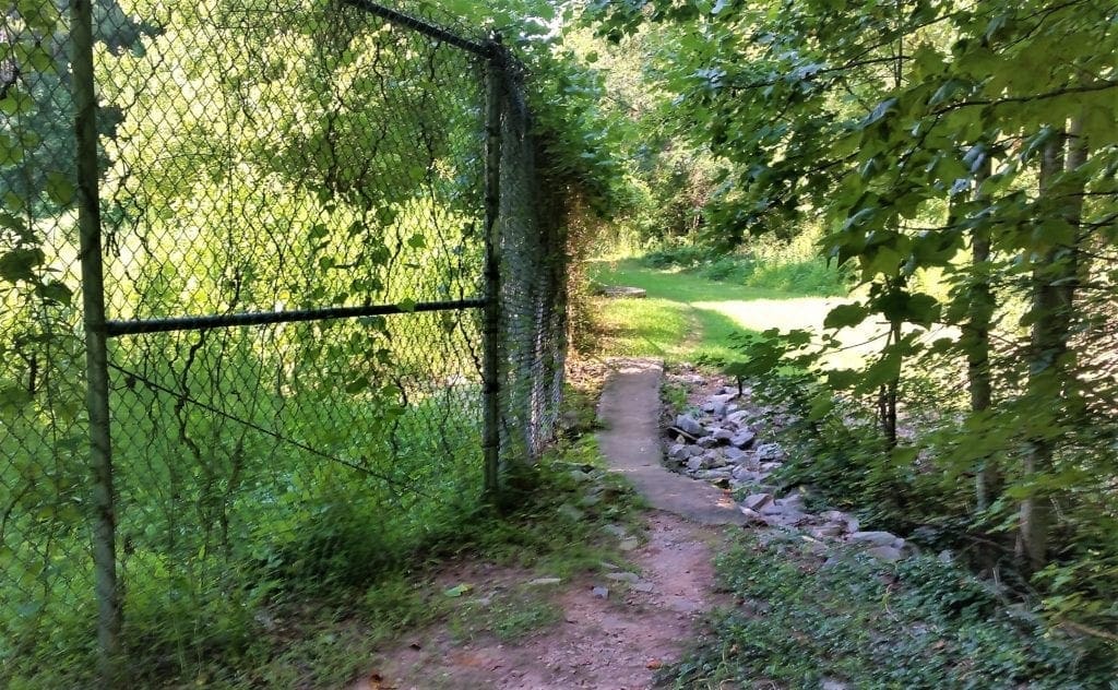
This paved path will abruptly end in front of a chain link fence. As you approach, you might be wondering if you’re in the right place.
Don’t worry – you’ll see that a subtle path through the grass to the right continues the trail. Follow this path along the fence and cross any rocky ditches or bodies of water you come across.
You’ll come to another piece of paved greenway and follow it under Edwards Mill Road.
As you emerge from the tunnel, you’ll want to ignore the snazzy little footbridge at the end of the sidewalk to your left. (That takes you nowhere you want to go.)
Cross into the grass again and scramble over another rocky ditch.
This next section of wide, grassy trail is definitely prone to flooding. Large puddles will wait for you if there’s been rain in the past couple of days.
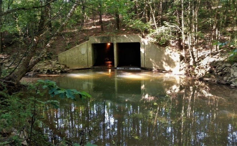
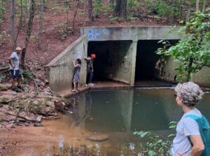
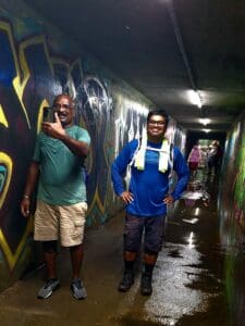
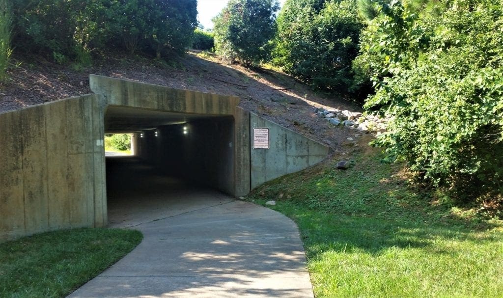
The Zombie Tunnel
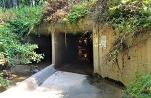
Re-enter the forest and after another 0.25 miles you’ll come upon another tunnel under the highway.
This one might be a little forbidding, though, because it’s at the same level as another tunnel right beside it, a tunnel full of water.
It’s also pretty dark inside.
This is the one I call the “Zombie Tunnel”… But, you’ll be fine. 🙂
NOTE: A couple of years ago the amber-hued older lights were replaced with bright halogen bulbs so the ambience isn’t nearly as spooky. But there’s now a bunch of graffiti in there, and some of the bulbs are out so it’s still pretty spooky, though!
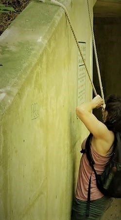
The creek runs through the left tunnel, and you’ll cross on the lighted side on the right.
The far side is a bit tricky, and you might need to use the rope that’s there to help you balance your way across the edge of the creek.
Once you complete the scary tunnel ledge part, there’s another little creek to cross here, too.
There are rocks for that.
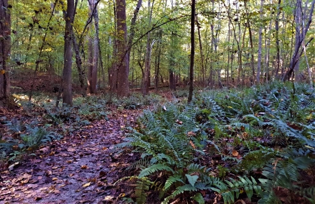
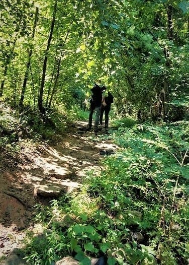
From this point, you’re in Carl Schenk Memorial Forest and the trail follows along creekside through some lowlands that get flooded when it rains.
In Schenck Forest
The Richland Creek trail continues as a wide, puddle prone path along the creek with westbound Wade Ave a few meters away.
The trail gets a little obscure in the next part, but as long as you stay within sight of the creek you won’t lose your way.
This portion is flat and easy to navigate. And you’ll feel pretty comfortable about where you’re headed.
Continue onto a narrower, more single-track-like section of the trail, that leads you over terrain with a mild hill here and there.
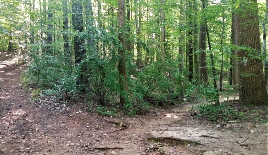
At one point in the trail, there’s a somewhat confusing array of trees and matted leaves on the ground, making the trail a bit tough to discern.
Look for the city greenway trail marker.
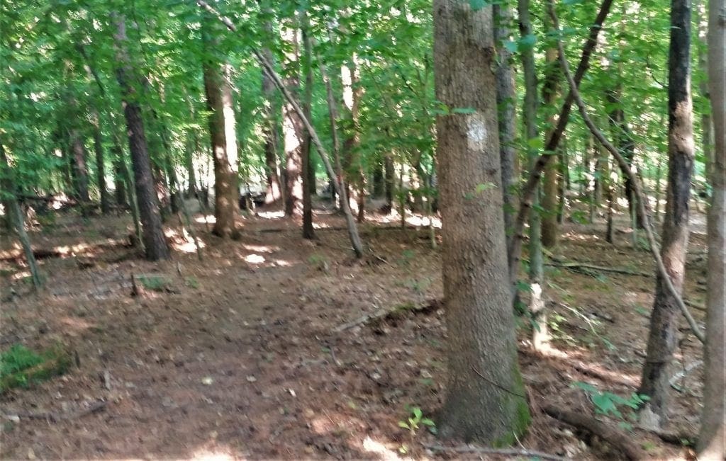
If you’re still confused, ignore the sign and just concentrate on where the creek is.
-
- If you’re heading to Reedy Creek Road and Umstead, the creek should be to your left;
- If you’re going back towards the RBC Center, the creek should be to your right.
White blazes are painted on trees along the trail to keep you on the right track.
The trail integrity breaks down a bit in some areas, but you’re generally funneled back to it if you keep walking.
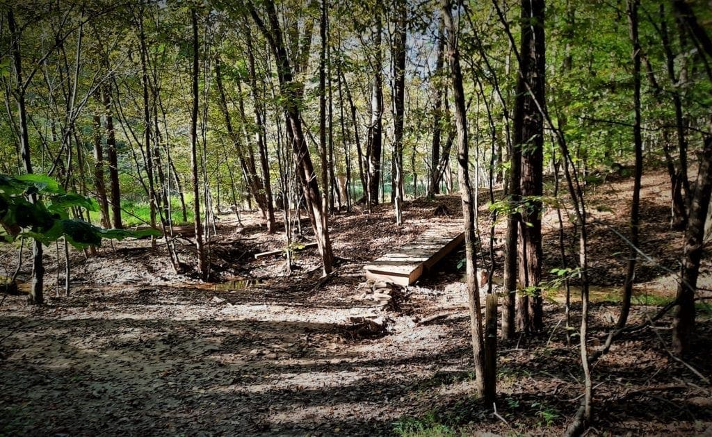
In about a half mile you will reach a little plank bridge – cross it and and keep going.
About 100 feet up the trail to your left is a large pond, that goes into Richland Lake (across the greenway from Schenck).
The very end of this heavily wooded trail intersects with Reedy Creek Road, and the roadside segment of the Reedy Creek Trail.
Cross Reedy Creek Road and go right on the paved Reedy Creek Trail.
Follow the paved greenway until you come to a stairway heading down into the woods on your left.
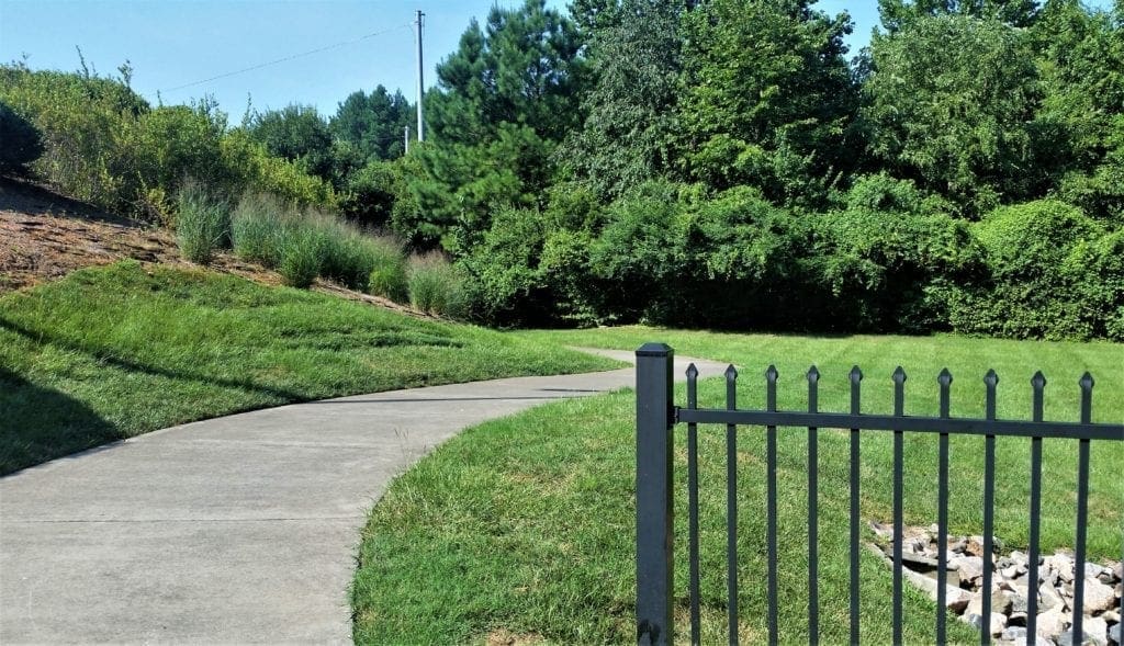
Take the stairs and follow the trail that borders Richland Lake. You’ll climb through a pipe fence and go up a grassy hill for a great view of the lake.
Next, follow the trail down the other side of the hill, through some open green space, and go through a gate to go back into the forest.
The Schenck Loblolly trail ends in the woods where it connects to Umstead’s Loblolly Trail.
(Umstead’s Loblolly continues a few more miles from that intersection back to the trailhead at the Harrison Ave entrance.)
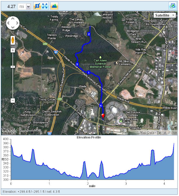
Trail Distance:
- 4.3 miles (out & back from RBC to end at Richland Lake)
- 12ish miles (RT from Loblolly Trailhead in Umstead to RBC)
Trail Difficulty: Easy
If you’d love to hike the Zombie Tunnels trail, but 12 miles feels like a LOT, maybe my hike training plan could help you work up to it.
Get The FREE PDF!

Everything that you need to start your 8 Week hike training is included in this post.
But it’s a long read and may be inconvenient to refer to while you’re training.
For your convenience, you can click here to sign up and download your FREE “8 Weeks to Awesome” PDF file.
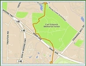
Richland Creek to Loblolly Map
As you can see, there’s not a lot of elevation gain on this trail, which is part of why it has an “easy” rating:
The “Zombie Tunnels Hike” is just one of the ways you can combine trails in the Carl Alwin Schenk Memorial Forest with the Capitol Greenway System, Town of Cary Greenways, and Umstead State Park trails.
I hope you get a chance to go try the Zombie Tunnel hike for yourself soon!
How About Taking A Ghost Walk For More Spooky Fun?
So the Zombie hike really needs to be done in the day time, but you can continue the spooky fun by booking a Ghost Walk in the evening!
I booked a tour in Raleigh, but the ghost walks are available in 170+ cities across the US, so you can find a tour petty much anywhere.
We met at the Capitol downtown, and to my surprise That Man and I were given a private and extended tour!

Tours are 1-hour long across a 1-mile walking distance, and the extended bonus tour added another 15 minutes and maybe another bit of walking! We didn’t mind – we’re hikers after all 😉
Our guide, Chris was very knowledgeable and told us stories of Raleigh ghosts and hauntings from the Civil War through Prohibition, all still active at locations we were able to walk to during the tour.
We had a great time, and I recommend this tour for the whole family – while spooky, none of the stories were too scary for children to enjoy.
Tours meet at 8pm daily, and free parking is available near the Capital.
Click here to find a tour near you: https://usghostadventures.com
Happy Haunting 🙂
If you have any questions about the Zombie hike or any others in the area, drop me a line at idratherwalkblog@gmail.com and I’ll get back to you as quickly as I can.
Learn more about other places to get outdoors on your own or with the kids on my Hiking Destinations page.
Thanks for stopping by – see you next time! LJ
To Get New Idratherwalk Posts
sent directly to your inbox (how convenient!) Click this Button
If you like this post, please share it!


LJ has spent much of her free time as a single Mom – and now as an empty-nester – hiking in the US and around the world. She shares lessons learned from adventures both local and in exotic locations, and tips on how to be active with asthma, plus travel, gear, and hike planning advice for parents hiking with kids and beginners of all ages. Read more on the About page.