Most recently updated February 10th, 2026
Estimated Reading Time: 24 minutes
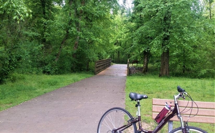
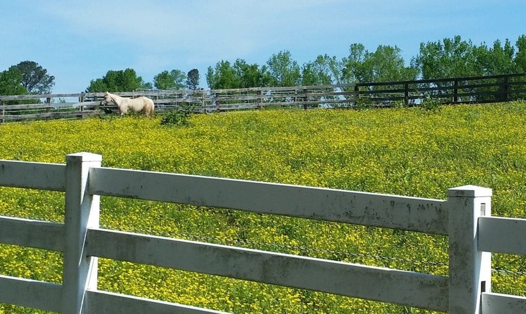
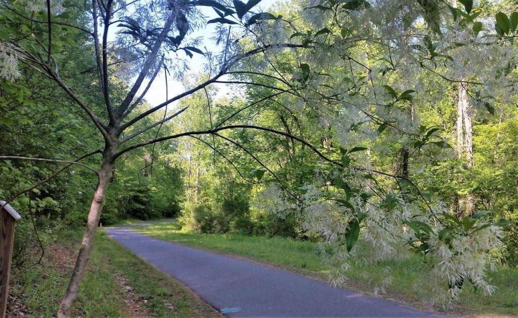
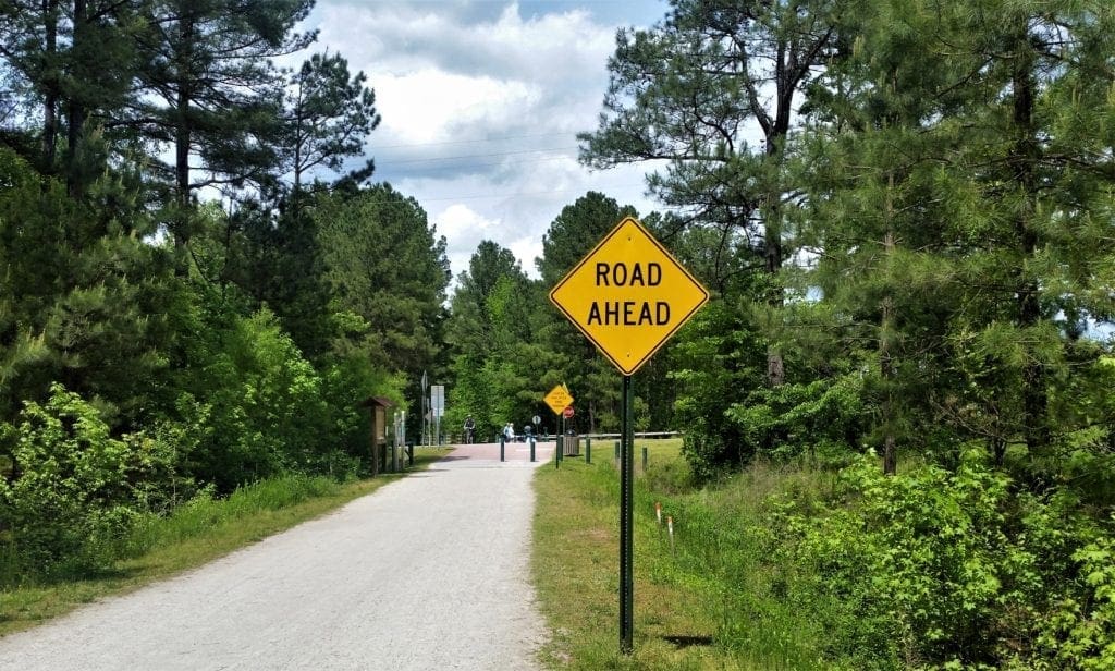
We have miles and miles of local greenways available near where I live in North Carolina.
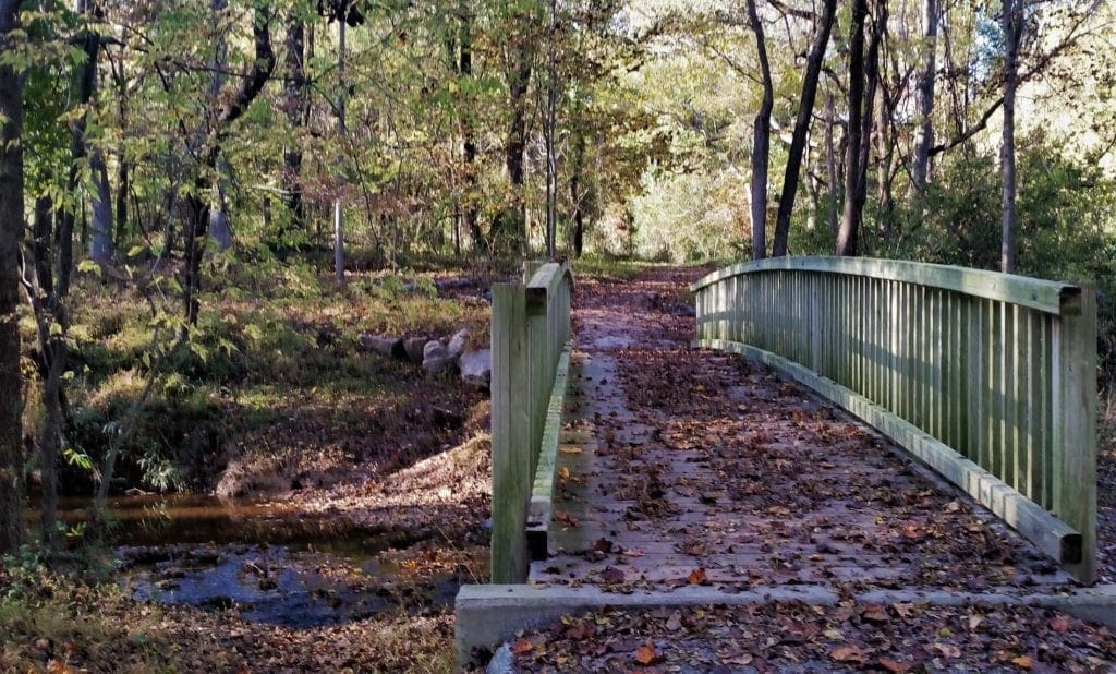
Greenways are a great off-road resource for healthy outdoor family activities like bike rides, hikes and walks.
This is especially important these days, when most State Parks and National Parks have been closed or partially closed since some recent devastating hurricanes, flooding, and ice storms – and we don’t know when we’ll be allowed to fully use them again.
When schools have been closed for whatever reason, and children have been home for weeks, they need someplace to play outside!
Fortunately, if you choose to leave your yard for outdoor activities, our greenways locally and across the State usually remain open for use.
If you don’t live right next to one or haven’t explored the greenways yet, it can be hard to figure out where to go.
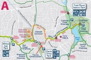
Best Local Greenways
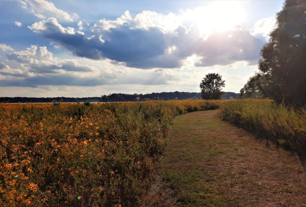
Black Creek Greenway, White Oak Creek Greenway, and the American Tobacco Trail are some of the longest and most used greenways in the Cary/Apex area.
The greenways also connect through some of the most popular local parks!
Some of my posts contain affiliate links. If you make a purchase through an affiliate link, I will receive a small payment at no additional cost to you. I do not get paid for recommendations, all opinions on this site are my own. See full Disclosure page here.
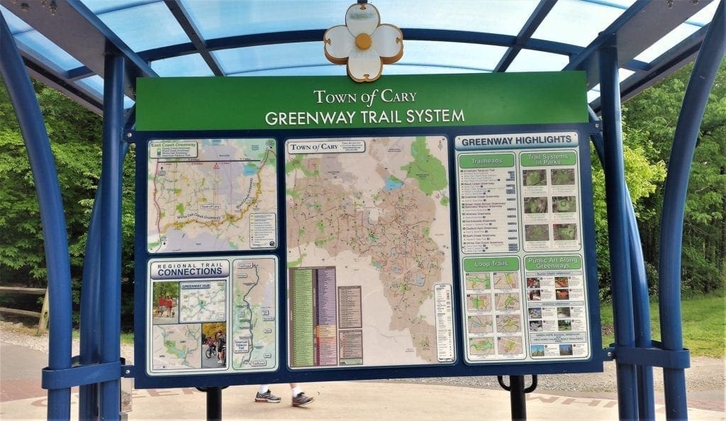
The town of Cary, NC, maintains 70 miles of greenways. It’s estimated that about one million people use the Cary greenway system each year.
With some State and National Parks still off limits, this year the greenways will probably see more use than ever!
Keeping that in mind, I recommend visiting the greenways in off-peak hours during workdays and early in the morning on weekends to avoid the biggest crowds.
The Walk-Friendly Community Program
The Walk-Friendly Community (WFC) designation is based on a communities efforts to expand opportunities for walking and improve pedestrian safety.
The Town of Cary supports pedestrian use inside its parks with many miles of natural walking trails and continuing development of local and County-wide greenway systems.
WFC designated Cary as a National Walk-Friendly Community at Silver Level status on April 25, 2017.
Learn more here about the Walk-Friendly Community program and Cary’s involvement.
What is a Greenway?
Greenways are an environmental, economic, and outdoor recreational resource for everyone to enjoy.
These linear parcels of land are generally located in floodplain areas and along wooded stream corridors in spaces that are unsuitable for development.
Cary’s greenway trails preserve and provide access to pristine wildlife areas that otherwise would have been lost.
Since 1980, the Town of Cary has built multiple greenways that bring open spaces within easy walking distance of our homes.
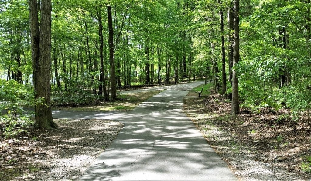
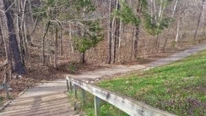
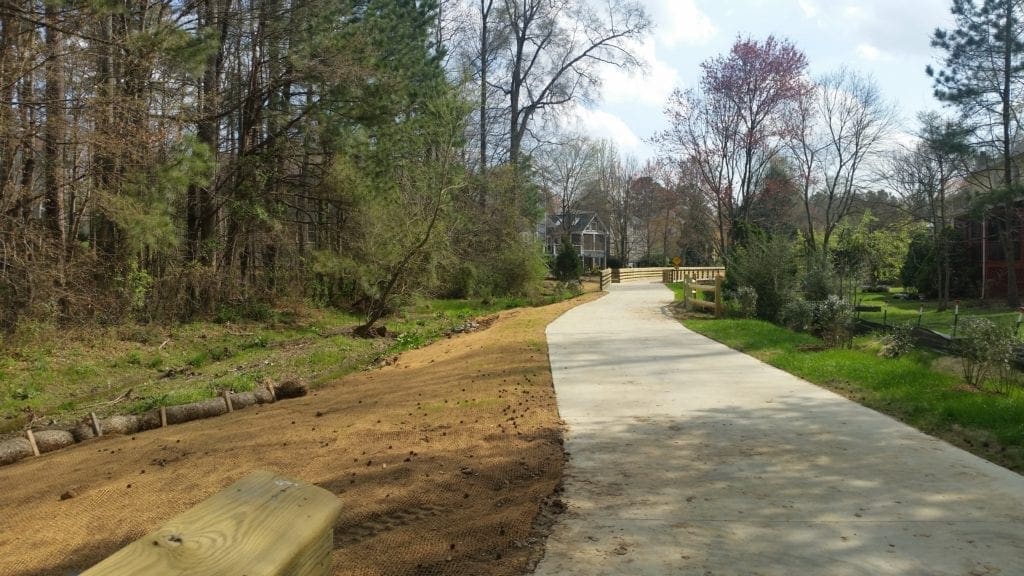
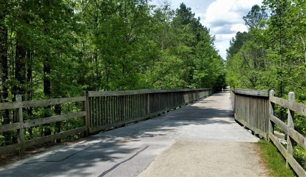
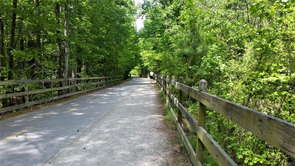
Cary’s greenways are usually 8-10 feet wide and paved with concrete, asphalt or gravel suitable for walking, running, or biking.
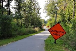
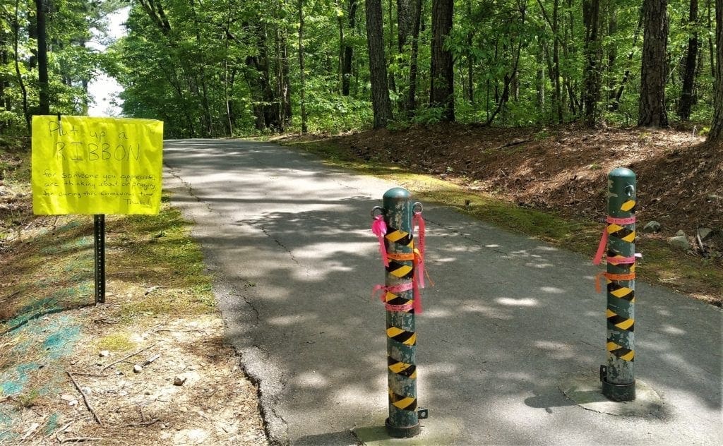
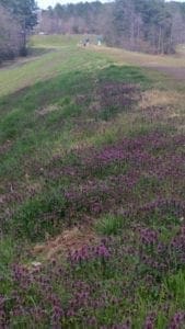
IMPORTANT UPDATE: The Crabtree Creek Sewer Rehabilitation project, affecting hiking routes in Lake Crabtree County Park and Umstead State Park , is still affecting trails.
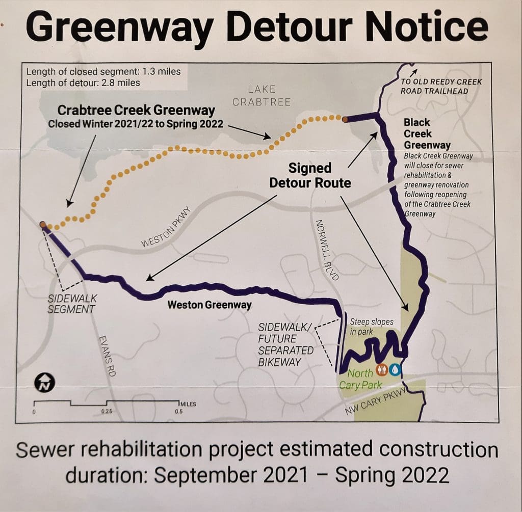
Though Spring 2022 has come and gone, if you’ve tried to hike these trails – especially the Lake Trail! – like I have, you know construction is still affecting these routes.
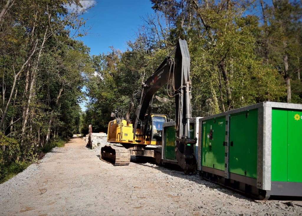
I went out again recently to see if I could hike all the way around the lake on the Lake Trail again, in spite of the continuing construction.
Good news! As of this writing, the trail is passable all the way around the lake, from the Old Reedy Creek Trailhead, along the White Oak Greenway, and along the blue-blazed Lake Trail through the woods back to the trailhead parking.
That said, there are portion of the Lake Trail on the Black Creek Greenway side that are still closed off.
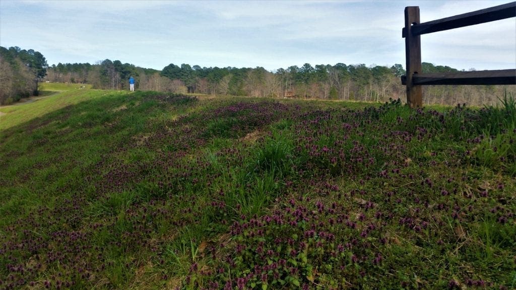
But the best news is… the wildflowers will be back soon! Yay!! 🙂
All the above said, detour and construction notice signs are still posted.
So you can hike, but be aware your hike length and trail access points may still be impacted due to possible detours.
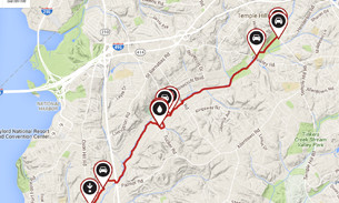
Black Creek Greenway to the American Tobacco Trail
The Black Creek Greenway and the White Oak Creek Greenway are two of the area’s most important regional greenways.
These two trails cover a distance of more than 15 miles and connect to the American Tobacco Trail, Bond Park, Lake Crabtree County Park, Umstead State Park, and more local greenways and parks along the way.
This trail section within Cary was recently made part of the East Coast Greenway, which will eventually go all the way from Maine to Florida.
NOTE: At the time of this writing, restrooms are not available for use at some parks and trailheads due to government Social Distancing mandate. Please check individual greenway and park websites for up to date info.
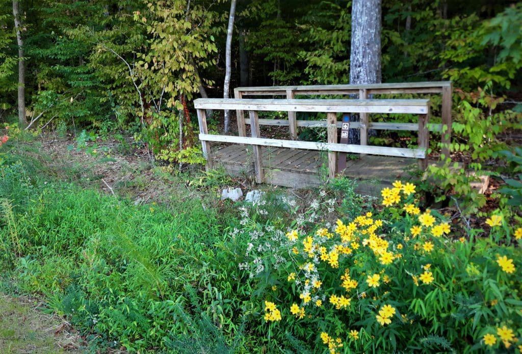
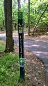
Black Creek Greenway
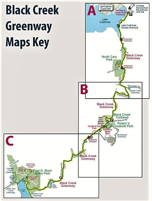
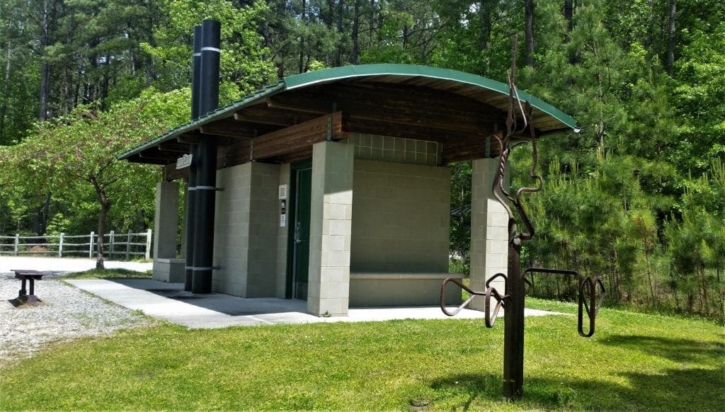
The Black Creek Greenway officially begins at the Old Reedy Creek Rd. trailhead where there are bathrooms and more than 80 parking spaces are available.
Mostly flat with a few short and steep hills, the greenway travels north to south, quietly passing by neighborhoods, schools and shopping areas.
The official South end of the Black Creek Greenway is at the trail hub in Bond Park.
White Oak Creek Greenway
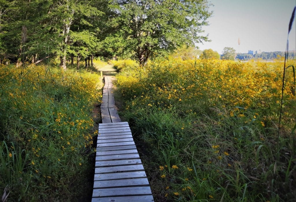
The White Oak Creek Greenway, also mostly flat, passes through more rural areas of Cary and Apex, with lots of boardwalks crossing over marshes and wetlands.
The greenway starts in Bond park, and at the South end, it connects to a beautiful unpaved portion of the very popular American Tobacco Trail.
The East Coast Greenway
Together, these two Cary greenways make up a portion of the longest complete metro stretch of the East Coast Greenway – plus provide connections to travel from one side of Wake County to the other (and beyond!).
The current main ECG route passes through Cary, Durham and Raleigh on greenway trails, then touches the Sandhills and enters Fayetteville.
It runs from there across the coastal plain along the Cape Fear River and through the port city of Wilmington.
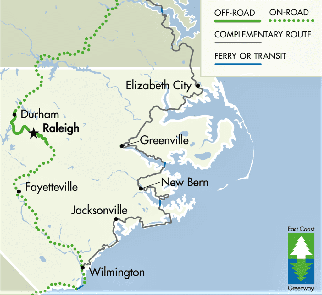
In addition to this main route, the Historic Coastal Route extends south from Virginia on the Dismal Swamp Canal Trail and then follows the North Carolina coast more closely, linking Greenville and Jacksonville before heading into Wilmington to join the spine route.
The Black Creek Greenway
The Black Green Greenway, at 7.1 miles, is Cary’s longest greenway.
Stretching from Old Reedy Creek Road in northern Cary and emptying into Bond Park in central Cary, Black Creek winds alongside shopping centers, restaurants, schools, subdivisions and employers.
Black Creek Greenway is one of the town’s most popular greenways due to its length and connection to other important recreational and open space areas.
The greenway extends from Lake Crabtree in the north, across town to the greenway hub at Bond Park.
Greenway Overview
Length: 7.1 Miles
Trail Width/Surface: 10 foot wide asphalt
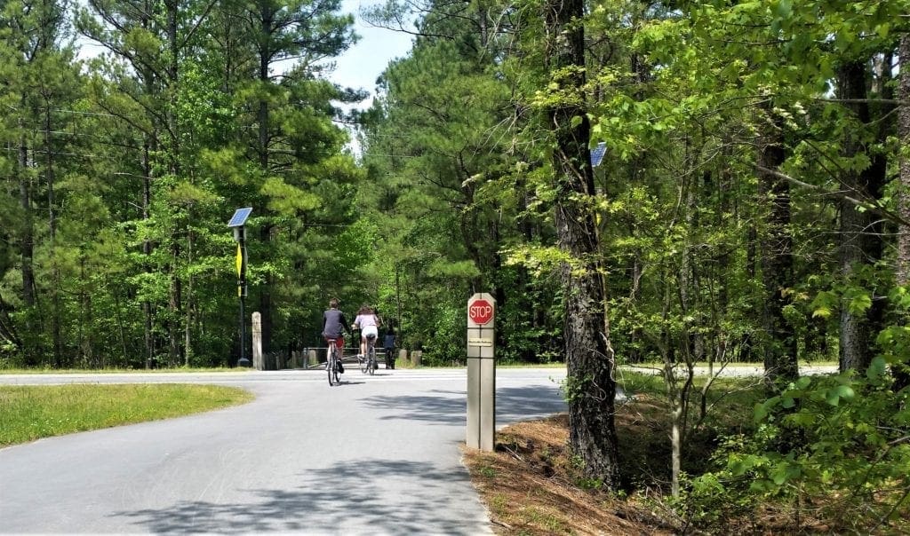
Used For: Walking, running, bicycling, walking leashed dogs, pushing strollers and wheelchairs
Restrooms: North Cary Park, Godbold Park, Fred G. Bond Metro Park, & Old Reedy Creek Road Trailhead
Benches: Yes
Along the Way
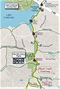
Old Reedy Creek Trailhead: Located at the northernmost end of Black Creek Greenway with parking for 82 cars, a restroom, water, and bike repair station.
North Cary Park Trailhead: Leave cars at the parking lot and travel the 0.4 mile trail through the park to Black Creek Greenway.
Black Creek Trailhead: This is a parking lot for trail users on the northern side of Maynard Road across from Godbold Park.
Goldbold Park Trailhead: Use parking lot at the park and enter the Black Creek Greenway between Sk8-Cary and the Dog Park.
Fred G. Bond Metro Park Trailhead: Park at Bond Park Boathouse parking lot or at Bond Park Community Center parking lot, short walk from either to the trailhead kiosk in the Bond Park Spillway.
Directions:
The northern end of the trail can be accessed at the Old Reedy Creek Road trailhead. Walk south from the trailhead kiosk on the trail beside Lake Crabtree.
At the 0.5 mile point there is a shelter overlooking the lake.
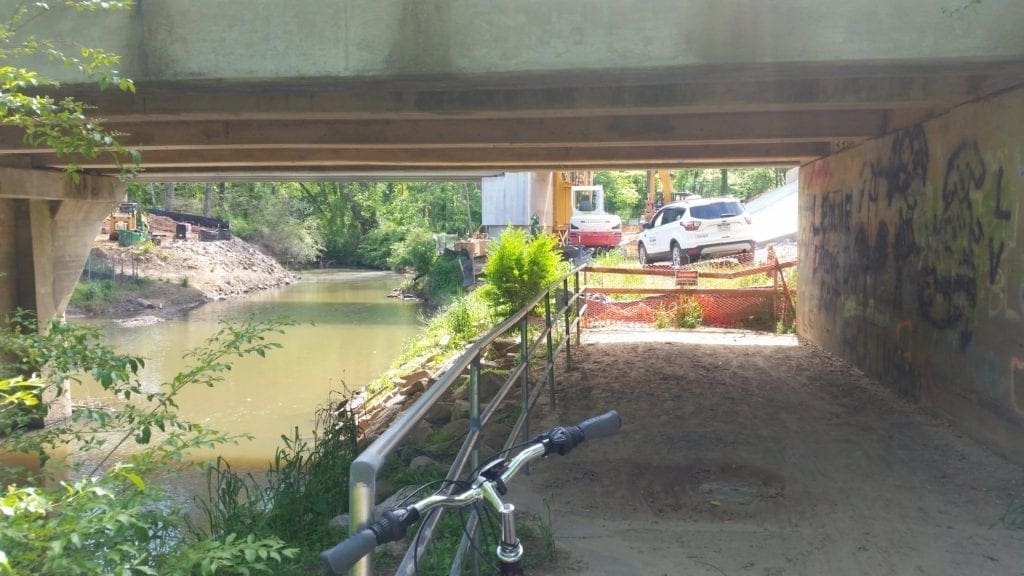
From there, it’s another 0.3 miles to the pedestrian underpass at Weston Parkway.
Travel on for 0.7 miles to the entrance to North Cary Park following the creek all the way. (Access points along the way include Weston Parkway, Tynemouth Drive, Linton Banks Place, and Midenhall Way.)
Going south from the North Cary Park cross under the North Cary Parkway. (There are entrances at Livingstone Drive and Homestead Drive.)
It’s 0.7 miles from North Cary Park to the Reedy Creek Greenway which heads out to the east.
Go another 0.5 miles to West Dynasty Drive and follow the sidewalk for 0.3 miles – up a REALLY steep hill.
Follow West Dynasty Drive down the hill and cross the street at the blinky crossing light and follow the Black Creek Greenway for a mile to the Black Creek Trailhead at NW Maynard Road (there’s a parking lot here).
West Cary Middle School is just to the west of the trail at that point.
Cross NW Maynard Road at the pedestrian crossing where there are flashing lights to notify drivers to slow down for pedestrians and bicyclists.
Just across the road is Robert V. Godbold Park.
Travel on between the Cary Dog Park and Sk8-Cary where the trail joins the Northwoods Greenway and then heads off towards the southwest.
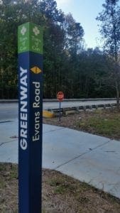
There is a pedestrian underpass at Evans Road.
At Chapel Hill Road, cross at the stop lights and continue on along NW Maynard Road using the new pedestrian overpass to cross the railroad tracks.
It is 0.8 miles from the Black Creek Trailhead to Carrousel Lane where the trail leaves NW Maynard Road.
At Carrousel Lane the trail travels away from the road past neighborhoods and following a stream for 0.9 miles.
When it reaches NW Maynard Road again turn south and follow along on the east side for 0.2 miles and then cross at the stop lights and go for 0.2 miles more on the west side of the road.
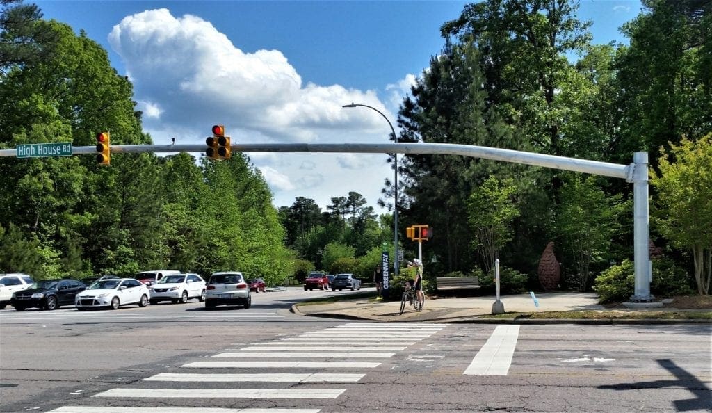
At High House Road cross at the stop lights and follow the trail off-road to the southwest.
The trail goes past Battery Lake and at the 0.6 mile mark reaches Castalia Drive. Cross the road there and the trail follows on further to the point where it enters Bond Park.
From Castalia Drive it is 0.5 miles until Black Creek Greenway joins up with Oxxford Hunt Greenway and the Bond Lake Trail.
As you travel north for the last 0.3 miles, passing the Bond Lake Boat House on the west, the trail terminates at the Trailhead Hub Kiosk where it meets the White Oak Greenway.
Protect Your Joints on Paved Trails
Paved greenways are a great resource for bikers for sure, and a good surface for speed running – because you don’t have to lift your feet very much.
They’re also a do-able alternative for hikers, walkers and trail runners when natural trails aren’t available.
But be aware that paved surfaces have a different effect on your body than softer dirt trails.
“Concrete is the worst surface you can run on,” for joint wear and tear, according to Joseph Herrera, DO, assistant professor of rehabilitation at the Icahn School of Medicine at Mount Sinai in New York City.
“In general, the softer the surface, the more joint-friendly it is,” says Dr. Herrera.
Softer surfaces tend to absorb some of the impact and be a little easier on the joints.
It follows that walking on natural surface trails (dirt, bark dust, pea gravel) is easier on the joints than walking or running on paved paths of asphalt or concrete.
Uneven dirt or gravel trails also give you more balance exercise and work more of your core muscles naturally during your walk or run, so it’s a better workout.
These days, the longer natural trails inside State and National Parks are unavailable to us, and private and neighborhood gyms have also been closed by government mandate – so unless you have a treadmill at home, you can’t use that either.
Because of these restrictions, our only choice right now for longer walking and running workouts may be streets, sidewalks and greenways that are paved with concrete and asphalt.
These surfaces and can be very hard on your knees, hips, and ankles. One way to limit the damage to your joints is to choose the right footwear.
Choose The Right Shoes or Boots
While you may not be able to control which kind of surface you run or walk on right now, you can control what you put on your feet.
Finding the right shoes might take some trial and error – especially if you need to order them online without going to a specialty store in person and getting fit for shoes that match your specific foot type.
But don’t give up – order what you need online and try it on. Return policies are pretty forgiving now, and the return process is also a lot more streamlined than it used to be.
As time goes on, you lose cushion and ability of a shoe, and it’s recommended that you replace your footgear every 300-400 miles.
If you make a mistake in your footwear choice, or have sore feet or other injuries from working out on hard surfaces, you can read here about how to prevent and treat injuries to your feet.
For more info on shoe and boot choices, take a look at my Gear page, or recommended Dayhike Gear.
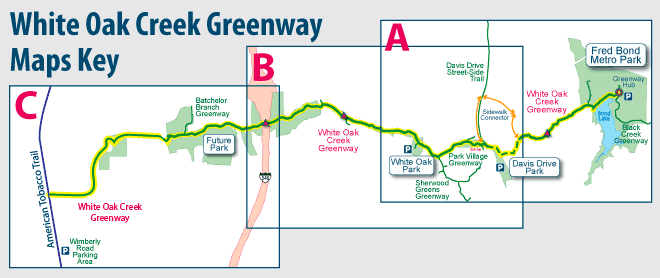
White Oak Creek Greenway
Starting in Bond Park, the White Oak Creek Greenway trail segments extend West from Bond Park to Green Level Church Road, and to the American Tobacco Trail.
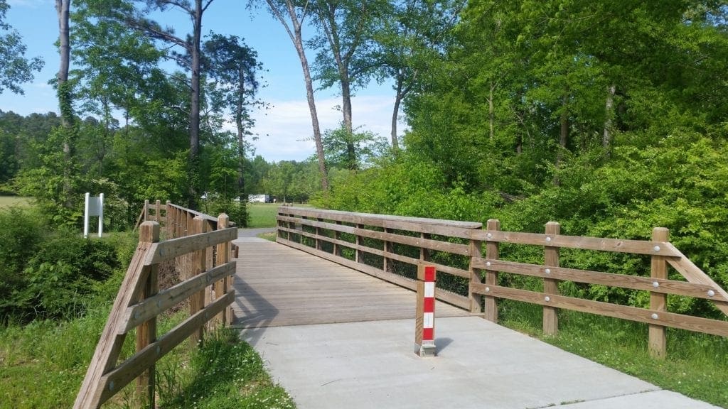
A pivotal section of the White Oak Creek Greenway (made up of nearly 1.5 miles of winding boardwalk and a half-mile of pavement and a tunnel) opened recently.
The trail now stretches approximately 7.5 miles in total from east to west.
Greenway Overview
Length: 7.5 miles
Trail Width/Surface: 10-foot wide asphalt
Used For: Walking, running bicycling, walking leashed dogs, pushing strollers and wheelchairs
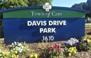
Restrooms: Bond Park, Davis Drive Park, White Oak Park
Benches: Yes
Connects To: Bond Park, Black Creek Greenway, Cary YMCA, Davis Drive Park, Davis Drive Street-Side Trail, Davis Drive Schools, Park Village Greenway, White Oak Park, Batchelor Branch Greenway, American Tobacco Trail
Along the Way
Bond Park Greenway Trailhead: Park at Bond Park Boathouse Parking Lot or at Bond Park Community Center Parking Lot, short walk to trailhead kiosk.
Crabtree Creek Greenway Trailhead: Park at Bond Park Ropes Course parking lot, walk along Crabtree Creek Greenway to access White Oak Creek Greenway.
Davis Drive Park: From the parking lot, cross Davis Drive to access White Oak Creek Greenway on west side of road, just south of Davis Drive Middle School.
White Oak Park: From the parking lot, short walk to access White Oak Creek Greenway.
White Oak Creek Trailhead: The newest trailhead is located at 8232 Green Level Church Road near Roberts Road at the Green Level High School. A 22-space parking lot now provides direct access via a short walk along Green Level Church Road on a street-side trail that crosses over a bridge crossing White Oak Creek.
Directions:
On the eastern end, the trail can be accessed from the parking lot at Bond Community Center or from the Bond Boathouse parking lot.
A short walk leads to the Greenway Hub kiosk where the trail officially starts.
From here the the greenway goes west below the dam on Bond Lake for 0.3 miles and then turns right into the woods.
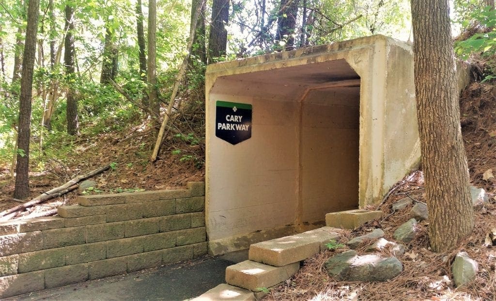
After about 300 feet the Crabtree Creek Greenway joins the trail on the right. White Oak Creek Greenway follows a small stream for 0.6 miles to the point where it goes under Cary Parkway.
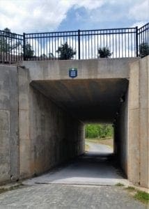
After another 0.3 miles, the trail crosses the road and becomes a raised boardwalk and ends in a tunnel that goes under the railroad tracks.
You emerge into Davis Drive Park. This newest section is about 1.5 miles long.
Cross Davis Drive at the crosswalk at the park’s entrance and turn right to go along Davis Drive to just before the Davis Drive Schools.
You’ll see a greenway entrance to the left off the sidewalk.
At the 0.6 mile point the trail is joined by Park Village Greenway.
After 0.2 miles more you’ll reach the 12-acre White Oak Park where there are amenities.
From the White Oak Park the trail goes west, crossing the busy two-lane Jenks Carpenter Road where there is a rectangular rapid flashing beacon to enhance safety.
The trail goes along the creek’s edge and within neighborhoods for 0.8 miles.
At NC Highway 55 there is a pedestrian underpass.
From there, the trail continues to follow along a stream with considerable wetland areas.
In 0.8 miles you’ll reach the pedestrian underpass at I-540, the Triangle Expressway.
After the pedestrian underpass at I-540, the trail winds along close to a major wetland area.
At the 0.9 mile mark the Bachelor Branch Greenway joins the trail from the north.
Presently the trails crosses wetlands with 1700 feet of boardwalks.
The trail threads through a pedestrian underpass at Green Level Church Rd. and continues through Apex all the way to the American Tobacco Trail.
This segment of trail consists of 1.5 miles of boardwalk and .5 miles of concrete and asphalt.
Why The Surface You’re on Matters
It’s common knowledge that running has an impact on the musculo-skeletal system. Hiking and walking have similar affects.
Body mass, form, and running/walking surface all play a role in just how much impact there actually is.
-
-
- With each step (roughly 180 x per minute), the athlete’s body ‘collides’ with the ground with a force that is 4-5 times their body weight.
- The degree of compliance, or ‘give,’ that a surface has, will determine the speed of energy transfer between the foot and the ground.
- The athlete’s legs must adjust stiffness according to the compliance of the terrain; this is necessary to yield the lowest cost of oxygen demand.
-
In other words, the body needs a happy medium in surface flexibility to be most efficient.
Biomechanical Demands of Different Surfaces
One of the beauties of walking, hiking and running for fitness is that you can use just about any surface, anywhere in the world.
As long as you have feet, you can train wherever you find yourself.
But not all surfaces are created equal because of the different impacts involved and the stresses which make their way up to your joints.
Let’s break down the pros and cons of some different surfaces:
Road
Concrete has the most impact of any surface, due to its density.
Moreover, a bone and joint analysis study of sheep walking on concrete over two years found thickened subchondral bone plates and bone cortex, resulting in less elastic bone and poor shock absorption (Feehery, 1986).
In clinical terms, this is classic, premature osteoarthritis, or “wear and tear” arthritis.
Asphalt is the mixture of gravel, tar and crushed rock that makes up most road surfaces. It isn’t the softest surface around, but it’s difficult to avoid and it’s better than concrete.
Luckily for us, most area greenways are paved with asphalt rather than concrete.
For the sake of your joints, when possible, it’s better to hit the pavement rather than the sidewalk in order to reduce impact.
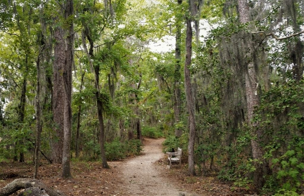
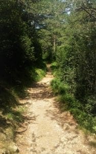
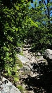
Natural Woodland Trail
Trail running or hiking is a great challenge, offering both variety in terrain and scenery to break up the monotony of miles.
The uneven nature of a forest trail requires the athlete to adapt quickly to rocks, roots, water hazards, unexpected creatures (!), and fallen trees or branches.
The earth surface itself is low-impact. However, bad weather can make for dangerous conditions.
Be cautious in late autumn or after a winter storm, where leaves and snow may conceal hidden holes and rocks/roots.
Even so, for beauty, length of trail, and effect on the body, soft woodland trails are a gift to hikers and runners.
In some forests they even go on for multiple days’ worth of miles!
Treadmill
The treadmill is most always the beginner’s first choice for safe, controlled walking or running.
One study found that the plantar forces on the foot, a measure of injury-risk, were lowest with treadmill running.
Treadmill belts can vary greatly, but they generally provide a great surface for lower-impact exercise and injury rehabilitation.

The smooth surface is easy on the legs, and hitting a desired pace is simply a matter of adjusting the machine – as long as you can keep up!
Also, you don’t have to worry about wind and bad weather. Or bears 🙂
On the down side, running or walking in the same spot isn’t very exciting, and without the benefit of a natural breeze, treadmillers tend to sweat a lot.
And you don’t get the benefits of being outdoors in the sunshine and fresh air!
That said, if you can treadmill in a gym, they usually have banks of TVs you can watch while using cardio machines, or you could even stream a movie for longer workouts.
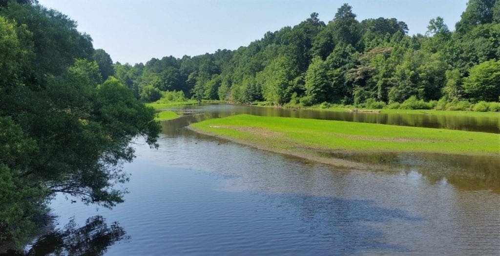
American Tobacco Trail
The American Tobacco Trail totals 23 miles long through Durham, Wake and Chatham counties, with nearly five miles in Cary.
The rail-trail in this section passes through woodland, with occasional views of houses, farm fields, ponds and creeks.
Since the whole trail is built on an old railroad bed, though it’s unpaved (and easier on your joints), the surface is very flat and smooth.
The American Tobacco Trail is also home to Cary’s only marathon, held annually in March.
This trail stretches from the western edge of Apex passing through Wake, Chatham and Durham Counties on its way to Downtown Durham.
The Town of Cary, with assistance from the State of North Carolina Adopt-A-Trail and the FHWA SAFETEA-LU programs, rebuilt and now maintains the 4.7 mile Chatham County section.
Road crossings throughout the Chatham County section are all at grade level except at Yates Store Road where the ATT crosses under the roadway.
Greenway Overview
Length: The Cary/Chatham County section is 4.7 miles of a total of 23 miles overall extending both north and south from Chatham County.
Trail Width/Surface:
-
- The Wake County trail has a 12-foot wide granite screenings surface.
- The Chatham County trail consists of 10-foot wide asphalt pavement with an adjacent 6-foot wide granite screenings.
- The Durham County section has the same surface as Chatham County up to Scott King Road, where it changes to 10-foot wide asphalt with two foot wide granite screenings shoulders for the rest of the trail.
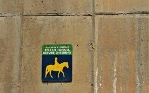
Used For: Horse-back riding, walking, running, bicycling, walking leashed dogs, skating, roller blading, pushing strollers and wheelchairs.
Special Considerations
-
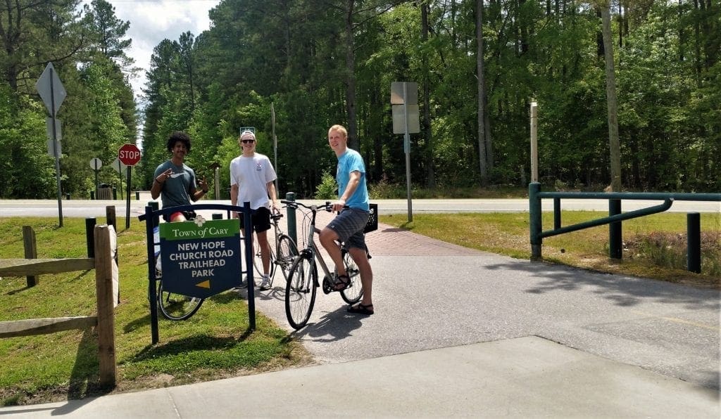
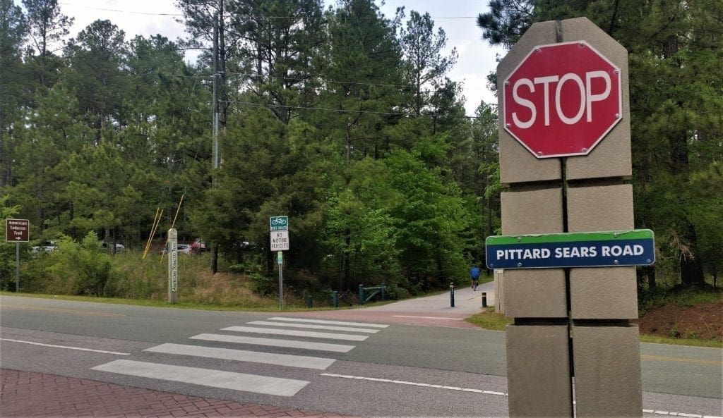
- Water fountains are located at the New Hope Church Road Trailhead and the Pittard Sears Road Trailhead along the Chatham County section of the ATT.
- Water is also available at the White Oak Church Road Trailhead in Wake County and at Herndon Park in Durham.
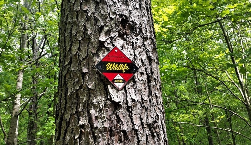
- Hunting is allowed, in season, on U.S. Army Corps of Engineers Jordan Lake Game Lands managed by the NC Wildlife Resources Commission. These areas are posted and have 4-foot high fencing which separates trail users from hunting areas. Periodic openings in the fence allow hunters to cross the trail.
- Horses are allowed in the Chatham and Wake County sections of the American Tobacco Trail. Be aware that horses need a wide berth and that fast-moving bicycles may startle animals and pedestrians.
Restrooms:
-
- Restrooms are at the trailhead at White Oak Church Road and at the southern trail entrance at New Hill-Olive Chapel Road.
- There are public restrooms in Chatham County at the New Hope Church Road Trailhead Park.
- The City of Durham Herndon Park at Scott King Road in Durham County has restrooms, also.
Benches: Yes
Directions
The trail can be accessed from a variety of locations if you’re on foot or bicycle, but on-street parking is prohibited by law along some busy cross streets and there are no sidewalks available.
One of the easiest ways to get there, on foot or a bike, is to to start at some point along the White Oak Creek greenway and just keep going until it bumps into the ATT.
But you may want to tackle the whole ATT, not just the 4.7 mile Cary-maintained section, and for that you’ll probably want to park somewhere along the ATT and start from there.
For the Cary/Chatham County section, parking lots are available (starting from the South end to the North end) at White Oak Church Road, New Hope Church Road and Pittard Sears Road.
Benefits of Walking on Uneven Ground
As humans, we’ve evolved to have certain patterns of physical activity that are necessary for health.
As a species, we’re built for long-distance walking, and it’s estimated that our hunter/gatherer ancestors covered daily distances in the range of 3.5–10 miles.
While walking may be our most natural form of exercise, ancestral humans learned to do this on rough surfaces—far from the easy smoothness of pavements and man-made flooring.
In theory, our species’ large brain evolved partly to address the various challenges of bipedal upright walking on naturally uneven ground.
Natural Movement for Humans
Surfaces like concrete, asphalt and treadmills present us with essentially new ways to move as a species.
A continual flat surface creates repetitive motions in muscles and joints, so movement patterns are locked in one direction and we lose the ability to move in a wider range of motion.
Walking on uneven ground continually shifts our center of gravity, so we have to work harder to continually come back to balance in the midline, and this has a deeper engagement of our whole muscle and skeletal systems.
For people with a healthy musculo-skeletal system, walking on uneven terrain (as opposed to a smooth surface) ultimately results in more muscle strength and skeletal support.
Sensory Awareness Fights Aging
When you’re walking in the wild, you need to be aware of where to place the next footstep, and make split-second decisions to take a step that you may have to change at the last moment if the surface seems risky.
If you’ve ever followed a muddy trail or used stepping stones to cross a river, you’ll remember the focus you needed to do it without falling.
This connection between the eye and foot changes the mind–body relationship as we walk on rougher ground.
Compensating for irregularities on the ground involves many bits of information coming from the limbs.
All aspects of movement need this sensory–motor integration.
As we age, we become clumsier with slower postural support responses, which tend to make us wary even when stepping on flat ground.
Regular walking or hiking over rough terrain will help slow age-related loss of sensory–motor integration.
Conditions (aside from normal aging) associated with proprioceptive impairment like stroke, Parkinson’s disease, and injury to ligaments, joint capsules and muscles will also be improved by movement over rougher terrain.
Uneven Terrain Burns More Calories
When the ground beneath our feet is uneven, the increased shifting of our center of gravity means more muscle effort and tissue movement is required to keep our balance, footing and forward motion.
A recent study from the University of Michigan examined the physical changes of walking on uneven terrain compared with smooth surfaces.
The study tested 11 healthy men and women in their 20s, using a special treadmill that mimicked moving over trails, grass and uneven pavement.
The research found that walking on a surface that varied by only 1 inch from a flat smooth one resulted in an extra 28% increase in calorie-burning than normal – the equivalent of walking up a steady 2% incline.
Because step length was also shorter, the participants were getting a harder workout than they would have had over the same distance on a smooth surface.
What’s Rough Enough?
One woman’s epic hike may be equivalent to another’s walk to the end of the road. It all depends on your current state of health and fitness.
If you’re pain-free and mobile, exploring some local trails and hikes could hugely increase your quality of life.
If you have physical limitations that make you nervous about going off-track, start small on a grass trail or a natural surface greenway trail to get a feel for it.
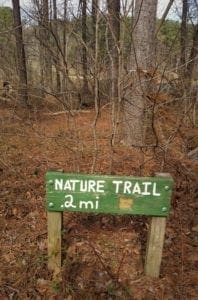
Longer local natural trails are available at Umstead State Park, and there are some short natural trails at Lake Pine off of the paved lake loop trail that are open for use.
One of these short natural surface trails might be a good place to start if you’re a beginner.
Our paved greenways are a wonderful resource, especially for bikers.
But for your best overall health, it’s recommended to alternate using trails with uneven surfaces (when available) and smooth-surface trails for exercise on foot.
Other Local Greenways
Reedy Creek Greenway
The Reedy Creek Greenway is a 5 mile paved trail that suitable for running, walking or biking.
It connects Umstead State Park with the NC Museum of Art, passing alongside NC State University horse farms, Schenck Forest , and the Prairie Ridge EcoStation along the way, and ultimately crossing over I440 on the pedestrian bridge from NCMA Park to the Meredith College campus.
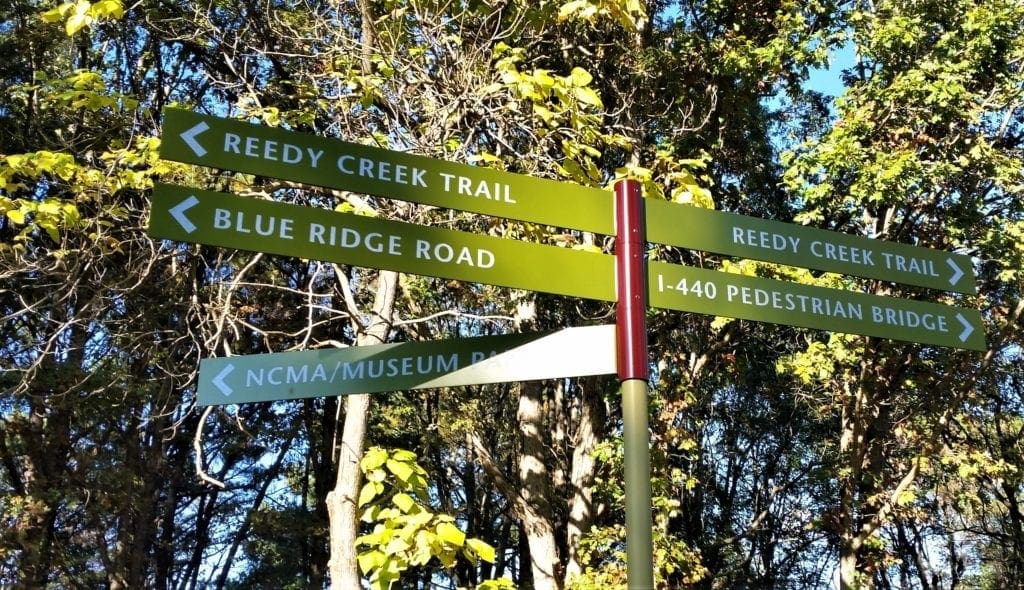
You can follow the greenway on foot or by bike in the other direction through Umstead State Park via the Reedy Creek Trail and cross over Interstate 40 to access either Lake Crabtree County park or connect with the Black Creek Greenway,
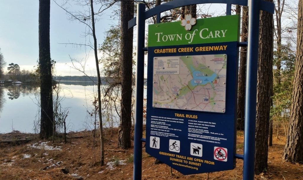
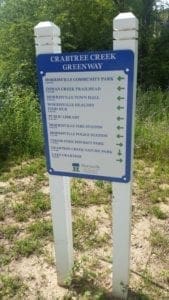
Crabtree Creek Greenway
There are currently two separate segments to Cary’s Crabtree Creek greenway:
-
- The 1.7 mile Crabtree Lake segment that runs along the south shore of Lake Crabtree from Black Creek Greenway to Evans Road and the 0.3 mile Bond Park segment.
- And Morrisville’s segment of Crabtree Creek Greenway currently extending 1.4 miles from the Crabtree Lake segment west to Cedar Fork District Park.
Crabtree Lake Segment
The Crabtree Lake segment starts at the Black Creek Greenway approximately 0.5 miles south of the Black Creek Greenway’s northern terminus. Heading west, the trail immediately crosses an arm of the lake on a 730-foot concrete boardwalk.
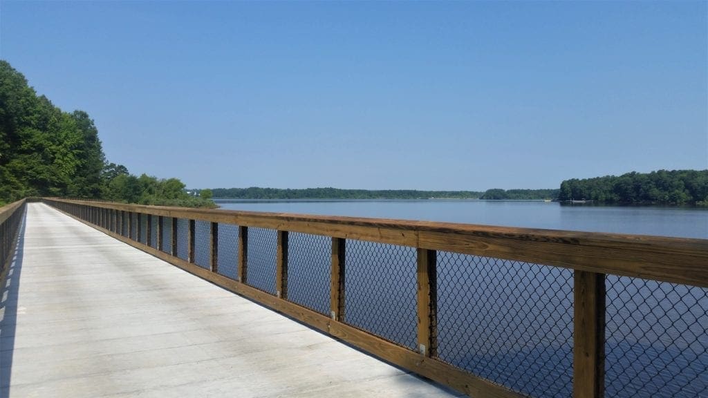
From there, the trail runs close to the lake for about 0.3 miles on a level bench below steep, wooded slopes with sweeping views north and west across the lake to Lake Crabtree County Park.
The trail then enters the woods and continues the next 0.9 miles to Evans Road, mostly in woodland, with intermittent views of the lake and wetlands.
The trail emerges from the woods at Evans Road and turns to parallel Evans for 0.4 miles, with views into forested wetlands, crossing Crabtree Creek on a 105-foot bridge.
Shortly after crossing the creek, the trail divides.
Turn left towards a mid-block signalized crossing of Evans Road to continue west on Morrisville’s trail.
Or, proceed straight to the current terminus of the trail at Pharma Drive in Southport Business Park.
Morrisville Segment
Upon completion of a railroad underpass (expected in 2020) Morrisville’s segment of Crabtree Creek Greenway will connect to their Hatcher Creek Greenway to provide a continuous 4.4 miles of trail from Black Creek Greenway west to Davis Drive.
The Town’s greenway master plan calls for the Bond Park segment to connect eventually via the existing pedestrian underpass under Cary Parkway and from there through Morrisville to connect to Morrisville’s segment at the railroad underpass.
GREENWAY OVERVIEW
Length: 1.7 miles
Trail Width/Surface: 10-foot wide asphalt
Used For: Walking, running, bicycling, walking leashed dogs, skating, roller blading, pushing strollers, wheelchairs
Restrooms: None along trail. Closest are at Old Reedy Creek Rd trailhead, North Cary Park, and Cedar Fork District Park.
Special Features: Lake views, 730 ft concrete boardwalk across lake
Benches: Yes
Connects To: Black Creek Greenway, Lake Crabtree County Park’s Lake Trail (unpaved footpath)
Directions:
From the East: Enter the trail from the Black Creek Greenway, 0.5 miles south of Old Reedy Creek Road Trailhead (about 250 feet beyond the gazebo) or 0.8 miles north of North Cary Park (about 0.25 miles after passing under the Weston Parkway bridge).
Public parking is at Old Reedy Creek Road Trailhead and North Cary Park.
From the West: There are three entry points from Evans Road:
-
- Via the sidewalk from the south to the trail entrance about 700 feet north of Weston Parkway (about 100 feet beyond Sage Commons Drive);
- Via Evans Road sidewalk from Aviation Parkway to the northern entrances of the trail at Evans Road, and
- From the west via Morrisville’s Crabtree Creek trail segment.
Public Parking is at Cedar Fork District Park.
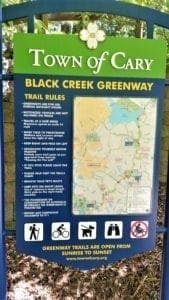
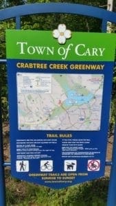
Greenway Rules
-
-
- Greenways are for use during the daylight hours.
- Motorized vehicles are not allowed on trails.
- Bikes yield to pedestrians. Walkers and runners always have the right of way.
- Announce yourself before passing. Politely warn trail users as you approach from behind, “Passing On The Left.”
- If you stop, please step off the trail.
- Remove your pet’s waste.
- Keep pets on short leash. Use 6-foot maximum leash length. Walk pets on the right-hand shoulder.
- The possession or consumption of alcoholic beverages on greenways is prohibited.
- Report any suspicious incidents to 911.
-
I hope you’ve found this post helpful in learning about local outdoor exercise options. Have fun deciding which greenways you’d like to visit! 🙂
If you have a question drop me a note and I’ll reply as soon as I can.
Thanks for stopping by – see you next time! LJ
To Get New Idratherwalk Posts
sent directly to your inbox (how convenient!) Click this Button
If you like this post, please share it!

LJ has spent much of her free time as a single Mom – and now as an empty-nester – hiking in the US and around the world. She shares lessons learned from adventures both local and in exotic locations, and tips on how to be active with asthma, plus travel, gear, and hike planning advice for parents hiking with kids and beginners of all ages. Read more on the About page.