Hiking in Patagonia – The W Trek in Torres del Paine
Most recently updated January 16th, 2025
It’s been more than a year since I returned from hiking in Patagonia, spending a week on the W trek in Torres del Paine National Park.
I wrote a very short “I’m baack!” kind of post right after the trip, but now I’m finally getting around to sharing more details.
Hiking the W Trek in Patagonia
Frankly, this is partly just an excuse to post more amazing Patagonia photos!
Be warned, this is an extremely long post, but it’s jam-packed full of useful information:
Different options for getting to Patagonia,
Torres del Paine hiking info,
What you’ll need to bring for the W Trek, and
A day by day description of my trip.
This is all really good info for you if you’re thinking about a similar trip. Anyway….about the place:
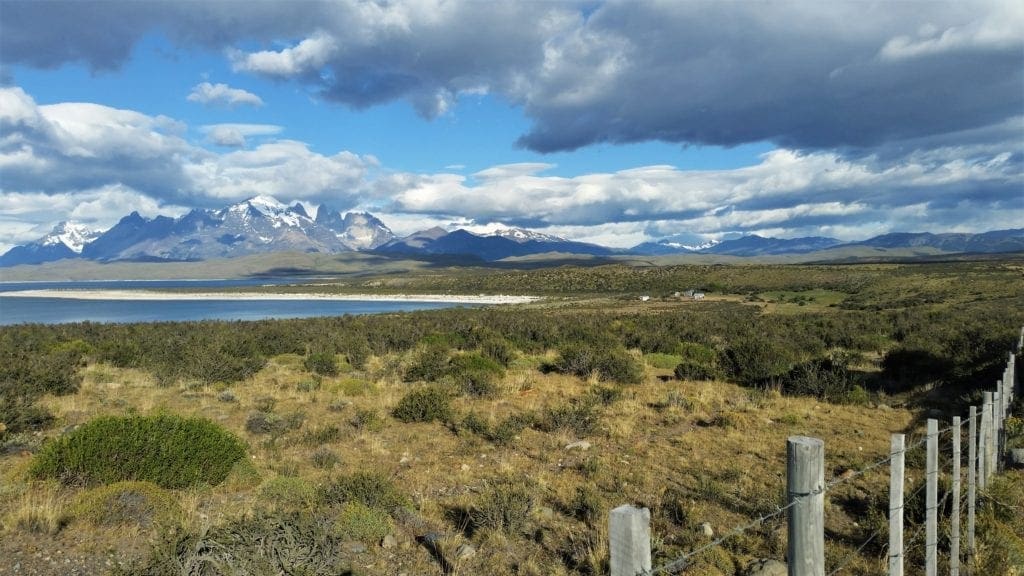
Patagonia, Chile is at the southernmost tip of South America, very close to Antarctica. Torres del Paine National Park is located on the eastern edge of the continent.
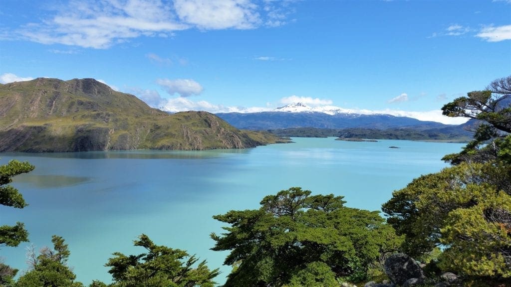
It’s a place of spectacular beauty, with dark jagged snow-topped mountains, turquoise glacier-fed lakes and rivers, and abundant wildlife.
Returning to Puerto Natales from Torres del Paine.
The W Trek, and the whole Patagonia trip, was an unforgettable experience.
Even though I’m a fit experienced hiker, I wasn’t sure if it would be a good trip for me, personally – being in my 50’s, asthmatic, and not a big fan of wilderness camping. But I took a chance, and I’m very glad I did.
With some extra training and planning ahead, I had no issues at all.
In fact, I held up much better than most of the 20-somethings! 🙂
Torres del Paine National Park
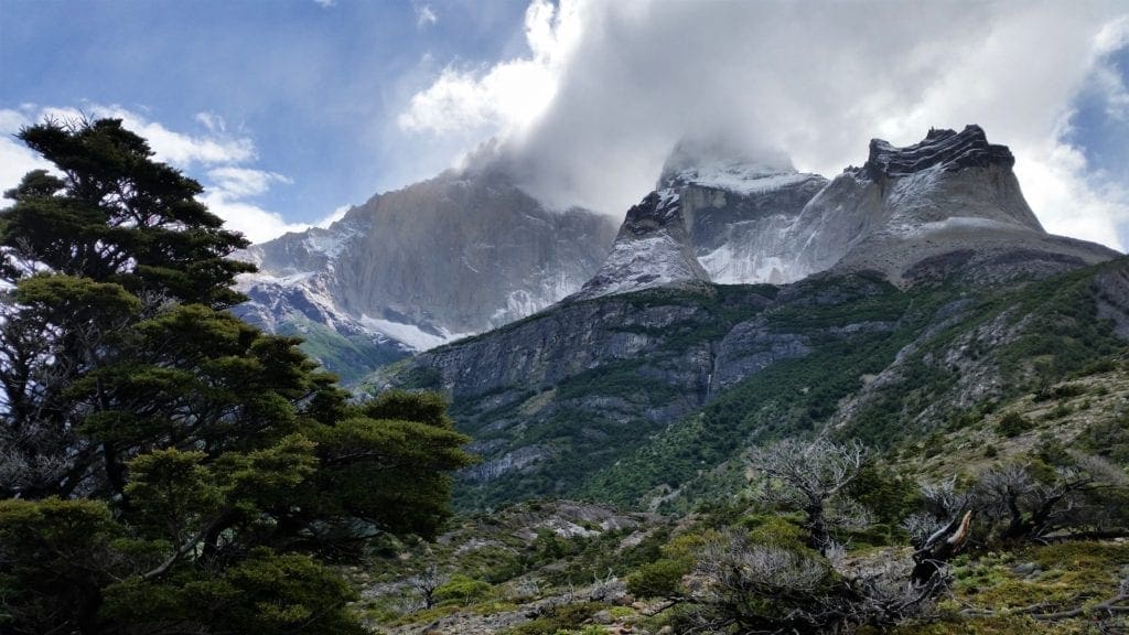
The park is in the southern tiers of the Andes and features mountains, lakes, and glaciers. Torres del Paine is Spanish for “Towers of Paine”.
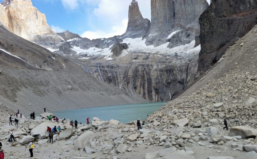
Hikers at the base of the Torres
Three immense gray-blue rock towers (torres) are what give the park it’s name.
Paine means “blue” in the native Tehuelche (Aonikenk) language and is pronounced PIE-nay.
The towers extend up to 2,500 metres (8,200 ft) above sea level, and are joined by the Cuernos del Paine.
Some of my posts contain affiliate links. If you make a purchase through an affiliate link, I will receive a small payment at no additional cost to you. I do not get paid for recommendations, all opinions on this site are my own. See full Disclosure page here.
Torres del Paine National Park is one of the largest and most visited parks in Chile. The park averages around 252,000 visitors a year, of which 54% are foreign tourists from all over the world.
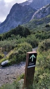
Trail marker in Patagonia
There are established camps/refugios, with dining halls and bathhouses inside the park.
There are also some cabins to rent near the Cuernos camp.
I stayed in a tent at a group campsite each night – this helped keep my costs down.
The W Trek
The W Trek route I took was a 4-day, 62km (38.5 mi), excursion into Torres del Paine NP.
The route is called the W Circuit/Trek because on a map, it creates a “W” (following the red dots, below).
Map of Torres del Paine
The W Trek is normally done in 4-5 days, walked east to west, starting at Refugio Las Torres and ending at Refugio Paine Grande.
It runs up three valleys, creating the W shape that gives it its name.
Each of those valleys contains one of the iconic sights of the park:
Ascencio Valley – in the east takes you all the way to the base of the famous towers. The ascent to their base is a steep 800 meter climb as part of a 6-8 hour day of hiking.
French Valley – the central spur of the W, is dominated by the hanging glacier Francés. This glacier lies ahead of you on your rocky climb into the heart of the valley.
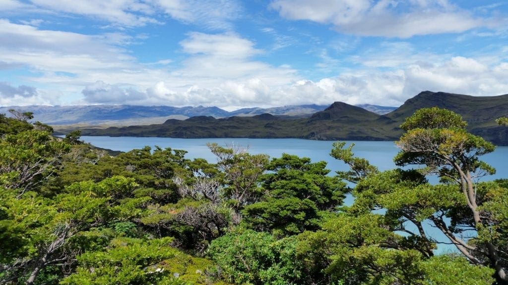
The final leg runs alongside Lago Grey. The lake is dotted with cobalt blue ice floes, up to the face of the enormous glacier that stretches towards the ice cap.
For many hikers, the W trek is a perfect length and gets extra points for its access to some of Torres del Paine’s top attractions.
If you’re looking for more of a challenge inside the park, the Q, the Circuit, or O treks could be just the thing.
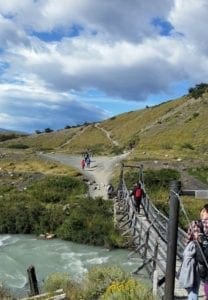
Crossing a bridge on Day 1 of the W Trek
While the W covers 38 to 48-miles (62-76km), the Circuit and the Q are routes with distances of 57-miles (93km) and 68-miles (110km) respectively.
P
These treks are more adventurous and require more experience and preparation than the W Trek.
Instead of figuring all of this out by myself, I went on a trip managed by G Adventures travel company, with local hike hosts in Torres del Paine.
It was a small group, about a dozen adults of all ages and from all over the world.
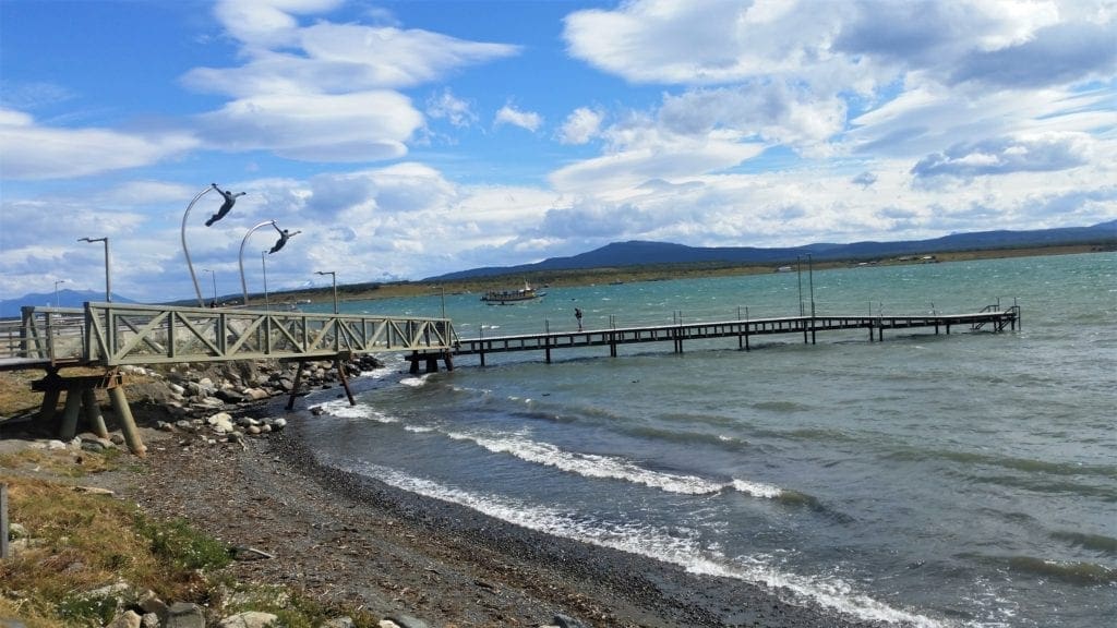
View of the pier into the Puerto Natales harbor
The G Adventures people managed all of the site reservations and fees, transporting and setting up the tents from camp to camp, and food for meals when there was no dining hall.
There’s also good info about discounts and special savings. There are plenty of trips to choose from – one of them could be just perfect for you 🙂
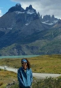
View from the road going to Torres del Paine NP
They also handled lodging and transportation from Puerto Natales, which – though the closest town to Torres del Paine – is still about a 3 hour drive from the park.
For more of my favorite travel deals and resources, see my Travel Resource Page.
Training for the W Trek
It was a fantastic trip, and I trained like a maniac before I went.
As it turns out, I didn’t need to train so hard.
Though the Torres del Paine park – and Patagonia in general – is visually imposing, the W Trek is not insurmountable for any hiker in average shape, even if you are a bit on the “mature” side.
The ascent to the base of the three towers in Torres del Paine
There was a lot of vertical gain on the trail, but elevation was only 9,462 ft total at the summit of Paine Grande, the tallest mountain in the group.
For fit hikers, that’s not a lot of elevation and we didn’t hike anywhere high enough to worry about lack of oxygen or altitude sickness.
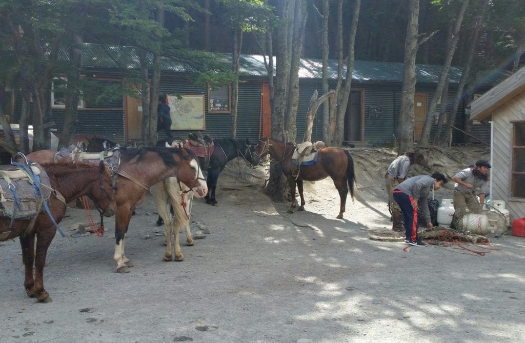
We had help carrying supplies on the trail, too.
The G Adventures crew had horses to help carry the tents and food supplies.
The gauchos (cowboys) would ride ahead on horse trails to our next camp, so that our tents would already be set up when we got there.
Peruvian cowboys prepare the horses for the trek
They also carried a dry bag for each hiker, which held our extra clothes and toiletries.
(We retrieved our dry bags when we got into camp each day.)
Hikers only had to carry personal gear, water, and lunch that was needed each day on the trail in our packs, so they weren’t very heavy.
Initially all of this help made me feel like a wimp, but after hiking to the base of the towers I was over it 🙂
If you feel you might need a little bit of extra training before you go, see my training guides for older hikers and ways to get extra fit while you train for an epic trip!
In Patagonia, January is late summer – which means it was not freezing cold at night, and temps can get up to a balmy 72 degrees F during the day.
Snow blowing from mountain peaks in Torres del Paine
That said, Patagonia’s infamous winds are at their strongest that time of year and can reach over 120 miles an hour.
During my trip, the winds were gusting up to 80mph on one day.
Every so often you had to stop and grab onto a rock to avoid being blown off of the narrow hillside track.
Coming from hurricane country in North Carolina, it really didn’t seem that bad.
We hiked another half day in some pretty steady rain, too, but other than that the weather was just perfect.
What to Pack
The temptation for me (always) is to over-pack, because I want to be prepared for anything that could happen.
P
But I also know that I’m going to have to carry everything on my own – if not on the trail, at least through all of the travel to get there!
Viewpoint on Day 2 of the W Trek
Knowing that, I lay out everything I think I’m going to need and then reduce all of the clothing items by half, and then sometimes by half again.
P
I usually still carry more with me than I absolutely have to. But a girl likes to have choices 🙂
Packs dropped for a rest break at the Italian Camp
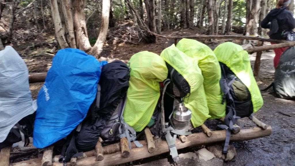
On the W trek with G Adventures, you will carry all your daily gear and layers in your daypack or in an extra (provided) 40L dry bag, so travel light.
You can leave the rest of your luggage at your hotel in Puerto Natales.
BASIC REQUIRED GEAR
For the W Trek, because you are able to leave extra gear in camp, you’ll just need basic day hike gear, plus a couple of extras:
Sturdy hiking boots. Wear boots that are already broken in and comfortable, because you’ll be in them for days. Learn how to choose the best boots for your hike.
Flip flops (for showers or tent wear)
2-3 pairs of socks that won’t slide down into your shoes and cause blisters. I usually layer 1 pair of thick socks over 1 thin pair.
2 pair of quick-drying pants: wear one and pack one. It would be good if one pair is waterproof and you can layer the two pairs, if necessary.
Base layer bottoms – I usually use wicking tights, that I also sleep in.
Base layer long-sleeve top- you may need this only at night, depending on the time of year.
Mid-layer long sleeve– 1 or 2 of these.
Quick-drying t-shirts – bring 1-2 for summer hikes, and to layer over long sleeves
Packable down vest – good to layer over base layers and under jackets.
Light jacket for a layer of warmth
Rain jacket – also bring a packable rain poncho to throw over the top of everything in a storm.
Gloves – thin, wicking, and waterproof.
Buff – to wear over your ears, around the neck, or over your mouth for warmth
Hat – hat with front brim for sun and rain protection
Portable USB charger(s) – I used this every day in camp to recharge my phone, which is also my camera.
Water bottle – I carried a couple of hard bottles and a large collapsible one as well.
Sleep liner –packable liner for your sleeping bag. (Bags were provided by my tour.)
Travel towel
Toiletries and medication – essentials for just a few days
You’ll also want to bring your Passport, plenty of cash (no ATMs in the park), sunglasses, sunscreen, and some sort of camera.
Other Notes:
Trekking Poles: Personally, I don’t care for poles. If you’re an experienced hiker and used to rugged terrain, I don’t think you’ll need them either.
If you’re not, then you might want to try the poles.
(G Adventures had them available to rent before we left Puerto Natales.)
Food: All of our meals, including box lunches, were taken care of on the trek. Our meals at the camp dining halls were also pre-paid with the tour.
You may want to bring extra cash if you’d like to sample a pisco sour in camp on the last night 🙂
WiFi/Cell Service: Cell service ended at Puerto Natales, be ready to be totally off the grid during your trek.
Getting To Patagonia
When it came time to go, I wasn’t worried about the trek itself.
I was more worried about the logistics of getting from my home in the US all the way to Puerto Natales without missing a connection.
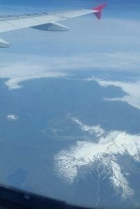
View from the flight
My joining trip ended up taking almost 30 hours door to door: 3 flights and one taxi to get to my hotel in Puerto Natales.
I opted to fly in to the new small airport right in Puerto Natales, rather than the larger airport in Punta Arenas.
It saved me a longer drive by bus, taxi or train at the end of my journey.
To make sure the timing will work, you can book your flight with G Adventures at the same time as you book your trip.
They will also help you find transportation options from the airport to your joining hotel.
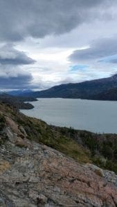
View of the lake from the trail
W Trek Itinerary
Day 1: Puerto Natales
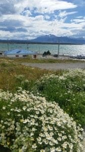
Seawall with yellow flowers in Puerto Natales
The first day was Arrival Day – which means that all of the group were trickling into town according to whatever their joining travel required.
Generally, G Adventures has a Welcome Meeting and a group dinner on arrival day, so everyone knows what’s going on, gets vouchers and dry bags, rents any equipment, etc.
In my case, I got there early afternoon, so I was able to stash my gear at the hotel and explore the town a little bit before check-in.
Puerto Natales
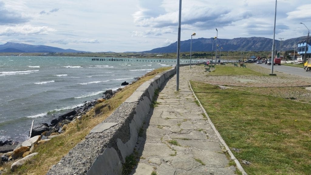
Walk along the shore in Puerto Natales, Patagonia, Chile
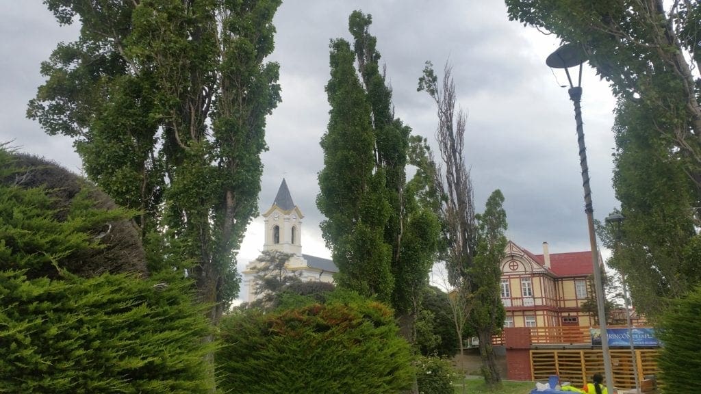
Puerto Natales is a port city on the Señoret Channel.
In addition to being the gateway to Torres del Paine National Park, it’s also the port for boats touring the Patagonian fjords.
A formerly modest fishing port, Puerto Natales has blossomed into a mecca for adventure tourism.
Boutique beers, wine tastings, and gear shops have sprung up to cater to international visitors, but the town still maintains it’s sleepy Patagonian feel.
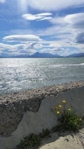
Wildflowers blooming in Puerto Natales
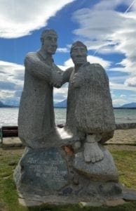
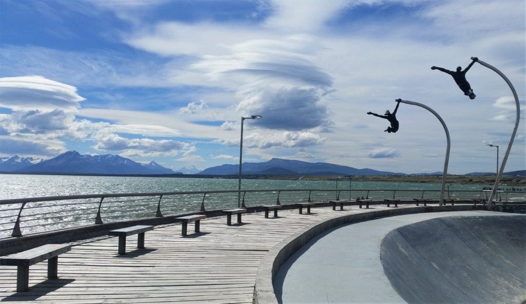
Before the welcome meeting, I was able to get down to the harbor where there are some commemorative statues, and a beautiful skate park on the water.
P
I also made the acquaintance of some of the town dogs.
These community animals are on many of the sidewalks by the shops, where they have staked out their own little grassy territories.
P
The residents don’t want you to feed the dogs, but I found they mostly wanted attention, not food.
P
There was one demanding puppy in who would block my path until he thought I had petted him enough! 🙂
Skate park on the water in Puerto Natales, Chile
After our Welcome Meeting, most of us went out to get dinner in Puerto Natales before packing for the trek in the morning.
The food was delicious, and very reasonable – like most of the restaurants in town.
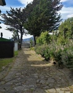
Hotel Capitan Eberhard
Flagstone access road behind the Hotel Capitan Eberhard
Normally, if you are travelling alone, G Adventures will pair you with a same sex roommate.
I opted for single accommodation for my trip – which cost a little bit extra – but was worth it for me to be able to control my environment (for my lung health).
Also, you never know if you’re going to get a roommate who snores, or likes to stay up chatting all night. Anyway…
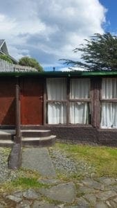
Hotel Capitan Eberhard cabana rooms
Our hotel in Puerto Natales, the Hotel Capitan Eberhard, was very close to the main coast road, across from the shoreline.
When I checked in, there was some issue about having a single room for me, unless I wanted to stay in one of their Cabana rooms out back.
I was definitely ok with that.
The cabanas were a small row of private rooms with corrugated roofs behind the hotel proper, where people could stay for extended times.
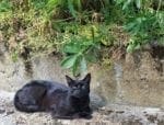
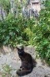
The hotel cats initially viewed me with suspicion….
They had their own baths, etc – the only drawback was having to walk outdoors to get to the hotel breakfast in the morning.
On the plus side, I got to make friends with the hotel cats!
Day 2 – Puerto Natales and Serrano Camp
First thing in the morning, we dropped our packed dry bags in the lobby, ate breakfast and boarded our private bus to make the long drive to the Torres del Paine park.
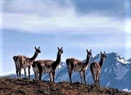
A group of Guanaco watching us
Along the way, in addition to stunning landscapes, we spotted a few herds of Guanaco.
They’re the Patagonian cousins to Alpacas and Llamas.
W Trek – Day 1
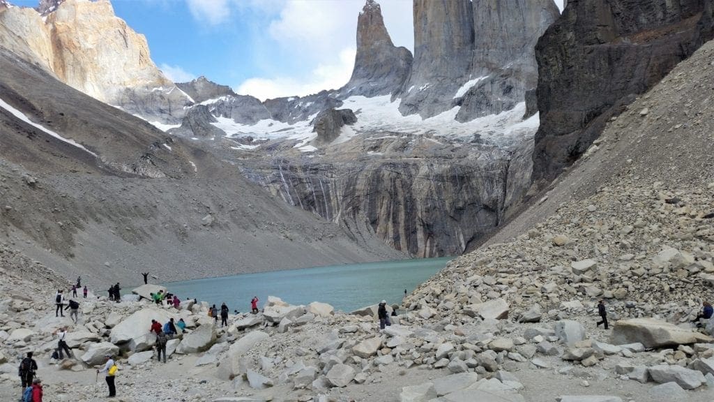
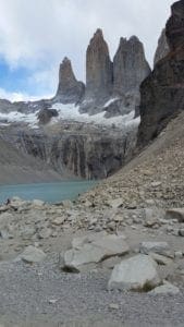
Our first hike was a steep out and back that took us through dense forest and on mountain paths before making the rocky ascent to the base of Las Torres (the towers).
Taking a snack break at Las Torres camp
While taking a break in the woods, we had our first introduction to the Patagonian foxes.
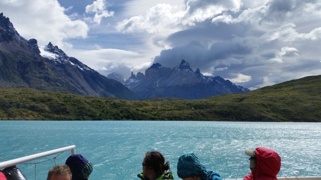
A view of the three towers
They are much larger than we’re used to in the US – about the size of a German Shepherd, and more gray than red.
They walked casually among us as we rested.
When we got to the towers, we picnicked on the rocks at the base of the lake, marveling at the beauty and scale of the landscape.
After lunch we retraced our footsteps back down and transferred to the Serrano campsite for the night.
THE SERRANO CAMP
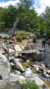
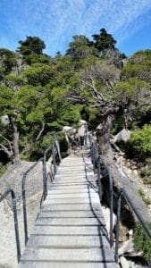
Most bridges allowed only 2 people to cross at a time.
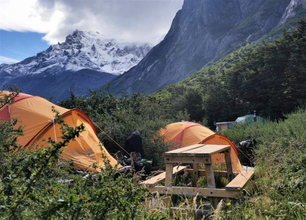
The first night of the trek, we camped at a private site for our group.
It was smaller than the established park camps, but still had a bath house, a small dining hall, and just enough flat space to accommodate a row of 10-12 tents.
After we got settled, our guide team surprised us with a delicious hot meal in the dining hall – with some champagne to celebrate completing our hike to the Torres!
After dinner, we discussed the next day’s itinerary and said goodnight.
Later, lying in my sleeping bag, I could hear the birds and grass rustling outside.
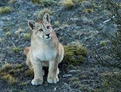
Pumas look so sweet….
After a while there was also some soft grunting and snuffling outside my tent, and then a loud “squawk!” from a wild goose.
This was when I remembered there are Pumas in the park…
Day 3 – Serrano Camp and Cuernos Camp
The next morning, we awoke to a chilly and wet day. We stashed our stuff and then met for another delicious hot meal in the dining hall.
Our guides had also prepared a selection of food for our lunches, so we self-packed brown bags to carry in our packs.
W Trek – Day 2
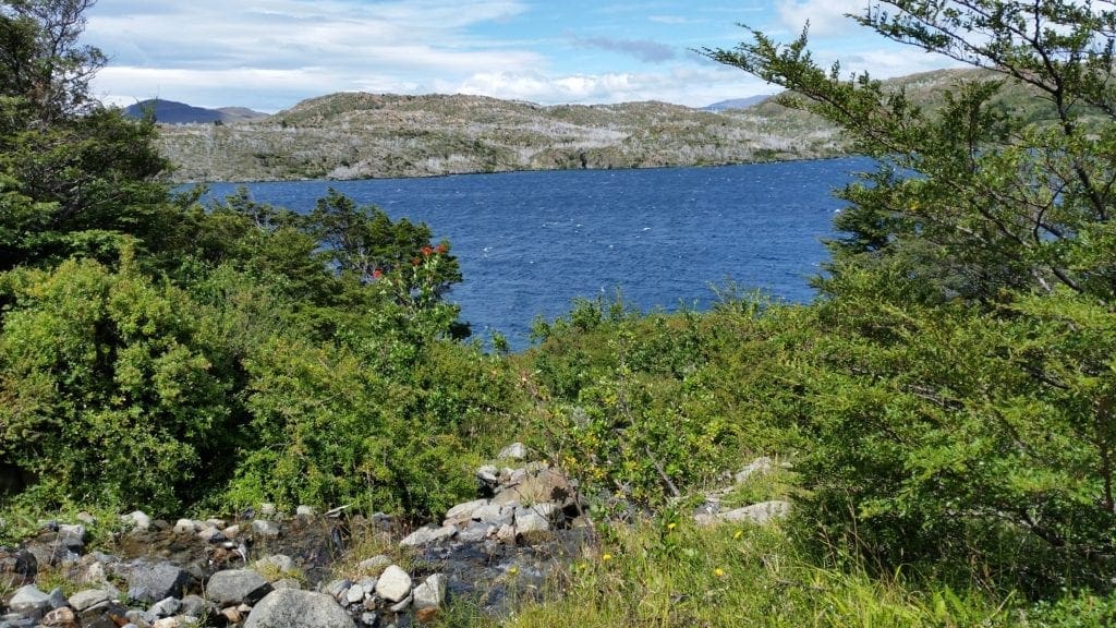
View of the lake from day 2 of the W Trek
It was a rainy morning hike to the viewpoint, and we wore ALL of our layers.
Our perseverance was rewarded with spectacular views of the lake, and the sun came out just as we got there.
We took some time to warm up in the sun and helped each other and some other passing hikers take photos.
Then we rearranged our layers for the remainder of the hike to camp.
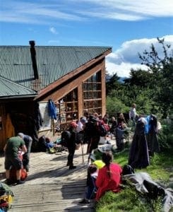
CUERNOS CAMP
Hanging bridges allowed only 2 hikers to cross at a time
We crossed some final hanging bridges and rolled into camp mid-afternoon.
Cuernos houses individual hikers and groups from all over.
Because of the morning rain, camp was busier than usual.
The sun had come out, so the hikers had clothes and gear spread out to dry on bushes, tables, and hanging from trees.
The deck outside the dining hall was littered with hikers sitting in the sun, juggling poi, playing guitar, drinking beer, and airing out their feet.
Camp sites can get crowded
It looked like some sort of Patagonian Woodstock.
We joined the party, and sat down to have a beer and hang out in the sunshine before getting cleaned up for dinner.
In this camp, tents were set up on wooden platforms to keep us off of the wet ground. Our group was split up with a couple of tents on either side of the dining hall.
They also had wooden picnic tables set up for each pod of 3-4 tents, which was a good place to read or look at your photos away from the crowded dining hall.
Day 4 – Cuernos Camp and Paine Grande Camp
Can’t beat the view at Cuernos camp.
Next morning after dropping our dry bags and a quick breakfast in the dining hall, we set off for our longest hike of the trip.
We would hike to the French Valley lookout for awe-inspiring views of the mountain range spreading across the national park.
W Trek – Day 3
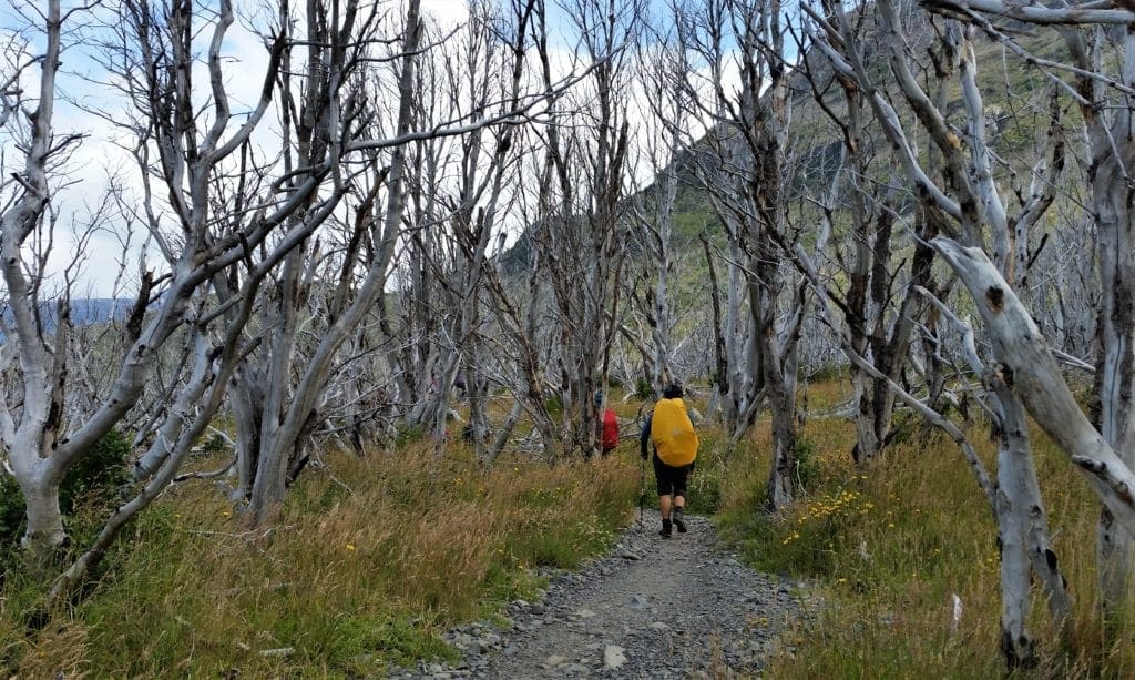
View of the lake and silvery remnants of a burnt forest
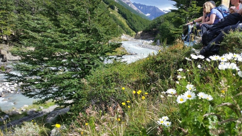
We hiked first to the Italian camp, then after a break set out to the French Valley Mirador – total of around 15 miles.
The sun was out, and the air was fresh from the recent rain.
The scenery was amazing on this stretch – the glacier-fed lakes and streams contrasting beautifully against the bright blue sky.
The water was so pure, we were able to fill our bottles from the streams.
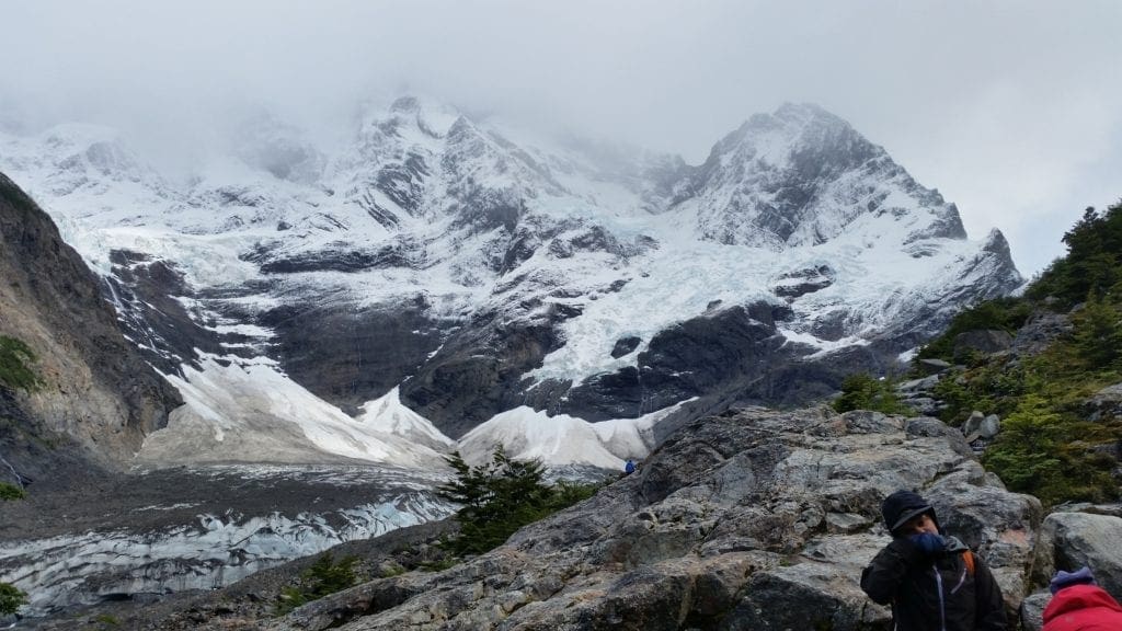
We witnessed a couple of avalanches on the opposite peak.
After a steady climb, we witnessed a snow avalanche on the opposite peak at the summit of our hike. It was the highlight of the day.
After a flurry of selfies in front of the snow-caps and a quick picnic, we started back down the mountain to make our way to our next camp.
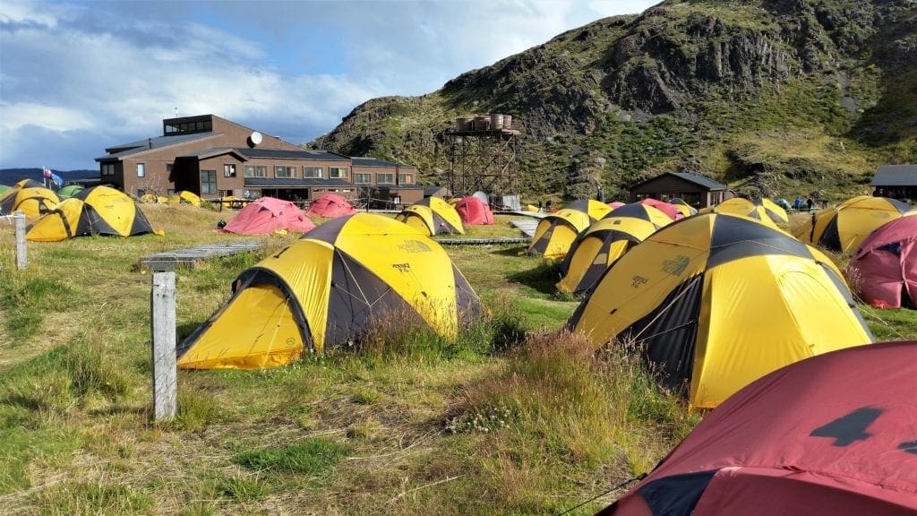
Campsite PAINE GRANDE
Paine Grande was the largest camp we stayed at, the one with the most conveniences, and the most windy.
The Camp is located between turf-covered hills beside beautiful Lake Pehoe.
Camp with bath house at Torres del Paine
Tents were set out in the flat, with tall hills on two sides, and the dining hall and lakeshore on a third side.
Wooden boardwalks created a pathway from the tents to the bathhouse, to keep your feet clean.
To accommodate the large number of campers, dinner and breakfast both had two seating times.
There was a lot of vying for the early seating at breakfast to allow for a quick morning departure.
Dinner was a bit less hurried, so we could relax afterwards at the loft bar with a pisco sour before bed.
Day 5 – Paine Grande and Puerto Natales
On the final day of our trek, we woke to see the silhouettes of fox kits wrestling against the sky as dawn broke over the hilltops beside the camp.
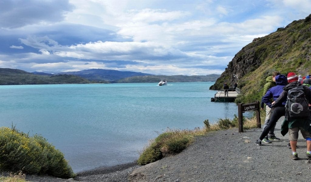
Waiting for the ferry at Paine Grande camp
Luckily, we had drawn the early breakfast seating because we had a more strict schedule to follow.
We wanted to do a quick hike in the morning to to Grey Lake and the lookout point for Grey Glacier, and be back in time to catch the ferry.
W Trek – Day 4
Morning view of Lake Grey
We enjoyed the brisk morning hike to the glacier, where we saw chunks of blue glacier ice floating in the lake – and then the edge of the actual glacier!
We made quick work of the return hike, then grabbed our gear and a box lunch to eat on the ferry.
The ferry ride was a beautiful change from hiking, and allowed us to get an overview of all our hike locations of the previous days.
It was amazing to see how far we had come and how high we had been in the mountains.
P
When we disembarked the ferry, we found our private bus and began the 3 hour drive back to our hotel in Puerto Natales.
Looking back at Torres del Paine peaks from the ferry
When we were back and settled (I had an “official” room this time), we had just enough time to get cleaned up for our final dinner together.
We chose a small white-table cloth restaurant, and afterwards some of us went on to a less formal bar for some music and a drink or two.
Day 6 – Puerto Natales
Looking up from a town square in Puerto Natales
Departure day is usually a scattered affair and this one was no different.
When I went down to breakfast at 8am, many of the group had already departed to start the long journey home.
The cats were still unimpressed.
After breakfast and final goodbyes with the remaining folks, I stashed my luggage to take another walk around Puerto Natales.
I wanted to say goodbye to the lovely little town – and the community puppies and hotel cats.
UNTIL NEXT TIME…
The penguin is sad to see us go.
A week is not nearly enough to see what Patagonia has to offer, but I am so glad I was able to have even a short visit.
I made note of things I didn’t have time to see and do this trip – they will be the basis of a whole new itinerary for my next visit.
For more detailed information about the hikes or cities I visited, click the links in the post above. They will take you to park websites or travel itineraries.
To read about more about trips I’ve taken with G Adventures, and learn how you can go, see my Adventures For You! page.
For more travel tools and discounts or more ideas for your next adventure, check out my Travel Resources page.
Thanks for stopping by – see you next time! LJ
To Get New Idratherwalk Posts sent directly to your inbox (how convenient!) Click this Button
LJ has spent much of her free time as a single Mom – and now as an empty-nester – hiking in the US and around the world. She shares lessons learned from adventures both local and in exotic locations, and tips on how to be active with asthma, plus travel, gear, and hike planning advice for parents hiking with kids and beginners of all ages. Read more on the About page.
Published by
LJ
LJ has spent much of her free time as a single Mom - and now as an empty-nester - hiking in the US and around the world. She shares lessons learned from adventures both local and in exotic locations, and tips on how to be active with asthma, plus travel, gear, and hike planning advice for parents hiking with kids and beginners of all ages. Read more on the About page.
View all posts by LJ
Do you dream of a great hiking trip but aren’t sure where to go?
Need some practical tips on finding amazing trails locally and at adventure travel destinations?
I have a few ideas that might be perfect for you 🙂
Sign up to get new Idratherwalk.com articles in your inbox every month!
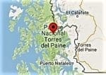 Patagonia, Chile is at the southernmost tip of South America, very close to Antarctica. Torres del Paine National Park is located on the eastern edge of the continent.