Most recently updated February 6th, 2024
Estimated Reading Time: 19 minutes
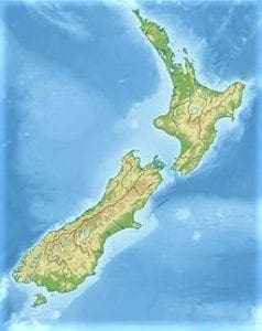
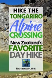
The Tongariro Alpine Crossing, a 12 mile day hike on New Zealand’s North Island, is one of the most popular day hikes in the country.
Located inside The Tongariro National Park, the alpine crossing is part of a larger 3-4 day hike that is one of New Zealand’s Great Walks.
Tongariro National Park was made famous – like so many places in New Zealand – by it’s appearance in the Lord of the Rings movie trilogy.
The park’s alpine, volcanic scenery is the setting of Mordor, home of Mount Doom – aka Mt Ngauruhoe – the object of Frodo and Sam’s quest throughout the series.
I had the opportunity to take this trek as part of an active group trip to the North Island early this Spring.
(Fortunately, I was able to return home before travel became restricted due to the COVID-19 pandemic.)
Here’s how hiking the Tangeriro Alpine Crossing went for me, and some information that will help if you want to go try it for yourself!
Some of my posts contain affiliate links. If you make a purchase through an affiliate link, I will receive a small payment at no additional cost to you. As an Amazon Associate, and other marketing affiliations, I earn from qualifying purchases. See full Disclosure page here.
Welcome or Kia Ora! as the Kiwi’s say 🙂
This was my first visit (of many, I hope!) to New Zealand.
I opted to go on a trip organized by my favorite adventure travel company, which saved me the effort of dealing long distance with a lot of details.
You can make your own arrangements to hike the Tongariro Alpine Crossing, or get help from a travel company or a licensed operator at the Park.
What struck me most, aside from the friendly out-going nature of everyone I talked to, was the incredible variety of landcapes and environments encompassed within a relatively small country.
In the North Island, there are volcanoes, native rainforest bush and mighty long rivers with steep valley sides.
Then the South Island takes us into beech forest territory, paradise beaches, secluded tussock lands, and onto majestic mountains.
What better way to enjoy this great variety than on foot?
The Kiwi’s have provided citizens and visitors a fantastic way to do this with New Zealand’s Great Walks.
New Zealand’s Great Walks
The Great Walks are scattered in New Zealand’s most impressive and remote natural environments. There are 10 Great Walks of New Zealand , some on each island.
Most of the walks are multi-day treks, but some of them have sections that can be done as a dayhike.
I was lucky to be able to hike a portion of two of the Great Walks on my recent trip.
Whanganui Journey
This “walk” is actually done by canoe or kayak on the Whanganui River. Steep valley walls and native forests line the river as you paddle.
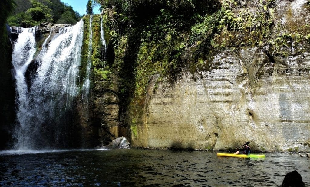
The Whanganui Journey is also a cultural experience, since one of the backcountry huts you’ll stay in is a Maori meeting house.
You can learn more in Guide to the Whanganui Journey.
Distance: 89mi (145km). 3-5 days.
My group spent some time on the Whanganui during our stay at Blue Duck Station.
Tongariro Northern Circuit
The Tongariro Northern Circuit includes one of the most popular day hikes in New Zealand: the Tongariro Alpine Crossing.
This Great Walk makes it’s way around the three volcanic peaks in Tongariro National Park, and includes a magnificent view of the Emerald Lakes that fill the volcanic craters. The whole Great Walk is a 3-4 day trip.
Distance: 26.7 miles (43km). 3-4 days.
Tongariro National Park
Tongariro National Park is New Zealand’s oldest national park – and the fourth oldest national park in the world!
The park’s central location makes it easy to get to from Auckland, Wellington and other North Island locations, and it’s a favorite destination for local hikers and visitors from all over the world.
Tongariro is not just for hikers – it’s an active adventure center for hiking, biking, rafting and skiing.
You can explore the whole area from one of the park’s villages.
For a directory of the facilities available at National Park Villages, click this link.
The Gift of Tongariro
The Tongariro National Park is rich in both cultural identity and dramatic, awe-inspiring natural scenery.
To the Maori tribes who have inhabited this land since at least the 14th century, Tongariro is also tapu – sacred.
For the Maori people, the mountains at the heart of the park symbolize the spiritual links between the community and its environment.
Thanks to a forward-thinking Maori chief who felt the encroachment of European settlers might threaten this sacred land, the Tongariro area has been a national park since 1894.
In 1887, the Ngati Tuwharetoa people partnered with the Crown to enact a tuku (act of customary lore) to preserve the natural beauty of the three mountain peaks, Ngaruhoe, Tongiriro and Ruapehu.
This act by the Ngati Tuwharetoa made Tongariro the first National Park in the world to be gifted by its indigenous people.
Since the park was officially established, the area protected by National Park status has grown from 2,640 hectares to 25,000 hectares.
In 1993, the Tongariro National Park was listed as a UNESCO World Heritage site.
It was the first National Park ever to be listed under a Dual World Heritage classification for both its cultural associations and stunning volcanic landscape.
The Maori Legend
If there’s one thing that sets New Zealand apart from the rest of the world, it’s the beauty of the Maori legend.
The mountains, islands and surrounding seas all come with treasured stories that have been passed down through the centuries.
Maori Primer
Ko Tongariro te maunga Tongariro – is the mountain
Ko Taupo te moana – Taupo is the lake
Ko Ngāti Tuwharetoa te iwi – Ngāti Tuwharetoa is the tribe
Ko te Heuheu te tangata – te Heuheu is the man / Chief
Tongariro is traditionally known as the belly of the great fish of Maui which, in time, became known as New Zealand’s North Island.

How the Maori Came to Tongariro
Ngatoroirangi, the ancestor of the Ngāti Tuwharetoa people, ascended the great mountains of the Central Plateau over 30 generations ago, and visited Taupo in order to lay claim to the region.
However, when he reached Rangipo (a desert area east of the three mountains) he met Hapekituarangi, who also wanted to claim the land.
The two became rivals, so Ngatoroirangi decided to climb Mount Tongariro and lay claim to all he could see from the summit.
Underestimating the strong South Wind, Ngatoroirangi became weakened by the cold and strenuous climb and arrived at the summit almost chilled to death.
He called on his ancestral spirits to send fire to warm him.
His calls were answered. The gods took fire from all over the lands and sent it to Tongariro.
The heat traveled underground and reached Tongariro’s summit, creating a volcanic crater and spouting warmth to revive Ngatoroirangi.
It was then that he named Tongariro and many features of the surrounding landscape, declaring this area as home for his descendants.
It’s from these beginnings that Ngāti Tuwharetoa inherits the responsibility to protect the mountainous lands of their ancestors.
The name Tongariro is said to describe the South Wind that almost killed Ngatoroirangi.
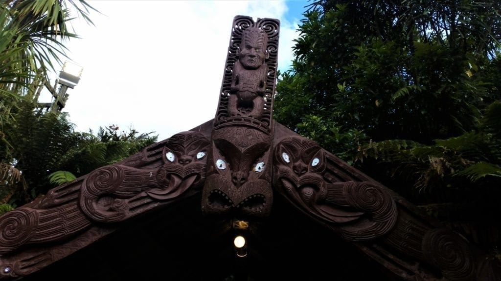
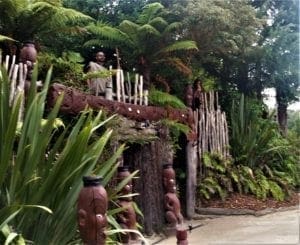
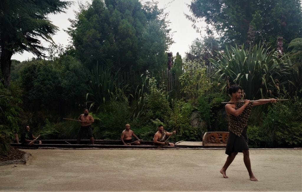
My group was able to spend some time at Tamaki Maori Village in Rotorua, where we learned a lot about Maori traditions.
In the evening, we participated in Maori ceremonies and partook of a traditional hangi feast.
We even spent the night – all of us in one room – in a traditional carved wharemoe (sleeping house).
It was a fantastic way to learn about New Zealand’s history and the history of the Maori – which are woven tightly together.
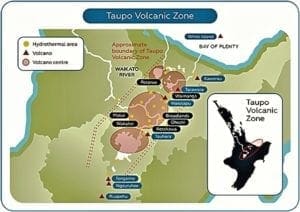
About Volcanoes In the Park
Tongariro National Park is an active volcanic area, home to three volcanic mountains whose landscape has developed over the last 300,000 years:
-
-
- Ruapehu – the largest mountain in the north island at 2797m tall,
- Ngauruhoe – the youngest volcano at 2291m tall, and
- Tongariro – at 1967m tall.
-
The volcanoes lie at the southern end of Lake Taupo.
To the west of the volcanoes, the land is rough forested hill country. To the north, close to Lake Taupo, the land is fertile and hilly.
To the east, the barren, ash-laden soils and harsh alpine climate can grow nothing but scrubby plants.
This is the area known as the Rangipo Desert.
Beyond the eastern boundary of the plateau lies the rough hill country in the Kaimanawa Ranges.
PARK SAFETY
The Tongariro Alpine Crossing hike climbs up through volcanic terrain, with old lava fields, walks through giant calderas, and even past a smoking, steaming volcano that erupted just eight years ago.
The volcanic activity of the park is constantly being monitored, with warning signs at various points along the trail alerting hikers what to do if an eruption should occur.
That said, volcanic eruptions can occur with little or no warning, and facilities may not be closed in time.
Mt Ruapehu
Mount Ruapehu is the highest point in the North Island and, like Tongariro, it’s history began before the last ice age.
The volcanic vent in the top of the mountain contains a warm, acidic crater lake.
-
-
- Sacred Crater Lake passes through regular warming and cooling cycles, which may result in small eruptions of ash and steam.
- More than 60 eruptions from the Ruapehu crater have been recorded since 1945.
- Mt Ruapehu’s last major eruption was in 1996 with a small eruption in September 2007 and the last lahar was in March 2007.
-
The majestic slopes of Mt Ruapehu also are home to New Zealand’s largest and most developed ski areas, Whakapapa and Turoa.
The world-class facilities have something for all levels from the beginning skier to the advanced and adventurous.
Mount Ruapehu’s eight named glaciers are the only ones in the North Island. The summit region has a permanent cover of snow and ice.
Mount Tongariro
Mount Tongariro is composed of layers of both lava and tephra and first erupted 275,000 years ago.
Tongariro consists of at least 12 cones. Mount Ngauruhoe, while often regarded as a separate mountain, is geologically a cone of Tongariro.
Unlike nearby Mt. Ruapehu, no glaciers exist on Tongariro today.
However, dating of moraines on western Tongariro show that the mountain held glaciers several times in the past, before they all finally melted away at the end of the Last Glacial Maximum approximately 18,000 years ago.
The Volcanic Plateau u
One of the biggest volcanic eruptions in the last 5000 years originated from the Taupo Volcanic Centre.
This eruption – about 1800 years ago – ejected pumice 30 miles into the air, and sent volcanic material travelling outward at a speed of 370 mph.
It leveled forests, incinerating and burying everything within a 50 mile radius from Taupo.
 This area is known as the Volcanic Plateau and includes The Tongariro National Park.
This plateau is New Zealand’s main area of volcanic activity.
In this zone, the Pacific tectonic plate is sinking beneath the Australian Plate.
At a certain depth its rocks heat and produce volcanic activity, which erupts at the surface in minor ways, with steam vents, mud pools and hot springs, and major ways with volcanic eruptions, collapsing mountains and lake formation.
Most Recent Volcanic Eruptions In the Park
-
-
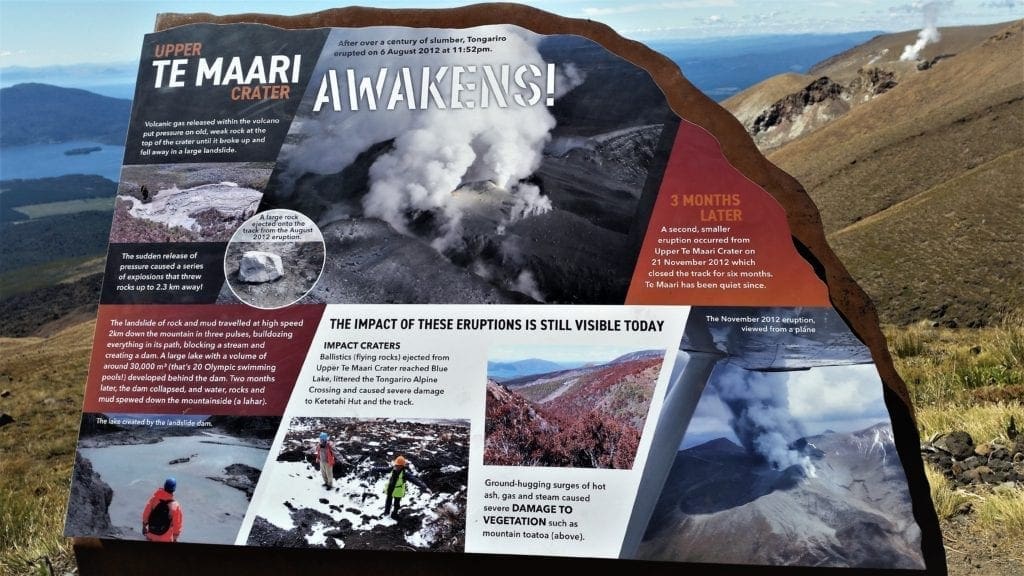
- The Te Maari craters on the northern slopes of Mount Tongariro erupted on August 6, 2012 and November 21, 2012.
- Mount Ruapehu’s last eruption was September 25, 2007. Prior to that there were large eruptions in 1995 and in 1996.
- Traditionally Ngauruhoe has erupted at least every nine years, although the last eruption was in 1975.
- Mount Tongariro’s active Red Crater last emitted ash in 1926.
-
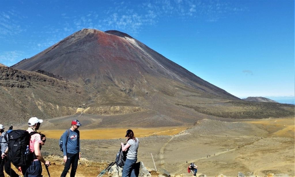
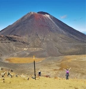
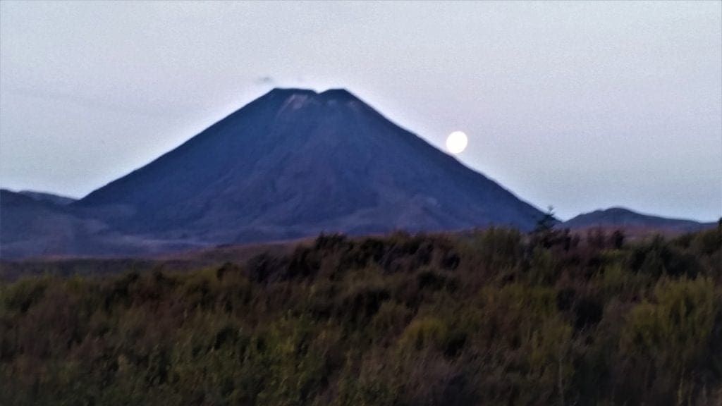
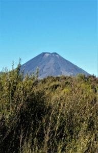
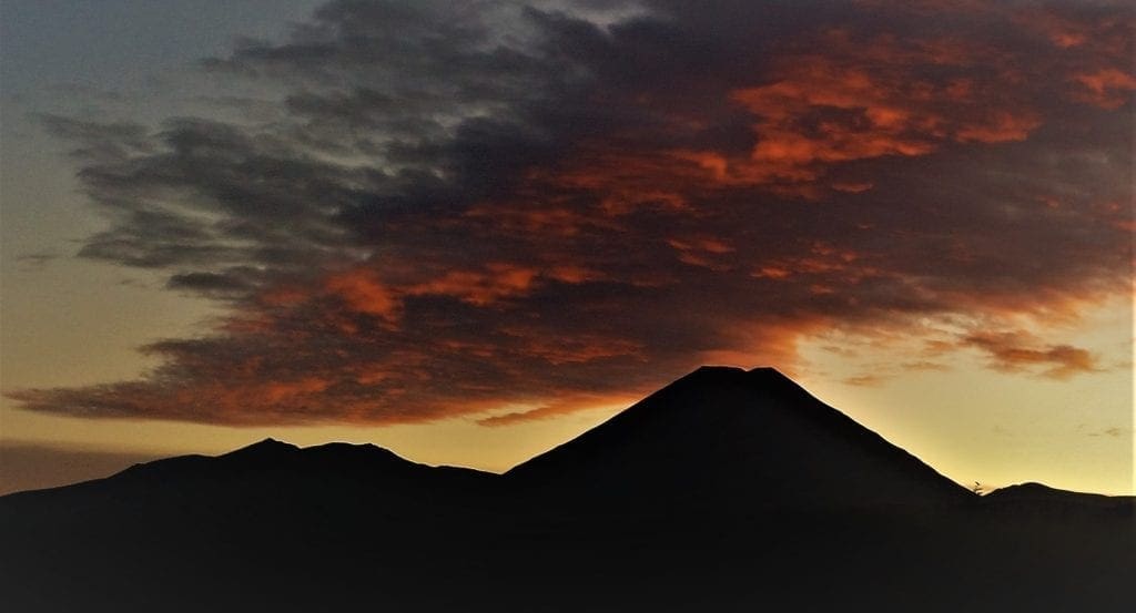
Mount Ngauruhoe (Mt. Doom)
Mt. Ngauruhoe is New Zealand’s newest and historically most active volcano.
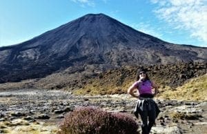
Mt Ngauruhoe has been active for at least 2500 years.
It has produced more than 70 eruptive episodes since 1839.
There have been no eruptions since February 19, 1975 and the temperature of fumaroles in the crater floor has steadily cooled since 1979, suggesting that the main vent is becoming blocked.
You may recall that in Maori legend, Ngatoroirangi prayed to the gods to save him from freezing while climbing Mount Ngauruhoe.
The flames they sent South emerged first at White Island, then Rotorua and Taupo before finally bursting at Ngatoroirangi’s feet.
For that reason, Ngatoroirangi is credited with bringing volcanic activity to New Zealand – not as a curse upon the land, but as a blessing.
Tongariro Alpine Crossing Day Hike
Despite the popular ski fields on Mount Ruapehu, there are more visitors to Tongariro National Park in summer than winter due to the excellent hiking opportunities – like the Tongariro Alpine Crossing day hike.
Unique landforms, including the volcanic peaks of Ngauruhoe, Tongariro and Ruapehu are what make the Tongariro Alpine Crossing a world-renowned trek.
Know Before You Go
If you’re thinking about taking this hike, here are a few things you should know before you head out:
Facts About the Hike:
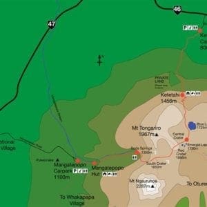
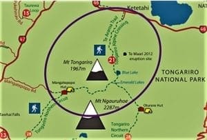
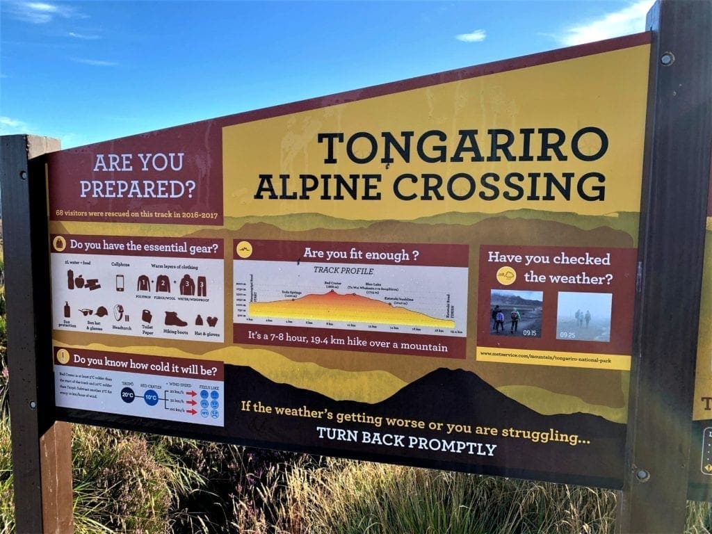
Distance: 19.4 km (12 miles) point-to-point
Elevation Gain: 765m (2510 feet) elevation gain and 1125m (3691 feet) elevation loss if you hike from Mangatepopo car park to Ketetahi car park
Difficulty: Strenuous
Length of Time: 6-8 hours
Location: Tongariro National Park, North Island of New Zealand
The Tongariro Alpine Crossing is a point to point hike so you will need to arrange transportation to either the start or finish of the hike.

There are several companies that provide this service, such as the Mountain Shuttle and Tongariro Crossing Shuttles.
You can do the hike in either direction, but most people go from Mangatepopo to Ketetahi. Mangatepopo sits at a higher elevation than Ketetahi, so starting here eliminates almost 200 meters of climbing. It is also much more interesting to climb up through the volcanic scenery in the shadow of Mt Doom than to climb up through the monotonous scenery near Ketetahi.
There are limited toilet facilities on the hike. There are toilets at the car parks, and also toilet facilities an hour into the hike right before the strenuous climb starts, as well as toilet facilities just before the long walk back down to the Ketetahi car park. BRING YOUR OWN TOILET PAPER!
Weather conditions can change quickly. Make sure you have plenty of layers with you. Depending on the season, it can get very cool at the summit or it could rain. Also bring plenty of water and sunblock. There’s very little shade on the trails.
Try to avoid weekends. We did the hike on a weekday and there were a lot of people on the trail – but mostly because of a large High School group that were also out. Most of the young hikers looked unhappy so I suspect the hike was a mandatory school activity 🙂 .
I’m assuming that on normal weekdays the trail would be less crowded.
How Fit Should You Be?
Hikers of all shapes, sizes, age and experience were on the trail with me, and no one seemed to be in too much distress.
However, if you don’t regularly get any physical exercise, you may have some difficulty on this hike, especially during the steep ascent on the first half of the hike.
People with bad knees may also have some issues with the descents, especially the steep scree trail coming down from the Red Crater summit.

Also, 12 miles might be a daunting distance for people unused to hiking or running anywhere near that far.
I did some extra training for a couple of months prior to my trip, and you can see my training plan in my 8 Weeks to Awesome training post.
Normally, I wouldn’t do that much training for this hike, but I was recovering from an illness and had to make my way back to my “normal” as well as prepare for the hike.
If you work out regularly and stay in pretty good shape, you could probably get by just doing some extra stair-climbing or hill-running for a few weeks before you go.
The Hike
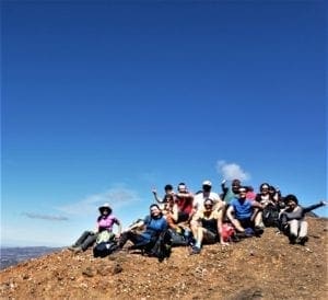
My group started the day early, departing our lodgings in Rotorua at 5am to meet our Tongariro transport to Mangetepopo at 8:30am.
The Tongariro Alpine Crossing was just one option for the day’s activities, but nearly everyone in our group opted to “give it a go” as the Kiwi’s say 🙂
For people who didn’t have appropriate gear, there were poles, packs and even boots available to rent at the park for the day.
Getting Started
There’ s a 4 hour parking restriction at Mangatepopo road end to allow for those doing shorter walks.
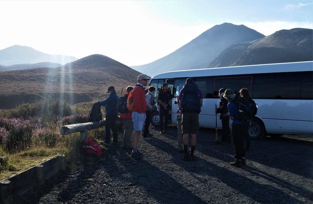
If you’re planning to hike the entire Tongariro Crossing, you can catch a shuttle from a licensed operator in either National Park Village or Whakapapa Village.
Our transport dropped us off, and then picked us up later at the other end of the hike.
Hike Description By Section
One of the interesting things about this hike was how dramatically the terrain changed from one section to another.
Mangatepopo Valley To Soda Springs
Grade: Easy – Allow 1 – 1.5 Hours
The first section of the trail is fairly flat, well formed and boardwalked in damp areas.
The trail continues up the valley at a gentle incline, following the Mangatepopo Stream and around the edge of an old lava flow.
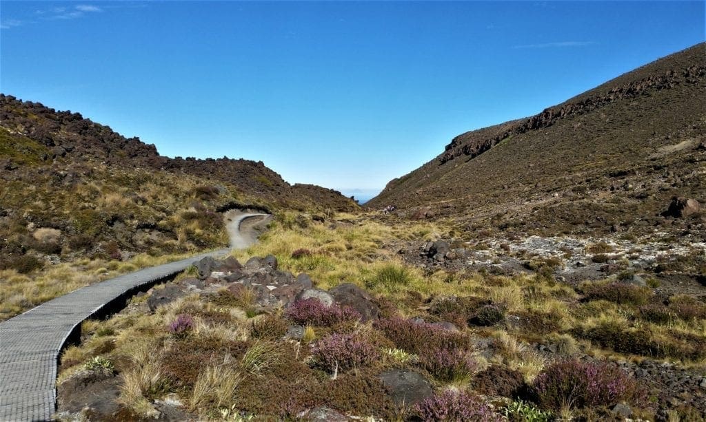
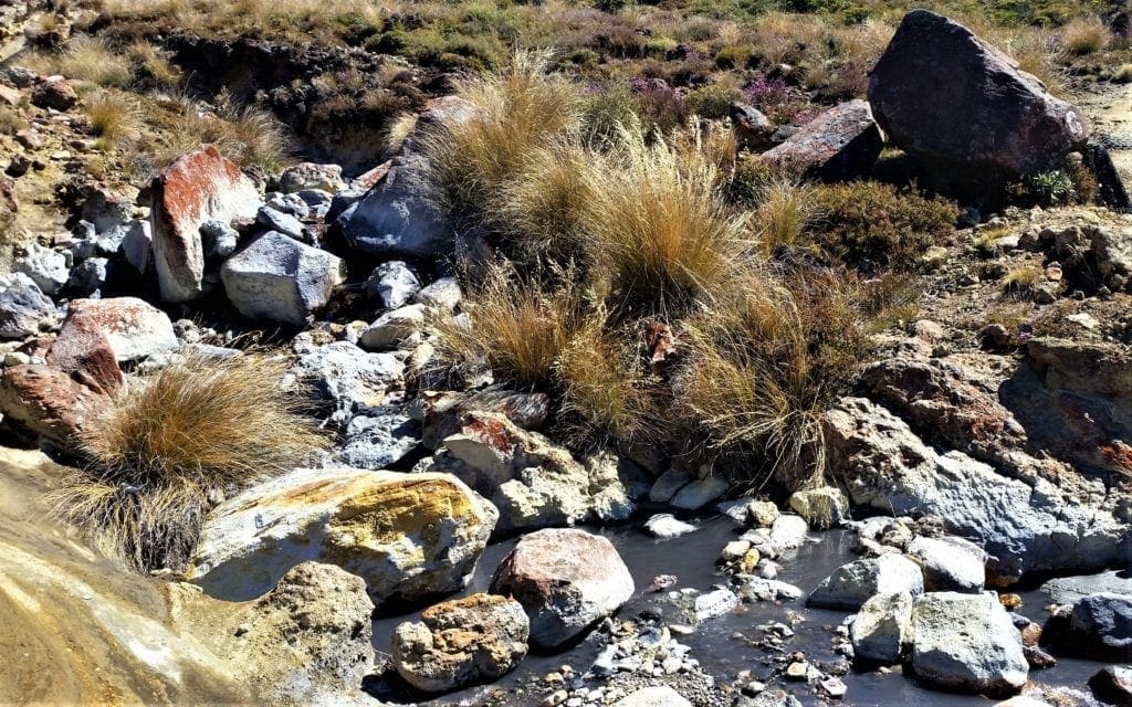
Don’t drink the water in Mangatepopo Stream – it contains dissolved minerals from the volcanic rock the water passes through on the way to the surface.
The Mangatepopo Valley was carved out by glaciers during the last ice age and later partially in-filled by lava flows from Ngauruhoe.
You’ll notice the different colors of the lava flows as you walk up the valley.
The surface color of younger lava is darker than the older flows and absorbs a lot of the sun’s heat.
After forty-five minutes of hiking up a steady, gradual incline through alpine vegetation, the scenery changes. The ground becomes darker, and volcanic boulders are strewn across the landscape.
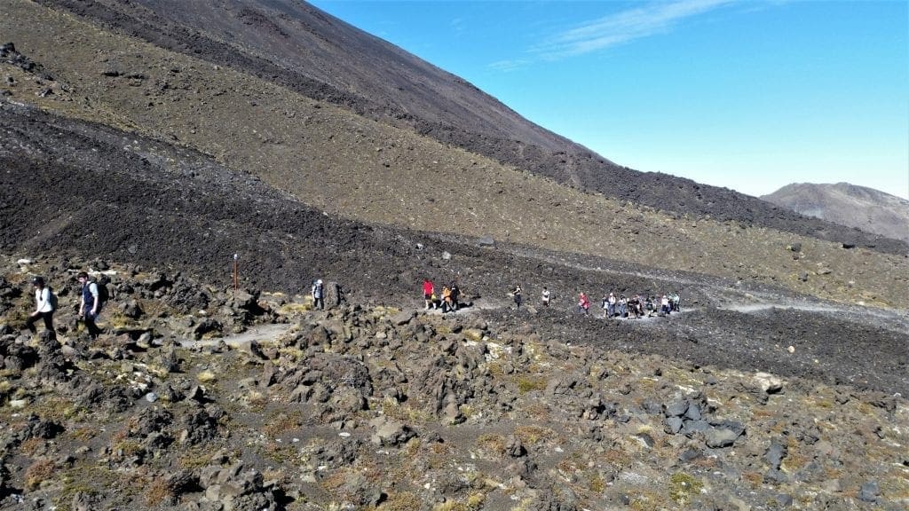
Then, after a warning sign alerting hikers about how strenuous the trail is about to become – and advising those already tired out to turn back – we began the real climb up the mountain.
We hiked across a caldera, over flat, squishy, wet volcanic soil and then it was time for one more push to the top.
The final climb was steep, strenuous, and a little dangerous if you didn’t have good shoes.
Soda Springs To South Crater
Grade: Moderate – Difficult, Allow 40-60 Mins
NOTE: The last toilet facilities are located at Soda Springs; there are no further facilities until you reach the Ketetahi Hut.
This section of the track, known as the Devil’s Staircase, is steep – gaining 340m from Soda Springs to South Crater.
You’ll cross over two lava flows from eruptions in 1870, and two pyroclastic flows from 1975.
On a clear day there are magnificent views from this section of the trail, as far as Mount Taranaki on the west coast.
You’ll need to take your time on this section, because you’ll be hiking over layers of ancient and modern lava flows and other volcanic deposits, and the trail is a little rough.
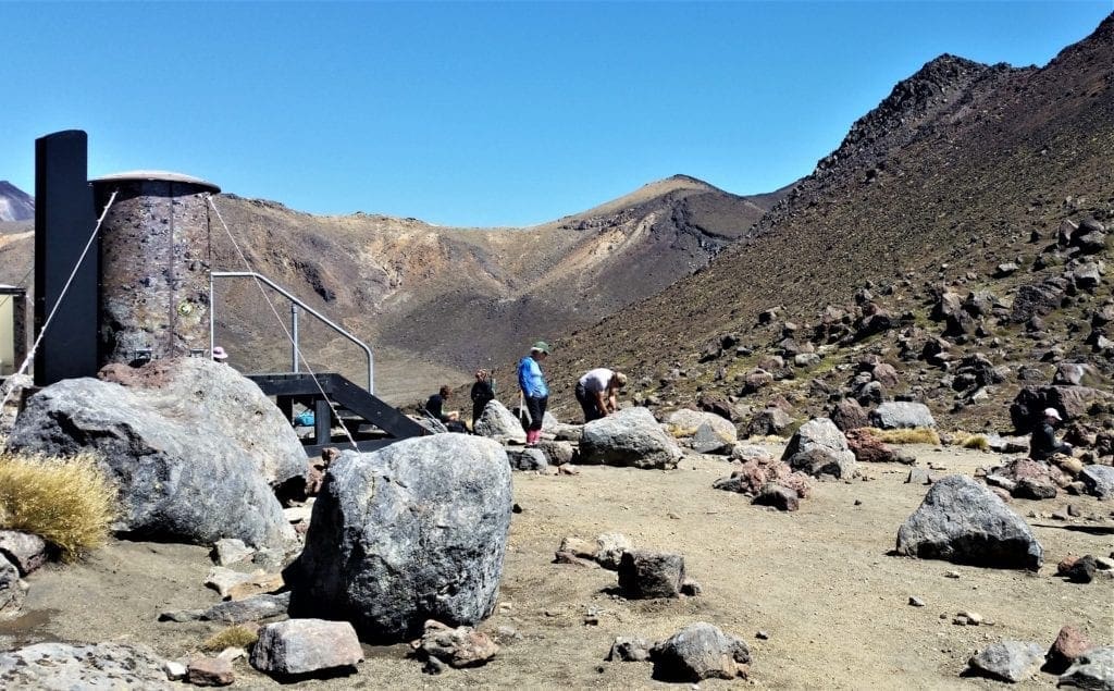
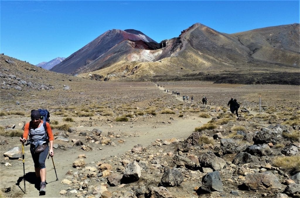
At the top of the climb, the Tongariro Alpine Crossing continues east across South Crater.
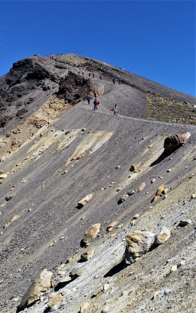
South Crater To Red Crater
Grade: Moderate – Difficult, Allow 1 Hour
Enjoy the flat trail here, as it won’t last very long 🙂
South Crater is not a real crater, but a glacially carved basin that has since filled with sediment from the surrounding ridges.
An explosion pit in the southeast part of the crater formed around 14,000 years ago, and the lava seen from Ngauruhoe dates back to the 1870 eruption.
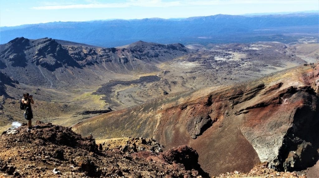
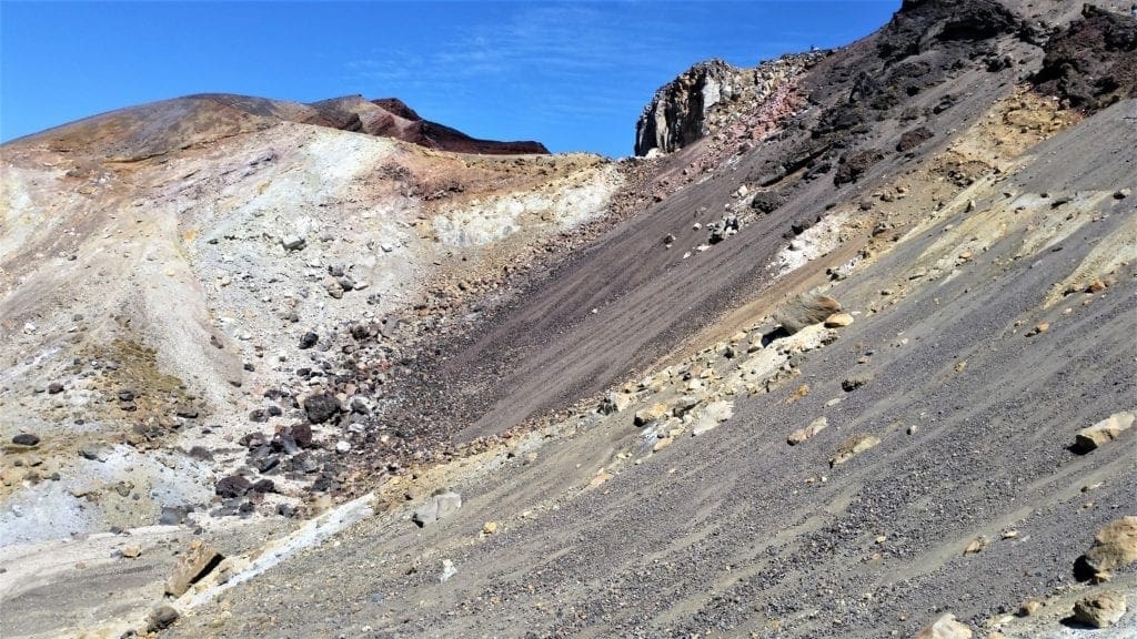
Once you’ve passed South Crater there’s another short climb on an exposed ridge, and the trail follows this ridge to Red Crater.
The summit of Red Crater (1886m) is the highest point on the Tongariro Alpine Crossing.
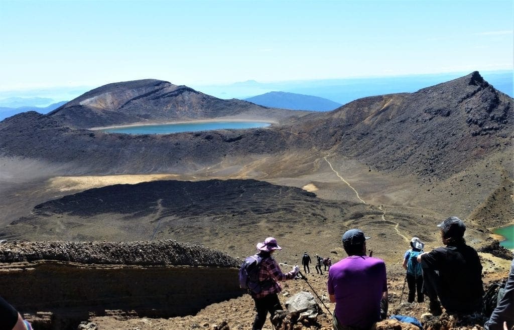
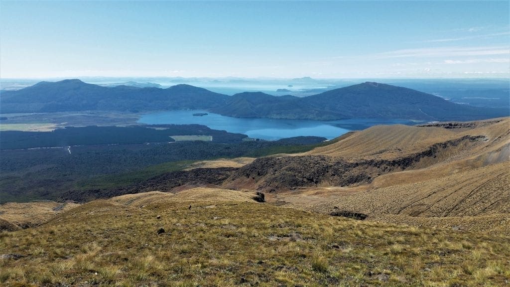
From this point you’ll get the best views of Tangeriro out over the Oturere Valley, Rangipo Desert, Kaimanawa Ranges and down towards the Emerald Lakes.
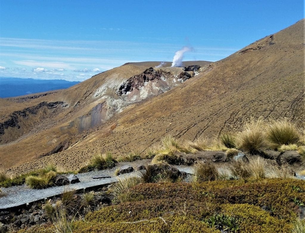
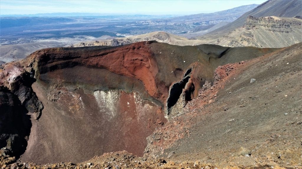
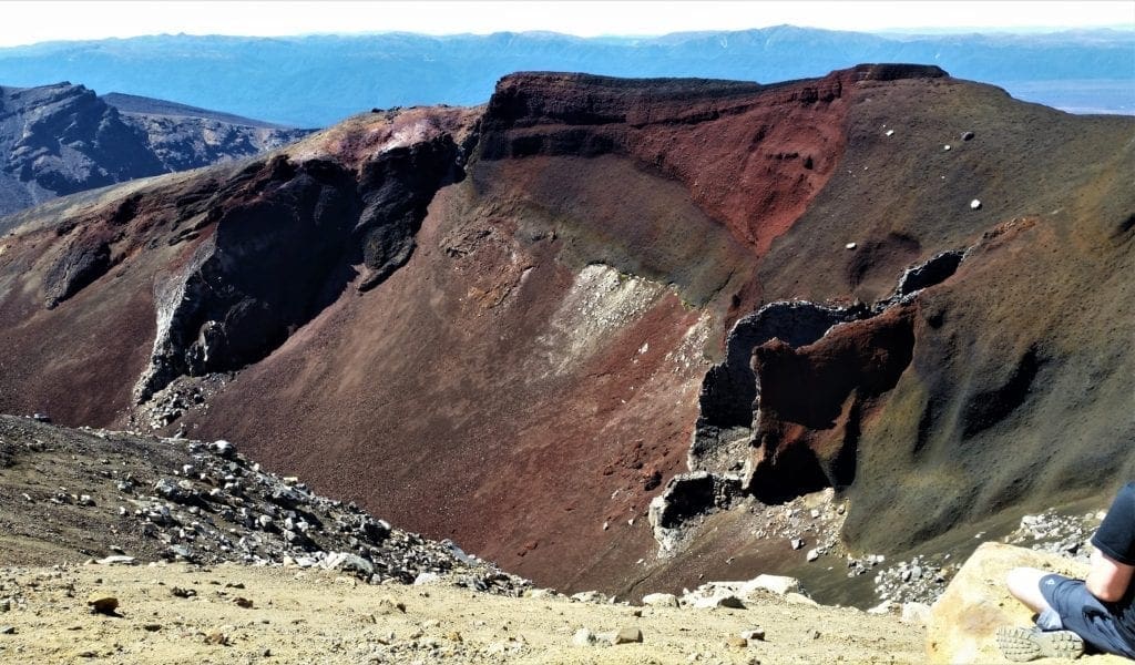
Red Crater
As you walk up the ridge to Red Crater you can smell sulphur – evidence that Red Crater is still active.
Looking into Red Crater you’ll see an unusual formation known as a ‘dike’:
-
-
- This feature was formed as molten magma moved to the surface through a vertical channel in the crater wall.
- After its outer surface solidified, the dike was later left partially hollow when the magma drained from below.
- Erosion by wind and rain of the surrounding scoria left the dike exposed.
-
The red colour of the crater is from high temperature oxidation of iron in the rock.
Some us stopped here on the narrow ridge with a view down to the Emerald Lakes for a quick snack before hiking the rest of the way down.
Red Crater To Emerald Lakes
Grade: Moderate – Allow 30 Mins
This was the most fun part. 🙂
The steep descent from Red Crater down to the thermal pools demands extra care on loose stony terrain (scree).
The relatively narrow trail was covered with thick ankle-deep dirt and gravel with a sharp drop-off on either side.
Some people were very worried about making it down without falling, and one of our guides talked them through it step-by-step.
Others figured out how to slide down through the gravel, almost like skiing, getting to the bottom in almost no time at all.
Since I had hiked Mt. Tarawera the day before, and had already made a steep scree descent, I didn’t have any problems.
The hardest part for me was safely avoiding other more timid hikers who were stopped or sitting down.
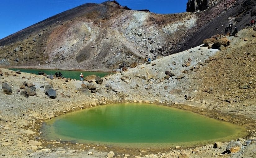
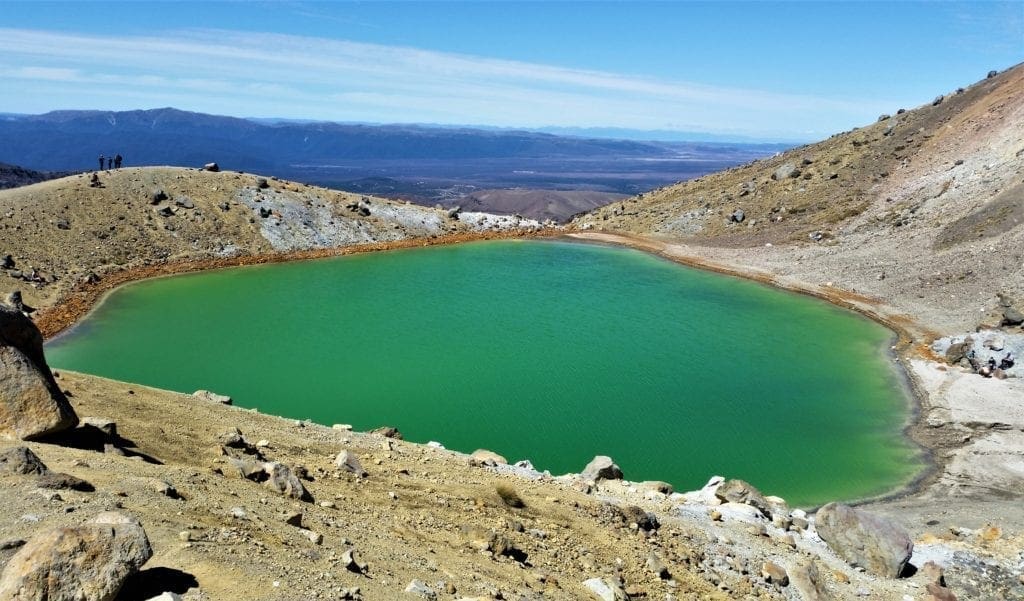
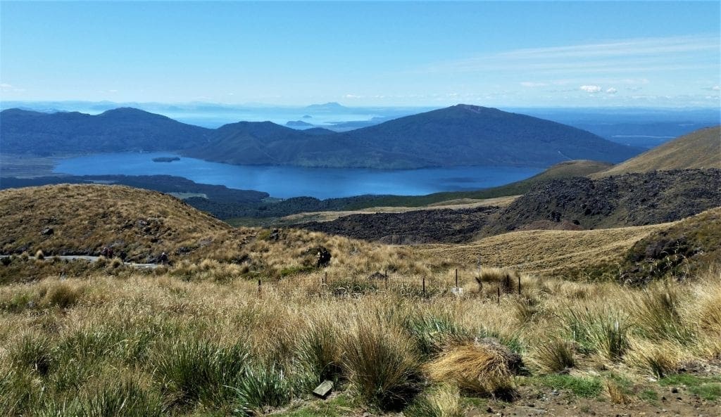
From the bottom of the scree, the track descends a little less steeply to the Emerald Lakes and you can see across to Blue Lake past the Central Crater.
The Emerald Lakes’ brilliant color is caused by minerals leaching from the adjoining thermal area.
You can even see thermal steaming – venting – around the Red Crater and Emerald Lakes.
The Maori name for the lakes is “Ngarotopounamu” – meaning greenstone-hued lakes. The water is cold and acidic, and these lakes freeze in winter.
The next two sections of the trail go through the active volcanic zone, near Te Maari craters, the site of the 2012 volcanic eruptions.
No need to worry, but observe the warning signs, and keep your stops to a minimum.
You’ll notice the trail to Otureree Hut, part of the Tongariro Northern Circuit branches off just past the lowest lake.
The Tongariro Alpine Crossing trail follows around the edge of Central Crater then climbs up to Blue Lake (a cold acidic lake).
Blue Lake is Tapu (sacred) and it is disrespectful to touch, enter, eat or drink around its shores.
Blue Lake To Ketetahi Shelter
Grade: Moderate – Allow 1 Hour
It’s a short easy climb to the edge of North Crater.
This crater was once filled with molten lava and then cooled and solidified to give a level surface more than 1000m wide.
From the top you can see Te Wai-whakaata-o-te-Rangihiroa (Blue Lake) – this translates as “Rangihiroa’s mirror”.
Te Rangihiroa was the son of local chief Pakaurangi, and Te Maari (who gives her name to the crater) was his sister.
Te Rangihiroa is thought to have explored the Tongariro volcanoes around 1750 AD.
From Blue Lake, the trail sidles around the flanks of North Crater (a cooled lava lake) and descends to Ketetahi shelter.
You can see evidence from the volcanic eruptions in 2012 – excellent views of the new steaming vents at Te Maari craters, and impact craters near the trail.
Ketetahi Shelter To Ketetahi Bus Park
Grade: Moderate – Allow 2 Hours
The trail crosses the stream that flows down from Ketetahi Springs and you’ll notice minerals in the water have stained the rocks.
The trail continues to descend through golden tussock-covered slopes to the tree line, which is the end of the Active Volcanic Hazard Zone.
The cool, shady podocarp-hardwood forest and it’s very vocal bird life provide a final contrast on the long descent to the trail’s end.
At two points the trail passes over the tongue of a lava flow from Te Maari Crater and for a while you’ll hike on a boardwalk that follows beside the Manga-a-te-tipua Stream.
Toward the end of the trail you can even take a short side track to see a waterfall.
The End of the Hike
The hike just sort of ends, and suddenly you’re at the Bus Park.
We all hung out in the shelter for a while, drinking water and waiting for the rest our group and the transport to show up.
People were tired, for sure, but no one – including the novice hikers – was injured or completely exhausted.
I really enjoyed hiking the Tongariro Alpine Crossing.
The views are fantastic, the ever-changing terrain kept us from getting bored, the trails are rugged, it was challenging but not too hard, and this hike is just really a lot of fun!
In my opinion, if you only have time to do one hike when you’re in New Zealand, it should be this one!
Of course, I’ll need to go back and hike some more, to be sure I’ve made the right recommendation 🙂
Lord of the Rings in Tongariro
Much of Frodo and Sam’s journey into the land of Sauron was filmed on and around the Volcanic Plateau in the Tongariro National Park.
Mordor – Stronghold of Lord Sauron
The fictional land of Mordor is a great volcanic plateau filled with geologic wonders known as Gorgoroth.
-
-
- The jagged volcanic rock formations and eerie barren landscapes were ideally suited to Mordor’s sizzling wasteland.
- The maze of razorsharp rocks, cliffs and ravines of the Emyn Muil is located on Mt. Ruapehu.
- Special care was taken during filming to protect sensitive ecological areas.
- Acres of carpet were laid out for the Orcs and Elves to walk on, protecting the ground underneath.
-
Many extras, including the New Zealand Army, were used in the Orc army scenes filmed on location in the Rangipo desert.
You Can Climb Mount Doom
Mt. Ngauruhoe was digitally altered to make it appear as Mount Doom for the movies.
Climbers can trek to the summit of Mt. Ngauruhoe via a poled route that leads from Mangatepopo Road end.
(This hike can also be done as part of the Tongariro Alpine Crossing if you really want to get the feel of Mordor).
Please note that this climb should not be attempted in winter without mountaineering experience and equipment. Icy slopes can make this climb extremely hazardous.
In the Shadow of Sauron’s Eye
Early in the morning, before we boarded the transport to the Park, we had transferred our bags to the lodge for the coming night.
But we hadn’t had time to get our room keys or look around.
Imagine our delight when we returned from the hike, and found that our lodgings were around the backside of Mount Doom!
Even better – all of our rooms had patios to sit outside and enjoy the view, especially at sunrise.
We all had a well-deserved dinner and relaxing evening before calling it a day.
The following morning, we packed up early and said goodbye to Tongariro.
It was a great hike, and a great trip! I hope to return to New Zealand again soon to see more magnificent scenery and hike more trails in this beautiful country.
I hope you enjoyed this post, and that it inspires you to hike the Tongariro Alpine Crossing and try one of New Zealand’s other Great Walks, too!
If you have any questions or comments, drop me a note and I’ll get back to you as quickly as I can.
You can read about other adventure trips on my Adventures for You page. For more posts about my visits to State Parks and National Parks, go to the Hiking Destinations page.
Thanks for stopping by – see you next time! LJ
To get new posts via email Subscribe here!
If you enjoyed this post, please share it:

LJ has spent much of her free time as a single Mom – and now as an empty-nester – hiking in the US and around the world. She shares lessons learned from adventures both local and in exotic locations, and tips on how to be active with asthma, plus travel, gear, and hike planning advice for parents hiking with kids and beginners of all ages. Read more on the About page.