Most recently updated May 15th, 2026
Estimated Reading Time: 16 minutes
The Shenandoah National Park is right on the edge of the areas of North Carolina and Virginia that were hardest hit by Hurricane Helene.
That said, the Park is open and many of the surrounding communities are open for business and could really use your Fall vacation dollars to help rebuild!
Go to my Hurricane Helene page to get the latest updates on the latest Park, Trail and road repairs.
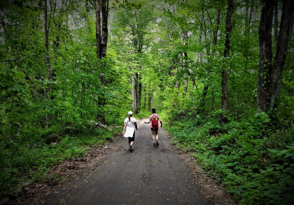
I made the journey to Shenandoah National Park in Virginia again last Spring, specifically to (finally!) hike the iconic Old Rag summit hike.
It was the hike that got away – my Moby Hike!
I’ve had plans to hike Old Rag for the past three years – but each attempt was thwarted by weather or logistics.
So I went back to try again – and I’m so glad I did!
It was a perfect-weather weekday in May before all of the families started their Summer vacations, so there were other hikers on the trail, but the place wasn’t over-run.
There’s a long rock scramble to the mountain’s summit that works better with some teamwork – especially if you’re a little bit vertically challenged, like I am 🙂
I conquered Old Rag, then I found a couple of other rock-scrambly hikes in Shenandoah that were a little less daunting to do the next day.
Read on to learn how you can hike Old Rag, and those other hikes too!
Or if you prefer video, take a look at the Shenandoah playlist on IRW YouTube.
Some of my posts contain affiliate links. If you make a purchase through an affiliate link, I will receive a small payment at no additional cost to you. I do not get paid for recommendations, all opinions on this site are my own. See full Disclosure page here.
Where is Shenandoah National Park?
Shenandoah National Park is only 115 miles from Washington, D.C., 95 miles from Richmond VA, and 250 miles from Raleigh NC.
That’s close enough for a great long weekend or longer family vacation, without the expense of air travel!
Like last year, my trip this time was a quick visit of only 3 nights – just enough time to hike Old Rag plus a couple of other great hikes and see some local sights!
Plan Your Visit
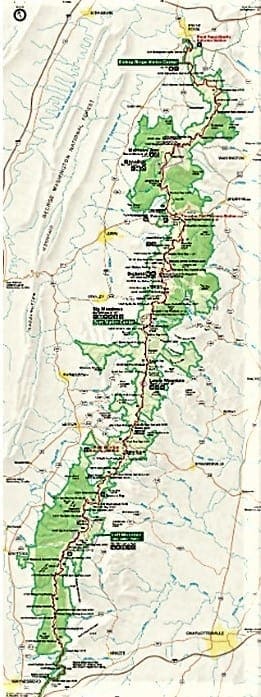
When you enter Shenandoah National Park, you’ll be on Skyline Drive – the primary roadway within the park.
Because the park stretches out over such a long distance, you’ll need to include extra time to get from your lodgings to your trailhead in your planning.
Park entrances on Skyline Drive:
Front Royal (North Entrance)
21073 Skyline Dr, Front Royal, Va 22630
Thornton Gap
31339 Skyline Dr, Luray, Va 22835
Swift Run Gap
22591 Spotswood Trl, Elkton, Va 22827
Rockfish Gap (South Entrance)
282 Skyline Dr, Waynesboro, Virginia 22980
Old Rag Parking & Trailhead:
Figure time to hike your trail on top of your travel time to estimate when you need to set out in the morning to get back to your trailhead before sunset.
It also helps to know what time the sun goes down 😉
The closest park entry to my cabin was the Swift Run Gap Entrance Station, near the center of the park.
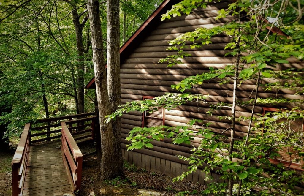
So I planned the timing for all of my trips into the park using that entrance – knowing it would take me about 40 minutes to get to the park entry from my cabin in Gordonsville, Va.
The trailhead for Old Rag is different, because it’s outside of the Park in Etlan, Va. You still need to do the same time planning, though.
The trailhead for the Old Rag Circuit Hike is actually inaccessible from Skyline Drive (inside the Park), so use roads outside the Park to get there.
Permits and Passes for Old Rag
To get into Shenandoah (like other National Parks) you’ll need to have some sort of pass or pay a day use fee.
Even though the parking area for Old Rag sits outside of the central part of Shenandoah National Park, you have to pay the Park entrance fee to hike Old Rag.
There’s a manned pay station at the trailhead, so take cash or your National Park pass with you. (The fee is $30 per car or free with Annual Pass.)
If you’d like to purchase an annual pass, go to this website.
Old Rag Day Hike Tickets
In addition to a Park entrance pass, visitors to Old Rag Mountain area (including hikers on the Saddle, Ridge, and Ridge Access trails) need to get an Old Rag day-use ticket in advance online.
The tickets are only $1 each, so I bought tickets for two different days. That way if the weather was bad on one day, I could try the next.
Print out your ticket, or have it available on your phone. They’ll ask to see it at the Old Rag trailhead, and Rangers randomly ask for it on the trail, too.
Learn more on the Old Rag day-use ticket FAQ page.
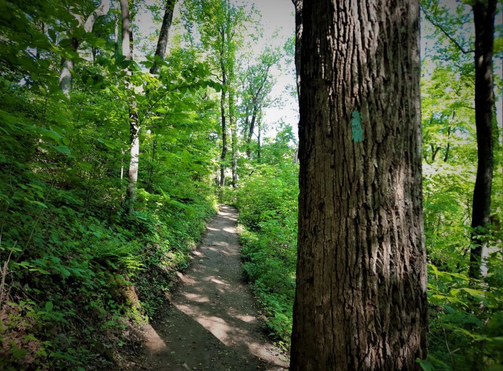
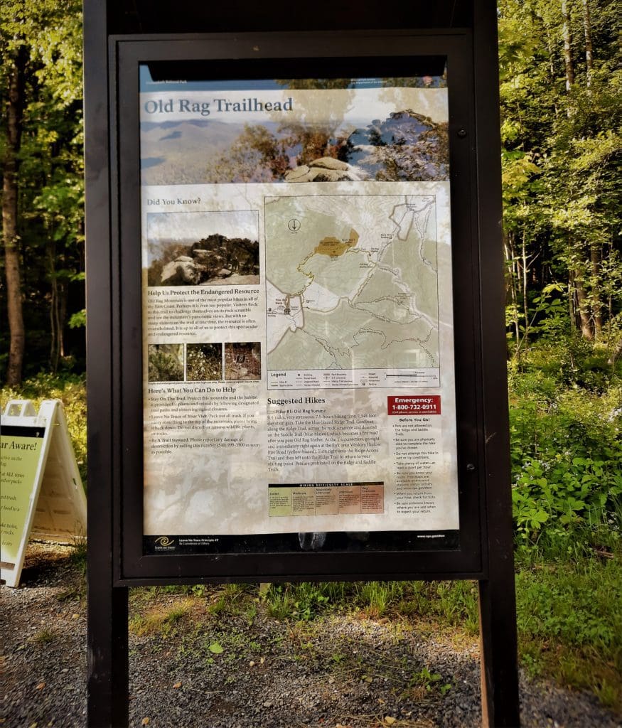
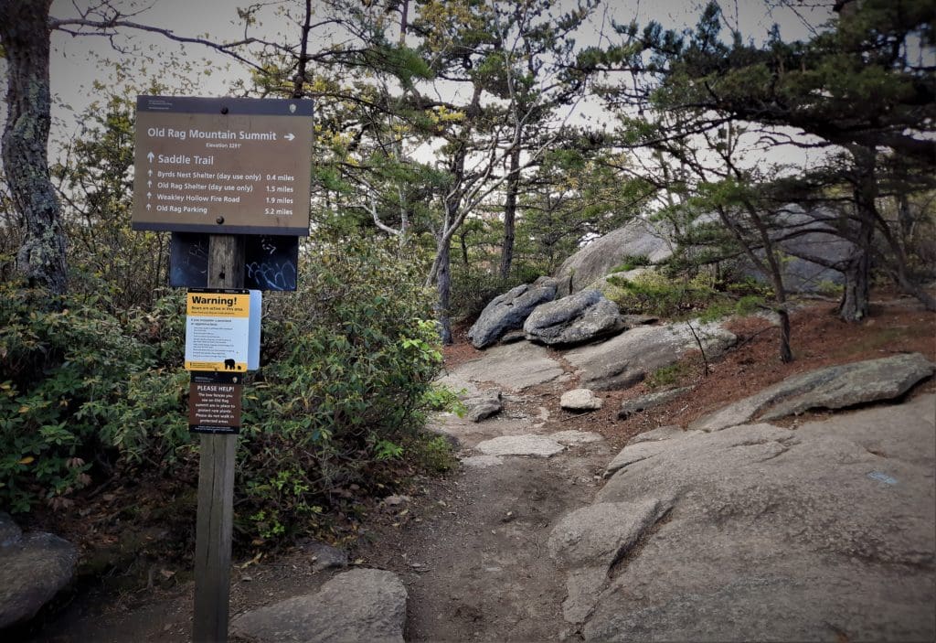
Trail Markings and Maps
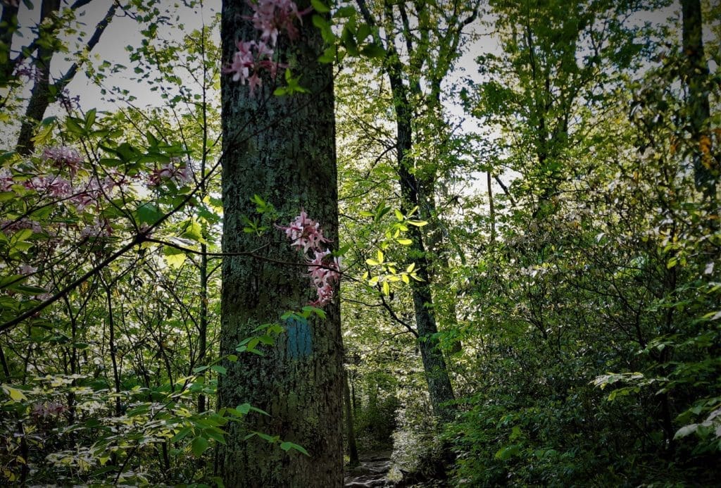
All hiking trails in Shenandoah National Park are marked with colored paint on trees or rocks.
-
-
- Blue paint for regular trails
- Yellow paint for horse trails or fire roads
- White blazes for the Appalachian Trail.
-
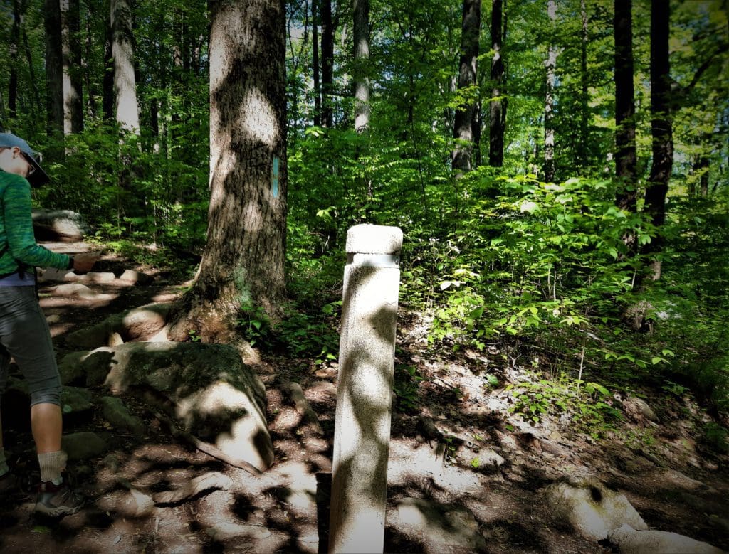
You’ll find a cement post at every trail intersection.
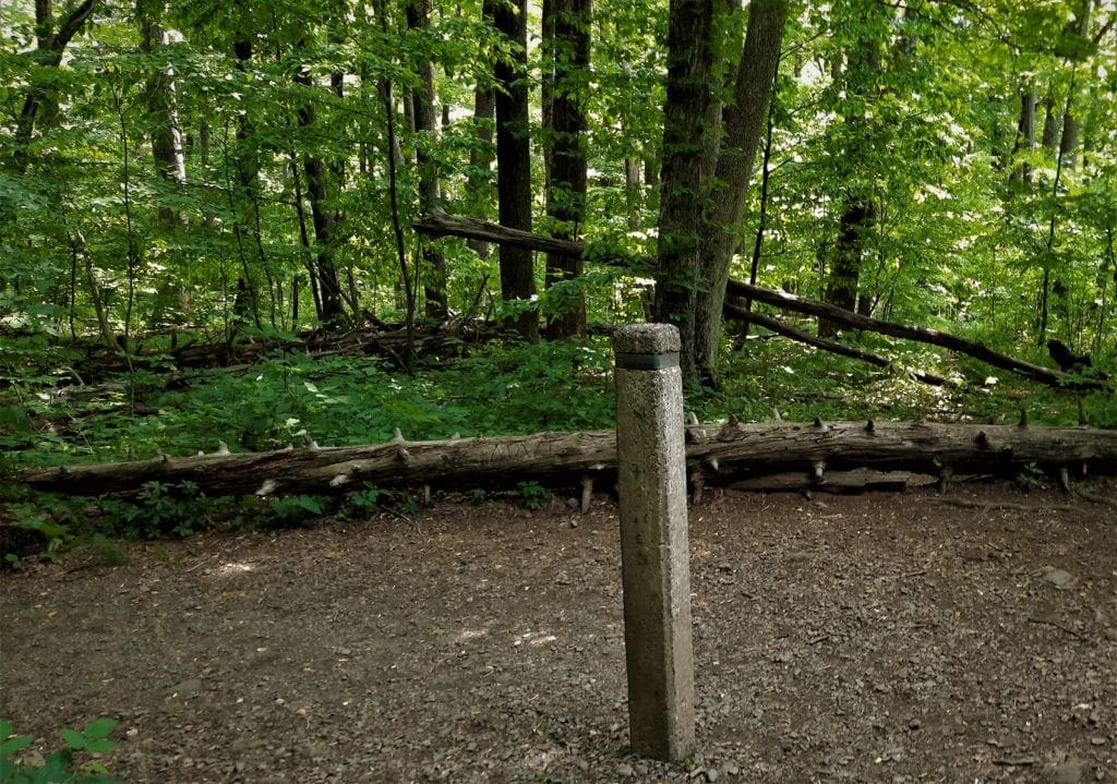
These posts have a metal wrapping around their top, stamped with trail names, directions and distances.
Even though Shenandoah’s trails are clearly marked, it’s still a good idea to have a map (and compass) with you.
This Shenandoah National Park maps page has a full park map, and maps of the individual park sections with trails as well.
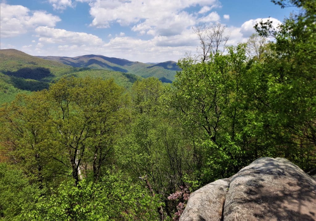
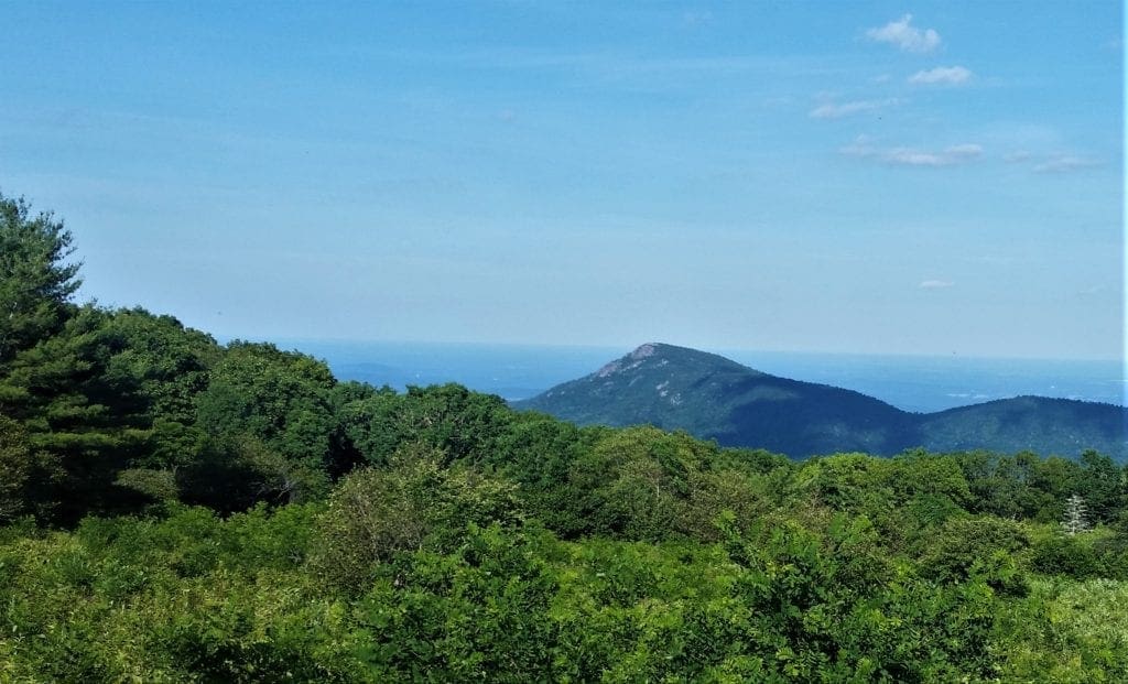 View of Old Rag mountain from Skyline Drive.
Old Rag a.k.a “Moby Hike”
The Park website says: “a day on Old Rag is one of Shenandoah’s premier experiences”.
I can’t disagree. Though I’ve hiked a number of great hikes in Shenandoah, this one was just a bit different.
The Old Rag Circuit hike is a full day, 9.5-mile roundtrip circuit, takes 5-7+ hours to complete and climbs more than 2600 ft, with most of the gain in the first 3 miles.
After you hike uphill for a few miles you’ll still need to scramble and claw through another mile of rocky terrain before starting down the Fire Road to complete the trail.
This hike is rated by the Park as “very strenuous”, and I think it would be to most people – especially in the heat of Summer.
Is This Hike for You?
The Old Rag hike is ranked among the 22 best hikes in Virginia and top 25 hikes in the world.
Yes, the whole world. Not just the United States. So, yeah, it’s amazing 🙂
That said, the Old Rag circuit hike is not for everyone. You need to have a certain level of fitness, and a minimal level of common sense.
If you don’t, you could get hurt, cause harm to others, or go to jail. Seriously.
For example, in October 2020 – for two days in a row – hikers had to be rescued from atop Old Rag.
In both cases, the injured hikers were reported late in the day – too late for a same-day rescue by helicopter.
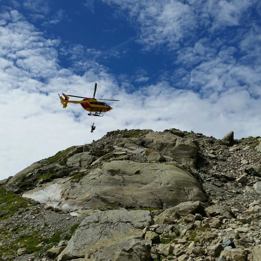
So both times the injured hikers and emergency teams had to wait on top of the mountain until morning.
This looks pretty cool, but is the opposite of fun, and very expensive, too.
Following these incidents, the Park cautioned visitors that they may be charged with “disorderly conduct” if they require rescue due to a series of bad decisions.

In this case, bad decisions could include things like:
-
-
- Improper footwear to hike (e.g., flip-flops),
- Not carrying a flashlight or first-aid kit,
- Not carrying enough water, and
- Setting off on a hike too late in the day.
-
These kinds of incidents have increased in recent years, I think due in part to people trying new things to escape the confines and closures of COVID-19.
I also blame Instagram Models who post selfies (in unlikely outfits) in front of peaks or trailhead signs, having only “hiked” across the parking lot.

Photos on social media – even from legit hikers – often give the impression that these strenuous (and sometimes dangerous) hikes are easy.
The result is that new visitors to the Parks are sometimes unprepared for dealing with the outdoor elements and difficult terrain.
I’ve never learned the art of the selfie – luckily for you! – but this isn’t just sour grapes, truly.
Bottom line, be prepared, and be realistic about your physical abilities.
If you’re unsure and want to train yourself up to it, try my 8 Weeks to Awesome training plan 🙂
Getting There – Trail Access
Although Old Rag Mountain itself is within the boundaries of Shenandoah National Park, most people approach it from outside the Park’s eastern boundary, instead of from Skyline Drive.
Though you need to pay an entrance fee, parking at the lots operated by the National Park Service is free.
Trailhead Directions
From Madison to Old Rag Parking: From Route 29 Business, turn onto Route 231 and follow it for 12.8 miles. Turn left onto Route 602. Follow signs for the parking area, approximately 3 miles.
GPS Trailhead Address: 2577 Nethers Rd, Etlan Va.
IMPORTANT NOTE: GPS is notoriously spotty in Shenendoah, so don’t rely solely on your device to get you there and back. You may want a printed map with directions.
My GPS got me to the trailhead all right, but afterwards, trying to go home, I couldn’t get signal and spent some time driving around just *hoping* I was going in the right direction.
Choose Your Route
There are a lot of different ways you could combine the trails in the Old Rag area, as long as you have a decent trail map.
But for the purposes of this article, I’m going to stick to the route I went which is listed by the Park, along with some other options, in their Old Rag Area Maps and descriptions.
They should know, right ? 😉
Old Rag Circuit Hike
If you opt to do the Old Rag Mountain loop, which is what I did, you’ll go clockwise up the Summit Ridge Trail to the rock scramble and hike down the Weakley Fire Road on the way back to recover.
TRAILHEAD: 2577 Nethers Rd, Etlan, VA 22740-2383
-
- Distance: 9.5 miles
- Difficulty: Very strenuous
- Time Needed: 5-7 hours depending on your fitness and crowds
- Type of Trail: Loop
- Elevation Gain: 2,683 feet
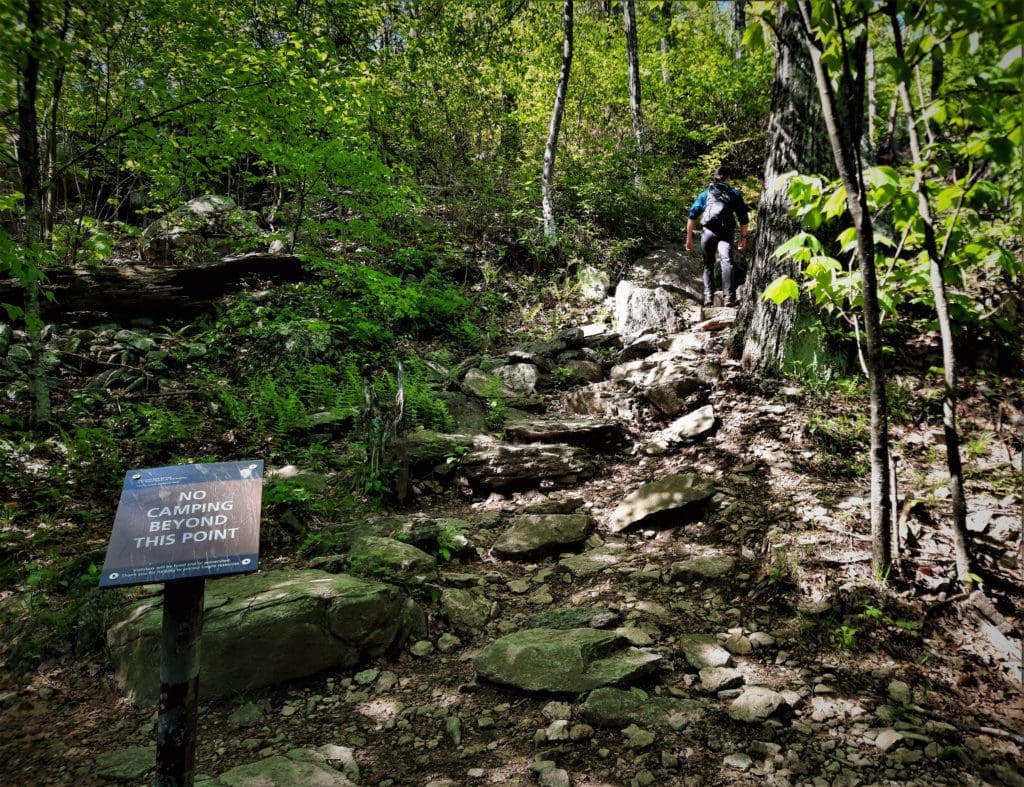
NOTE: Pets are not allowed on trails to the Old Rag rock scramble or summit, but there are some alternate hikes for pets that start from this trailhead.
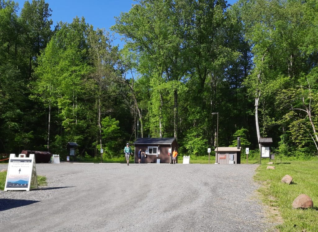
Old Rag Parking
Get to the Old Rag parking lots early as they do fill up quickly!
I got there around 9am on a weekday in mid-May, and the first parking lot – the upper lot – was almost full already.
After I hiked back down the trail, I noticed some spots had opened up, so another option could be to get there after noon, when the early hikers are finishing up.
But whenever you start, make sure you have plenty of time to complete the hike during daylight hours.
To get to the Old Rag trailhead and start your hike, walk to the back of the upper lot near a couple of small buildings.
Here you’ll find the National Park pay station as well as the trailhead bathrooms.
From there, head to your left and up the trail!
I’ve mentioned the “rock scramble” a couple of times, like you know what I’m talking about. Just in case you don’t, I’ll tell you 🙂
What is Scrambling?
Scrambling is how we describe hiking in rough and rocky terrain that involves using your hands and feet – and sometimes elbows and knees too – while hiking rough terrain.
Rock Scrambling Safety Tips
Rock scrambling (at it’s simplest level) doesn’t require any previous experience, but it can still be dangerous.
Here are some tips to avoid injury:
-
-
-
- Take It Slow – This allows you to plan your next move and keep your balance.
- Watch Your Footing – One misstep on the rocks and your foot could slide in a crevice and strain or break your ankle.
- Don’t Push Your Limits – If a hike feels too challenging, turn back. Come back when conditions are better, or you feel stronger.
- Turn Around – If you realize partway through a scramble that it’s too hard, turn around.
-
-
Scrambling isn’t for everyone, and that’s okay. Depending on the trail, a scramble can be challenging, and sometimes very dangerous.
To improve your scrambling skills, try training in a gym to improve upper body strength, agility and stamina.
Then get out there and try again!
Let’s get to the actual hike, shall we? 🙂
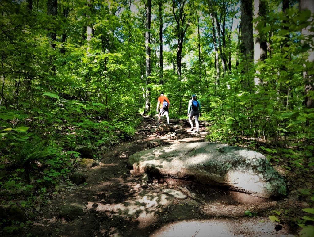
Hike the Old Rag Circuit Hike
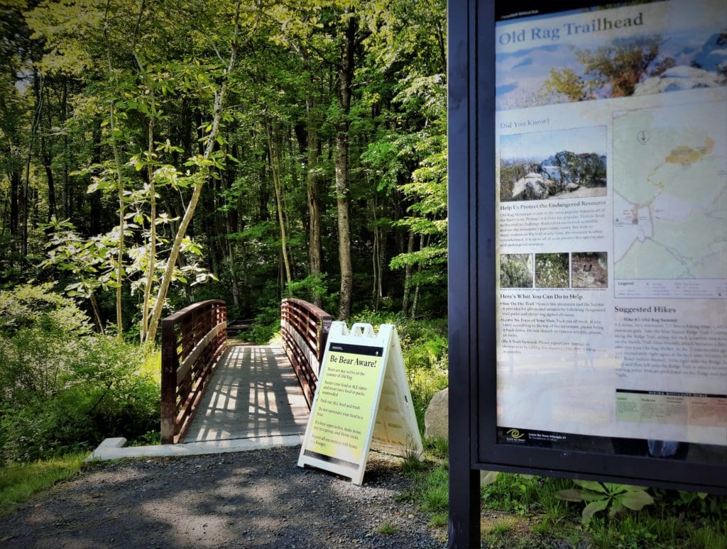
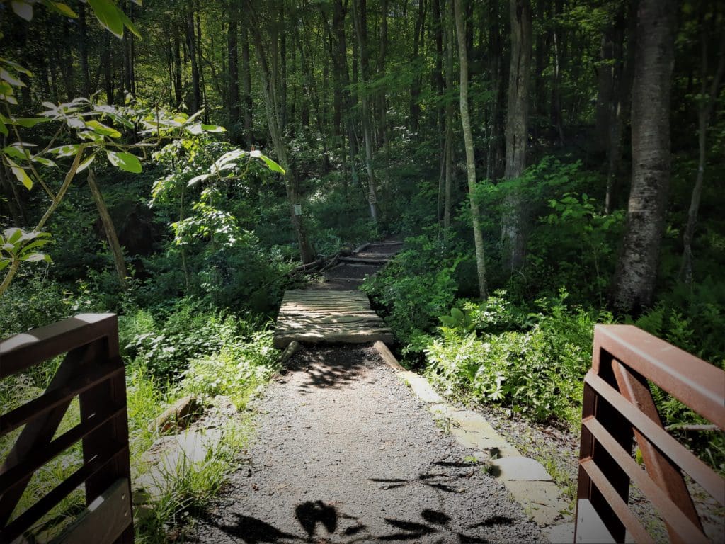
Walk past the trail kiosk and over a footbridge to begin your hike on the Old Rag Trail.
This switchback-laden trail section goes on for a little less than a mile.
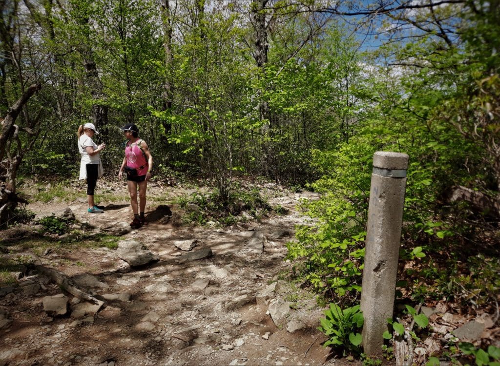
You’ll reach a concrete trail marker and an intersection.
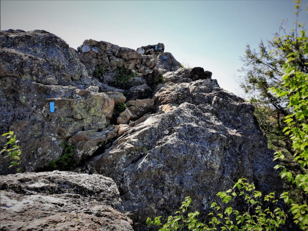
Stay left to take the blue-blazed Ridge Trail to the rock scramble that leads to the top of Old Rag.
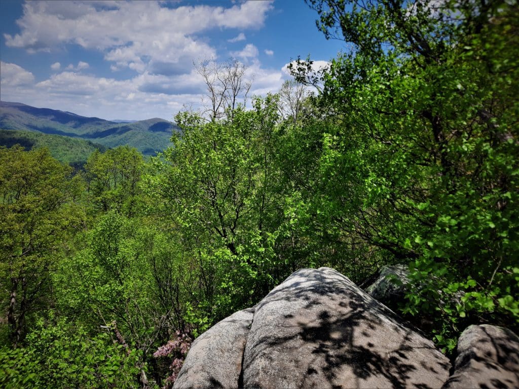
Ahead of the Old Rag rock scramble, you’ll reach a rocky outcrop, probably at the 2.6-mile mark.
The views are fantastic!
Time to Scramble
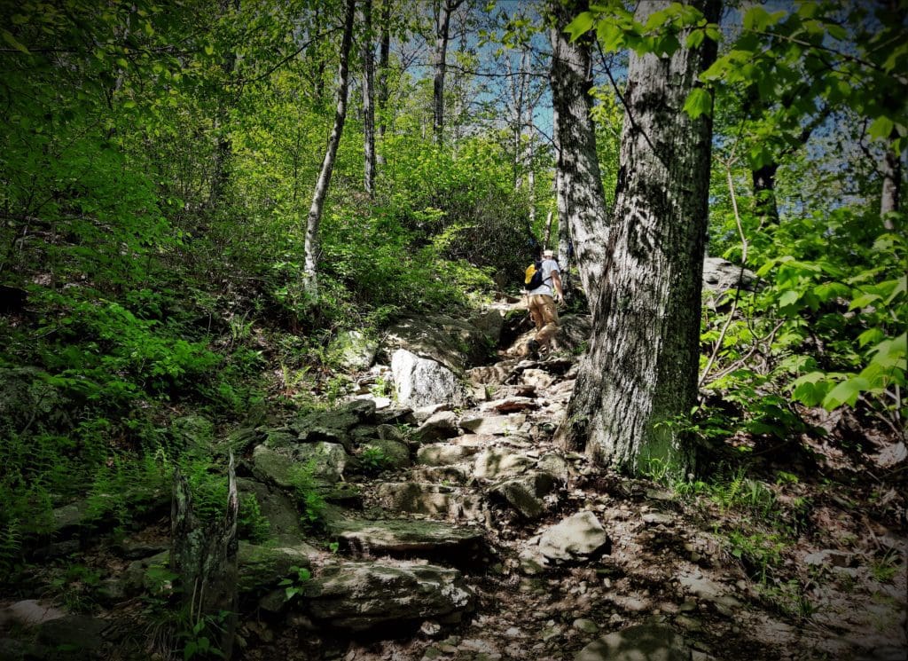
The rock scramble begins in earnest at the 2.8-mile mark. From here, it’s all climbing, gripping, pulling and scrambling to reach the top.
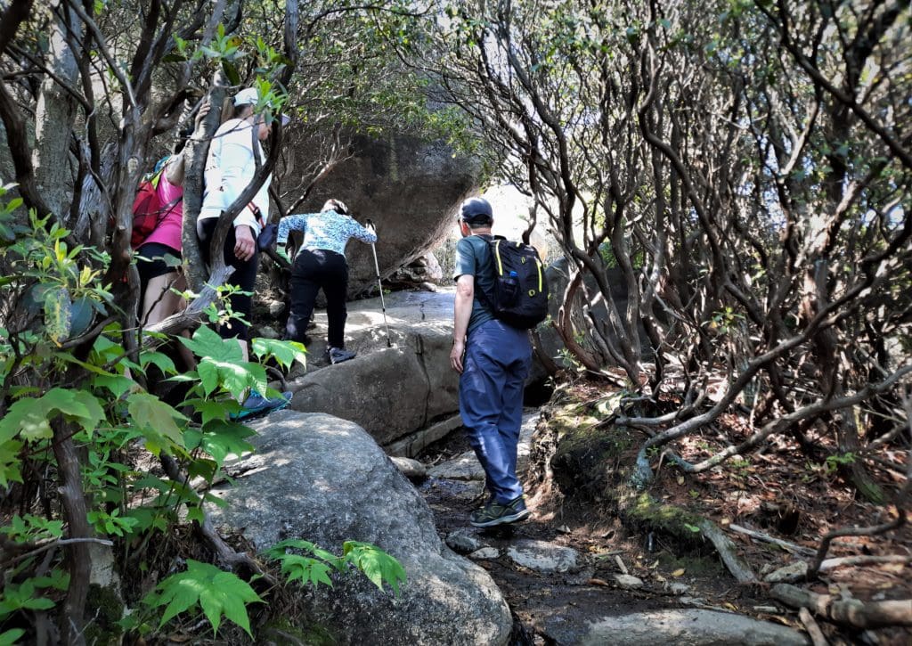
The scramble lasts for over a mile, moving up towards the Old Rag summit.
You’ve got to navigate tight spaces and rocky passages, slide down granite surfaces and use your upper body strength to pull yourself up onto rocks and boulders.
There are even some spots where you need to remove your pack to squeeze between the rocks.
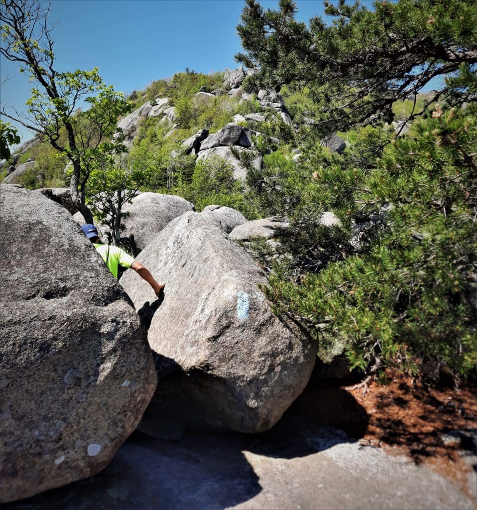
Early on in the rock scramble, you’ll reach a narrow crevasse, maybe six or seven feet deep. You’ve got to find your footing and get down into the crevasse to move forward.
This particular section causes a lot of hikers to hesitate – I know I did!
When it’s really crowded, the wait time to get through this passage can be up to 90 minutes.
Since I hiked Old Rag on a weekday before family vacation season, people did bunch up, but there was really no wait to complete this section of the rock scramble.
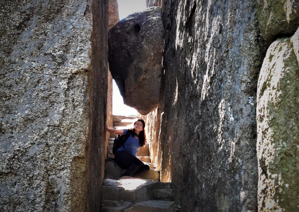
At the 3.0-mile mark, you’ll reach a staircase that goes right through a boulder – with another smaller boulder lodged above the staircase. It’s very cool.
That was the easy part of the scramble. From there it got much harder, and really there was no safe way to take any photos. You’ll just have to take my word for it 🙂
At the start of the scramble I was hiking behind a family that had done the Old Rag hike several times before, and they knew all the tricks.
For instance, there were times when it was hard for me to reach the next handhold (I am rather petite) and the man would just stick his leg out so I could grab his foot to pull up on.
I was very grateful for his help!
I recommend wearing long pants to protect your legs, carrying a very small pack, and wearing climbing gloves to improve your grip.
While we were scrambling, we were still going uphill very steeply, and I stopped to rest for a minute, while the family kept on.
So I ended up hiking with two other women – Dawn and Cecilia.
We teamed up and found our way to the the 3.8-mile mark, with a trail sign for the summit.
Then…Success!!
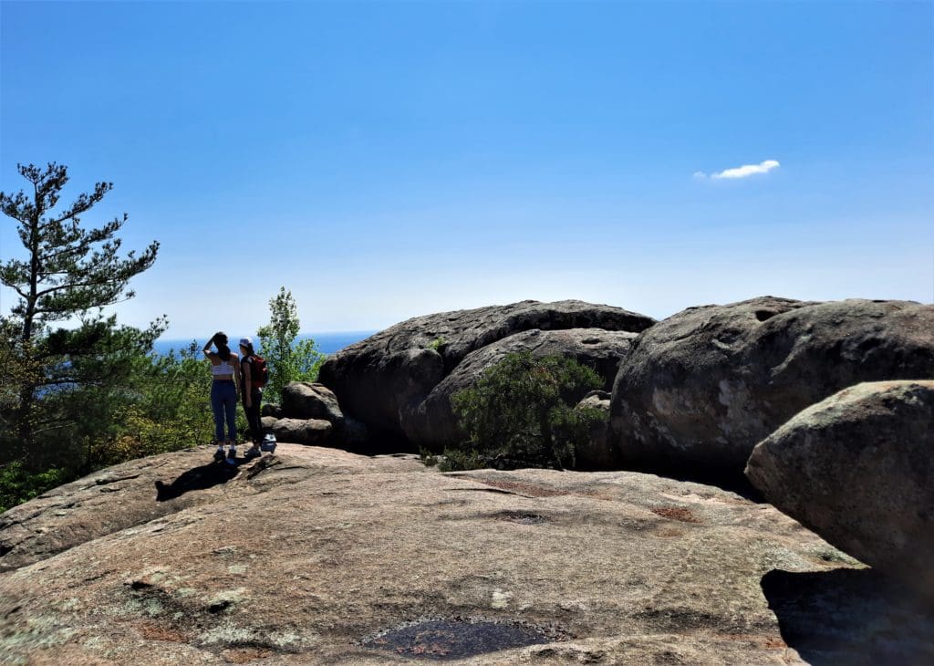
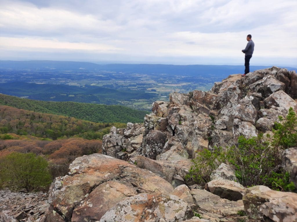
The Old Rag Summit
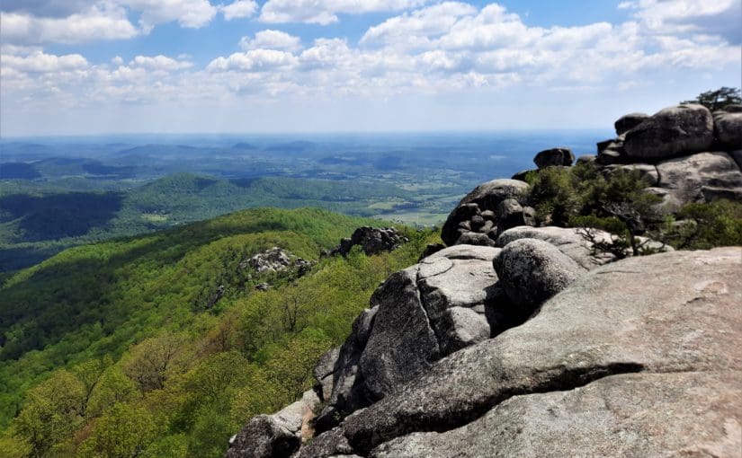
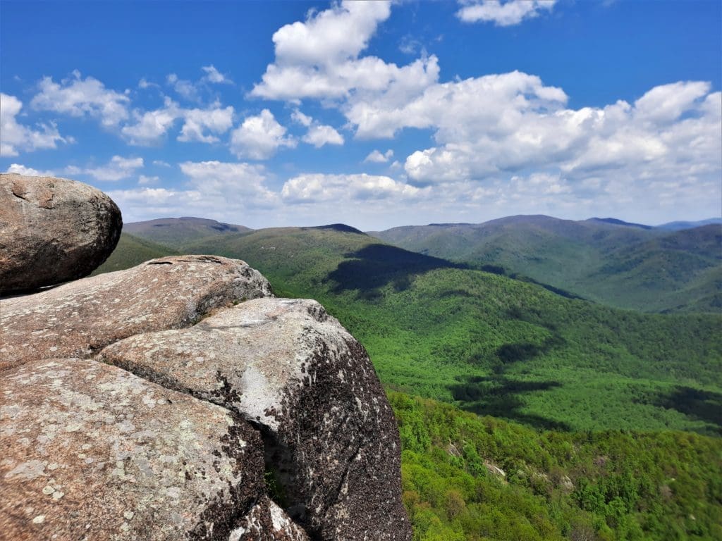
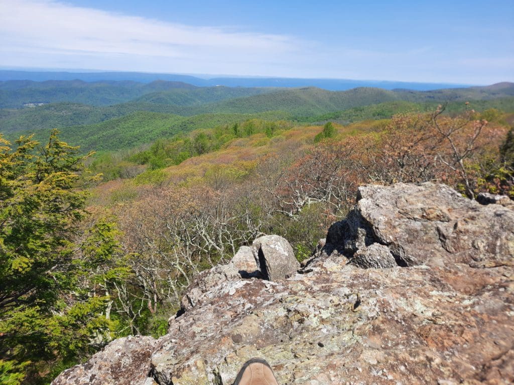
The summit of Old Rag sits at 3,284 ft and offers fabulous 360 degree views of the surrounding mountains and valleys.
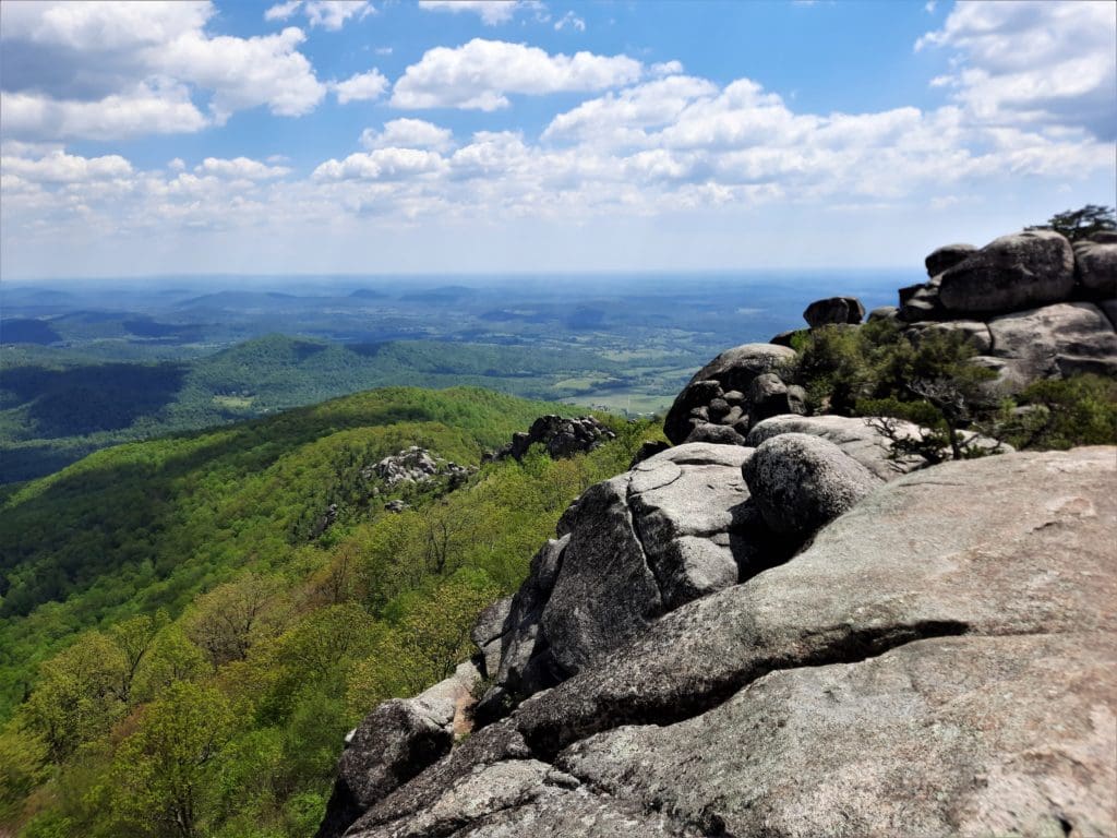
With many boulders sticking out of the top, you’ll be able to climb up and find a perch to relax and take in the views before you head back down.
Getting Down (with your bad self)
When you’re ready to go back down, re-trace your steps to the trail sign.
Turn right to complete the loop.
An out-and-back hike would be shorter, but I just said, “No!” to hiking the scramble in the opposite direction on the way back down.
Besides, it’s a really bad idea to go against the flow of humanity on a steep dangerous trail.
I found that out when we hiked Angel’s Landing on a hiking trip to Utah parks a few years ago.
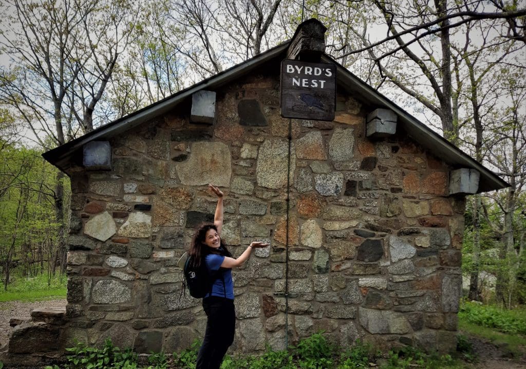
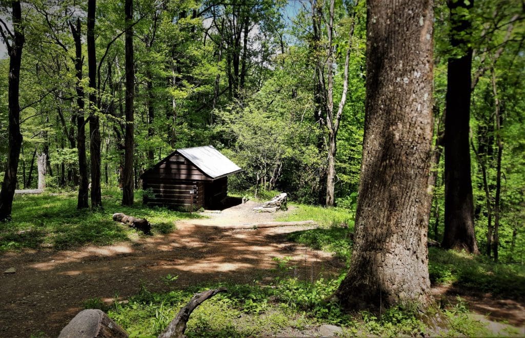
At the 4.5-mile mark, you’ll reach Byrd’s Nest Shelter. This is a day-use shelter with a picnic table.
Turn right here to connect with the blue-blazed Saddle Trail.
In less than one mile, at the 5.4-mile mark, you’ll reach Old Rag Shelter. This is another day-use shelter with a picnic table. There is also a vault toilet.
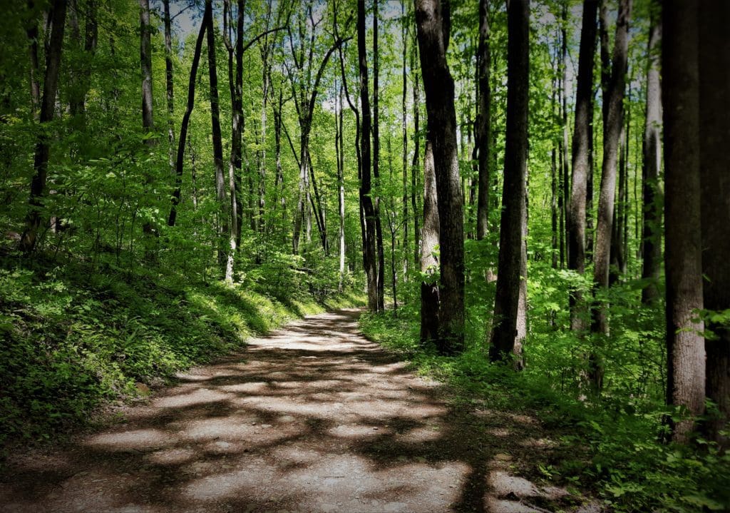
From here, turn right onto the Weakley Hollow Trail. This is a wide dirt hiking trail.
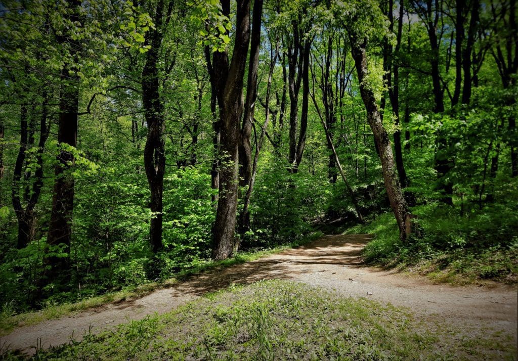
At the 6.0-mile mark, turn right at the large trail kiosk. From here, it’s an easy walk along the gravelly yellow-blazed Weakley Hollow Fire Road.
I guess you could describe the walk along this fire road as boring, especially after the challenging and strenuous rock scramble. But it’s also a nice break 😉
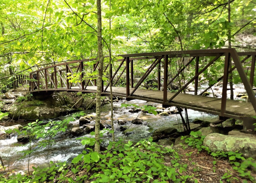
At the 7.3-mile mark, cross over Brokenback Run. You’ll walk alongside cascading waters for the next mile. Several spurs allow you to get close to the water.
You’ll cross back over Brokenback Run at the 8.3-mile mark. You’ll actually cross over four different footbridges.
At the 8.5-mile mark, you may recognize the paved traffic circle from the previous hike route.
On the new route, you’ll turn right at the trail kiosk and have another 1.2 miles to go. (Which makes the hike more like 10.5 miles than the 9.5 miles in the hike descriptions.)
We ran into a Ranger at that point who told us we could either hike the 1.2 miles (uphill) or go less than a half mile down the paved road that connects the old parking lot.
We decided we were done with going up for the day, so took the shorter option.
We passed the old lot, walked a side street for a minute, and came out very close to the new parking lot.
Then we exchanged numbers, said goodbye, and I spent the next hour driving around in circles trying to find signal 😉
While this hike only took me about 5 hours, it could have taken much longer.
Fortunately, I got a perfect weather day with low crowds and not much back-up and waiting at the scramble.
Even if you’re in peak condition, if the trail is busy, you may get stuck waiting for a good while while people maneuver in the scramble.
Allow yourself more than enough time for the hike. This will reduce your stress if you have to wait for others, and you’ll avoid having to race the sun.
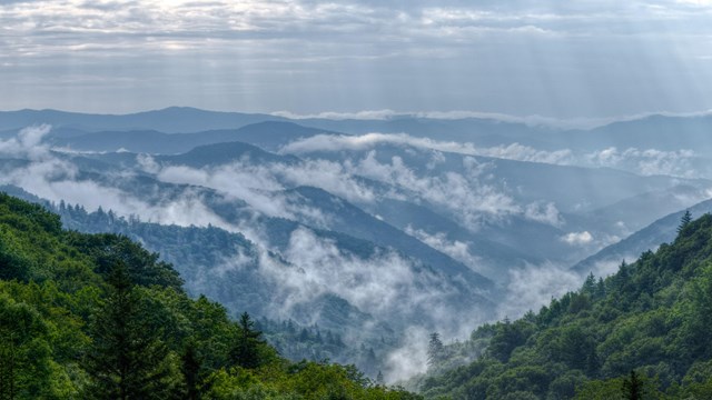
Other Shenandoah Scrambles
I hiked Old Rag the first day of my visit to Shenandoah, so with that done I ventured into the Central part of the park the next day.
My goal was to continue the theme of scrambling, but in a less strenuous and time-consuming way than the Old Rag hike.
I wouldn’t recommend taking children younger than teenagers through the Old Rag scramble, simply because of their short reach.
But the scrambles below can give kids – and adults too! – the same feeling with a much shorter hike and much less elevation gain.
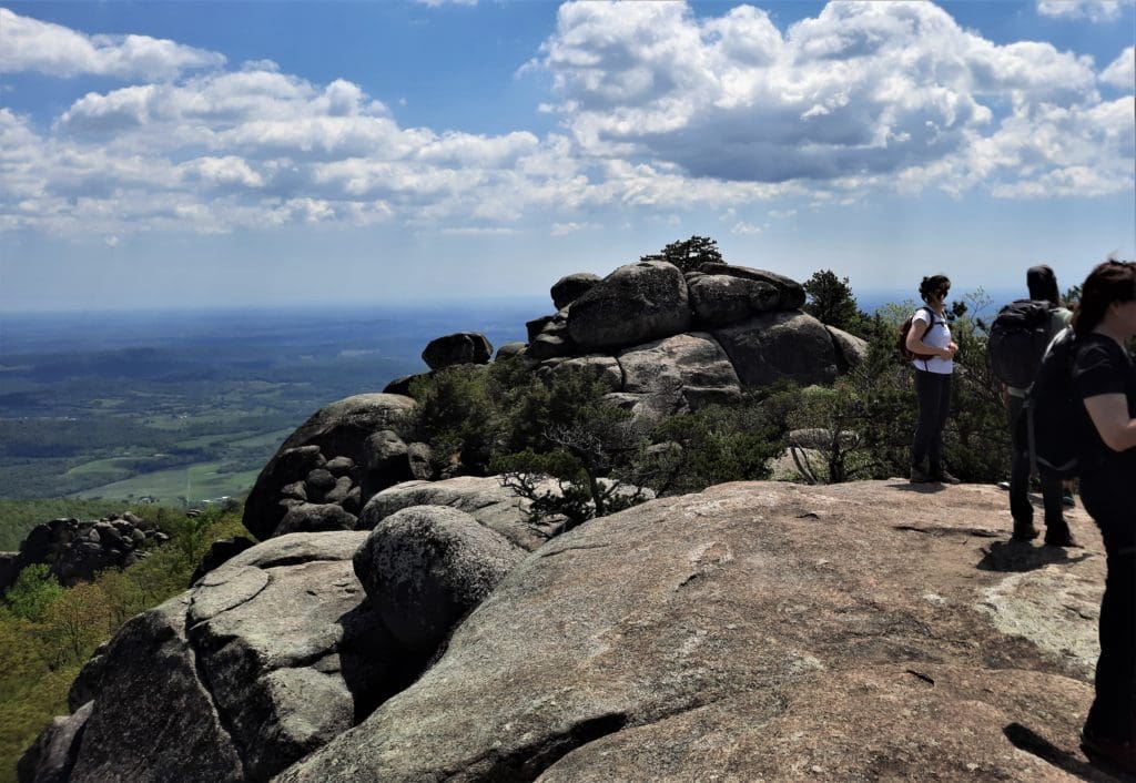
I started in the morning with the Bearfence Rock Scramble.
The Bearfence Rock Scramble
Don’t underestimate this short Skyline Drive hiking trail, particularly the rock scramble. (That said, there’s an option that will get you to the viewpoint without the scramble, too.)
You’ll find a large trail sign in the parking lot outlining the Bearfence Rock Scramble Hike (the harder one) and the Bearfence Viewpoint Hike (the easier one).
Like any good scramble, you’ll need to use your hands, feet and arms, even knees to reach the top.
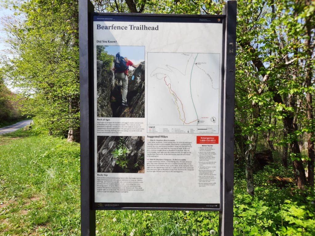
But if you’re up for the challenge, it’s totally worth the effort!
TRAILHEAD: Milepost 56.4 on Skyline Drive. You’ll find maybe a dozen parking spaces. The trailhead is directly across Skyline Drive.
-
- Distance: 1.4 miles round trip
- Difficulty: Moderate
- Time Needed: 1 Hour
- Type of Trail: Loop
- Elevation Gain: 311 feet
NOTE: Dogs are not allowed on this trail (for very good reason).
Also, don’t even attempt this trail if it is wet or icy in any way. The rocks will be dangerously slippery.
After I finished Bearfence, I quickly moved on to Stony Man.
Stony Man Hike
There are a couple of different options for this hike, and you can start from two different trailheads.
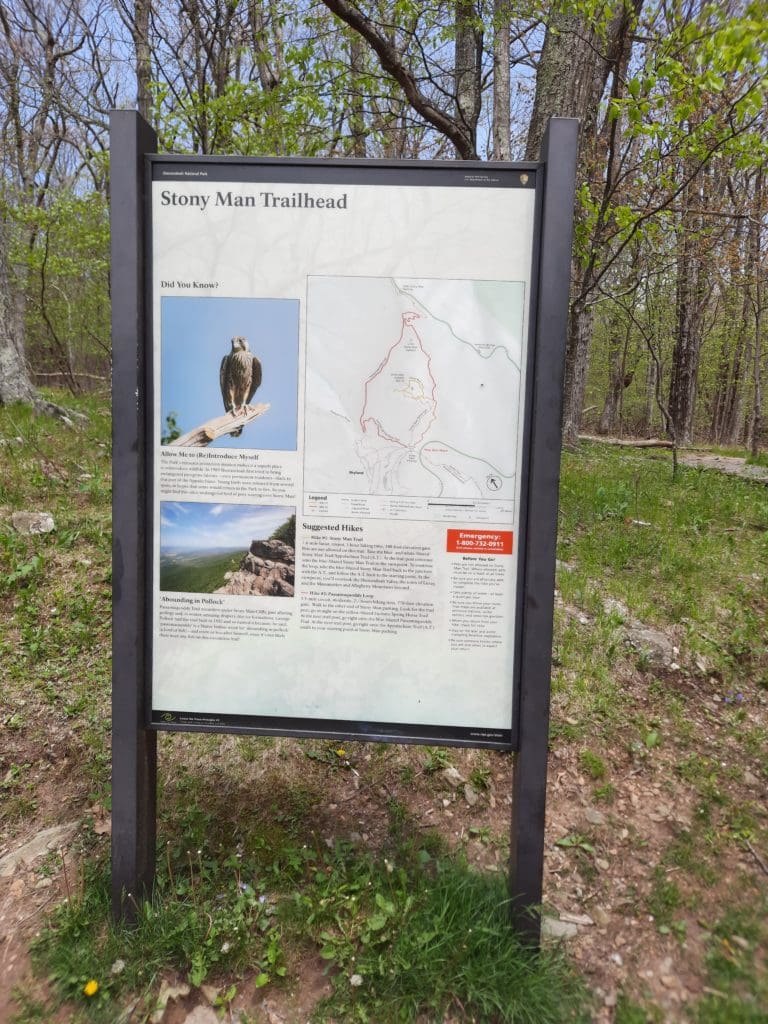
-
- For a longer 4-mile hike, park at the Little Stony Man trailhead near MP 39.
- For a shorter 1.6 mile option – and also access to the longer hike – turn into the Skyland Area between MP 41 and MP 42, and park in the lot immediately on the right.
I started from the second trailhead, for more options, and ended up taking the shorter trail to the Viewpoint due to threatening rain.
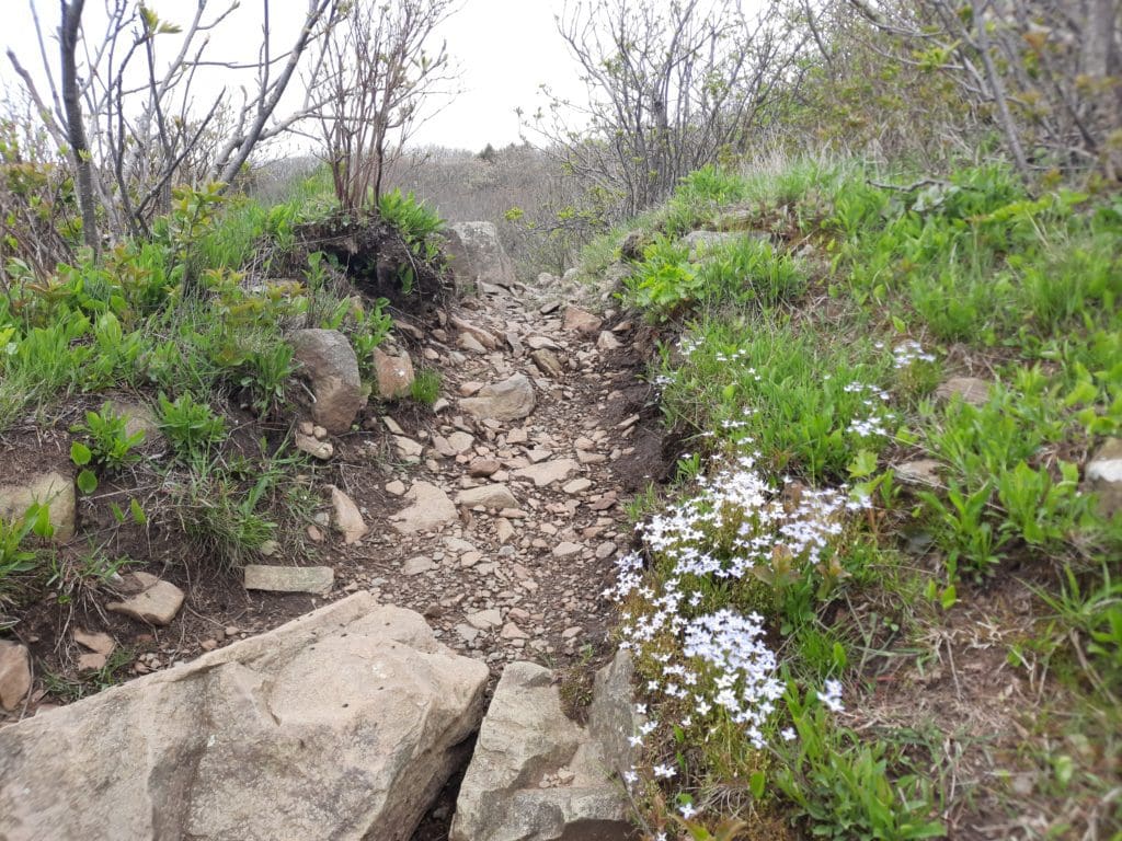
This trail is mostly smooth pea gravel and shouldn’t be at all difficult for most people, and it’s beautiful and lined with wildflowers in Springtime.
I even saw a doe grazing beside the path, and she didn’t seem at all bothered by me.
The rocky outcroppings at the Viewpoint are fun to climb on, and not challenging, but you’ll want to watch your step – and the views are very impressive!
TRAILHEAD: Skyland entry between MP 41 and MP 42
-
- Distance: 1.6 miles
- Difficulty: Easiest
- Time Needed: 1 Hour
- Type of Trail: Loop
- Elevation Gain: 340 feet
NOTE: No pets are allowed on this trail .
I got back to the trailhead just before the rain came down, and headed back down the mountain to my cabin for the evening.
The next morning I left for home – and had some adventures along the way! But that’s a story for another time 🙂
Park Info
Shenandoah National Park is always open. Campgrounds, and picnic grounds begin opening in March and close by late November.
Learn about visiting Shenandoah here.
I hope this post has inspired you to visit Shenandoah National Park and hike Old Rag!
You can learn more about other great Shenandoah hikes here: Shenandoah Visit Guide and week of hikes!
If you have any questions drop me an email and I’ll reply as soon as I can.
Thanks for stopping by – see you next time! LJ
To Get New Idratherwalk Posts
sent directly to your inbox (how convenient!) Click this Button
If you like this post, please share it!


LJ has spent much of her free time as a single Mom – and now as an empty-nester – hiking in the US and around the world. She shares lessons learned from adventures both local and in exotic locations, and tips on how to be active with asthma, plus travel, gear, and hike planning advice for parents hiking with kids and beginners of all ages. Read more on the About page.