Most recently updated April 27th, 2026
Estimated Reading Time: 18 minutes
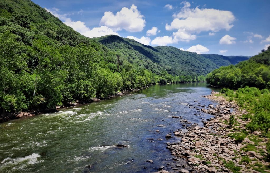
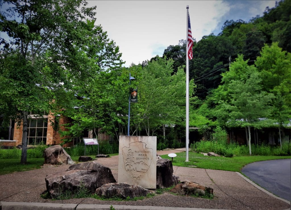
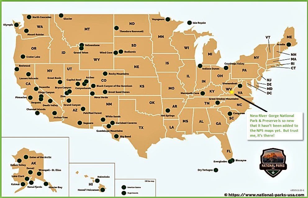
New River Gorge National Park and Preserve in West Virginia is our nation’s 63rd – and newest – National Park.
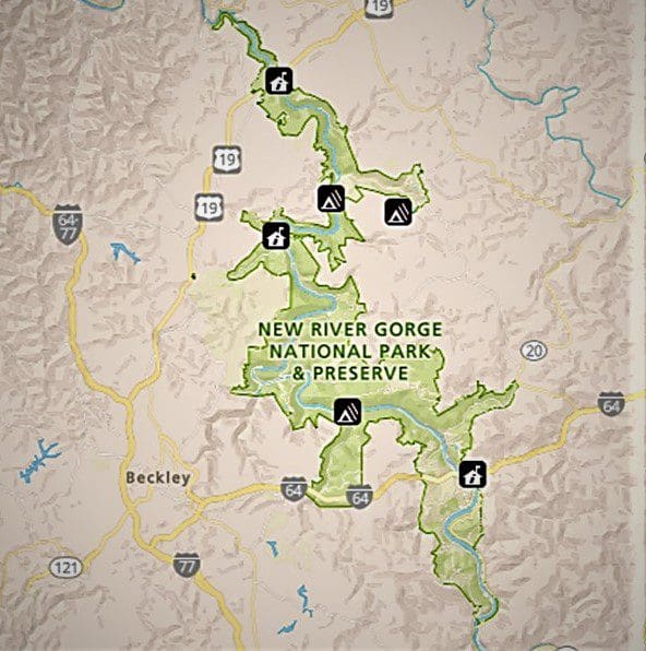
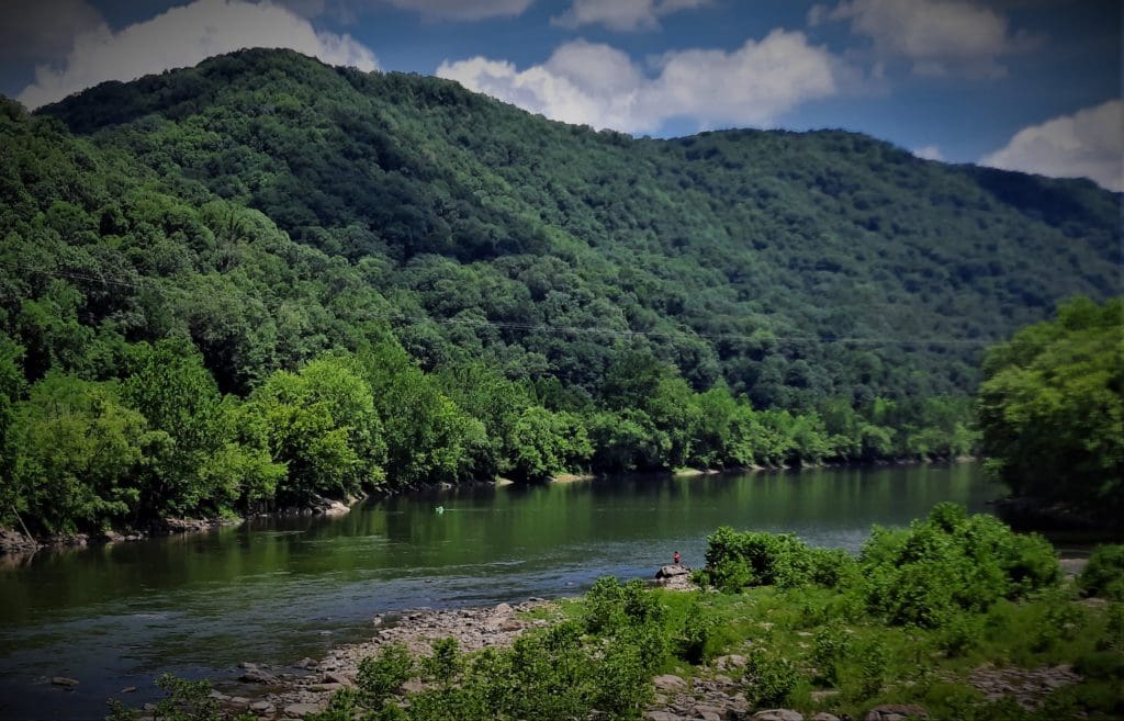
The park encompasses over 70,000 acres of land along 53 miles of the New River from Bluestone Dam to Hawk’s Nest Lake.
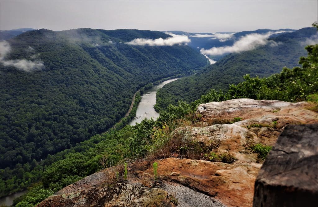
In spite of it’s name, the New River is one of the oldest rivers on Earth, and has carved the deepest and longest river gorge in the Appalachian Mountains – dropping 750 feet over 50 miles!
More than a million people visit the gorge each year to kayak, canoe, and fish in the river or hike, bike, and camp on the land.
For the past few years, I’ve been one of them!
Each Summer, my family has a reunion in Indiana over the July 4th holiday.
It’s a long drive, so on the return trip I’ve stopped at New River Gorge National Park to break up the drive and check it out.
The first year, I only had a day at the Park, but this time I scheduled 4 whole days! I was NOT disappointed 🙂
Read on to find out about the hikes I found there, and how you can go, too!
Or if you prefer video, take a look at the New River Gorge Playlist on IRW YouTube.
Some of my posts contain affiliate links. If you make a purchase through an affiliate link, I will receive a small payment at no additional cost to you. I do not get paid for recommendations, all opinions on this site are my own. See full Disclosure page here.
Getting There
New River Gorge National Park is only 315 miles from Washington, D.C., 260 miles from Richmond VA, and 285 miles from Raleigh NC, easily accessible from Route 19 and I-64. (I used the New River Gorge Bridge as the end-point to get these distances.)
That’s close enough for a great long weekend or longer family vacation, without getting on an airplane!
No matter where you start your journey, when you get to the Park, you’ll want a car to get between the different areas of the park, because it’s pretty spread out.
There’s no central road – like Shenandoah’s Skyline Drive – in New River Gorge National Park.
Park visitors just use local highways and surface roads to get around.
Also signal can be sketchy, so pay attention to how you get to places, so you can find your way back without your GPS!
Plan Your New River Gorge National Park & Preserve Visit
You’ll need to take into account the unique logistics of New River Gorge National Park when planning your visit, in addition to your usual hike planning.
The park is very long, so time to get from your lodgings to the Visitor Center or trailhead you’re aiming for could be significant.
I chose to stay in a local hotel near the North end of the park, but there is also camping available.
Camping in New River Gorge NP
Camping spots available at New River Gorge National Park are for primitive camping only.
Located along the river, these primitive camping areas have no drinking water or hookups, and limited restroom facilities. Stays are limited to 14 days in the same area.
All sites are managed on a first-come, first-served basis and reservations are not accepted. But there are NO FEES for camping 🙂
Learn more about New River Gorge National Park Camping.
Lodgings Outside OF NEw River Gorge NP
Other parks nearby, like Hawks Nest State Park, Babcock State Park and Bluestone State Park also have campgrounds or lodging that is more developed.
If you’re looking for some additional travel pointers or more lodging ideas for your next adventure, check out my Travel Resources page.
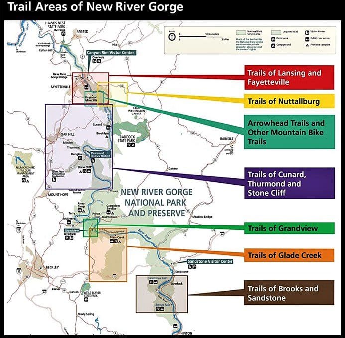
The Park Layout
For my visit, I stayed outside the park, about a 10 minute drive from the Canyon Rim Visitor Center.
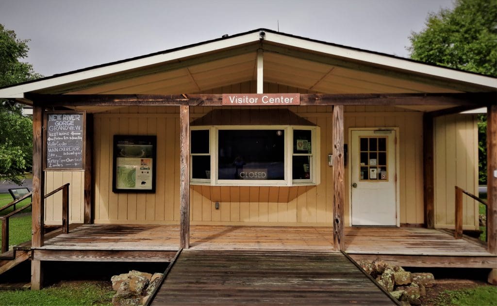
Visitor Centers
You can usually find maps, information, interpretive displays, a Ranger, maybe a gift shop, and restrooms at any Visitor Center.
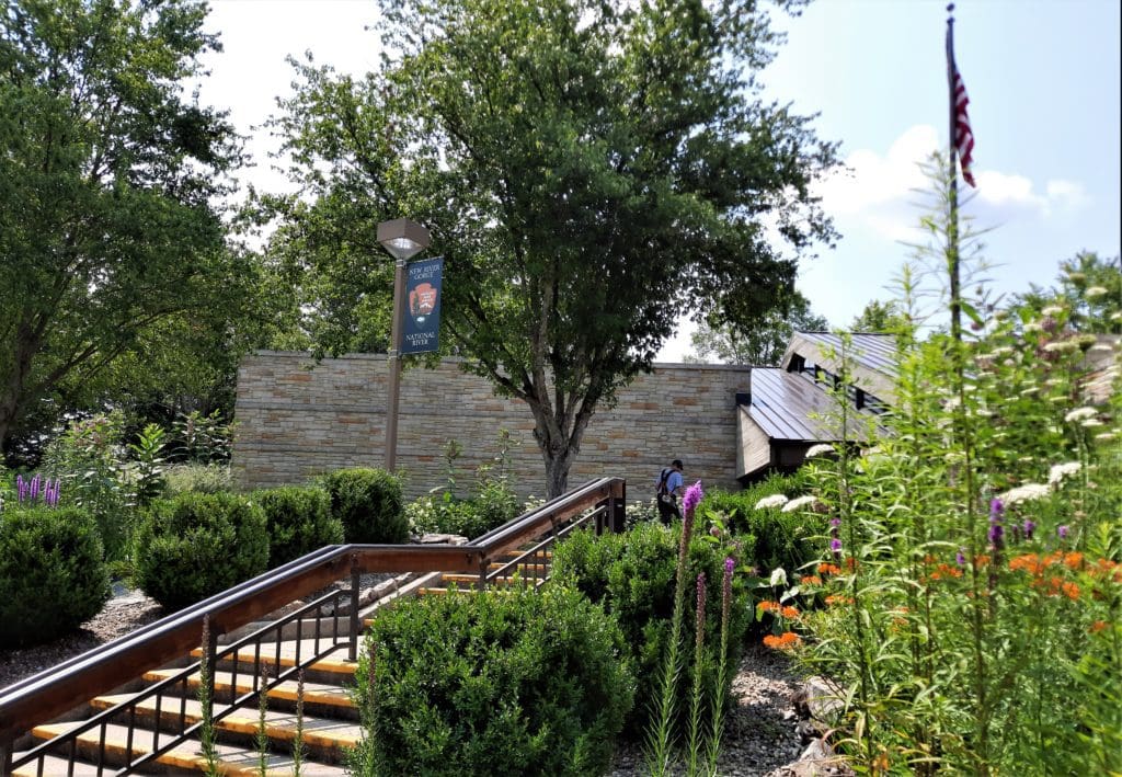
Canyon Rim Visitor Center
ADDRESS: 162 Visitor Center Road, Lansing, WV 25862.
HOURS: Canyon Rim Visitor Center is open from 9:00 am to 5:00 pm year round.
FEATURES: The center features exhibits, information, park film, and a book store. Located at the New River Gorge Bridge, just north of Fayetteville, WV.
A wooden boardwalk gives scenic views of the New River Gorge Bridge and the gorge.
(No hiking trails start at the visitor center. )
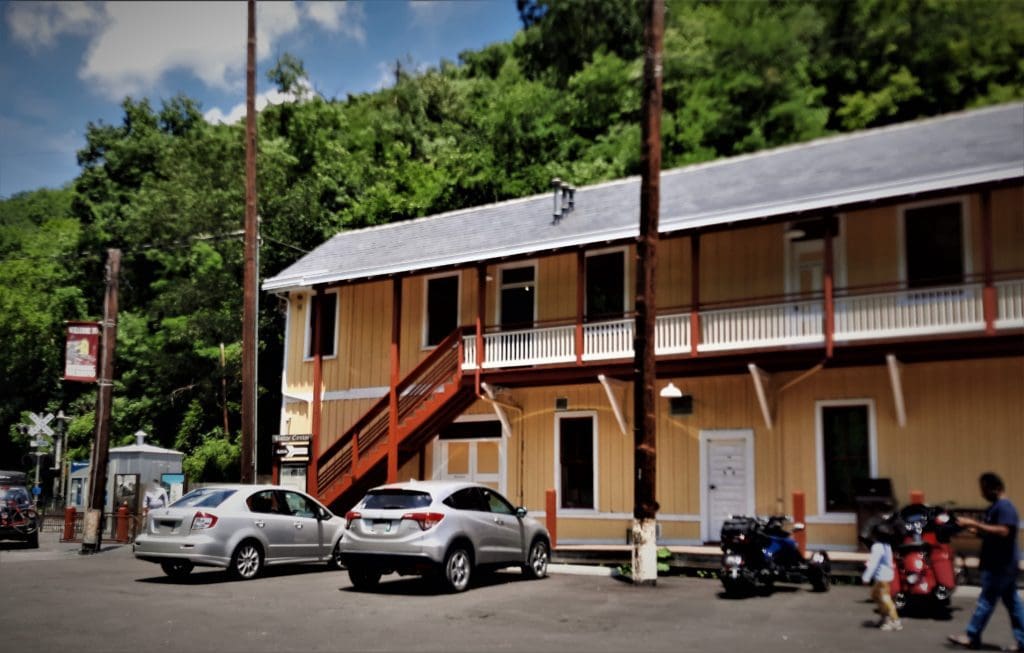
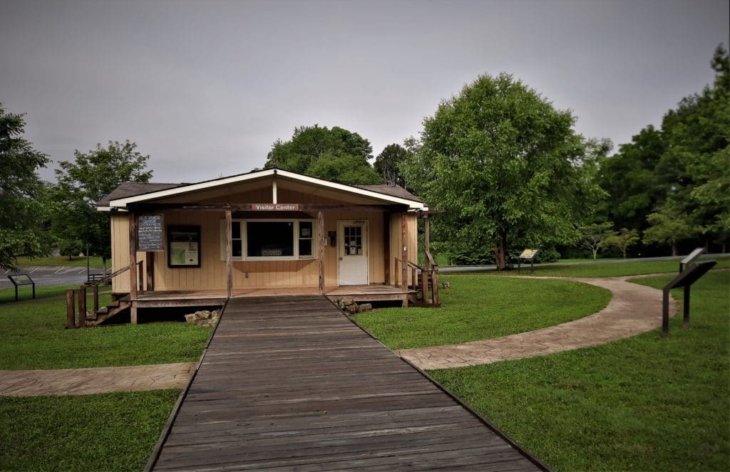
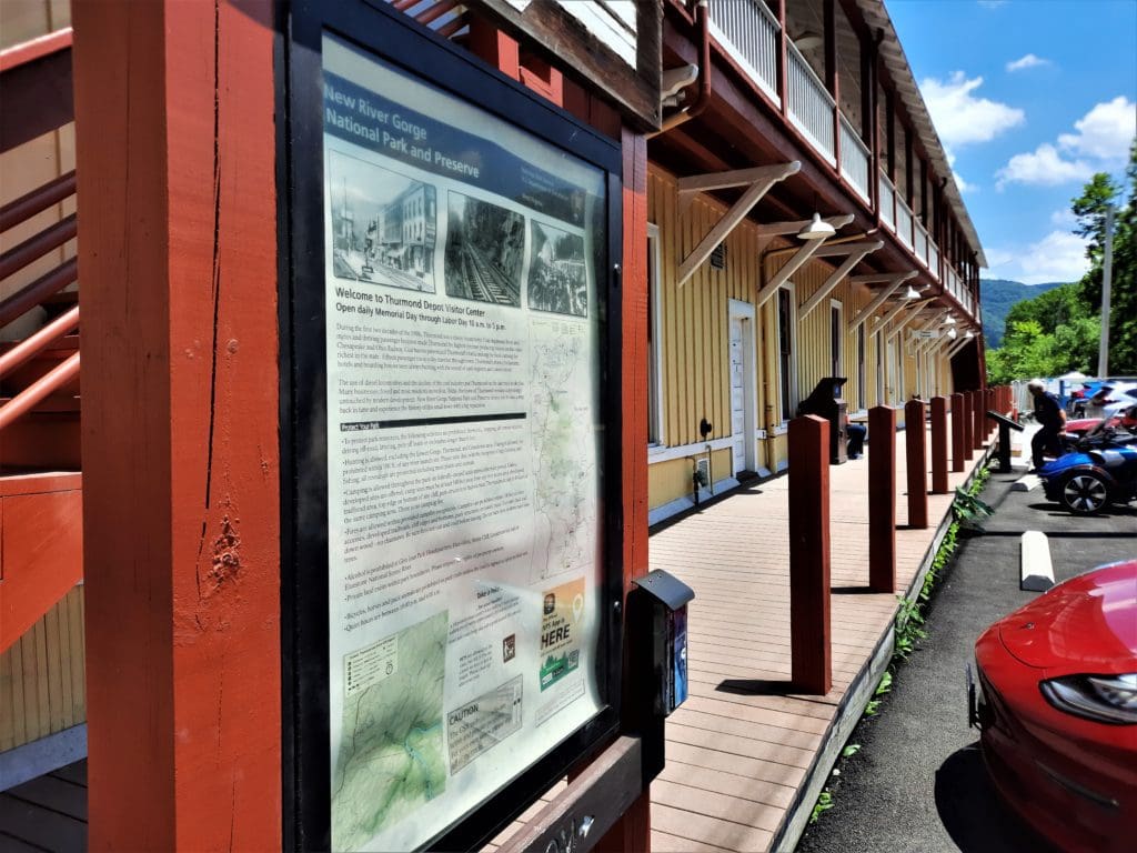
Thurmond Depot Visitor Center
ADDRESS: 254 River Crest Road Thurmond, WV 25936.
HOURS: Open Memorial Day through Labor Day, and sometimes after Labor Day depending on staffing.
FEATURES: Thurmond Depot is a restored railroad depot located in the historic railroad town of Thurmond.
The Depot is an information center and a park store.
Grandview Visitor Center
ADDRESS: 4700 Grandview Road Beaver, WV 25813.
HOURS: Open Memorial Day through Labor Day, and sometimes after Labor Day depending on staffing.
FEATURES: Overlooks of the New River, five short hiking trails, ranger-led walks and talks, summer outdoor dramas, and picnic areas with playgrounds.
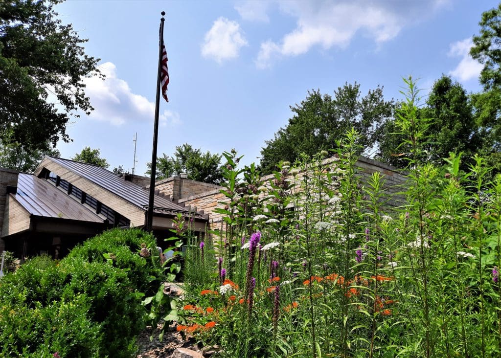
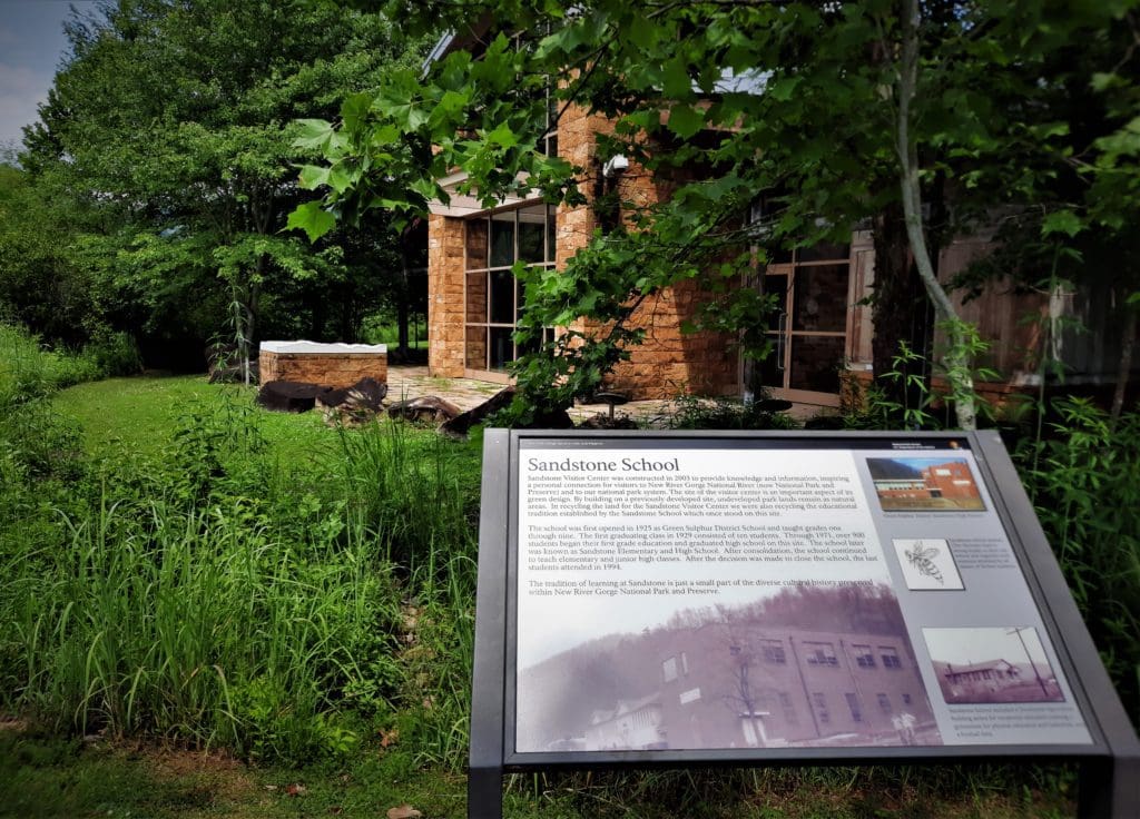
Sandstone Visitor Center
ADDRESS: 330 Meadow Creek Road, Sandstone, WV 25985.
HOURS: Open 9:00 am to 5:00 pm daily, April through October; open intermittently from November through March.
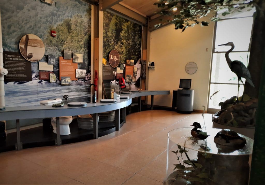
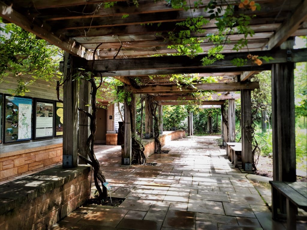
FEATURES: A green design building with a learning center and a park film, a native plant garden, picnic areas, and book store.
NOTE: All visitor centers are closed on Thanksgiving, Christmas, and New Years Day.
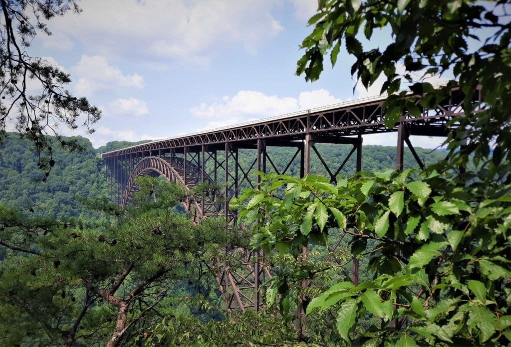
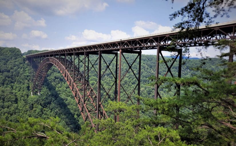
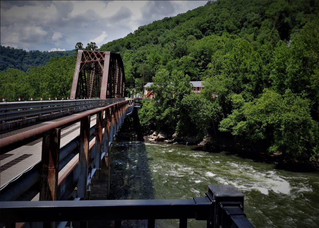
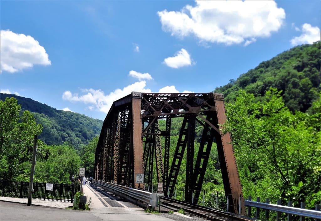
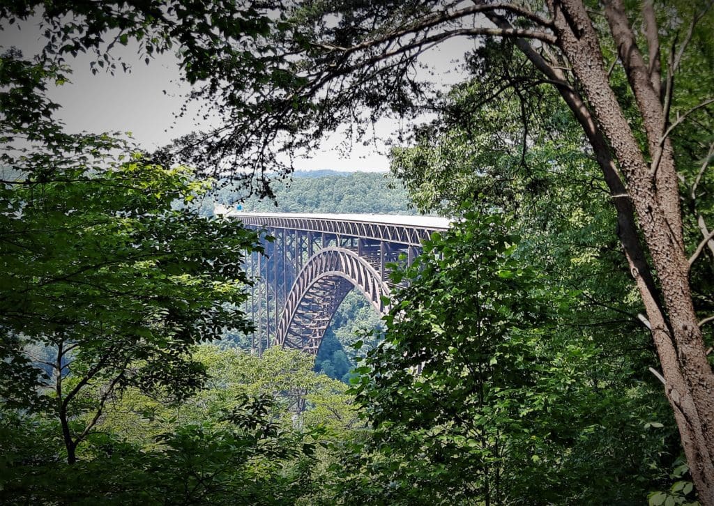
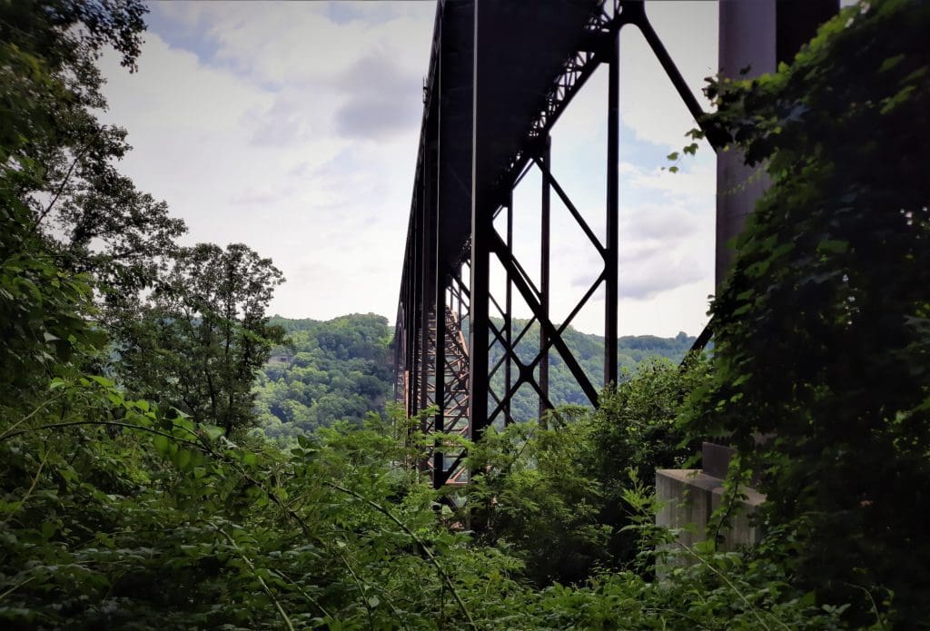
The Bridge
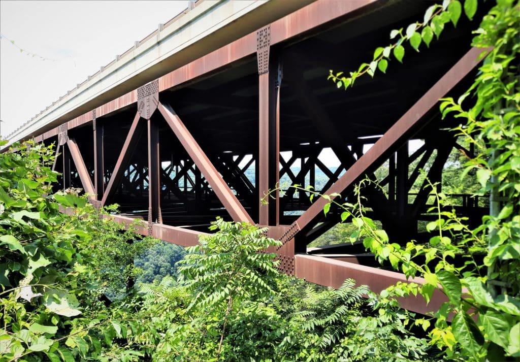
The New River Gorge Bridge is the most iconic feature of the New River Gorge National Park, besides the gorge itself.
The 3,030 ft long steel arch bridge hangs over the New River Gorge near Fayetteville, West Virginia, at the North end of the Park.
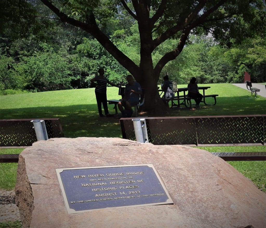
When completed in 1977, it was the world’s highest bridge carrying a regular roadway, a title it held until the 2001 opening of the Liuguanghe Bridge in China.
With an arch 1700 ft long, the New River Gorge Bridge was the world’s longest single-span arch bridge for 26 years; it’s now the fifth longest.
The roadway of the bridge is 876 ft above the New River, making it the third highest bridge in the United States.
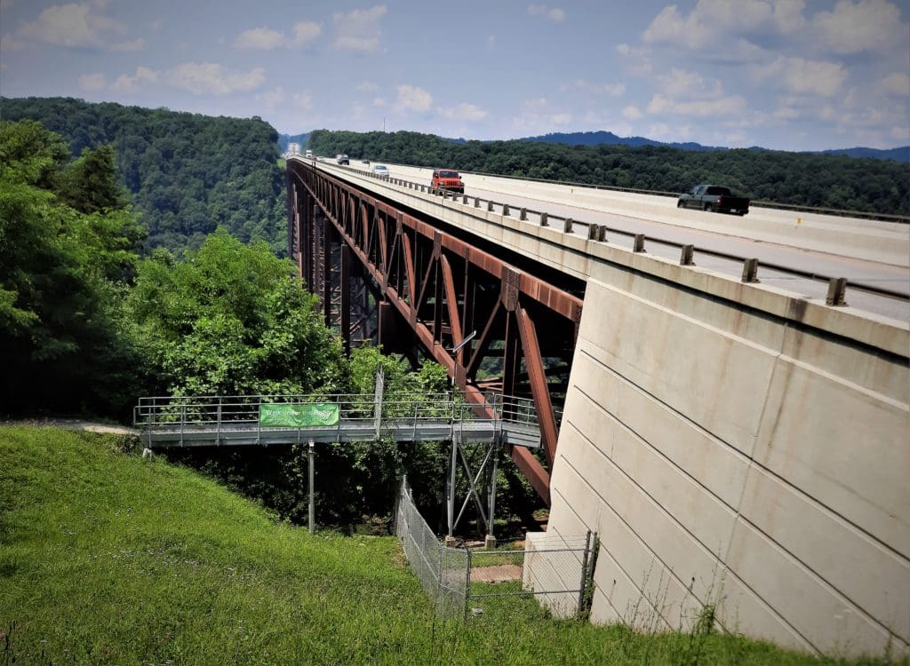
Because of its height, the bridge has attracted daredevils since its construction.
To help channel that energy, a local celebration called Bridge Day is held every October, closing traffic so pedestrians can explore the Bridge.
They also allow BASE jumping from the bridge for a few hours that day.
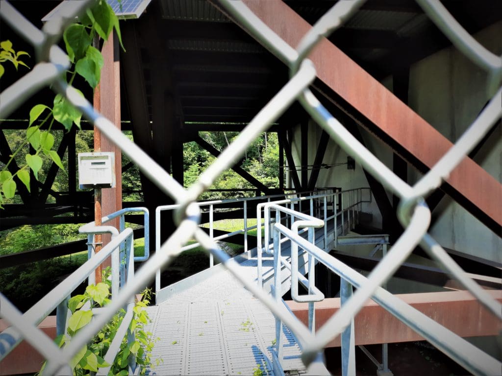
If you can’t visit on Bridge Day, you can still get a little taste of that adventure by taking a Bridge Walk guided tour on the walkway beneath the Bridge.
WARNING! I’ll be getting into some area history for a little bit, so if you don’t want to read this very interesting part, just scroll on or use the Menu links above to skip to the 5-Day Guide. 🙂
Park History
Many West Virginians worked hard to turn their favorite place into a National Park without compromising the natural and sporting features that make it so special.
But how, exactly, do you turn a piece of public land into a National Park?
Our Newest National Park
Well, it didn’t happen overnight.
President Jimmy Carter first signed legislation way back in November of 1978 establishing New River Gorge National River, shortly after the 1977 completion of the New River Gorge Bridge.
If you weren’t aware that we recently added yet another National Park to our ranks, that’s understandable.
The upgrade from “National River” to the “National Park & Preserve” designation happened in December 2020, under the Covid Relief Act, when there was a lot of other stuff going on 😉
Even so, this change in designation really triggered an increased popularity of the New River Gorge as a tourist destination.
Even better than the upgrade, there were no funds allocated to the change in designation.
In other words, it didn’t cost taxpayers anything extra to change the Park’s status. Yay!! 🙂
Early Area History
In pre-history, what is today called New River Gorge National Park was the ancestral, traditional land of the Eastern Band of Cherokee, and the Tutelo, the S’atsoyaha, and Moneton peoples.
These Indigenous tribes cared for and lived off the Park land long before Europeans ever set foot on it.
Descendants of these tribes still live in the area today and observe the centuries-old traditions of the area’s First People.
Farms, Coal Mines and Railroads
By the 1700’s, hardy pioneers had made their way into the mountains to make their living farming and trapping.
Though the land was harsh and didn’t lend itself easily to growing crops, some determined souls hung on and maintained subsistence-level farms.
Though not great for the early farmers, West Virginia does have enormous reserves of energy- rich bituminous coal in 53 of the State’s 55 counties!
This includes 62 individual seams of coal that are considered economically minable.
Coal was mined as early as 1810 near Wheeling, in the northern panhandle.
Then in the 1820s-1830s, the growth of the salt industry led to the opening of mines to supply furnace fuel for local business and domestic consumption.
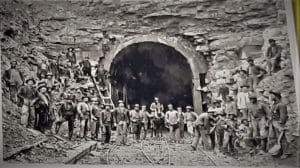
Building the railroad through New River Gorge was the key event in shaping the modern coal industry of the region.
Between 1869-1872, the original Chesapeake and Ohio railroad company line was constructed, following the New River through the gorge.
It transformed the isolated, sparsely populated area of subsistence farmsteads into booming company-owned coal mining and logging towns.
Hiking or driving through New River Gorge today, you can still see stone walls, historic buildings, and remnants of coal mine works.
In fact, some areas within the park, like historic Thurmond, have been preserved specifically to give visitors a glimpse into the Park’s coal-mining and railroad building past.
These places are reminders of a time when New River Gorge coal fueled the industrialization of our nation.
The construction of the C&O rail line was not a product of modern machinery, but of the sweat and backbreaking physical labor of thousands of workers over three years.
Using hand tools, explosives, and teams of horses and mules, these men literally carved the path for the railroad through the mountains by hand.
The C&O railroad was built primarily by two groups of working men: African-Americans recently freed from enslavement, and recent Irish Catholic immigrants.
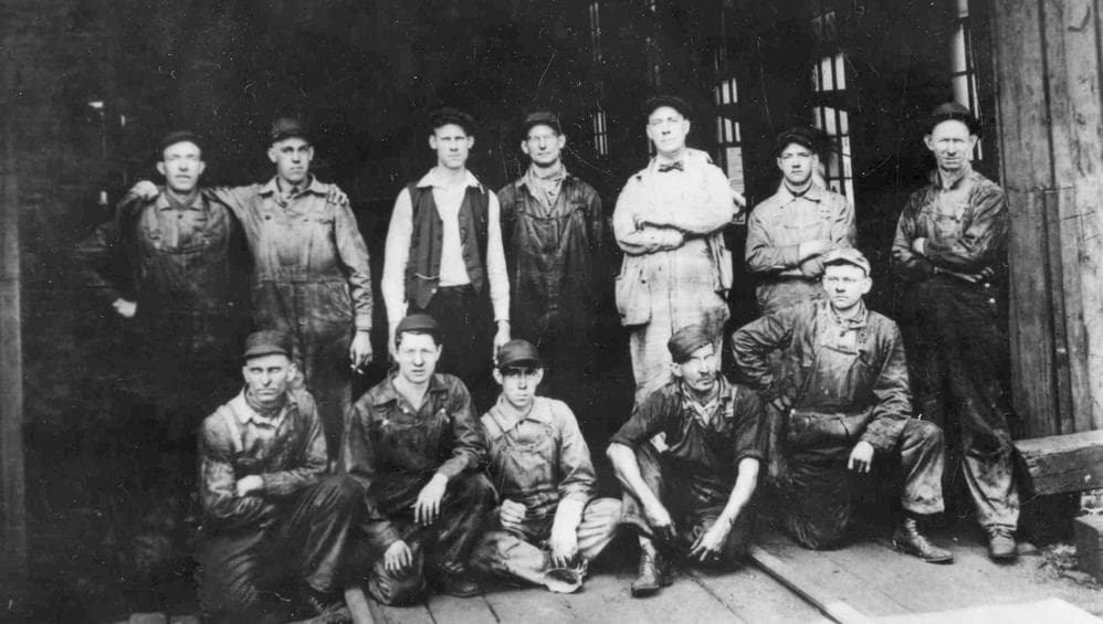
It seems like a very harsh job choice now, but at the time this railroad work gave these men a chance to begin new lives for themselves and their families as American citizens.
Eventually, steam-powered trains gave way to diesel-powered engines, the use of coal for heating declined sharply, and the coal business in the New River Gorge also began to dwindle, leading to fewer jobs.
Many residents moved away to search for work elsewhere.
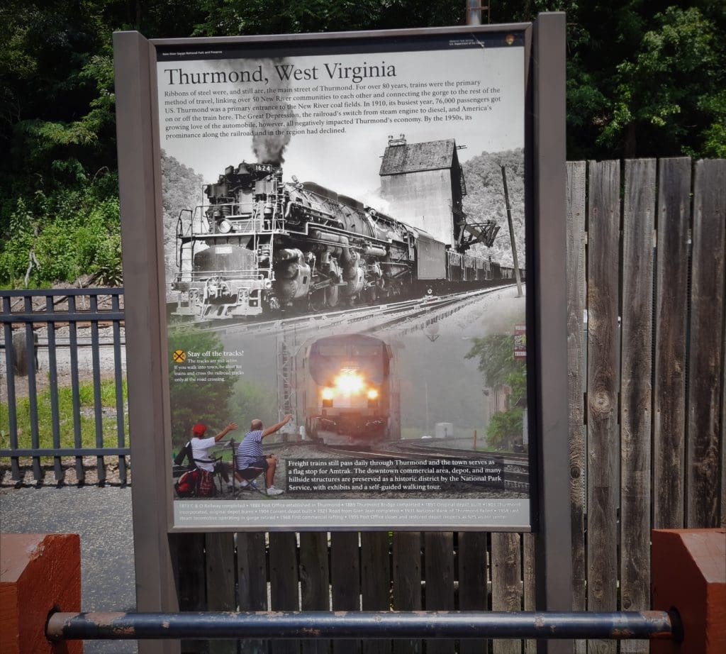
Coal mining within the park lands was over by the late 1960’s, but the railroad is still very active today with daily coal and freight train runs, and Amtrak’s Cardinal passenger line.
New River Gorge National Park Trails
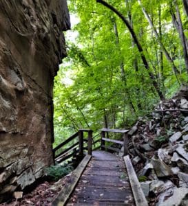
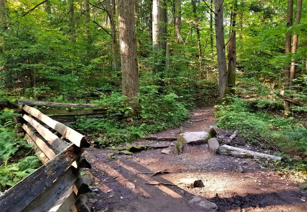
Peaceful forest trails, gorge overlooks, and historic scenery are all available on hiking and walking trails within the Park.
Trail surfaces are mostly natural or gravel, although there are some shorter paved trails – notably in the Grandview area. Old dirt roadbeds also sometimes serve as park trails.
You should wear sturdy trail runners or hiking boots, since the natural trails are rocky, rooty, and can be slippery near waterfalls and streams.
While you’re hiking, you can see lots of wildlife! The region is home to whitetail deer, black bears, turkeys, grouse, small game, and lots of waterfowl.
Trails range from 1/4 mile to 7 miles in length. Some trails can be combined to make for longer hikes for an all-day excursion.
Difficulty varies from flat, smooth walking to steep challenging terrain.
There are hikes to suit all ability levels and whatever time you have available – some taking less than an hour, with other longer hikes that will take the better part of a day.
5-DAY HIKE ITINERARY
My visit (both years) was in July, and the weather was very warm and stormy. Maybe next time, I’ll visit in May or September!
I’ll tell you below about the trails I hiked, and how I decided which hikes to do on which days. Maybe this will help you decide what trails to visit on your trip.
DAY ONE – Canyon Rim: Boardwalk, Endless Wall, and Long Point
Inside the Center, there’s an interesting movie that talks about the building of the bridge, and you can talk to a Ranger, buy a trail guide book and gifts.
I got some advice from a Ranger about recommended hikes and recent trail closures to help me do some planning for the week, too.
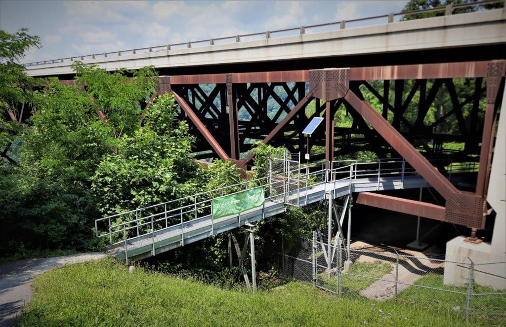
The catwalk is not very long in distance, but the tour takes about 3 hours. If you have about a half day to spend, and aren’t afraid of heights, I’d go for it!
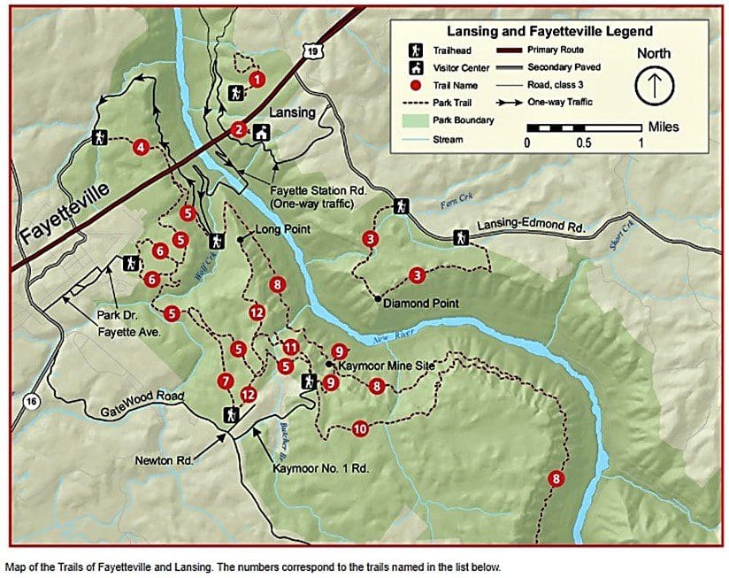
The Canyon Rim (Lansing and Fayetteville area) trails are generally where the more serious hiking trails are located, though most trailheads are not at the Visitor Center.
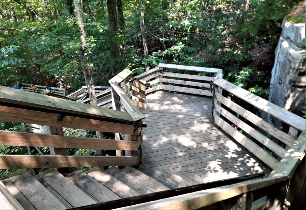
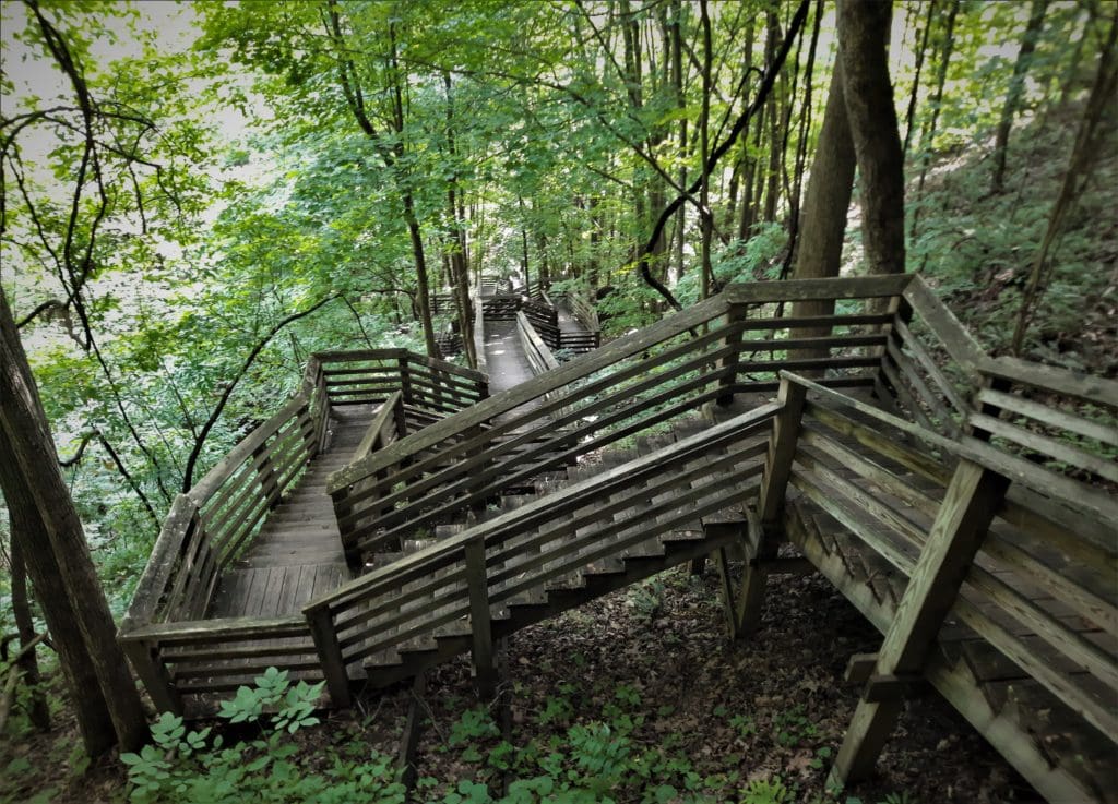
#2 – Canyon Rim Boardwalk
- Distance: 0.1mi one way
- Difficulty: easy + strenuous stairs
- Trailhead: Canyon Rim visitor center
- Map & Details: Lansing & Fayetteville Trails
Remember, you also have to walk back up! 🙂
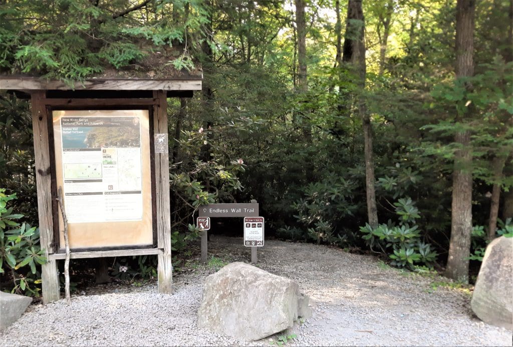
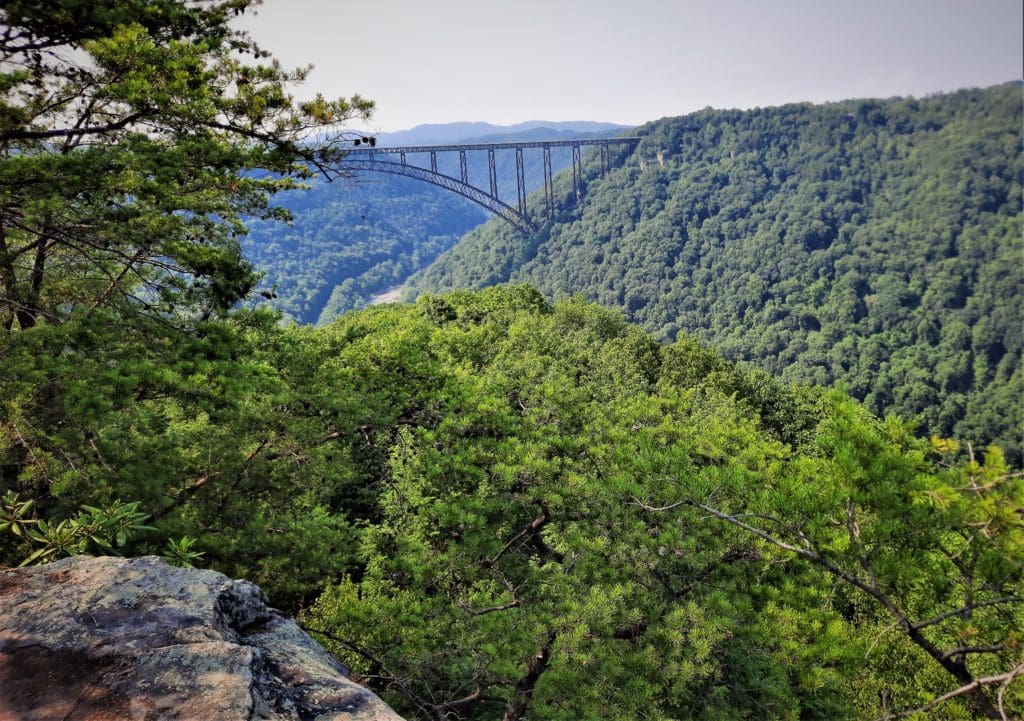
#3 – Endless Wall Trail
- Distance: 2.4 mi one way
- Difficulty: easy – moderate
- Trailhead: Nuttall trailhead
- Map & Details: Lansing & Fayetteville Trails
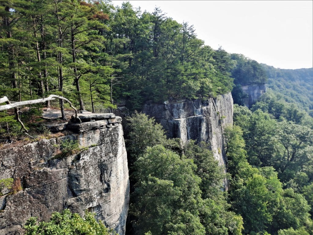
Great views of the gorge without a lot of climbing, because you are already at rim level when you start.
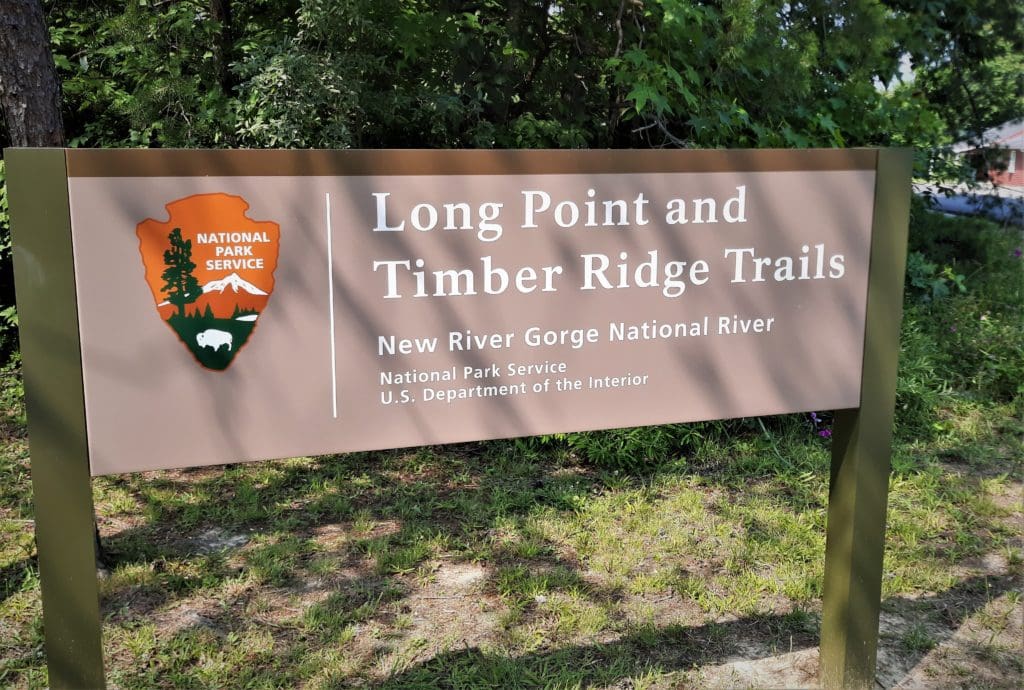
#12 – Long Point Trail
- Distance: 1.6mi one way
- Difficulty: moderate
- Trailhead: Newton Rd in Fayetteville
- Map & Details: Lansing & Fayetteville Trails
This trail is also already at rim level, and gives you a great view of the the Bridge from the Point.
DAY TWO – Canyon Rim: Bridge Trail, Kaymoor Miner’s Trail
I also kept my hikes short due to forecasted severe thunderstorms, and I didn’t want to be caught near mining equipment with lightning strikes happening 🙂
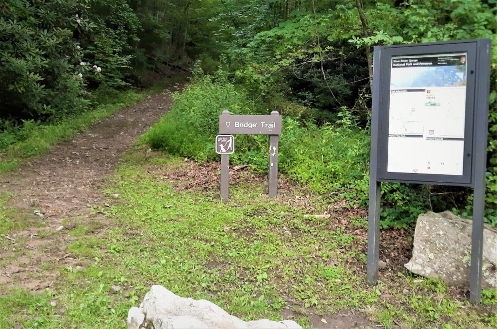
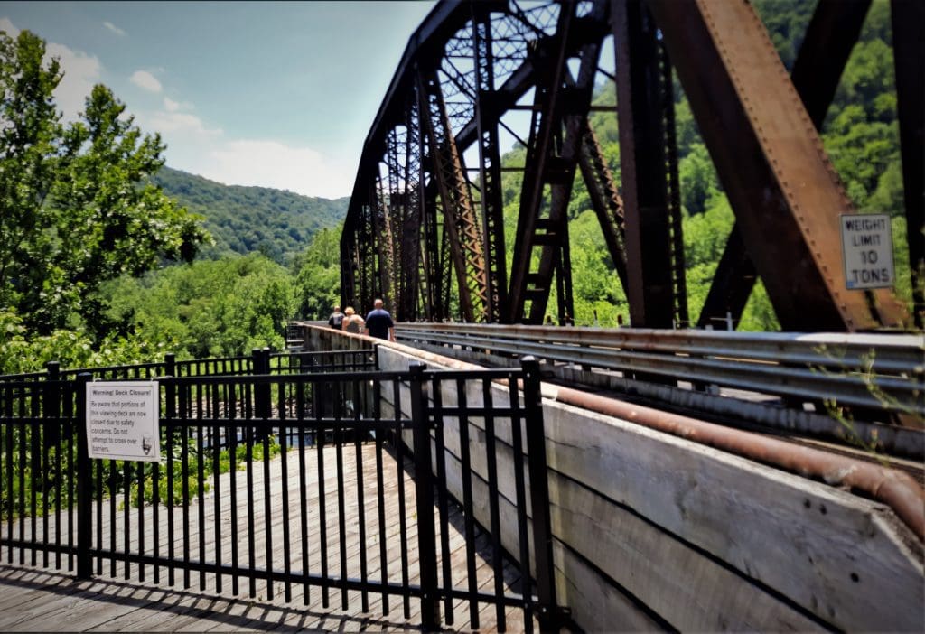
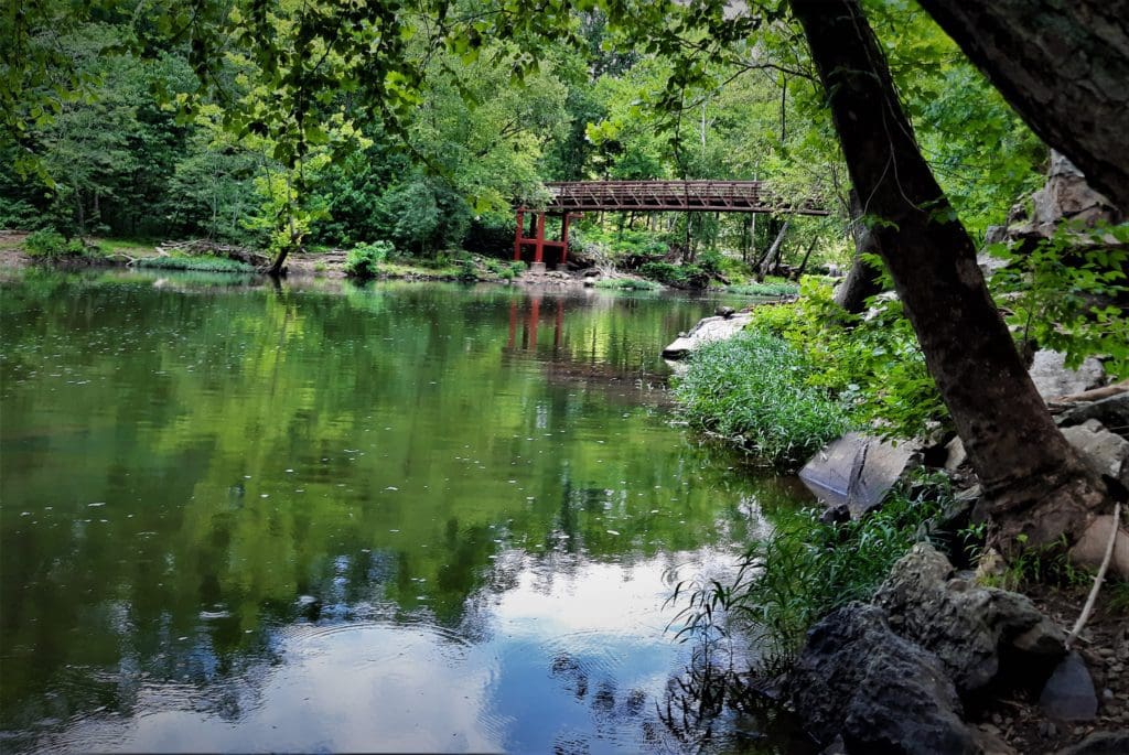
#4 – Bridge Trail
- Distance: 0.86mi one way
- Difficulty: moderate – strenuous
- Trailhead: Fayette Station Rd (Co 82) in Fayetteville
- Map & Details: Lansing & Fayetteville Trails
The Bridge Trail connects to the longer Fayetteville Trail if you want to make it a longer hike.
There’s another trailhead underneath the bridge at Canyon Rim, but I started at the far end to be closer to the Kaymoor Miner’s Trail, which I hiked next.
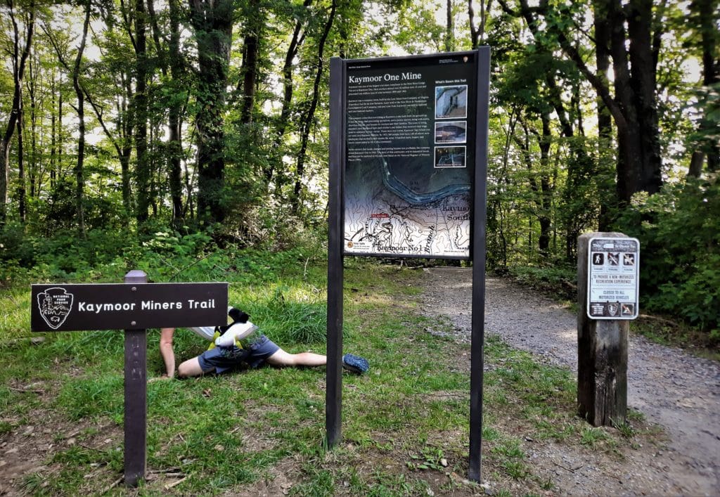
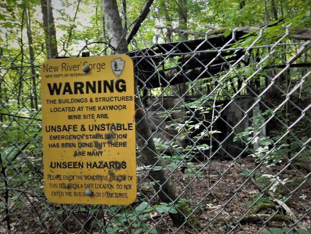
#9 – Kaymoor Miner’s Trail
- Distance: 1.0 mi one way
- Difficulty: strenuous
- Trailhead: Kaymoor No 1 Rd in Fayetteville
- Map & Details: Lansing & Fayetteville Trails
Some of the old signs and buildings are still there, so you get a real feel for what the miners’ walk to work must have been like each day.
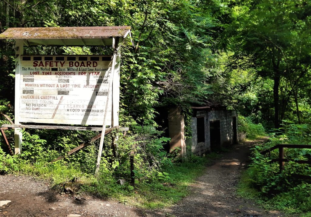
In addition to rock scrambles down, you have to hike down 821 wooden steps and then hike back up the steps and the scrambles to get back.
DAY THREE – Thurmond Depot: Town Walk, Rend Trail
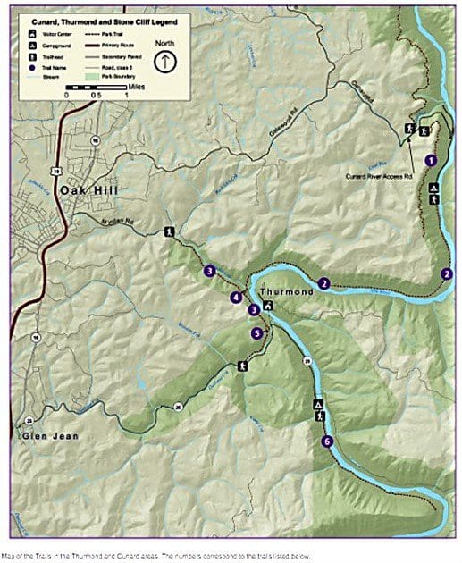
The numbers on the hike labels (below) correspond with the hike numbers on the area trail map above. Click the link in each description to go to the NPS interactive online map for more details.
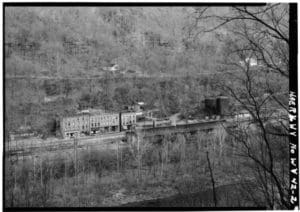
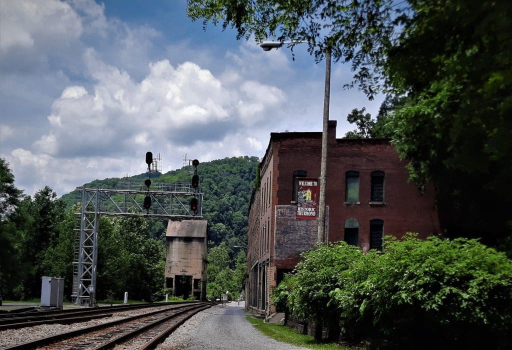
The Thurmond Area is mostly about the preserved railroad boom-town of Thurmond.
Thurmond Visitor Center is housed in the restored old train depot, which is pretty neat, and the Ranger there was very helpful.
Town Walk
- Distance: .5mi one way
- Difficulty: easy
- Trailhead: Thurmond Visitor Center
- Map & Details: Thurmond Trails
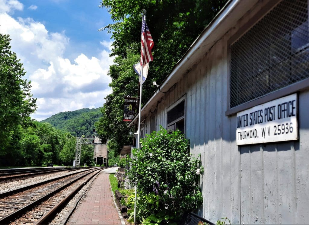
First thing, I took the short Town Walk along the railroad tracks beside the preserved buildings (including the old Post Office) of Thurmond.
Old Thurmond
During the first two decades of the 1900s, Thurmond was a classic boomtown.
Huge amounts of coal were brought in from the local mines, and it had the largest revenue on the Chesapeake & Ohio Railway.
Fifteen passenger trains per day came through town — its depot serving as many as 95,000 passengers a year.
With the advent of diesel (as opposed to steam) locomotives, and less coal coming in from local mines, the town went into decline.
Businesses closed down, and most residents moved on.
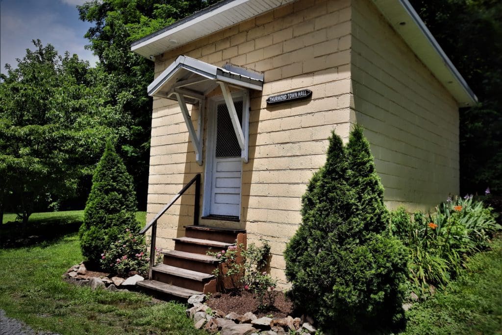
Today, part of the old town of Thurmond has been preserved for visitors, and the old train depot serves as the Visitor Center.
It’s normally longer, but the rest of the trail was on the the other side of the broken bridge!
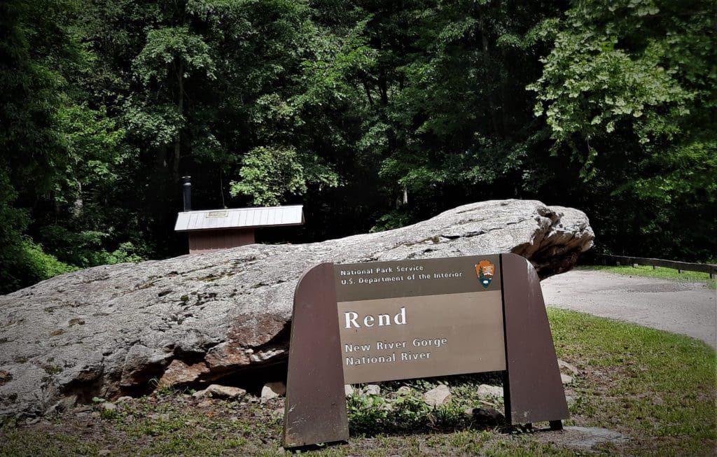
#3 – Rend Trail
- Distance: 3.4 mi one way
- Difficulty: easy
- Trailhead: 5.1 mi down Rt 25 in Thurmond
- Map & Details: Thurmond Trails
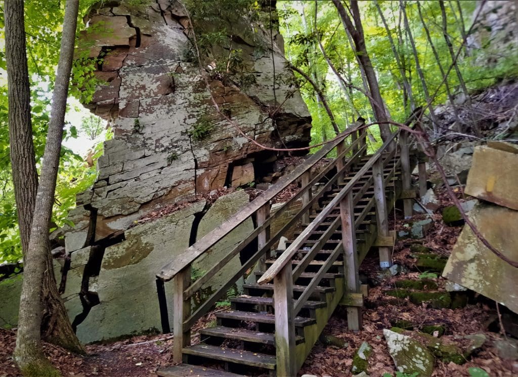
The Rend trail is very smooth and wide, because it’s an abandoned branch line of the Chesapeake & Ohio railway.
While not very physically challenging, this hike does include some good views and a short wooden staircase to detour around an impressive old rock slide.
Fortunately, the connectors to the Arbuckle Trail and the Church Loop trail were both on the front end of the trail, so I was able to get to them.
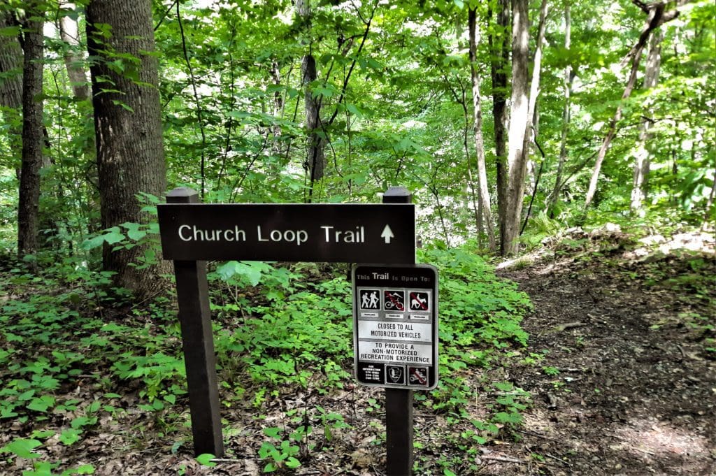
#5 – Church Loop Trail
- Distance: 0.1 mi one way
- Difficulty: moderate to strenuous
- Trailhead: offshoot of the Rend Trail
- Map & Details: Thurmond Trails
The Old Black Church
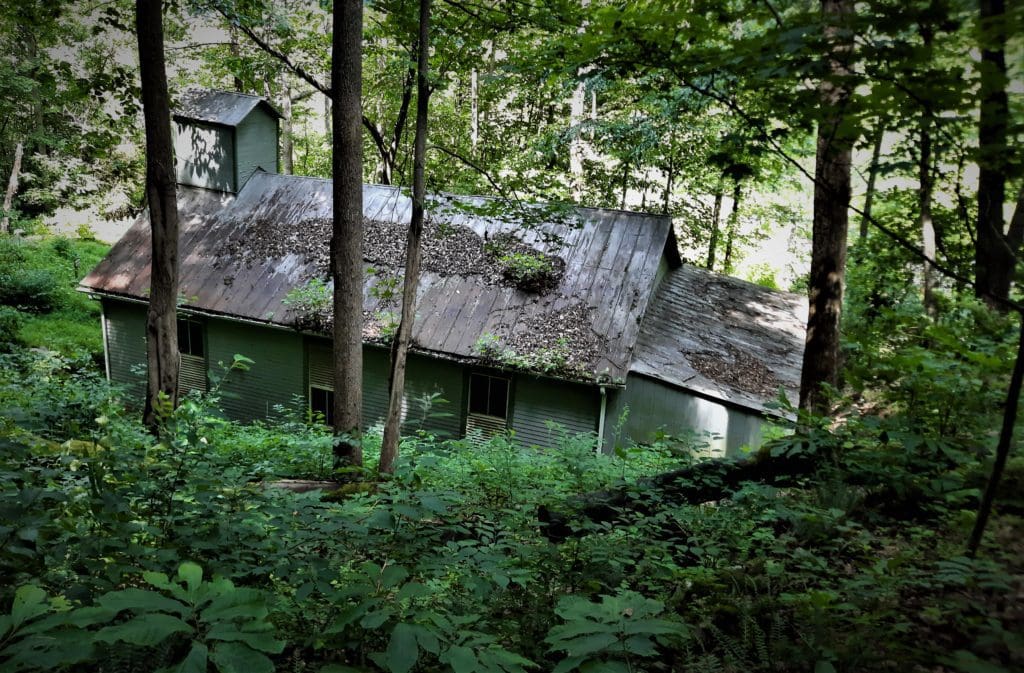
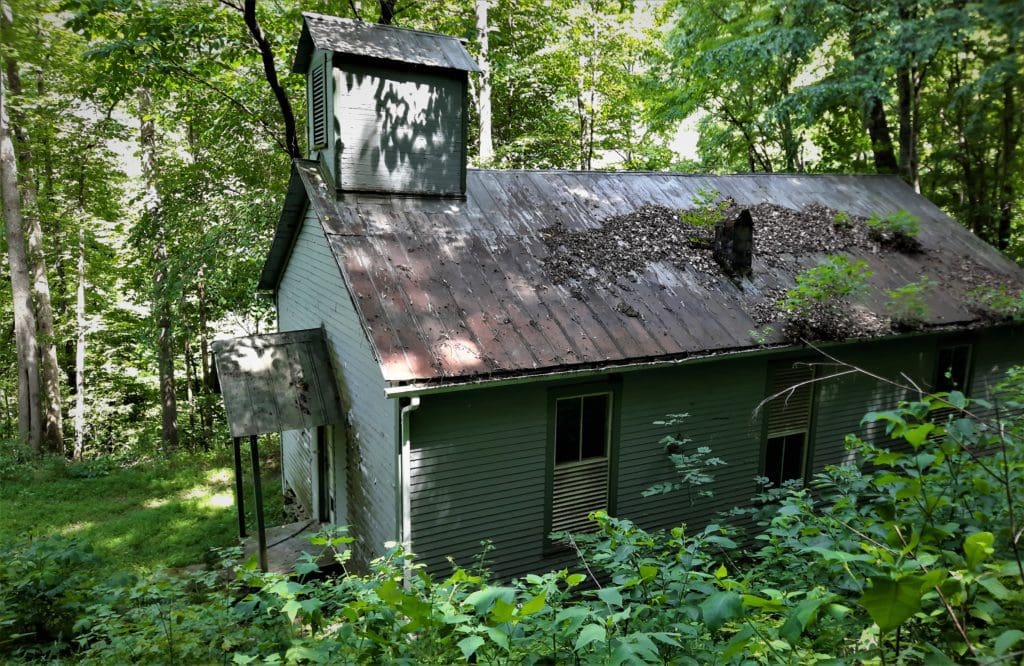
In the heyday of coal mining and industry in the New River Gorge, white and black residents worshipped in separate churches.
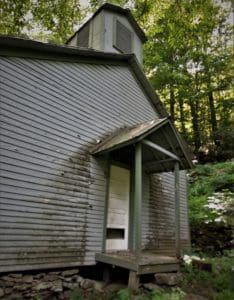
Across the New River from the Thurmond Depot, sitting in the edge of the forest is one of the few historic African American churches still standing in the New River Gorge.
For many years, this church served the Black community of the coal camps and railroad towns along the New River.
This historic black church can be reached on the Church Loop Trail, an offshoot of the Rend Trail.
The name and denomination of the church has been lost to time, but it’s still a reminder of an important piece of local heritage.
#4 – Arbuckle Connector Trail
- Distance: 0.3 mi one way
- Difficulty: strenuous
- Trailhead: offshoot of the Rend Trail
- Map & Details: Thurmond Trails
This short but steep trail connects the Rend Trail to the Southside Trail, which is 7 miles one-way.
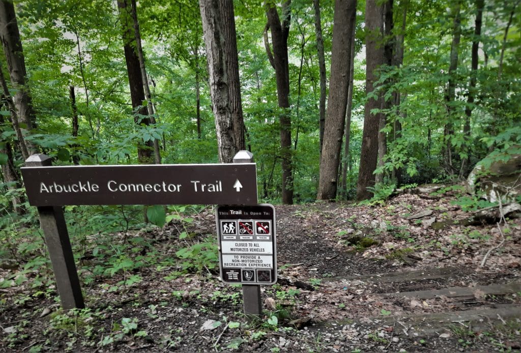
The Southside Trail looks pretty neat (from the description), but time and weather didn’t allow me to try that one this year – it would need a whole day on it’s own!
I just hiked the Arbuckle Connector down and back to the Rend, then continued towards the bridge.
DAY FOUR – Grandview: Rim Trail, Tunnel Trail, Castle Rock
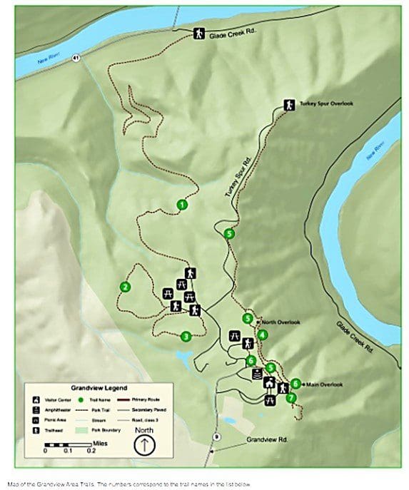
The numbers on the hike labels (below) correspond with the hike numbers on the area trail map above. Click the link in each description to go to the NPS interactive online map for more details.
Grandview is the next Visitor Center to the South of Thurmond, and it takes almost an hour to drive there from the Canyon Rim area.
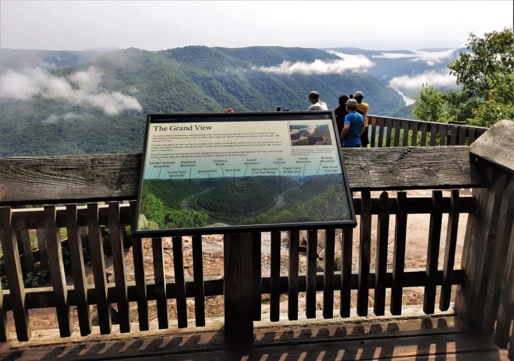
Of course, I went and took in the view from the Grandview Overlook, and then I hiked ALL of the shorter trails near the Visitor Center in this section.
The Tunnel Trail, Grandview Rim Trail, and my favorite, the Castle Rock Trail, were all pretty short, but had lots of features.
There are a few longer trails in the area, too, ranging from 2 to 5 miles long and easy to strenuous in difficulty.
The Grandview area also has flush toilets, a picnic area, and a playground, plus ample parking.
This is the most self-contained area of the the Park, and could stand on it’s own as a family destination. If you’re entertaining younger kids, Grandview would be a great day-long adventure!
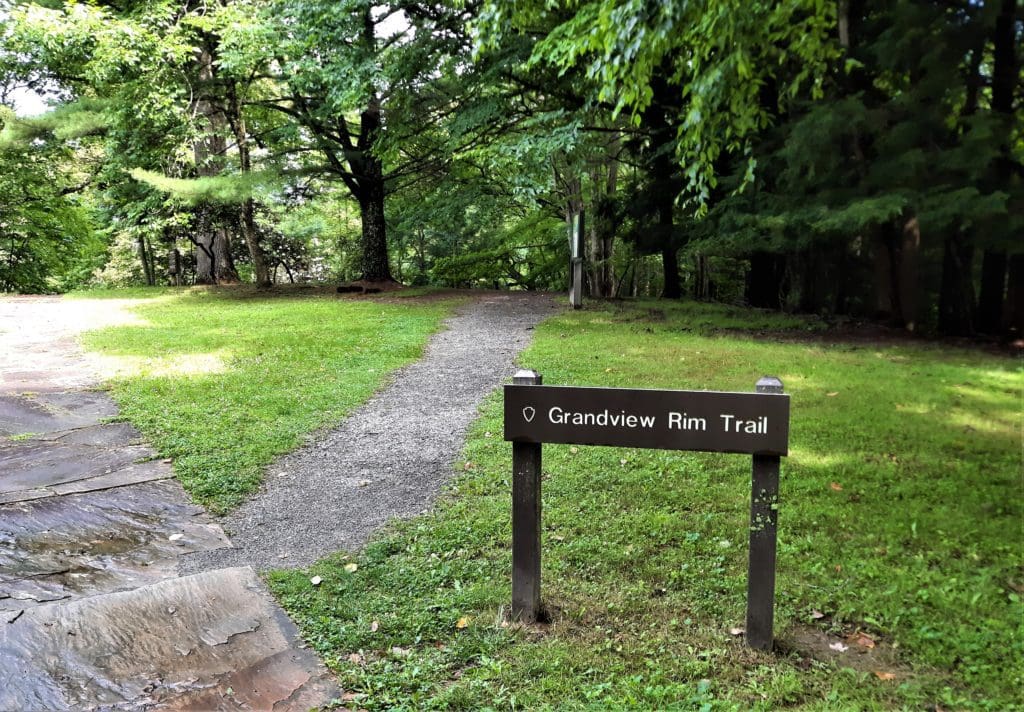
#5 – Grandview Rim Trail
- Distance: 1.6 mi one way
- Difficulty: moderate
- Trailhead: near the Main Overlook
- Map & Details: Grandview Trails
This is the longest trail at Grandview, connecting Main Overlook with Turkey Spur.
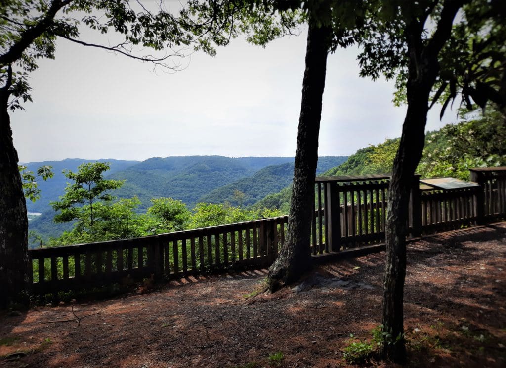
Along the way you’ll see views of the gorge and river far below.
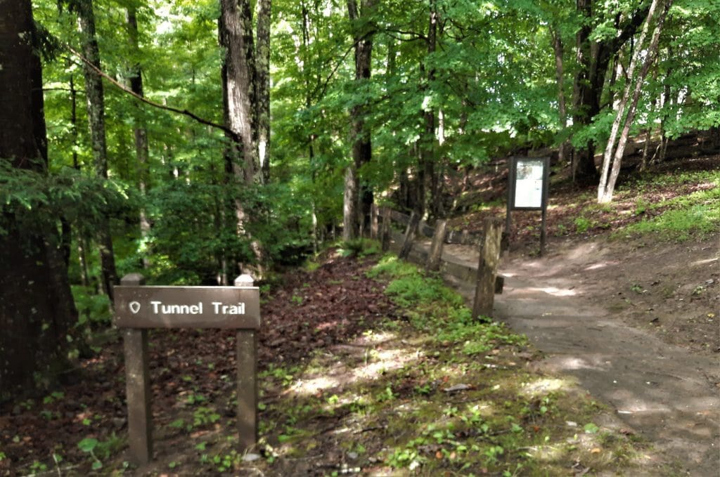
#7 – Tunnel Trail
- Distance: 0.5 mi one way
- Difficulty: moderate
- Trailhead: near the Main Overlook
- Map & Details: Grandview Trails
You get a lot of bang for your buck on this short and shady trail!
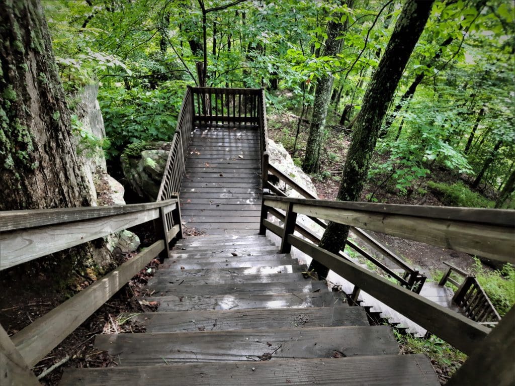
This paved trail passes several tunnels in the rock and passes beneath a large rock overhang.
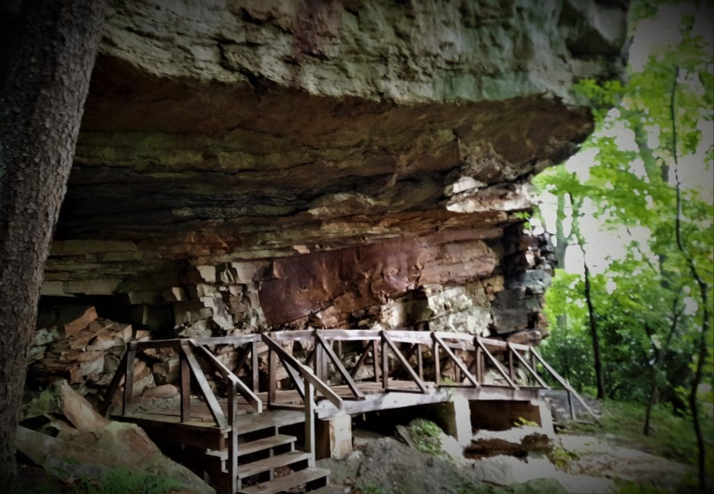
If you’ve got little ones along and they’ll only endure for one trail, I’d choose this one 🙂
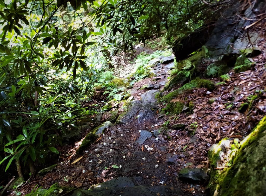
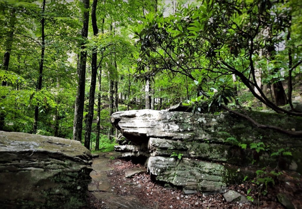
#4 – Castle Rock Trail
- Distance: 0.6 mi one way
- Difficulty: strenuous
- Trailhead: near the Main Overlook
- Map & Details: Grandview Trails
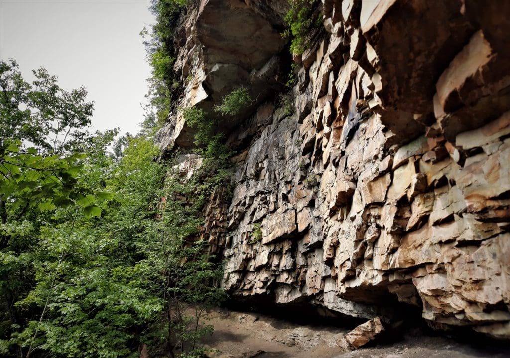
This short hike features close-up views of towering rock walls and exposed coal seams.
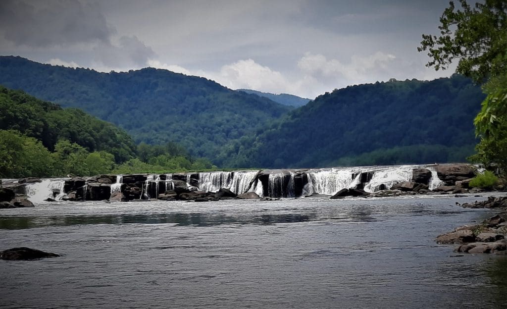
DAY FIVE – Sandstone Visitor Center, Sandstone Falls Boardwalk, Island Loop Trail
Sadly, there are no trails there, it’s just basically an education center with some nice picnic tables and restrooms.
I didn’t take this trail because I was at that point 1.5 hours drive from my lodgings and more thunderstorms were coming!
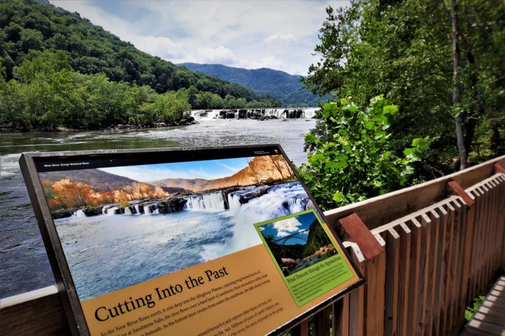
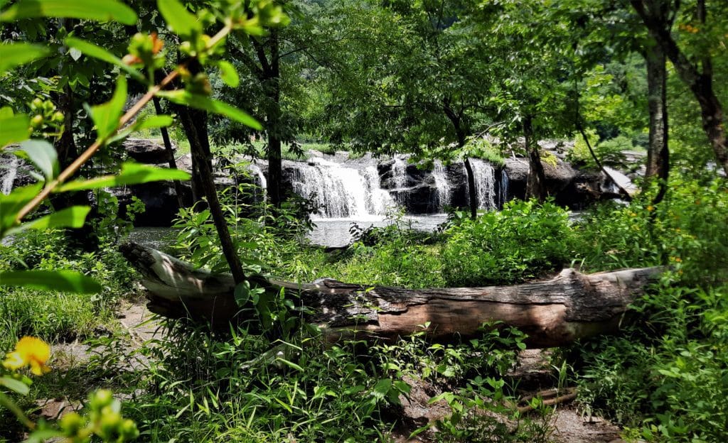
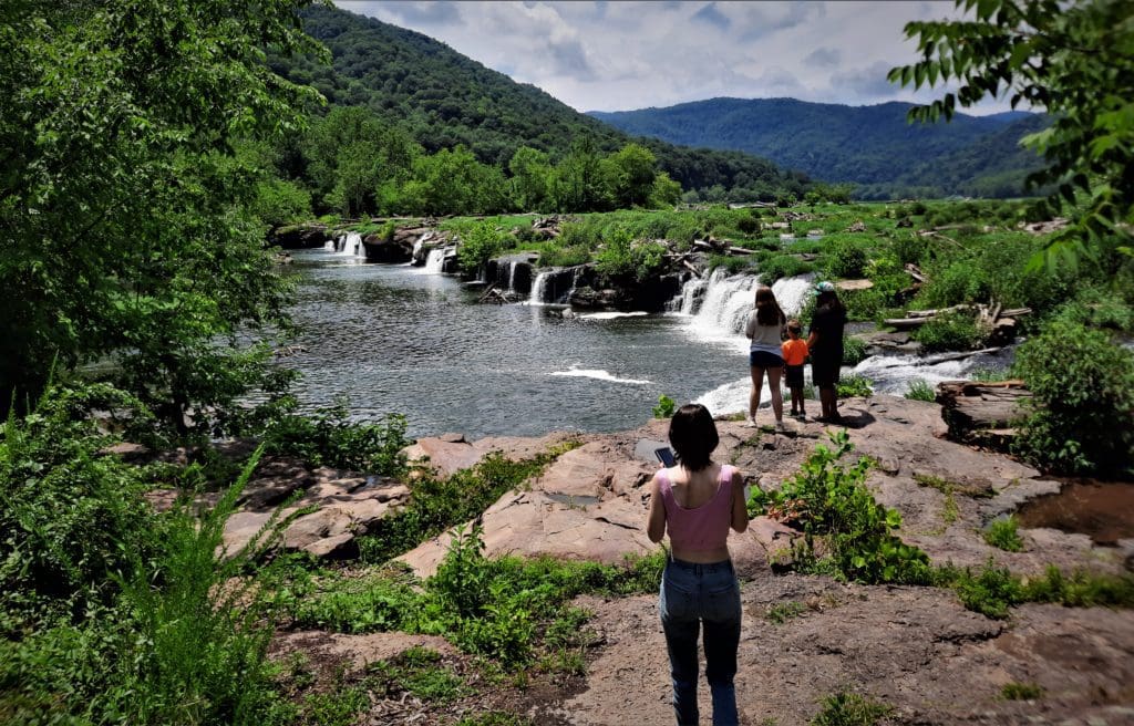
#3 – Sandstone Falls Boardwalk
- Distance: 0.2 mi one way
- Difficulty: easy, handicapped accessible
- Trailhead: River Road at Sandstone Falls
- Map & Details: Sandstone Trails
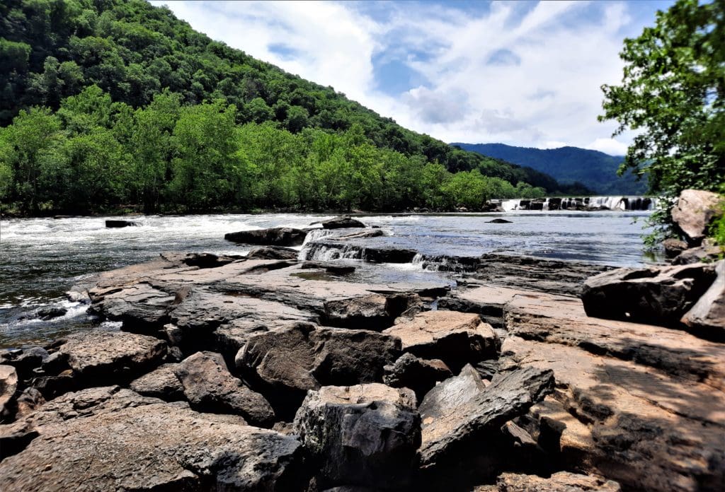
Sandstone Falls is the largest waterfall on the New River, spanning 1500 ft across. Divided by islands, the falls drop from 10 to 25 feet.
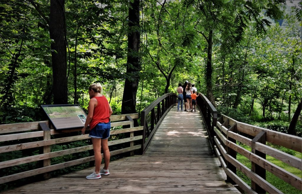
The boardwalk crosses two bridges leading to islands and observation decks that offer fantastic views of the falls.
I ate my pack lunch on the rocks with a great view!
#4 – Island Loop Trail
- Distance: 0.2 mi one way
- Difficulty: easy, handicapped accessible
- Trailhead: River Road at Sandstone Falls
- Map & Details: Sandstone Trails
The Island Loop Trail loops around the largest island below Sandstone Falls.
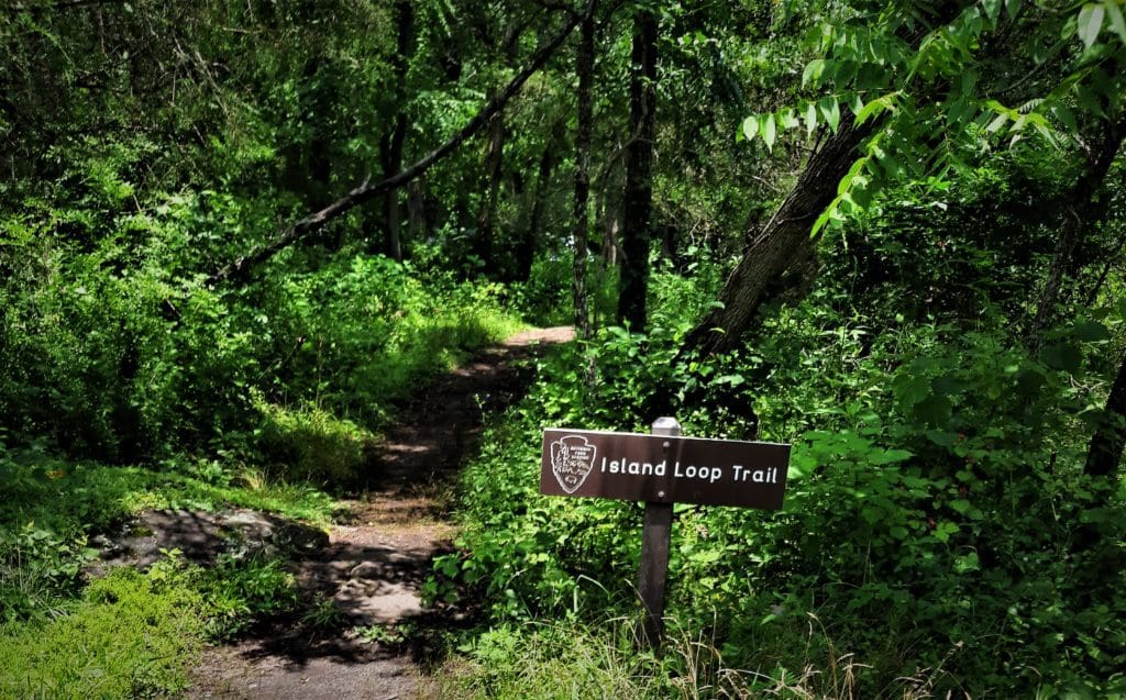
The island was once farmed, grazed, and timbered, with an operating grist mill.
NEXT TIME – All the things I missed!
I only had a few days at the Park, and unfortunately there were some trail closures, and every day was fraught with bad weather – so once again I didn’t get to do ALL of the things I wanted to do.
But I guess that gives me a reason to go back 🙂
Other Park Info
New River Gorge National Park & Preserve is always open. There are no fees for entry.
Portions of trails or whole sections may be closed due to weather events or bridges being out.
Always check with a Ranger for up-to-date closures before you head out!
You can also check the Park Website for closures and other conditions that could impact your planning.
I hope this post has inspired you to visit the New River Gorge National Park and try some new hikes!
Or if you prefer video, take a look at the New River Gorge Playlist on IRW YouTube.
If you have a question drop me an email and I’ll reply as soon as I can.
Thanks for stopping by – see you next time! LJ
To Get New Idratherwalk Posts
sent directly to your inbox (how convenient!) Click this Button
If you like this post, please share it!

LJ has spent much of her free time as a single Mom – and now as an empty-nester – hiking in the US and around the world. She shares lessons learned from adventures both local and in exotic locations, and tips on how to be active with asthma, plus travel, gear, and hike planning advice for parents hiking with kids and beginners of all ages. Read more on the About page.