Most recently updated September 21st, 2025
Estimated Reading Time: 16 minutes
The Blue Ridge Parkway runs through or very near areas of North Carolina and Virginia that were hardest hit by Hurricane Helene.
The North Carolina section of the Blue Ridge Parkway is closed, along with many other NC State Parks. That said, the Virginia side of the BRP and many surrounding communities are open for business and could really use your Fall vacation dollars to help rebuild!
Go to my Hurricane Helene page to get the latest updates on the latest area Park, Trail and road repairs.
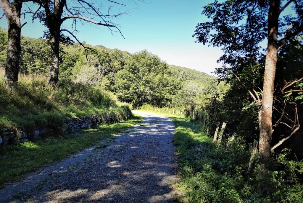
I’ve been driving the Blue Ridge Parkway (BRP) in North Carolina and Virginia to get between places for more than 25 years.
But, I have to admit – until the last couple of years – I have completely neglected Blue Ridge Parkway hikes!
Then last year, a hiking friend introduced me to the Rock Castle Gorge trail near Rocky Knob on the BRP. Ever since then I’ve kept an eye peeled for new Parkway hikes I could try.
And this summer… I found some! 🙂
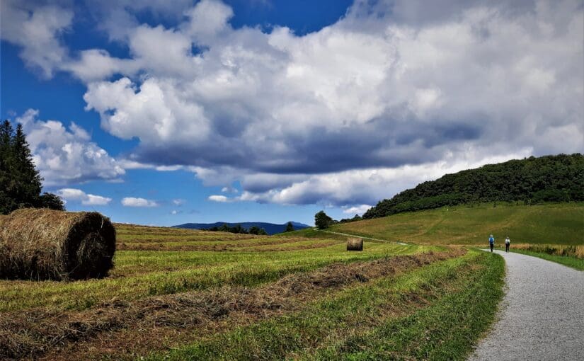
This past season, I hiked some trails in and around Grandfather Mountain State Park (more on that later) and found myself driving the Parkway more than once to get from my lodgings in Banner Elk, NC to nearby trailheads and attractions.
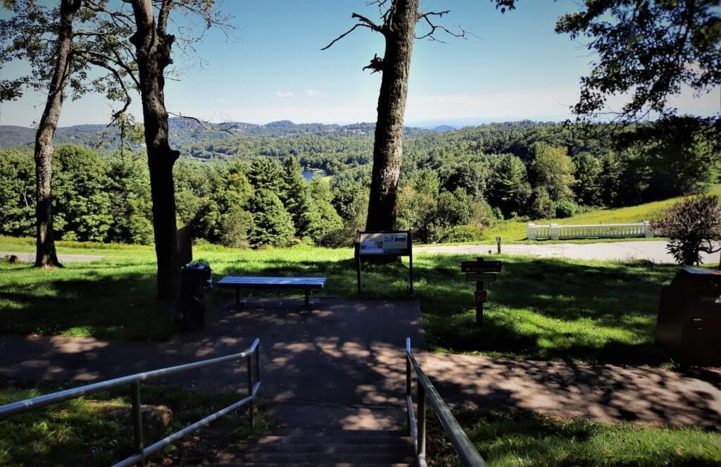
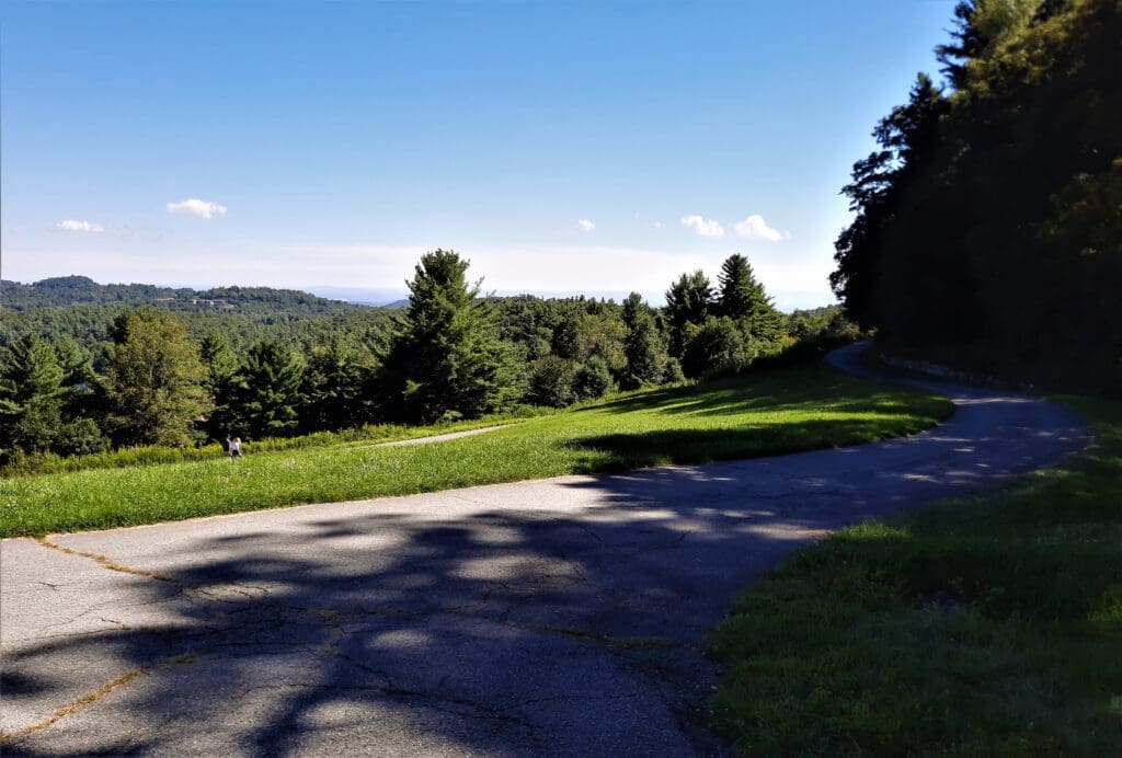
One afternoon I finished a hike earlier than planned, and spotted Moses Cone Memorial Park on the way back.
It was a beautiful day, and I still had a couple of hours until sundown so I stopped to check it out.
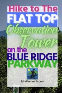
I found beautiful grounds with 25 miles of hikes along old carriage roads, including a 5-mile RT hike to the Flat Rock Observation Tower!
Read on to learn more about the Flat Top Tower hike in Moses Cone Memorial Park and all of the other beautiful bridle and hiking trails you can experience there, too.
Some of my posts contain affiliate links. If you make a purchase through an affiliate link, I will receive a small payment at no additional cost to you. I do not get paid for recommendations, all opinions on this site are my own. See full Disclosure page here.
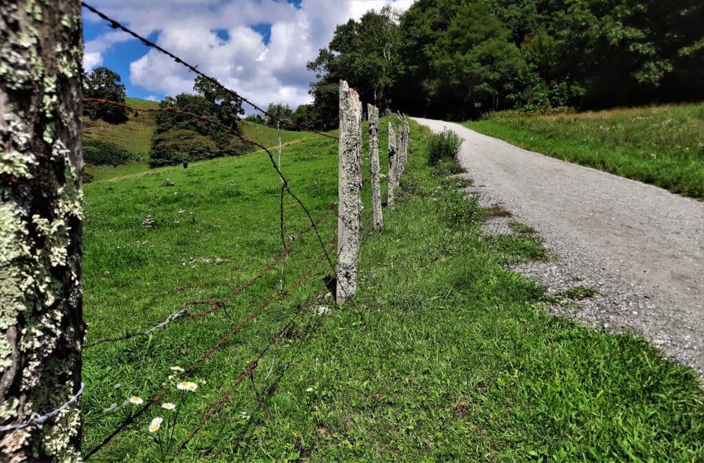
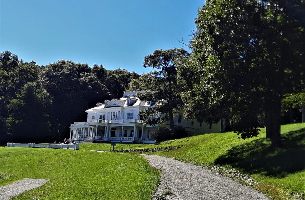
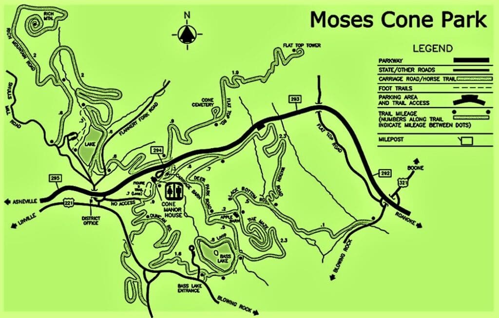
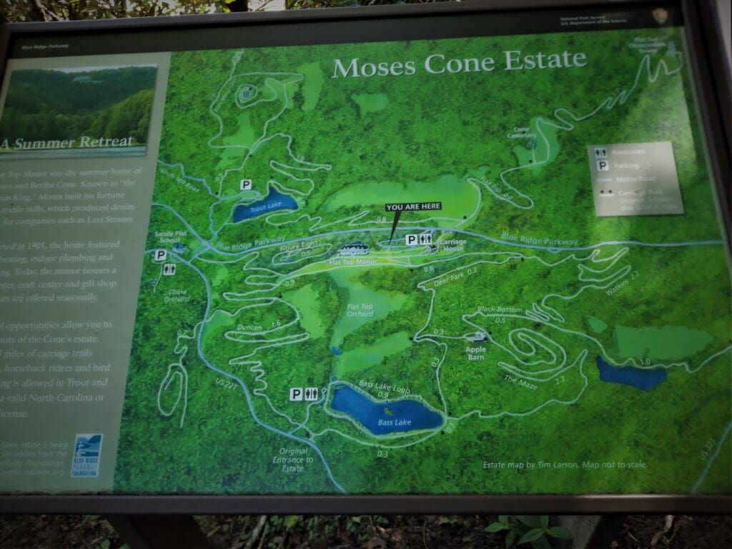
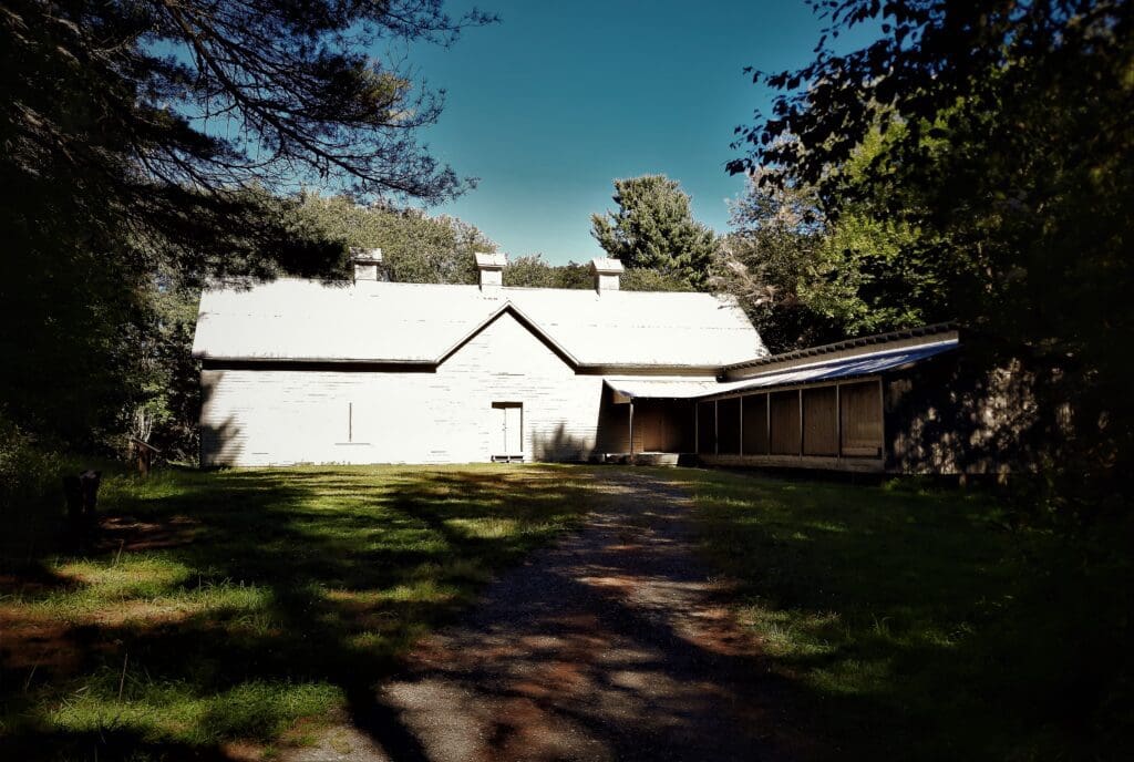
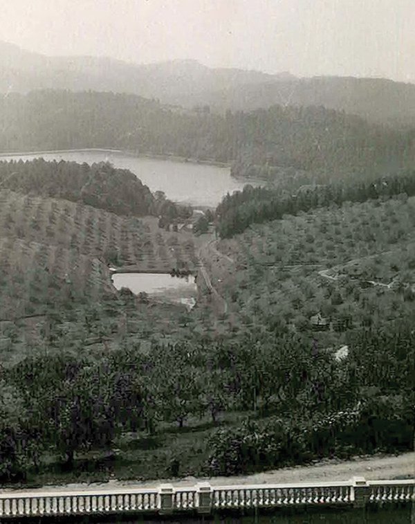
Besides miles of carriage roads for hiking and horseback riding, the Park features 3,600 acres of forests, meadows and wildflowers, bass and trout lakes – plus historic Flat Top Manor.
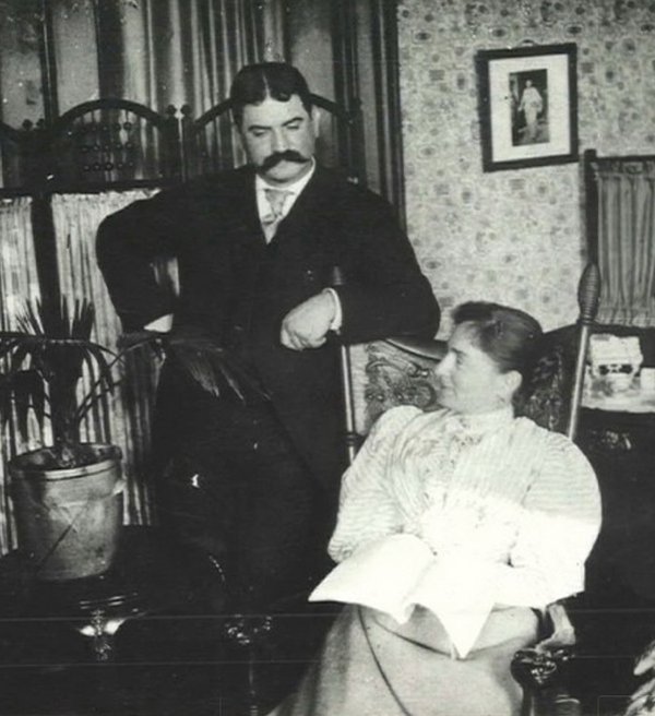
Textile magnate Moses H. Cone built this home as a summer retreat with his wife, Bertha, at the turn of the 20th century.
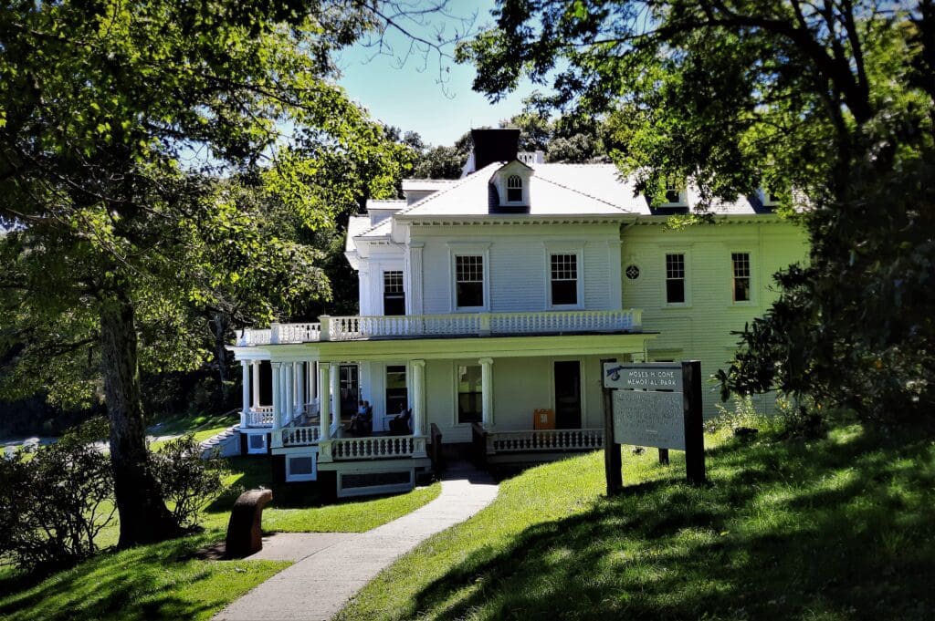
These days, the house and grounds are listed on the Register of Historic Places with the National Park Service, and Ranger-led tours of the Manor are offered seasonally on weekends.
Moses H. Cone Park is just a short drive from any of the North Carolina Mountain towns near the Blue Ridge Parkway, like Blowing Rock, Boone, or Banner Elk.
In fact, the Park is a favorite with locals for morning jogs and dog walks on the smooth, wide trails at all times of day.
The Blue Ridge Parkway
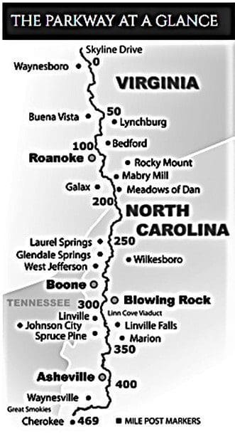
The Blue Ridge Parkway isn’t technically a National Park, but it might as well be.
It connects two National Parks (Shenandoah and the Great Smoky Mountains), and it also has it’s own National Parks web page.
Today – and since 1949 – The Blue Ridge Parkway Association (BRPA), a nonprofit organization, provides maps, brochures and the Blue Ridge Parkway Travel Planner free of charge.
Cone Memorial Park is:
-
- Named after Moses H. Cone who was a textile entrepreneur during the late 19th century.
- A 3,500 acre park located on the Blue Ridge Parkway near Blowing Rock and Banner Elk in North Carolina.
-
- Located adjacent to the Julian Price Memorial Park which, combined with Cone Memorial Park, comprise the largest developed area set aside for public recreation on the Parkway.
There are over 369 miles of hiking trails along the Blue Ridge Parkway – 25 of them within Moses Cone Memorial Park – so deciding which trail to explore can be difficult!
Cone Manor Park Hikes
Any hike you take at Moses H. Cone Memorial Park packs incredibly beautiful views into fairly easy terrain, especially for hiking in the Blue Ridge Mountains.
None of the hikes in the park are overly long, rugged, or steep, so it’s a perfect spot for families and casual hikers.
There are a couple of more well-known hikes in the Park, though with the interconnected trails, you could create a totally individualized route of your own based on the time and energy you have that day.
I hiked the two trails below on two consecutive days after completing other hikes in the Grandfather Mountain area, while I still had some daylight – and energy – left.
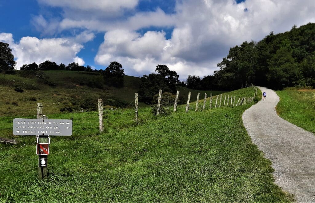
Flat Top Tower: This 5-mile roundtrip hike begins and ends at the Manor House parking area. The trail climbs gently through meadows and forests to the mountain summit with a 4-story lookout tower to climb at the end.
Bass Lake: You can hike an easy 1 mile loop around the lake, or extend your hike with connecting trails for a 4.5-6.5mile loop using Deer Park Road and the Maze by the Apple Barn. ( For the easy loop, park at the Bass Lake Parking area off US 221. Park at the Manor House for longer loops. )
I hiked the Bass Lake trail to the Apple Barn and back on the first day for about a 3 mile RT hike before I ran out of light.
But I was in the Park long enough to find out about the Flat Top Tower hike – A tower! I must climb it! – so I came back the next afternoon specifically to hike that trail.
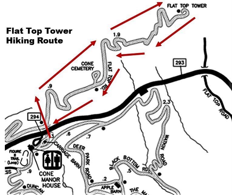
Flat Top Tower Hike
The hike ends at the summit, where there’s a 40ft observation tower you can climb (or not, if you don’t care for heights).
Location – Moses H Cone memorial Park, milepost 294, Blue Ridge Parkway near Blowing Rock and Banner Elk.
Distance – 5.3 miles.
Elevation – Gains only 580 ft elevation at its highest point (Observation tower)
Along the Flat Top Tower Trail
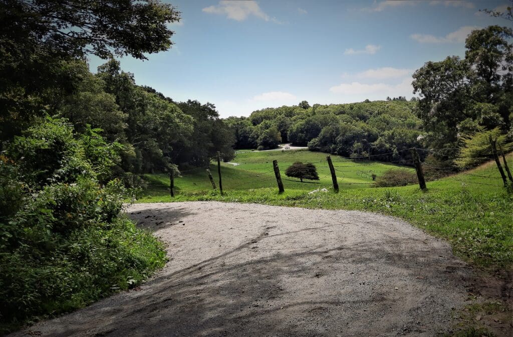
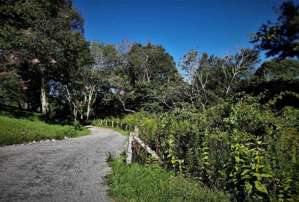
This hike starts at Flat Top Manor parking and winds through forest and Alpine-like fields for 2.6 miles to the observation tower at the 4,558-foot summit of Flat Top Mountain.
The trailhead is at the far end of the parking loop just past the restrooms (carriage house).
There’s an informative plaque just above the restrooms if you want to view a map of the estate and the trail to Flat Top Mountain, and you can get a brochure with a map from the kiosk by the edge of the parking area.
To start the hike, follow the main carriage path from the restrooms. (From here it is 2.5 miles to the top.)
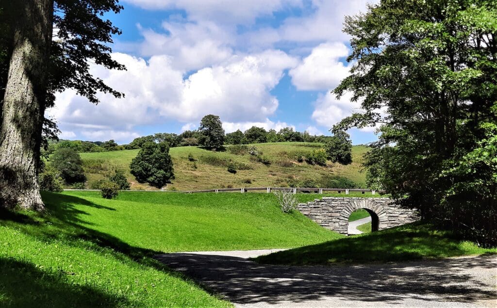
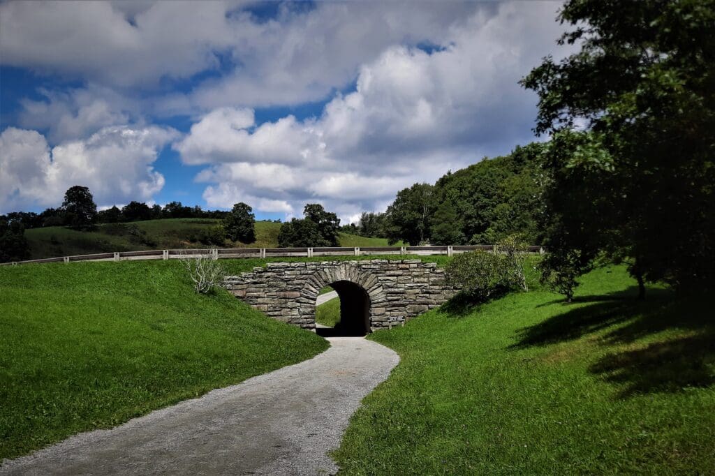
Go left following the paved trail towards the Blue Ridge Parkway.
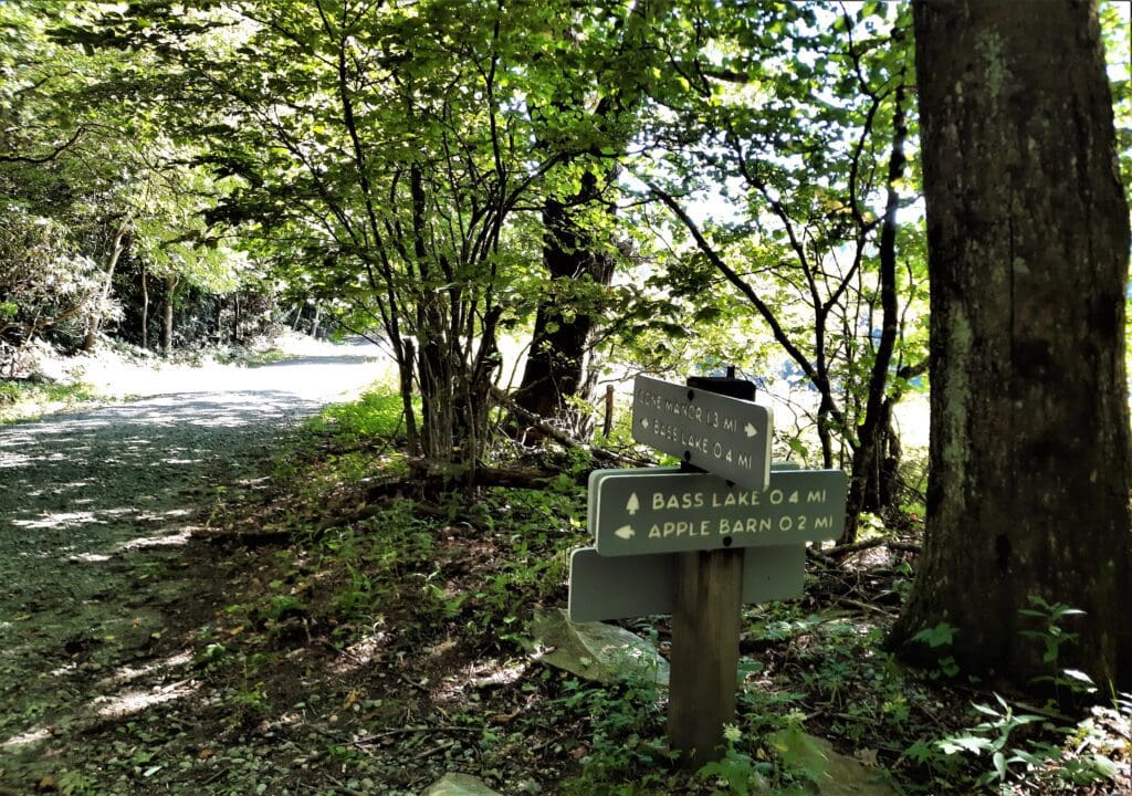
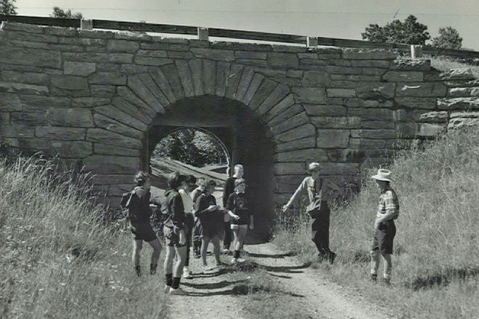
Pass through a stone tunnel under the Blue Ridge Parkway. On the other side of the tunnel the trail splits.
The trail on the left leads to Trout Lake and Rich Mountain. Stay right to follow Flat Top Road.
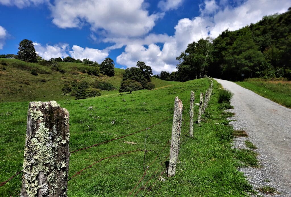
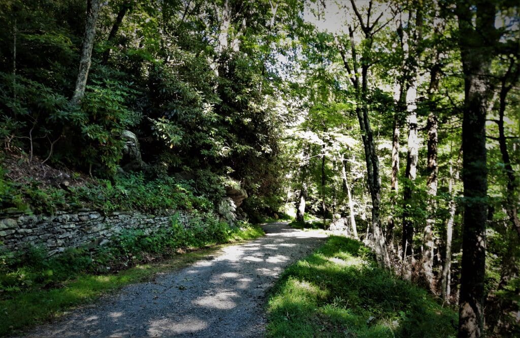
The trail goes slightly uphill the entire hike, but the incline is never too difficult because there are plenty of switchbacks.
Just before the 1 mile point is the turnoff to the Cone gravesites. I didn’t take the turn but it’s only .1 mile to the site, and I’ve heard it’s worth checking out.
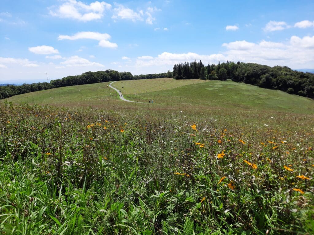
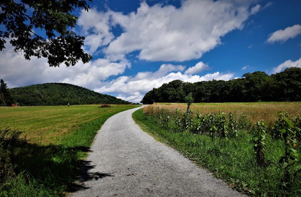
Continuing on the main carriage road up the mountain, the trail crosses a large open pasture and then switches back and enters the woods again.
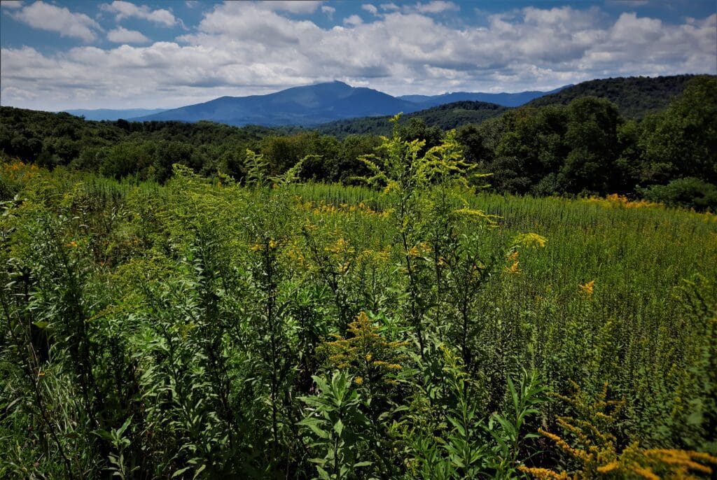
On this stretch you’ll see fantastic views southwest of Rich Mountain, Grandfather Mountain, Sugar Mountain, and Hanging Rock. Towards the east you’ll see Blowing Rock homes in the hills.
The trail switches back several times as you hike up the steepest section of the trail.
The main trail is on the well-maintained carriage roads, but you may notice some natural paths that short-cut the switchbacks.
Some of them appear to be “official” because they’re lined with gravel, but others look like unofficial social trails.
Stay off of the unofficial social trails to limit erosion. (I took a couple of the “official” shortcuts on my return trip down the hill.)
After you pass through a thick section of rhododendron, a small rock outcrop on the right offers a great view of Blowing Rock. The outcrop was occupied when I went past, so I didn’t spend any time there.
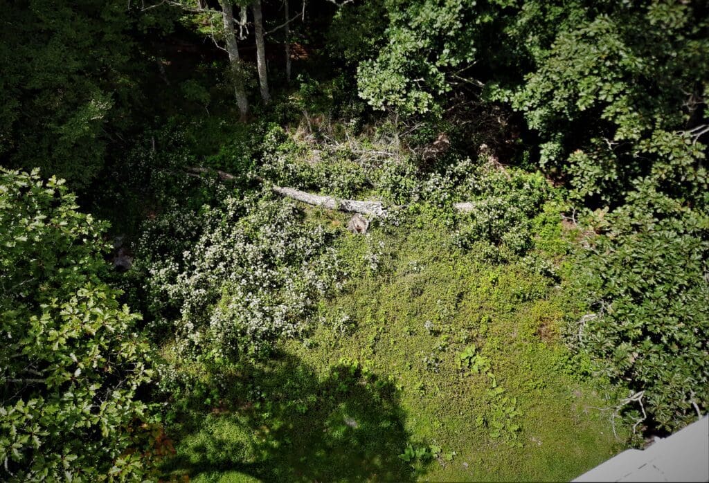
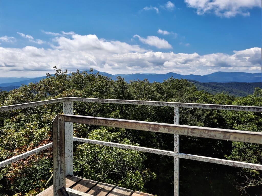
Eventually you’ll get to the the forested summit of Flat Top Mountain, where you’ll find the Observation Tower!
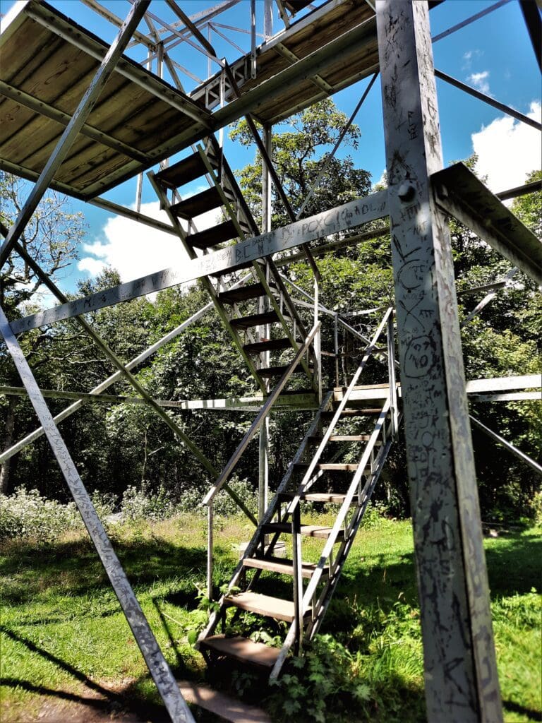
The tower is a bit creaky, but safe to climb. I found the graffiti entertaining, too 🙂
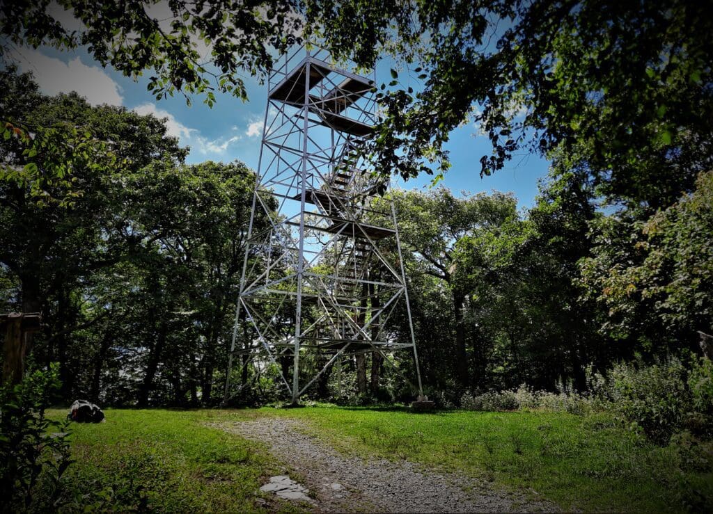
A few flights of stairs take you to the platform on top of the 40′ high Flat Top Tower.
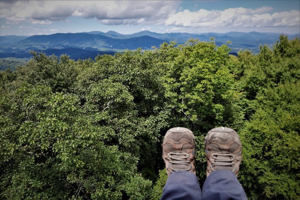
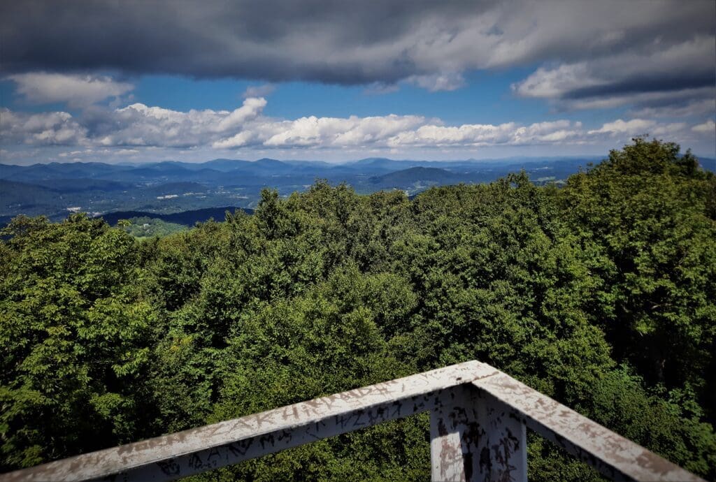
Your view is just above the tree line, with a 360 degree view of the surrounding mountains.
I ate my pack lunch at the top and just enjoyed the view for a while.
When I first got to the tower I was the only person there, but as I ate my lunch a few more people arrived – one couple decided NOT to climb the tower, but a couple of college boys decided to climb up.
It was fun to listen to their conversation on the way up: I was seated, so they didn’t know I was there. One of the boys was clearly nervous about going up so high!
When you’re finished enjoying the view at the Tower, just reverse your steps and take the downhill trek back to the Manor parking lot.
Views from the Tower
The Flat Top Observation Tower was originally built in 1900 from wood but after severe deterioration was torn down and the four-story 40ft tower you’ll see today was built in 1954.
This tower is always open, climb the stairs for the fantastic 360° views from the top.
To the southwest Grandfather Mountain dominates the region and this is one of the best views you will find of Calloway Peak – the ultimate goal of many hikes going up the mountain!
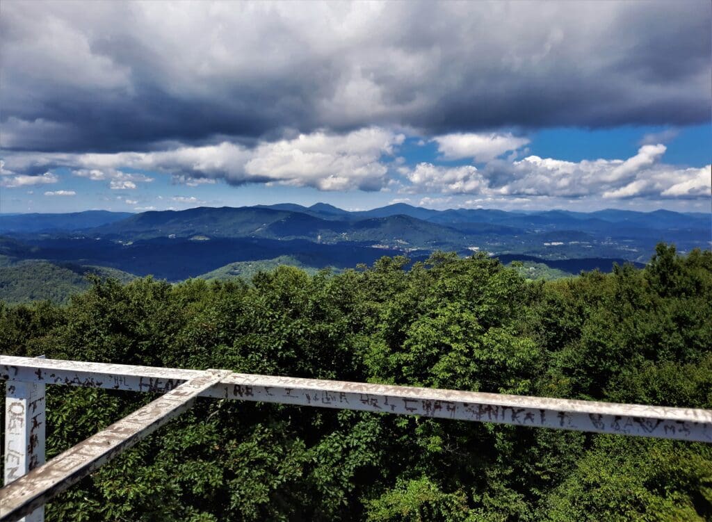
Immediately to the right of Grandfather Mountain, the condominium building on Sugar Mountain is plainly visible (ugh – everybody hates this building!) with the pointed summit of Hanging Rock to the right.
To the north high, rugged peaks rise above Boone and the Watauga Valley.
The sharp topped peak on the left is Snake Mountain, and the large rounded peak in the center is Elk Knob, the two tallest mountains in the range.
Blowing Rock lies far below the summit to the southeast. Due south you’ll see the large meadow at Cone Cemetery, with the peaks of Linville Gorge visible in the distance.
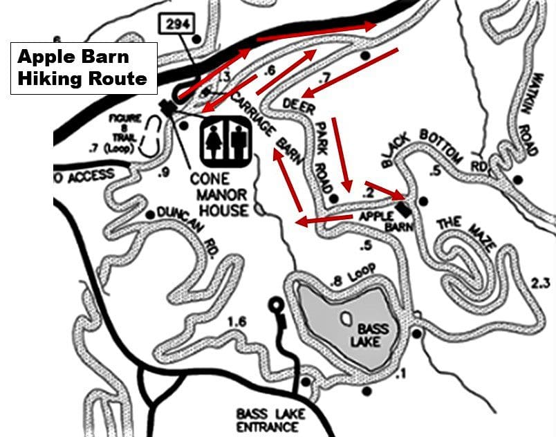
Apple Barn/Bass Lake Hike
Distance – 3.0 miles
This short 3 mile hike is the route I took on my first afternoon visit to Cone Memorial Park.
I was exploring without a map, and if I’d known where I was, would have taken the trail all the way down and around Bass Lake for about a 6.5 mile mike.
I did sees “Bass Lake” on the trail sign, but I wasn’t sure how long it would take me, so I turned back when I reached the Apple Barn, so I could return to the trailhead well before sundown.
I found the printed brochure and map on my way back to the car (darn it!), and made a firm decision to come back and hike to the Observation Tower before leaving the area for home.
Location – Moses H Cone memorial Park, milepost 294, Blue Ridge Parkway near Blowing Rock and Banner Elk.
Distance – Approx 3 miles.
Elevation – No noticable elevation gain
Along the Apple Barn/Bass Lake Trail
This hike (like the Tower hike) starts at Flat Top Manor parking and goes along smooth carriage roads slightly downhill to the Apple Barn, and further on to Bass Lake.
The trailhead is at the far end of the parking loop just past the restrooms (carriage house).
To start the hike, follow the main carriage path to the right from the restrooms towards the Manor.
In about .6 miles, you’ll reach an intersection. Take a sharp left onto Deer Park Road.
In another .7 miles, you’ll reach another intersection with Black Bottom Road.
Take another left and follow the signs about a quarter mile to the Apple Barn.
From there I retraced my steps for a 3 mile hike, but if you’d like something longer, you can continue on through the Maze and the Bass Lake Loop to create a 4.5-6.5 mile hike.
About the Park
Cone Memorial Park is located just off the Blue Ridge Parkway at Milepost 294.
The turnoff is a short loop with a fairly small number of parking spots scattered throughout the loop.
This is a very popular area, especially in the Fall, and finding available parking can be a challenge at times.
Your best bet is to arrive early, or later in the afternoon as I did. Just be sure you have enough time to finish before dark!
Parking
-
- Trout Lake and Manor House parking are just off the Blue Ridge Parkway.
- Bass Lake parking area is in the town of Banner Elk off US 221.
The network of trails connect all parking areas, so you could really park anywhere if you have enough time to do to your chosen hike and get back.
Other Things to Know
-
- Admission to the Park is free.
- You’ll find restrooms in the old Carriage House at the far end of the Manor parking.
- Dogs are allowed on a leash.
- To avoid crowds, go early in the morning. Busiest times are weekend afternoons.
- The parking area is open every day of the year unless that section of the Blue Ridge Parkway is closed for snow, ice or repairs.
- You share the trails here with horseback riders, so give them the right of way.
Park Hours
The Park office is open 10am-5pm, Mon-Fri.
The House is open Weds-Sun 10:00 AM – 4:00 PM through May.
Beginning June 1, the House is open daily 10:00 AM – 5:00 PM.
Carriage trails are open year round.
More About Flat Top Manor
Construction on the house didn’t begin until 1899 and was finally finished in 1901.
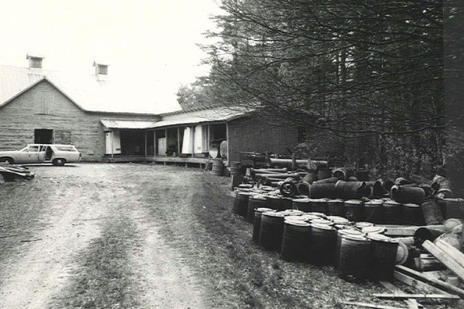
Flat Top Manor is one of only five original buildings still standing at Moses H. Cone Memorial Park.
The house was outfitted with modern amenities including indoor plumbing with hot and cold running water, wood-fired heating system and carbide gas lighting system. Electrical lines were established in 1927.
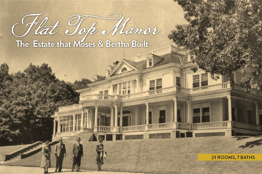
When finished, the white Colonial Revival manor home was about 13,000 sq ft in size and had 23 rooms including 11 bedrooms, seven bathrooms, a billiard room, music room and library.
Renovations at Flat Top Manor

Just recently, in 2021, the exterior of the mansion was restored to its original glory.
The Blue Ridge Parkway Foundation and many private donors funded the project, which cost near $2.4 million to complete.
Crews began their work in December 2020 to tackle the long-overdue repairs.

Today, with the exterior renovations complete, Flat Top Manor looks much as it did when it was first constructed.
I was lucky to visit after renovations were complete, and got to see Flat Top Manor restored to it’s former glory 🙂
Area Attractions
While you’re in the area, take time to visit some of these other nearby attractions.
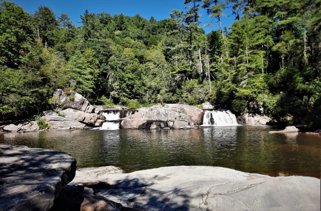
Linville Falls – Just down the BRP from Cone Memorial Park at Marker 316, you’ll find Linville Falls.
With many views of the pretty Falls, fairly short, smooth and not-so-steep trails, this is a great spot for families and casual hikers to spend some time or stretch their legs.
See more info on the NPS Linville Falls info page.
Grandfather Mountain State Park is also pretty close by – and every hike is a great hike!
I’ll write more about my hikes there soon, but meanwhile you can get more details on the NC State Parks Grandfather Mountain page.
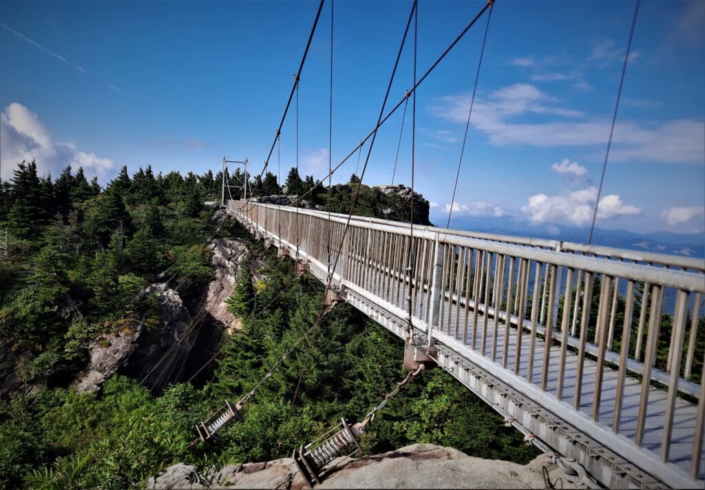
The Mile-High Swinging Bridge at Grandfather Mountain is nearby too – and not to be confused with the State Park. This attraction requires a paid ticket for entrance, but in addition to the bridge, you’ll get access to some convenient trailheads and parking with your fee.
NOTE: Tickets to see the Swinging Bridge must be purchased online.
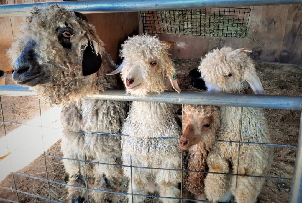
Apple Hill Farm – Just a short drive from the Parkway, you’ll find Apple Hill Farm, a textile farm on the site of an old apple orchard.
You can book a farm tour to meet all the animals and see how the farm works. You must have a ticket for a specific time to visit – and it’s well worth your time!
Warning: historical facts ahead. If you don’t want to learn more, skip to the end! But if you do, read on….
Beginning in 1897, Moses H. Cone designed and built his impressive retreat featuring carriage trails, lakes, orchards, fields, and forests – with Flat Top Manor as the centerpiece.
But who was Moses Cone, and how did he amass the great fortune required to build this mountain oasis?
From Stockboy to “Denim King”
Moses Cone was born in Jonesborough, Tennessee in 1857, after his father immigrated to the US from Bavaria. Early on, the family moved from Tennessee to Baltimore where Cone’s father ran a dry goods and grocery business.
By 1878, Moses and his brother Caesar were full partners in their father’s grocery business, known by then as H. Cone & Sons.
The brothers spent the next 10 years traveling the South as salesmen for the company. Times were tough, and many customers bartered baled textiles and yarn – instead of cash – as payment for groceries.
This led the Cone brothers to become commissioned sales agents for some of the textile companies they bartered with.

More success and other opportunities followed:
-
- In 1891, Moses created the Cone Export & Commission Company and in 1893 set up headquarters in Greensboro, North Carolina.
- In 1895, the Cone brothers launched a denim mill called Proximity Manufacturing Company on the outskirts of Greensboro.
- Moses and Caesar expanded their operation, acquiring other North Carolina mills including ones in Asheville, Salisbury and Gibsonville.
The brothers provided subsidized housing for mill workers, plus large lots for raising their own gardens and fruit trees.
By the time he died in 1908, Cone’s mills were producing a third of all the denim produced in the world, and he became known as the “Denim King.”
The Widow Cone Takes Charge
Cone died in 1908 from heart disease at the age of 51, but Bertha didn’t die until age 89 in 1947.
After her husband’s death, the widow Cone took on managing all aspects of the Estate – and she definitely made her mark!
In 1913, she created the Flat Top Manor Dairy, the first Grade A facility in Watauga County. The dairy supplied milk to local hotels and others around the Blowing Rock area into the 1940s.
The apple crop was the estate’s main source of income, but they also sold sheep, cattle and wool.
By 1915, there were approximately 250 sheep at the estate along with 82 cows, 13 horses and mules, and also chickens and turkeys.
Bertha continued to enjoy entertaining guests for dinner, and being involved in the community.
But Bertha also valued her privacy, and never wanted her home to be opened to the public.
She even wrote to President Franklin D. Roosevelt and strongly opposed his plans to route the Blue Ridge Parkway through her property.
Secretary of the Interior Harold Ickes reportedly assured her that no road would be built on the Cone estate in her lifetime.
After Bertha’s death in 1949, having no children to inherit, money from the estate was donated to create the Moses H. Cone Memorial Hospital in Greensboro.
It took four years to complete the project, and the hospital opened in 1953.
Bertha also willed the rest of her estate to the hospital, with the express wish that it never be sold to the National Park Service.
But estate maintenance proved a costly burden, and in 1950, the Supreme Court granted Hospital officials the right to donate the Cone estate to the National Park Service to become part of the Blue Ridge Parkway.
The orchards that the Cones planted are much diminished today, and many of the farm’s buildings were sold off and repurposed elsewhere.
Though it was something they opposed in their lifetimes, Moses Cone Memorial Park – along with Flat Top Manor and 25-miles of carriage trails, and the hospital – remain as a legacy of Moses and Bertha Cone.
I hope this post has inspired you to visit Moses H. Cone Memorial Park on the Blue Ridge Parkway to try some new hikes, and see other area sights!
Another good nearby place to hike is Rock Castle Gorge.
If you have a question drop me an email and I’ll reply as soon as I can.
Thanks for stopping by – see you next time! LJ
To Get New Idratherwalk Posts
sent directly to your inbox (how convenient!) Click this Button
If you like this post, please share it!

LJ has spent much of her free time as a single Mom – and now as an empty-nester – hiking in the US and around the world. She shares lessons learned from adventures both local and in exotic locations, and tips on how to be active with asthma, plus travel, gear, and hike planning advice for parents hiking with kids and beginners of all ages. Read more on the About page.