Most recently updated May 15th, 2026
Estimated Reading Time: 35 minutes
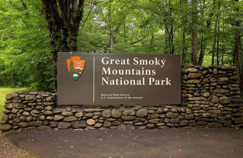
The Great Smoky Mountain National Park is right on the edge of the areas of North Carolina and Tennessee that were hardest hit by Hurricane Helene.
That said, the Park is open and many of the surrounding communities are open for business and could really use your tourist dollars to help rebuild!
Go to my Hurricane Helene page to get the latest updates on the latest Park, Trail and road repairs.
For years, I’ve been driving from my home near Raleigh, NC past the Great Smoky Mountains National Park (GSMNP) in Tennessee for work, but never had a chance to stop and explore.
It was very frustrating… 🙁
But finally, last summer, I was able to spend a few days hiking in the GSMNP.
It was everything I hoped it would be!
The Great Smoky Mountains National Park (GSMNP) was the most visited national park in 2019, with over 12.5 million visitors.
That’s nearly twice as many tourists as the Grand Canyon had that same year!
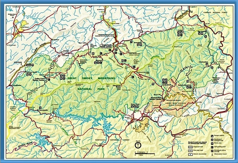
The Park covers 522,419 acres in North Carolina and Tennessee, making it one of the largest protected areas in the eastern United States.
It also straddles the ridgeline of the Great Smoky Mountains, part of the Blue Ridge Mountains, which are a division of the larger Appalachian Mountain chain.
And as if that’s not enough to warrant a visit, the Appalachian Trail also passes through the center of the park on its route from Georgia to Maine.
Read on to learn about the park layout, history and the amazing trails that I hiked during my visit… and how you could hike them, too!
Some of my posts contain affiliate links. If you make a purchase through an affiliate link, I will receive a small payment at no additional cost to you. I do not get paid for recommendations, all opinions on this site are my own. See full Disclosure page here.
NOTE: This article is very long, with lots of info for your Great Smoky Mountains National Park visit! Use the Table of Contents below to go straight to the things that are important to you, like the really interesting geeky history stuff 🙂
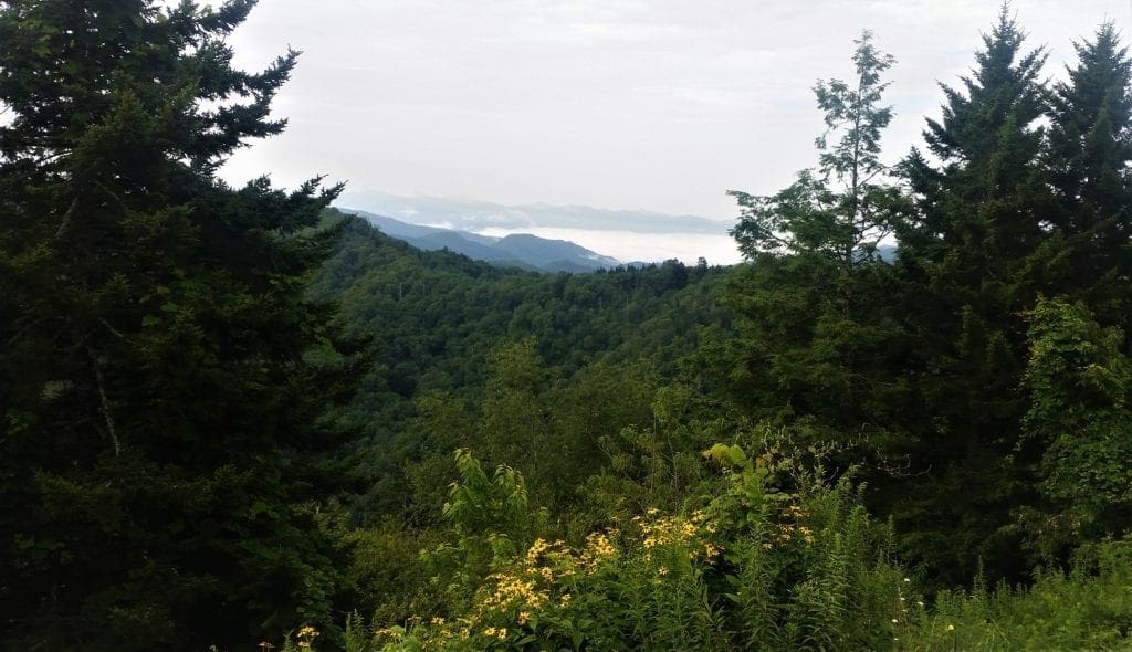
One of the big challenges in writing about this trip was deciding which photos NOT to include.
Every view was beautiful, so I’ve shared as many of them here with you as I could 🙂
Plan Your Park Visit
In addition to your usual hike planning, you’ll need to consider the unique logistics of the Great Smoky Mountains National Park when planning your visit.
Because the park is so large, you’ll need to think about how long it will take you to get from where you’re staying to your trailhead access.
Figure time on the trail on top of that to estimate when you need to set out in the morning to get back to the trailhead before sunset.
The Park Layout
U.S. Highway 441 (known in the park as Newfound Gap Road) bisects the park, providing access by car to many trailheads and overlooks, most notably that of Newfound Gap.
The main park entrances are located along Newfound Gap Road in Gatlinburg, Tennessee and Cherokee, North Carolina, and in Townsend, Tennessee.
Park Sections
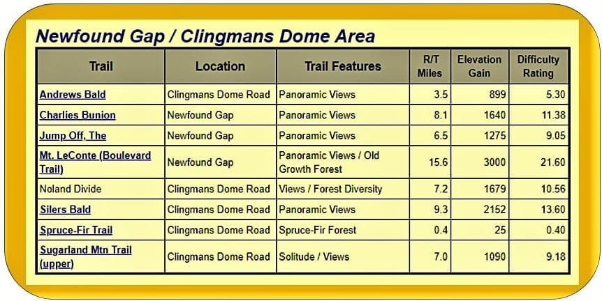
There’s a great resource online for GSMNP trails by section, that helped a lot with my hike planning.
The grids show the location/area as well as hike length, elevation gain, and level of difficulty. (The higher the number, the more difficult the hike.)
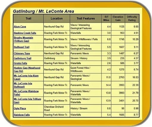
I knew for sure that I wanted to summit Mt Leconte, so to start with I focused on that area of the park, called the LeConte/Gatlinburg area in the trail chart above.
If you don’t already have a specific hike in mind, do some research – or maybe you’ll be interested in one of the hikes I took 🙂
Gatlinburg
Visitors often start in Gatlinburg, and make their way from there to some of the park’s more famous trails. I made my home base just outside of Gatlinburg, too.
Gatlinburg was damaged in the 2016 fires but has since rebuilt.
On the main road through town, you’ll find many restaurants, wineries and other attractions specifically made for vacationing families in a theme-park atmosphere.
I had rented lodgings with a full kitchen so I could cook. There are a couple of grocery stores nearby, so I was able to stock my shelves easily.
There are three entrances to Great Smoky Mountains National Park from Gatlinburg, but the easiest way to get a handle on this GSMNP area is to take a drive on the Newfound Gap Road.
Highlights along the way include the Sugarlands Visitor Center, Newfound Gap, and Clingman’s Dome Road.
Most of the trailheads for my planned hikes were off of one of these roads, too.
My plan was to tackle hikes in the LeConte area for the first few days, then as time and weather allowed, move on to the Newfound Gap area.
Park Lodgings
You’ve got a few options if you want to stay inside the park. But you’ll want to make your reservations early, because spots fill up fast!
Park Lodge
Hikers may spend a night at the LeConte Lodge, located near the mountain’s summit. Cabins and rooms are for rent (except during the winter season).
It’s the only private lodging available inside the park, and the only way to reach it is by hiking trail! Hiking routes to the lodge vary in length from 5 to 8 miles.
Reservations for LeConte Lodge
LeConte Lodge is very popular, and requires advance reservations – sometimes as much as a year in advance!
The Reservation Office is closed on most major holidays and between noon and 1 p.m. for lunch.
-
-
- Phone (865) 429-5704
- Online at www.lecontelodge.com
-
CAMPING AND Cabins
In addition to day hiking, the GSMNP offers opportunities for backpacking and camping in designated camping areas and shelters.
Most of the park’s trail shelters are located along the Appalachian Trail or a short distance away on side trails.
A permit, available at ranger stations and via the Park website, is required for all backcountry camping and shelters.
To get all of the details about each campground, and learn how to make reservations, see the Park’s camping info page.
Lodgings Outside OF the Park
For hotel accommodation in towns around Great Smoky Mountains National Park, such as Gatlinburg, Pigeon Forge or Bryson City, I like to use Booking.com or VRBO.
If you’re looking for some additional travel pointers or more lodging ideas for your next adventure, check out my Travel Resources page.
For more tips on how to plan a multi-day hiking trip, check out this article.

Nearby Attractions
As the most visited national park in the United States, the Great Smoky Mountains National Park anchors a large tourism industry based in Sevier County, Tennessee adjacent to the park.
Tourism to the GSMNP contributes an estimated $2.5 billion annually into the local economy.
If you want to take a break from hiking, other major local attractions include Dollywood – the second most visited tourist attraction in Tennessee – Ober Gatlinburg, and Ripley’s Aquarium of the Smokies.
Area History
Before the arrival of European settlers in the 18th and early 19th century, the region that includes the Great Smoky Mountains National Park (GSMNP) was part of the homeland of the Cherokees.
But in 1830, President Andrew Jackson signed the Indian Removal Act, which forced all Indian tribes east of the Mississippi River to move into what is now Oklahoma.
The Legend of Tsali
Very little is known of the early life of the Cherokee Indian Tsali.
He is remembered most for his rebellion against the Indian Removal Act, when he was around 60 years old.
According to the 1835 census, Tsali lived with his wife and his three sons in a cabin where the Nantahala River drained into the Little Tennessee.
Like other Cherokee in the area since Revolutionary times, Tsali farmed a small hillside plot and hunted wild game peacefully alongside white settlers.
But for Tsali and the rest of the Cherokee Nation, their rights as Americans and human beings rapidly eroded after the election of 1828.
That was the year “Old Hickory” – better known by then as Andrew Jackson, the leader of the new Democratic party – became the American President.
Two years later, Jackson signed the Indian Removal Act.
Eight years after that, in the summer of 1838, General George Winfield Scott arrived in the Smoky Mountains with a force of 7,000 soldiers.
Their task was to round up Cherokee and detain them in holding pens in Bushnell, to await the march west to Oklahoma, on what later became known as “The Trail of Tears”.
In late October of that year, a Lieutenant Smith and three soldiers invaded Tsali’s cabin.
They then forced his family (and his brother’s family) at gunpoint to gather whatever they could carry and march toward the stockade in Bushnell.
During the march, speaking secretly in the Cherokee language, Tsali and his fellow captives devised a plan to overtake the soldiers.
According to the U.S. Military records, one of the captives drew a concealed axe and tomahawked it into the skull of a soldier.
In the ensuing struggle, a rifle discharged, leaving one soldier with a mortal head wound.
Lieutenant Smith fled for his life.
Meanwhile, Tsali’s party of 12 made their way north into present day Smoky Mountain National Park. Legend says that they hid in a cave on Deep Creek below Clingman’s Dome.
 On November 6, Colonel William S. Foster received orders to hunt down the fugitive band.
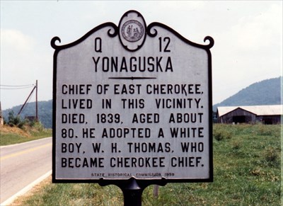
The Quallatown band of Oconaluftee Cherokee Indians lived outside of the Cherokee Nation but they were also threatened by the 1830 Indian Removal Act.
So Chief Drowning Bear (Yonaguska) and his white adopted son William Holland Thomas made a deal with General Scott to deliver Tsali’s band, so their own group could remain in Quallatown.
Tsali and his fellow renegade farmers remained hidden through the late Fall, while Colonel Foster’s infantry and the Oconaluftee Cherokee tracked the runaways like wild game.
Eventually the search party caught up with the rest of his family, killing his two eldest sons, but sparing Tsali’s youngest boy and Tsali’s wife.
The military continued to hunt four remaining fugitives who were the principal leaders in the upheaval, and soon Tsali was the only renegade still at large.
 So, with December approaching and their mission basically completed, Foster’s troops pulled out of the mountains.
But the Oconaluftee Cherokee kept up the hunt and soon caught up to Tsali, cornering him in a rock shelter in the Smokies.
On November 26th, they marched their captured brother to Big Bear Reserve, now known as Bryson City, NC.
The men tied Tsali to a tree and prepared for an execution by musket firing squad at high noon.
Legend says that Tsali refused to wear a blindfold, so he could look the Cherokee who had betrayed him directly in the eyes.
Or maybe he just wanted to have one last look at his beloved Smoky Mountains in the distance.
Over the next 100 years more European settlers arrived, and logging grew as a major industry in the mountains.
A rail line, the Little River Railroad, was also constructed in the late-19th Century to haul timber out of the remote regions of the area.
But the cut-and-run-style clearcutting was destroying the natural beauty of the area, so visitors and locals banded together to raise money for preservation of the land.
GSMNP History
The U.S. National Park Service wanted a park in the eastern United States, but didn’t have much money to establish one.
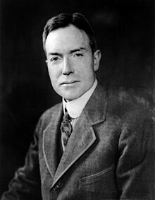
Though Congress had authorized the park in 1926, there was no federally owned land to build a park around.
So, John D. Rockefeller, Jr. contributed $5M, the U.S. government added $2M, and private citizens from Tennessee and North Carolina pitched in to assemble the land for the park, piece by piece.
But even though they had collected the funding for the Park, they still needed to clear the purchased lands of their current occupants.
Mountain homesteaders, miners, and loggers were evicted from the land, and farms and logging in the area were abolished in order to establish the park.
If they owned the land, they were paid for it, and some went willingly.
Others fought against it, but most families moved immediately.
A select few, including the six unmarried Walker sisters, received a special lifetime lease—a chance to live out the rest of their lives in the log cabin they were raised in.
The Walker Sisters
John N. Walker married Margaret Jane King in 1866 shortly after returning from the Civil War, where he fought for the Union and was imprisoned by the Confederacy.
After marrying, John Walker obtained a house and property in Little Greenbrier Cove, an area which later became part of the Great Smoky Mountains National Park.
Other buildings on the Walker property included a barn, corncrib, smokehouse, pig pen, apple barn, and blacksmith shop.
A springhouse on a nearby flowing creek kept dairy products like milk and butter cool throughout the year, and provided storage for pickled root vegetables.
John also planted orchards that included more than 20 kinds of apples, as well as peaches, cherries, and plums. Chickens, sheep, goats, and hogs were all raised on the farm.
Together the Walkers raised eleven children—seven girls and four boys. The sisters, from oldest to youngest, were Margaret, Polly, Martha, Nancy, Louisa, Sarah Caroline, and Hettie.
The Walker boys left home or married, while only one of the seven sisters—Sarah Caroline—married. The other six unmarried sisters stayed in Little Greenbrier with their father and inherited the farm after his death at the age of 80 in 1921.
The Walker sisters did all of the farm and housework themselves, providing self-sufficient food and shelter for more than 40 years.
In 1926, after Congress approved authorization of the national park, parcels of land collected from families were eventually purchased, including the Walker sisters’ 122-acre homestead.
Refusing to leave their mountain home, the sisters held out until 1940, when President Roosevelt officially dedicated Great Smoky Mountains National Park from the stone memorial at Newfound Gap.
At that point, the sisters’ property was forcibly sold to the government for $4,750, but they were also offered a lifetime lease to live out the rest of their lives at their home.
But living in the National Park meant the sisters had to develop a new lifestyle, since they were no longer allowed to hunt, fish, or graze livestock.
Their homestead became known as “Five Sisters Cove”, and became a favorite spot for visitors.
Polly passed away in 1946, Hettie died a year later in 1947, and Martha died in 1951.
With only two sisters left, Margaret (age 82) and Louisa (age 70) wrote a letter to the park superintendent asking if the “visitors welcome” sign could be taken down, because they were getting too old to get work done on the farm and greet visitors, too.
Margaret Walker died in 1962 at age 92, and Louisa stayed in the house until she died on July 13, 1964. The last sister, Caroline, who had moved away and married, died in 1966.
Though the Walker sisters are now gone, their legacy lives on through their homestead, which you can still visit.
How to Visit:
Park at Metcalf Bottoms, walk a half mile to the school house, then take the Little Brier Gap Trail a mile up to the Walker sisters beloved home.
Source reference: Lindsey Taylor for the National Park Service.
Other Important GSMNP Dates
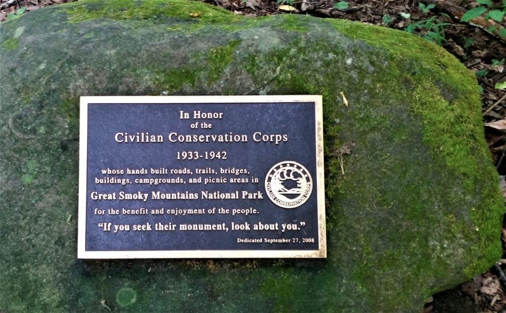
During the Great Depression, the Civilian Conservation Corps, and other federal organizations built trails, fire watchtowers, and other park improvements.
The Great Smoky Mountains National Park was officially established on June 15, 1934, and dedicated by President Franklin D. Roosevelt in 1940.
The Park was also:
-
- designated an International Biosphere Reserve in 1976
- certified as a UNESCO World Heritage Site in 1983, and
- became a part of the Southern Appalachian Biosphere Reserve in 1988.
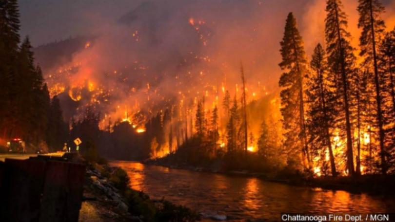
Wildfires of 2016
More recently, in late November and early December 2016, a series of wildfires engulfed a total of 17,900 acres in the park and surrounding areas.
The wildfires killed at least 14, injured 190, and forced the evacuation of more than 14,000 people.
The fires began on November 16, when two juveniles started a wildfire near the summit of Chimney Tops.
The fire grew to 500 acres by November 28th.
On that afternoon, after several months of extreme drought, and wind gusts of more than 80 mph, the fire literally exploded.
Over the next several hours almost 18,000 acres were burned, including 11,410 acres within Great Smoky Mountains National Park.
From Chimney Tops the fire raced north, passing around the edges of downtown Gatlinburg and reaching the outskirts of Pigeon Forge.
Before it was brought under control the fire had damaged or destroyed at least 2,460 structures at a cost of more than $500 million.
The air was so full of smoke it was hard to breathe even as far away as Raleigh, NC where I live.
The wildfires were the deadliest in the Eastern United States since the Great Fires of 1947 and were one of the worst natural disasters in the history of Tennessee.
You can still see evidence of the fires along some of the park trails and mountain sides.
What’s in the GSMNP Forest?
The park is almost 95% forested, and almost 36% of that (187,000 acres), is estimated to be old growth forest with many trees that predate European settlement of the area.
Over 100 tree species grow in the park, and the park also has over 1,400 flowering plant species and over 4,000 species of non-flowering plants.
The animal wildlife includes more than 200 species of birds, 50 species of fish, 39 species of reptiles, and 43 species of amphibians, with an estimated additional 100,000 undocumented species.
Elk (wapiti) were reintroduced to the park in 2001, and can be found in the Cataloochee area in the southeastern section of the park.
The GSMNP is also home to raccoon, bobcat, two species of fox, river otter, woodchuck, beaver, two species of squirrel, opossum, coyote, white-tailed deer, chipmunk, two species of skunk, and various species of bats.
And of course, there are bears in the woods 🙂
Black Bears
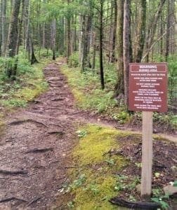
The Smoky Mountains are bear country and it’s possible you could run into a bear when you’re hiking. (The park has a known black bear population of about 1500.)
If this possibility makes you nervous, invest in some Bear Bells and mace, just in case.
I wear bear bells, but I’m never sure if it’s warning the bears away, or just calling them for dinner…. 😉
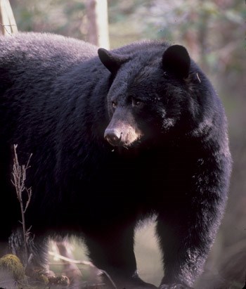
Actual Black bear attacks are extremely rare.
That said, it’s important to know what to do if you encounter a black bear on the trail.
The GSMNP website offers advice on what to if you encounter a bear in the Park.
Essentially, you should pro-actively make noise to make your presence known before they get too close, and seal any food tightly so it doesn’t attract unwanted bear attention.
Black bears are generally friendly and curious animals. They tend to keep to themselves and usually leave the area once they notice people are around.
The only exception is when food’s present, which is why you should store your food in bear-proof containers.
Don’t let this section put you off – a black bear sighting in the wild is an incredible experience! I’ve seen a few bears over the years and have never been attacked.
GSMNP Hiking
There are 850 miles of trails and unpaved roads in the park for hiking, including 70 miles of the Appalachian Trail.
Elevations in the park range from about 875 feet to 6,643 feet at the summit of Clingmans Dome.
Within the park a total of sixteen mountains reach higher than 5,000 feet.
Even if you’re not a big fan of steep uphill trails, there are still many beautiful hike options to choose from.
There are hikes in the park to suit all ability levels and ages, ranging in length from just 1-2 miles up to longer hikes that’ll take an entire day or more.
It’s good to do research and hike planning ahead of time, but still try to leave some time to explore things that just look interesting along the way, too 🙂
Hiking Gear
Sturdy hiking boots or shoes are absolutely necessary when hiking the rooty, rocky and sometimes slippery trails in the Smoky Mountains.
Hiking poles aren’t required, but could be useful on many trails.
It’s always a good idea to bring an extra layer of clothing with you, and be ready for rain, too.
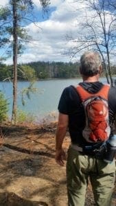
And you’ll need a pack to carry your water, food, rain gear and extra layers, too.
Take a look at my dayhike gear recommendations, gear tips for beginning hikers, or check out the Gear Page for more information on other gear pieces you might need.
GSMNP Maps
All of the hiking trails in the Park are pretty well marked. That said, it’s still a good idea to have a map (and compass) with you.
Sometimes, you just want to be able to double-check your map to make sure you’re going in the right direction.
This Great Smoky Mountains National Park maps page has a full park map, and maps of the individual park sections with trails as well.
Be sure to order your maps well in advance of your trip, so you have them in time! It’s a good investment, because you’ll want to visit more than once.
4-DAY HIKE ITINERARY
My Park visit was in late August, and the weather was as expected – meaning very hot – with thunderstorms more likely than not each afternoon 🙂
Even though the days are longer in the summertime, it’s still a good idea to hit the trails early.
NOTE: At the time of this visit, there were some COVID-19 restrictions and closures in place, but some trailhead restrooms and water were available. I’ve returned several times since then, and all amenities are open. That said, please check current restrictions and closures before you head out!
Below is a summary of the trails I hiked, and how I decided which hikes to do each day. Maybe this will help you decide what trails to visit on your trip 🙂
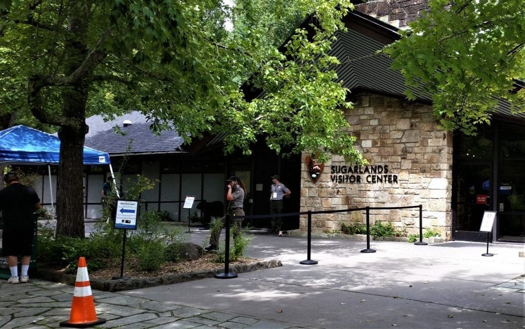
DAY ONE – Sugarlands Visitor Center
I was driving in from the Raleigh area, so there wasn’t much of the day left when I got into Gatlinburg.
After I got checked in and settled, I did some poking around to get the lay of the land before hitting the trails in the morning.
First, I wanted to find a Visitor’s Center.
These ranger stations provide exhibits on wildlife, geology, and the history of the park. They also sell books, maps, and souvenirs.
So, I drove to Sugarlands Visitors Center, to see if I could get some pointers from the Rangers, and maybe some additional section maps.

Unfortunately, due to COVID restrictions, the center was closed.
But you could stand in a socially-distanced line to be allowed entry one person/group at a time – as the previous group left.
Progress seemed slow…..
It was getting late, so I decided that the maps I already had would have to do – and I could double check online before I set out in the morning.
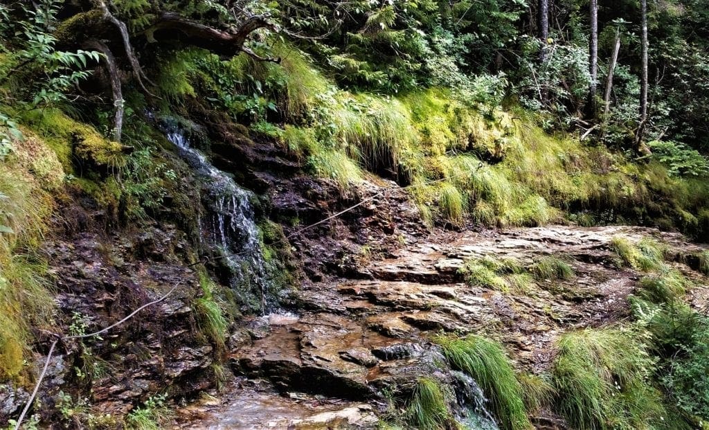
There was a nice little walk around the Center that I took to a *very* small waterfall called Cataract Falls.
Cataract Falls is a good way for your kids to get rid of squirrely energy if you’ve been in the car all day getting to the Park 🙂
After that, I took a drive down Newfound Gap road to find the trailheads and parking for the hikes I had planned for the morning:
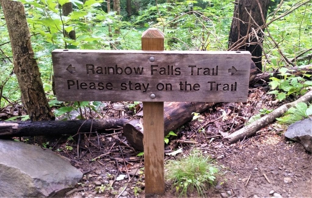
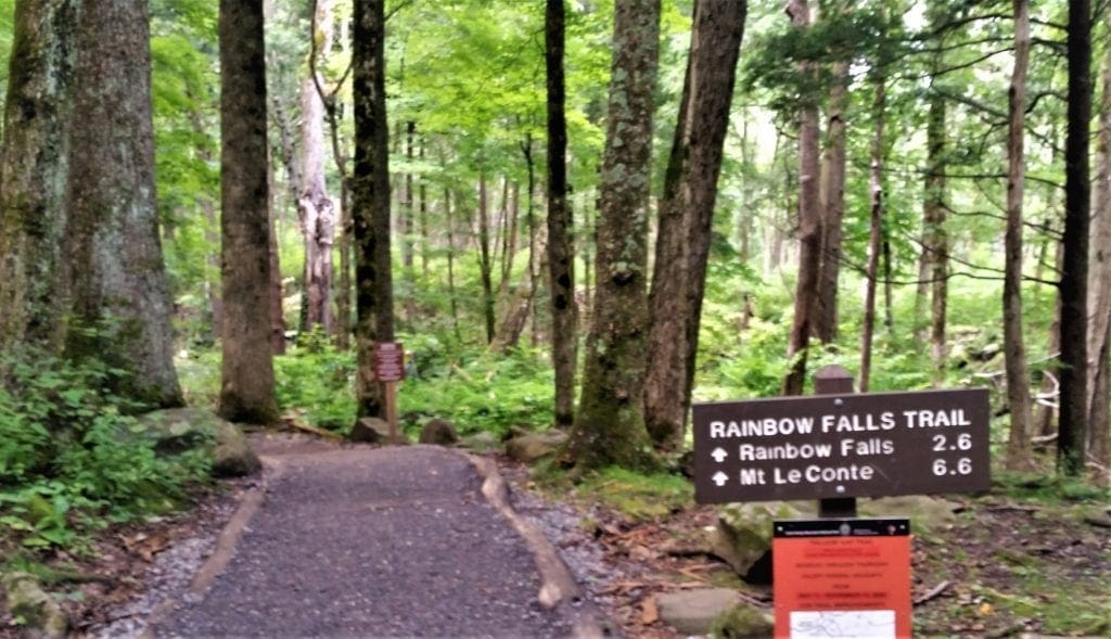
The Bullhead Trail and Rainbow Falls.
Fortunately, both hikes start from the same trailhead!
DAY TWO – Bullhead Trail and Rainbow Falls
The next day I got an early start, because I had a long day of hiking ahead!
I was planning two hikes that would cover ~12 miles and 3300 ft elev gain/loss combined, and take an estimated 8 hours to complete.
The weather looked good until the early evening, so I didn’t think I’d need to finish early to avoid a forecasted storm.
It was my first time on either of these trails, and I only attempted to do both of them in a single day because:
-
- I’m usually faster than the estimated times given in guides,
- the sun was going to be up until around 8pm, and
- the hikes were starting from the same trailhead.
I don’t mind admitting it was a tiring day, mostly because of the steep elevation gain. But well worth the effort, for sure 🙂
If you have a slower hiking pace or small children with you, I wouldn’t attempt both of these hikes in a single day – especially in a season when the sun sets earlier.
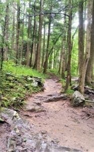
Bullhead Trail
Trail Difficulty: Moderate
Round Trip Hours: 4 Hrs
Round Trip Miles: 5.9 Mi
Elevation Gain: 1607 Ft
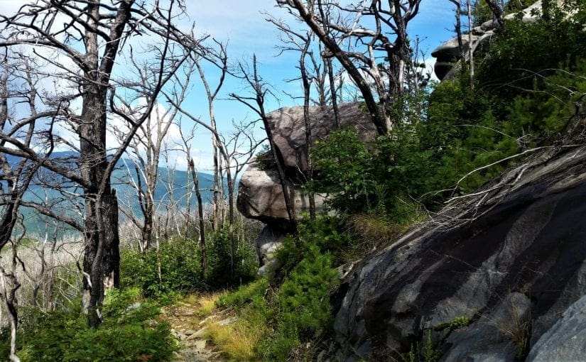
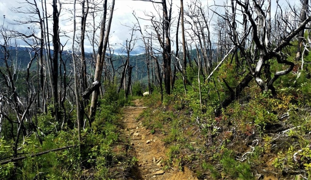
On October 25, 2018, the Bullhead Trail was reopened after being closed for almost two years due to the November 2016 wildfire.
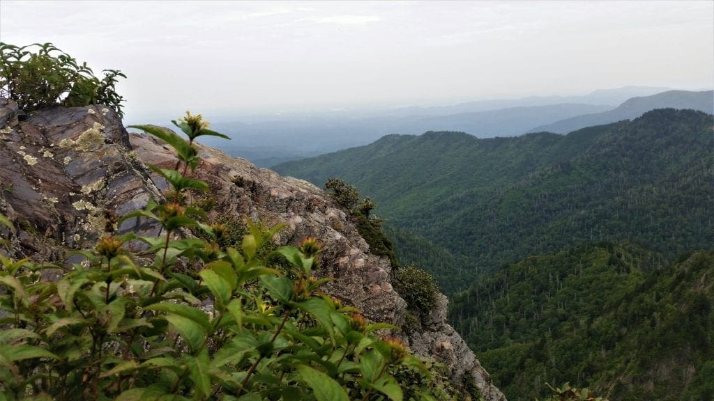
The trail ascends Mount Le Conte – the tallest mountain east of the Mississippi River – and offers outstanding views all along the way.
This is one of the hikes you can take to get to LeConte Lodge near the mountain’s summit, but I planned to summit LeConte on a different trail the next day.
So I only hiked Bullhead to the Pulpit (rock cairn) – the official end of the Bullhead trail – for a 6 mile round-trip hike.
The Bullhead is a less well-known and less worn trail than some other popular park favorites.
I was alone on the trail for most of the hike.
There was a short portion where a bear snuffled along beside me in some bushes parallel to the trail. I sang loudly and just kept walking 🙂
That made me a little nervous. But otherwise I found the solitude and the views on the Bullhead Trail to be a great beginning to my visit.
BTW, that was the only bear sighting I had on any of the week’s hikes.
Directions to Trailhead:
The Bullhead Trail begins from the Rainbow Falls Trailhead, located just outside of Gatlinburg.
-
- Starting from Light 8 in Gatlinburg, turn onto Historic Nature Trail / Airport Road.
- After 0.7 miles veer right onto Cherokee Orchard Road, and Great Smoky Mountain National Park.
- After driving another 2.2 miles you’ll enter the one-way Cherokee Orchard Loop Road.
- After driving roughly 0.6 miles on the loop, the Rainbow Falls Trailhead will be located on your right.
If the parking lot is full there’s an auxiliary parking area about a tenth-of-a-mile further down the road.
Find the gate just before the parking-lot entrance.
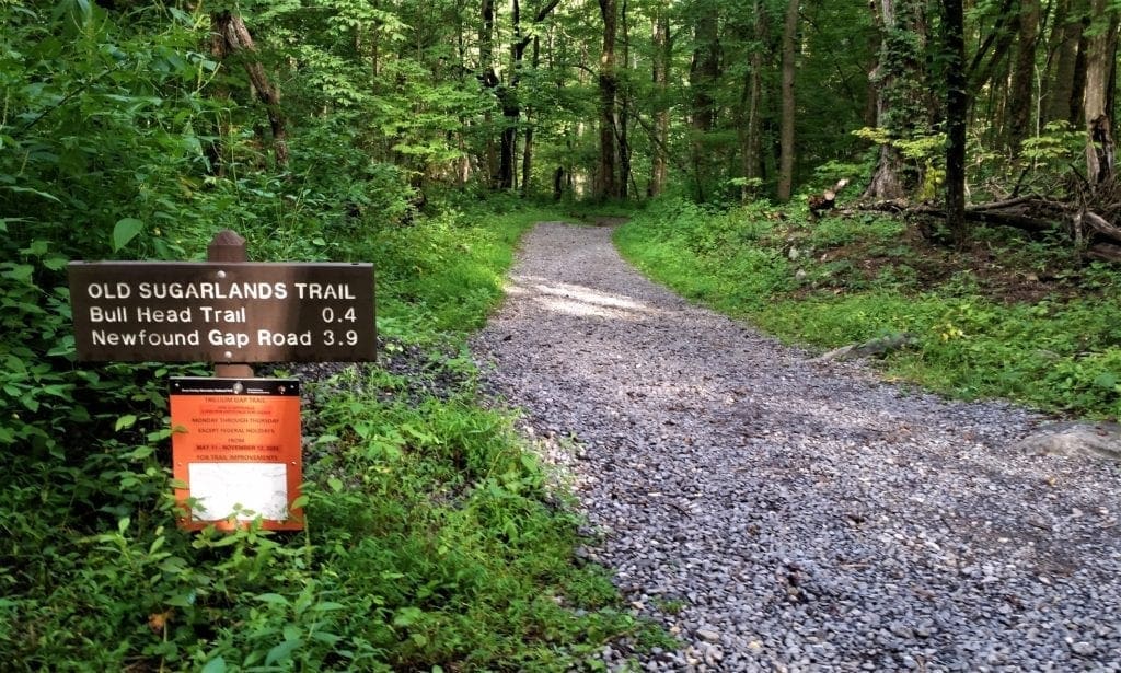
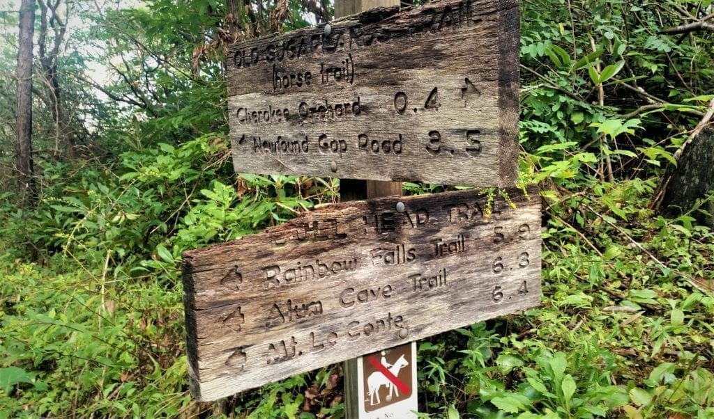
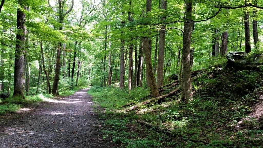
That’s the starting point for the Bullhead Trail – which actually begins on the Old Sugarlands Trail, a historic wagon road linking park headquarters at the Sugarlands Visitor Center with Cherokee Orchard.
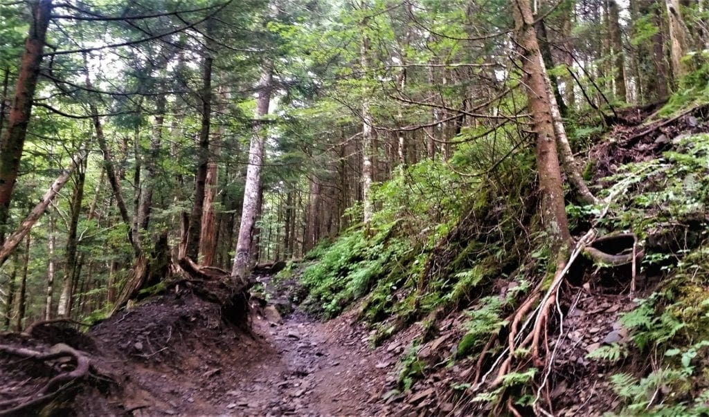
Along the Bullhead Trail
In about a fourth of a mile, you’ll hang a left off the Old Sugarlands Trail and commence on the Bullhead proper.
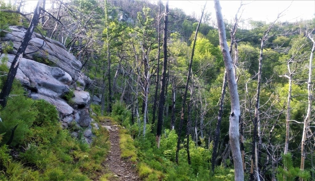
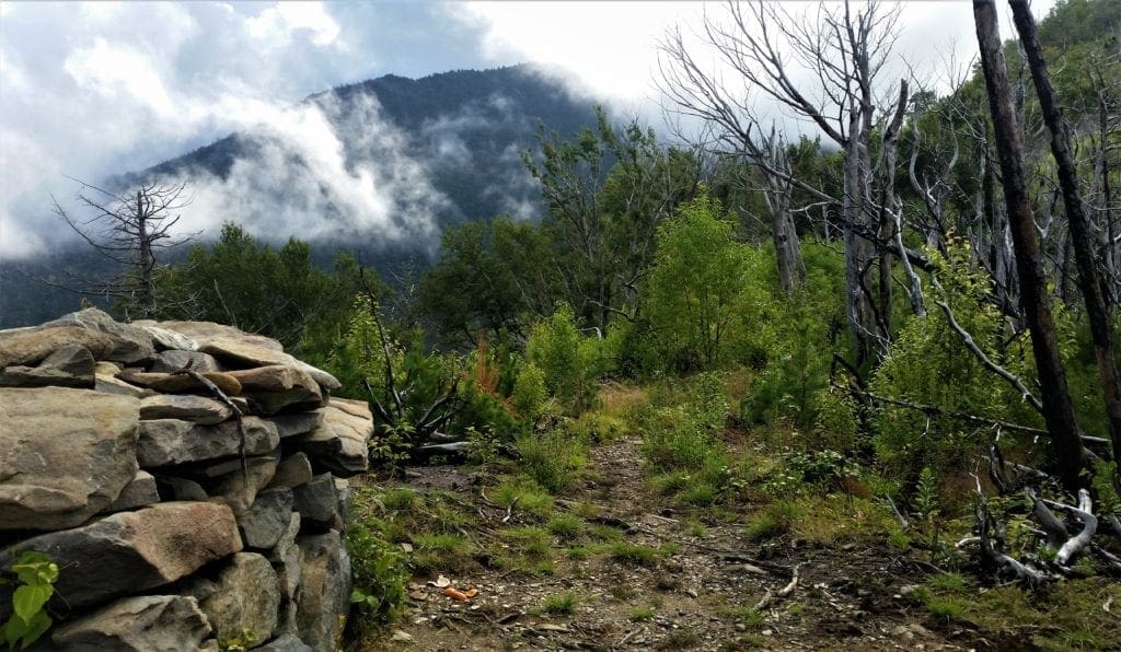
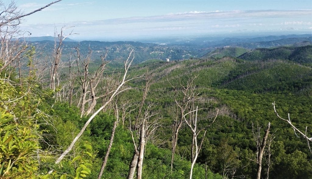
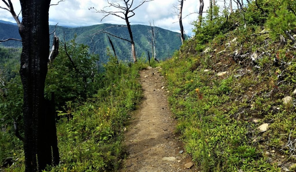
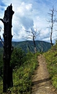
Almost from the beginning you’ll notice evidence of the 2016 wildfire.
At this point, these were small spot fires.
As you climb higher the trail will pass through some of these larger burn areas.
You may also notice trees snapped-off or completely blown down, due to two high-wind events in early 2019.
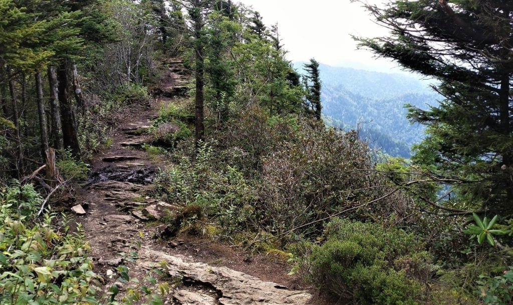
At just over a mile from the parking lot the trail begins to ascend more rapidly as you climb the Bullhead, a heath-covered bald extending off Balsam Point.
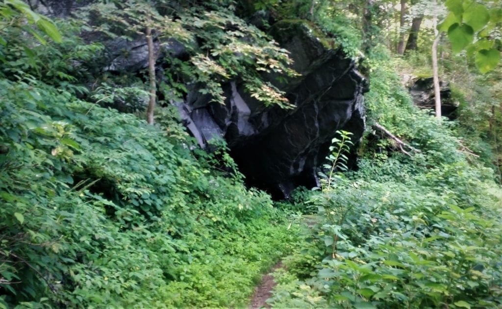
Over the next mile or so you’ll pass several rock cliff faces, and at roughly 1.5 miles from the trailhead, you’ll pass two small caves created by overhanging slabs of rock.
After ascending the west ridge of the Bullhead the trail begins to level out.
As you begin traveling along the south side of the mountain the trail also passes through a large burn scar.
At about 3 miles from the trailhead you’ll arrive at a large rock cairn sitting along the side of the trail.
This cairn, known as “The Pulpit”, was built by the Civilian Conservation Corps in the mid-1930’s.
Although my hike ended at the Pulpit, hikers have the option of following the trail for another 4.2 miles to reach the summit of Mt. LeConte.
From the Pulpit the trail travels up the western slopes of Balsam Point, before exiting onto the ridge to the right of the mountain.
If you want to make a full-day circuit combining the Bullhead with the Rainbow Falls Trail, consider doing Rainbow Falls (a steeper hike) on the way up the mountain and descending via the Bullhead.
Round-trip mileage for the Bullhead/Rainbow Falls combo loop is 13.6-miles.
I was tempted to combine the trails and do the loop since Rainbow Falls was my next hike.
But I decided to save a couple of miles (hiking across the mountain top) by going back down and starting the Rainbow Falls hike again from the trailhead.
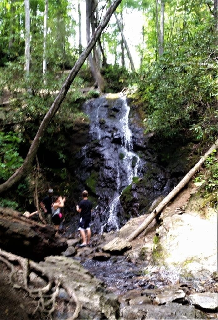
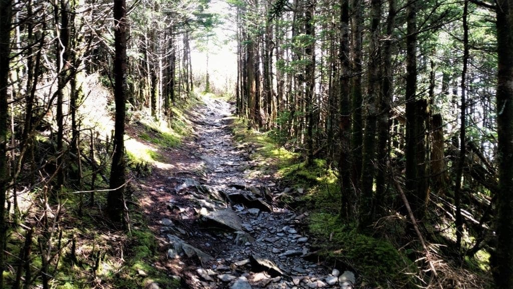
Rainbow Falls Trail
The 80-foot Rainbow Falls waterfall is the tallest single-drop waterfall in the GSMNP, cascading over a jutting cliff face and then rushing over rock formations at the cliff’s base.
On sunny afternoons, visitors to the falls can see a stunning rainbow created by the water’s mist – which is how the Falls got it’s name 🙂
Over the decades the Rainbow Falls Trail has gained a reputation for being a rough footpath, and though the Park remediated some of those issues in 2017, the trail is still somewhat rugged.
Sandals, flip-flops and shoes without good treads are not recommended. Wear sturdy hiking boots for the best experience.
NOTE: Due to the rapid elevation gain, this trail is not recommended for young children.
Directions to Trailhead:
The hike begins from the Rainbow Falls Trailhead, located just outside of Gatlinburg. (See directions at Bullhead Trail description above – it’s the same trailhead.)
Along the Rainbow Falls Trail:
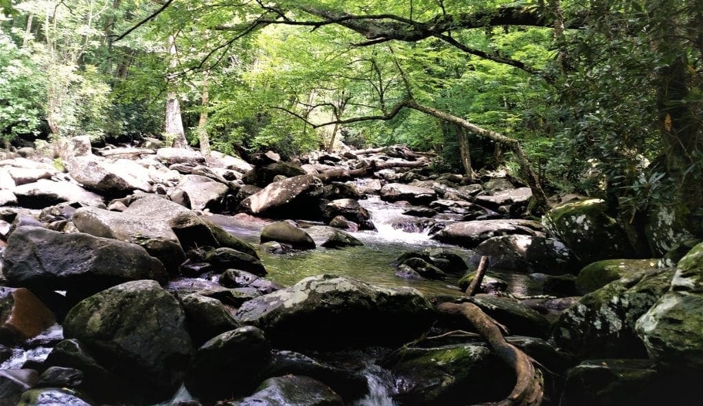
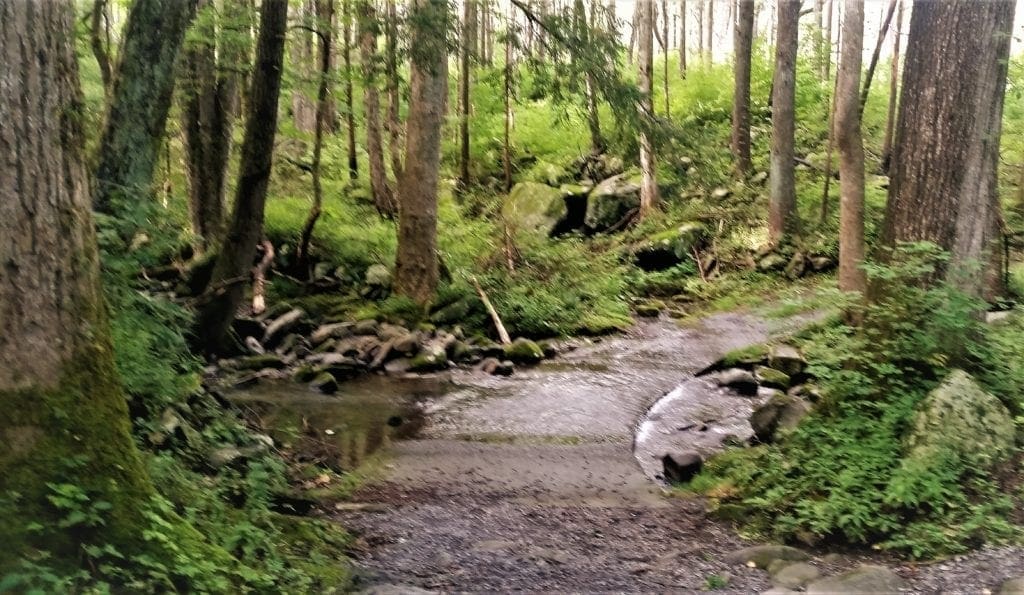
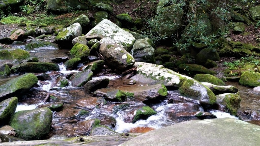
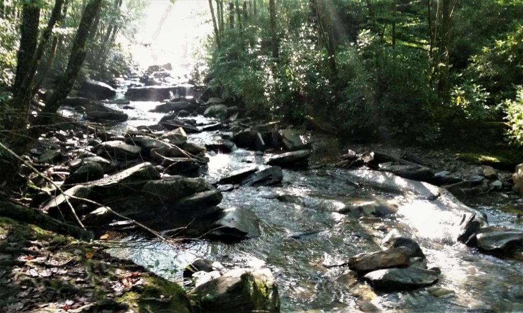
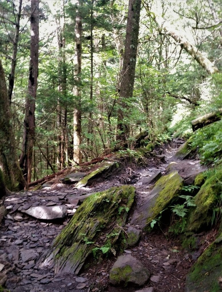
The first two-thirds of a mile along the Rainbow Falls Trail is a steady climb through a large boulder field.
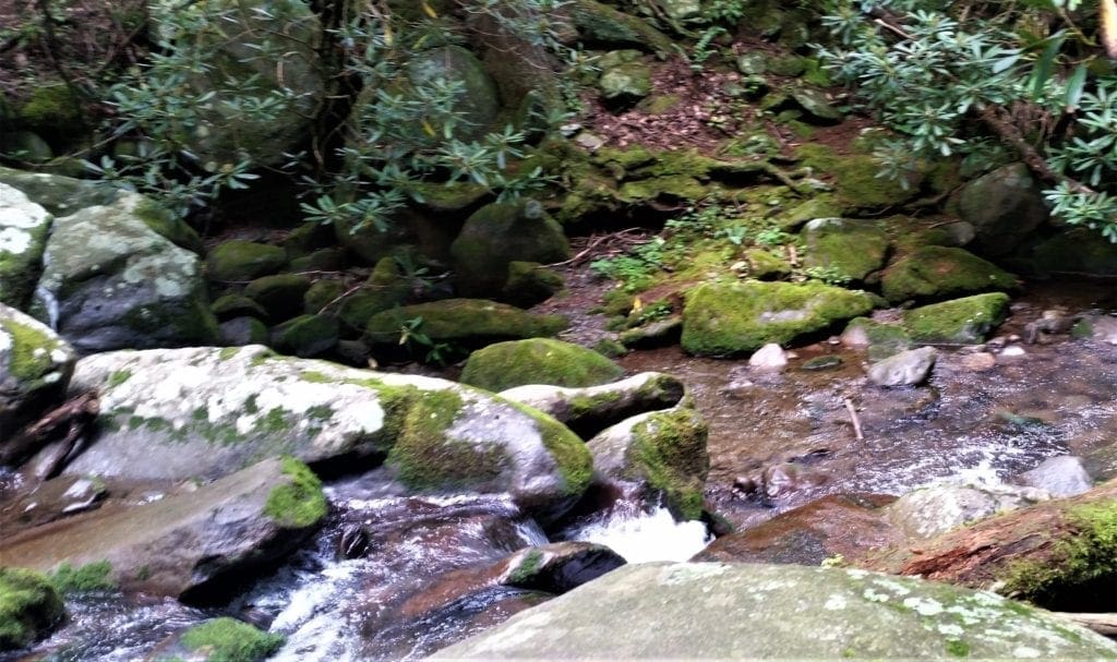
As you walk through this area, you’ll see LeConte Creek cascading down the mountain on your right.
You can find some great spots for a picnic along this stretch of trail – which is what I did!
Having a pack lunch on some rocks beside LeConte Creek was a great way to take a break between my two hikes 🙂
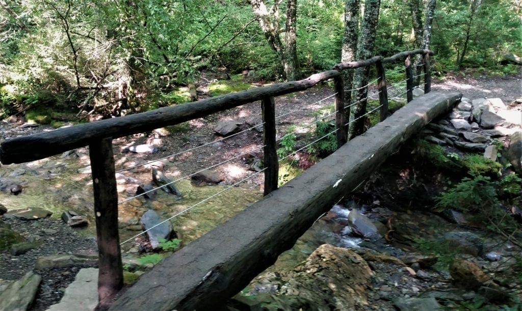
Although the waterfall is amazing, the actual trail itself has mini-falls, boulder fields, scenic bridges, and creeks that are beautiful in their own right.
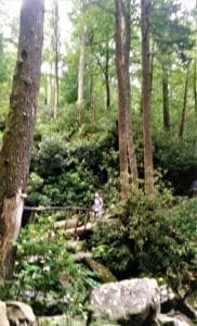
As you continue up the LeConte Creek valley, you’ll cross over two footbridges along the way; one at 1.7 miles, and the other just as you reach the waterfall, roughly 2.7 miles from the trailhead.
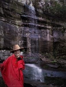
They say the Falls are best viewed after long periods of rain. I’ve got a funny story about that…
About halfway through the hike, it started to rain. At first, just a sprinkle, then it started to rain harder.
I put on my rain jacket, stuck my phone in a plastic bag, threw a poncho over the top of me and my pack – and topped it all off with my bush ranger hat 🙂
I was already a little bit wet, there was no thunder, and I thought the rain would probably blow over, so I kept going up the trail.
The rain didn’t stop; it kept coming down harder.
The trail was turning into a small river, and hikers coming down the mountain were all soaking wet – since most hadn’t brought any rain gear.
But they were having fun with it. They started cheering for my red poncho, so I cheered if they had ponchos, too 🙂
I asked people making their way down how far I was from the Falls, and they urged me to keep going because it was very close.
When I finally got there, it was still pouring rain – but the Falls were amazing!
I was afraid to take my camera out because it was so wet, so here is an artist’s rendering of a “selfie” of me at Rainbow Falls:
Warning:Do not climb on the rocks surrounding Rainbow Falls; several deaths have occurred in the past few years and serious injuries occur on a regular basis.
From Rainbow Falls the hiking trail continues another 4.2 miles to the summit of Mt. LeConte.
But, that was not on my agenda for the day – and my boots were soaked through – so I headed back down the mountain towards the trailhead.
It stopped raining just a few minutes after I started back down – of course 😉
For a while, the people passing me on the way up had obviously been caught in the rain, too.
One very large man, no jacket, soaked from head to toe including his Cowboy hat, looked at me and very seriously said, “It’s a bit humid today.”
But it didn’t take long until I was able to put my poncho and raincoat back in my pack, and the people coming up the hill were all dry.
I made my soggy way back to the auxiliary parking, very happy I’d been able to do both hikes – but also looking forward to a hot shower and some dinner.
I was also really glad I’d packed an extra pair of boots 🙂
DAY THREE – Alum Caves Trail to Mt LeConte Summit
Day three I decided to do my most ambitious hike of the week – to summit Mt LeConte by way of the Alum Cave Bluffs.
My ambition wasn’t anything unusual, since the summit of Mount Le Conte is one of the most visited destinations in the GSMNP.
At an elevation of 6,593 ft, it’s the third highest summit in the park and, measured from its base to its highest peak, the tallest mountain east of the Mississippi River.
The Alum Cave Trail is the shortest and steepest of the five trails leading to the Le Conte summit. It’s also the most popular route to the top.
I didn’t choose this route because it’s the shortest, but because of the unique natural features such as Alum Cave Bluffs and Arch Rock along the way.
After having made the climb, I would also recommend this hike for it’s sheer astounding beauty.
I had checked the weather to make sure no early thunderstorms were forecast. It looked all clear, so all I had to beat was the sunset!
Alum Caves to Mt LeConte Summit
Your experience on the Alum Cave Trail will vary depending on weather.
-
- Choose footwear that’s comfortable, and has good traction on rocks that may be wet and slippery.
- Make sure you pack a lunch, and bring plenty of water – especially in the warmer months.
- Bring a raincoat!
With an elevation gain of more than 2700 ft, never mind the 11mi round trip length, this hike easily takes most hikers 7-10 hours to complete.
The exact amount of time it takes you to finish depends on your pace and how frequently you stop to enjoy the sights – or catch your breath 🙂
Directions to the Trailhead:
To reach the Alum Cave Trailhead from the Sugarlands Visitor Center near Gatlinburg, drive 8.7 miles south along Newfound Gap Road.
The parking area will be on your left.
Because the Alum Cave Trail is so popular, there are actually two parking lots for this trailhead.
I recommend arriving early to get a spot – I arrived at 8am and the lot and almost all of the close roadside spots were already taken.
Take advantage of the public restrooms located at the trailhead parking lots.
I was pleasantly surprised to find them open for use, and running water available to fill up, too.
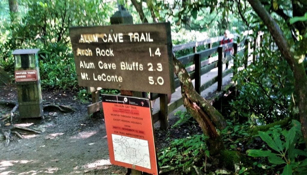
A trailhead sign indicating the distance to each major landmark along the trail was to the far right of the restrooms.
From the parking area, it’s just 1.4 miles to Arch Rock and 2.3 miles to Alum Cave Bluffs.
That doesn’t sound so hard, does it? 😉
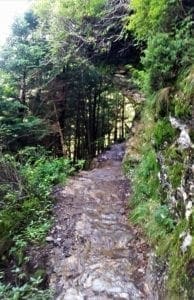
Along the Alum Cave Trail:
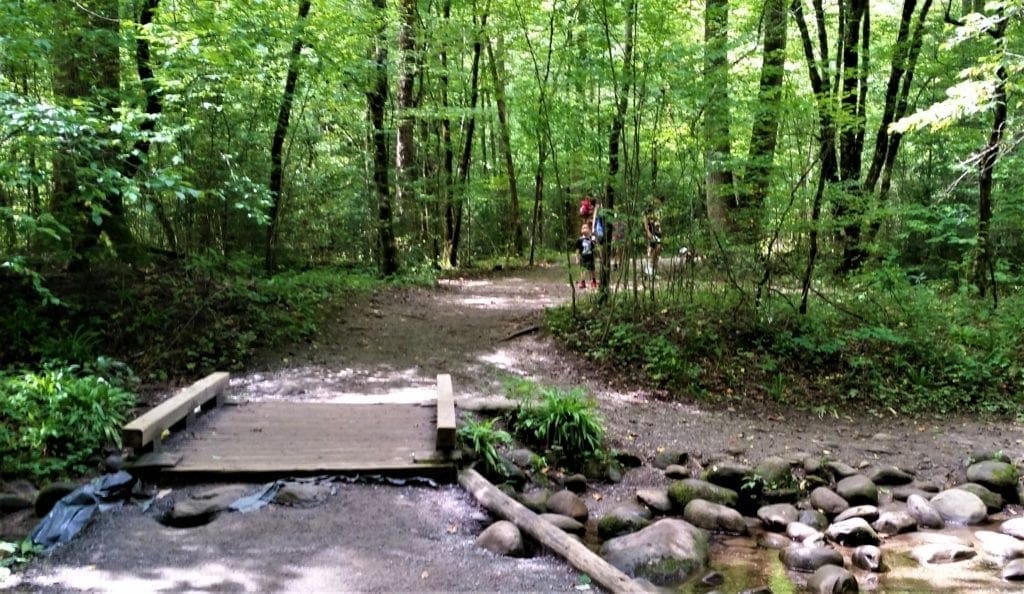
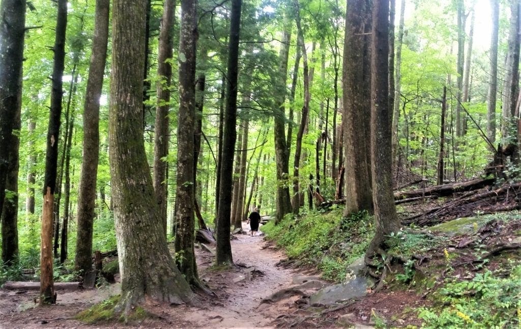
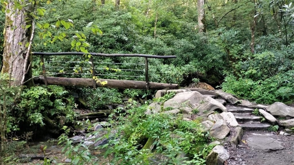
Crossing bridges and streams, the early part of the trail is heavily forested and also quite busy – but hikers string out more as the hike goes on.
Alum Cave Stream follows the trail for about a mile, as the trail gradually inclines.
A wild turkey crossed the path in this portion – much to the delight of the hikers 🙂
Just before reaching Arch Rock, the trail begins following the Styx Branch.
Arch Rock
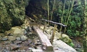
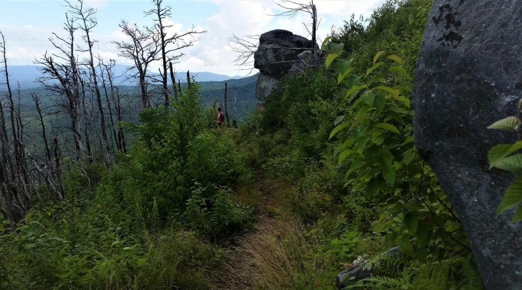
At just over 1.3 miles from the trailhead you’ll reach Arch Rock, the first major landmark along the trail.
Arch Rock is a large concentration of black slate that has formed a natural, arch-like shape over time.
You’ll hike through the arch on rock stairs using cable handrails before exiting at the top.
The Arch was formed by freezing and thawing, which eroded away the softer rock from underneath the harder rock.
Inspiration Point
Beyond Arch Rock the trail begins ascending towards Alum Cave in earnest.
At roughly 2 miles from the trailhead you’ll reach Inspiration Point at an elevation of 4,700 ft.
From that point you’ll be treated to views of Little Duck Hawk Ridge to the west and Myrtle Point towards the northeast.
You can also see The Eye of the Needle, a hole in the rock near the top of Little Duck Hawk Ridge, from this vantage point.
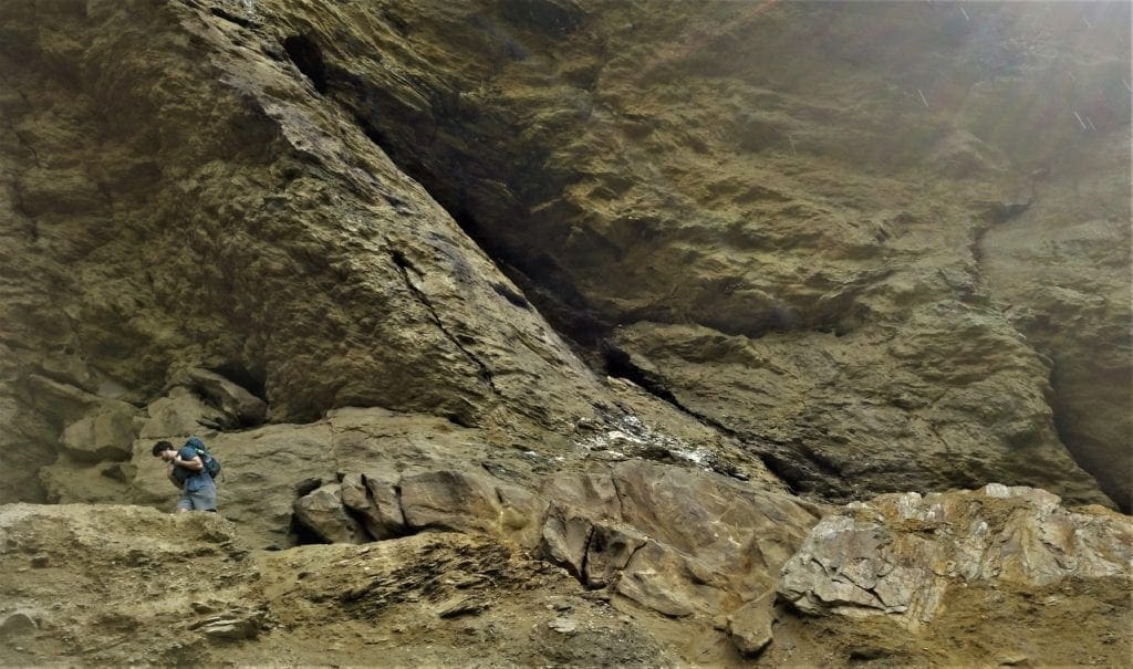
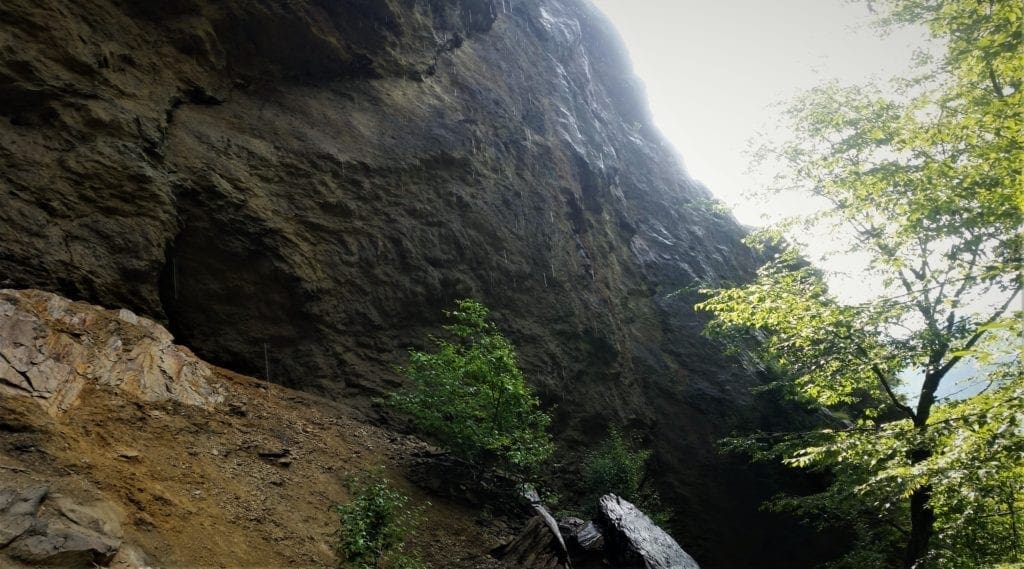
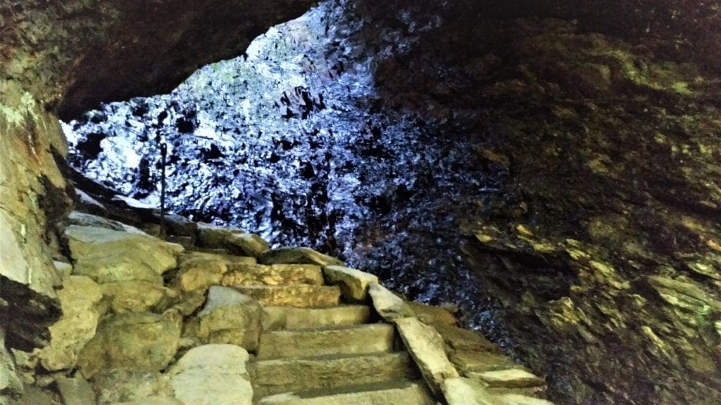
Alum Cave Bluff
The Alum Cave Bluff is located at 2.2 miles, just before the trail’s half-way mark.
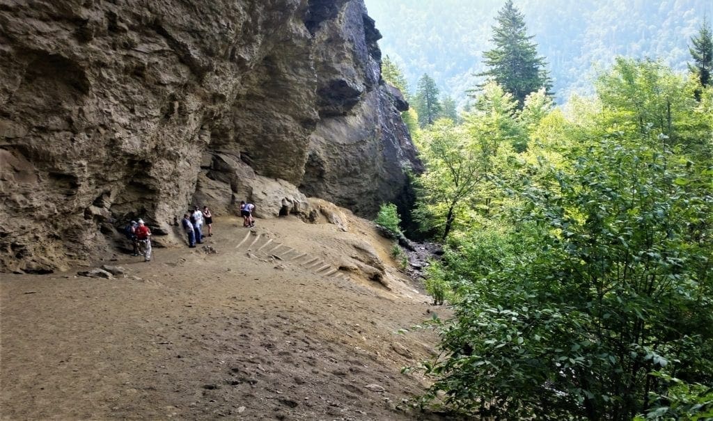
Alum Cave Bluff is not actually a cave, but a concaved bluff, about 80 ft high, and roughly 500 ft in length.
This large area is a popular resting point and for many, a turnaround point as well.
During the warmer months of the year water drips off from the ledges overhead. In the winter these droplets turn into large icicles.
In 2015 the park launched a two-year project to rehabilitate the Alum Cave Trail.
Restoration efforts focused on improving hiker safety by repairing cable handrail systems and reinforcing hanging trail sections.
Moving on from the Alum Cave the trail underfoot is often solid rock, made slippery by trickling water flows.
The cable handrails were very nice to have in some spots.
Alum Cave History
The first recorded account of Alum Cave goes back to 1837 when three farmers from the Oconaluftee Indian Village applied at the Sevier County Land Office for a grant of a 50-acre tract of land that would include Alum Cave and its salt deposits.
Tennessee sold the tract of land to the three men on December 6, 1838. The Epsom Salts Manufacturing Company was formed to mine the deposit.
Until it was sold in 1854, the company mined alum, magnesium sulfate, saltpeter, magnesia, and copperas from the cave.
Locals used the salts to to dye their homespun clothing a reddish brown.
The easily accessible salts were depleted by the mid-1840s, but mining resumed during the Civil War, when the Confederate Army mined saltpeter from the cave to manufacture gunpowder.

The cave is the official end of the Alum Cave trail, and if that’s all the hiking you wanted to do, you would turn around here.
But if you’re hiking to the LeConte Summit, you’ve still got more than half of the way to go to the top, and there’s plenty more to be seen.
And just so you know, the trail also keeps ascending, and gains 1,000 ft more elevation before leveling off. Yay 🙂
Alum Cave to Mt. LeConte Peak
Just past Alum Cave is Gracie’s Pulpit.
This landmark is named after Gracie McNichol, who, despite several physical challenges throughout her life, climbed Mount LeConte 244 times.
Her last climb was on her 92nd birthday!
At roughly 2.6 miles from the trailhead, Gracie’s Pulpit marks the halfway point to the LeConte Lodge.
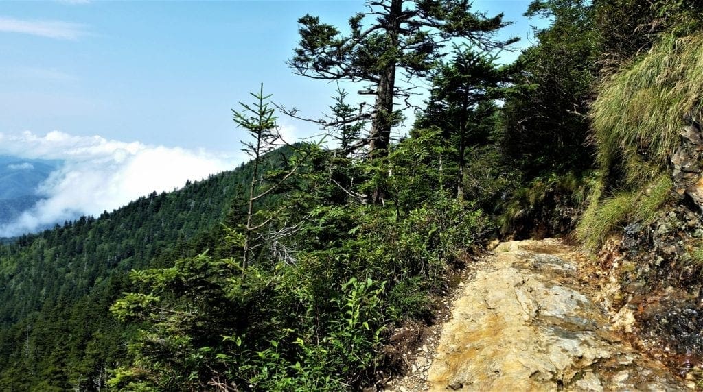
Above Gracie’s Pulpit the trail continues by hugging the cliff face. Over the next 2 miles you’ll pass over several narrow rock ledges, many with cable handrails.
Once you’re beyond this, the trail flattens out and you’ll begin passing through a dense spruce-fir forest.
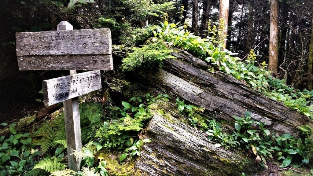
At just over 5 miles from the trailhead the Alum Cave Trail dead-ends into the Rainbow Falls Trail. Turn right to continue towards the summit.
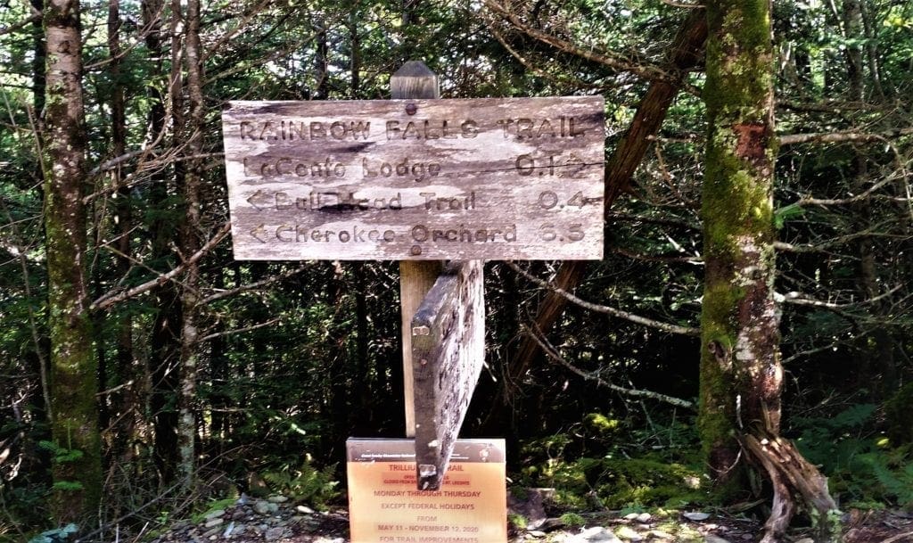
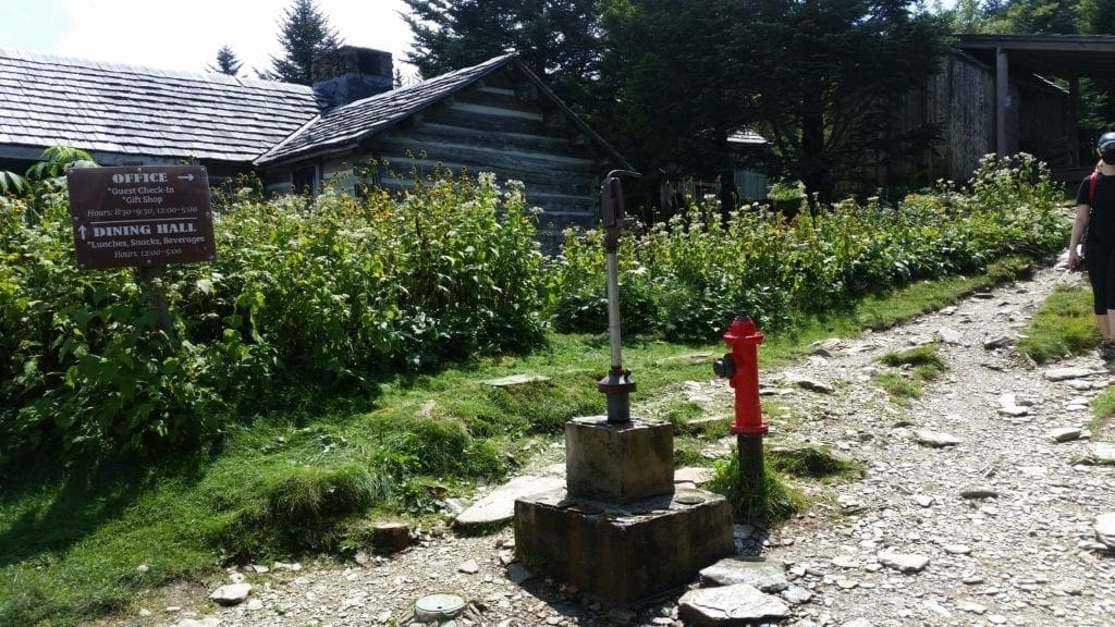
Just a short way past the junction you’ll arrive at the LeConte Lodge area.
Take the short side trail on the left to go down to the main lodge.
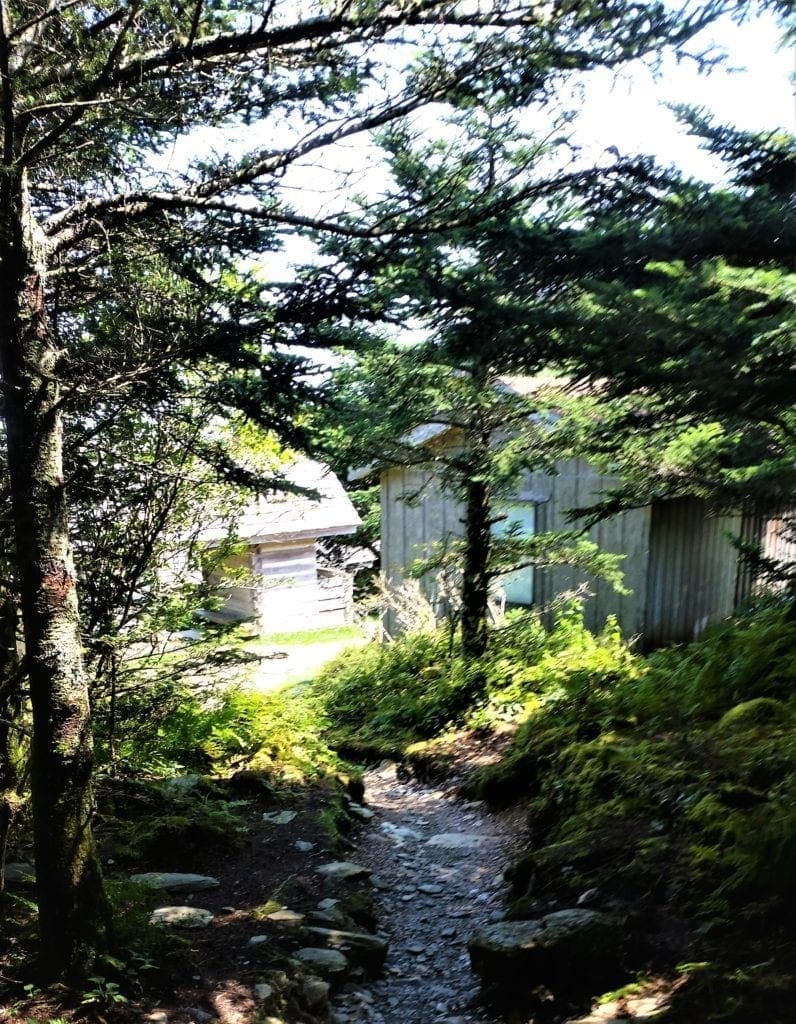
Many people stop at LeConte Lodge for lunch or a snack before continuing to the summit – which is exactly what I did!
You might be tempted to end your hike here, but to reach the true summit of Mount LeConte, you still have almost another half-mile to go.
If you don’t care so much about the summit, but just want to get some great views, your best option is to turn right at Cliff Top, located roughly 0.2 miles further up the mountain.
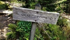
I went up to Cliff Tops, sat on the rocks in the sun, and soaked up the views before retracing my steps back to the main trail to continue to the summit.
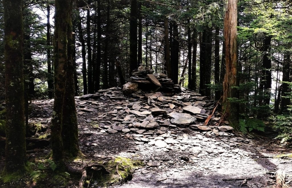
You’ll know you’ve reached the highest point on the mountain when you reach the large cairn, or pile of rocks, just off the main trail on your right.
The summit, better known as High Top, is at the 5.5-mile mark.
It’s a little obscured by pine trees, and kind of disappointing after all of that buildup… But I made it! Yay!!! 🙂
I took another pit stop at the Leconte Lodge before heading back down to the Alum Cave Trail, and eventually made it back to the trailhead parking area.
The whole hike, with breaks, took me about 8 hours.
It was a very hot day, but the way up – being early in the morning – was both cooler and less crowded than the trail back down.
To me, hiking down is always more fun – especially if I just finished hiking up!
I was glad that I’d started early, and also ready to be off of my feet for awhile 🙂
If you only have time to hike one trail in the GSMNP, I would recommend the Alum Cave Trail – even if you don’t go all the way to the top.
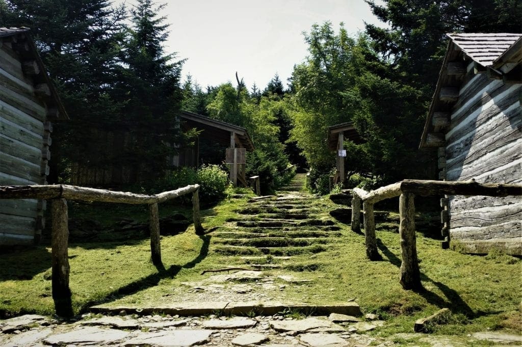
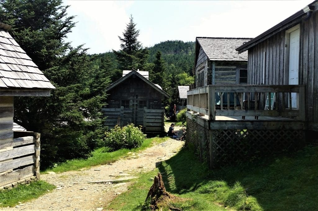
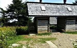
LeConte Lodge
For more than 80 years, the LeConte Lodge has provided visitors to the summit of Mt. LeConte with a sheltered place to rest overnight – more than a vertical mile above Gatlinburg!
It’s the only place in the eastern United States where visitors can stay overnight at a summit in a permanent structure and enjoy hot meals and propane heat along with the majestic views.

LeConte Lodge can accommodate up to 60 guests in one-room cabins or one of the three multi-room lodges.
Fresh supplies arrive three time per week via llama pack train.
The llamas travel the Trillium Gap Trail where their padded feet create very little impact.
History of LeConte Lodge
LeConte Lodge was originally a summit camp before the creation of the Great Smoky Mountains National Park.
The original tent camp opened in 1925 with hiker, guide, and avid outdoorsman Paul Adams as its caretaker.
Adams hosted both dignitaries and hikers at the camp, promoting establishment of the Smoky Mountains National Park and improving several trails that led to the summit.
In the spring of 1926, Gatlinburg native Jack Huff took over from Adams as caretaker.
Huff was instrumental in building the main lodge and was LeConte Lodge’s operator alongside his wife and children for more than 35 years.
The original cabin was built from balsam logs and featured a tarpaper roof and natural clay floor. Inside it held several rough-hewn bunk beds crafted from local timber.
Today, the lodge is owned and operated by Stokely Hospitality Enterprises and is a concession of the National Park system.
Hiking to the Lodge
There are five trails that lead to LeConte Lodge.
Alum Cave Trail is the shortest, at just 5.5 miles, but it’s also the steepest. This is the route I took 🙂
The other four trails include:
• Rainbow Falls: 6.5 miles/5-hour hike
• Trillium Gap: 6.5 miles/5-hour hike
• Bullhead: 7.2 miles/5-hour hike
• Boulevard: 8 miles/5.5-hour hike
The trails leading to and from LeConte Lodge can have patches of snow and ice as late as May and as early as October. Parking is available at each trailhead.
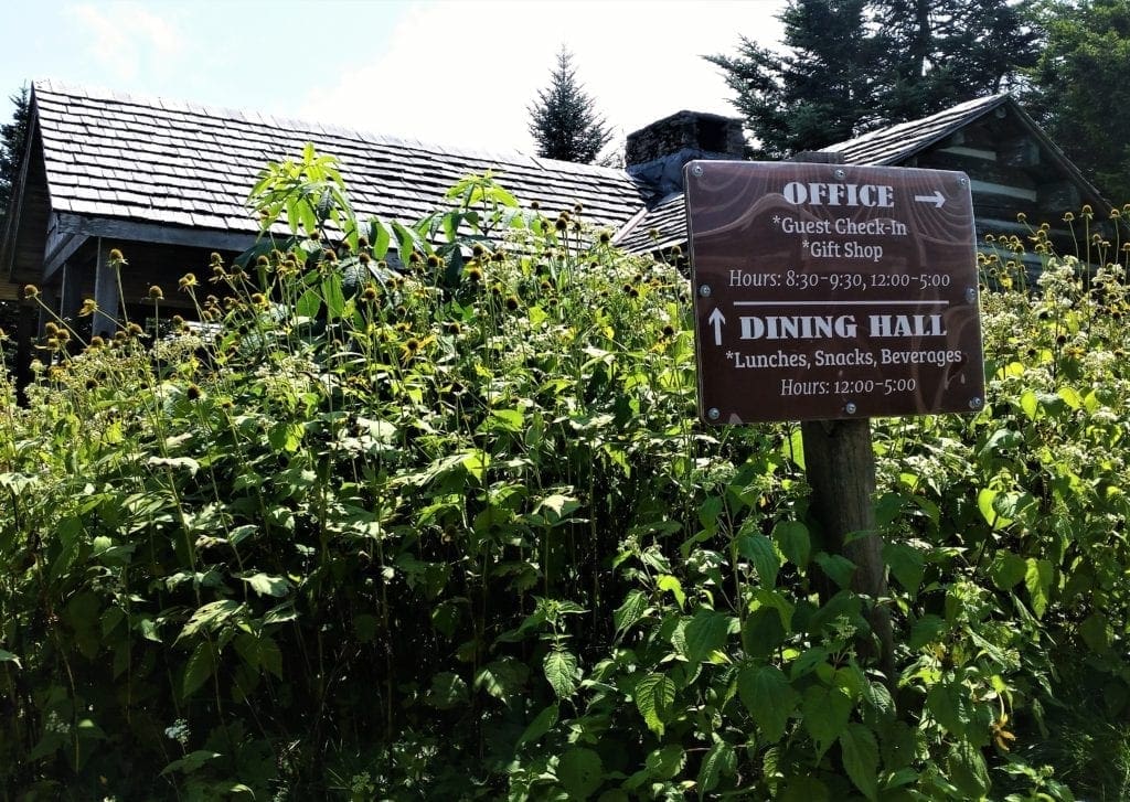
LeConte Lodge Dining Hall and Gift Shop
Family-style meals dinner and breakfast are served to guests in the LeConte Lodge dining hall.
You can also order a sack lunch for your hike down the mountain, when you’re ready to leave.
Day-Hikers can purchase their lunch for $11, plus additional treats and beverages.
The lodge gift shop offers hiking supplies, toiletries and even popular hiking books and trail maps.
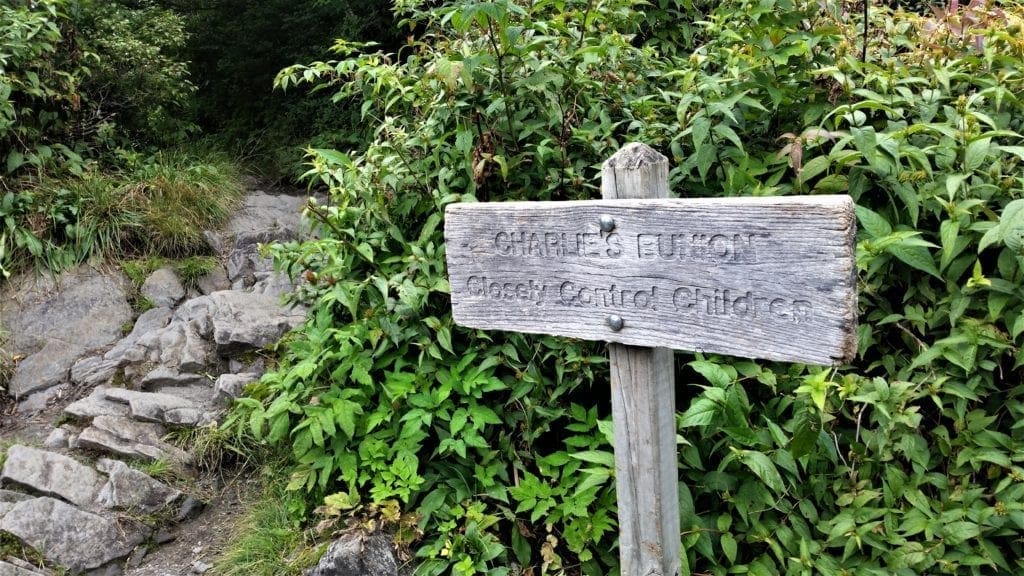
DAY FOUR – Charlie’s Bunion Trail
After a wonderful hike (or does it count as two hikes?) on the Alum Cave trail to the LeConte summit on Day Three, I only had one more full day of hiking left on my visit.
I planned to spend the day in the Newfound Gap area, and had already picked out a few hikes: Charlie’s Bunion, The Jump-Off, and Andrews Bald.
In theory, I had time to do all of them, but there was a thunderstorm predicted for early afternoon, and I didn’t want to be caught in it on a mountaintop.
So, I chose to start with the longest – and most interesting – of the three hikes: Charlie’s Bunion.
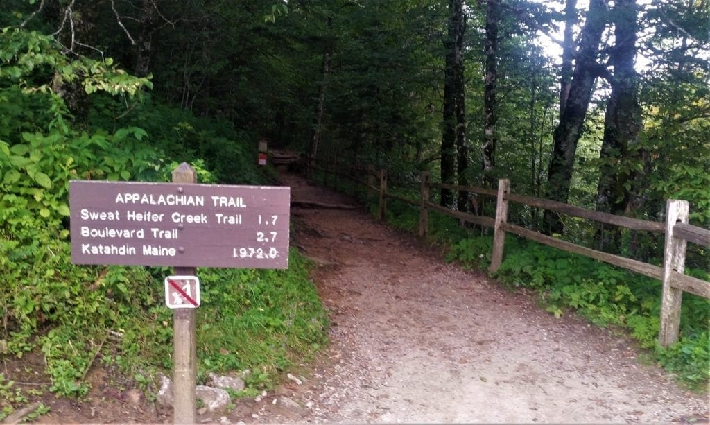
I have to admit, part of my interest in Charlie’s Bunion was due to the name of one of the cross trails – they had me at “Sweat Heifer” 🙂
I would do more hiking later if the weather – and my feet! – allowed.
Charlies Bunion Trail
The scenery alone makes the Charlies Bunion hike one of the more popular in the Smokies, plus the added bonus that it’s actually a gorgeous stretch of the Appalachian Trail – so you can have bragging rights!
Given the scenery, and the proximity to Newfound Gap, it’s no wonder that Charlie’s Bunion trail is a well-used one.
Get an early start from the trailhead for a less populated hike.
Directions to the Trailhead:
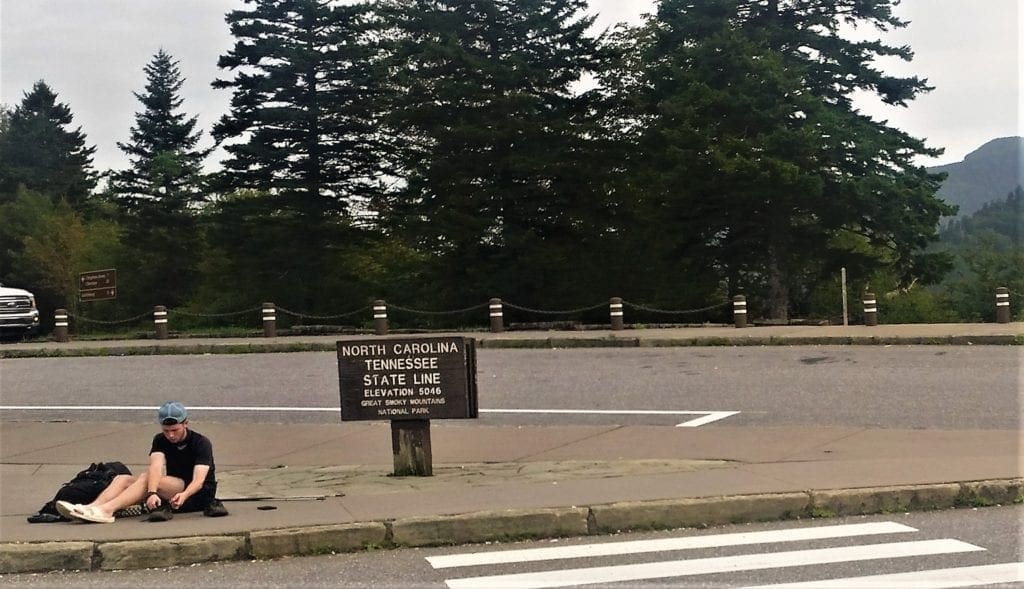
The start point for Charlies Bunion is right at the hub of the Smokies: Newfound Gap.
From Gatlinburg, head into the National Park towards the Great Smoky Mountains National Park’s Sugarlands Visitor Center and take the Newfound Gap Road some 13 miles to the namesake pass.
Travelers from Gatlinburg climb approx 3,000 ft, ascending to reach Newfound Gap at 5,046ft – that’s nearly a mile high!
Head for the northeastern corner of the parking lot, left of the Newfound Gap overlook, to pick up the eastbound Appalachian Trail.
The out-and-back to Charlies Bunion covers just over 8 miles with an elevation gain of 1,640 ft.
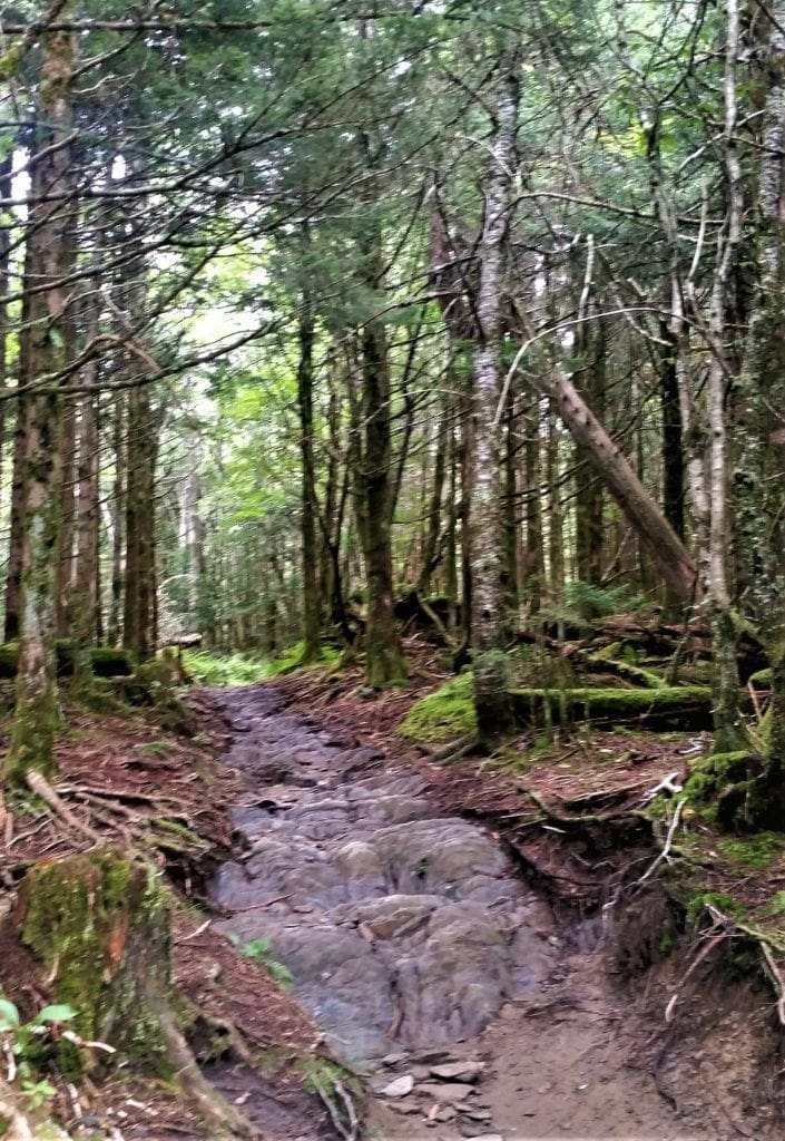
It’s a fairly difficult hike that’s quite rocky, with a few steep sections. It also feels surprisingly different from the hikes I’d taken in the LeConte area.
The trail here tunnels through the highest closed-forest zone in the Great Smokies, woods of Fraser fir and red spruce that populate the ridges and mountaintops of the Southern Appalachians above 4,500 ft.
Along the Charlie’s Bunion Trail
From the trailhead just to the right of the Rockefeller Memorial, the first couple of miles are a steady climb.
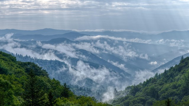
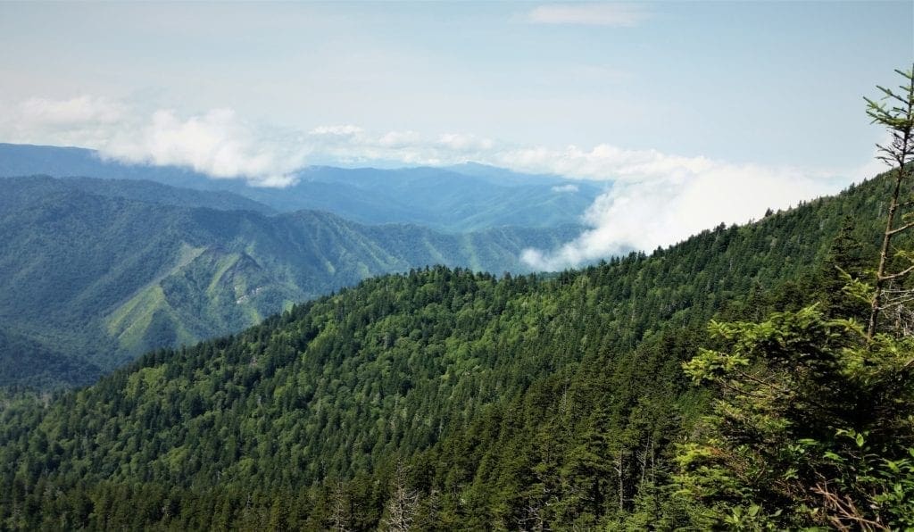
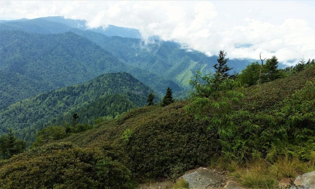
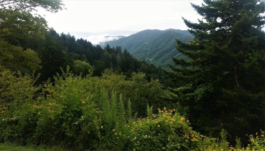
But breaks in the forest make windows for beautiful views into the North Carolina high country at elevations hovering around 6000 ft.
Along this portion of the trail, I was joined by a doe and her fawn for a while. They seemed curious, but unafraid.
Just before reaching the Sweat Heifer Creek Trail junction 1.7 miles from the trailhead, look for views of Mount LeConte and Myrtle Point towards the northwest.
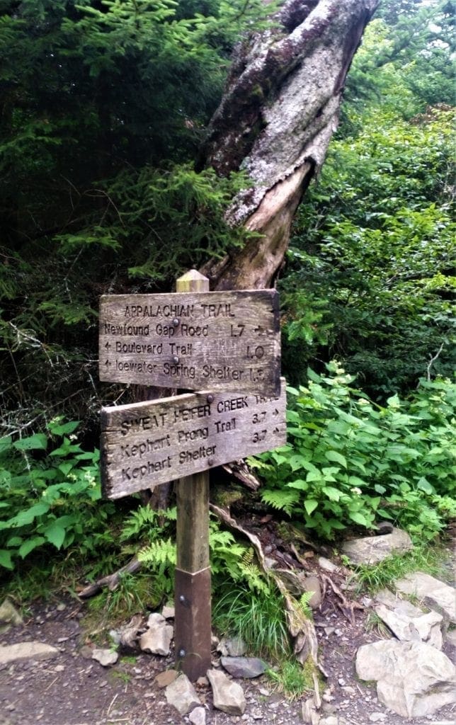
At just over 2.7 miles the Boulevard Trail to Mount LeConte forks off to the left.
The Jumpoff
 Hiking to Charlies Bunion, you’ve got the option of nabbing an equally stellar hike with a short midway detour – literally, a side quest – to The Jumpoff.
Turn off on the Boulevard Trail and take the marked side path for a half-mile or so to the Jumpoff, a cliff-buttressed spur off Mount Kephart’s northern flanks that affords a view of the Bunion to the east.
My plan was to take the Jumpoff on my return from the Bunion, if the weather was still holding.
Keep going straight ahead to continue towards Charlies Bunion.
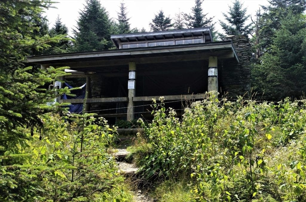
A quarter-of-a-mile further down the trail you’ll pass the Icewater Spring shelter, named for the nearby spring that flows from a pipe onto the Appalachian Trail.
If you’re thirsty, you’ll need to treat this water first before drinking it.
The path to Charlies Bunion lies about another mile northeast of Icewater Spring.
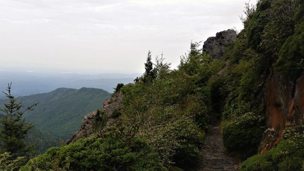
At roughly 4 miles from the trailhead a short spur trail will branch off to the left and lead you to your destination: Charlies Bunion.
The Anakeesta Formation
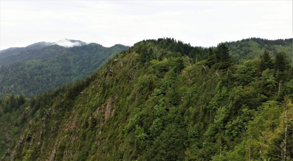
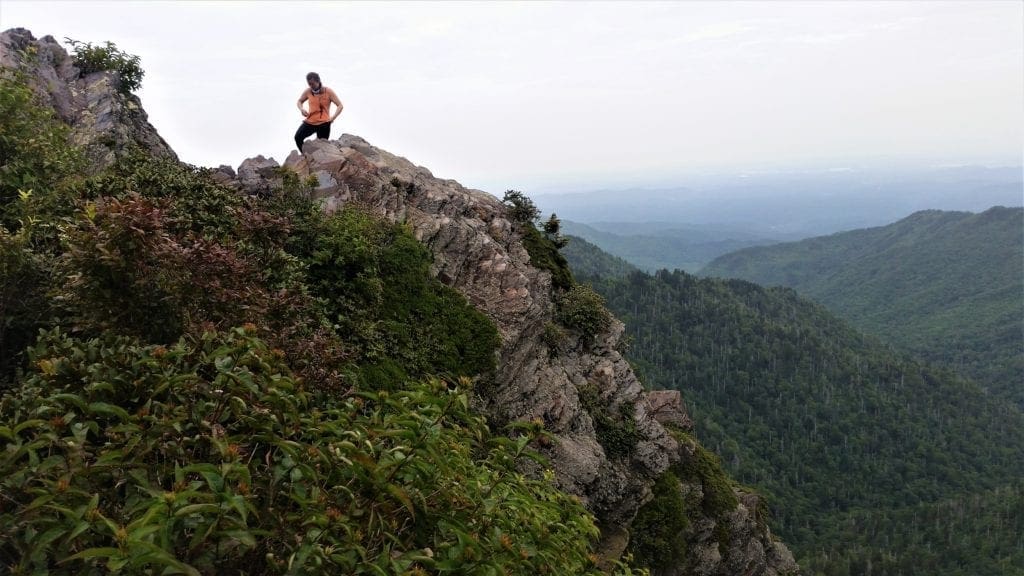
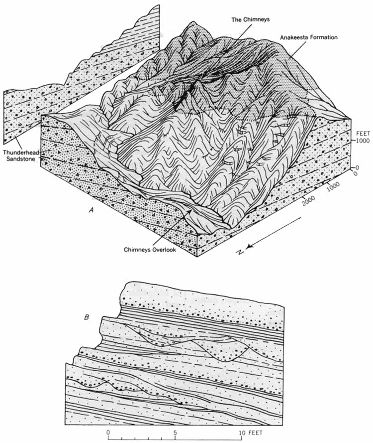 Charlies Bunion is part of this impressively rugged, steep-sided outcrop on the north side of the divide.
The Anakeesta Formation, a Precambrian metamorphic mostly-slate rock, is responsible for some of the rockiest topography in the Smokies.
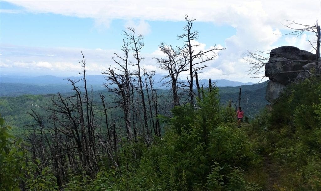
To the east along the ridge crest, cliffy Anakeesta exposures form the Sawteeth – a series of narrow, jagged cliffs connecting the high peaks of the Central Smokies with the high peaks of the Eastern Smokies.
The prominence of Charlies Bunion and the Sawteeth are due primarily to a wildfire that scorched this divide in 1925.
A few years later, a heavy rainstorm caused landslides that revealed even more of the raw rock.
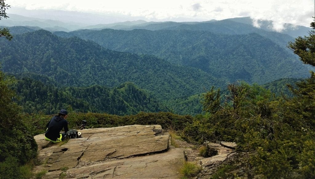
I finally made it to my destination – but sadly, a few other hikers had made it before me, and were already perched atop the Bunion.
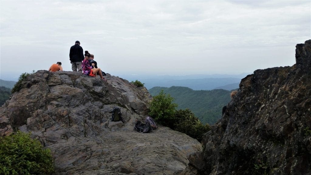
They didn’t seem inclined to relinquish their spot anytime soon, and I didn’t attempt to squeeze in with them for safety reasons – so, some random hiker chick is the star of my Bunion photos 😉
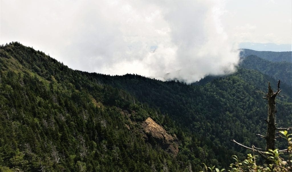
But even so, just let me say this: from Charlie’s Bunion you can see everything!!
To the immediate west Mount Kephart soars to 6,217 ft, and Mount Le Conte dominates the northwestern skyline.
Northeastward the sharp ridge crest you’ve been tracking points to the distant summit of 6,621-ft Mount Guyot, the second-highest mountain in the range.
NOTE: Be very cautious on Charlies Bunion. The cliffs are nothing to play around with. Reckless scrambling could result in a nasty, potentially fatal, fall.
How Charlie’s Bunion Got It’s Name
 The current name was bestowed when Charlie Conner went hiking one day with his friend Horace Kephart.
 Looking at Conner’s feet, Kephart said, “Charlie, I’m going to get this place put on a government map for you.”
I hung about at the Bunion for a little bit but turned around pretty quickly to create some space between myself and the other hikers on the return trip.
I also wanted to see if I could get back to the Boulevard junction in time to take the side-trip to the Jumpoff.
Sadly, it was not to be.
By the time I reached the Jumpoff turn, I could see clouds gathering and there was a rumble of distant thunder, so I made my way back to the trailhead at Newfound Gap.
The return hike went quickly, because it was mostly downhill 🙂
Newfound Gap
I think it’s fair to say that Newfound Gap is in the middle of everything.
-
- Newfound Gap is located near the center of the Great Smoky Mountains National Park.
- Situated along the border of Tennessee and North Carolina, the state line crosses the gap, as does Newfound Gap Road.
- The Appalachian Trail (AT) crosses over Newfound Gap Road and straddles the state lines of North Carolina and Tennessee for most of its length through the GSMNP.
- It’s also halfway between the towns of Gatlinburg and Cherokee.
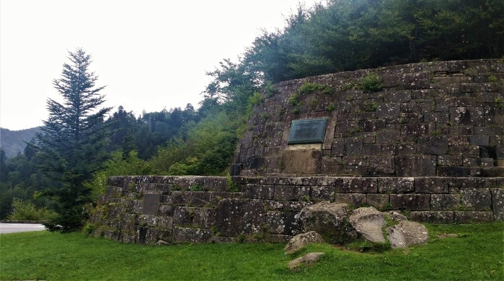
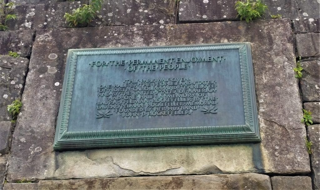
It was also here that in 1940, from the Rockefeller Memorial, Franklin Delano Roosevelt dedicated the Great Smoky Mountains National Park.
Rockefeller Memorial honors a $5 million donation from the Rockefeller Foundation to help complete land acquisitions to bring about the park’s creation.
Who Found Newfound Gap?
In southern Appalachian vernacular, a gap is a low point in a mountain ridge.
New Englanders call them “notches” while westerners refer to them as mountain “passes.”
Newfound Gap’s recognition as the lowest pass through the Great Smoky Mountains didn’t come until 1872.
Arnold Henry Guyot, a Swiss geographer, measured many Southern Appalachian elevations. Mount Guyot, the second highest peak in the Smokies, is named for him.
The old road over the Smoky Mountains crossed at Indian Gap, located about 1.5 miles west of the current site.
Guyot’s work revealed Newfound Gap as the lowest pass through the mountains, displacing nearby Indian Gap.
When the lower, easier crossing was discovered, it became known as the “newfound” gap.
A new road followed, which was the forerunner of today’s Newfound Gap Road.
When I emerged from the Charlie’s Bunion trail to the Newfound Gap trailhead, I was disappointed to see that the storm was still a little ways off.
I mentally kicked myself, thinking I might have been able to squeeze in the Jumpoff hike before heading back. 🙁
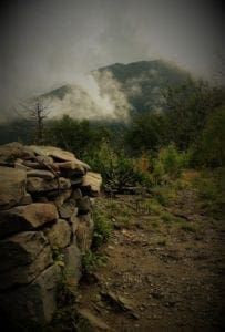
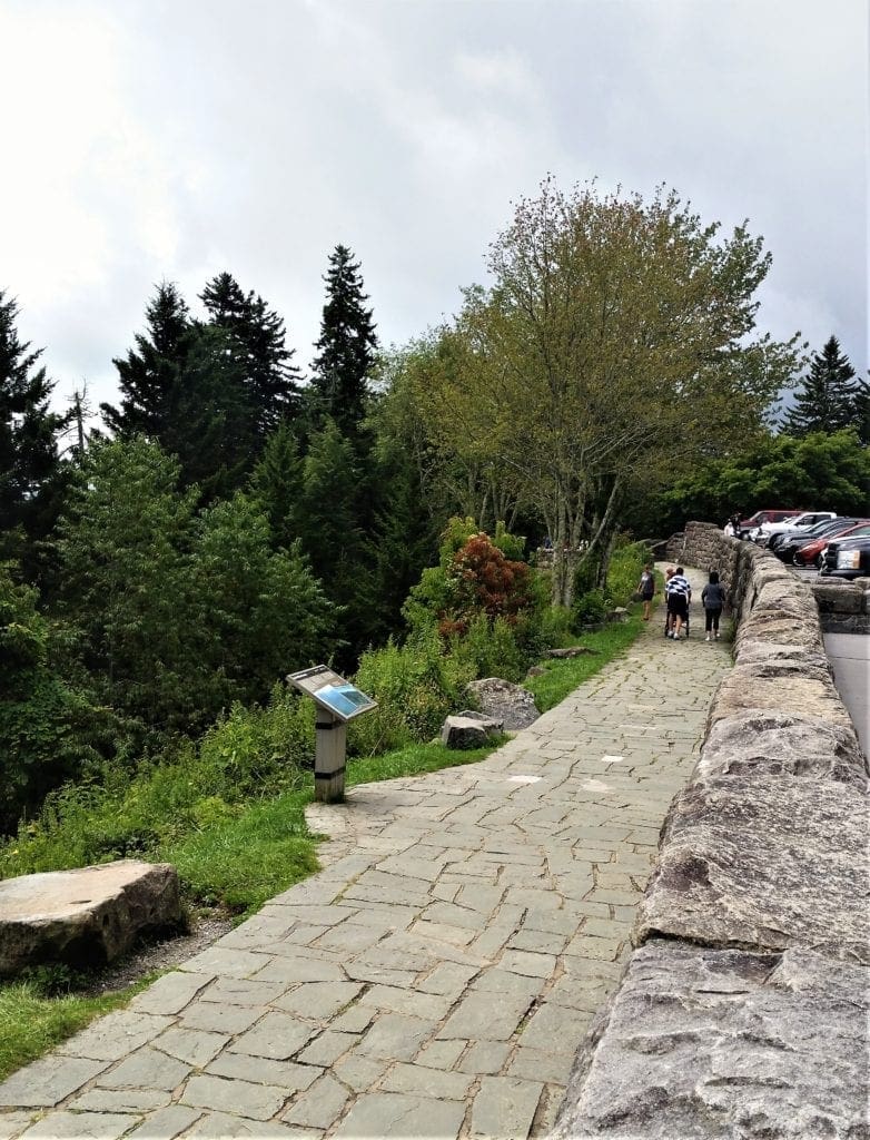
But, I contented myself instead with exploring the Rockefeller Memorial, and grabbing a snack while sitting on the overlook wall, taking in the views.
It was great to have a little rest, and chat with some of the other passing visitors.
Persistent thunder and encroaching storm clouds were my cue to head back down from the Gap to my lodgings for a well-deserved shower and a cold drink!
By the time I got cleaned up and had something to eat, the storm had moved off and there was still some daylight left.
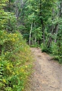
During the course of my visit, I had seen several “Quiet Walkway” signs along the road and they had sparked my curiousity, so I set off to find one.
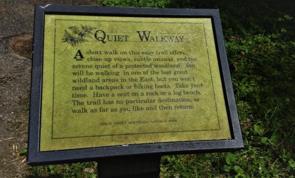
The Quiet Walkways are short and relatively easy GSMNP trails that lead directly from the road.
There are around 14 of these special trails in the park, and several of them can be found along Highway 441 (Newfound Gap Road).
Even non-hikers and small children will enjoy these peaceful trails.
After that, it was time to be done for real. I was leaving first thing in the morning, so I had lot to do after sunset.
NEXT TIME – So Many Trails!
My plan was to get in an early morning hike on my way out, but rain killed that idea, so I headed straight for home.
The toll on my boots after 4 days of official GSMNP hikes totaled 30.4 miles with 7,695 ft elevation gain/loss.
Let’s just say I was kind of looking forward to the long drive home 😉
My trail wishlist for next time (and there will be a next time!) is the below:
-
- Chimney Tops – was closed during my visit – hopefully it’ll re-open!
- The Jumpoff – well, you know what happened there…
- Andrews Bald – further out near Clingman’s Dome
- Clingman’s Dome – well, the observation platform, of course. Right?
… and so much more.
Park Info
1420 Little River Road
Gatlinburg, TN 37738
Entrance to Great Smoky Mountains National Park is free. The park is one of the few national parks where no entrance fees are charged.
I hope this post has inspired you to visit The Great Smoky Mountains National Park and try some new hikes!
If you have a question drop me an email and I’ll reply as soon as I can.
Thanks for stopping by – see you next time! LJ
To Get New Idratherwalk Posts
sent directly to your inbox (how convenient!) Click this Button
If you like this post, please share it!

LJ has spent much of her free time as a single Mom – and now as an empty-nester – hiking in the US and around the world. She shares lessons learned from adventures both local and in exotic locations, and tips on how to be active with asthma, plus travel, gear, and hike planning advice for parents hiking with kids and beginners of all ages. Read more on the About page.