Most recently updated May 15th, 2026
Estimated Reading Time: 22 minutes
The Appalachian Trail (AT) runs through or very near areas of North Carolina and Virginia that were hardest hit by Hurricane Helene.
Portions of the AT are open, along with many other Virginia and NC State Parks and trails in the Eastern part of the State. That said, Parks and the AT on the Western side of the State have been damaged and may be inaccessible.
Go to my Hurricane Helene page to get the latest updates on the latest area Park, Trail and road repairs before you travel.
As soon as I heard about the Triple Crown hike in the Blue Ridge Mountains, I knew I had to do it!
It’s an epic hike within easy driving distance from my home in North Carolina, do-able as a solo hiker – with reasonable precautions – even in the heat of summer.
Most importantly the summer of 2020, the Triple Crown trails and trailhead parking were just re-opened for use.
Effective June 13: The National Park Service has reopened the Appalachian National Scenic Trail in Virginia’s Blue Ridge, including the Triple Crown section of Dragon’s Tooth, McAfee Knob, and Tinker Cliffs.
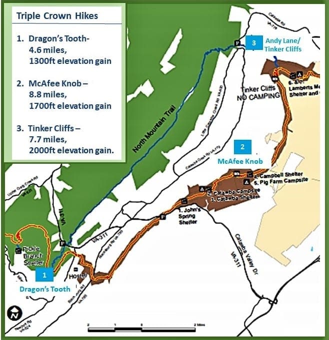
The Triple Crown hike is actually a group of three hikes – Dragon’s Tooth, McAfee Knob, and Tinker Cliffs – that can be done individually or tackled as an overnight backpacking hike all together.
The Triple Crown trail loop is 35 miles of the best hiking in the Roanoke Valley and arguably some of the best overlooks in the entire state of Virginia.
If you decide to explore this portion of the Appalachian Trail, you’ll be rewarded with incredible overlooks, unique rock formations, shelters for rustic camping, and challenging, bucket-list-worthy trails 🙂
Some of my posts contain affiliate links. If you make a purchase through an affiliate link, I will receive a small payment at no additional cost to you. As an Amazon Associate, and other marketing affiliations, I earn from qualifying purchases. I do not get paid for recommendations, all opinions on this site are my own. See full Disclosure page here.
Overview

The Triple Crown gives hikers the opportunity to conquer three of the region’s most popular trails and access to some of the area’s most spectacular views.
The whole loop can be completed by taking the individual day hikes over multiple days (around 25 miles of hiking), or if you’re a backpacker, there’s the option to create a 35-mile multi-day loop. (Connector trails make up the difference in length between the loop and dayhike options.)
The three legs of the Triple Crown are:
-
-
-
- Dragon’s Tooth
- McAfee Knob
- Tinker Cliffs
-
-
If you plan to do the backpacking loop, it’s important to do the hikes in order, beginning with the Dragon’s Tooth.
If you’re doing them as day hikes, it doesn’t really matter which one you do first – the trailheads are all within a 15-30 minute drive of each other.
On my visit, due to the extreme heat and forecasted afternoon thunderstorms each day, I planned to do the hikes one at a time as day hikes in the loop order.
But, due to changes in the forecast, I actually started with what I thought would be the hardest hike – McAfee Knob – and ended up hiking the Dragon’s Tooth later that same day, too.
The next day I hiked Tinker Cliffs, and still had time to get cleaned up and visit a local winery, Beliveau Farm, before the thunderstorms rolled in.
I’ll tell you about each of the hikes in the same order as I did them….
NOTE: In this post, I dip into local legends and history now and then. If you’re not interested, please use the Table of Contents above to skip those parts. 🙂
McAfee Knob
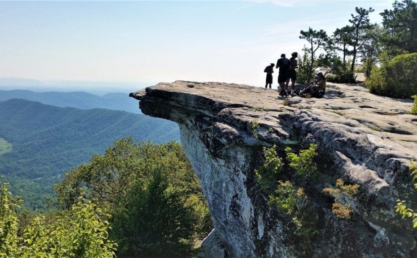
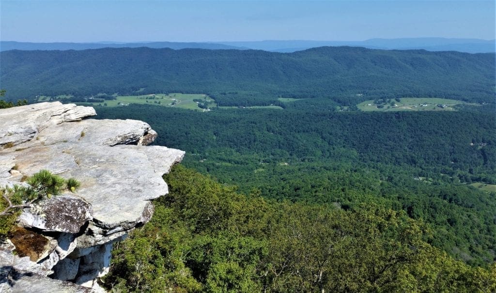
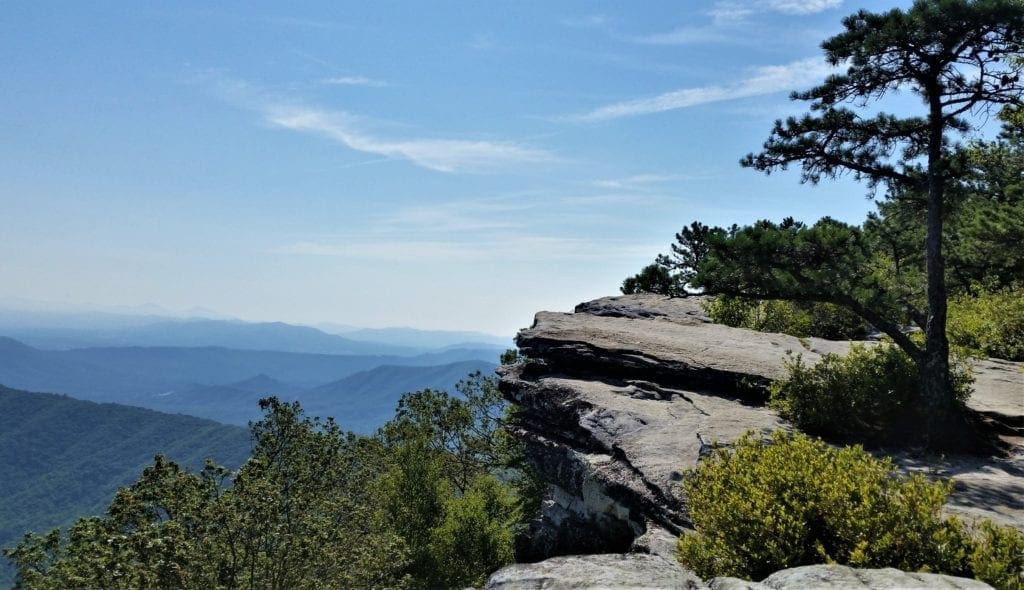
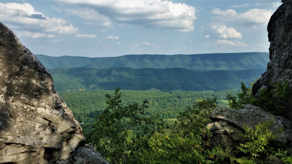
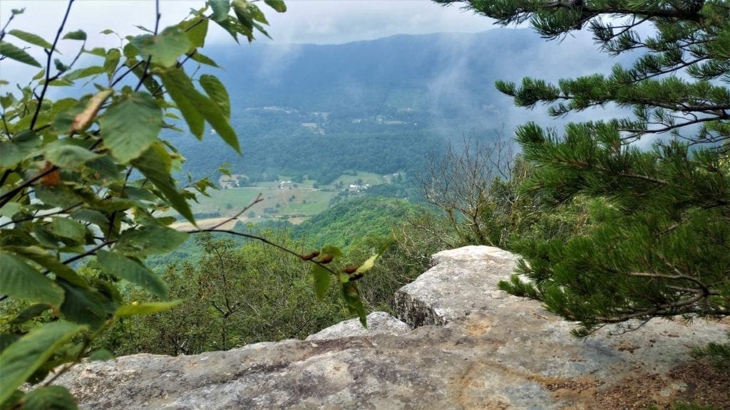
With its stunning, 270-degree panoramic views of the surrounding valley and mountains, it’s easy to see why McAfee Knob is on the bucket list for hikers from around the world.
I assumed this would be the hardest of the three hikes, and I wasn’t wrong – but I didn’t find it to be terribly difficult, either.
I think if you’re used to hiking distances of 5-8 miles and have done some uphill hiking or hike training for elevation gain, you should be fine.
Older kids probably won’t have a problem either – but anyone younger than 10 years old who is too big to carry might not be able to do it.
Starting first thing in the morning when it’s cooler helps, too. 🙂
The rock ledge located atop Catawba Mountain has become one of the most recognizable points along the entire 2,160-mile Appalachian National Scenic Trail, as well as the most popular hike in Virginia’s Blue Ridge.
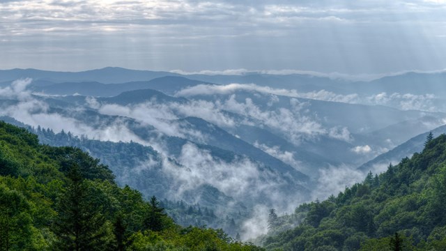
McAfee Knob sticks out into space and offers 200-degree views of the Catawba Valley, plus vistas of Peaks of Otter to the south, Potts Mountain to the west and House Mountain to the north.

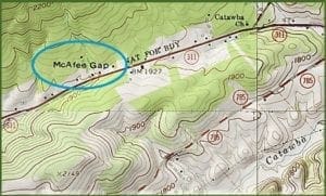
The Knob is named for James McAfee Sr., a Scotch-Irish immigrant (that is, a Scot from Northern Ireland) who settled with his family along Catawba Creek in about 1750, to make his living as a farmer.
McAfee Gap, just across the valley, is also named for his family.
McAfee History
Born on Oct 17, 1707 in Ulster, Northern Ireland, James McAfee married Jane McMichael in 1735, also of Ulster.

In 1739 he proposed to his family that they emigrate to America.
Everything they had was conveyed into gold for investment in the new country. They embarked from Belfast.
The family group consisted of Mrs. John McAfee, (mother of James, then 84 years old), James McAfee, his wife Jane, and their three children, James, John & Malcom.
Baby Malcom died and was buried at sea almost within sight of the American shore.
A few days later, on June 10, 1739 they landed at New Castle on the Delaware River.
James McAfee purchased a tract of land situated on what was known then as Octorora Creek, in the SE part of the Susquehanna River near Port Deposit.
He made a home for his family there for nearly 10 years, and it was there his other children – George, Margaret, Robert, Mary, William, and Samuel – were born.
On December 15, 1749 James McAfee received a 300-acre grant on the Catawba (a branch of the James River), and his family came to live in the area in 1749.
The granted land was in the extreme south-west corner of Botetourt County where it now adjoins Craig County and extended into Roanoke County.
In 1763 McAfee’s sons, James Jr. and George, took over the 300-acre tract of land on the Catawba.
They held this land until 1779 when the family migrated to Kentucky.
The McAfee brothers all served in the in the Kentucky County VA Militia in the Revolutionary War, where they ranked as “brave soldiers who could be relied on”.
Their mother Jane died in the Summer of 1783. Their father James McAfee, for whom McAfee’s Knob is named, died two years later, in 1785.
Hike Overview
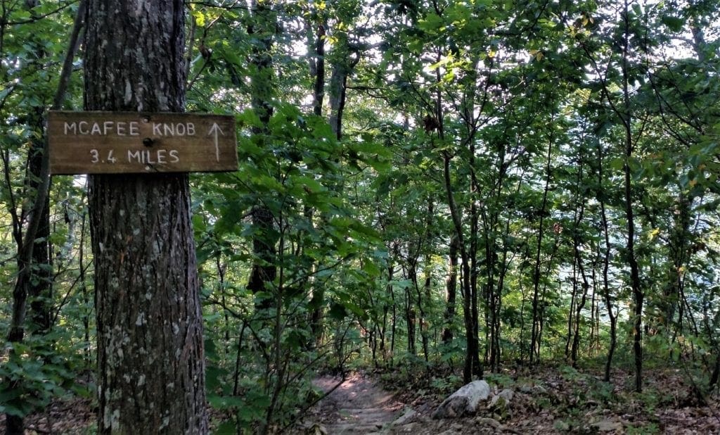
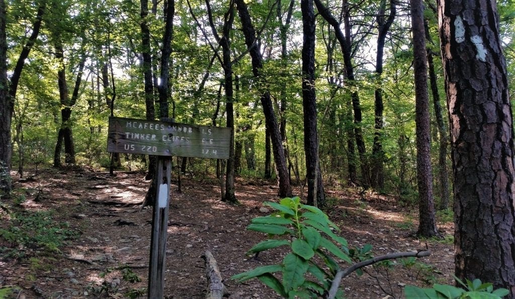
The McAfee Knob trail is an approximate 8.8-mile round-trip hike from the trailhead at state Route 311 to McAfee Knob.
It’s around 6 miles one way from Tinker Cliffs to McAfee Knob if you’re doing both of those hikes together or the whole Triple Crown loop.
The hike takes 4-6 hours if you do the out-and-back trip from the McAfee Knob Parking Lot off Route 311.
This trail is extremely popular and is especially crowded on weekends, with very limited parking. Consider hiking the trail during the week (like I did!) to avoid larger crowds.
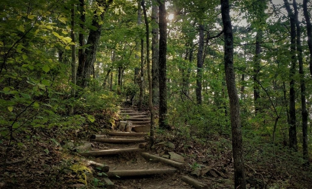
Along the Trail
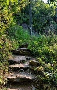
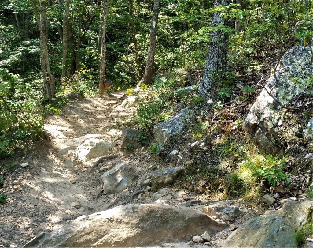
From the trailhead parking, cross the street to the start of the trail, and follow the white-blazes to make the gradual ascent to McAfee Knob, which is 3,197 feet at the top.
It’s a steady, moderately difficult climb of 1700 feet to the top.
The knob is a great place for a snack or picnic, though you’ll want to be careful because of the steep drop-offs nearby.
For the return, retrace your steps along the trail for a round-trip hike.
For a more leisurely return, you can turn right on the old fire road that’s approximately 1.4 miles from the knob.
Then take the fire road for just over 2.6 miles until you reach Route 311 and the parking lot, which will be on the other side of the road.
Directions to the Trailhead
From Interstate 81, take Exit 141 to VA 419/311.
-
- Go north for approximately 1/4 mile and turn right on Route 311.
- Travel 5.5 miles north on Route 311 to the top of Catawba Mountain, where there’s a gravel parking lot and the spot where the Appalachian Trail crosses the road.
- From the parking lot, walk back across Route 311 to begin your hike.
Parking
There’s limited parking at the trailhead on Catawba Mountain.
Parking is prohibited along the road on Route 311, and cars parked along the side of the road will be towed.
If you’re in a group with multiple vehicles, consider using the Park & Ride lot in front of Orange Valley Market at the intersection of Route 419 & Route 311.
Loop Option
If you’re completing the Triple Crown in one trip, once you reach the Knob, you’ll opt to continue north on the Appalachian Trail instead of making your way back to the parking lot.
From McAfee Knob, it’s approximately 6 miles to Tinker Cliffs along the trail.
About Catawba
The Catawba Valley is bordered on the south by Catawba Mountain and on the north by the mountainous border between Roanoke County and Craig County, Va.
The Appalachian Trail passes through the Catawba area and provides access to two of the three Triple Crown hikes – Dragon’s Tooth and McAfee Knob.
How Catawba Got It’s Name
Catawba Mountain and the nearby river were both named for the Catawba tribe that lived in the area.
Around 1650, Catawba Indians moved into the region after being driven out of their original home in modern-day Ohio by other Indians.

The entire Catawba population at that time was ~ 11,000 people.
-
- The Catawba gained control of the river (now known by their name), by engaging in a constant state of war with Cherokees who resided along and west of Broad River
- By about 1700, the name “Catawba” applied generally to an alliance of Esaw, Sugaree, Shuteree, and Catawba sub-tribes. Their central community was at the confluence of Sugar Creek and Catawba River.
- After large numbers of European colonists settled coastal Virginia, Siouan tribes, Cheraw, Santee, Pee Dee, Waccamaw, and Catawba also aligned with colonists against the allied and individual Algonguian, Tuscarora and Cherokee tribes.
- In May 1715, a local problem with the Yamasees in South Carolina escalated into a general Indian uprising that included the Waxhaw and Catawba.
- The Catawba wanted peace and blamed the Waxhaw for forcing their involvement. As a result, in August 1716, the Catawba destroyed the Waxhaw tribe.
- Survivors of that attack, along with other vanquished Indians, migrated and merged into what became known as Catawba Nation, located in present-day Lancaster and York Counties. There they traded deerskins for manufactured goods, including guns, gunpowder, tools, and textiles.
- Although the Catawba had survived colonial settlers, they still had strong Indian enemies, and were continually subject to Iroquoian Shawnee raiders from as far away as the Ohio River.
- For these reasons, the Catawba allied themselves with settlers during the French and Indian War (1756–1763) and the American Revolution.
- In spite of their alliance with colonists, the condition of Catawba and other Piedmont Indian tribes was deteriorated, especially by smallpox epidemics in 1738 and 1759.
- Finally, to avoid smallpox at the Sugar Creek village, Catawba King Haigler established a new village where Twelve-Mile Creek joins the Catawba River.
In 1760, King Haigler negotiated with both North and South Carolina colonial governments to legally establish the Catawba Nation boundary on a 15-mile square.
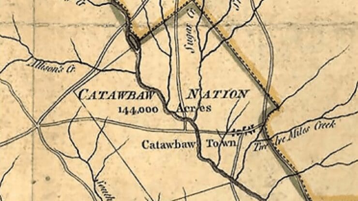
A corner of this square is evident today in a right-angle notch along the state boundary immediately west of Pineville, North Carolina.
As a result, the Catawba became landlords collecting rents from settlers.
A fort was also built at present-day Fort Mill, South Carolina, for protection against other Indians and to free braves for soldier duty.
After King Haigler was killed by Shawnee raiders in 1763, no effective Catawba leadership emerged. All but 600 acres of the Nation were sold to the South Carolina government in 1840.
You can read more about the Catawba in modern times on the tribe website .
Catawba Sanatorium
The land on which Catawba Hospital (previously known as Catawba Sanatorium) stands was once owned by James McAfee, Sr. in the 1700’s. It’s history of healing dates back to 1857.
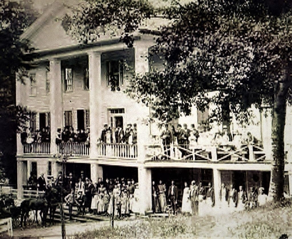
That was the year several businessmen from Salem, VA discovered the healing potential of sulphur and limestone springs on Catawba mountain.
Red Sulphur Springs Resort
Roanoke Red Sulphur Springs Resort opened in June of 1858.
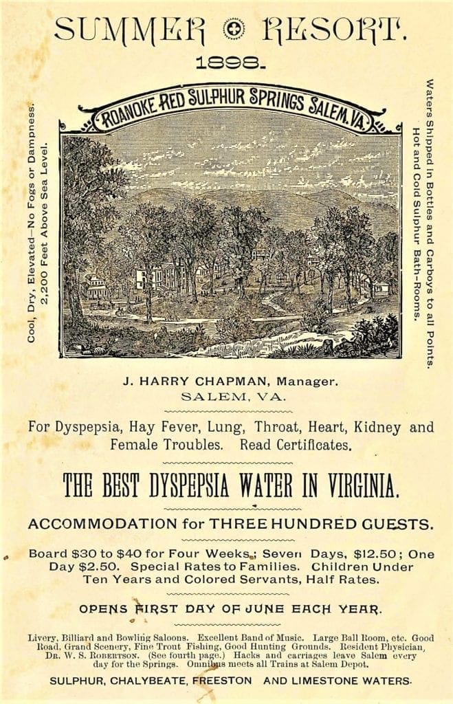 The 700 acre resort was located ten miles north of Salem on the northern border of Roanoke County, and extended up the mountain from the Catawba Valley.
The resort catered to people who wanted to escape to the mountains for the clean, healthful air and peace and quiet the resort offered.
Water from Red Sulphur Springs, called “Catawba Iron”, was shipped around the country and advertised to be beneficial in treating lung diseases.
By the early 1900s, the resort had attracted many tuberculosis victims.
At the height of its popularity, the main hotel accommodated 300 guests, and it continued to operate until 1908.
In 1908, the Commonwealth of Virginia purchased the property and appropriated $40,000 to establish the first Tuberculosis Sanatorium.
In 1909, TB patients were treated with fresh air (cold or hot), plenty of sunshine, rest and as much food as they could handle.
These were the only known treatments for Tuberculosis until the advent of thoracic surgery around 1920.
Tuberculosis was eventually brought under control with the invention of Streptomycin and Isonicotinic Hydrazide (INH) in the late 1940s and 1950s.
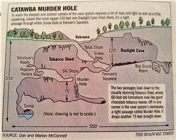
Catawba Murder Hole
Along with scenic and treacherous mountain cliffs, Botetourt County is home to another unique place of danger and beauty – the Catawba Murder Hole cave.
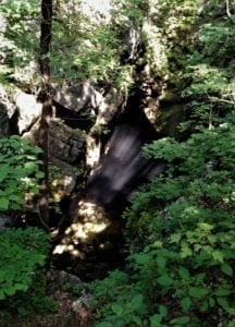
The only above-ground indication of the danger below is a yawning gap in the earth below the craggy ridge to McAfee Knob.
To the naked eye, the cave is 100 feet wide and another 120 feet deep.
But that part, named “Daylight Cave,” is merely the visible section of a larger cave system that stretches beneath a 34-acre wooded spread that belongs to Dan and Marian McConnell.
Two unseen lower levels take the cave depth down to 234 feet, and one of the underground chambers has a 75-foot-tall ceiling.
Why “Murder Hole”?
The name “Murder Hole” is exciting, but the cave has nothing to do with any killing, real or imagined.
Instead, the name refers to a hidden vertical hole partway down one of the cave’s slanted subterranean passageways known as “Ski Slope” that drops 75 vertical feet into the cave’s third and deepest chamber.
It’s similar to a defensive feature found in the ceilings of English, Scottish and Irish castles, called “murder holes,” where occupants could retreat during a castle siege.
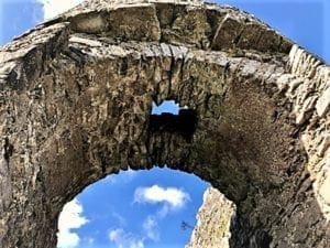
Castle Gatehouses
The gatehouse was built to protect the castle entrance from enemy attack as it was traditionally the most vulnerable part of the medieval castle.
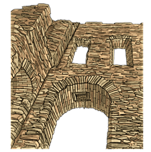
Murder holes were usually built near the entrance and all along the Gatehouse passageway.
The enemy could often be trapped in the gatehouse passages.
Defenders would then use their vantage point to throw rocks or pour boiling oil down on their attackers.
More often than not archers would also be lined up at the top of gatehouse passage walls, and massacre the enemy under a rain of arrows.
There are a lot of stories about the Catawba Murder Hole – some are fact and others are legend.
Here are a few:
-
-
- A Civil War deserter was angrily thrown into the pit for his cowardly transgressions.
- A heartbroken young woman jumped into the cave because her parents disapproved of her beau.
- A traveling salesman’s horse-drawn wagon mysteriously disappeared in the Catawba area in the early 1900s. As the story goes, a local farmer stole his goods, killed the tinkerer, and disposed of his horse and wagon in Murder Hole.
-
Those are legends, so far unconfirmed.
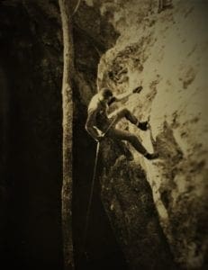
Then there’s the one about the Virginia Tech student who fell and died there when his climbing rope snapped during a caving expedition in 1958.

Unfortunately, that one’s a fact.
Tragically, fibers in the rope had weakened because some cleanser stored with the line had leaked onto it.
Murder Hole has been featured in nonfiction and fictional books, a documentary movie, and even has it’s own coffee-table book, written by property owner Marian McConnell.
McConnell and her husband Dan have been defenders and caretakers of the cave since they bought the property in 1994.

“But we won’t live forever,” Marian McConnell said.
“So before I pass on and they sprinkle my ashes into the cave, I wanted to share what I’ve learned in a book.”
The book about this fascinating cave by landowner and caver Marian McConnell was published in 2012.
It’s a collection of legends, history of its early explorers, and stories from those who survived accidents in its dark depths.
The book includes over 150 pages of historical and current photographs, maps, artwork, stories, and more.
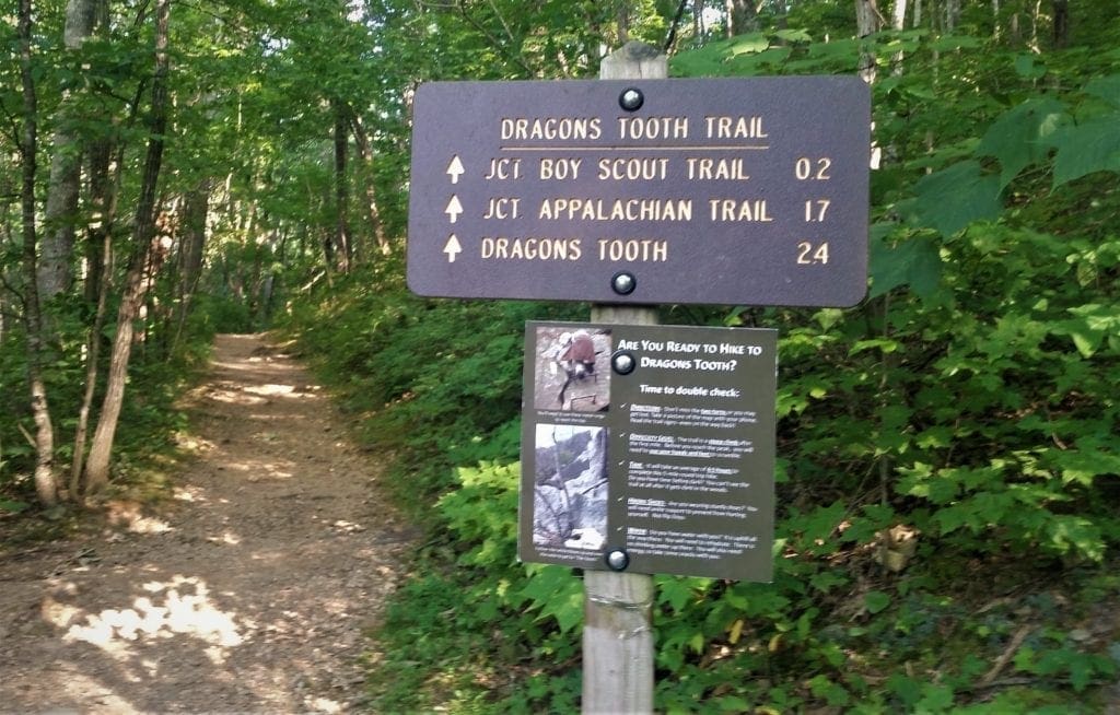
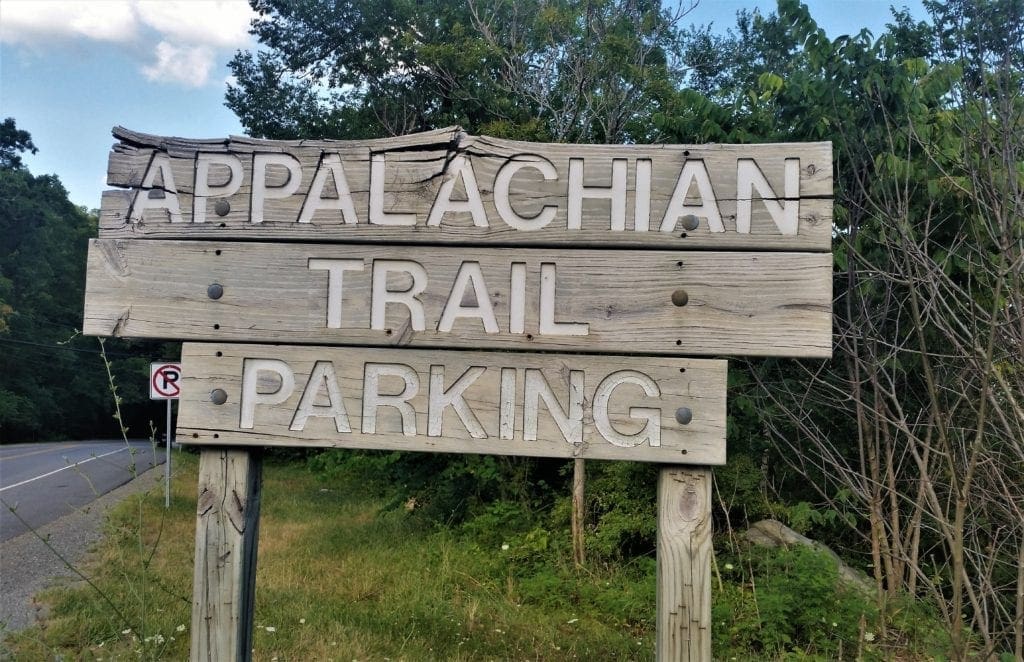
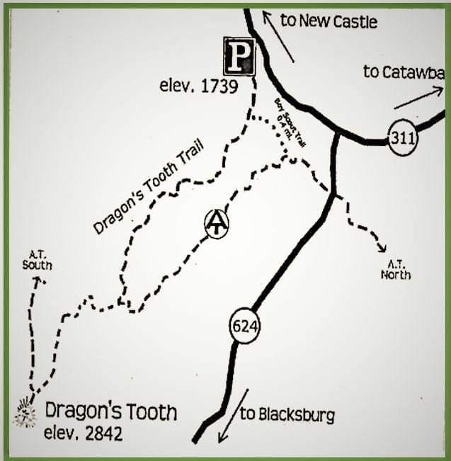
Getting to the Appalachian Trail Dragons Tooth parking area off Route 311 is pretty straight forward.
It’s a beautiful drive to the turn-in to the trailhead, about half a mile north of the VA624 off of the VA311.
The earlier you arrive the better, because the parking area is limited to 35-40 car capacity and can fill up quickly.
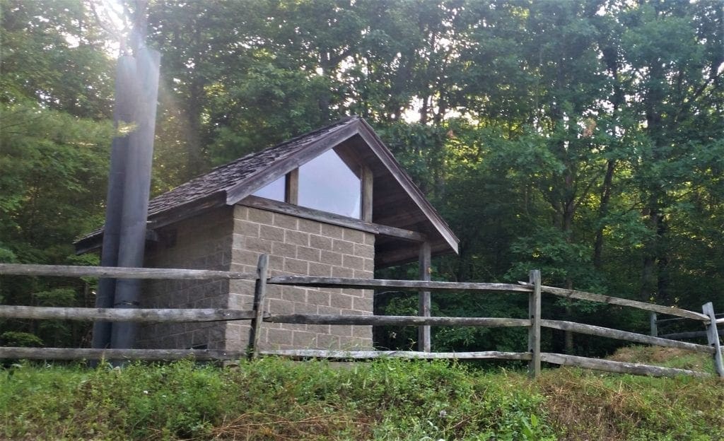
Also, there’s is a non-flush facility for one last pit stop before you begin.

NOTE:
Currently restrooms and water are not available at trailheads due to COVID-19 restrictions.
Please plan ahead for this.
Hike Overview
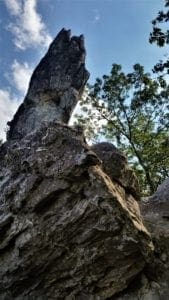
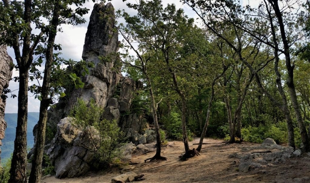
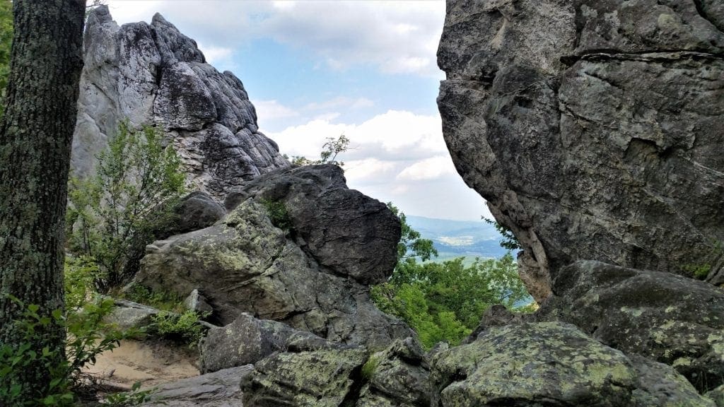
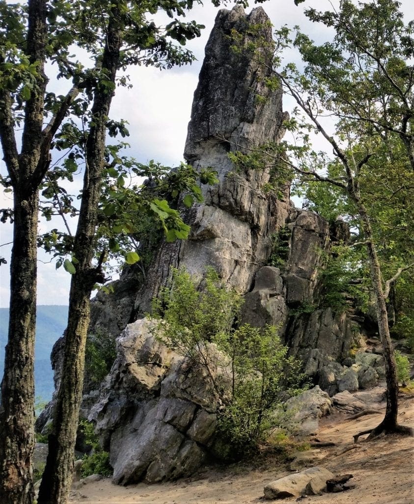
It’s a 4.6-mile round-trip hike south to Dragon’s Tooth, a dramatic sandstone monolith that provides views of Millers Cove below.
Dragon’s Tooth juts from 3,020-foot Cove Mountain and offers views of the Catawba Valley.
The tough, steep climb from the trailhead to Dragon’s Tooth will gain and then lose about 1,300 feet in elevation.
The round-trip trek should take about 3.5 hours.
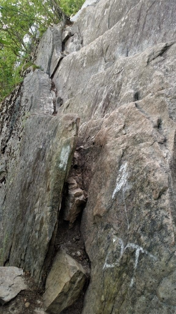
The first 1.5 miles wind along streams and well-marked trails, but don’t worry – you’ll be challenged by scrambling and a steep ascent to the top 🙂
The final 0.8 miles of the hike will test your bouldering skills, but some iron climb bars have been put in place to help you make your way up the sheer rock walls.
At the top, the climb pays off with a stunning view of Virginia’s Blue Ridge Mountains on the horizon.
For an even more unique view, climb to a spot actually on “The Tooth” – a 35-foot tall quartzite rock spire that reaches into the sky.
This hike should be fine for older children, but it might give parents heart palpitations watching their kids on the rock scrambles – never mind if they want to climb the Dragon’s Tooth!
Littler children may not have the coordination or reach (with their short little legs) to do some of the scrambling.
So if they’re too big to carry, but too small to scramble I’d skip this hike with the little ones.
Getting Started
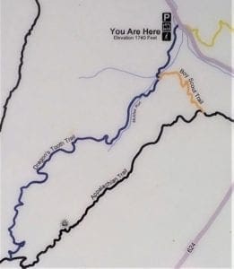
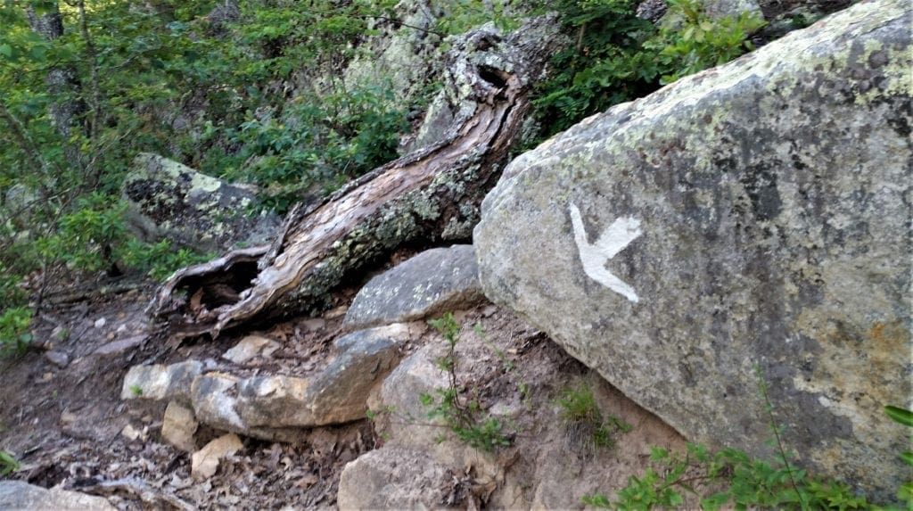
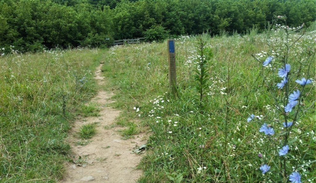
You’ll start your hike at the information kiosk located at the far left end of the parking lot. Follow the White markers.
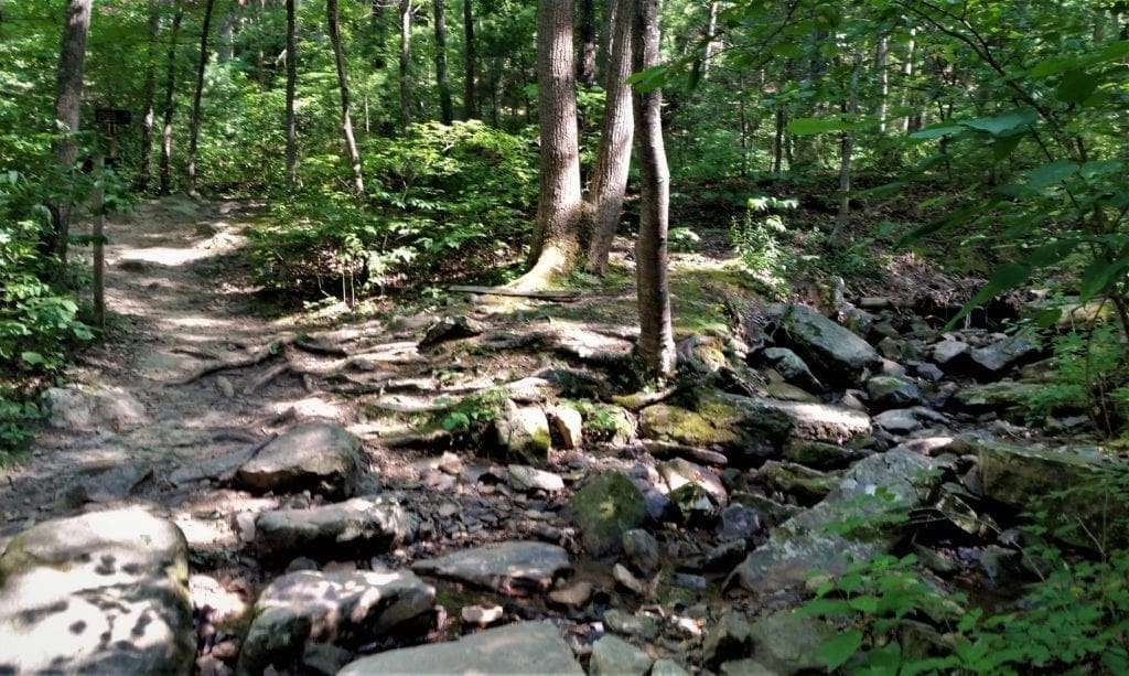
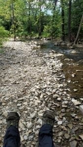
The trail is twisty and windy with a creek on the left. You’ll cross the same creek a few times and you could get a bit wet, depending on the time of year or recent rain.
On my hike, there was some water, but the creek was pretty low.
You’ll reach a flat area with a sign that says .7 miles. This is where the hike becomes more challenging.
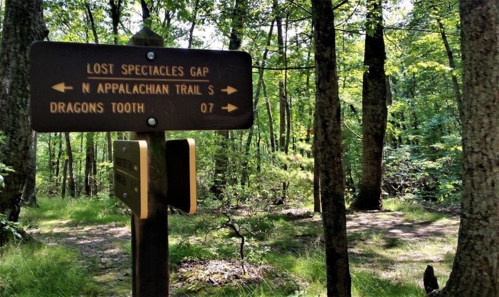
Lost Spectacles Gap
The signposts on the trails have some local references that visitors don’t understand.
The “Lost Spectacles Gap” sign at 1.55 miles where Dragons Tooth Trail intersects with the Appalachian Trail is one of those.
As the story goes, Lost Spectacles Gap was named by long-time Roanoke Appalachian Trail Club (RATC) leader Thomas Campbell when he misplaced his glasses here. 🙂
If you’re already struggling or it’s getting dark, you’ll want to turn around here and come back another day.
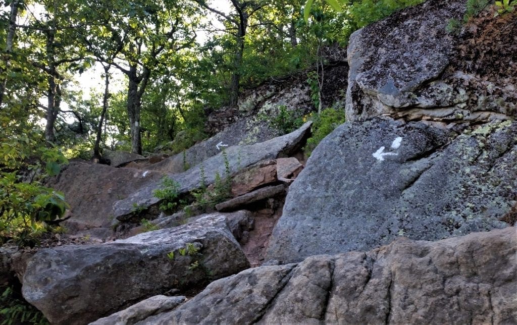
Otherwise, it’s time to conquer Dragons Tooth! Continue to follow the White markers.
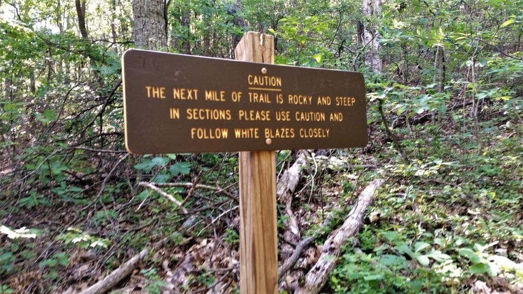
The Funnest Part
The trail is really very easy until you get to the rocks. Then it’s not really hiking any more…. it’s more scrambling.
The good news is the rock scrambles all have very good foot and hand holds, which makes the ascent much easier.
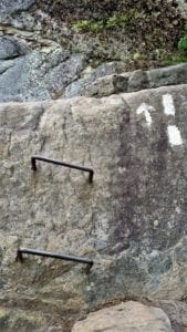
There are a couple of places where, due to the height and extreme angle of the rock-face, the Rangers have placed a few metal rungs into the rock to help.
I think this is the funnest part, but maybe that’s just me 🙂
Be mindful if the rocks are wet and take your time, pay attention and stay focused at all times.
There may also be others hikers making their descent while you’re on the way up, so be prepared to make room on the trail.
Some of the trail is pretty basic uphill climbing, but there are a few sections that are either steeper or more narrow than others.
Just keep pushing on, and you’ll get there!
There are a few overlooks along the way that could also serve as resting points if you need it.
Your view will vary depending on the time of year, but don’t worry – the best views are still ahead.
Dragons Tooth
Once you reach the top you have a few nice outlooks to choose from right away.
The first is a nice view, but there’s a straight drop down that made me a little nervous.
The centerpiece provides the best views, and there are a couple of places that are perfect for sitting or leaning on while enjoying the magnificent view.
If you’re feeling adventurous – and have no fear of heights – you can go around the inside edge of the tooth and climb to the top for a 360° view!
When you’re done messing around, head back down the trail.
The Descent
To get back down to the parking lot, just go back the way you came.
I thought the rock scrambles were a bit easier to navigate on the way down – but I don’t have bad knees 🙂
If you do, just take it easy and remember the smallest step is usually the best one.
After the .7 miles of scrambling, you’ll reach the flat area.
From there you can either continue back the way you came or choose the alternate Boy Scout Trail.
The Boy Scout Trail
I didn’t take the Boy Scout Trail, because the light was fading and I preferred to stick to a familiar trail rather than risk being on the mountain in the dark.
I think the Boy Scout trail is an option because it’s different, it’s the path less traveled, and it’s mostly in the shade.
Here are some specifics from my sources:
-
-
- Markers for the Boy Scout trail are blue.
- The Boy Scout path is very steep from the beginning, and the pathways are much narrower than the initial route.
- There are some great rock scrambles that rival the last leg of Dragons Tooth trail.
- As the trail starts to level off you’ll come to two different lookouts. The first is nice but the second is amazing – and also a great opportunity for a rest stop.
-
Most of the rest of the hike is steadily downhill, but starts to flatten a bit when you rejoin to the original trail.
Conclusion
Before you know it you’re back at the parking lot!
The entire 4.6 mile hike can be done in less than 2.5 hours if you’re in great hiking shape and go quickly.
I took my time, but didn’t dawdle either because it was late in the day, and completed the loop in about 3 hours.
It’s not a race, and you want to allow time to spend at the top – so plan on going more slowly than you normally do for your timing estimate.
One of the benefits of this hike is that you’re in the shade most of the time which I really appreciated in the heat of summer!
That reminds me – if you think you’ve brought enough water, go back and get some more.
Dragon’s Tooth can be a demanding hike, especially in hot weather, and you’ll want to stay hydrated.
Loop Option
If you’re hiking the entire Triple Crown loop, when you reach the Dragon’s Tooth summit continue north on the Appalachian Trail for 7.5 miles until you reach the McAfee Knob Parking Lot, to begin the Triple Crown’s second leg.
Another option is to return to the Dragon’s Tooth Parking Lot and drive south on Route 311 for 4 miles until you reach the McAfee Knob Parking Lot.
Tinker Cliffs
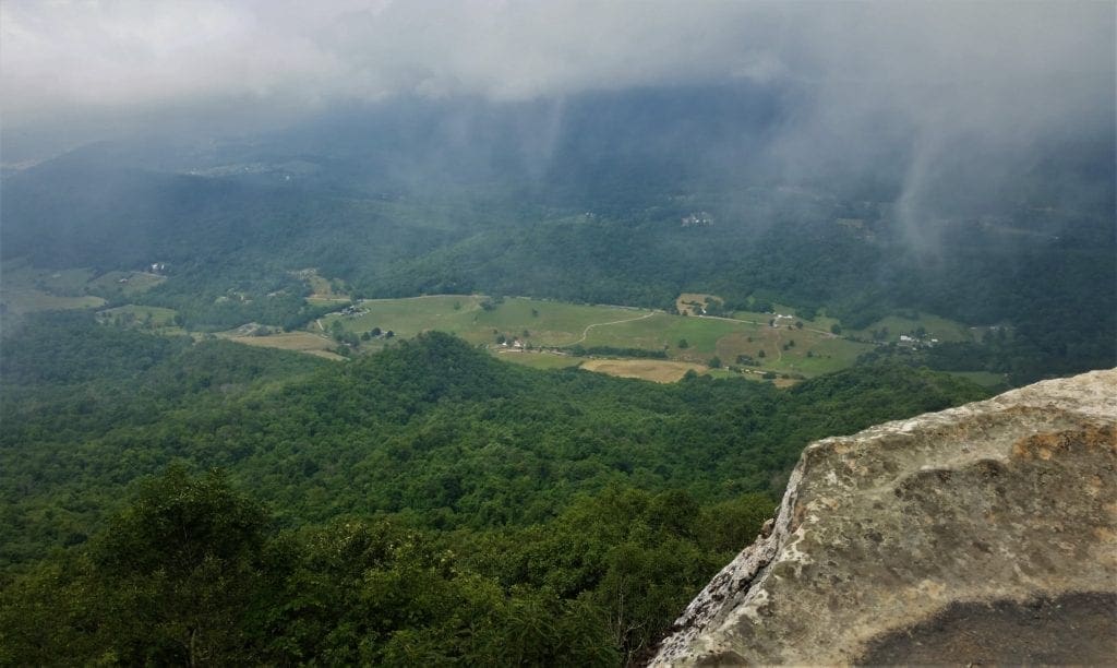
Tinker Cliffs, which are made from limestone that’s over 250 million years old, give you an amazing view from an elevation of 3,000 feet.
Many claim the hike to Tinker Cliffs is the most difficult of the “Triple Crown” hikes. I would disagree- I think McAfee Knob is a physically more difficult hike.
That said, if I had to pick the “hidden gem” of the three segments of the Triple Crown, I think it would be Tinker Cliffs.
That’s because on this hike, you’ll get a little bit of everything.
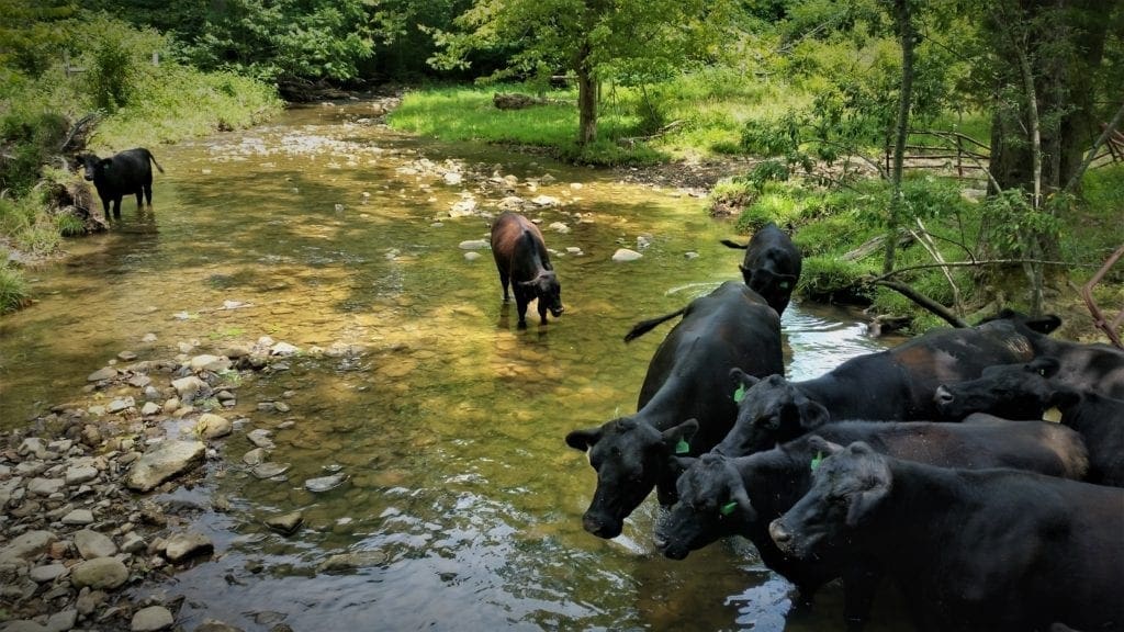
Along the way you’ll encounter some beautiful forests, amazing rocks, a few wooden bridges and a nice creek – as well as some cows that may or may not be friendly 🙂
And the reward at the end is not just one, but many different cliff-edge overlooks down into the valley.
Hike Overview
At 7.7 miles, Tinker Cliffs is one mile shorter than McAfee Knob and has 2000ft elevation gain to the Knob’s 1700ft gain.
But while the Knob hike just goes up continuously until you reach the top, Tinker Cliffs has a few sections that are very steep, and the rest of the hike is quite easy.
Directions to the Trailhead
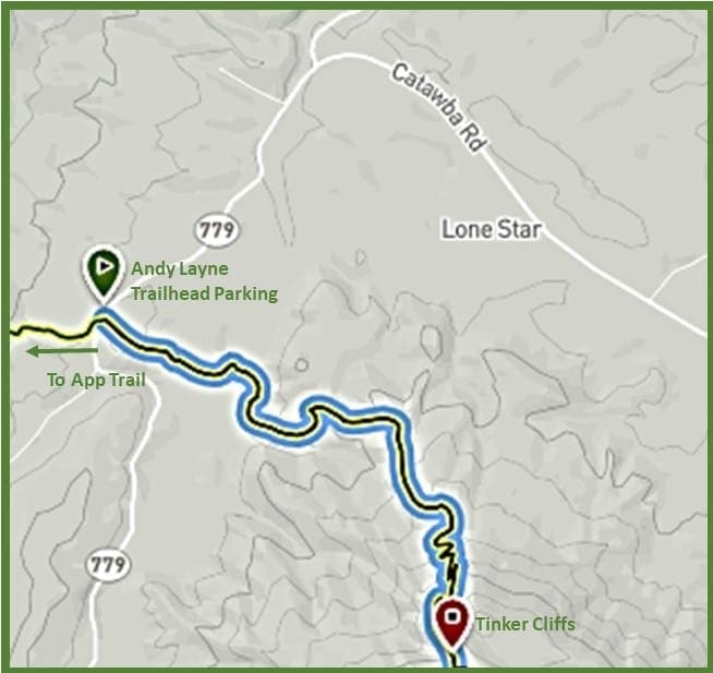
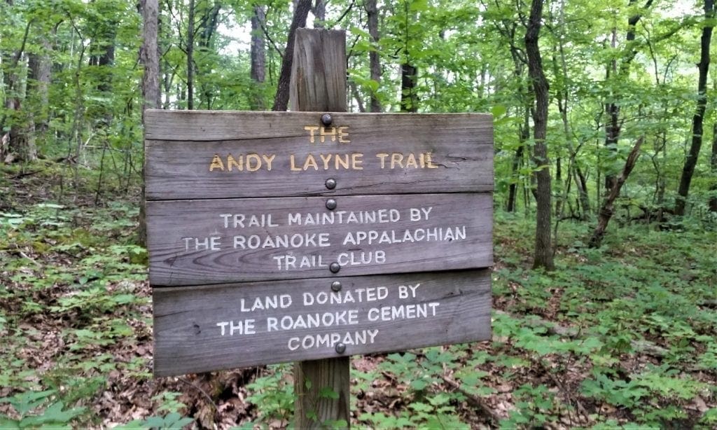
The hike starts at the Andy Layne Trail Parking lot, just off Little Catawba Creek Road (Rt. 779).
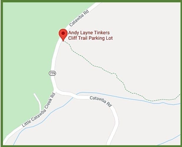
It can only hold around 15 cars and it’s the only parking option – so it’s best to get there early to get a spot.
If you’re visiting in the summer, earlier is better to hike when it’s cooler, too.
The trailhead is on the east side of the parking lot underneath the trees, directly in the middle.
Along the Trail
There’s a map of the trail on the board at the trailhead kiosk. But, the trail is really simple to follow so I wouldn’t worry too much about getting lost.
You’ll start on the Blue-blazed trail heading uphill and then descending back down.
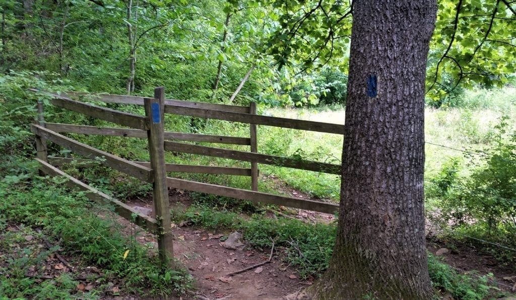
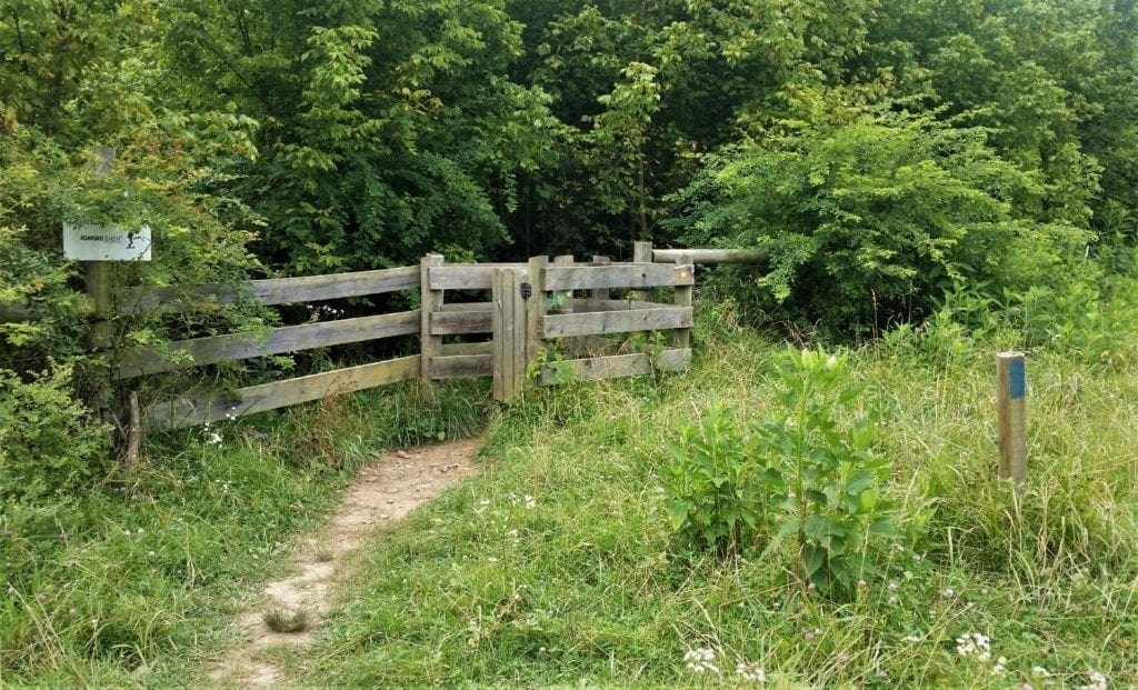
After about 10 minutes in you’ll see a small wood “gate” that marks the beginning of a pleasant flat stretch of trail.
The Bridges
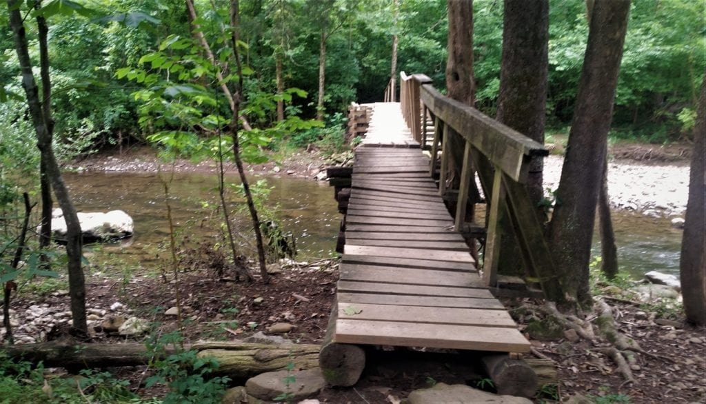
At about the 0.6 miles you’ll reach a rickety wooden bridge with hand rails only on one side across the Catawba Creek.
I also found a bunch of cows here in the creek, and at least one of them wasn’t happy to see me.
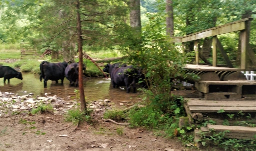
They mooed, but otherwise left me alone as I crossed the meadow to the next gate.
The trail meanders through woods down to a second bridge.
This bridge is even more rickety than the first. (But it’s perfectly safe.)
The Real Hike
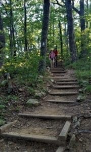
The real hike begins after the second bridge. You start with a semi-steep climb through the forest.
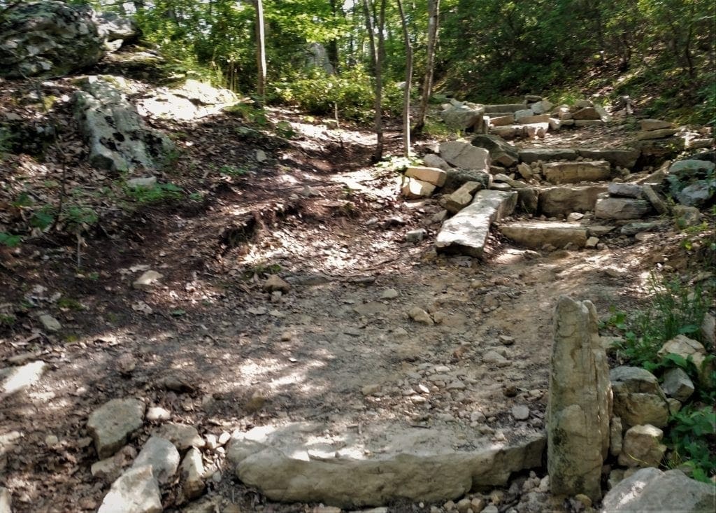
About a mile in there are wide, steep steps that seem to go on for a loooooong time 🙂
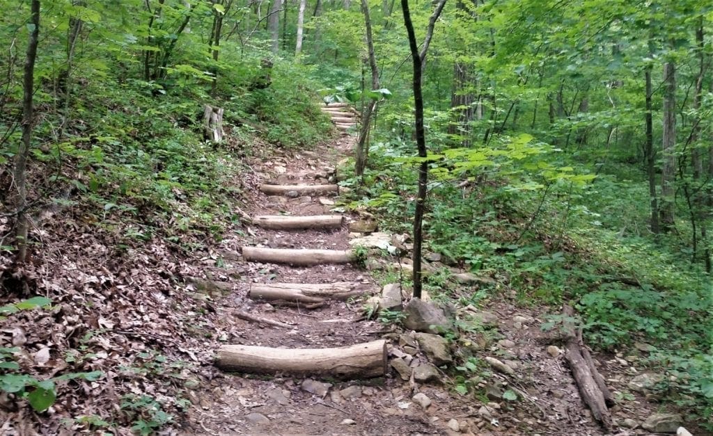
You’ll gain about 900ft elevation in just over a half-mile stretch.
Junction with the AT
Around the 3-mile mark you’ll reach a flat area marked by a great rock formation, wood signs and a switch to the White blazes of the Appalachian Trail.
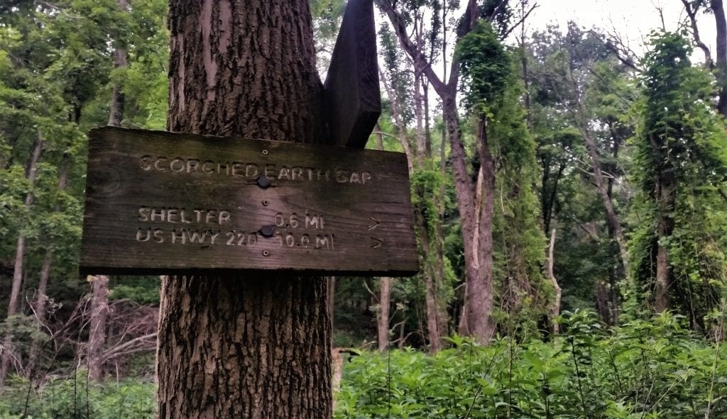
Scorched Earth Gap
The signpost at the AT junction with the Andy Lane Trail references Scorched Earth Gap.
The story comes from a trail maintenance crew that had hiked up the Andy Lane Trail to do some work on the AT.
The leader claimed that the language that came out of one lady’s mouth after the climb was so foul it “scorched the earth” beneath them! 🙂
At this point you’re only 0.5 miles from the top. Be prepared, because this is the toughest stretch of the hike.
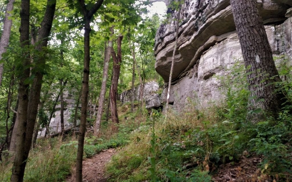
It is almost all uphill from here, but eventually you’ll start to see rock faces straight ahead and to your left. Continue to climb.
The Views
As you reach the top you’ll notice different rock groupings to your right. Some are just really cool while others are ideal for viewing the valley below.
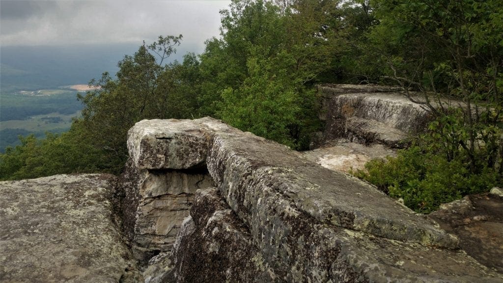
Eventually you’ ll arrive at the cliff tops, where there’s a series of great lookout points to choose from.
They’re all flat, and have a similar view but each different formation is unique.
Spread out in front of you is such a clear vista of the Catawba Valley that you can even can see both of the other “sisters”, Dragons Tooth and McAfee Knob.
The Way Back
When you make your way back down the same path you came up on, the angle of the sun changes the look of the forest from earlier in the day.
As with so many hikes, the way back down seems to go faster than the way up.
It doesn’t take long to make your way back to the bridges and the cows, and eventually back to the trailhead parking lot.
Loop Option
For those completing the Triple Crown as a loop, once you reach Tinker Cliffs, you continue north on the Appalachian Trail until turning left onto Andy Layne Trail.
-
- Follow this trail until you reach the parking lot at Route 779 and cross the road to connect with the yellow-blazed North Mountain Trail.
- Turn left and head south on the trail along the ridge of North Mountain until you reach Route 311.
- Turn left and hike south on Route 311 until reaching the Dragon’s Tooth Parking Lot to complete the loop.
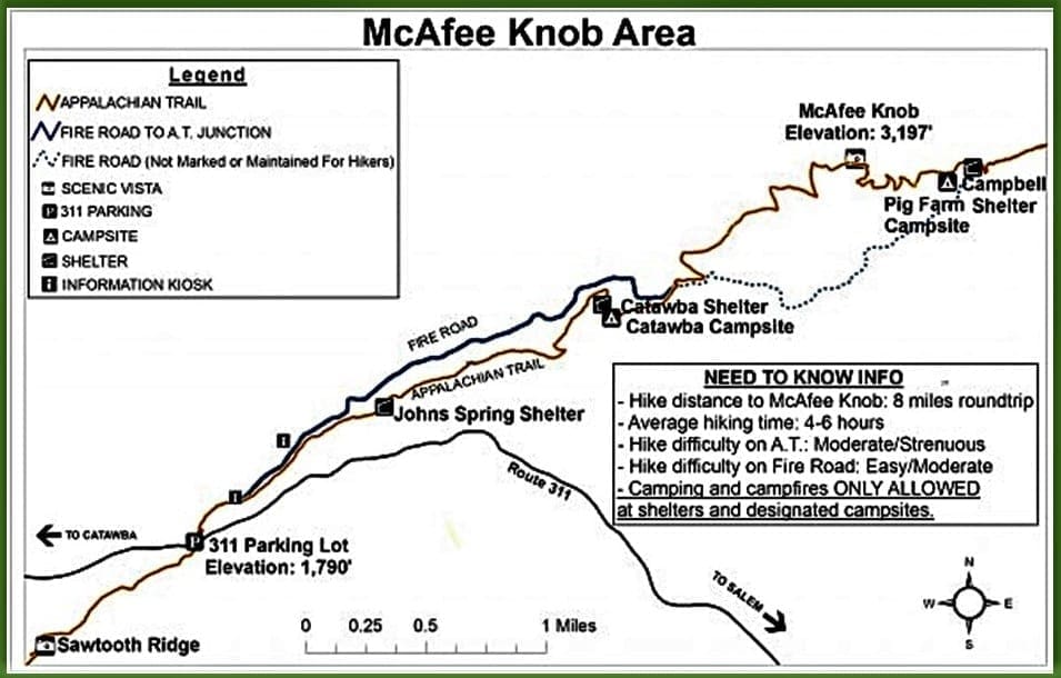
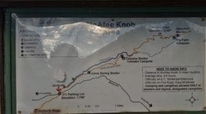
Virginia Triple Crown Map
The following is a helpful map for hiking the Triple Crown, with a hike summary, info about camping shelters, parking lots, and where each summit is located.
Camping
Camping is prohibited on McAfee Knob and Tinker Cliffs.
That said, there are numerous camping shelters along this portion of the Appalachian Trail in Virginia’s Blue Ridge.
Please camp only in designated spots along the trail.
The four designated camping shelters located along this route are:
-
-
-
-
- Campbell
- Catawba Mountain
- Johns Spring
- Lamberts Meadow
-
-
-
Leave No Trace

Protecting the environment is an essential part of what makes the Appalachian Trail and Virginia’s Blue Ridge continue to be an amazing destination.
Please adhere to Leave No Trace principles to help ensure the Virginia Triple Crown remains an enjoyable hiking experience for locals and visitors for years to come.
You can learn more by visiting the Leave No Trace website.
Hike the Appalachian Trail
Did you know that the Appalachian Trail is actually part of the United States’ National Parks system?
The trail was conceived in 1921, built by private citizens, and finally completed in 1937.
Today the trail is managed by the National Park Service, US Forest Service, Appalachian Trail Conservancy, numerous state agencies and thousands of volunteers!
Footpath for the People
The Appalachian National Scenic Trail is a public footpath that follows more than 2,100 miles of Appalachian Mountain ridgelines between Maine and Georgia.
The Triple Crown is just one of many segments along the trail that you can hike as an overnight or weekend backpacking trip, a single day trip or even just an afternoon.
The trail is open year-round and accessible from many locations. Find the closest Appalachian Trail access point to you HERE.
I hope you enjoyed this post, and that it inspires you to go hike the Triple Crown yourself!
For more posts about my visits to State Parks and National Parks, go to the Hiking Destinations page.
You can read about other adventure trips on my Adventures for You page.
Thanks for stopping by – see you next time! LJ
To Get New Idratherwalk Posts
sent directly to your inbox (how convenient!) Click this Button
If you enjoyed this post, please share it:


LJ has spent much of her free time as a single Mom – and now as an empty-nester – hiking in the US and around the world. She shares lessons learned from adventures both local and in exotic locations, and tips on how to be active with asthma, plus travel, gear, and hike planning advice for parents hiking with kids and beginners of all ages. Read more on the About page.