Hike the Rock Castle Gorge Trail on the Blue Ridge Parkway
Most recently updated May 15th, 2026
Estimated Reading Time: 16 minutes
The Blue Ridge Parkway runs through or very near areas of North Carolina and Virginia that were hardest hit by Hurricane Helene.
The North Carolina section of the Blue Ridge Parkway is still partly closed for repairs. That said, most surrounding communities are open for business and could really use your vacation dollars to help rebuild!
Go to my Hurricane Helene page to get the latest updates on the latest area Park, Trail and road repairs.
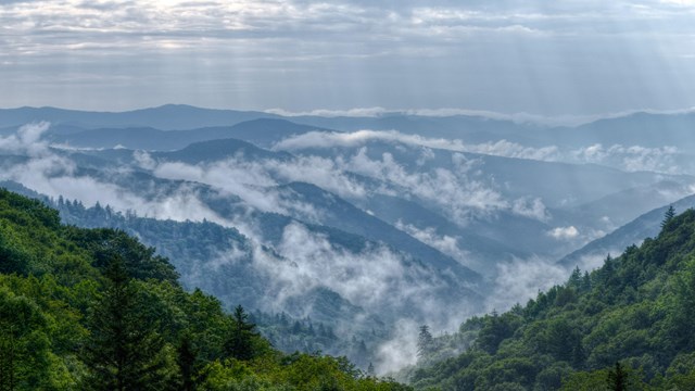
Smoky Mountains get their name from the mist that settles in the valleys.
I’ve enjoyed driving the Blue Ridge Parkway (BRP) in North Carolina and Virginia for more than 25 years.
But, I have to admit – other than some quick roadside waterfall viewing – I have completely neglected Blue Ridge Parkway hikes!
But recently I found out what I’d been missing when I was invited to hike the Rock Castle Gorge Trail at Rocky Knob 🙂
The Blue Ridge Parkway is a National Parkway in the United States, noted for its scenic beauty.
Combined with Shenandoah’s Skyline Drive, the Blue Ridge Parkway is also a favorite twisty-windey motorcycle adventure through some beautiful scenery, especially in the Fall.
Read on to learn more about the Parkway and Rocky Knob Recreation Area hiking trails – including the famous Rock Castle Gorge Trail!
Some of my posts contain affiliate links. If you make a purchase through an affiliate link, I will receive a small payment at no additional cost to you. I do not get paid for recommendations, all opinions on this site are my own. See full Disclosure page here.
The Blue Ridge Parkway
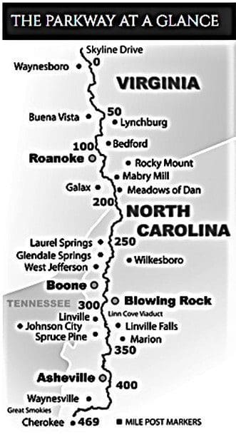
An overview map of the Blue Ridge Parkway.
The Blue Ridge Parkway isn’t technically a National Park, but it might as well be.
Today – and since 1949 – The Blue Ridge Parkway Association (BRPA), a nonprofit organization, provides maps, brochures and the Blue Ridge Parkway Travel Planner free of charge.
The Blue Ridge Parkway is:
The longest road planned as a single unit in the United States.
A series of parks providing access to high mountain passes, and a continuous series of panoramic views
There are also over 369 miles of hiking trails along the Blue Ridge Parkway, so deciding which trail to explore can be a difficult choice!
For me, I think the Rock Castle Gorge Trail will be just the first of many BRP hikes I’ll be exploring in the future – so it was a “gateway” hike 🙂
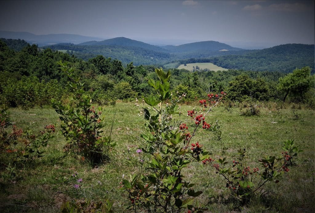
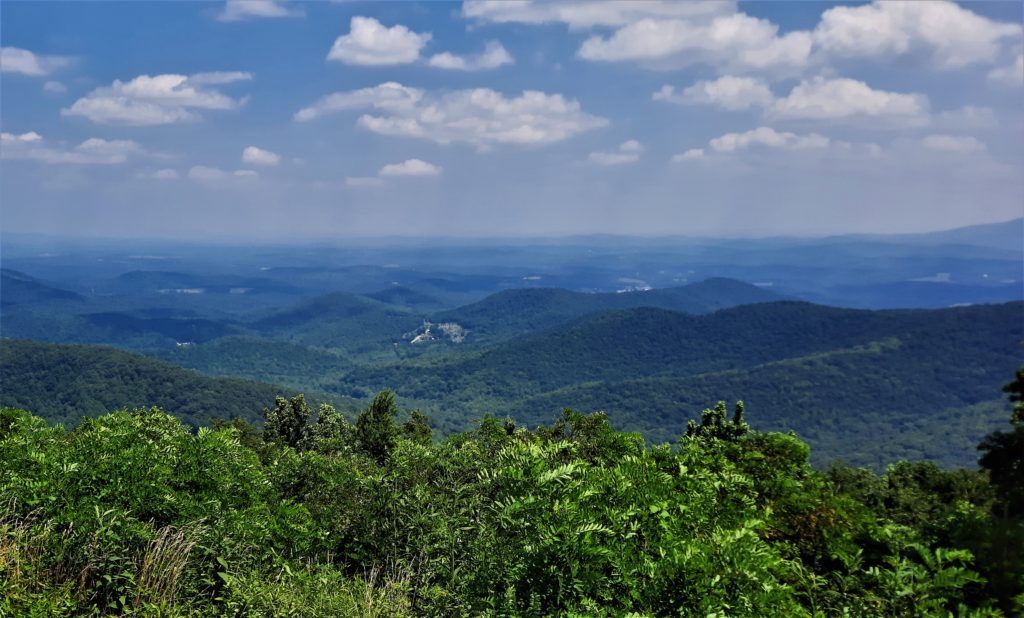
View from one of the Overlooks at Rocky Knob Recreation Area
Parkway History
The Blue Ridge Parkway was created primarily because people needed jobs during the Great Depression in the 1930’s.
A Scenic Motor Road
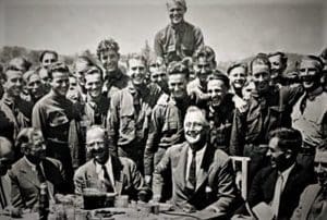
FDR at the Shenandoah CCC Camp in 1933.
President Franklin D. Roosevelt visited Virginia’s first Civilian Conservation Corps (CCC) camp in Shenandoah National Park while they were working on the Skyline Drive in 1933.
He liked it so much, he approved the concept of a scenic motor way linking Shenandoah with another new park – the Great Smoky Mountains National Park.
Congress decided that the necessary rights-of-way should be purchased by the States and then administered by the National Park Service as a park.
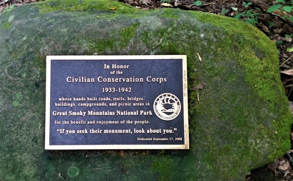
CCC Plaque at the Great Smoky Mountains National Park
Construction
Construction of the Parkway didn’t begin until late in 1935, although the plan had been in the works for the two years prior.
Progress was steady until World War II, when funds were diverted for the war effort.
The 1950s and 1960s saw a slowing in construction, until by 1968 the only thing left was a seven-mile stretch around North Carolina’s Grandfather Mountain.
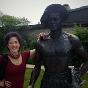
Author with “Mike” sculpture dedicated to the CCC at Shenandoah National Park.
The Grand Finish
Even though portions of the Parkway had already been in use for decades, it wasn’t entirely finished and dedicated until 1987.
The 469-mile Blue Ridge Parkway was officially dedicated on September 11, 1987, fifty-two years after the groundbreaking.
Once derided by a Michigan congressman as “the most ridiculous undertaking that has ever been presented to the Congress of the United States”, the Parkway has been enjoyed by more than 600 million visitors since its beginning.
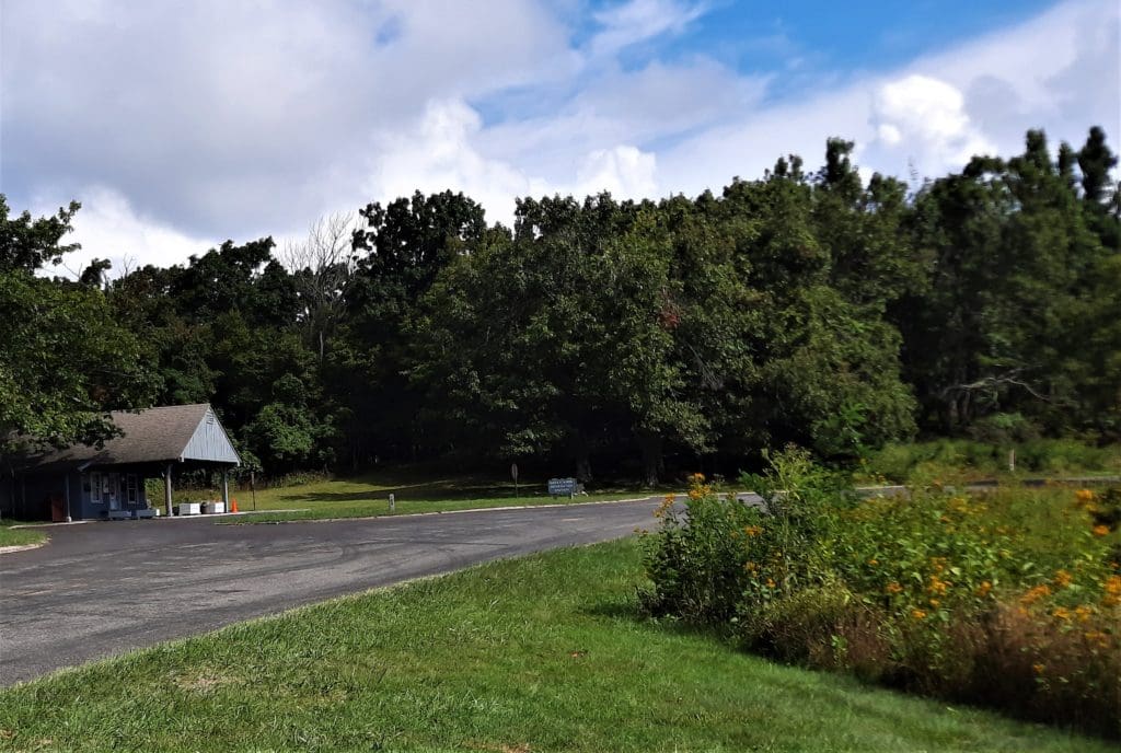
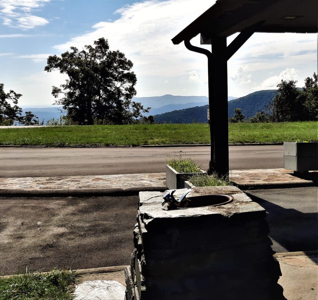
The Rocky Knob Recreation Area Visitor Center
Plan Your Visit
To help with your exploring, Blue Ridge Parkway (BRP) offers many Visitor Centers along its 469 miles – great places to stretch your legs, take a rest, enjoy the view, and learn more about the region.
You’ll find water fountains, restrooms, maps and area information – and sometimes campgrounds to stay in, too.
There are 9 BRP Visitor’s Centers in North Carolina and 6 BRP Visitor’s Centers in Virginia – one of them at Rocky Knob Recreation Area, where we can access the Rock Castle Gorge Trail.
Why Call It “Rock Castle” Gorge?
P
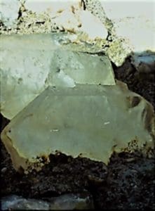
Crystals used to be found in the Rock Castle Gorge.
The name of the Gorge comes from the long, pointed, clear quartz crystals that were found there by Native Americans, early explorers, and first settlers.
The crystals reminded early settlers of castle turrets they recalled from European landscapes they left behind.
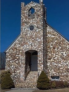
Crystals from the Gorge were used as part of this church front.
Nearly all of these crystals have been removed from the area long ago.
But you can see some Gorge crystals in the Slate Mountain Presbyterian Church located on Route 726 (Rock Church Road) near the Gorge upper rim, implanted in the stone façade in the late 1920s.
Rocky Knob Recreation Area
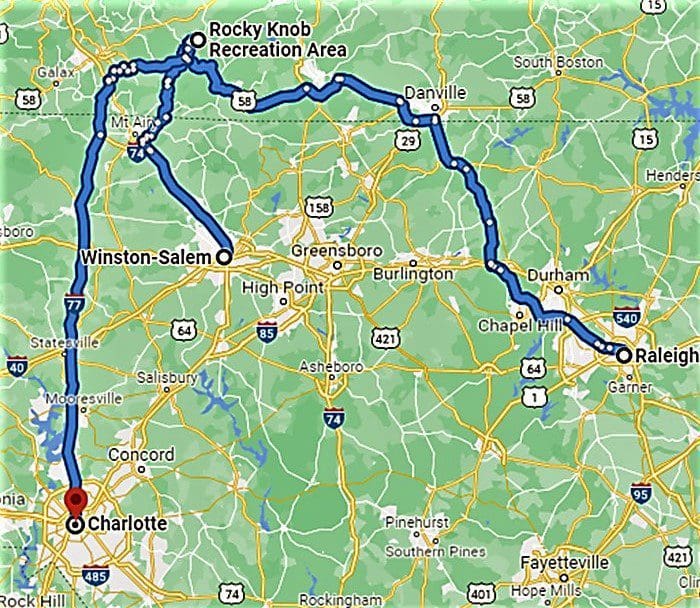
Rocky Knob Recreation area is just a short 1.5 hour drive from Winston-Salem, and roughly a 2.5 hour drive to the Durham or Charlotte areas in North Carolina.
Rocky Knob Recreation area is just a short drive away.
Thanks to the over 70,000 acres of forest growing along the Parkway, it’s also a beautiful drive. 🙂
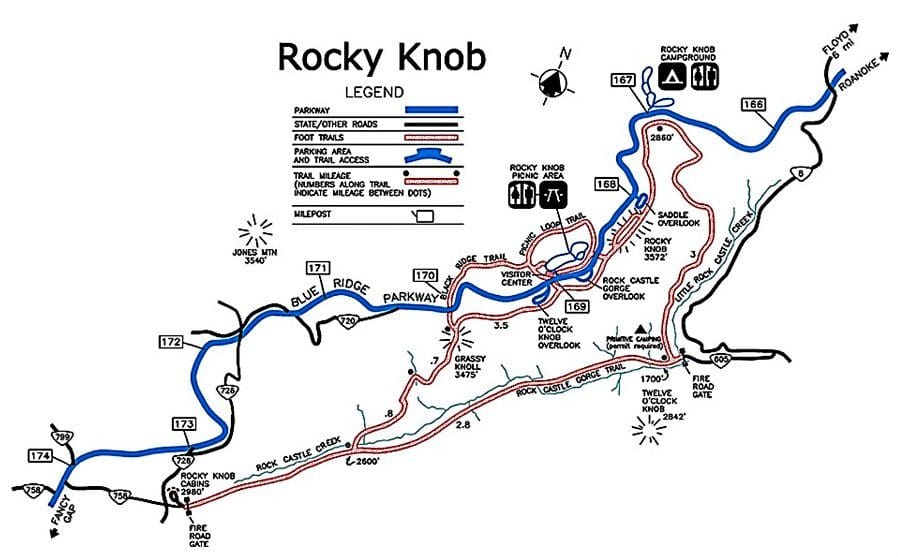
Located near the intersection of the Parkway with Virginia Route 8, the Rocky Knob recreation area covers more than 4000 acres.
Three large picnic areas, hikes into Rock Castle Gorge and the wonderful roadside scenery make this a truly unique portion of the Blue Ridge Parkway.
View across the Parkway from the Visitor Center
Lodgings at Rocky Knob
Rocky Knob cabins
The Rocky Knob Cabins, built by the Civilian Conservation Corps in the 1930s, used to be the only cabins for rent on the whole length of the Parkway!
The entire complex consisted of seven rustic cabins, tucked away in a small hollow in the forest.
Sadly, Rocky Knob Cabins are currently closed.
That said, there is a great campground at Rocky Knob. But you’ll want to make your reservations early, because spots fill up fast!
Driving into the Rocky Knob picnic area.
CAMPING AND BACKPACKING
81 Tent Sites| 28 RV sites| 72 Picnic Sites
Rocky Knob Campground has easy access to Rockcastle Gorge and is just nine miles from Mabry Mill historic site.
Reservations can be made for portions of this campground.
Backcountry camping is permitted at the designated site in Rock Castle Gorge. A permit is required and can be obtained for any time of the year.
NOTE: Rocky Knob’s campground usually opens in May.
To get all of the details about each campground, and learn how to make reservations, see Rocky Knob’s camping info page.
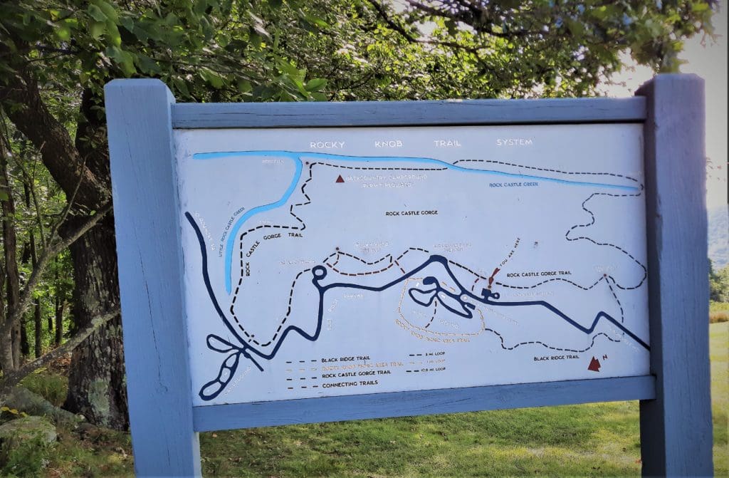
Rocky Knob Recreation Area Trail Map
Rocky Knob Hiking
There are several hiking trails at Rocky Knob Recreational area, ranging in length and difficulty.
The Rocky Knob Visitor’s Center is right off of the Blue Ridge Parkway.
The Trails
To reach any of the trails, you can park your car at the Visitor’s Center near the picnic area.
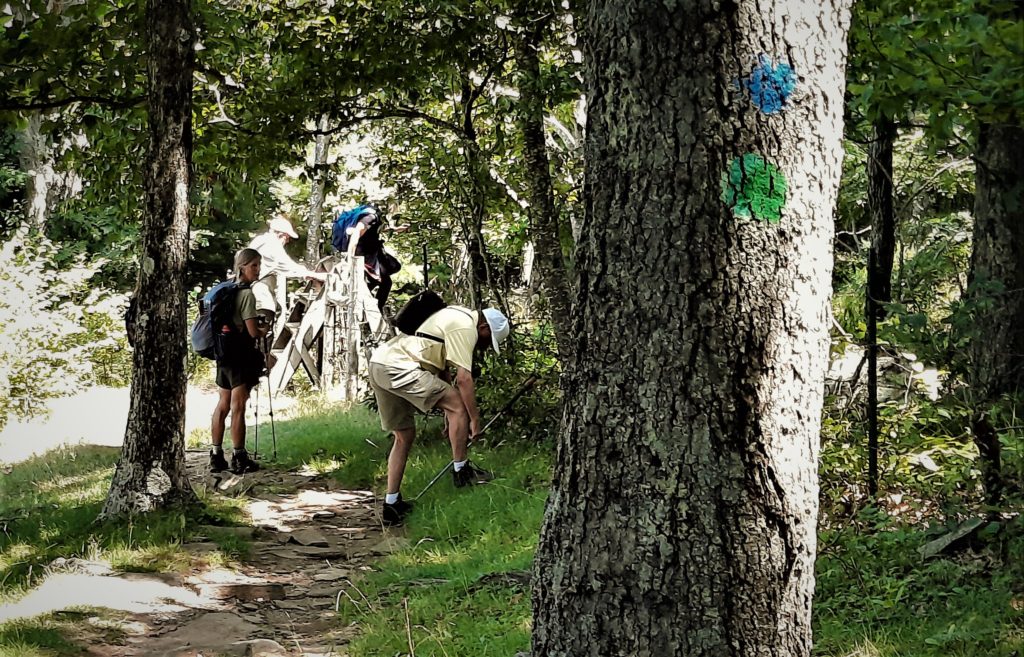
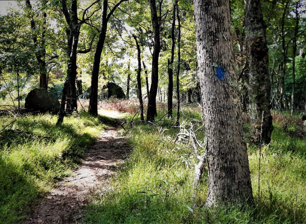
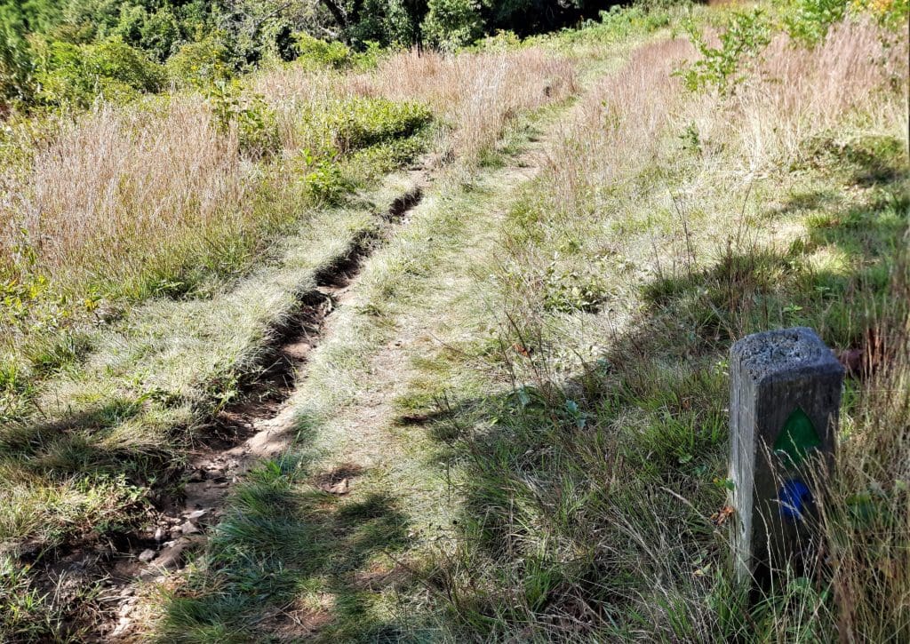
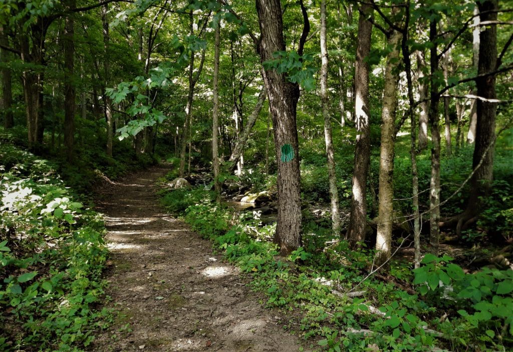
To avoid confusion, the major trails in the Rocky Knob area have blaze markings in different colors. (All connecting trails are blazed in red.)
Map of the Rocky Knob Trails near the Gorge overlook
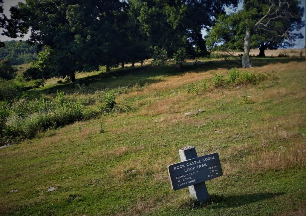
Rock Castle Gorge Trail
The Rock Castle Gorge Trail, blazed with green, is a moderate to strenuous loop – made up of three roughly equal parts:
One part follows the ridgeline at over 3,000ft with spectacular views,
One part follows Rock Castle Creek through a thickly forested hollow at 1,700ft, and
One part involves steep descending or climbing (depending on which way you go) to get between the two.
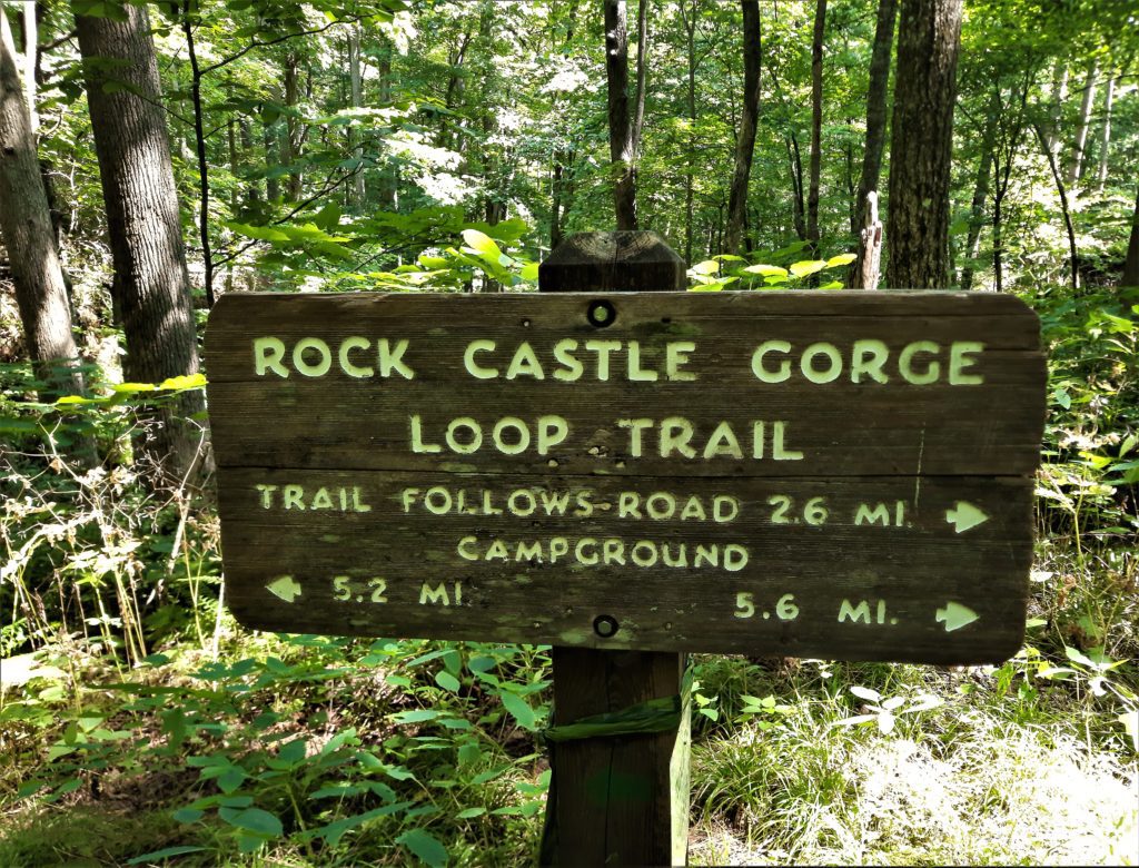
Trail sign about midway on the Rock Castle Gorge Loop
In 1984, the Rock Castle Gorge Loop Trail was designated a National Scenic Trail in recognition of its outstanding features.
There are multiple places to start this hike from any of the Rocky Knob Recreation Area overlooks to the left of the Blue Ridge Parkway, heading south.
Starting from the Saddle Overlook (going to the right) you get a short but steep climb to Rocky Knob first instead of having this be your last stretch – after already making a rugged 1,800ft climb out of the gorge.
We started the hike going left down the hill.
Or, to avoid doing the most strenuous uphill sections, hikers can begin at the Rocky Knob Campground and head (left) downhill toward Rock Castle Creek – and this is what we did.
Location – Rocky Knob Recreation Area, milepost 167, Blue Ridge Parkway near the Floyd-Patrick County line. It’s about 50 miles south of Roanoke, and just a few miles from Floyd.
Distance – 10.6 miles.
Elevation – From 3,572 ft at its highest point on Rocky Knob (near the Blue Ridge Parkway) to 1,700 ft at its lowest point in the Rock Castle Gorge (at the confluence of Rock Castle and Little Rock Castle Creeks.)
Along the Rock Castle Gorge Trail
We parked our cars right outside the Rocky Knob campground, just beyond the entry, to start the hike.
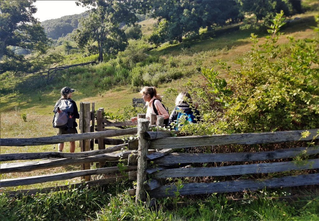
Go through a squeeze stile at the beginning of the hike.
Directly across the Parkway from the campground entrance, there’s a “squeeze” stile leading into a field. This is to keep the cows from wandering off, so don’t open any gates!
(The cows currently grazing alongside the road in Rocky Knob are part of a longstanding program of agricultural leases with the Park Service.)
You’ll see some trail signs, so you’ll know you’re in the right place 🙂
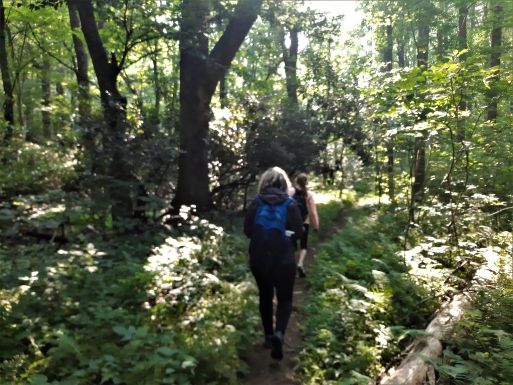
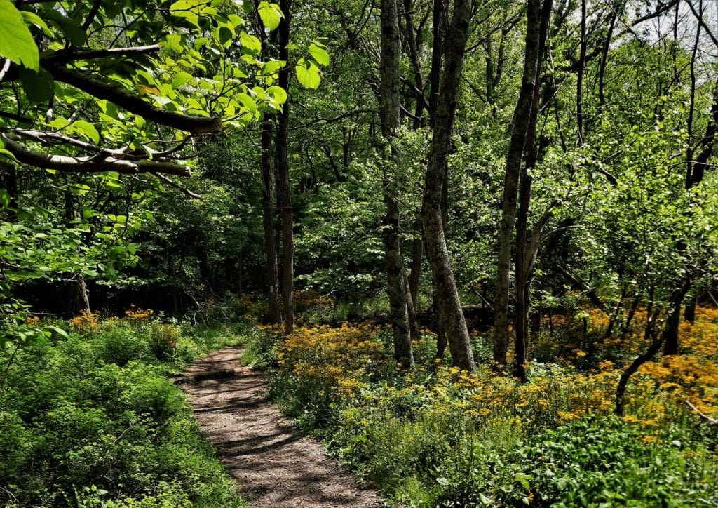
After crossing through, head left (following the green-blazes) through the grassy fields. You’ll descend this hillside, and pretty quickly find yourself heading into the woods.
The trail goes into the woods very quickly.
From the campground, the trail descends over 1,000 ft in 3 miles, passing through a cove hardwood forest of oaks, hickories, tulip trees, basswoods, maples, magnolias and a stand of bigtooth aspens.
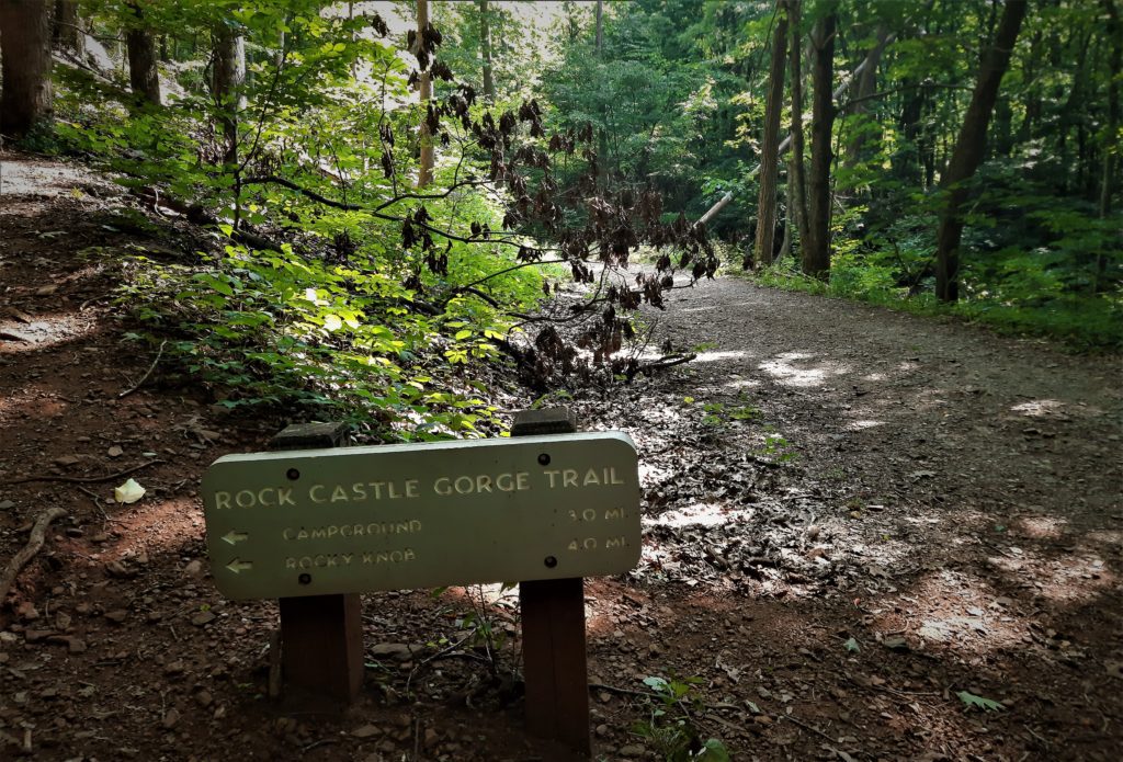
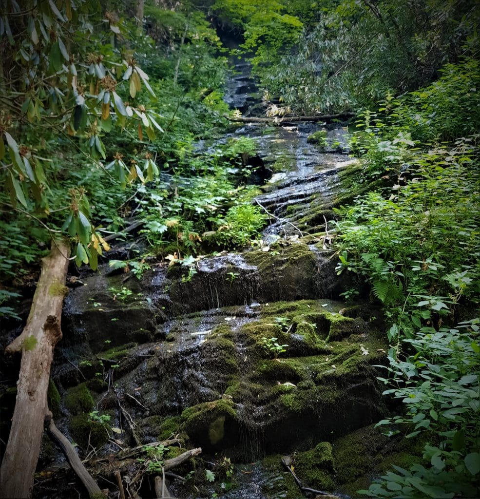
Next, we followed an old fire road that paralleled Rock Castle Creek, so the trail was wide and mostly level.
Intersection with the old fire road.
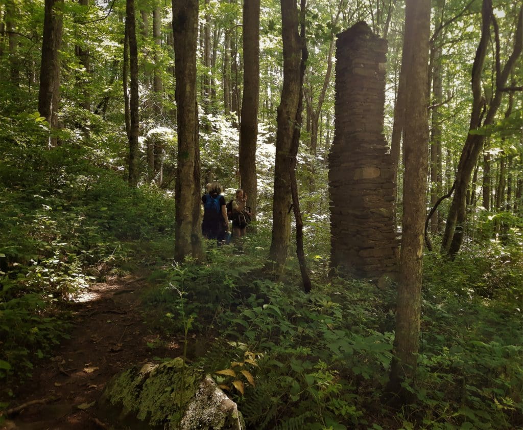
Within .5 mile, the road passes a back-country campground on the site of a former Civilian Conservation Corps complex. (You can camp there with a permit.)
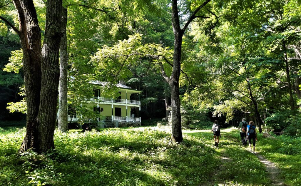
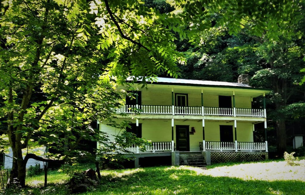
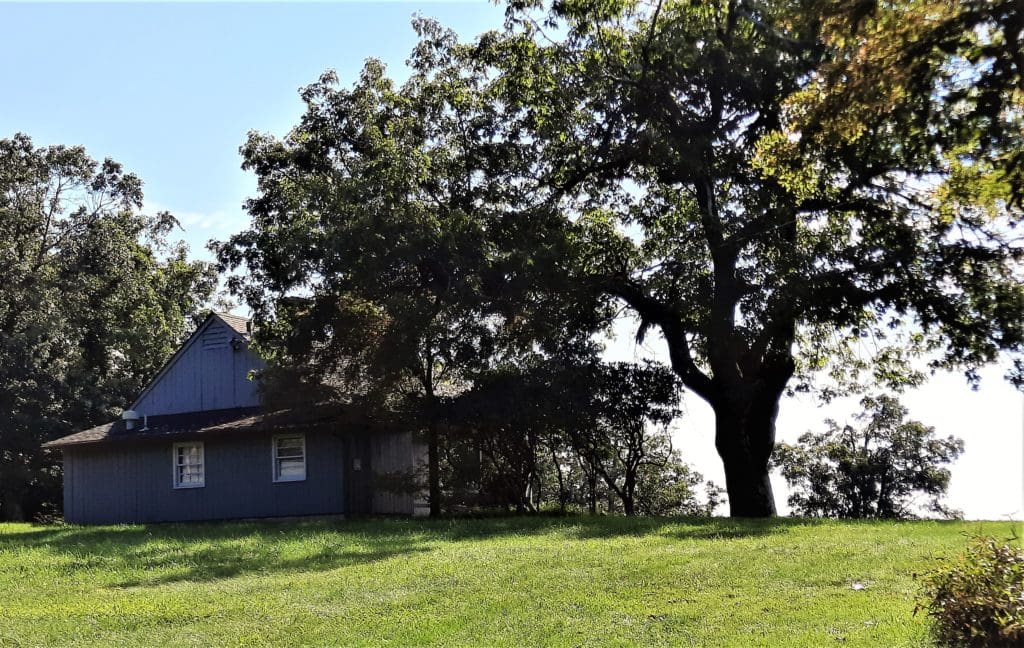
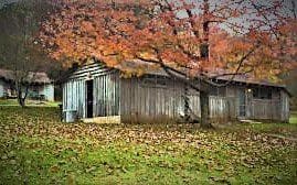
Continuing along the road, you’ll come to a large two-story white house on the left, known as the “Austin/Conner House”.
The house is privately owned, and is not open to the public.
You’ll soon come to the Austin/Conner House.
Unlike many structures you see along hiking trails, this one looks like it’s in pretty good shape.
The Austin/Conner House
The Austin/Conner house and surrounding acreage is the site of the first permanent home in the Gorge, and was occupied by descendants of original settlers until the mid 1950s.
P
Also known as the “White House” or the “Conner House,” it’s also the only house still standing inside the Gorge.
The current house, built by landowner Mac Conner in 1916, was the second house on this location.
The Austin/Connor house, originally built circa 1916.
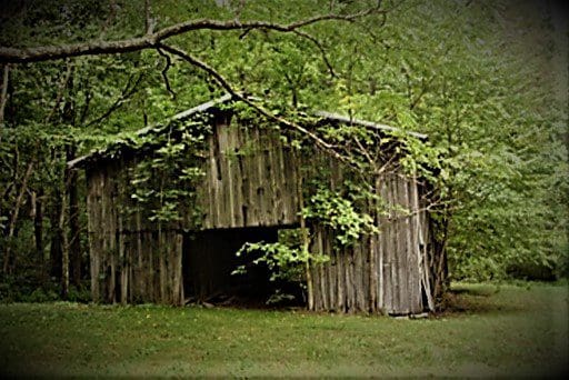
An earlier, smaller log cabin existed on the property about 75’ closer to the creek at the most current barn site.
P
This log cabin was built by Benjamin Belcher, who originally bought the property in 1839, and was temporarily vacated after his death in 1884.
Mac Conner obtained the property through marriage to Anna L. Belcher, Reed Belcher’s daughter (Benjamin’s granddaughter).
Conner moved to the Gorge by 1910 and lived in the cabin until the big house was finished in 1916. (The deed of trust was conveyed to Conner in 1925 after Reed Belcher’s death.)
In 1931, logs from Benjamin’s original cabin were used to build the barn, which is still standing.
The “White House” is a two and a half story house with eight rooms, two front porches one over the other.
P
It was never wired for electricity, but it did have a crank telephone by the 1930s. No other house in the Gorge had one.
The barn was built with logs from the original cabin.
John W. Austin, Jr. bought the property in 1954 from the Mac Conner heirs, renaming it “the Austin/Conner House” or just “the Austin House.”
With the exception of the Austin/Conner House, all land parcels in the Gorge were transferred to the Blue Ridge Parkway by 1938.
P
This house was considered the “finest” of the houses in the Gorge at the time of Parkway acquisition.
Owners and guests still occasionally host gatherings there.
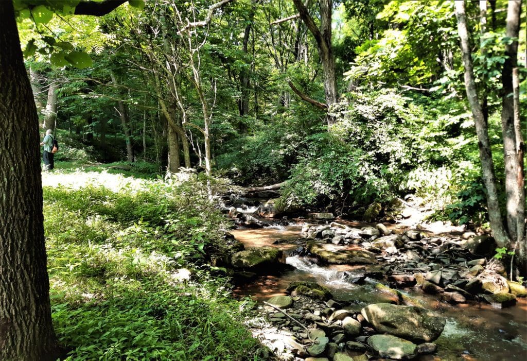
Creek flowing near the Austin/Conner house.
After steadily climbing beyond the Austin/Conner house, there are excellent views of the creek, 100 ft below.
For a while, the return climb doesn’t seem all that bad — a gradual rise up and above a small stream.
You’ll see Lethia Spring to your left as you cross a bridge at the headwaters of Rock Castle Creek, at the edge of what used to be Lethia Boyd’s property.
Lethia Spring is a Gorge landmark.
It became a landmark in the Gorge because when residents saw the Spring, they knew they were getting closer to the rim.
Up ahead, the climb becomes harder to ignore, scratching along rock ledges on a sometimes eroded footpath. (The Rock Castle Gorge Trail gains 875 feet in the next 1.5 miles.)
The views that open to your right and behind as you scramble along are breathtaking — and worth stopping to take a breath to see.
Turn right at the trail junction where the trail passes through a hardwood forest.
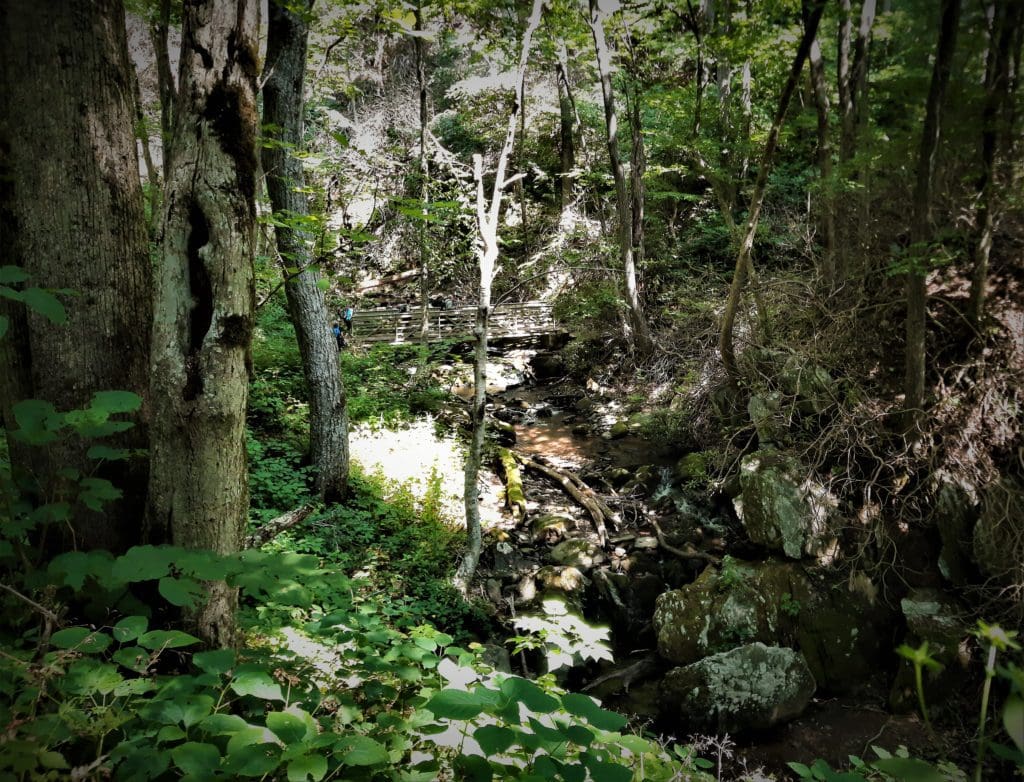
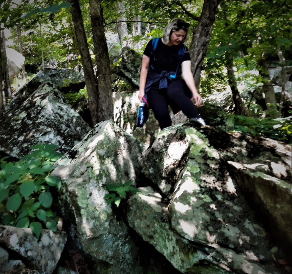
After .5 mile, the trail goes through an extensive boulder field, some chunks as big as houses, known as the Bear (or Bare) Rocks.
A bridge high above the rocks.
Bear rocks is a geological feature created by the faulting and fast erosion of Gorge walls. Their block shape, large size, and general stacked-up configuration created pockets that residents called “caves.”
Some said that when bears lived in the area, they used the caves for their dens.
We take a short break on Bear Rocks.
This impressive metamorphic rock structure was a gathering place for picnics, socials, and other Rock Castle Gorge community events before the Great Depression.
So, following tradition, we stopped at the Bear Rocks for a quick snack break 🙂
Stopping for a snack at Bear Rocks.
After the steep part, the trail makes several gradual rises back to the parkway.
Crossing the parkway leads to the Rocky Knob campground, but the Rock Castle Gorge Trail turns left for more climbing across a grassy hillside.
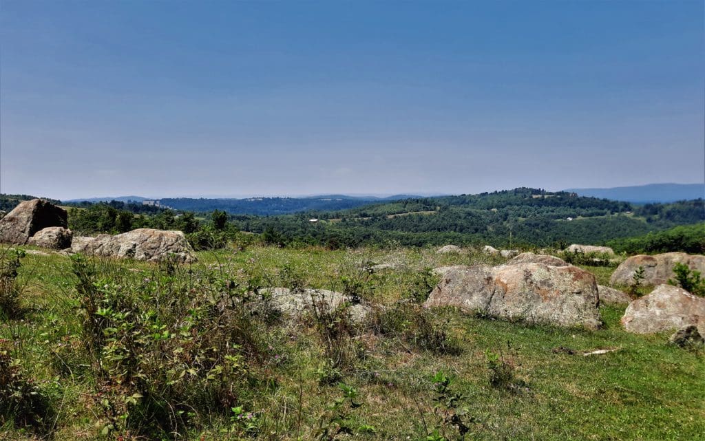
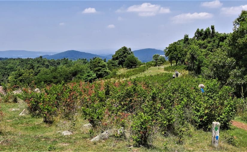
As you cross the grassy fields, you’ll see magnificent vistas west toward the lopsided hump of Buffalo Mountain and east toward the tamer hills and valleys of the Piedmont.
Following the Rock Castle Gorge trail on a grassy hillside.
If you hike the trail in Summer, you’ll also find a field of blackberries on the grassy hilltop.
We ate the ripe berries right off the bushes as we went along, giving the bears some competition 🙂
In days past, Gorge residents depended on foraging to supplement their income – and wild blackberries were gathered and sold, too.
Wild berries were growing on the hillside.
One resident noted that the berries used to sell for 30¢/lb. and that his father was able to pay for his 110 acre farm and build a framed house just using his proceeds from berries.
Play
When the trail goes through a stile into another wooded area, it’s less than a mile to the Saddle Overlook.
Crossing over another stile into the woods.
Because of the route we took, the Rocky Knob summit was at the last part of our hike.
We weren’t feeling it, so that day we just followed the trail straight back to the to the Overlooks, instead of going to the top.
Another view from the hike.
If you do want to continue to the top, just read the trail signs and follow the white blazes around the Knob.
The trail to Rocky Knob is narrow and steep, but you’ll be rewarded with outstanding views.
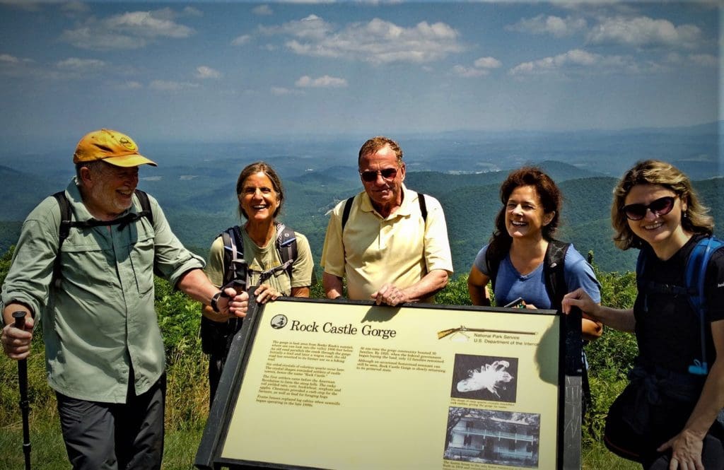
Happy hikers near the end of the hike!
The Rocky Knob trail is a loop, so just hop back on the green-blazed Rock Castle Gorge Trail when you come back down.
Follow the trail and finish your hike back by the Campground entrance where you started.
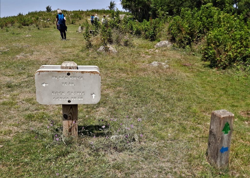
Hiking the Black Ridge Trail.
Black Ridge Trail
Distance – 3.0 miles
If the Rock Castle trail is a little too much for you, the Black Ridge Trail is only three miles and stays on top of the ridge throughout, following part of the course of the Rock Castle Gorge Trail.
The Black Ridge Trail, blazed with blue, is a moderate loop that conveniently starts and finishes at the Rocky Knob Visitor Center.
Passing through forest to a quiet gravel road, you’ll see good views to the north from atop Black Ridge, then cross the Parkway to join the Rock Castle Gorge Trail to return to the Visitor Center.
The Black Ridge Trail goes along part way with the Rock Castle Gorge Trail.
Rocky Knob Trail
Distance – 2.3 miles
If you just want a shorter hike or – like us – decided to save Rocky Knob for later, you can do it as a short, steep standalone hike.
Begin by parking your car outside the Rocky Knob campground entry, like we did for the Rock castle Gorge hike.
Cross the Parkway and go through the squeeze stile into the field, head right following the blazed posts. Go up the hillside. At .6 miles, you’ll come to another squeeze stile that leads into the woods.
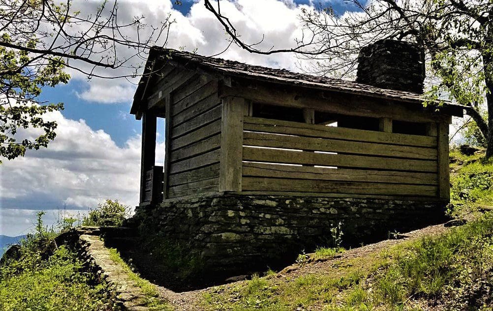
Old AT shelter on the Rocky Knob trail
At .75 miles, you’ll come out of the woods and reach the Saddle Overlook area. Keep going straight and go back into the woods. You’ll reach a junction shortly. (This is the beginning of the loop section of the trail.)
At 1.0 miles, you’ll reach the end of this trail, which leads to the Rocky Knob shelter. Head up the trail (north) just about 150 ft to the Rocky Knob overlook. Backtrack to the AT shelter to enjoy the views.
Take a Connector back to the green-blazed Rock Castle Gorge Trail (south), and pass by the Saddle Overlook to make your way back to your car.
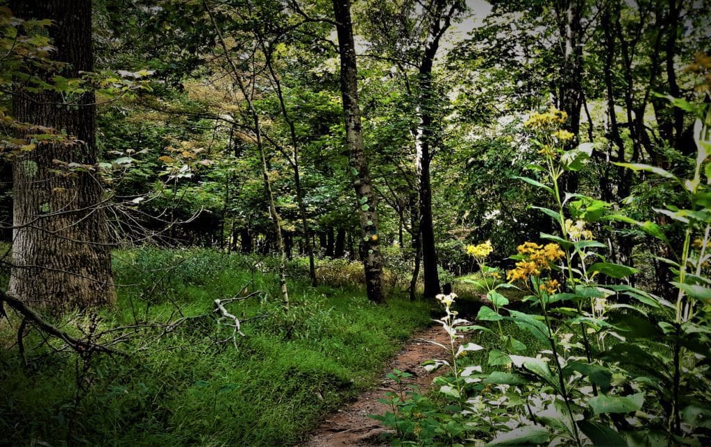
Flowers bloom along the yellow-blazed picnic area trail.
Picnic Area Trail
Distance -1.0 miles
The Rocky Knob Picnic Area Trail (yellow blaze) is an easy loop and offers a pleasant walk for the entire family through a mature forest of large oaks, ashes, hickories, Fraser magnolias, hemlocks, and other native trees and shrubs.
It starts from the Picnic area or the Visitor Center.
Mabry Mill is just down the road from the Rocky Knob Recreation Area.
Area Attractions
As long as you’re in the area, be sure to visit some of the other nearby attractions.
Fairy Stone SP, VA
Floyd, Virginia – home of Floydfest, the annual music festival – is only a few miles away and well worth a visit!
Fairy Stone State Park is also pretty close by – a Virginia State Park with cabins, camping, a big lake and hiking trails.
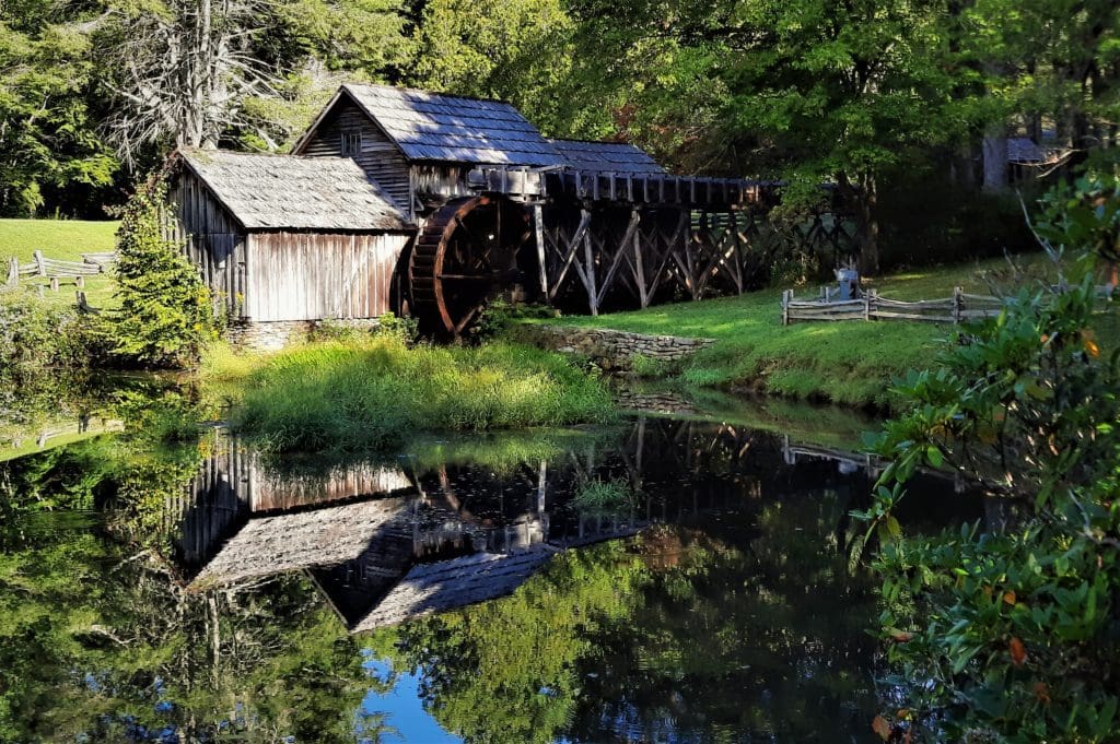
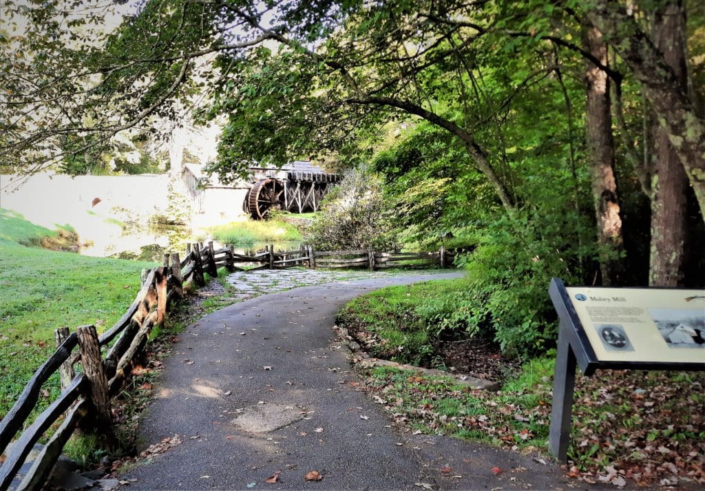
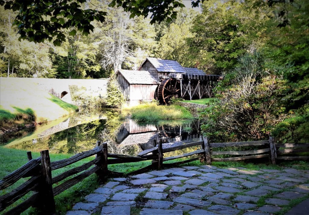
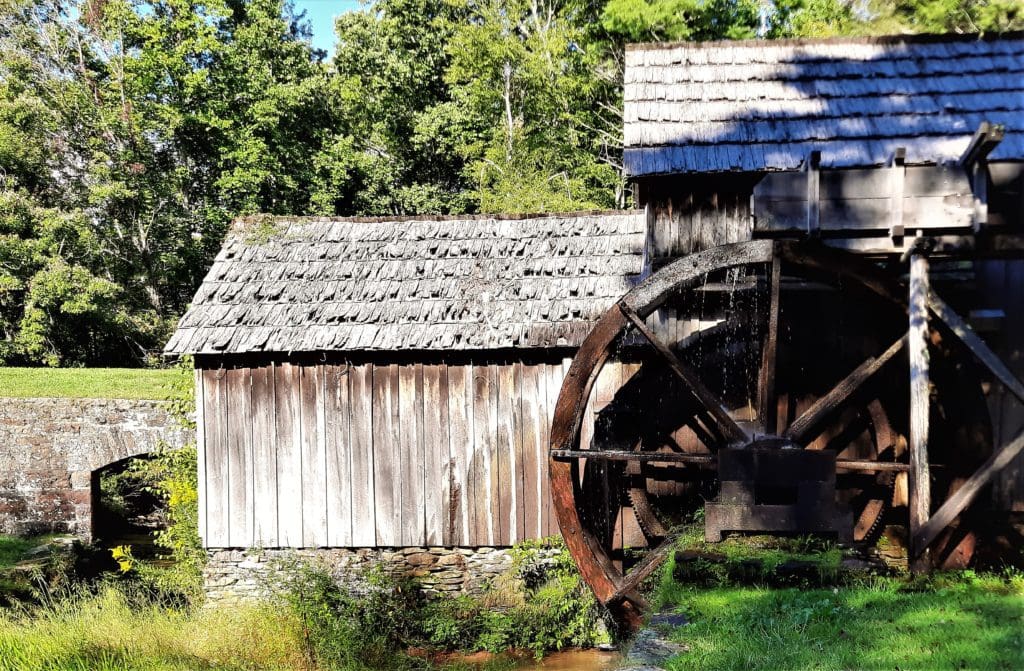
Mabry Mill – Just a short drive down the Parkway from Rocky Knob, you’ll find Mabry Mill , a very popular historic preservation site that includes a short hiking trail, and a gift shop and restaurant, too.
In fact, the mill is one of the most photographed places on the Parkway!
Oh, look – here’s a mill photo now:
Walkway to the photogenic Mabry Mill.
It makes a good stop for a leg-stretch – and maybe some pancakes! – on the way to or from Rocky Knob.
They’ve also been having Sunday afternoon music at the Mill for decades 🙂
I drove past it on my way to Rocky Knob on my first visit, and made a note to come back and check it out later. I’m glad I did!
So many Mabry Mill photos….
Mabry Mill
Mabry Mill is a watermill run by the National Park Service located at milepost 176.2, just 9 miles from Rocky Knob Visitors Center.
Originally constructed in 1905 by Ed and Lizzie Mabry, the mill was in operation by 1908 and many people in the region brought their corn in to be ground.
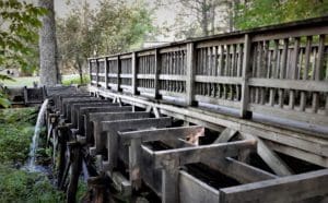
The mill was lacking water power, which made it a “slow mill”.
View of the water run for Mabry Mill.
But because of this, the mill couldn’t grind too fast and scorch the corn, which made the Mabry’s mill famous for producing some of the finest tasting corn meal in the region.
The National Park Service purchased the property from Lizzie after Ed Mabry passed away in 1938.
The mill was completely restored in 1942 and continues to educate visitors about the rich culture of Virginia’s Blue Ridge.
There’s also a short trail around the mill, connecting additional historical exhibits about life in rural Virginia.
Play
So, just when you thought you made it through one of my articles without a visit to Historyville…
P
That’s right! I’m about to go full History Geek and lay some historical info on you 🙂
If you don’t want to learn more, skip ahead! But if you do, read on…..
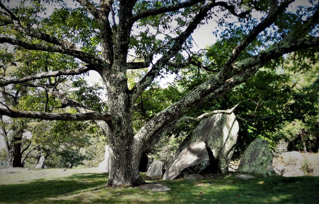
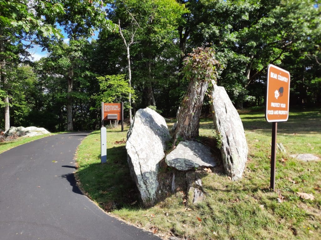
The tree and rocks near the Gorge overlook.
Rock Castle Gorge History
The Gorge is around 2,700 acres of the 4,000 acre Rocky Knob Recreation Area.
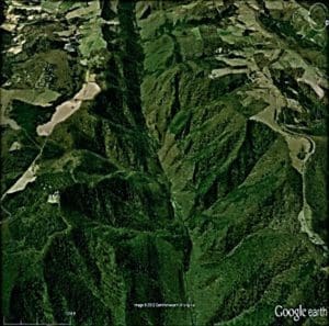
It’s a steep and narrow ravine created by Rock Castle Creek cutting into the Blue Ridge Escarpment over the past 250 million years.
Aerial view of the Gorge from Google Earth.
Walking through the dense forest of Rock Castle Gorge today, you could easily believe you’re the first one to walk in these woods.
But more than a century ago this land was filled with sounds of gristmills, sawmills, and wagon-loads of American chestnuts driving along Rock Castle Road.
Early settlers in the gorge found a virgin forest of huge hardwood trees, a fast-moving mountain stream that was one of the best trout streams in the region, plentiful wildlife, and fertile soil that would support the growth of apple trees and corn, among other things.
Through hard work and perseverance, the Gorge would eventually become home to hundreds of stalwart, rugged individuals who made their living primarily through subsistence farming, hunting wild game, foraging – especially Chestnuts and wild berries, and barter.
Over the years, the population of the gorge grew to 200+ residents spread among 30 families along the six miles of Rock Castle Creek.
There were three mills in the Gorge.
Eventually the Gorge was also home to two stores to purchase food and clothes, three mills, nearby churches, a schoolhouse, and even a distillery (prior to Prohibition).
But the Civil War was not kind to the Gorge, and the war’s aftermath wasn’t either.
Though there were no slaves within the community, the War took many of the strong young men to fight – at least one of them fought for both sides – and many of them didn’t return.
After the war, renegade soldiers stole livestock and stored goods, causing some people to give up farming and seek work and find homes elsewhere.
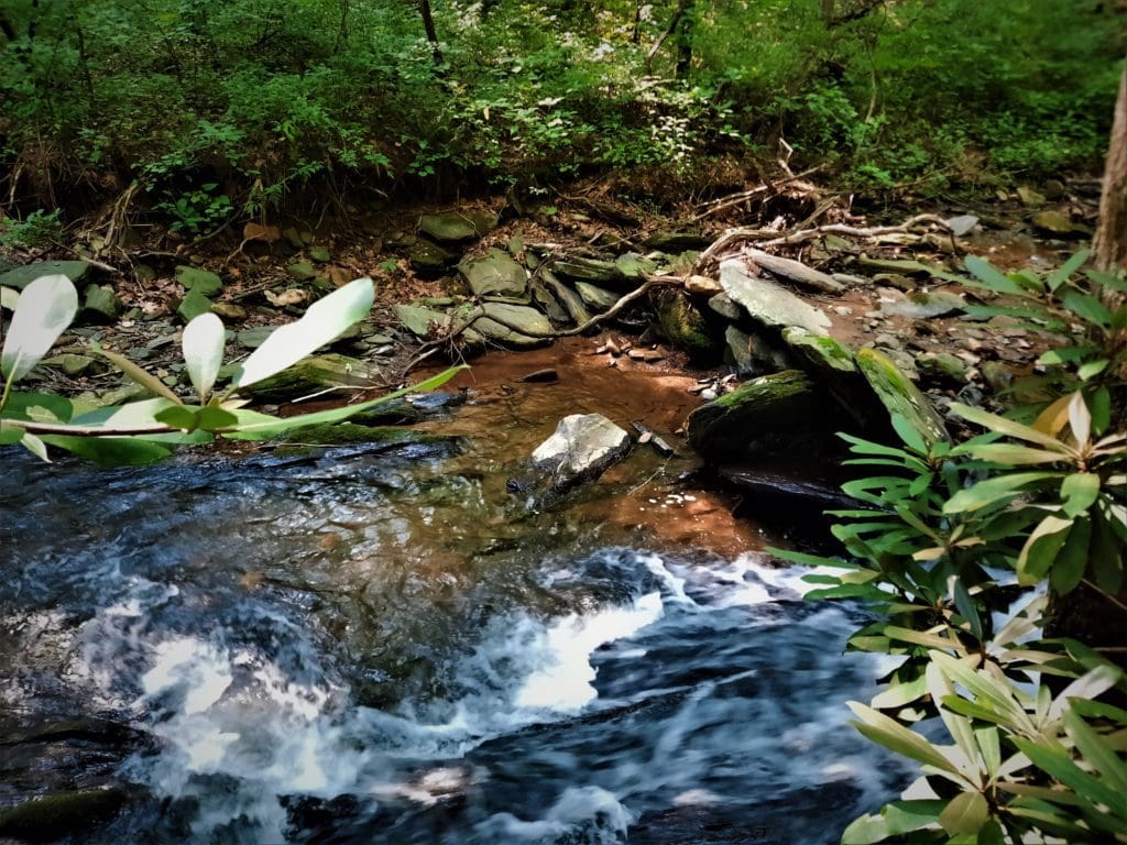
Cascades in the Gorge.
Later, the Chestnut blight removed even that source of income, and more people left, taking work elsewhere in textile mills and coal mines.
By the time of the Parkway land purchase in the 1930’s, only 11-12 families remained in the Gorge.
Since then, with the help of the National Park Service, Nature has reclaimed the Gorge.
But even while we enjoy Nature on our hikes, we can still see reminders – and spare a thought – for the hardy people who came before us and once made the Gorge their home.
Remnants of Gorge community homes still can be seen in the woods.
LJ has spent much of her free time as a single Mom – and now as an empty-nester – hiking in the US and around the world. She shares lessons learned from adventures both local and in exotic locations, and tips on how to be active with asthma, plus travel, gear, and hike planning advice for parents hiking with kids and beginners of all ages. Read more on the About page.
Published by
LJ
LJ has spent much of her free time as a single Mom - and now as an empty-nester - hiking in the US and around the world. She shares lessons learned from adventures both local and in exotic locations, and tips on how to be active with asthma, plus travel, gear, and hike planning advice for parents hiking with kids and beginners of all ages. Read more on the About page.
View all posts by LJ
Do you dream of a great hiking trip but aren’t sure where to go?
Need some practical tips on finding amazing trails locally and at adventure travel destinations?
I have a few ideas that might be perfect for you 🙂
Sign up to get new Idratherwalk.com articles in your inbox every month!
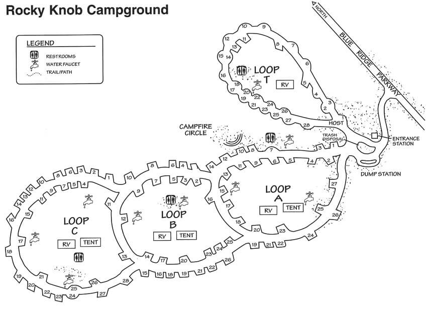 81 Tent Sites| 28 RV sites| 72 Picnic Sites