Most recently updated July 23rd, 2022
Estimated Reading Time: 13 minutes
I’ve been exploring and hiking on trails in North Carolina for more than 20 years, but one thing I’ve neglected – partly because they don’t have many long hiking trails – are the State Natural Areas.
Though not great for hiking North Carolina State Natural Areas are good for exploring nature and different habitats in a fairly small space.
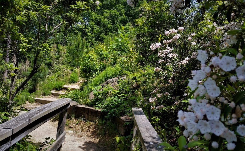
This kind of place can be an exciting outdoor adventure for small children, like your kids or grandkids.
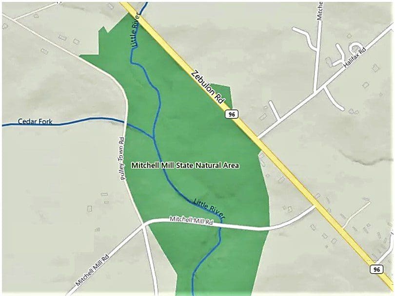
Mitchell Mill State Natural Area in Northern Wake County is one such very unique spot to explore.
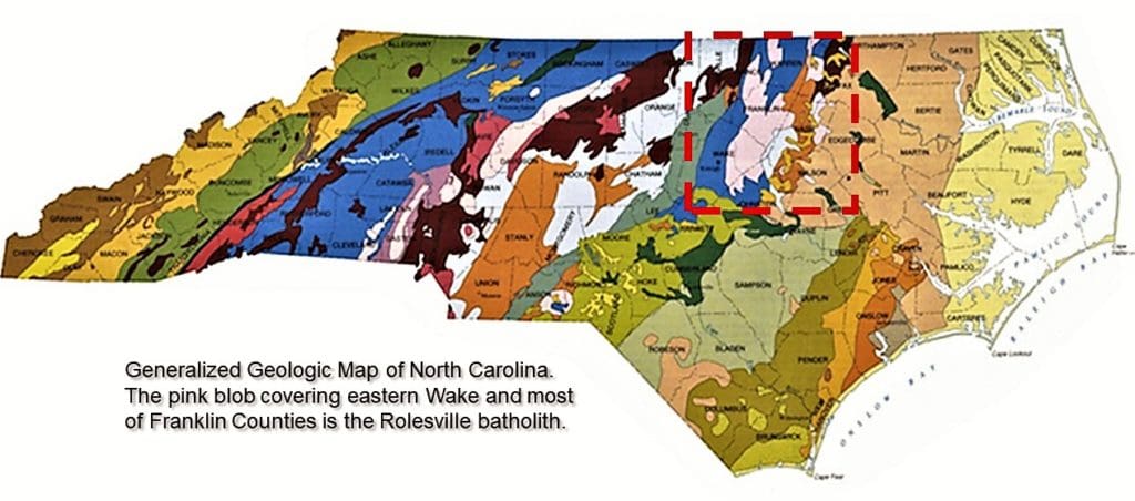
The 93-acre site is a Registered Heritage Area, and sits atop one of the largest granite domes on the east coast, called the Rolesville Batholith.
Mitchell Mill State Natural area protects this Paleozoic-era granite, and also houses a fragile and rare ecosystem, including native plant communities that can only grow in such a “granitic flatrock” environment.
Read more to learn how you can visit and explore this unique State Natural Area!
Some of my posts contain affiliate links. If you purchase through one of them, I will receive a small payment at no cost to you. See Disclosure Page in new window.
State Natural Areas
The main purpose of the State Natural Areas is to preserve areas of scientific value, so facilities are limited to what’s needed for environmental protection, and minimum area maintenance.
If you’ve lived in or visited North Carolina, you may have been to one of the State Natural areas and didn’t even know it.
I’ve been to few of them myself – usually in conjunction with a visit to a nearby State Park with hiking trails.
I plan to visit more, and maybe tell you all about them 😉
There are currently more than 20 State Natural Areas.
Like the State Parks and the State Trails, they can be found anywhere in North Carolina from the East Coast to the mountains in the farthest Western corner of the State.
If you visit, be aware that public use facilities that you might find at State Parks, such as camping, swimming, picnicking, and hiking, usually aren’t available in North Carolina State Natural Areas.
For instance, there are likely to be no restroom facilities. (There are none at Mitchell Mill SNA.)
State Natural Areas were established in North Carolina in 1963 with the creation of the first State Natural Area, Weymouth Woods, that same year.
Mitchell Mill State Natural Area in Wake County was established 13 years later, in 1976.
Read more about the State Natural Areas (opens in new window).
Mitchell Mill State Natural Area
The main thing that makes the Mitchell Mill State Natural Area so interesting is that it’s on top of the enormous slab of granite known as the Rolesville Batholith.
I first heard about the Rolesville Batholith from one of my hiking friends – and at first it was interesting just because I liked to say “batholith” 😉
But after some research, I realized just how special it is!
At most other parks in the area, you’re walking on grass, mulch, or dirt; for the majority of Mitchell Mill, you’re walking on stone.
Specifically, at Mitchell Mill SNA, you’re walking on 300 Million-year-old granite!!
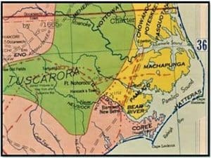
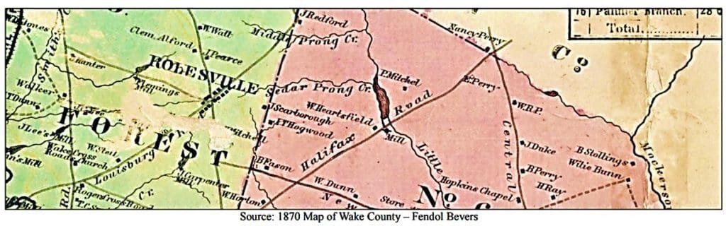
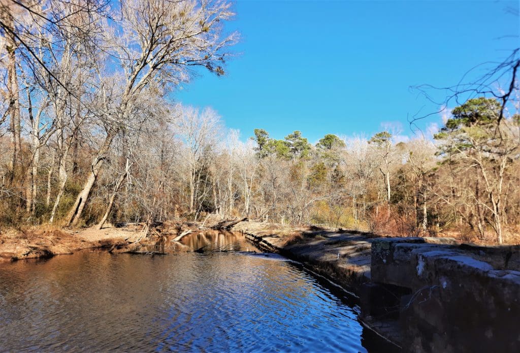
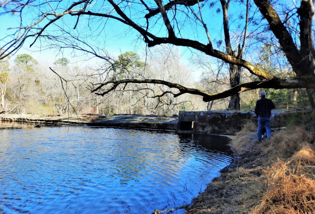
Besides the Batholith, the other thing that makes the Mitchell Mill SNA interesting is it’s namesake mill and historic community.
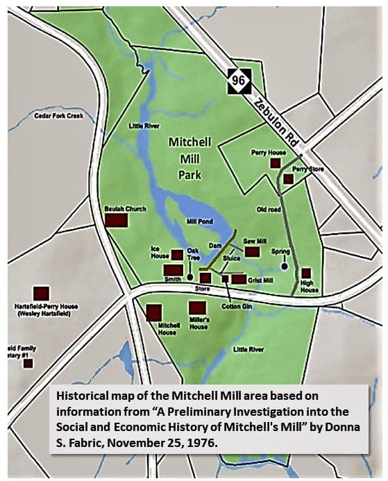
In the map above, you can see what the area looked like when it was an active mill community.
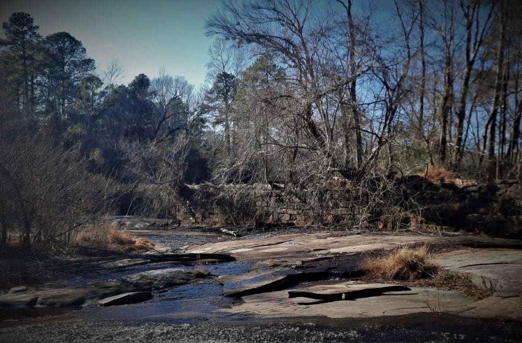
Today, the buildings are all gone, but you can still see remnants of the dam wall.
Mitchell Mill History
Once known as “Hartsville”, Mitchell Mill State Natural Area was at the heart of a thriving community.
Complete with a grist mill, saw mill, general store, blacksmith, church, and school, it was a center of commerce in this portion of Wake County.
Local farmers would bring their wheat, corn or barley to the mill to have it processed.
Many folks would gather at the general store to buy tools or food, or just to chat about what was happening in the community.
The people who lived there at that time helped shape surrounding communities like Louisburg and Rolesville, as well as other towns in Wake and Franklin Counties.
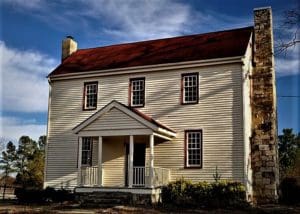
Of the five original residences used by the former owners, only two remain.
Both houses are still in use and privately owned, and are listed on the National Register of Historic Places.
The North Carolina Division of Parks and Recreation received the bulk of Mitchell Mill State Natural Area through a purchase from the Martin Marietta Corporation in 1976.
Several smaller sections were added from private landowners in the late 1980’s.
Area History
300 years ago the area where Mitchell Mill State Natural Area sits was the territory of the Tuscarora Indians – once one of the largest bands of Native Americans in the British colony.
For years the Tuscarora had been subjected to forced expansion into their territory as well as poor treatment by European traders.
When German and Swiss immigrants founded the town of New Bern along the banks of the Neuse River, this was the last straw for the Tuscarora.
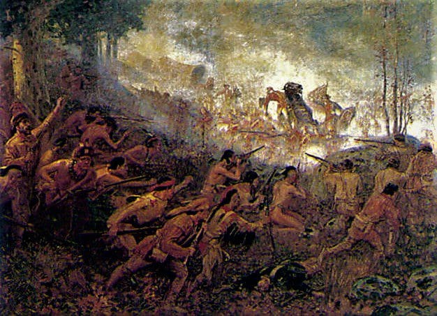
In September 1711, the Tuscarora attacked New Bern. Hundreds of settlers were killed and many homes and fields were burned.
These acts launched the Tuscarora War, and fighting continued for almost 2 years.
Then in March 1713, armed militiamen and allied Yamasee Indians met the Tuscarora at their stronghold of Fort Neoheroka (located near present day Snow Hill in Greene County).
This army laid siege to the Fort for 3 days until the Tuscarora were defeated.
Those that survived (around 950 people) were captured and sold into slavery. Many of the remaining Tuscarora fled North Carolina.
After the Tuscarora left North Carolina, many settlers moved into the area.
Much of the former Tuscarora territory, located in present day Wake and Franklin counties, was settled by a man named Osborn Jeffreys (1715-1793).
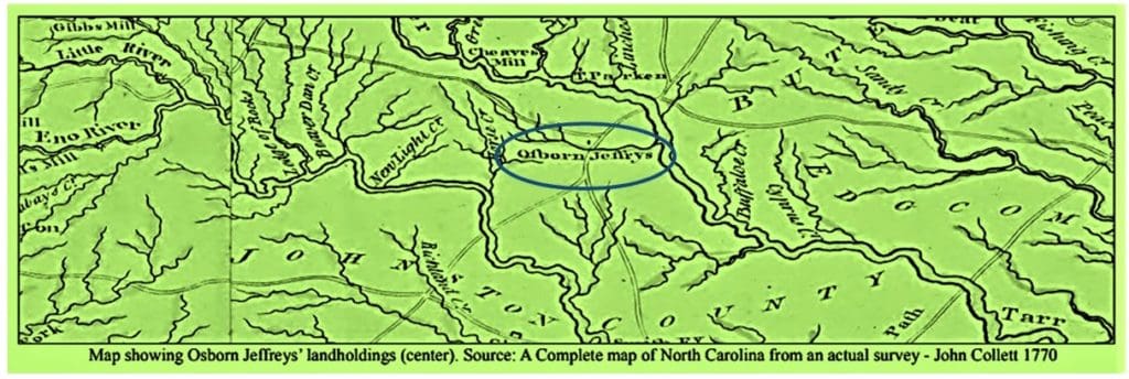
Osborn Jeffreys was the first colonist known to own the land that later became Hartsville, Mitchell Mill, and finally the Mitchell Mill State Natural Area.
Read more detail of the early Mitchell Mill history here: Mitchell Mill History (pdf ).
The Park Location
Incorporated in 1837, Rolesville is the second oldest town in Wake County. Raleigh, incorporated in 1792, is the oldest city in the County.
Back in the 1800s, farming was the main occupation in the area, and even today there are still many family-owned farms around Rolesville.
One strange thing to note about Rolesville as a town incorporated in the 1800’s: there’s no water in town. It’s not built on a river, or near any natural lakes.

A birds-eye view of modern Rolesville, NC clearly shows it is a town in transition, with working farms and sprawling subdivisions side-by-side.
There are a couple of creeks running through it – like Sanford Creek – but Rolesville was apparently built primarily as a mill town.
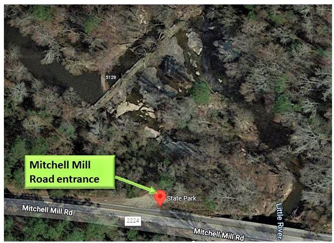
Finding The Park Entrance
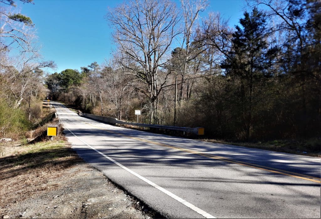
Getting to the general area of the Mitchell Mill SNA is pretty easy (just think Rolesville-ish), but you won’t be able to find it by just driving by.
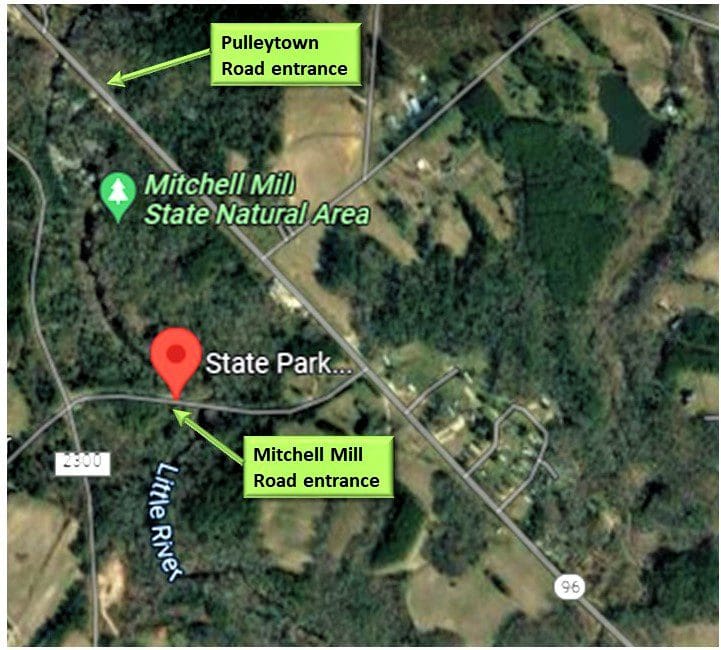
The tract is situated in Little River Township in Eastern Wake County near the intersection of Mitchell Mill Rd. (S.R. 2224) and Zebulon Rd. (NC 96).
You can get into the Park by 2 different entrances – one off of Mitchell Mill Road, and another off of Pulley Town Road.
That said, there is no parking lot or any real sign showing that this is a state park at either entrance.
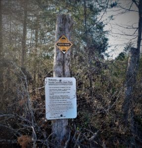
All you’ll see is a small dirt pull-off where a couple of cars can park on the side of the road.
At both entrances, you need to look for a small gravel shoulder and a yellow diamond sign with a white rectangular sign.
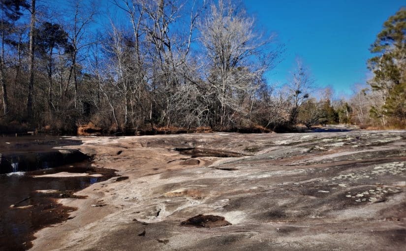
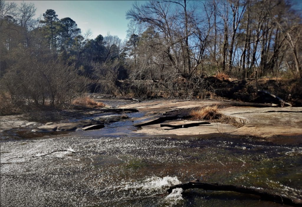
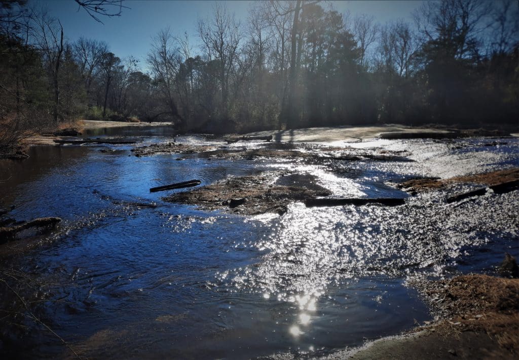
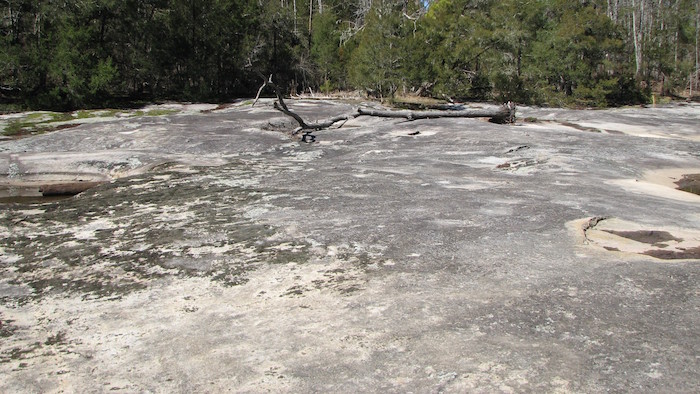
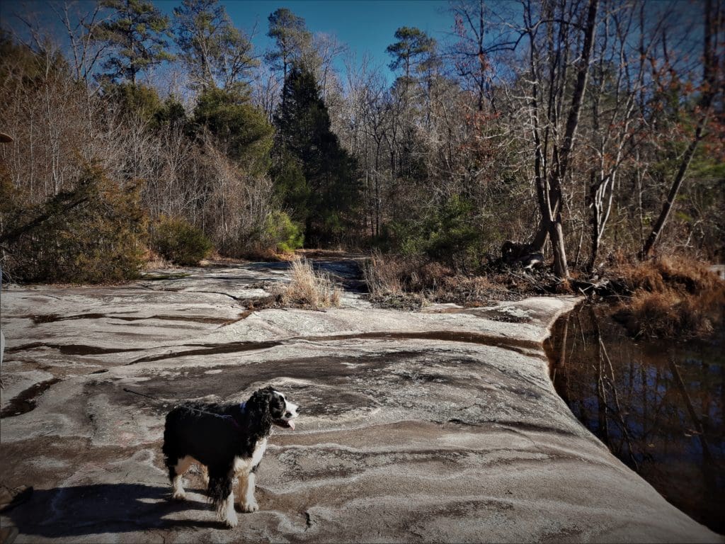
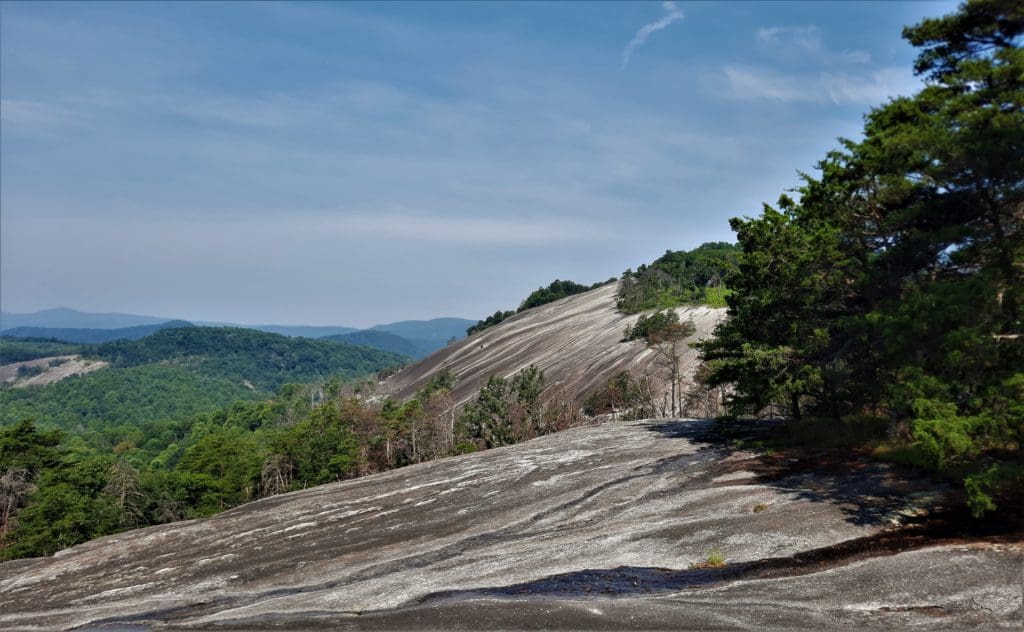
When you enter this park, you are approaching one of the largest naturally exposed outcrops of granite in North Carolina.
Such a large granite outcropping in a horizontal orientation is called a “pavement”, but please don’t try to drive on to it!
Also, since this park is such a natural, untouched area you’ll want to cover yourself in bug spray before you visit!
Inside the Park
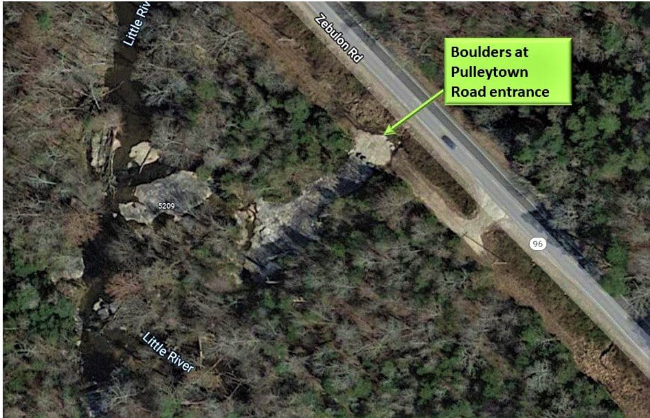
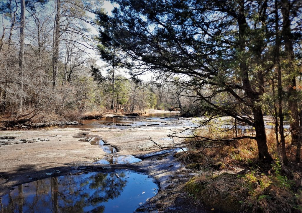
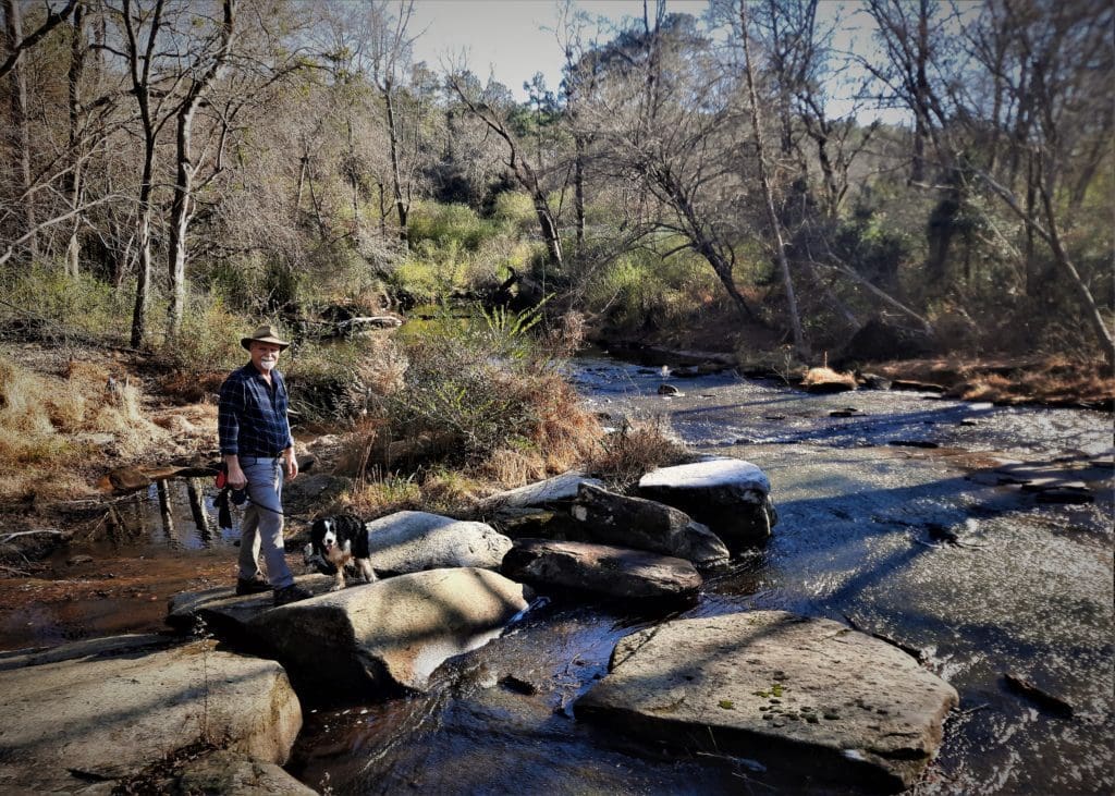
At the Pulleytown Road access, there’s a space to pull off the road on the right.
Park here and follow the path by the big blocks of rock.
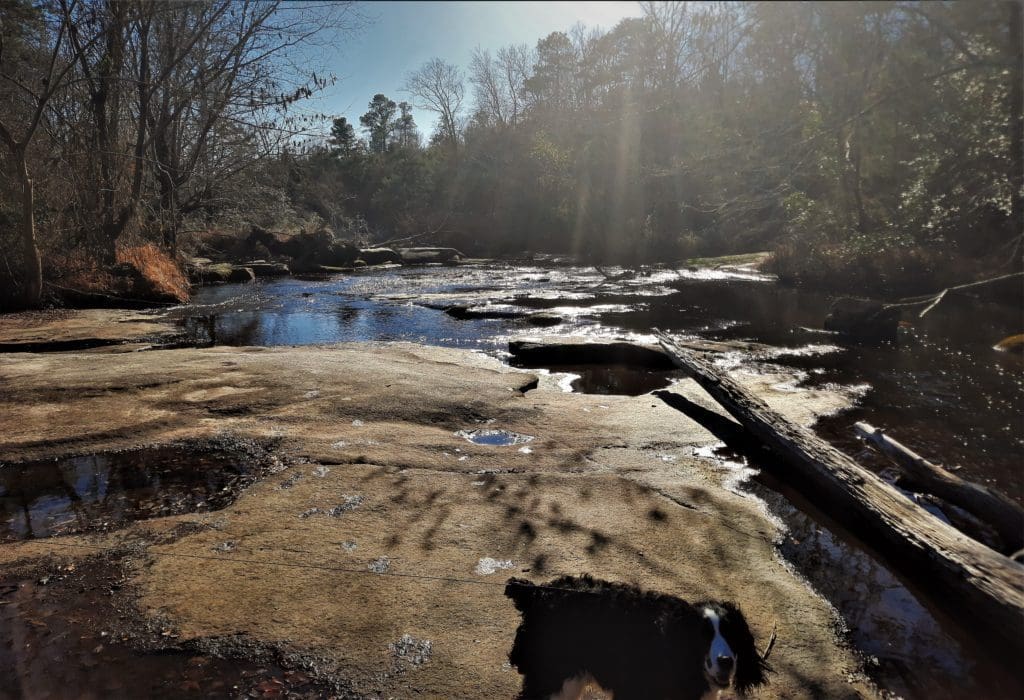
You’ll see an extensive exposure of granite.
From this exposure, follow the trail from the back corner (it’s less than .10 miles), near more blocks, and you will come to an even larger expanse of granite.
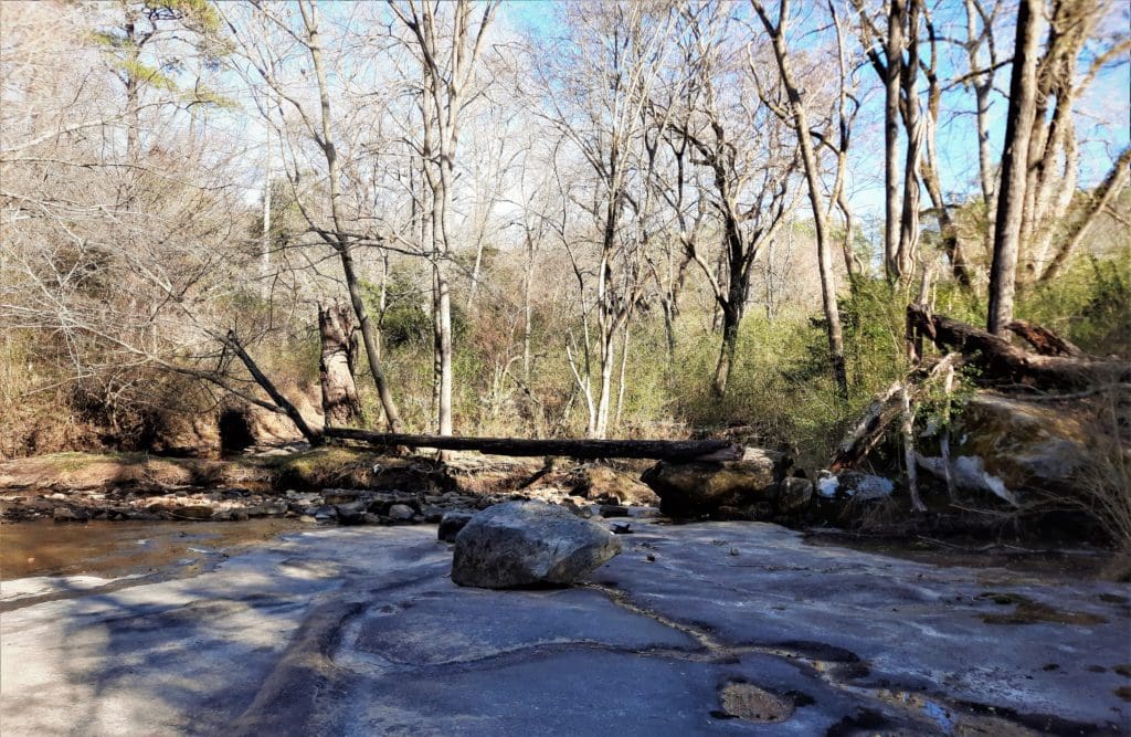
The Mitchell Mill Road entrance has the remnants of the old mill wall, which is pretty much the photo you’ll see when you Google “Mitchell Mill”.
Just follow a short trail to the Mill wall, and from there to the accessible parts of the granite flatrock face.
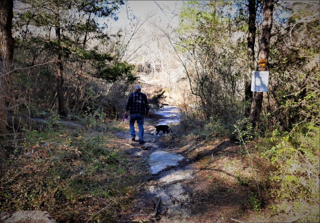
This area is actually fairly small. The Pulley Town Road entrance offers much more area to explore, and even a couple of short trails.
If there’s water at either entrance, you may get wet trying to get in, and the rocks may be moss-covered and slippery.
We were just in hiking boots – but their grippy soles made it easier to cross areas of the granite that were under water.
But because there’s a lot of water that flows by on top of the granite, in warmer weather you may want water shoes for this adventure, especially for the little ones.
One last tip: Bring your sunblock! There wasn’t a lot of shade out on the rocks.
Also, the Park Service has not been entirely successful in their renovation efforts, so keep an eye out for garbage and/or glass.
Go For It!
You can’t be very goal oriented in this Park – you’re not going to log a lot of miles. It’s more about discovery.
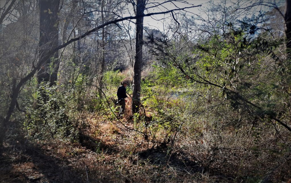
There are no real hiking trails to speak of, just some overgrown paths between the areas.
Just get in there and poke around 🙂
Basically, you can explore the rocks, the pools, and the Mill remains.
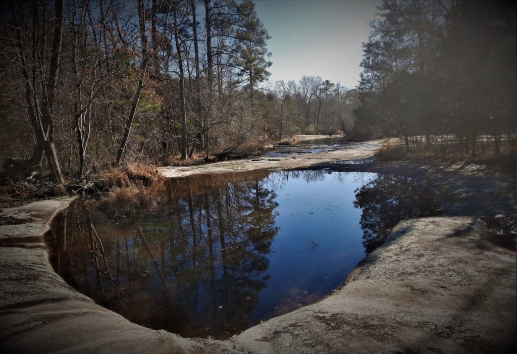
Ephemeral Pools
We visited Mitchell Mill twice – once from each entrance – on warm days in December and February.
I think it may have been easier to explore in Winter with less tangled greenery to deal with, but in warmer months, you’ll see more wildlife – especially in the ephemeral pools.
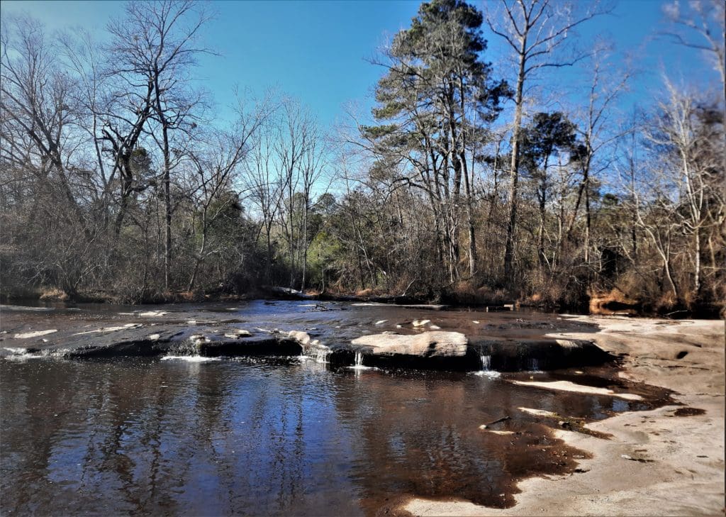
When you’re walking around Mitchell Mill SNA, the main rock underfoot is medium-grained biotite granite forming a “flatrock”.
Mitchell Mill State Natural Area granite flatrock
Most granite flatrocks are very small, usually only a few acres at most, but Mitchell Mill State Natural Area has almost 20 acres of exposed granite.
Over the years, running water has eroded the exposed stone.
One of the more interesting results of this erosion are the ephemeral pools you’ll see at the Pulley Town Road entrance.
These pools fill with water when it rains and can be home to salamanders, frogs, crayfish and other tiny critters.
Each pool has their own little eco-system – separate from each other but all containing some kind of life.
They’re also home to a gazillion tadpoles in the Spring and early Summer.
The pools formed over time as the result of small pebbles getting caught in a crack, then acting as a “drill bit” when swirled into a pothole by fast-moving water.
Sometimes potholes line up along a fracture in the granite.
Erosion by running water goes very slowly here, due to the resistance of this hard rock, but eventually the granite breaks down into quartz sand and clay.
Rare Plant Life
Granite flatrocks and domes have been around long enough that some plants have adapted to live only in these harsh environments.
Mitchell Mill SNA contains some of the best examples of native plant communities that only grow in such a “granitic flatrock” environment.
This Park is home to rare plants such as the Narrow-leaf Blue Curl, Elf Orpine, and the Neuse River Water Dog, which is only found along the banks of the Neuse River.
The plants are rare because this kind of habitat is so hard to find.
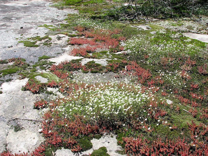
Elf Orpine and Appalachian Sandwort (white bloom)
In the 1970s, Mitchell Mill SNA was a regular field trip for biology classes to study the ecological process of primary succession – that is, the sequence of fungal and plant life colonizing a previously lifeless area.
A good example of Primary Succession is the colonization of bare rock:
-
-
- First by lichens and mosses,
- Then more advanced vascular plants, and
- Eventually woody plants.
-
You can find all of these kinds of plants colonizing the rocks at Mitchell Mill SNA.
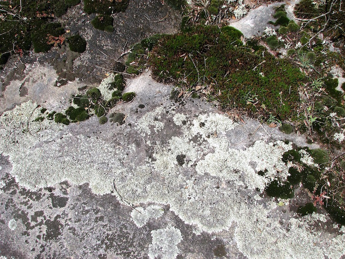
Lichens and mosses are the first to grow on the bare granite
A mature plant community above the rock surface can get set back to “zero” very quickly by wind or water events that strip the plants off the bare rock.
The Little River does this periodically at Mitchell Mill State Natural Area, with heavy rainfall and flooding that strips the plant life – and then the process starts all over again.
The granite you see at the park is part of one of the largest granite domes on the east coast, called the Rolesville Batholith.
The Rolesville Batholith
The magma that eventually became the Rolesville Batholith was generated during the collision of the ancient African continent with ancient North America, during the formation of the supercontinent Pangea approximately 300 million years ago.
The magma cooled underground and probably never reached the surface at the time.

Weathering and erosion of the overlying rock eventually exposed the granite body that we see now in the Mitchell Mill State Natural Area.
Today, the Rolesville Batholith is actually around 30 miles long, 13 miles wide, and 40,000-60,000 feet deep.
It’s the largest body of granite in the southern Appalachian region and occupies the eastern third of Wake County, and about two-thirds of Franklin County, from north of Henderson to south of Clayton.
It’s also probably why Eastern Wake county didn’t really feel the 5.1 magnitude earthquake in 2020!
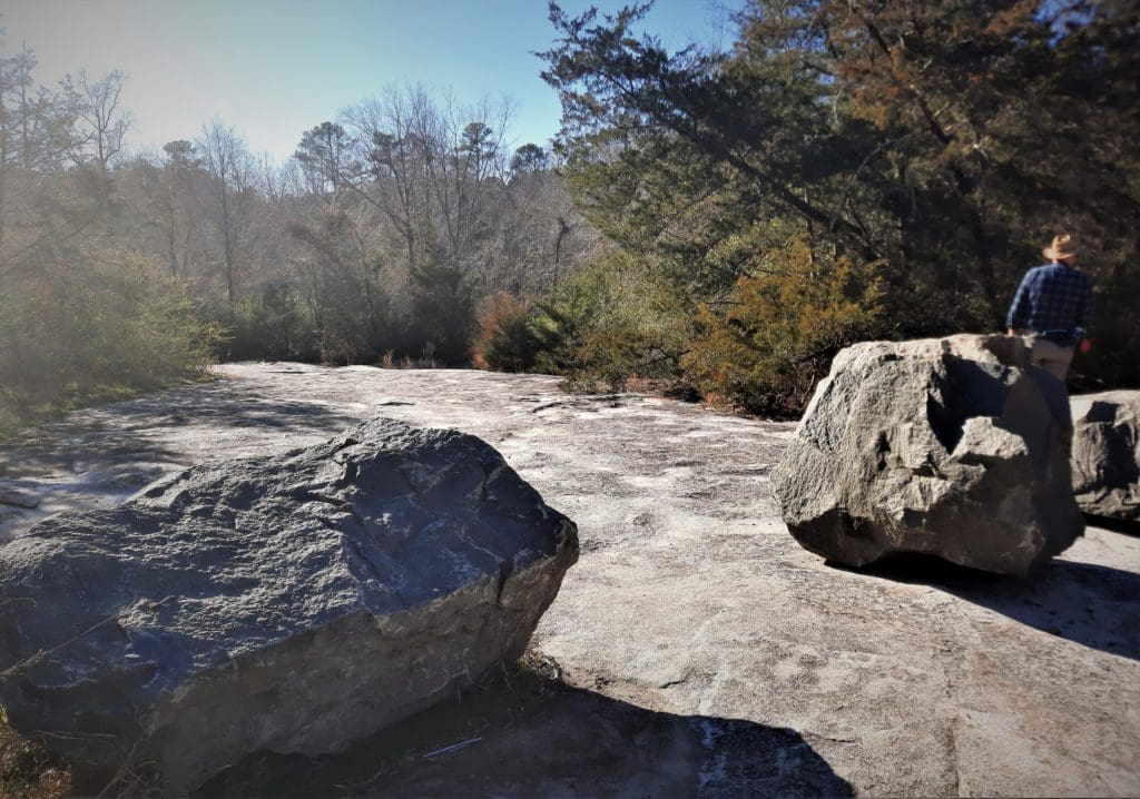
Even western Johnston County is over the southeastern edge of this granite body, and you can see large granite boulders in scattered locations in nearby woods.
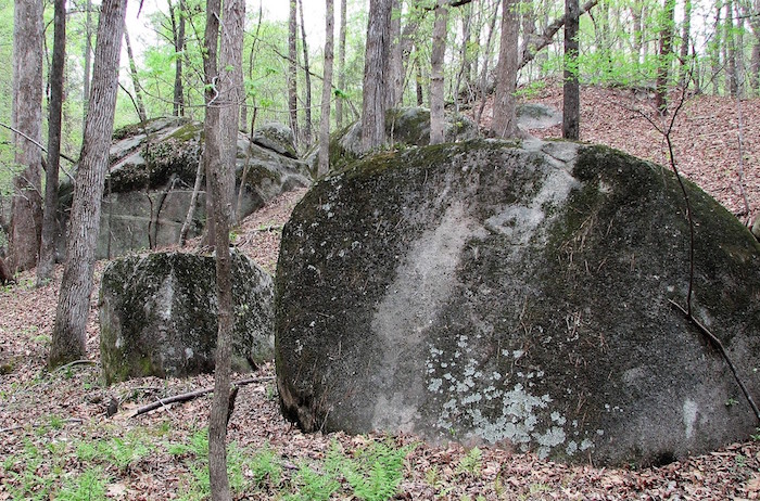
Boulders in Johnston County woods
Bonus Geology Stuff
I’m about to go all “Geology Geek” for a while, so if you don’t want to learn this very interesting stuff, just scroll on by 😉
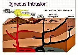
What’s a Batholith?
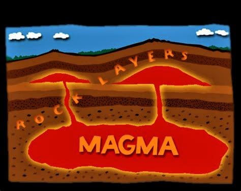
A batholith (from Ancient Greek bathos ‘depth’, and lithos ‘rock’) is a large mass of intrusive igneous rock (also called plutonic rock), larger than 40 square miles, that forms from cooled magma deep in Earth’s crust.
Although they may appear uniform, batholiths are composed of multiple masses, or plutons.
Batholiths are almost always made mostly of rock types such as granite, quartz monzonite, or diorite.
Individual plutons are solidified from magma that has traveled toward the surface from near the base of the Earth’s crust.
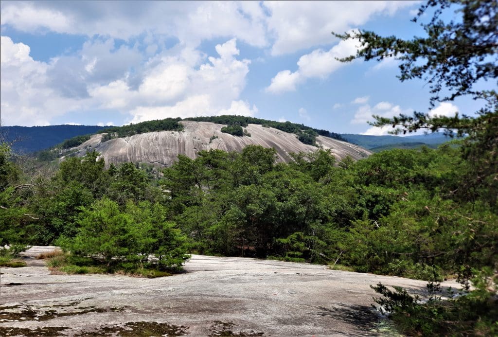
For example, the dome at Stone Mountain State Park is part of a 25-square-mile pluton.
Stone Mountain’s dome is the largest plutonic monadnock in North Carolina, made of light gray granite developed from magma several miles deep in the earth.
A monadnock is a rocky mass or small mountain that stands isolated in an essentially level area.
A pluton is a body of igneous rock formed below the earth’s surface by the consolidation of molten rock.
A Batholith is a composed of multiple plutons.
As erosion removed the overlying rock, the release in pressure caused the mass of Stone Mountain to move upward sometime during the mid-Paleozoic era, ~200 million years ago. (100 million years after the formation of the Rolesville Batholith.)
Batholiths exposed at the surface experience huge pressure differences between their previous location deep in the earth and their new location at the surface.

This results in a form of weathering called “exfoliation”.
This form of weathering causes thin sheets of rock to slough off the exposed surfaces of batholiths, resulting in fairly clean and rounded rock faces.
A well-known result of this process is Half Dome in Yosemite Valley.
The Rolesville Batholith is the largest pluton in the southern Appalachians – and you’re seeing only a fraction of it at Mitchell Mill.
The Rolesville batholith is actually 10-20 separate plutons that intruded the same region, cutting across each other and coalescing to form the batholith.
These rocks represent an early stage in the Alleghenian Mountain building event, which was a stage in the formation of the Appalachian mountains.
Nearby Trails
I hope this post has inspired you to explore Mitchell Mill State Natural Area and try some new hikes in the area!
If you’re interested in pre-historic plutons, but with more hiking trails, read about how to visit Stone Mountain State Park .
If you have a question drop me an email and I’ll reply as soon as I can.
Thanks for stopping by – see you next time! LJ
To Get New Idratherwalk Posts
sent directly to your inbox (how convenient!) Click this Button
If you like this post, please share it!

LJ has spent much of her free time as a single Mom – and now as an empty-nester – hiking in the US and around the world. She shares lessons learned from adventures both local and in exotic locations, and tips on how to be active with asthma, plus travel, gear, and hike planning advice for parents hiking with kids and beginners of all ages. Read more on the About page.