Hike the Mountains to Sea Trail at Rolling View in Falls Lake

Most recently updated September 21st, 2025

Estimated Reading Time: 11.5 minutes

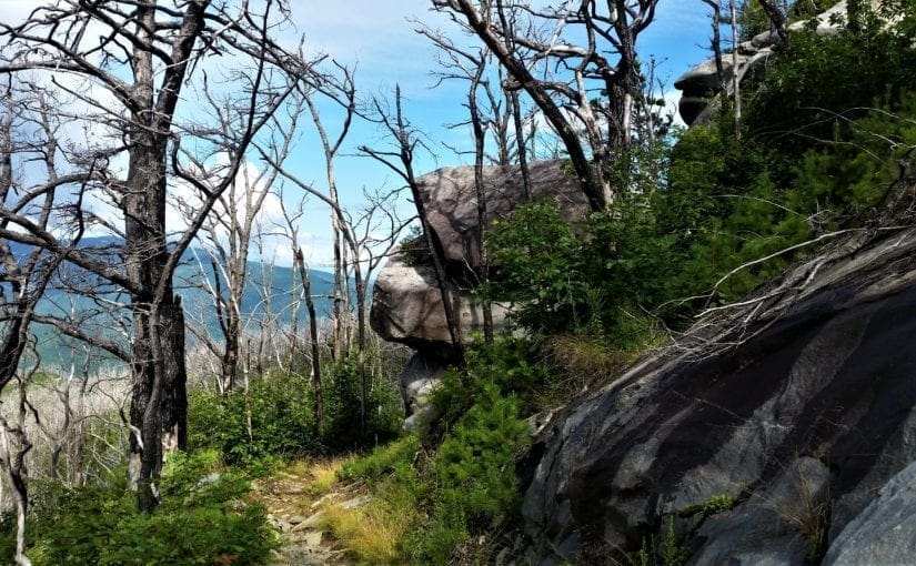
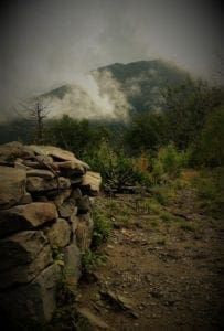
The Mountains to Sea Trail (MST) runs through or very near areas of North Carolina that were hardest hit by Hurricane Helene.

The Falls Lake section of the MST is open, along with many other NC State Parks and trails in the Eastern part of the State.  That said, Parks and the MST on the Western side of the State have been damaged and may be inaccessible. 

Go to my Hurricane Helene page to get the latest updates on the latest area Park, Trail and road repairs before you travel. 

Mists rise from the mountains after a summer rain.
Smoky Mountains get their name from the mist that settles in the valleys.

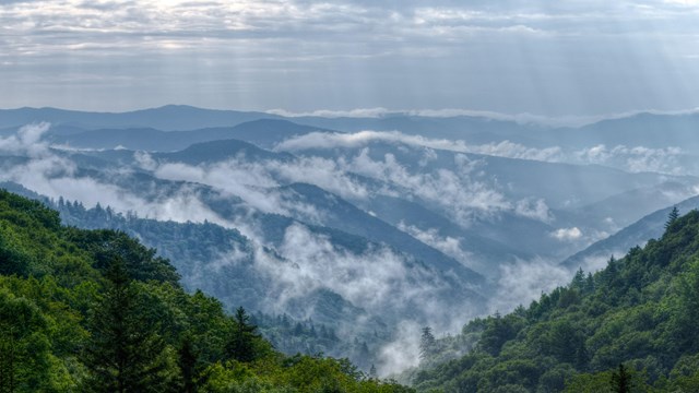
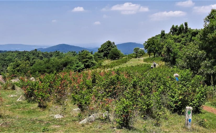
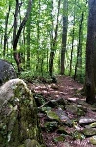
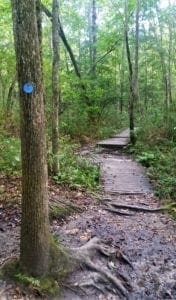
The Mountains-to-Sea-Trail (MST) is a simple hiking trail that spans almost 1200 miles across North Carolina, from the Great Smoky Mountains in the West to the Outer Banks on the East Coast.

Even though I’ve known about the MST for a good while, I didn’t really start hiking it on purpose until this past year.

MST Day Hike #22 in Winter.

Lately more and more people have been moving to my local area, and the easy-to-get-to hiking trails have become really crowded – especially on the weekends.

So I’ve had to look a little bit farther away for new trails – and that’s how I started paying more attention to the MST.

As of January 2019, 669 miles of the trail were completed, and even  more have been done since then.

The MST across North Carolina.

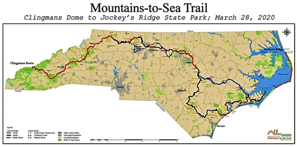
That’s just over half of the planned MST miles that are now completed in multiple segments across the state!

With temporary routes (for the unfinished parts of the MST) on backroads and bicycle paths, hikers can now follow the MST all the way  across North Carolina.

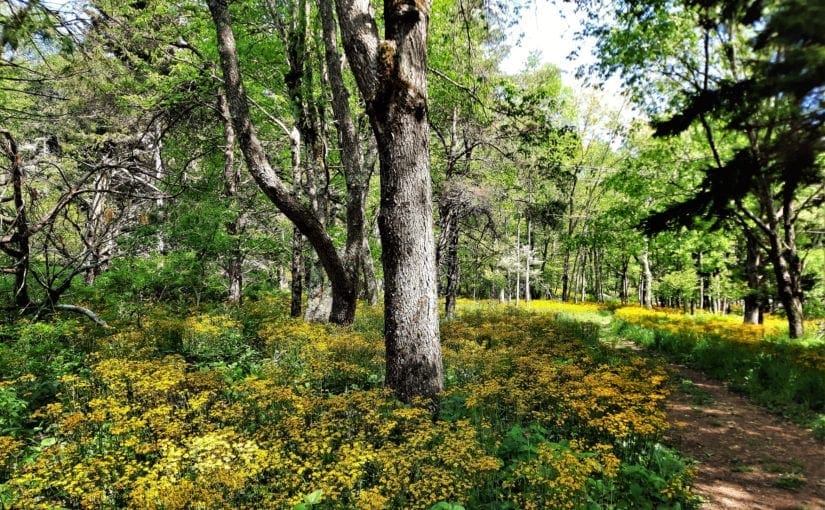
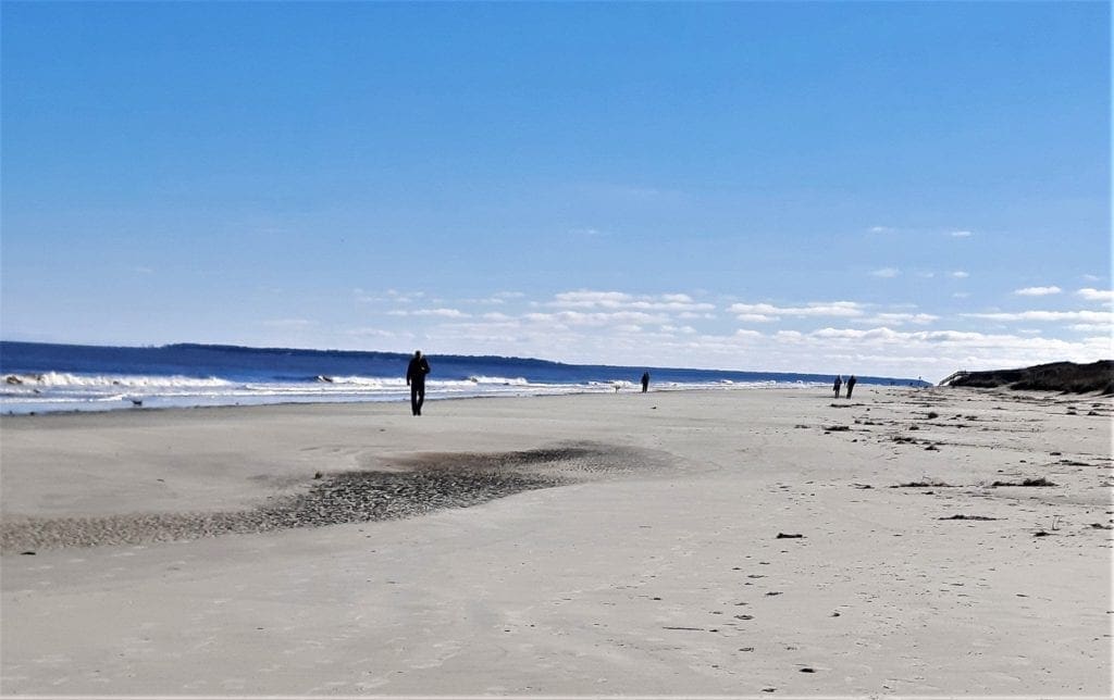
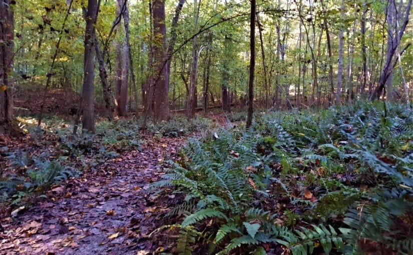
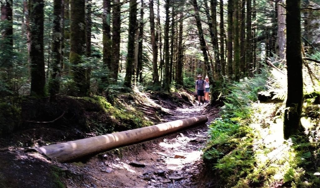
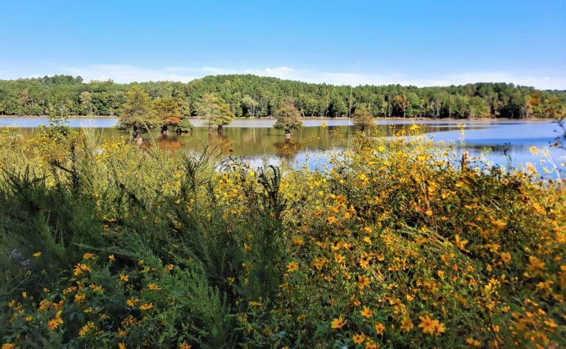
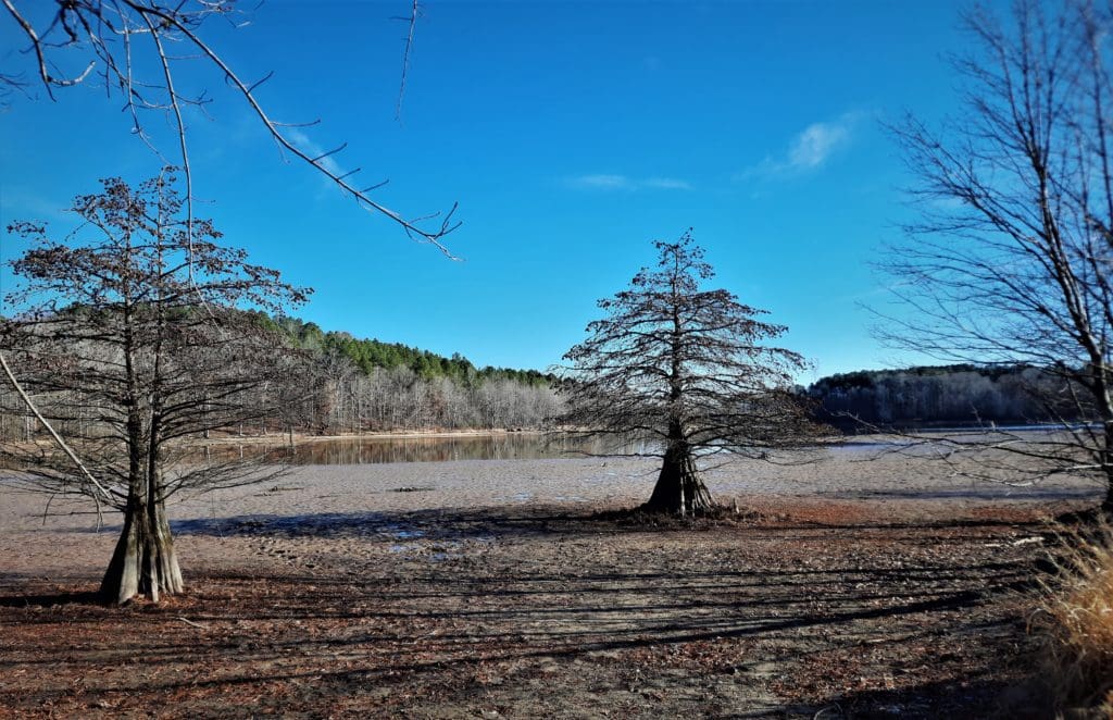
One of the longest finished segments goes ~60 miles along the Southern shore of Falls Lake, just to the North of Raleigh near Wake Forest.

View of Falls Lake from the trail.

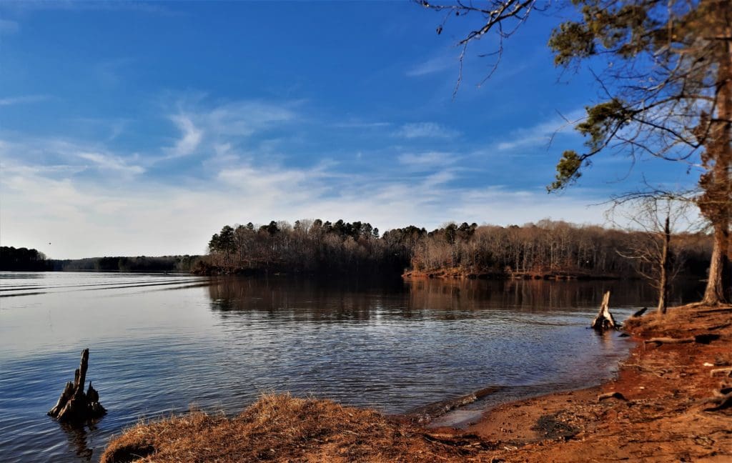
Even 60 miles (out of 1200) is an epic hike to most of us – but never fear!

You can hike smaller sections of the MST to make it an overnight backpacking trip, a day trip, or even just a few hours on the trail.

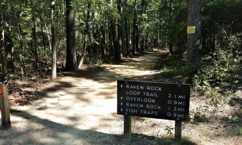
Today, I’ll tell you about the MST, and how you can hike my favorite local MST section (so far): MST Day Hike #22 at Rolling View in Falls Lake Recreation Area.

Continue reading Hike the Mountains to Sea Trail at Rolling View in Falls Lake

Hike the Rock Castle Gorge Trail on the Blue Ridge Parkway

Most recently updated October 15th, 2024

Estimated Reading Time: 16 minutes

The Blue Ridge Parkway runs through or very near areas of North Carolina and Virginia that were hardest hit by Hurricane Helene.

The North Carolina section of the Blue Ridge Parkway is closed, along with many other NC State Parks.  That said, the Virginia side of the BRP and many surrounding communities are open for business and could really use your Fall vacation dollars to help rebuild!  

Go to my Hurricane Helene page to get the latest updates on the latest area Park, Trail and road repairs. 

Mists rise from the mountains after a summer rain.
Smoky Mountains get their name from the mist that settles in the valleys.

I’ve enjoyed driving the Blue Ridge Parkway (BRP) in North Carolina and Virginia for more than 25 years.

But,  I have to admit – other than some quick roadside waterfall viewing – I have completely neglected Blue Ridge Parkway hikes!

But recently I found out what I’d been missing when I was invited to hike the Rock Castle Gorge Trail at Rocky Knob 🙂

The Blue Ridge Parkway is a National Parkway in the United States, noted for its scenic beauty.

Flower-lined trail at Shenandoah National Park

It’s America’s longest linear park, running 469 miles through  Virginia and North Carolina, linking Shenandoah National Park to the Great Smoky Mountains National Park.

Combined with Shenandoah’s Skyline Drive, the Blue Ridge Parkway is also a favorite twisty-windey  motorcycle adventure through some beautiful scenery, especially in the Fall. 

Read on to learn more about the Parkway and Rocky Knob Recreation Area hiking trails – including the famous Rock Castle Gorge Trail!

Continue reading Hike the Rock Castle Gorge Trail on the Blue Ridge Parkway

Hike Stone Mountain State Park

Most recently updated October 15th, 2024

Estimated Reading Time: 19 minutes

Stone Mountain State Park is very near areas of North Carolina that were hardest hit by Hurricane Helene.

Stone Mountain is currently closed, along with many other NC State Parks and trails in the Western part of the State.  

Go to my Hurricane Helene page to get the latest updates on the latest area Park, Trail and road repairs before you travel. 

Mists rise from the mountains after a summer rain.
Smoky Mountains get their name from the mist that settles in the valleys.

I’ve been visiting Stone Mountain State Park in North Carolina for almost 20 years, either with kid in tow, with That Man, or on my own.

My most recent visit was just a few weeks ago –  and the mountain was still just as beautiful as I remembered 🙂

Located on more than 14,100 acres in Wilkes and Alleghany counties in North Carolina, Stone Mountain State Park offers cascading waterfalls, cool mountain streams, and quiet forests to explore.

And of course, the massive 600-foot granite dome of Stone Mountain itself.

There are more than 18 miles of hiking and riding trails, and 20 miles of designated trout waters available in the park.

Can you imagine living in the shadow of the dome on Stone Mountain ?

You can also go rock climbing (with a permit) on the towering granite face of the landmark mountain.

Climbers on the dome look down over the Hutchinson Homestead, a restored mid-19th century mountain farm that rests in it’s shadow.

Read on to learn about the park and area history, hiking trails, and great views just waiting for you to visit!

Continue reading Hike Stone Mountain State Park

Hike Rose River and Cedar Run in Shenandoah National Park

Most recently updated October 15th, 2024

Estimated Reading Time: 18 minutes

The Shenandoah National Park is right on the edge of  the areas of North Carolina and Virginia that were hardest hit by Hurricane Helene.

That said, the Park is open and many of the surrounding communities are open for business and could really use your Fall vacation dollars to help rebuild!

Go to my Hurricane Helene page to get the latest updates on the latest Park, Trail and road repairs. 

Mists rise from the mountains after a summer rain.
Smoky Mountains get their name from the mist that settles in the valleys.

I went back to Shenandoah again this Spring, to hike the Rose River Loop, the Cedar Run Circuit and maybe add some more to my list.

It wouldn’t be hard to do, since Shenandoah National Park offers some of the best hiking in Virginia!

I took a break from hiking to explore the Barboursvillle ruins.

I had spent a great week there a couple of years ago, but the trip was over before I had a chance to complete my list of  “must do” hikes – including the Rose River Loop.

And of course the iconic Old Rag hike.

So I had to go back and try again!

Where is Shenandoah National Park?

Shenandoah National Park is only  115 miles from Washington, D.C., 95 miles from Richmond VA, and 250 miles from Raleigh NC.

That’s close enough for a great long weekend or longer family vacation, without the expense of air travel!

My previous Shenandoah visit was for a whole week.  This trip was a quick visit of only 3 nights – which was still enough time to get in a couple of great hikes and see some local sights 🙂

Continue reading Hike Rose River and Cedar Run in Shenandoah National Park

Hike Cannon’s Point Preserve on St Simon’s Island

Most recently updated February 10th, 2026

Estimated Reading Time: 25 minutes

A couple of years ago, after months and weeks of gloomy rainy or snowy local weather, I couldn’t stand it anymore!!

All of my local trails had become rivers of mud, and greenways just don’t feed the soul like sunshine and a soft forest path.

Leaving the floods in N Carolina.

Besides, walking greenways too much can also hurt your joints….

So I abandoned my spot on the Ark, and took off on a solo roadtrip down the East coast.

Starting from the Raleigh area, I drove all the way to St Augustine, FL (which is a story for another time) and then worked my way back up the Coast towards home.

Peacocks on the grounds of the Fountain of Youth archaeological park in St Augustine.

My first stop on the way back up was St Simon’s Island, Georgia 🙂

It's about a 6 hour drive from Raleigh to St Simon's Island.
St Simon’s is about 6 hours from Raleigh.

St. Simons,  the largest barrier island in the Golden Isles, lies just off the Georgia coast.

It’s a favorite family beach destination for visitor’s in the summertime.

Off the beach, St. Simons Island is dotted with remnants of historic sites you can visit, like the St Simon’s Lighthouse, Fort Frederica National Monument, and Christ Church.

The beach near St Simon's.
The beach near St Simon’s.

You can also follow the ancient footsteps of the very first tourists to the island, who travelled either by walking the forest paths or paddling down the waterways.

I did some research and found a historic hiking spot at Cannons Point Preserve on the north end of the Island.

Among other reasons to visit, the trail at Cannon’s Point Preserve  leads you to some extraordinary abandoned historic ruins along the coast.

Continue reading Hike Cannon’s Point Preserve on St Simon’s Island

Forest Bathing – Walk to Improve Your Wellness

Most recently updated July 7th, 2023

Estimated Reading Time: 11 minutes

Forest bathing, or shinrin-yoku, is a Japanese form of healing therapy that started to gain popularity back in the 80’s.

No rubber duckies required!

In case you’ve never heard of forest bathing,  rest assured you’re not going to need a towel or your rubber duckie.

You also won’t be required to wander the forest in your birthday suit 😉

At it’s simplest level, forest bathing could be described as taking a leisurely walk through the forest for physical, mental, emotional, and spiritual benefits.

Shinrin-yoku in Japanese means “taking in the forest atmosphere”.

Forest bathing is best done where there are a lot of trees.

Research has long shown “green exercise” to have a positive impact on our overall health, and the practice of forest bathing grew out of that recognition.

Promoted by the Japanese Ministry of Agriculture, Forestry, and Fisheries, the practice has become a mainstay of preventive health care in Japanese culture.

Today, many spas, resorts, and retreat centers across the world offer guided forest bathing experiences as part of their services.

That said, you don’t necessarily need a guide to take a forest bath yourself or with a friend.

All you need is a park or forest, a pair of good outdoor walking shoes, and some simple instructions.

Continue reading Forest Bathing – Walk to Improve Your Wellness

Great Smoky Mountains National Park – 5 Great Hikes in 4 Great Days

Most recently updated January 16th, 2025

Estimated Reading Time: 35 minutes

The Great Smoky Mountain National Park is right on the edge of  the areas of North Carolina and Tennessee that were hardest hit by Hurricane Helene.

That said, the Park is open and many of the surrounding communities are open for business and could really use your tourist dollars to help rebuild!

Go to my Hurricane Helene page to get the latest updates on the latest Park, Trail and road repairs. 

Mists rise from the mountains after a summer rain.
Smoky Mountains get their name from the mist that settles in the valleys.

For years, I’ve been driving from my home near Raleigh, NC past the Great Smoky Mountains National Park (GSMNP) in Tennessee for work, but never had a chance to stop and explore.

It was very frustrating… 🙁

The Pulpit rock cairn marks the end of the Bullhead Trail.

But finally, last summer, I was able to spend a few days hiking in the GSMNP.

It was everything I hoped it would be!

The Great Smoky Mountains National Park (GSMNP) was the most visited national park in 2019, with over 12.5 million visitors.

That’s nearly twice as many tourists as the Grand Canyon had that same year!

The Park covers 522,419 acres in North Carolina and Tennessee, making it one of the largest protected areas in the eastern United States.

It also straddles the ridgeline of the Great Smoky Mountains, part of the Blue Ridge Mountains, which are a division of the larger Appalachian Mountain chain.

And as if that’s not enough to warrant a visit, the Appalachian Trail also passes through the center of the park on its route from Georgia to Maine.

Hiking on the Appalachian Trail.

Read on to learn about the park layout, history and the amazing trails that I hiked during my visit… and how you could hike them, too!

Continue reading Great Smoky Mountains National Park – 5 Great Hikes in 4 Great Days

Hike to the Zombie Tunnels! – Schenk Forest’s Richland Creek Trail

Most recently updated November 24th, 2025

Estimated Reading Time: 10 minutes

The Zombie Tunnel Hike is a route that goes from Umstead State Park, and all the way through Carl Alwin Schenk Memorial Forest to the Lenovo arena – with the help of the Richland Creek Trail and Capital Area Greenways.

I’ve been leading this hike for years, and people really enjoy it. 

zombie tunnel
This is the actual tunnel we go through on this hike….

At over 12 miles, it’s a good long hike.  It’s pretty flat, but has a lot of different features – like Zombie tunnels!

Okay, there may not *actually* be any Zombies, but it sure looks like there could be….and one time I did find a mutant fish in there 🙂

I don’t host this hike very often because conditions need to be just right or the route is impassable, and I hate to disappoint anyone.

Just in time for Halloween, I hiked the route again AND (for a spook-tacular add-on) took a Ghost Walk in Raleigh the next day!!

According to legend, Brigadoon only appears for one day every 300 years.

(I’ll tell you all about the Ghost walk and how you can take one too, but first – the hike!)

Depending on recent weather conditions or new construction, parts of the trail have been known to disappear like Brigadoon at sunrise.

So earlier this year, before I posted the hike for others to join me, I decided to take a look and see if the route was still there – and still the same.

Good news!  The route was still there – and still mostly the same.  In fact some parts had actually been improved!  

The other tunnel is just for water.

Now I’ll tell you about the trail so you can try this somewhat spooky hike for yourself… perhaps followed by an equally spooky Ghost Walk!


Continue reading Hike to the Zombie Tunnels! – Schenk Forest’s Richland Creek Trail

Have a Kids’ Day of Adventure at Raven Rock State Park

Most recently updated January 18th, 2022

Estimated Reading Time: 12 minutes

Raven Rock State Park, a North Carolina state park, was a favorite destination when my daughter was in grade school.

Walking along the Campbell Creek Loop.

Located near Lillington, North Carolina, it covers 4810 acres along the banks of the Cape Fear River.

We would go on our own, or with another single Mom friend who also had young kids, and make a day of it.

The kids loved the access to the Cape Fear River at the Fish Traps rapids, and scrambling on tree roots and rocks on the trail to the massive Raven Rock.

The trails were short enough that we hardly ever had to carry them back to the trailhead – a big plus, since neither of us were all that much bigger than the kids 🙂

I haven’t had much reason lately to make the 50-minute drive to Raven Rock, since my daughter (though still pretty short) has been out of grade school for much longer than a decade now – and I usually like longer trails.

Trailhead sign at the Raven Rock loop.

I’d also lost touch with my friend, and though we’d comment on social media now and then, hadn’t really talked for at least ten years – no reason, just the kids got older and we had drifted apart.

Then, when I went to wish her a happy birthday, I found that she’d recently passed away.

So I decided to take a trip down to Raven Rock, walk the trails, and remember my friend.

Some things had changed, but the park is still a good place to go for a walk – with your kids or on your own.    🙂

Continue reading Have a Kids’ Day of Adventure at Raven Rock State Park

Hike Virginia’s Triple Crown – an Appalachian Trail Section

Most recently updated October 15th, 2024

Estimated Reading Time: 22 minutes

The Appalachian Trail (AT) runs through or very near areas of North Carolina and Virginia that were hardest hit by Hurricane Helene.

Portions of the AT are open, along with many other Virginia and NC State Parks and trails in the Eastern part of the State.  That said, Parks and the AT on the Western side of the State have been damaged and may be inaccessible. 

Go to my Hurricane Helene page to get the latest updates on the latest area Park, Trail and road repairs before you travel. 

Mists rise from the mountains after a summer rain.
Smoky Mountains get their name from the mist that settles in the valleys.

As soon as I heard about the Triple Crown hike in the Blue Ridge Mountains,  I knew I had to do it!

View of the Dragon's Tooth at the hike summit.
View of the Dragon’s Tooth at the hike summit.

It’s an epic hike within easy driving distance from my home in North Carolina, do-able as a solo hiker  – with reasonable precautions – even in the heat of summer.

Most importantly the summer of 2020, the Triple Crown trails and trailhead parking were just re-opened for use.

Effective June 13:  The National Park Service has reopened the Appalachian National Scenic Trail in Virginia’s Blue Ridge, including the Triple Crown section of Dragon’s Tooth, McAfee Knob, and Tinker Cliffs. 

The Triple Crown hike is actually a group of three hikes – Dragon’s Tooth, McAfee Knob, and Tinker Cliffs – that can be done individually or tackled as an overnight backpacking hike all together.

The Triple Crown trail loop is 35 miles of the best hiking in the Roanoke Valley  and arguably some of the best overlooks in the entire state of Virginia.

If you decide to explore this portion of the Appalachian Trail, you’ll be rewarded with incredible overlooks, unique rock formations, shelters for rustic camping, and challenging, bucket-list-worthy trails 🙂 Continue reading Hike Virginia’s Triple Crown – an Appalachian Trail Section